
Blair Atholl to Newtonmore via the Tarf Hotel
Having got back into wild camping last year on South Uist I was thinking about a trip this May when I saw the Gay Outdoor Club were having a weekend meet based at the Feithe Uaine bothy ( Tarf Hotel). A look at the map and a couple of accomodation bookings later and I had a trip planned with 2 nights in Perth, 3 nights wild camping and 2 nights at a great B&B in Newtonmore where I'd stayed before. This allowed me to get there and back comfortably on buses and trains from Norfolk.
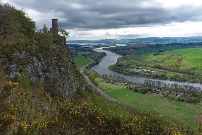
So on the Thursday evening of the early May bank holiday I arrived in Perth. Two nights at the Premier Inn were nicely comfortable without breaking the bank. On arrival my pack weighed just under 14Kg so on the Friday I thought I'd have a warm-up walk with a bit less than this so wandered around Kinnoul Hill leaving tent and food behind. It was a really nice walk with great views over the Tay and north to the Highlands where, ominously, Beinn a'Ghlo never emerged from the cloud.
 cairn1 by Peter Lynn, on Flickr
The Tay and Kinnoul tower
The plan was to walk in to the bothy over Carn a'Chlamain, camp nearby and socialise at the bothy then spend the Sunday walking over An Sgarsoch, Carn an Fhidhleir (Carn Ealar) and Beinn Bhreac and spend Monday and Tuesday making my way to Newtonmore with another nights wild camp, route depending on the weather.
Day 1 Blair Atholl to Tarf Hotel
18km : 1120m of ascent : 5 1/2 hours
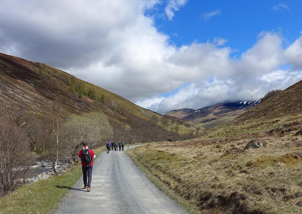
Saturday morning saw me catch the train to Blair Atholl and join up with the others. There were 6 of us setting off for the bothy and a number of others joined us for the walk up Glen Tilt.
 cairn2 by Peter Lynn, on Flickr
Delightful Glen Tilt
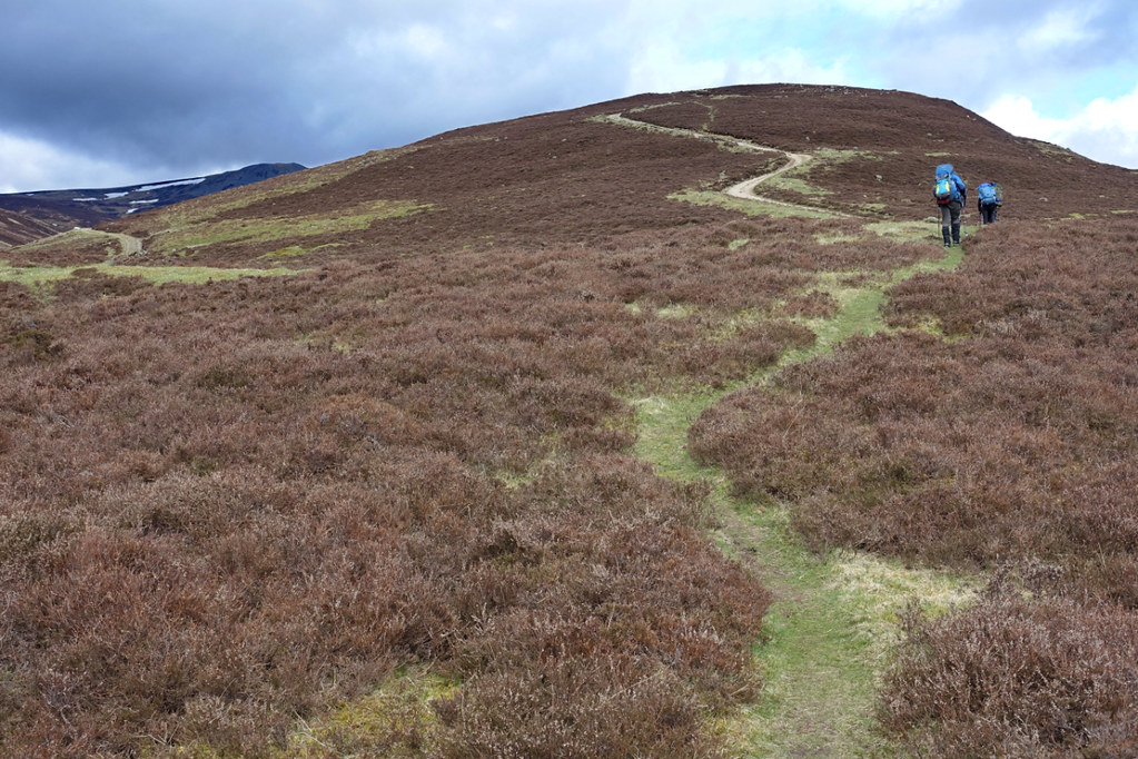
We followed the valley to the marble bridge then set off up the ridge to join the landrover track which goes virtually to the top of Carn a'Chlamain. The initial climb was a bit steep with a fully laden pack.
 cairn3 by Peter Lynn, on Flickr
Nearing the track
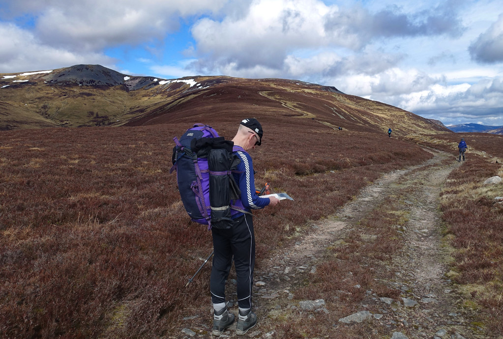
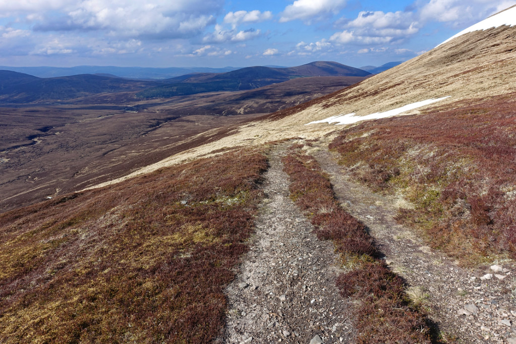
The cloud which had been down on the tops when we left Blair Atholl had now cleared. As we were a bit late in the day we saw several people returning and a couple of people we met said they had seen nothing when they were on the top.
 cairn4 by Peter Lynn, on Flickr
David needlessly checking the map
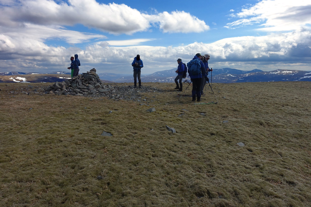
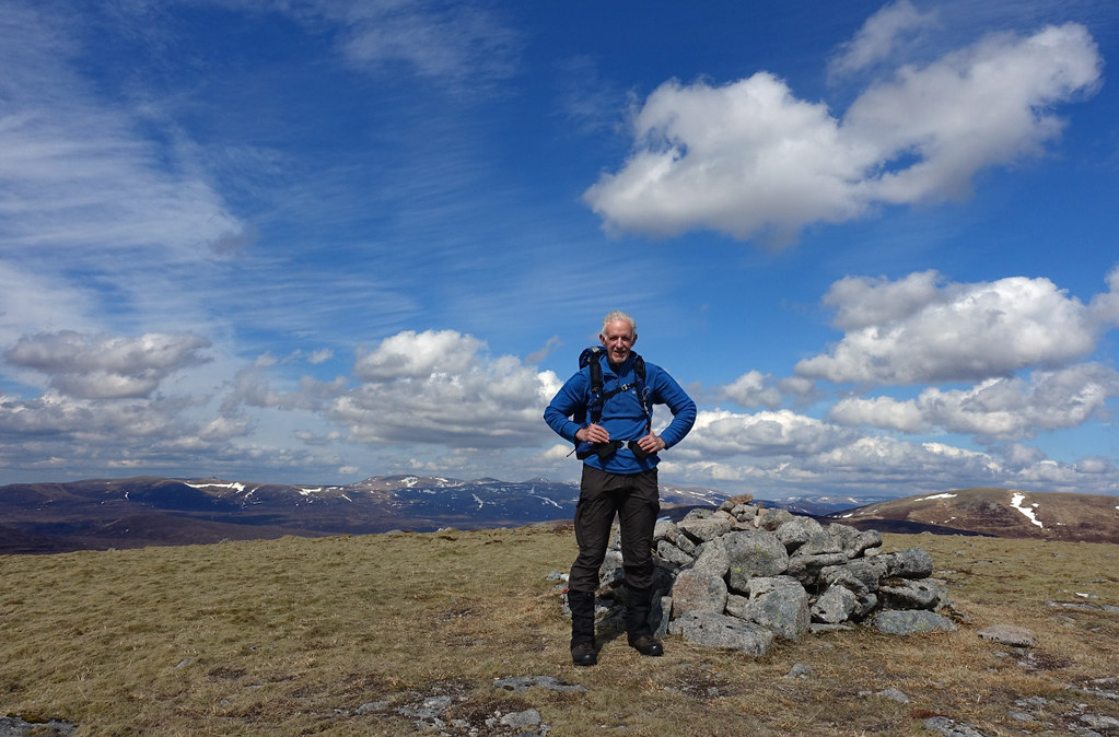
A steady plod up the track saw us at the top by about 3.30pm. It was difficult trying to stand up to take a picture as the wind was blowing hard over the summit.
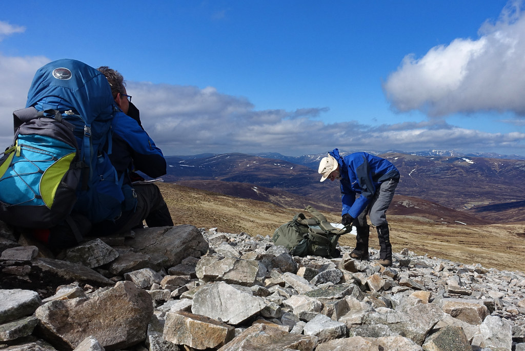 cairn5 by Peter Lynn, on Flickr
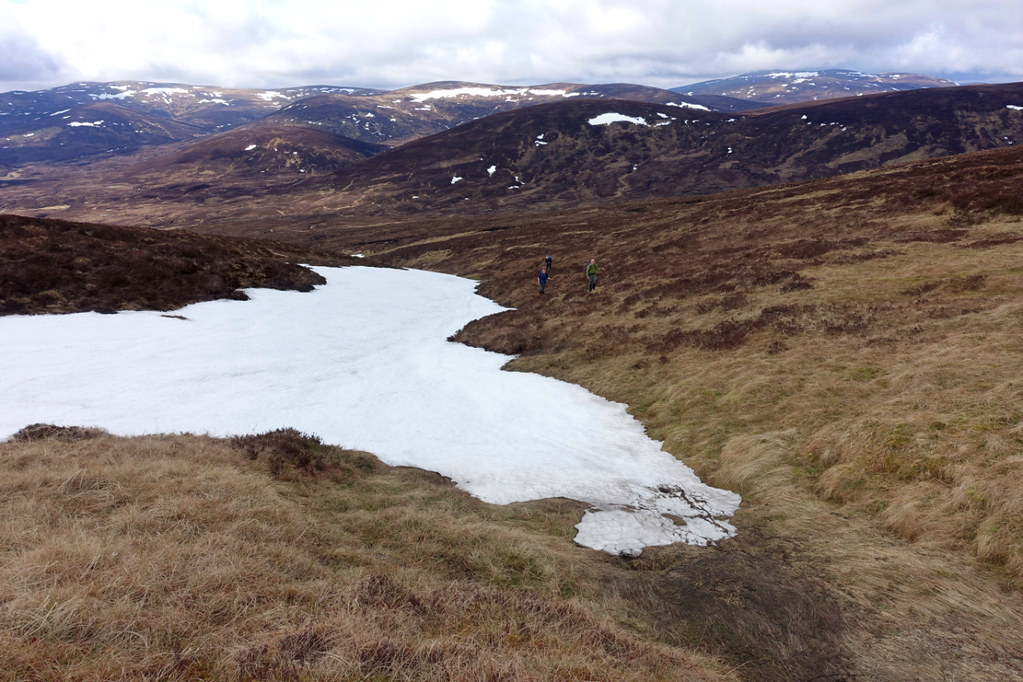
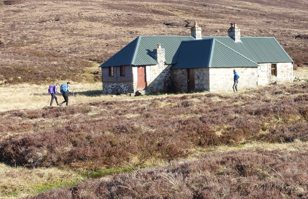
It took only about half an hour to descend to the bothy over the odd snow patch and unnecessarily crossing the Allt Feithe Uaine by choosing the wrong bank of the feeder stream. There were already some guys with a couple of dogs at the bothy but they made room for us and I and a couple of others pitched our tents nearby.
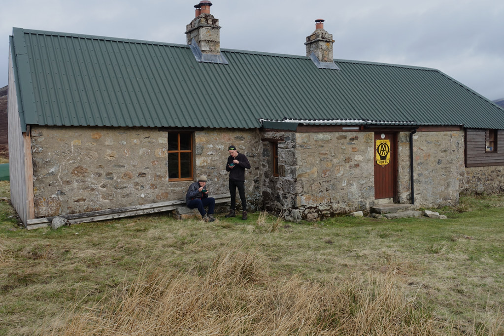 cairn7 by Peter Lynn, on Flickr
Supper at the Tarf Hotel
I didn't get much sleep because of a stiff breeze causing my tent to flap noisily - a major drawback to my lightweight tent.
Day2
22km : 1040m ascent : 8 1/2 hours
The intention today was to do An Sgarsoch, Carn an Fhidhleir (Carn Ealar) and Beinn Bhreac and return to the bothy for the night. So we didn't have to carry all our kit.
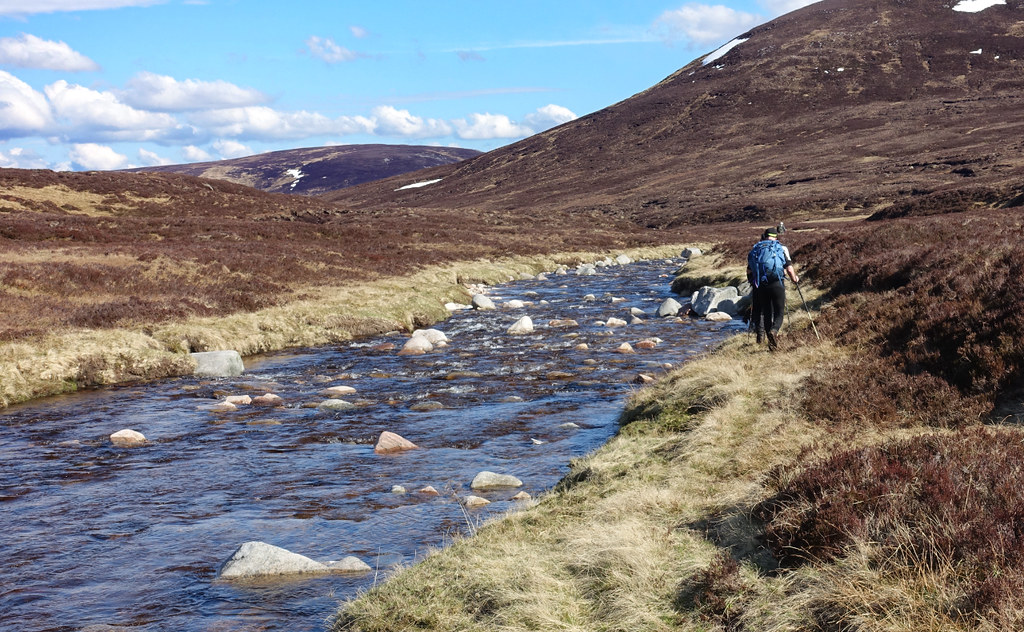
But first we had to cross the Tarf. I bought a pair of lurid blue and yellow boat slippers which were good for the job. Others crossed in socks or waterproof sandals.
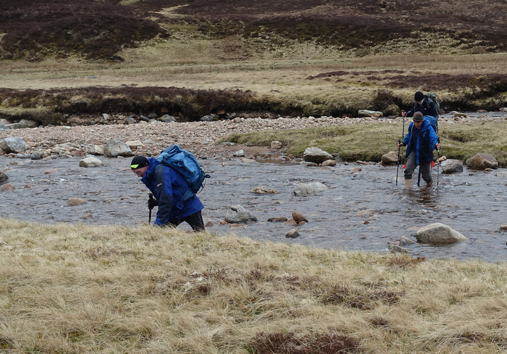 cairn8 by Peter Lynn, on Flickr
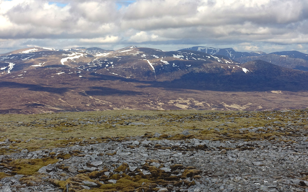
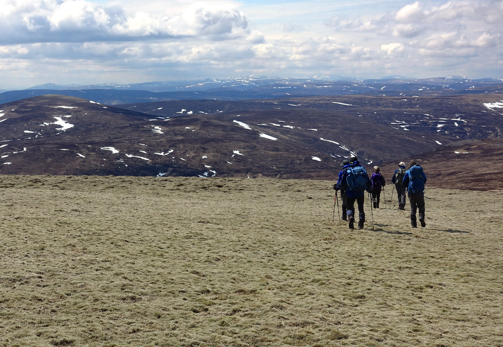
It was a straightforward ascent up by a burn to a col and then along the ridge to the broad rounded top. The tops were clear by now and the views extensive to the north and east.
 cairn9 by Peter Lynn, on Flickr
Back down to the Tarf, Beinn a'Ghlo behind.
 cairn10 by Peter Lynn, on Flickr
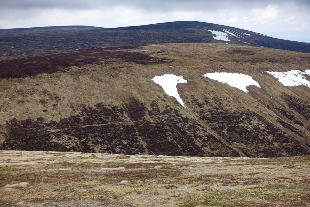
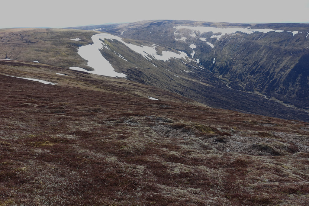
Quite a few snow patches in gullies.
 cairn11 by Peter Lynn, on Flickr
Cairngorms from the ridge.
 cairn12 by Peter Lynn, on Flickr
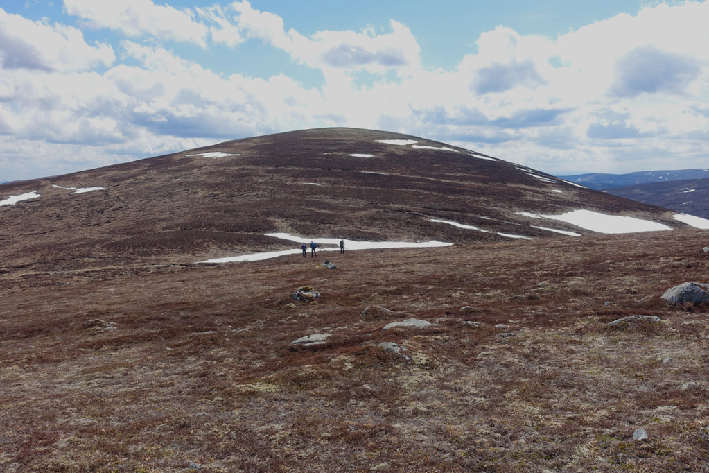
Summit of An Sgarsoch
There was then a fair drop to the col between An Sgarsoch and Carn an Fhidhleir and a climb up the other side. Met an orange clad walker here who'd come in from the Lin of Dee.
 cairn13 by Peter Lynn, on Flickr
 cairn14 by Peter Lynn, on Flickr
Looking back to An Sgarsoch
We had a short break before the next summit and were overtaken by a couple of young guys who were not only faster but seemed to need less clothing!
 cairn15 by Peter Lynn, on Flickr
Summit of Carn an Fhidhleir
Navigation was very easy today with no cloud down and good visibility so we just headed towards Beinn Bhreac in an arc trying to avoid losing too much height or getting into peat hag territory. Saw another walker here, a lady with a pack who seemed to be wearing wellington boots and shorts!
 cairn16 by Peter Lynn, on Flickr
Heading west off Carn an Fhidhleir
 cairn17 by Peter Lynn, on Flickr
Last pull up to Beinn Bhreac
 cairn18 by Peter Lynn, on Flickr
Summit Beinn Bhreac looking back to Carn an Fhidhleir and An Sgarsoch.
 cairn19 by Peter Lynn, on Flickr
Me on Beinn Bhreac
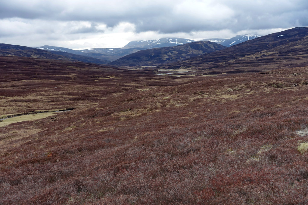
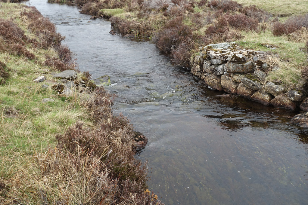
There was still about 8Km and a river crossing to get back to the bothy. While the river was delightful with common sandpipers piping away every few minutes and frogs leaping away from our boots regularly, it became a bit of a trudge. A couple of times we had to climb away from the river where a slope had been eroded and there was no easy low level way past.
 cairn20 by Peter Lynn, on Flickr
The banks of the Tarf
 cairn21 by Peter Lynn, on Flickr
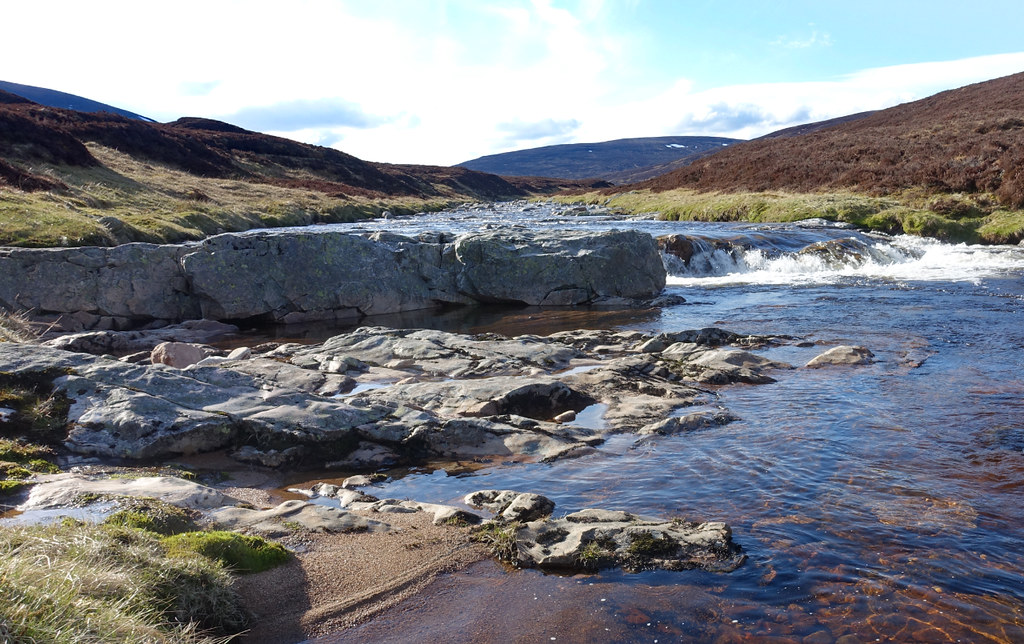
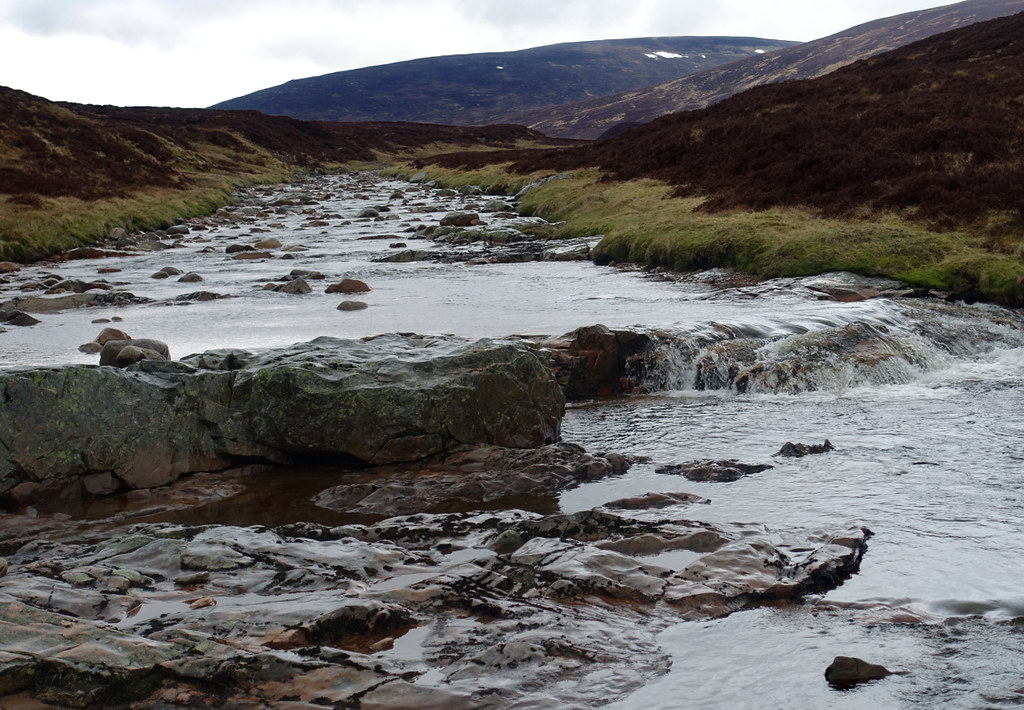
A small waterfall.
 cairn22 by Peter Lynn, on Flickr
Back at the Tarf Hotel
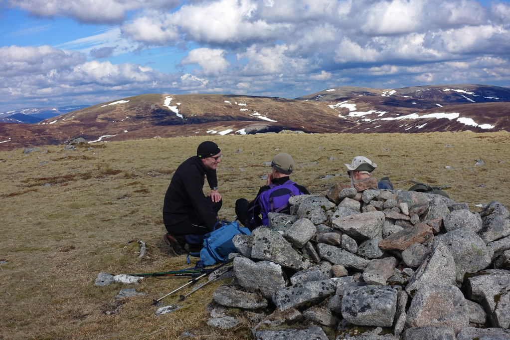
It was a relief to be back and the other guys and dogs had left. When we looked at the bothy book we were taken aback to read their entry (paraphrasing) ' We spent the night as usual smoking weed and telling fart jokes. A group of old men arrived and weren't very friendly and looked as if they might kick off at any time'. Well I am an old man so didn't mind but some of the others who were barely 50 were not amused. As for kicking off - I don't think we even had a football between us!
Day 3
21km : 550m of ascent : 9 hours
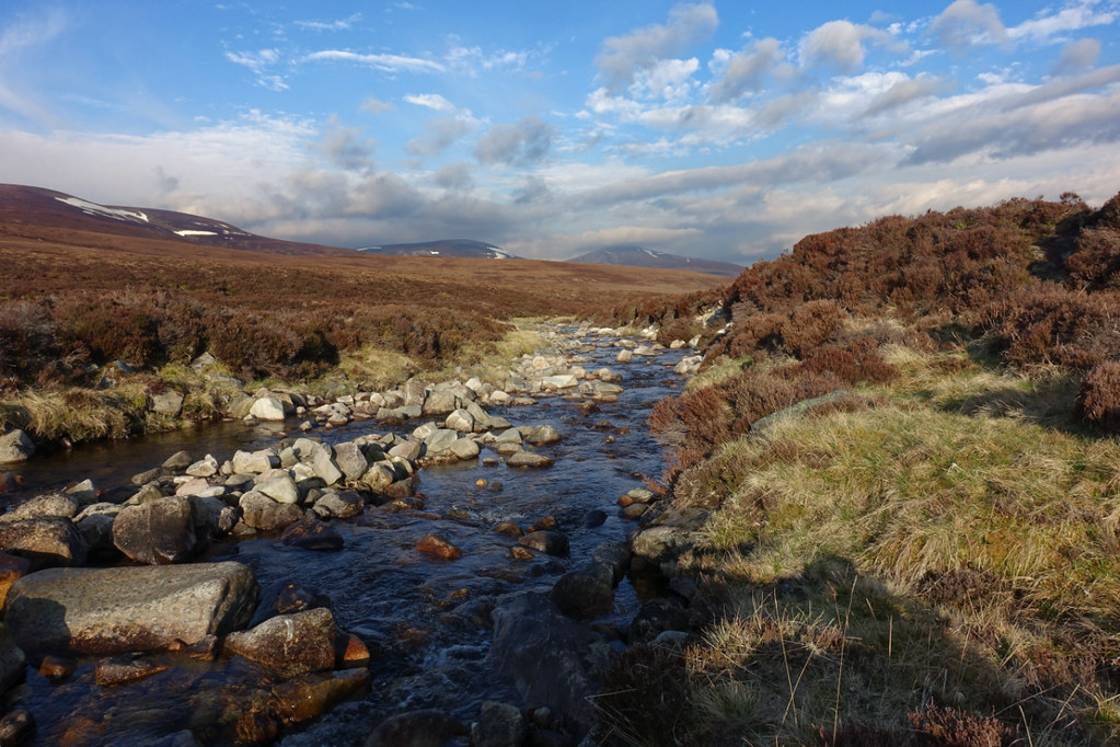
I got a better night's sleep as the wind dropped. So got up to a mild, calm morning with just a few midges about. The sky to the south soon looked ominous though and cloud was down on the hills. After yesterday's trudge along the Tarf I was hoping for the cloud to lift so I could enjoy a high level, and easier, route westward. Had breakfast with the others at the bothy and managed to get the tent down and packed up in the dry. We said our goodbyes and they headed back to Blair Atholl while I set off up the Tarf again. I must have got a good half mile when the rain came on so it was on with the waterproofs and pack raincover. I passed the little waterfall again where the river was noticeably lower - showing , I guess, that much of the flow was snowmelt which had slowed down overnight.
 cairn23 by Peter Lynn, on Flickr
Less flow over the fall this morning.
My first objective was to pass the point where we had come down from Beinn Bhreac and crossed the Tarf yesterday - then I'd be in new territory. But somehow, in between daydreaming and watching my feet, I missed it and realised I was getting nearer the decision about high or low level route.
 cairn24 by Peter Lynn, on Flickr
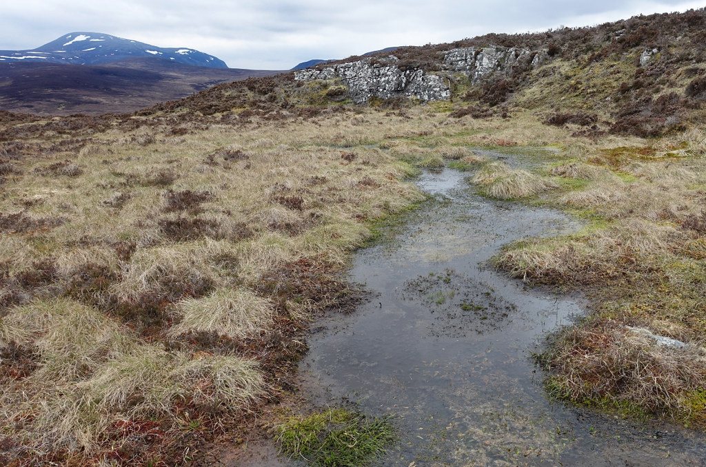
Getting a bit boggy near the watershed.
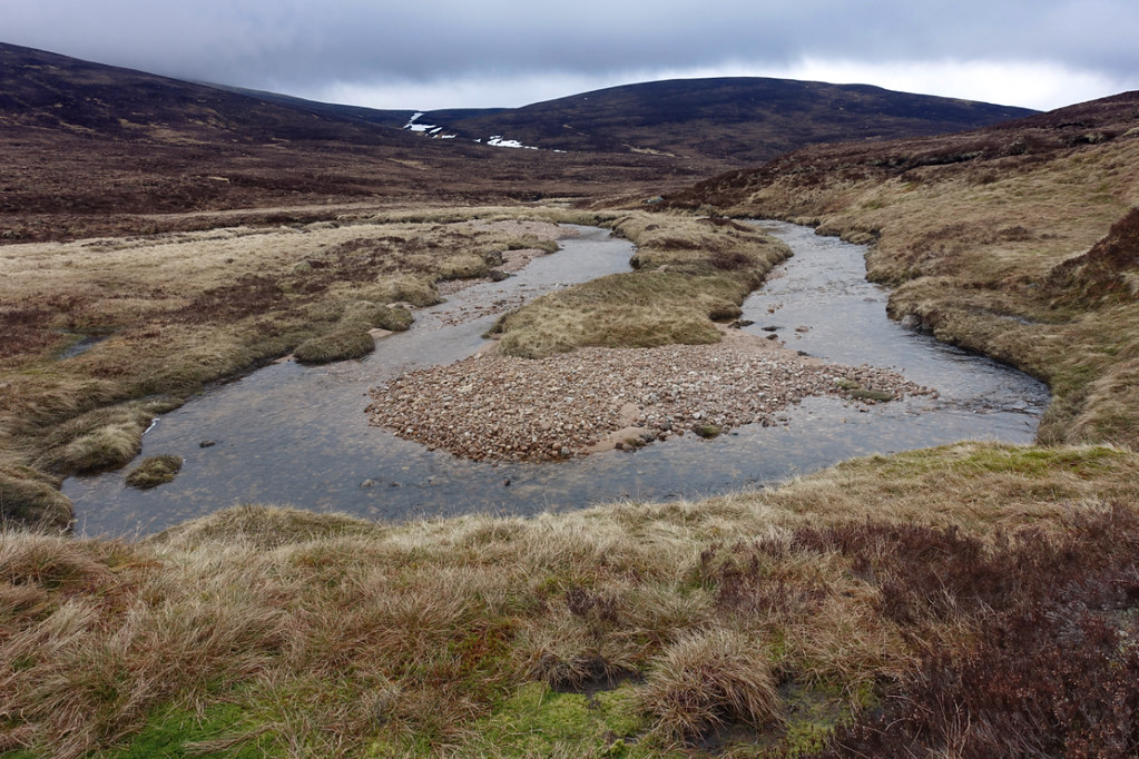
I'd taken to cutting off some of the meanders on the river as they were getting more extravagant.
 cairn25 by Peter Lynn, on Flickr
This is getting ridiculous.
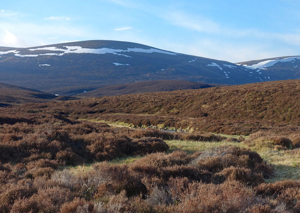
Eventually I reached the watershed with the Allt a'Chuil. The cloud now seemed to be above 800m and rising so, with some relief, I set off uphill away from the river.
 cairn26 by Peter Lynn, on Flickr
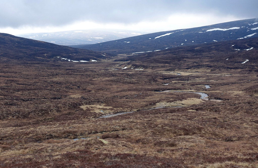
Last look back to the infant Tarf.
I could now follow my planned route over towards Leathad an Taobhain and the top of the Minigaig pass.
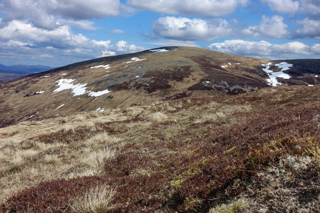
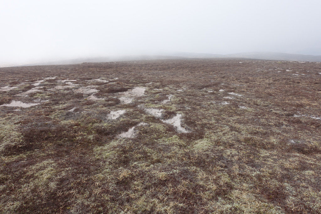
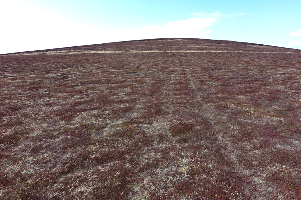
Above about 800m the heather died away leaving a surface of lichen, moss and gravel which made for really nice walking - though it seldom lasted long before a descent into boggy bits or heather again.
 cairn27 by Peter Lynn, on Flickr
Nice going up here
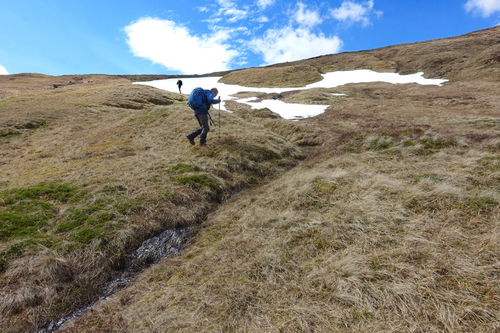
Quite a few of the boggy bits were filled up with melting snow and I was a bit cautious about what I would cross. Didn't fancy breaking through into a soggy hollow on my own with a pack on my back.
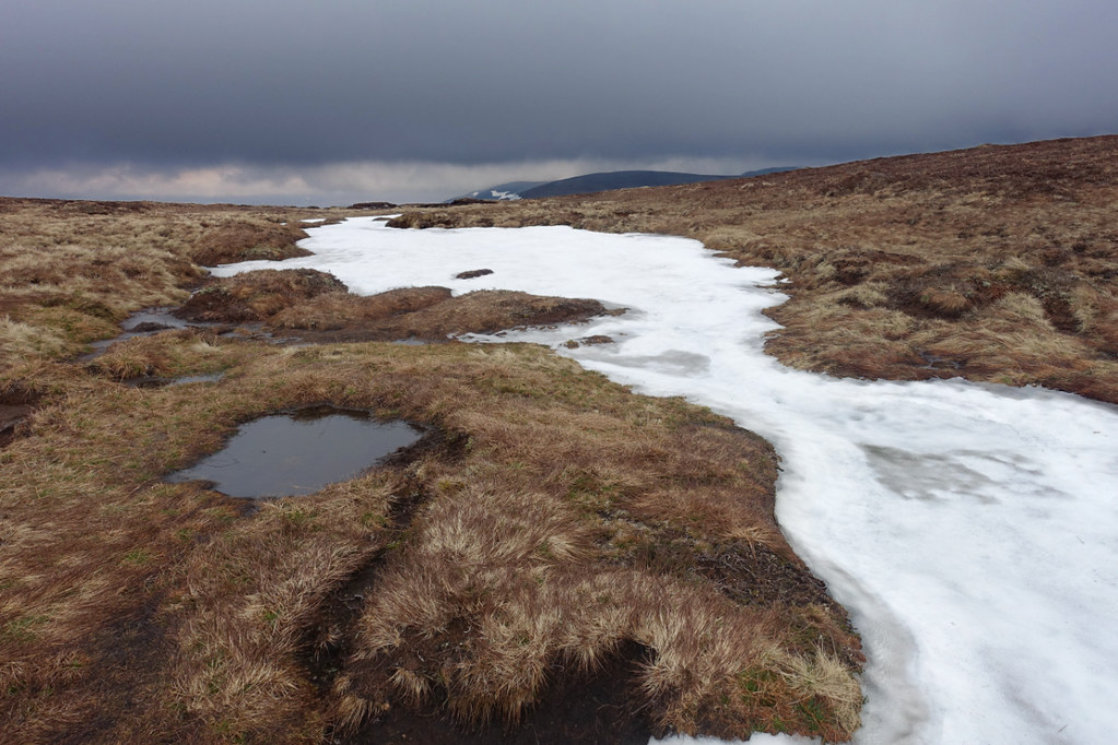 cairn28 by Peter Lynn, on Flickr
To cross or not to cross?
Altitude didn't seem to affect the abundance of frogs - just a bit of damp grass.
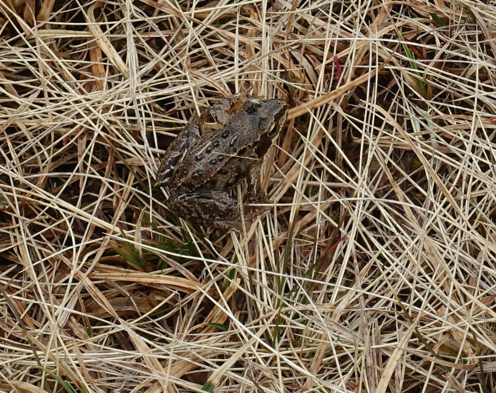 cairn29 by Peter Lynn, on Flickr
Got to the point marked 859m and the view to the north opened up.
 cairn30 by Peter Lynn, on Flickr
View over upper Glen Feshie
There was a steep valley between here and Leathad an Taobhain so I contoured around to avoid too steep a drop.
 cairn31 by Peter Lynn, on Flickr
Leathad an Taobhain now visible top left.
The way ahead lay across a snow filled gully or was blocked by a big drift. There were a few set of footprints crossing the snow but I had a look at where the stream exited from under the snow before deciding it was ok to cross.
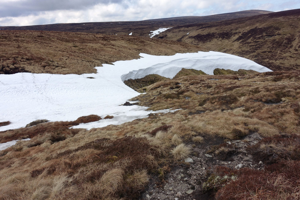 cairn32 by Peter Lynn, on Flickr
Snow obstacle
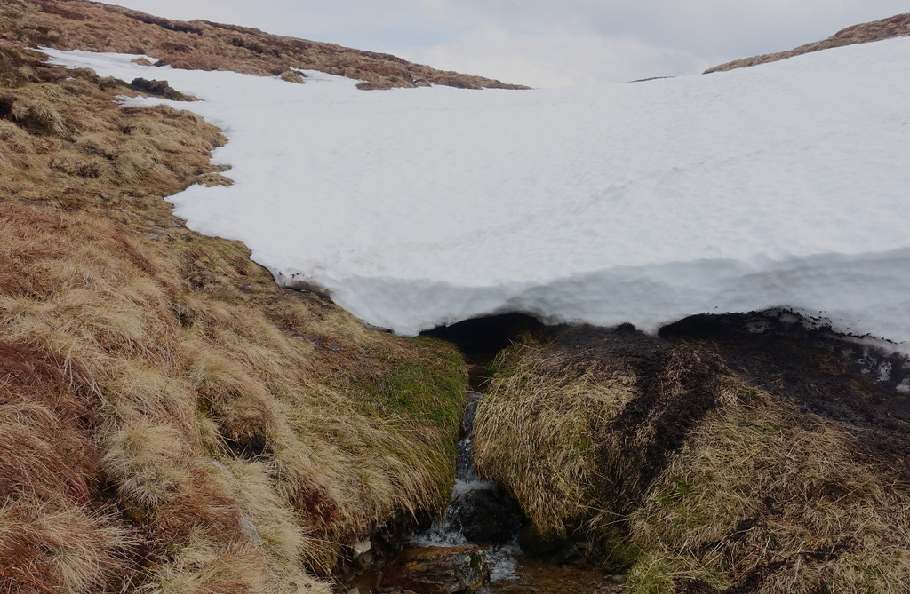 cairn33 by Peter Lynn, on Flickr
Stream emerging - several feet of snow above.
Soon after climbing out of the little valley I saw this mountain hare while crossing some peat hags.
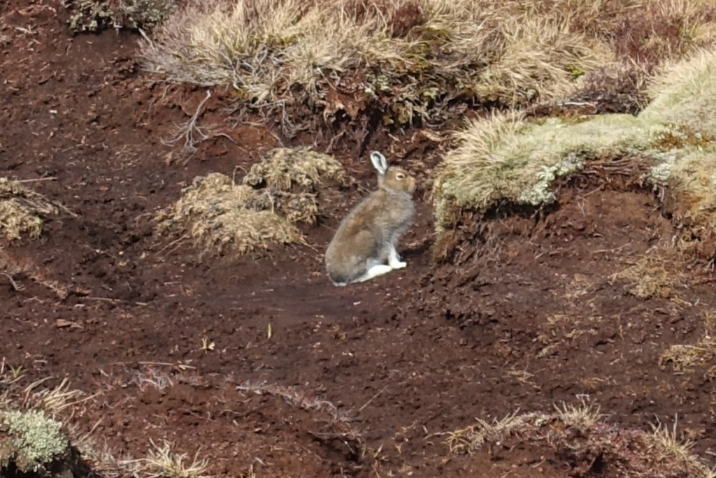 cairn34 by Peter Lynn, on Flickr
Once above the hags and heather it was back to good walking on lichen etc and even signs of a path.
 cairn35 by Peter Lynn, on Flickr
Nearly up Leathad an Taobhain
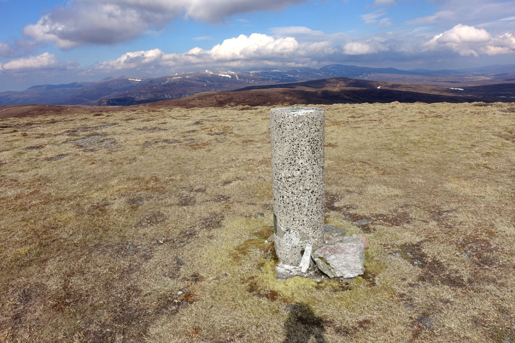
Then I was at the top of my second Corbett on the trip, both in the top ten by height but both pretty nondescript. The view north to the Cairngorms was pretty good though.
 cairn36 by Peter Lynn, on Flickr
The trig point on Leathad an Taobhain, Cairngorms beyond.
 cairn37 by Peter Lynn, on Flickr
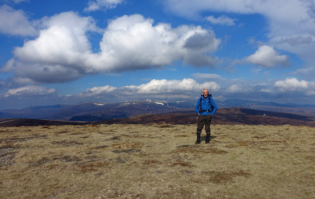
Selfie on the summit.
It was then a short descent, avoiding a couple of icy snow banks, down to the top of the Minigaig pass.
 cairn38 by Peter Lynn, on Flickr
Descending towards the Minigaig.
 cairn39 by Peter Lynn, on Flickr
The Minigaig
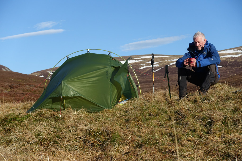
When I reached the Minigaig it was a great track and I set off with a renewed spring in my step - for a couple of hundred yards. This was definitely the only stretch of the Minigaig I saw that I would ride an MTB on. Within minutes the path disappeared into bog or itself became the main route for snowmelt off the hill. So I just splashed on for the next couple of miles, keeping the infant Allt Coire Bhran on my left. In fact this was one of the couple of times on the walk I used the GPS on my phone to see if I was anywhere near the path - I was, but there was little sign of it. Around 6pm I found a good spot to camp near a side stream and put up the tent.
 cairn40 by Peter Lynn, on Flickr
Having a cuppa after pitching.
It was a pretty idyllic spot, on the site of an old shieling and I managed to get all my pegs in ok, bar one which had to go in at quite an angle.
 cairn41 by Peter Lynn, on Flickr
Late evening in a great spot.
Day 4
22km : 440m of ascent : 9 hours
Although it was pretty calm when I turned in the wind soon got up leading to a fitful night's sleep. Sometime around midnight the poorly anchored peg came out and the end of the tent flopped onto my face. I got up and used one of my walking poles as a much better peg - reaching beyond the rocks to get a better purchase - ought to consider this in the future where a rock prevents a good peg position. Anyway, I got up at 5.15am to a beautiful morning and somehow managed to while away over an hour getting ready before setting off at 6.30am. I just had to descend into Glen Tromie, cross the river and then the moors to Newtonmore.
 cairn42 by Peter Lynn, on Flickr
Early morning by the camp spot.
 cairn43 by Peter Lynn, on Flickr
Last look back to the Minigaig. Path is more visible (diagonal climbing left to right in top centre) from here than on the ground.
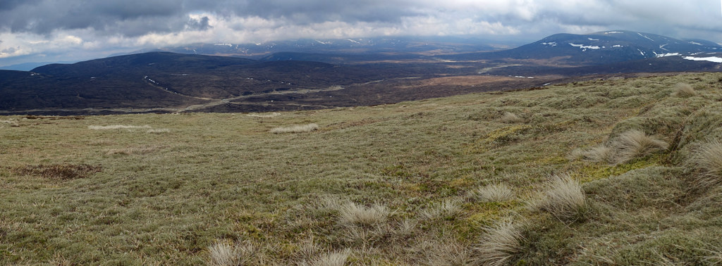
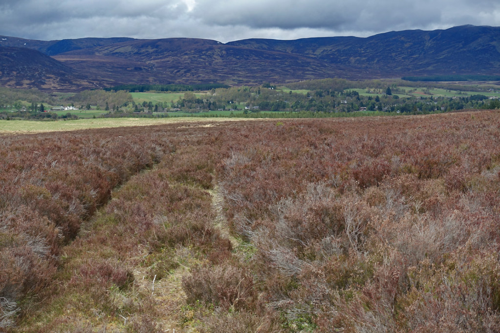
The hills in this area are pretty understated (boring to most?). This is made up for by the sense of space and emptiness. True, while out walking I (we) did meet 4 other people. But it was a fine bank holiday and these last couple of days I didn't see anyone until I reached the A9 at Newtonmore. But the thing I'll remember most are the rivers. The Tilt, the Tarf, the Allt Coire Bhran, the Tromie and the many smaller streams were a delight to sit beside and listen to - though often a pain to walk along. This wasn't really the lasting memory I expected to bring home with me.
 cairn44 by Peter Lynn, on Flickr
The Allt Coire Bhran
The path was mostly now just a deer trod through the heather or grass. But still worth following for ease of walking. I was really not expecting to see a snake coiled up at the side of the track, sunning itself at 7am. But suddenly there at my feet was an adder. A quietly as I could, I reached for my camera and focused. At that instant, it was off but I managed to get a shot of it slithering away through the vegetation.
 cairn45 by Peter Lynn, on Flickr
Adder - head is at the top left of the picture.
After that excitement, I followed the narrow path above a ravine and down into Glen Tromie by Bhran Lodge
 cairn46 by Peter Lynn, on Flickr
Bhran Lodge and Glen Tromie
Although a private road, much of the track down Glen Tromie is tarmacked.
 cairn47 by Peter Lynn, on Flickr
Track down Glen Tromie
 cairn48 by Peter Lynn, on Flickr
Interestingly decorated marker post by the track.
I knew the map showed a bridge at Dalriach. I knew I had read somewhere that it was sturdy enough to take shooting parties over on their transport. But I had the nagging feeling that I'd read somewhere that it was no longer there. The nagging doubt was right. The sturdy bridge pillars were there but only part of the wooden bridge was in place and another part lying in the grass. Not very surprised, I set off downstream looking for a place to wade across. The map seemed to show a wider and presumably shallower section further down. In fact, not too far down I came across a ford, nicely created for landrovers.
 cairn49 by Peter Lynn, on Flickr
Ford across the Tromie
Although a faff to remove boots, put on my boat slippers and reverse the process once across it was a nice break from walking. Strangely, although all the rivers must have been close to freezing seeing as they were mainly snow melt, they never seemed that cold on my feet. This ford came to just below the knee.
I now climbed up onto the moor above the Tromie - the advantage of crossing here being I was in a gap in the deer fence which encloses much of this valley. The cloud was filling in now as I looked back up Glen Tromie towards the Gaick.
 cairn50 by Peter Lynn, on Flickr
Looking back up Glen Tromie.
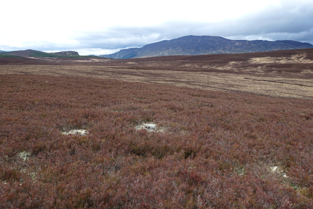
Ahead was heather moor, managed for grouse with a lot of recently burned patched to cross.
 cairn51 by Peter Lynn, on Flickr
Grouse moor and, across the Spey valley, the Monaliath
It was only when I came across this little rock outcrop that it occurred to me that I hadn't seen any rock since Glen Tilt.
 cairn52 by Peter Lynn, on Flickr
Bog and rock.
It also occurred to me that wildlife hadn't been that plentiful - lots of grouse calling and flying up noisily, golden plover, wheatear and meadow pipits on the hills, common sandpiper along the rivers, frogs and the adder. At this point I saw the first bird of prey of the walk when a golden eagle soared over a small hill and then passed overhead and off towards Glen Tromie.
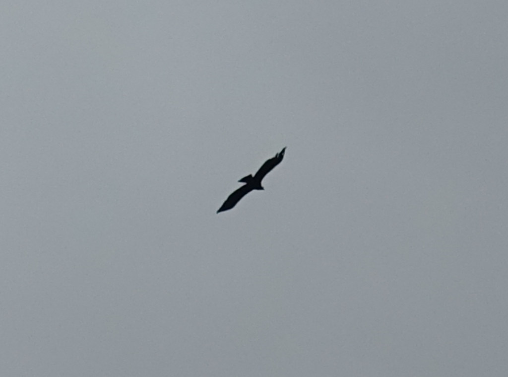 cairn53 by Peter Lynn, on Flickr
Usual picture of golden eagle in silhouette.
Because of the existence of a lot of deer fences on this moor I was trying to plot a course based on paths and tracks and footbridges on the map expecting to find gates in the fences there. I'm sure some of you old hands are smiling at this!
 cairn54 by Peter Lynn, on Flickr
Track , Craeg Dhubh beyond.
Anyway, just after crossing General Wade's Road, on the path marked on the map, the path disappeared and this was the bridge.
 cairn55 by Peter Lynn, on Flickr
No longer bridge
Fortunately there was a (newer or older?) alternative just upstream.
 cairn56 by Peter Lynn, on Flickr
Stepping Stones
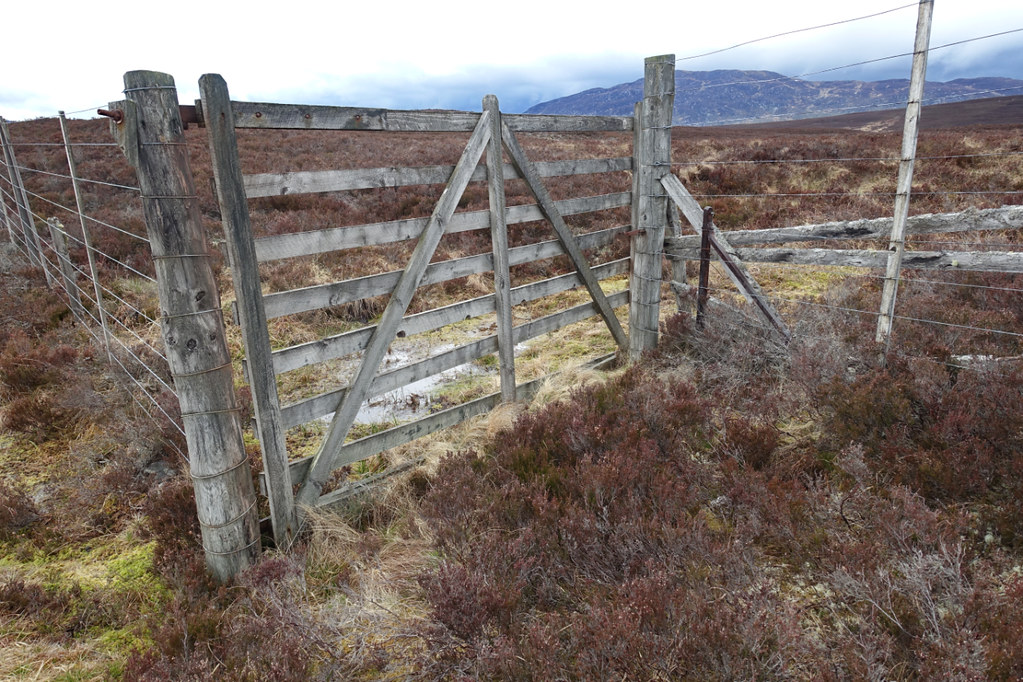
Although there was no sign of a path I could see a gate through my binoculars and bashed across to it and found it operative.
 cairn57 by Peter Lynn, on Flickr
Operational gate in deer fence.
I don't know why I thought it was a good idea to walk over something called Nuide Moss but it was on the direct line to my final track and from here looked a bit boggy.
 cairn58 by Peter Lynn, on Flickr
Across Nuide Moss to Creag Dhubh
In fact it was wet and the heather on the higher bits pretty tough but not too bad. The value of the deer fence became apparent when, in a few spots I saw self set Scots Pine seedlings.
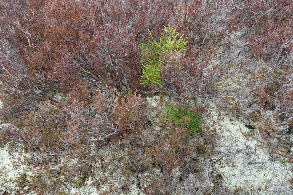 cairn59 by Peter Lynn, on Flickr
Pine seedling
I got across to the track and finally Newtonmore was in sight.
 cairn60 by Peter Lynn, on Flickr
Newtonmore
I got across the A9 easily (surprised at that) had a coffee at the Ralia Cafe and reached my B&B just as it came on to rain again. So I did what I set out to do. There were moments of great satisfaction separated by hours of trudgery. I was lucky with the weather. I also increased my count of Munros from 5 to 8 and Corbetts from 7 to 9. (you can see I'm not a bagger). There's a lot of satisfaction in a journey.
Note on kit:-
Tent Vaude Power Lizard 1/2 - very light and compact, easy and quick to put up, noisy in the wind, fabric stretches when wet so needs retensioning in the rain. Like all small tents suffers condensation when not windy and draughty when is.
Sleeping mat Exped DownMat Lite 5 - love this, compact, warm, not too heavy, thickish fabric so quiet and fairly tough.
Osprey Exos 48 pack. Light, right size for this type of trip, very comfortable for my 14Kg load. Stetchy pockets a bit flimsy and I already have a hole. Managed to make use of hip belt pockets (camera and PLB) and even one shoulder strap pocket (monocular).
So on the Thursday evening of the early May bank holiday I arrived in Perth. Two nights at the Premier Inn were nicely comfortable without breaking the bank. On arrival my pack weighed just under 14Kg so on the Friday I thought I'd have a warm-up walk with a bit less than this so wandered around Kinnoul Hill leaving tent and food behind. It was a really nice walk with great views over the Tay and north to the Highlands where, ominously, Beinn a'Ghlo never emerged from the cloud.
cairn1 by Peter Lynn, on FlickrThe Tay and Kinnoul tower
The plan was to walk in to the bothy over Carn a'Chlamain, camp nearby and socialise at the bothy then spend the Sunday walking over An Sgarsoch, Carn an Fhidhleir (Carn Ealar) and Beinn Bhreac and spend Monday and Tuesday making my way to Newtonmore with another nights wild camp, route depending on the weather.
Day 1 Blair Atholl to Tarf Hotel
18km : 1120m of ascent : 5 1/2 hours
Saturday morning saw me catch the train to Blair Atholl and join up with the others. There were 6 of us setting off for the bothy and a number of others joined us for the walk up Glen Tilt.
cairn2 by Peter Lynn, on FlickrDelightful Glen Tilt
We followed the valley to the marble bridge then set off up the ridge to join the landrover track which goes virtually to the top of Carn a'Chlamain. The initial climb was a bit steep with a fully laden pack.
cairn3 by Peter Lynn, on FlickrNearing the track
The cloud which had been down on the tops when we left Blair Atholl had now cleared. As we were a bit late in the day we saw several people returning and a couple of people we met said they had seen nothing when they were on the top.
cairn4 by Peter Lynn, on FlickrDavid needlessly checking the map
A steady plod up the track saw us at the top by about 3.30pm. It was difficult trying to stand up to take a picture as the wind was blowing hard over the summit.
cairn5 by Peter Lynn, on FlickrIt took only about half an hour to descend to the bothy over the odd snow patch and unnecessarily crossing the Allt Feithe Uaine by choosing the wrong bank of the feeder stream. There were already some guys with a couple of dogs at the bothy but they made room for us and I and a couple of others pitched our tents nearby.
cairn7 by Peter Lynn, on FlickrSupper at the Tarf Hotel
I didn't get much sleep because of a stiff breeze causing my tent to flap noisily - a major drawback to my lightweight tent.
Day2
22km : 1040m ascent : 8 1/2 hours
The intention today was to do An Sgarsoch, Carn an Fhidhleir (Carn Ealar) and Beinn Bhreac and return to the bothy for the night. So we didn't have to carry all our kit.
But first we had to cross the Tarf. I bought a pair of lurid blue and yellow boat slippers which were good for the job. Others crossed in socks or waterproof sandals.
cairn8 by Peter Lynn, on FlickrIt was a straightforward ascent up by a burn to a col and then along the ridge to the broad rounded top. The tops were clear by now and the views extensive to the north and east.
cairn9 by Peter Lynn, on FlickrBack down to the Tarf, Beinn a'Ghlo behind.
cairn10 by Peter Lynn, on FlickrQuite a few snow patches in gullies.
cairn11 by Peter Lynn, on FlickrCairngorms from the ridge.
cairn12 by Peter Lynn, on FlickrSummit of An Sgarsoch
There was then a fair drop to the col between An Sgarsoch and Carn an Fhidhleir and a climb up the other side. Met an orange clad walker here who'd come in from the Lin of Dee.
cairn13 by Peter Lynn, on Flickrcairn14 by Peter Lynn, on FlickrLooking back to An Sgarsoch
We had a short break before the next summit and were overtaken by a couple of young guys who were not only faster but seemed to need less clothing!
cairn15 by Peter Lynn, on FlickrSummit of Carn an Fhidhleir
Navigation was very easy today with no cloud down and good visibility so we just headed towards Beinn Bhreac in an arc trying to avoid losing too much height or getting into peat hag territory. Saw another walker here, a lady with a pack who seemed to be wearing wellington boots and shorts!
cairn16 by Peter Lynn, on FlickrHeading west off Carn an Fhidhleir
cairn17 by Peter Lynn, on FlickrLast pull up to Beinn Bhreac
cairn18 by Peter Lynn, on FlickrSummit Beinn Bhreac looking back to Carn an Fhidhleir and An Sgarsoch.
cairn19 by Peter Lynn, on FlickrMe on Beinn Bhreac
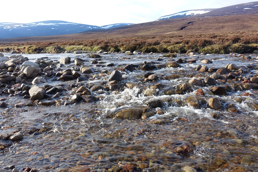
There was still about 8Km and a river crossing to get back to the bothy. While the river was delightful with common sandpipers piping away every few minutes and frogs leaping away from our boots regularly, it became a bit of a trudge. A couple of times we had to climb away from the river where a slope had been eroded and there was no easy low level way past.
cairn20 by Peter Lynn, on FlickrThe banks of the Tarf
cairn21 by Peter Lynn, on FlickrA small waterfall.
cairn22 by Peter Lynn, on FlickrBack at the Tarf Hotel
It was a relief to be back and the other guys and dogs had left. When we looked at the bothy book we were taken aback to read their entry (paraphrasing) ' We spent the night as usual smoking weed and telling fart jokes. A group of old men arrived and weren't very friendly and looked as if they might kick off at any time'. Well I am an old man so didn't mind but some of the others who were barely 50 were not amused. As for kicking off - I don't think we even had a football between us!
Day 3
21km : 550m of ascent : 9 hours
I got a better night's sleep as the wind dropped. So got up to a mild, calm morning with just a few midges about. The sky to the south soon looked ominous though and cloud was down on the hills. After yesterday's trudge along the Tarf I was hoping for the cloud to lift so I could enjoy a high level, and easier, route westward. Had breakfast with the others at the bothy and managed to get the tent down and packed up in the dry. We said our goodbyes and they headed back to Blair Atholl while I set off up the Tarf again. I must have got a good half mile when the rain came on so it was on with the waterproofs and pack raincover. I passed the little waterfall again where the river was noticeably lower - showing , I guess, that much of the flow was snowmelt which had slowed down overnight.
cairn23 by Peter Lynn, on FlickrLess flow over the fall this morning.
My first objective was to pass the point where we had come down from Beinn Bhreac and crossed the Tarf yesterday - then I'd be in new territory. But somehow, in between daydreaming and watching my feet, I missed it and realised I was getting nearer the decision about high or low level route.
cairn24 by Peter Lynn, on FlickrGetting a bit boggy near the watershed.
I'd taken to cutting off some of the meanders on the river as they were getting more extravagant.
cairn25 by Peter Lynn, on FlickrThis is getting ridiculous.
Eventually I reached the watershed with the Allt a'Chuil. The cloud now seemed to be above 800m and rising so, with some relief, I set off uphill away from the river.
cairn26 by Peter Lynn, on FlickrLast look back to the infant Tarf.
I could now follow my planned route over towards Leathad an Taobhain and the top of the Minigaig pass.
Above about 800m the heather died away leaving a surface of lichen, moss and gravel which made for really nice walking - though it seldom lasted long before a descent into boggy bits or heather again.
cairn27 by Peter Lynn, on FlickrNice going up here
Quite a few of the boggy bits were filled up with melting snow and I was a bit cautious about what I would cross. Didn't fancy breaking through into a soggy hollow on my own with a pack on my back.
cairn28 by Peter Lynn, on FlickrTo cross or not to cross?
Altitude didn't seem to affect the abundance of frogs - just a bit of damp grass.
cairn29 by Peter Lynn, on FlickrGot to the point marked 859m and the view to the north opened up.
cairn30 by Peter Lynn, on FlickrView over upper Glen Feshie
There was a steep valley between here and Leathad an Taobhain so I contoured around to avoid too steep a drop.
cairn31 by Peter Lynn, on FlickrLeathad an Taobhain now visible top left.
The way ahead lay across a snow filled gully or was blocked by a big drift. There were a few set of footprints crossing the snow but I had a look at where the stream exited from under the snow before deciding it was ok to cross.
cairn32 by Peter Lynn, on FlickrSnow obstacle
cairn33 by Peter Lynn, on FlickrStream emerging - several feet of snow above.
Soon after climbing out of the little valley I saw this mountain hare while crossing some peat hags.
cairn34 by Peter Lynn, on FlickrOnce above the hags and heather it was back to good walking on lichen etc and even signs of a path.
cairn35 by Peter Lynn, on FlickrNearly up Leathad an Taobhain
Then I was at the top of my second Corbett on the trip, both in the top ten by height but both pretty nondescript. The view north to the Cairngorms was pretty good though.
cairn36 by Peter Lynn, on FlickrThe trig point on Leathad an Taobhain, Cairngorms beyond.
cairn37 by Peter Lynn, on FlickrSelfie on the summit.
It was then a short descent, avoiding a couple of icy snow banks, down to the top of the Minigaig pass.
cairn38 by Peter Lynn, on FlickrDescending towards the Minigaig.
cairn39 by Peter Lynn, on FlickrThe Minigaig
When I reached the Minigaig it was a great track and I set off with a renewed spring in my step - for a couple of hundred yards. This was definitely the only stretch of the Minigaig I saw that I would ride an MTB on. Within minutes the path disappeared into bog or itself became the main route for snowmelt off the hill. So I just splashed on for the next couple of miles, keeping the infant Allt Coire Bhran on my left. In fact this was one of the couple of times on the walk I used the GPS on my phone to see if I was anywhere near the path - I was, but there was little sign of it. Around 6pm I found a good spot to camp near a side stream and put up the tent.
cairn40 by Peter Lynn, on FlickrHaving a cuppa after pitching.
It was a pretty idyllic spot, on the site of an old shieling and I managed to get all my pegs in ok, bar one which had to go in at quite an angle.
cairn41 by Peter Lynn, on FlickrLate evening in a great spot.
Day 4
22km : 440m of ascent : 9 hours
Although it was pretty calm when I turned in the wind soon got up leading to a fitful night's sleep. Sometime around midnight the poorly anchored peg came out and the end of the tent flopped onto my face. I got up and used one of my walking poles as a much better peg - reaching beyond the rocks to get a better purchase - ought to consider this in the future where a rock prevents a good peg position. Anyway, I got up at 5.15am to a beautiful morning and somehow managed to while away over an hour getting ready before setting off at 6.30am. I just had to descend into Glen Tromie, cross the river and then the moors to Newtonmore.
cairn42 by Peter Lynn, on FlickrEarly morning by the camp spot.
cairn43 by Peter Lynn, on FlickrLast look back to the Minigaig. Path is more visible (diagonal climbing left to right in top centre) from here than on the ground.
The hills in this area are pretty understated (boring to most?). This is made up for by the sense of space and emptiness. True, while out walking I (we) did meet 4 other people. But it was a fine bank holiday and these last couple of days I didn't see anyone until I reached the A9 at Newtonmore. But the thing I'll remember most are the rivers. The Tilt, the Tarf, the Allt Coire Bhran, the Tromie and the many smaller streams were a delight to sit beside and listen to - though often a pain to walk along. This wasn't really the lasting memory I expected to bring home with me.
cairn44 by Peter Lynn, on FlickrThe Allt Coire Bhran
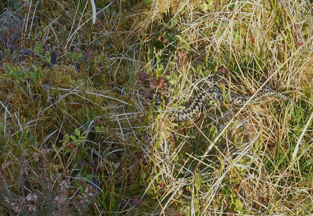
The path was mostly now just a deer trod through the heather or grass. But still worth following for ease of walking. I was really not expecting to see a snake coiled up at the side of the track, sunning itself at 7am. But suddenly there at my feet was an adder. A quietly as I could, I reached for my camera and focused. At that instant, it was off but I managed to get a shot of it slithering away through the vegetation.
cairn45 by Peter Lynn, on FlickrAdder - head is at the top left of the picture.
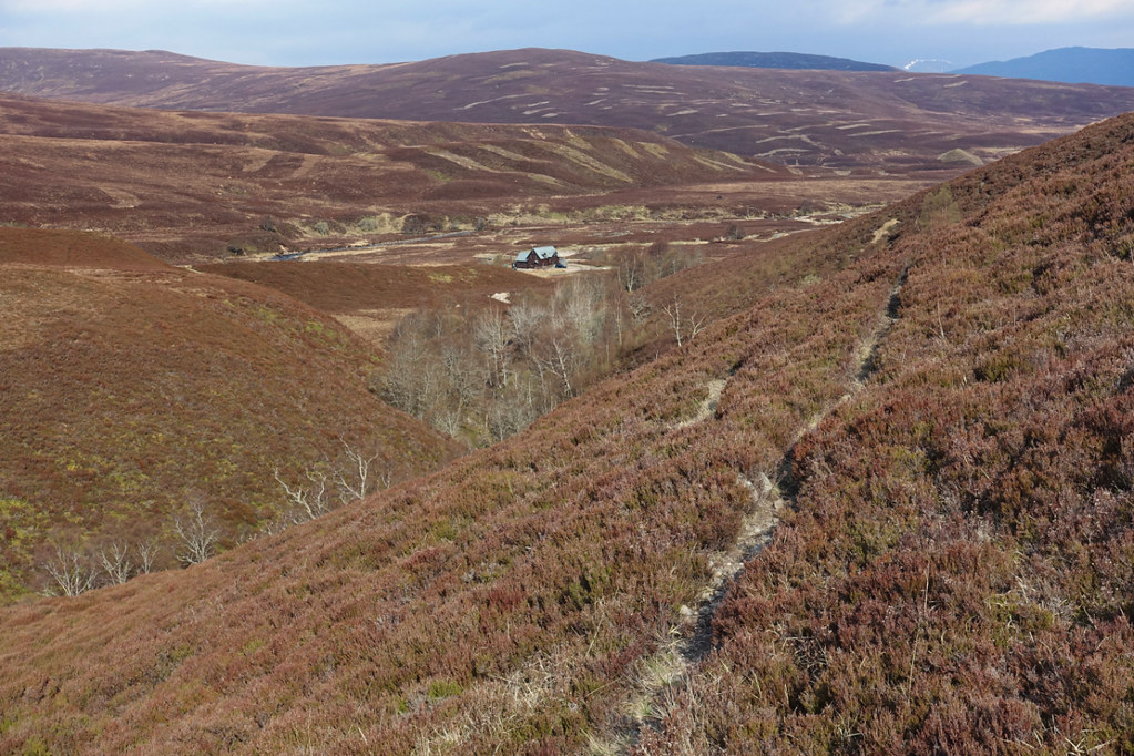
After that excitement, I followed the narrow path above a ravine and down into Glen Tromie by Bhran Lodge
cairn46 by Peter Lynn, on FlickrBhran Lodge and Glen Tromie
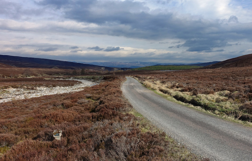
Although a private road, much of the track down Glen Tromie is tarmacked.
cairn47 by Peter Lynn, on FlickrTrack down Glen Tromie
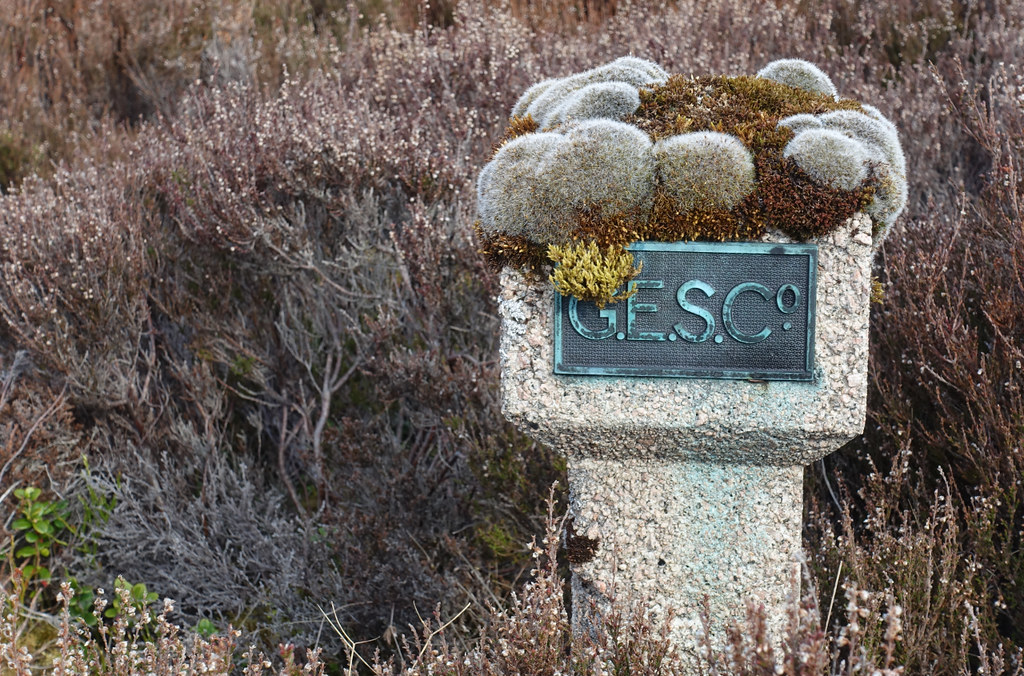
cairn48 by Peter Lynn, on FlickrInterestingly decorated marker post by the track.
I knew the map showed a bridge at Dalriach. I knew I had read somewhere that it was sturdy enough to take shooting parties over on their transport. But I had the nagging feeling that I'd read somewhere that it was no longer there. The nagging doubt was right. The sturdy bridge pillars were there but only part of the wooden bridge was in place and another part lying in the grass. Not very surprised, I set off downstream looking for a place to wade across. The map seemed to show a wider and presumably shallower section further down. In fact, not too far down I came across a ford, nicely created for landrovers.
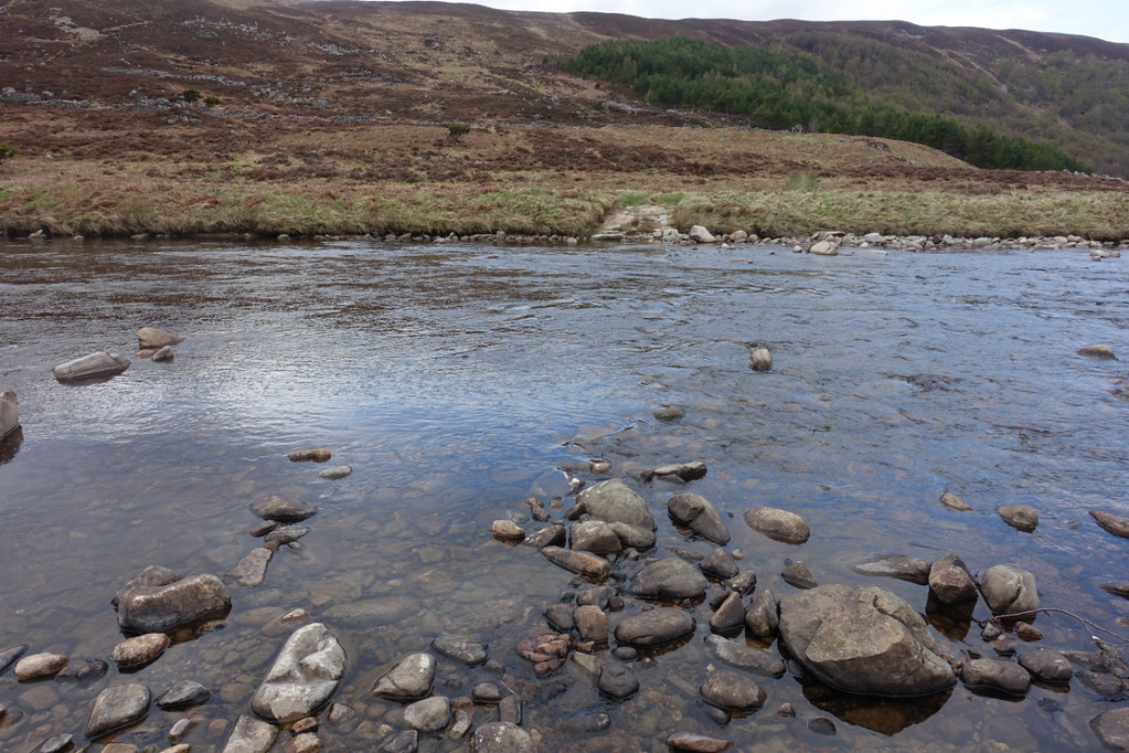
cairn49 by Peter Lynn, on FlickrFord across the Tromie
Although a faff to remove boots, put on my boat slippers and reverse the process once across it was a nice break from walking. Strangely, although all the rivers must have been close to freezing seeing as they were mainly snow melt, they never seemed that cold on my feet. This ford came to just below the knee.
I now climbed up onto the moor above the Tromie - the advantage of crossing here being I was in a gap in the deer fence which encloses much of this valley. The cloud was filling in now as I looked back up Glen Tromie towards the Gaick.
cairn50 by Peter Lynn, on FlickrLooking back up Glen Tromie.
Ahead was heather moor, managed for grouse with a lot of recently burned patched to cross.
cairn51 by Peter Lynn, on FlickrGrouse moor and, across the Spey valley, the Monaliath
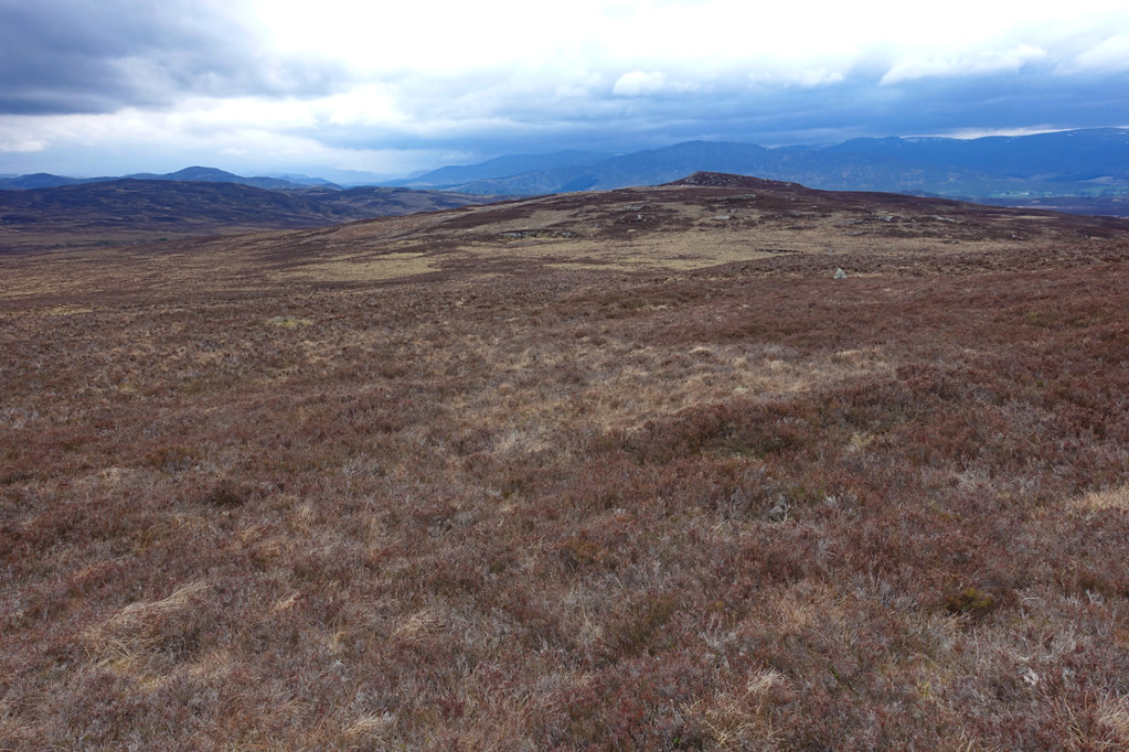
It was only when I came across this little rock outcrop that it occurred to me that I hadn't seen any rock since Glen Tilt.
cairn52 by Peter Lynn, on FlickrBog and rock.
It also occurred to me that wildlife hadn't been that plentiful - lots of grouse calling and flying up noisily, golden plover, wheatear and meadow pipits on the hills, common sandpiper along the rivers, frogs and the adder. At this point I saw the first bird of prey of the walk when a golden eagle soared over a small hill and then passed overhead and off towards Glen Tromie.
cairn53 by Peter Lynn, on FlickrUsual picture of golden eagle in silhouette.
Because of the existence of a lot of deer fences on this moor I was trying to plot a course based on paths and tracks and footbridges on the map expecting to find gates in the fences there. I'm sure some of you old hands are smiling at this!
cairn54 by Peter Lynn, on FlickrTrack , Craeg Dhubh beyond.
Anyway, just after crossing General Wade's Road, on the path marked on the map, the path disappeared and this was the bridge.
cairn55 by Peter Lynn, on FlickrNo longer bridge
Fortunately there was a (newer or older?) alternative just upstream.
cairn56 by Peter Lynn, on FlickrStepping Stones
Although there was no sign of a path I could see a gate through my binoculars and bashed across to it and found it operative.
cairn57 by Peter Lynn, on FlickrOperational gate in deer fence.
I don't know why I thought it was a good idea to walk over something called Nuide Moss but it was on the direct line to my final track and from here looked a bit boggy.
cairn58 by Peter Lynn, on FlickrAcross Nuide Moss to Creag Dhubh
In fact it was wet and the heather on the higher bits pretty tough but not too bad. The value of the deer fence became apparent when, in a few spots I saw self set Scots Pine seedlings.
cairn59 by Peter Lynn, on FlickrPine seedling
I got across to the track and finally Newtonmore was in sight.
cairn60 by Peter Lynn, on FlickrNewtonmore
I got across the A9 easily (surprised at that) had a coffee at the Ralia Cafe and reached my B&B just as it came on to rain again. So I did what I set out to do. There were moments of great satisfaction separated by hours of trudgery. I was lucky with the weather. I also increased my count of Munros from 5 to 8 and Corbetts from 7 to 9. (you can see I'm not a bagger). There's a lot of satisfaction in a journey.
Note on kit:-
Tent Vaude Power Lizard 1/2 - very light and compact, easy and quick to put up, noisy in the wind, fabric stretches when wet so needs retensioning in the rain. Like all small tents suffers condensation when not windy and draughty when is.
Sleeping mat Exped DownMat Lite 5 - love this, compact, warm, not too heavy, thickish fabric so quiet and fairly tough.
Osprey Exos 48 pack. Light, right size for this type of trip, very comfortable for my 14Kg load. Stetchy pockets a bit flimsy and I already have a hole. Managed to make use of hip belt pockets (camera and PLB) and even one shoulder strap pocket (monocular).