free to be able to rate and comment on reports (as well as access 1:25000 mapping).
Back in March, I spent several thoroughly unproductive and highly frustrating days in Strontian. My confidence had taken a severe knock, leaving me incapable of getting any higher than ~600m (approx snow level). I had had, in fact, a bit of a panic attack on Garbh Bheinn at 560m after scrambling up a wet rock that I’d have thought nothing of in dry conditions. Shaking, dizzy, and in a cold sweat, descending seemed the most prudent of options. I had similar experiences (although less severe) on Ben Resipol, and, on the way home, in a desperate attempt to end the weekend on a positive note, Beinn a’Chrulaiste. I really liked the B&B I stayed at, though, and promised myself a return visit under more amenable conditions. My agenda was more or less the same as it had been on my earlier visit.
Fri 28 Sep
Corbett: Glas Bheinn (Kinlochleven)
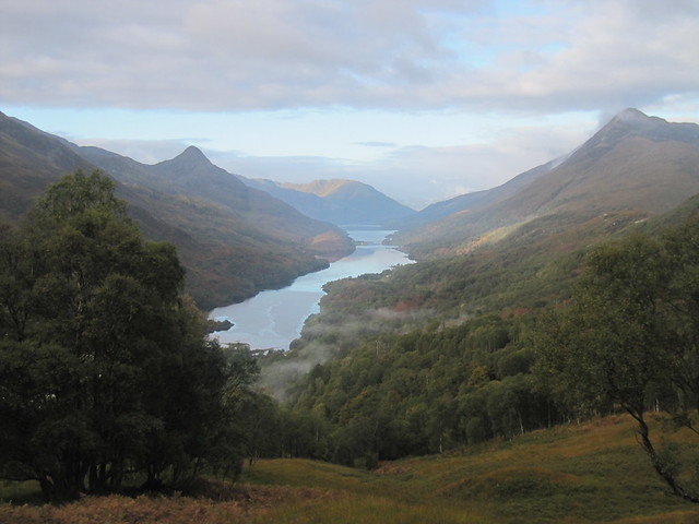
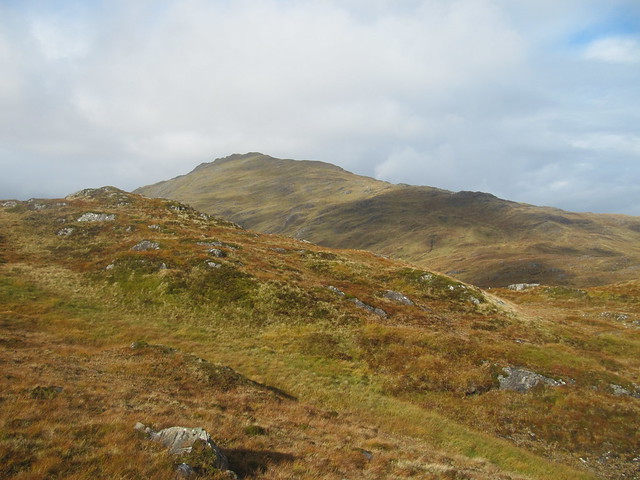
6.5 hrs / 19.54km / 976m I thoroughly enjoyed this route, and this hill. I set off from Kinlochleven around 9am, I think, taking the familiar path(s) – there are many! – up through the woodlands, as though heading up to the eastern Mamores.
magic!
When I reached the good track/motorway, I carried on along it for ½ km or so, rather than crossing it and continuing uphill. I was slightly concerned about getting across the outflow of Loch Eilde Mor, after having read about ongoing hydro works and the lack of a bridge at the dam, but I needn’t have worried, as there is now a brand new bridge, and the hydro work has finished.
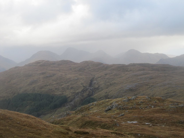
Beyond there, the path was boggy and muddy, as promised in the WH desc. Rather than following the path all the way to Meall na Cruaidhe, I cut off a corner and headed across the moor toward my summit. The view toward the Mamores opened up, and they looked fantastic. Soon the Grey Corries were getting in on the action, too, although shy BN kept its head in the clouds, as it so often does.
BEM, BEB, Bidean
AE ridge
Mamores
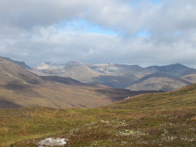
Grey Corries
Loch Treig + its hills
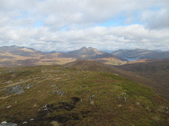
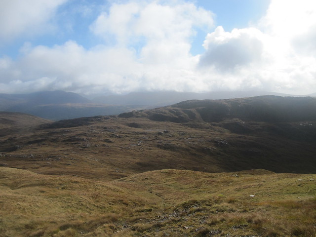
From the summit, I could see in all other directions as well—over to the Aonach Eagach, down onto both Blackwater Reservoir and Loch Eilde Mor. Schiehallion stood pointy in the far distance. BEM winked loudly at me, and continued to do so throughout my descent to the reservoir—I’d decided to do the circular route, rather than retracing my steps, hoping that it’d be a bit less boggy (it was).
Loch Eilde Mor and Loch Leven
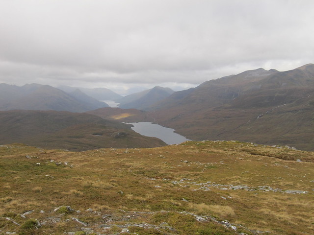
I sat on the summit for a while, but it was cold (there’s a stock sentence!), so before too long, I was moving along toward Meall na Cruaidhe. From there, I picked up the stalkers’ path that I’d been on before, and carried on along it for as long as it lasted—thereafter, simply heading “down” toward the dam. I realized that, along with BEM dominating the view, I was also looking at Beinn a’Chrulaiste—my target for Monday, on the way home.
"head for the dam." BEM winking at me; Beinn a'Chrulaiste on the left
It was a looooooong way back from the dam; much further than I’d anticipated. But there were some stunning waterfalls, a couple of burn crossings that demanded attention, and some lovely autumnal colours to keep me entertained.
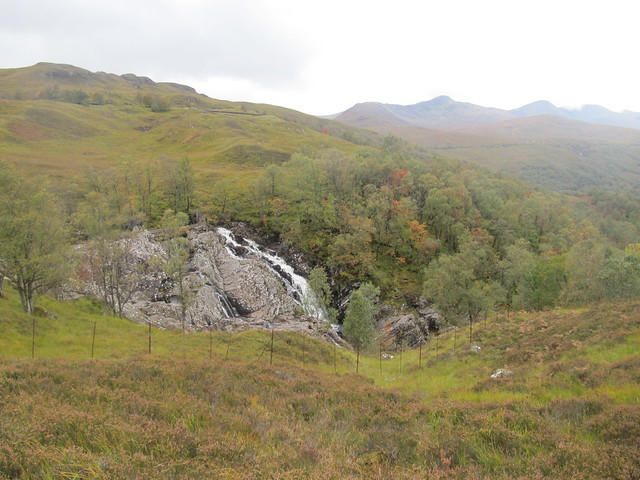
waterfalls + colour on the return journey
Upon my return to Kinlochleven, I decided to check out the café at the Ice Factor. They had a decent menu, and serve food all day. The mac ‘n cheese wasn’t the best I’ve ever had, but it did set me up for the rest of the evening.
From there, it was only a short drive up to the Corran ferry, and then the final bit of the journey to Strontian.
Sat 29 Sep
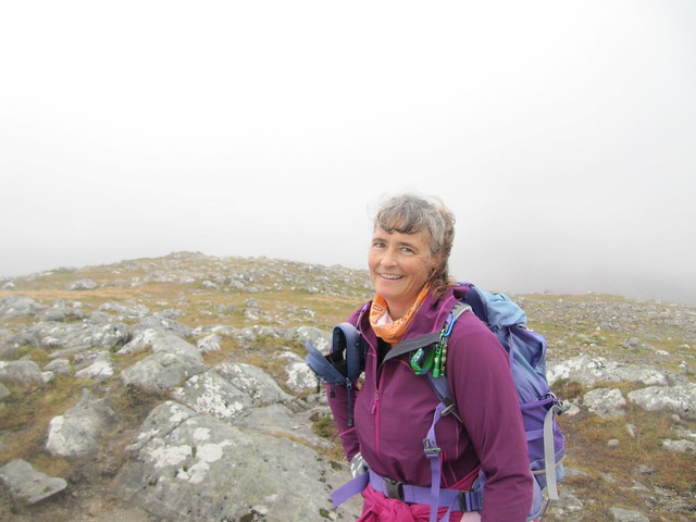
Garbh Bheinn recce (again) – proving to be one of THOSE hills!A later start than I’d planned, after having a lengthy natter about the state of the world over breakfast with my fellow guests. We’d watched several showers, as well as some spells of blue sky, pass over our heads from the breakfast room. I set off from the start point a few minutes after 10am, I think. As I remembered, it’s up up up from the start, over rough and boggy ground. When one of the passing showers became more prolonged, it was on with the waterproofs. The weather didn’t look promising, and before too long, I found myself marching ever upward in wind rain clag. When I reached the tricky bit that freaked me out the last time, I decided to call it a day; it wasn’t exactly the dry conditions I’d hoped for.
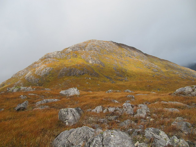
looking back up at the first tricky bit (left center). Which doesn't look at all tricky here...
nice colours, wet rocks, moody Loch Linnhe
I wasn’t scared, it was really more a matter of couldn’t be arsed. It seemed unlikely that I’d have any sort of view from the top, and the wind was kicking up rather enthusiastically. Less than two hours after setting off, I was back at the car. Ach, well, nevermind. Yet another excuse to go back yet again.
the one that got away...again (looking back up from the start point)
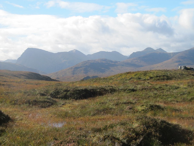
I took a drive across Morvern to Lochaline; somewhere I’ve never been. There’s not much there, other than the ferry terminal, which is dated and basic, but the drive over the top was beautiful—across as much empty and remote landscape as I’ve see anywhere in Scotland. By mid-afternoon, the rain had come on in earnest, and the wind hadn’t abated.
I was disappointed in my dinner at the hotel. The menu was limited, and after dithering between fish ‘n chips and the venison casserole, I finally settled on the casserole. It came topped with a “cheese and chive” scone, and I assumed (wrongly) that the cheese would be cheddar. Ugh, it was stilton that was melted over the top, sending its flavour throughout. Had that information been on the menu, I wouldn’t have ordered it. Additionally, the stew was filled with bay leaves, and something else – not peppercorns, which I wouldn’t have minded – but some other odd spice that was far too strong when bitten into, and which I didn’t care for. The veg were limp, overcooked, and soggy. The beer seemed off, but not so off it was obvious, so I didn’t send it back, but I also didn’t finish it (Imagine that, Karen leaving more than half a pint undrunk!

). The service wasn’t particularly friendly either.
Sun 30 Sep
Corbett: Ben Resipol, from Ariundle
7 hrs / 19.9 km / 935m A fab fab fab fab day – I set off directly from the B&B a few minutes past 9am, after getting directions that would take me on the scenic route to join up with the WH route just above Ariundle – to a small community-built hydro dam that supplies Strontian with its electricity (and contributes to the National Grid as well

). The track – the old right-of-way that carries all the way over to Polloch – was fine up to the dam, but then became a nightmare of a mud pit! It was a relief to leave it at its highest point, and strike up toward Meall an t-Slugain across rough heathery – and wet! – ground. I debated (with myself, huh) whether to carry on – showers, some quite heavy – kept passing through, and it still looked a long way, plus some descent, across mega-boggy ground just to gain the ridge; the summit(ish) kept going in and out of the cloud.
Finally, given that it was still early – maybe around 11:30? – and that I wasn’t particularly miserable – I got off the fence, and decided to carry on. Once I’d made the decision, I really began enjoying myself. It was one of those days when the weather is firmly in control, and you can’t do much except give yourself over to it. Wild, windy, wet, and completely exhilarating!
you might think that's the top. HA.
looking back across the vast waterlogged moor I'd come across

when it was good, it was very good!
Once I’d made it up onto the ridge, in the vicinity of what’s called Leac Chlann Domhhnuill Mhic Dhugaill (surely that's a mouthful even for Gaelic speakers), it was still a fair old distance to the summit. I clambered over various tops – some requiring a bit of hands on – each time thinking “this
must be it.” I thought I must somehow have overshot the summit, so stopped to check the map, only to find that I was still ½ km or so away! The cloud was down, and I was battling the wind, which had become ferocious. Finally, I DID reach it, only to turn around and stagger back in the direction I’d come – there were no views, and I was quite anxious for some respite from the wind.
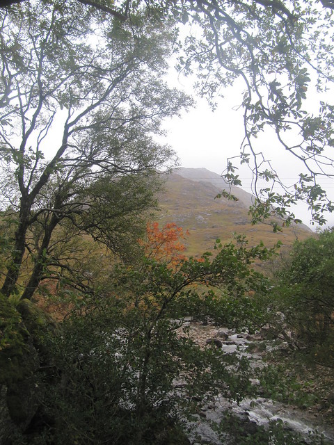
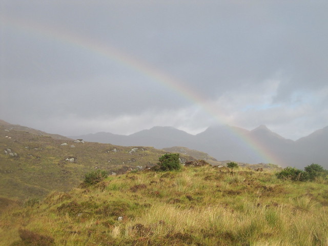
I caught the briefest glimpse of Loch Shiel on the descent. The first time, it appeared only for a few seconds, and I wasn’t quick enough with the camera to capture it. But a few minutes later, the cloud lifted for a little longer, and I got an inkling of the views I was missing. Yet another one to visit again on a good day!
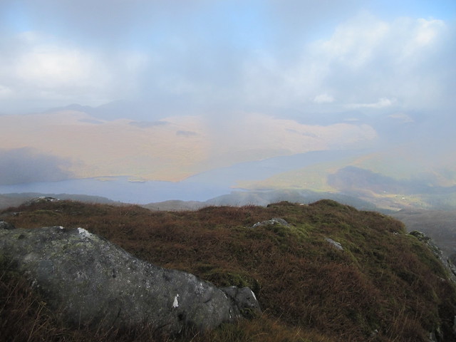
the teensiest teaser from Loch Shiel
there just might be some hills over there...
c'mon....
just enough to tantalize...
The “swim” across the moor was much quicker without my earlier backing and forthing with myself, and before too long, I was back into the mud pit. I carried on down to Ariundle, and began the road walk back to Strontian, another 3½ kms.
About halfway along, I stopped in at the Ariundle Center café and had soup, a sandwich, and a cheeky beer before walking the final km+ back to Strontian.
Mon 01 Oct
Corbett: Beinn a’ Chrulaiste
3 hrs / 6.54km / 598m A bonny leg stretcher on the way home. I set off from the layby at 10am, met and had a brief chat with two lads on their way down from their previous-night summit camp. Then it was up, up, up, following another man who’d yomped past us as we were talking.
BEB, Bidean
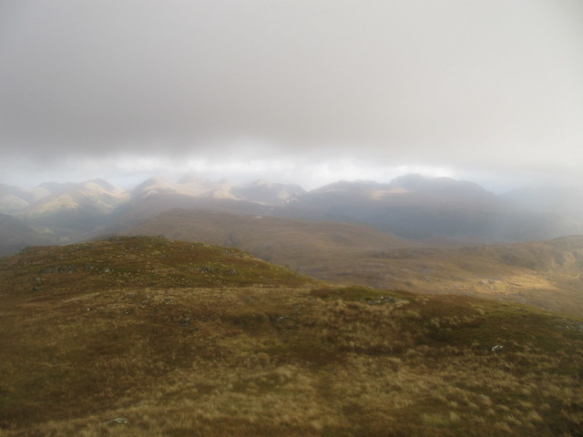
the Etive hills
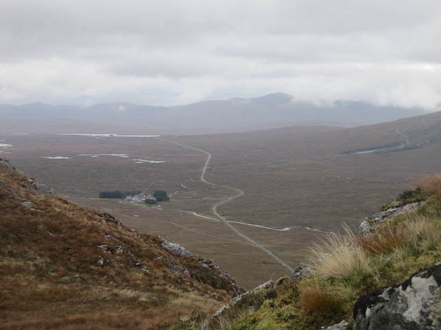
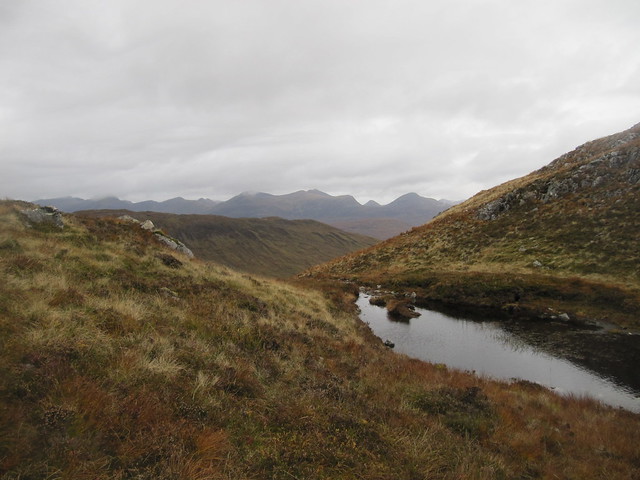
Rannoch Moor
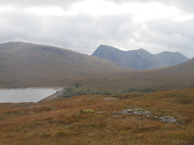
The views over to BEM, over to Bidean (sporting an icing-sugar topping of fresh snow!), across Rannoch Moor, and down Glencoe were spectacular. Before too long, I could see Blackwater Reservoir over t’other way, and Glas Bheinn, where I’d been on Friday.
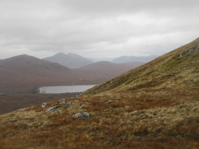
Blackwater Reservoir (I think that "my" Corbett is smack in the middle)
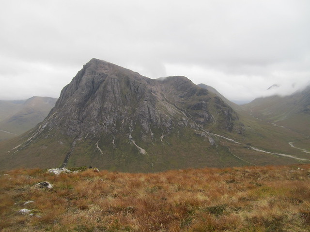
and, of course, the star of the show...
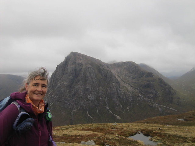
…and I am coming to get you!
I stopped at ~750m to take some (more) photos of BEM. I was soon glad that I had, because no more than five minutes before I reached the summit, the cloud came down, and what had been good visibility was completely gone. Typical!

believe it or not, BEM is still behind me!
I gave the trig point a tap, took a quick photo, and headed back down the way I’d come up, arriving back at the car at 1pm. The drive home was uneventful.
