
First Snow on the South Shiel Ridge
With Allison away on her holidays I had hopes to get a reasonable number of Munros in the bag. I fancied Kintail and had drawn out a route taking in the South Shiel ridge, then the Sisters and heading back over Beinn Fhada and Ciste Dubh, with a few Sims thrown in for good measure. However the weather was once again playing its own game - winds of 40-50mph on Friday, good Saturday then back to high winds and heavy rain on Sunday. Not really suitable for my plan. I thought I'd salvage the South Shiel ridge on the Saturday but couldn't think what to do before that - ended up deciding on Thursday lunchtime to do a circuit of Beinn Mhanach, Dothiadh and Dorain which would meet my objective of a walk in on Thursday night, three Munros plus a needed Munro Top and time to get up to Kintail on the Friday afternoon/evening. Friday's forecast was also much better for Bridge of Orchy than Kintail 
This was the intended route...
Off I set armed with my newest tent, a nice light 2 man Hilleberg Niak to see how it would fare in the wild. Parked up at the start of a forest track some way before the Auch track as for some reason I didn't fancy leaving the car at the side of the A82 - forgetting that there's a parking layby once you turn into the Auch track before the road is marked Private. Ach well, what's another kilometre. I was wondering how bad the river crossings would be - spotted a walker coming back who said the second one was the worst, up to his knees. Hmmm. I'd reached the first bridge when a black SUV pulled up and a stalker greeted me, asking what my plans were. I said I was planning to camp somewhere after Sithean Mor and head up Mhanach then cross over to Dothiadh in the morning. He thought a bit, said there was a stag they were after in Coire a'Ghabhalach tomorrow. I was prepared to just do Mhanach, but he said if I kept high between Beinn a'Chuirn and Dothaidh it should be OK. Nice and friendly encounter
.
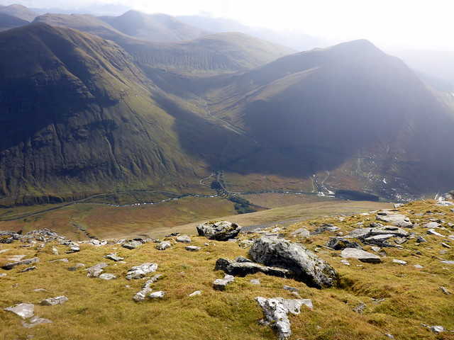
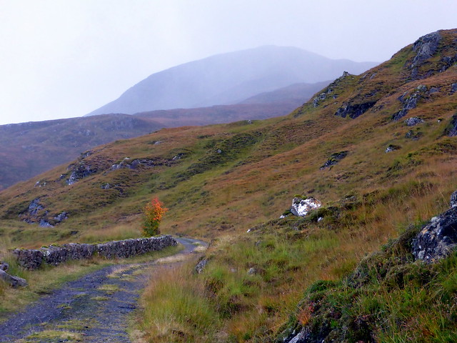
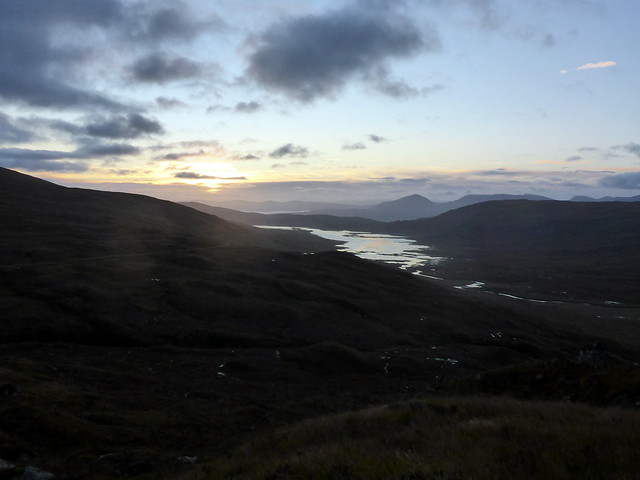
Not very promising looking weather
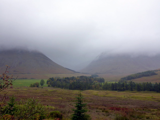 P1200738 by Al, on Flickr
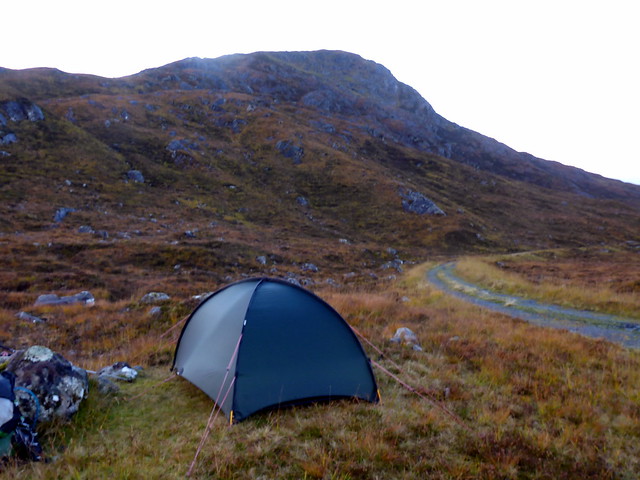
I splashed across the first crossing which was mid-calf and flowing fast. After that I thought I'd miss out the next crossing - the track, of course, crosses and re-crosses the same river several times. When I arrived at crossing number two it did look unpleasantly deep and fast, so I kept to the right hand side of the river, where there's something of a track, animal probably. A bit marshy in places, but better than immersion. I had thought to camp out near the old farm buildings, but they were occupied by a herd of cows. Pressing on I came to the joining of the tracks and found an ideal spot on a raised tussock. New tent pitched easily and provided an ideal night's shelter. Got into bed for 6.30 and read for a bit (Gavin Maxwell's "The Rocks Remain") before having one of the best tent sleeps I can remember - didn't waken up til 6.30am.
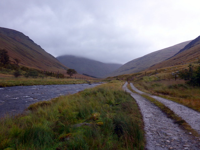 P1200739 by Al, on Flickr
Looking back along the lonely glen
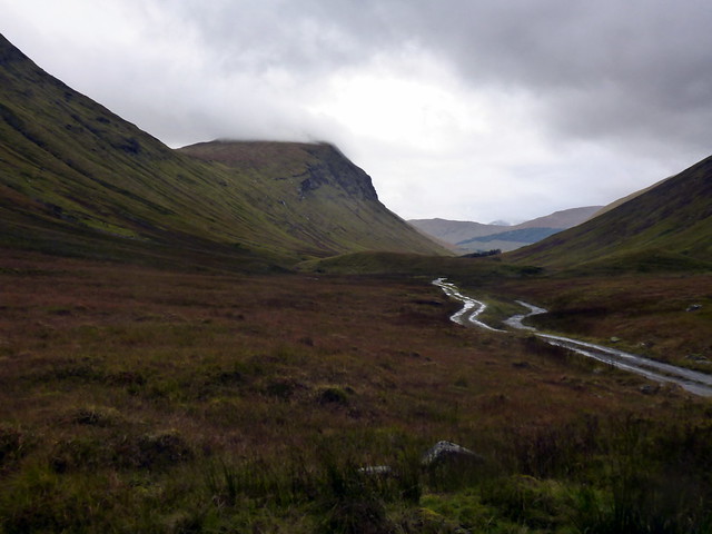 P1200740 by Al, on Flickr
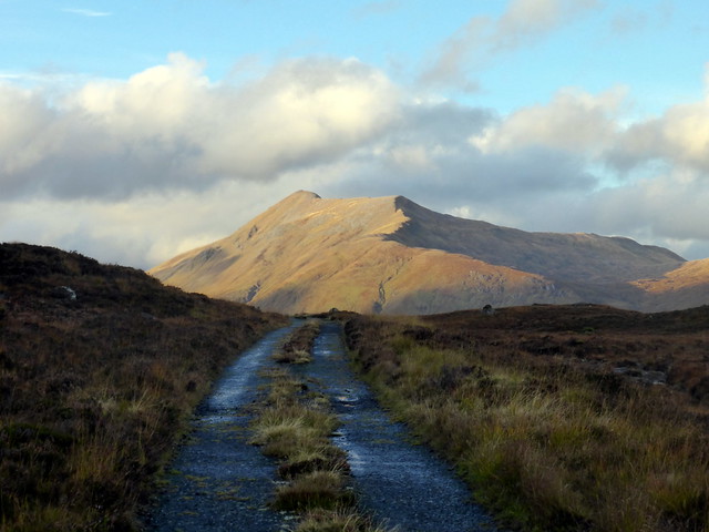
The morning looked ok - some clouds but patches of blue sky showing through and not much wind. Packed my gear away and set off along the track to the turn up to Mhanach. I decided to do Beinn a'Chuirn first, then left my pack at the bealach before heading up and back to Mhanach. Not the most dramatic summit, but good views to the Loch Lyon hills and to Beinn a'Chreachain which had a wee touch of snow on top. I headed around the north of Beinn a'Chuirn making for Lon na Cailliche, the lowest point I'd go to, then contoured up the flank of Beinn an Dothaidh. I spotted a walker in black below me, presumably a stalker. After a couple of kilometres of contouring, I picked up a more definite track that led to the SE slopes of Beinn Dothaidh and thence to the summit. Clag did close in a bit as I reached the top, but it was still by far the best visibility I've enjoyed in three visits to this hill.
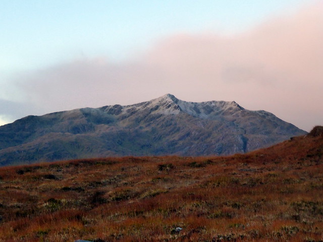
A touch of frost on Beinn a'Chreachain
 P1200745 by Al, on Flickr
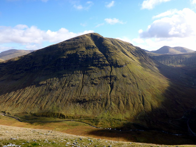
Mhanach from Beinn a'Chuirn
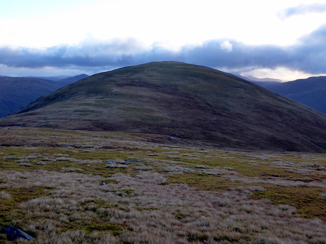 P1200746 by Al, on Flickr
Summit Mhanach
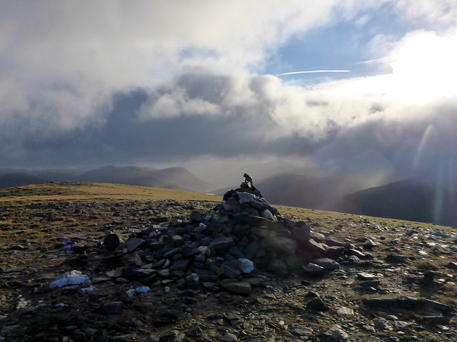 P1200749 by Al, on Flickr
Descent to this bealach then up Dothaidh
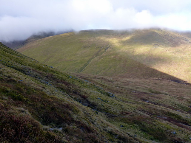 P1200750 by Al, on Flickr
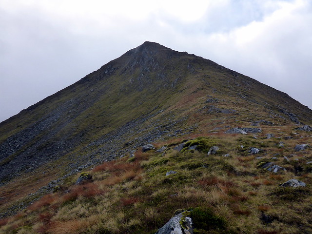
Dothaidh
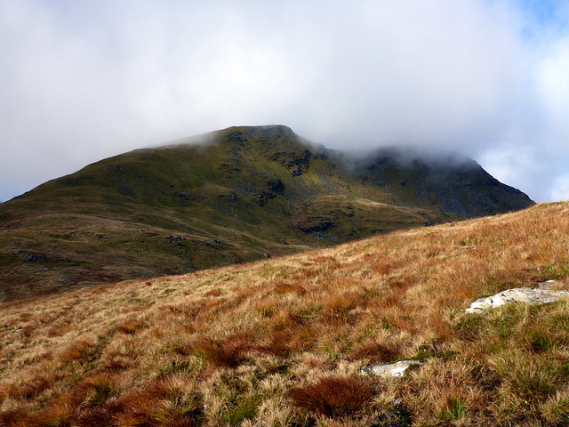 P1200751 by Al, on Flickr
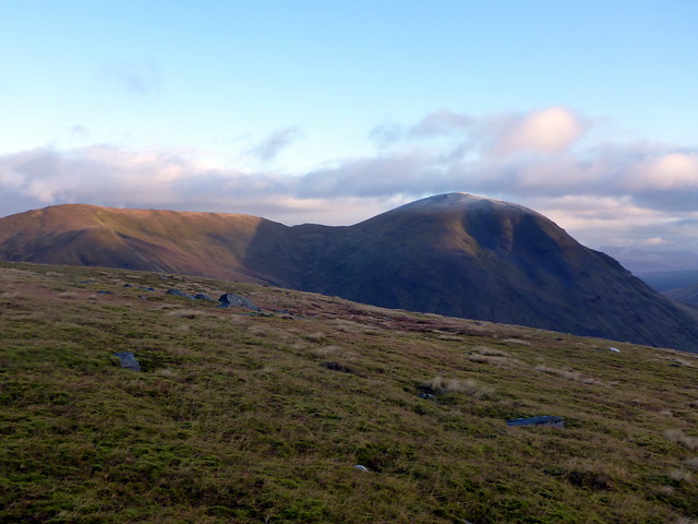
Beinn Achaladair
 P1200754 by Al, on Flickr
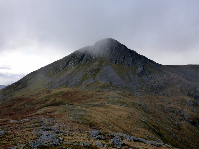
Beinn Dorain
 P1200755 by Al, on Flickr
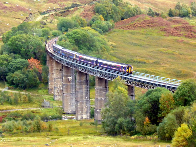
I took the usual route to the bealach with Beinn Dorain and paused at the 744m cairn for an early lunch. I was a little apprehensive about coming off the front of Dorain - for years I've been wanting to climb it that way, but descending might be a little on the steep side. Anyway, I continued on up Dorain, meeting a couple of guys descending. By now the sky was blue and there was fine sunshine illuminating the surrounding hills. Reaching the cairn I was pleasantly surprised to find a good path leading south, the way I wanted to go, but it swept westwards, presumably an alternative route back to Bridge of Orchy. So I continued south, picking my way round crags and onto steep grass/boulders. Probably best not attempted in poor visibility because of the crags, but otherwise a perfectly serviceable route. I did manage to slip twice - and as luch would have it, landing on a sharp rock each time. First onto my right hip, the second a much sorer bash midway down my left hamstrings, which left an egg-sized bruise deep in the muscle. I wasn't sure whether the worn soles on my boots were responsible - I've only had them 4 months, but I went about the rest of the descent in a gingerly fashion, making for the viaduct as I thought it improper to cross the railway lines when an option was available. Once under the viaduct I followed a faint path through the fields alongside the river until the bridge was reached and I rejoined the main track. I hoped my injuries would not stiffen up overnight.
 P1200756 by Al, on Flickr
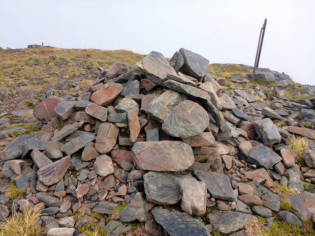
Summit Dorain
 P1200759 by Al, on Flickr
Descent towards the viaduct
 P1200760 by Al, on Flickr
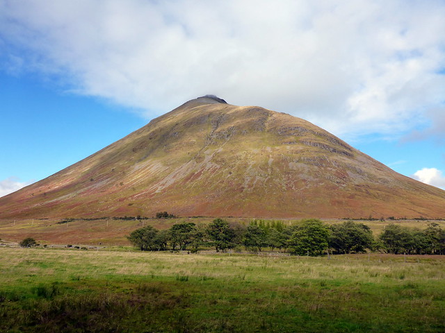
Beinn a'Chaisteal
 P1200762 by Al, on Flickr
 P1200763 by Al, on Flickr
 P1200765 by Al, on Flickr
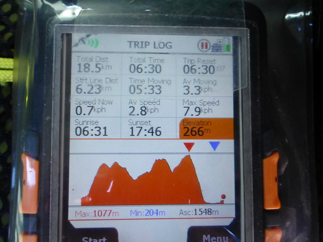
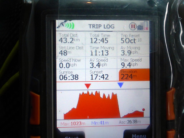
This omits the walk in on thursday (7.8km)
 P1200766 by Al, on Flickr
Drove up towards Kintail, stopping off at the Co in Ballachulish to get a sandwich for tomorrow's lunch - for some reason I'd only made 2 lunches instead of the three I needed. Parked on the track before the Cluanie Inn and assembled my gear. By this time it was about 4.30, just nice time to walk the 6.5km to the foot of Creag a'Mhaim where hopefully I'd find somewhere suitable to pitch. I had my doubts though - I remembered the ground as being heathery tussocks and bog. Cloud started to descend from the south as I walked along - across Loch Cluanie it was still nice and sunny, but I was getting hit by spots of rain. As I nearer my objective it wasn't looking promising for a tent pitch, but about 10 metres past the path that turns up onto Creag a'Mhaim there's a patch of flat grass by a big boulder that fitted the bill perfectly. Pitched, fed and tucked up in bed by 6.30 again. Unfortunately not such a good sleep - my injuries meant it was uncomfortable to lie on either side Probably having slept for nearly 12 hours solid the previous night didn't help either.
 P1200768 by Al, on Flickr
 P1200770 by Al, on Flickr
Pitch below Creag a'Mhaim
 P1200772 by Al, on Flickr
 P1200775 by Al, on Flickr
It was cold during the night and I was glad I'd switched my Thermarest XLite for the XTherm - made a noticeable difference. At around 6am it started to rain quite heavily for about an hour which didn't entice me to get up early. When I did get up, at about 7.30 there was ice on the guys. A sliver of crescent moon still hung in the sky.
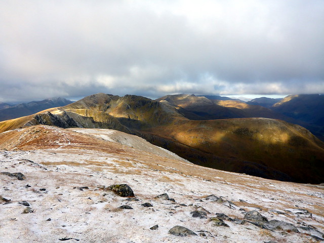
When I'd last done these hills at the end of June, it was one of the hottest weekend of the summer, plus I had tootchache that rendered my impressions of the ridge walk somewhat dull. No such warmth today. I could see snow up top on Spidean Mialach across the glen and at around 700m on Creag a'Mhaim there was snow lying and the puddles turned to ice. At the summit there was a good half-inch of snow lying, prettifying the scenery. The walk along to Druim Shionnach was made more interesting on the narrow rocky section by the presence of slippy snow, a big pack and boots I wasn't really trusting.
Spidean Mialach
 P1200776 by Al, on Flickr
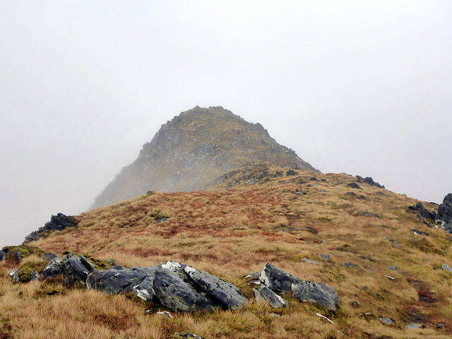
Creag a'Mhaim
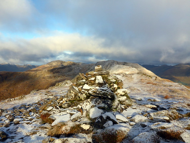 P1200778 by Al, on Flickr
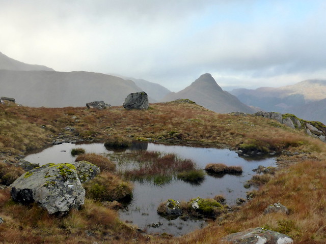
Creag a'Mhaim from Druim Shionnach
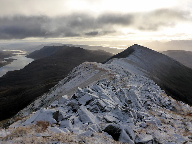 P1200781 by Al, on Flickr
The western summits are snow free
 P1200782 by Al, on Flickr
 P1200783 by Al, on Flickr
Last of the snow on Aonach Air Cirith
 P1200785 by Al, on Flickr
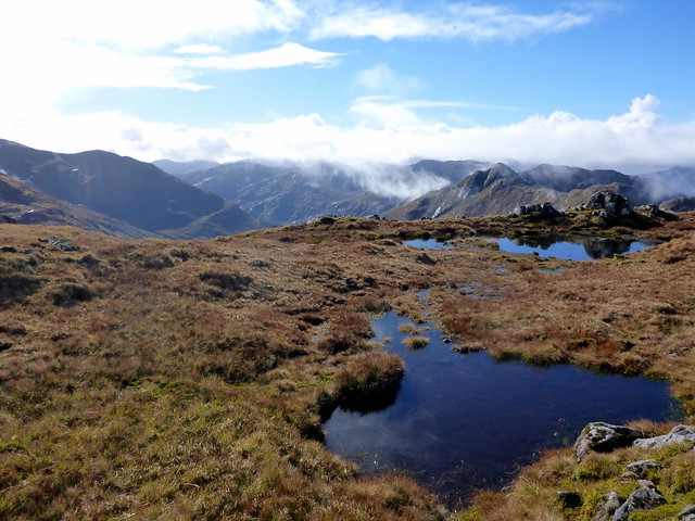
Somewhere between Druim Shionnach and Aonach Air Cirith I spotted footprints that appeared to come from no-where. At first I wondered if a stalker had come up from a gully, but they were proceeding along the ridgewalk. No-one had come up before me this morning - I wondered if I had gone crazy and was following my own footprints until I spied a walker some way ahead of me. Catching up with him, between Aonach Air Cirith and Maol chinn-dearg he admitted that he'd camped up on the ridge last night, explaining the sudden appearance of footprints. He had been very cold, at one point having to get up and do star jumps to try and keep warm. We chatted for a while, Alex the bus driver, enjoying a rare 4-day weekend off.
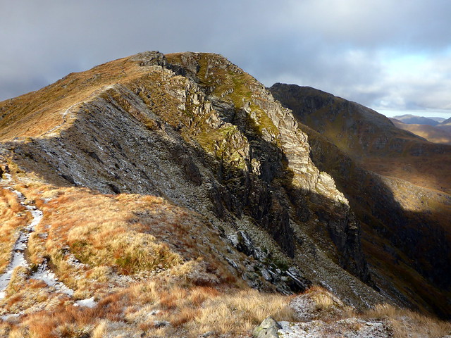
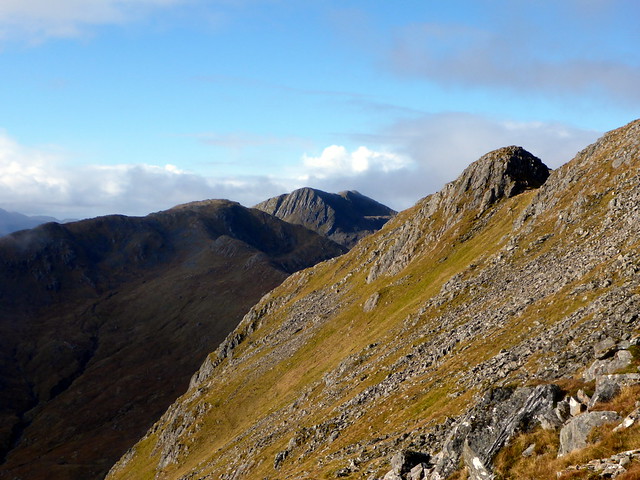
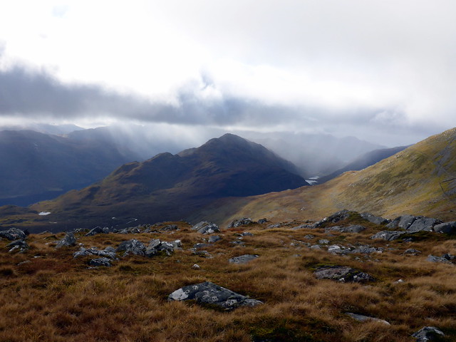
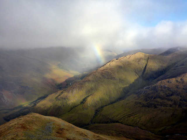
Pressing onwards along the ridge, I paused for lunch after Sgurr an Doire Leathain. Decided to bypass Sgurr Beag as I'd climbed it the last twice - met 6 walkers on the bypass route whom I'd never have known were there if I'd gone up high, including a girl with marvellously flame-orange hair. There's also a stream half way along the bypass route, useful to know as not much water elsewhere along the ridge. I could see rain hanging over Loch Hourn and misty swirls over the southern hills, but for the time being it continued dry and sunny on the Ridge. Across Creag nan Damh and I could see the stone wall stretching on ahead towards the ex-Corbett of Sgurr a'Bhac Chaolais and the impressively steep face of Sgurr na Sgine beyond.
 P1200786 by Al, on Flickr
Sgurr na Sgine in the distance
 P1200790 by Al, on Flickr
 P1200791 by Al, on Flickr
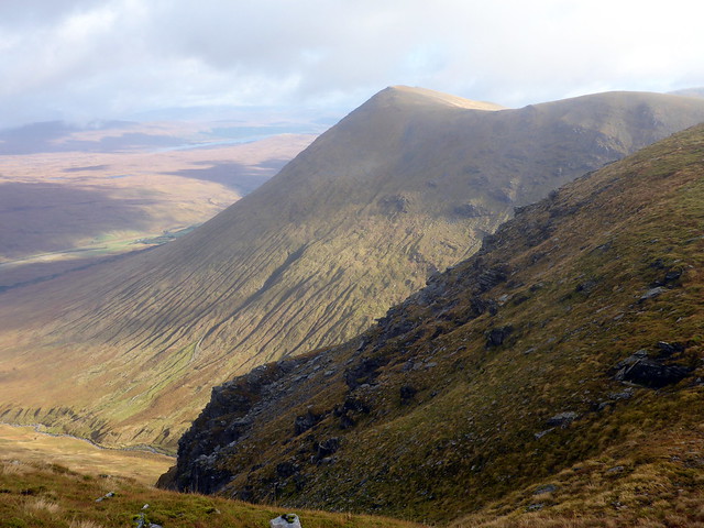
Creag nan Damh
 P1200792 by Al, on Flickr
Rain over Loch Hourn
 P1200794 by Al, on Flickr
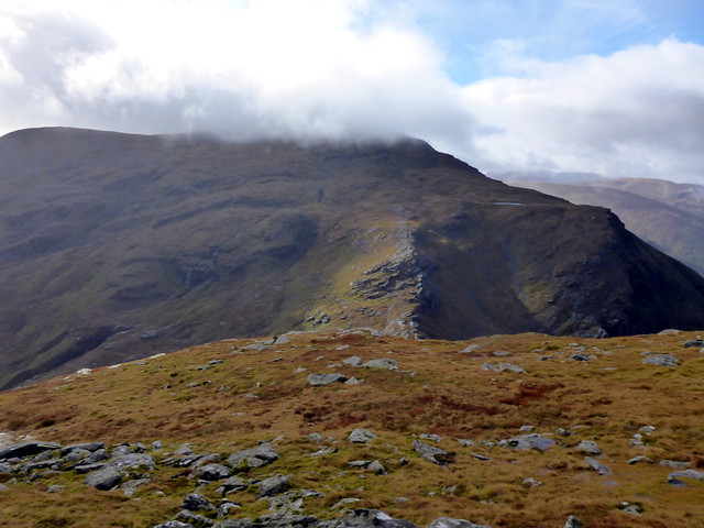
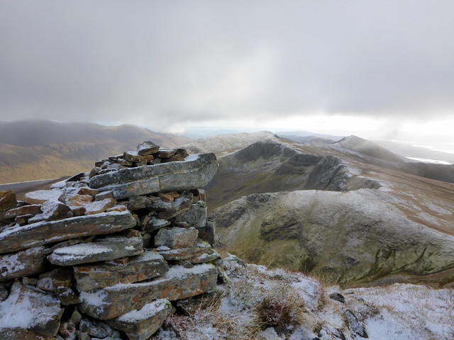
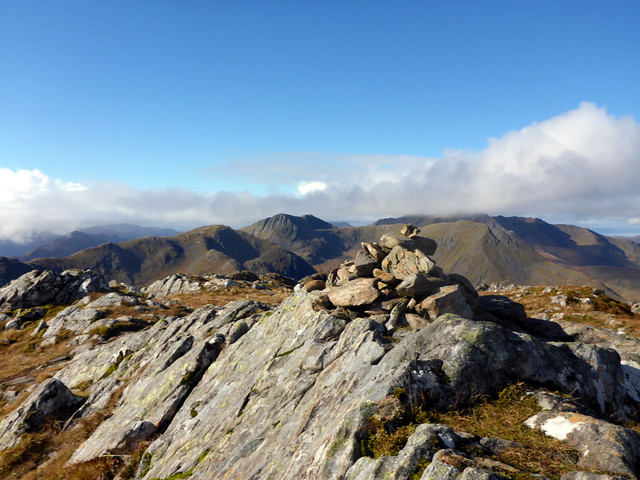
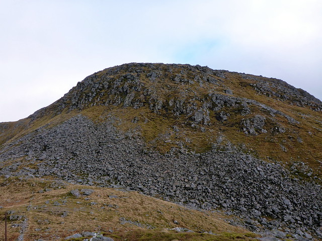
The WH report for Sgurr na Sgine recommends against ascending from Bealach an Tioteil due to extremely steep ground. I'll challenge that by saying the only steep section occurs on the way from Sgurr a'Bhac Chaolais down to Bealach an Toiteil. I'd forgotten this from the time we did a circuit of Buidhe Bheinn and Sgurr na Sgine from Kinlochhourn - it starts where the line of old fence posts stops and there's a very steep but definite path descending a bluff. Not much fun with a big pack and uncertain grip on one's boots It may be possible to bypass to the south, I think. Anyway, once on Bealach an Toiteil it's a simple matter of following the line of the wall which lies to the south of Sgurr na Sgine and tracking uphill once you've passed the worst of the scree, leaving an easy 200m to the summit. Clag had descended as I reached the cairn then headed to another prized Munro Top just a short distance from the main summit.
The steep section of Sgurr a'Bhac Chaolais
 P1200795 by Al, on Flickr
Sgurr na Sgine - in the bottom left you can maybe make out the section of wall to follow
 P1200796 by Al, on Flickr
Summit Sgine
 P1200798 by Al, on Flickr
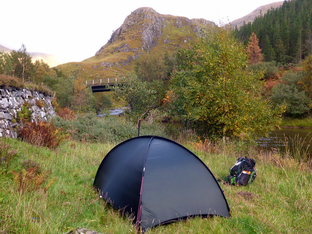
From here it was descent down Faochag, a route I'd not taken before - first time we did Sgurr na Sgine we went down Coire Mhalagain for some reason, probably reading about "how steep" Faochag's descent was. It was another Sim for me and a relatively pleasant descent, preferable, I'd say, to the descent from Bealach Duihb Leac from Creag nan Damh. My mind was now on how I was getting back to the car. I spotted a couple of lads below me and caught up with them at the stile. Unfortunately they were heading to Dornie. The bus was another option - but as I was 100m from the main road the 16.49 Citylink went past. Oh well, a walk it'll be then. I reckoned it was 8 miles back to where I'd left the car, it was just gone 5pm - probably enough time to get back in the light, as I didn't fancy walking along the busy A87 in the dark. However rain threatened, I'd already decided I wasn't doing hills the next day due to the terrible forecast and after a couple of kilometres I remembered a wee place Basscadet spoke of using to camp. This turned out very nicely and I pitched by the river - a little close to the road perhaps, but I was able to get my tea and finish my book, knowing I'd be able to take my time on the walk back in the morning.
Faochag
 P1200800 by Al, on Flickr
 P1200802 by Al, on Flickr
Descending Faochag
 P1200803 by Al, on Flickr
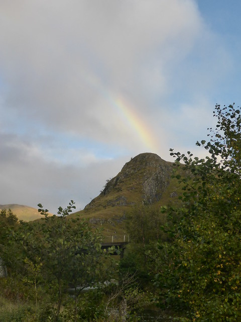
Biod nan Fhithich
 P1200804 by Al, on Flickr
 P1200806 by Al, on Flickr
 P1200807 by Al, on Flickr
The road was strangely quiet overnight, the rain was light but persistent and the sky rather cloudy when I awoke. Set off just after 7.30 and was pleased that the road continued to be quieter than expected as I made my way back to the Cluanie. Arrived at the car in around 1hour 40 which wasn't bad. Very pleased with the performance of the new tent - a great compromise between weight and stability in a 1-2 man tent.
 P1200808 by Al, on Flickr
This was the intended route...
Off I set armed with my newest tent, a nice light 2 man Hilleberg Niak to see how it would fare in the wild. Parked up at the start of a forest track some way before the Auch track as for some reason I didn't fancy leaving the car at the side of the A82 - forgetting that there's a parking layby once you turn into the Auch track before the road is marked Private. Ach well, what's another kilometre. I was wondering how bad the river crossings would be - spotted a walker coming back who said the second one was the worst, up to his knees. Hmmm. I'd reached the first bridge when a black SUV pulled up and a stalker greeted me, asking what my plans were. I said I was planning to camp somewhere after Sithean Mor and head up Mhanach then cross over to Dothiadh in the morning. He thought a bit, said there was a stag they were after in Coire a'Ghabhalach tomorrow. I was prepared to just do Mhanach, but he said if I kept high between Beinn a'Chuirn and Dothaidh it should be OK. Nice and friendly encounter
.
Not very promising looking weather
P1200738 by Al, on FlickrI splashed across the first crossing which was mid-calf and flowing fast. After that I thought I'd miss out the next crossing - the track, of course, crosses and re-crosses the same river several times. When I arrived at crossing number two it did look unpleasantly deep and fast, so I kept to the right hand side of the river, where there's something of a track, animal probably. A bit marshy in places, but better than immersion. I had thought to camp out near the old farm buildings, but they were occupied by a herd of cows. Pressing on I came to the joining of the tracks and found an ideal spot on a raised tussock. New tent pitched easily and provided an ideal night's shelter. Got into bed for 6.30 and read for a bit (Gavin Maxwell's "The Rocks Remain") before having one of the best tent sleeps I can remember - didn't waken up til 6.30am.
P1200739 by Al, on FlickrLooking back along the lonely glen
P1200740 by Al, on FlickrThe morning looked ok - some clouds but patches of blue sky showing through and not much wind. Packed my gear away and set off along the track to the turn up to Mhanach. I decided to do Beinn a'Chuirn first, then left my pack at the bealach before heading up and back to Mhanach. Not the most dramatic summit, but good views to the Loch Lyon hills and to Beinn a'Chreachain which had a wee touch of snow on top. I headed around the north of Beinn a'Chuirn making for Lon na Cailliche, the lowest point I'd go to, then contoured up the flank of Beinn an Dothaidh. I spotted a walker in black below me, presumably a stalker. After a couple of kilometres of contouring, I picked up a more definite track that led to the SE slopes of Beinn Dothaidh and thence to the summit. Clag did close in a bit as I reached the top, but it was still by far the best visibility I've enjoyed in three visits to this hill.
A touch of frost on Beinn a'Chreachain
P1200745 by Al, on FlickrMhanach from Beinn a'Chuirn
P1200746 by Al, on FlickrSummit Mhanach
P1200749 by Al, on FlickrDescent to this bealach then up Dothaidh
P1200750 by Al, on FlickrDothaidh
P1200751 by Al, on FlickrBeinn Achaladair
P1200754 by Al, on FlickrBeinn Dorain
P1200755 by Al, on FlickrI took the usual route to the bealach with Beinn Dorain and paused at the 744m cairn for an early lunch. I was a little apprehensive about coming off the front of Dorain - for years I've been wanting to climb it that way, but descending might be a little on the steep side. Anyway, I continued on up Dorain, meeting a couple of guys descending. By now the sky was blue and there was fine sunshine illuminating the surrounding hills. Reaching the cairn I was pleasantly surprised to find a good path leading south, the way I wanted to go, but it swept westwards, presumably an alternative route back to Bridge of Orchy. So I continued south, picking my way round crags and onto steep grass/boulders. Probably best not attempted in poor visibility because of the crags, but otherwise a perfectly serviceable route. I did manage to slip twice - and as luch would have it, landing on a sharp rock each time. First onto my right hip, the second a much sorer bash midway down my left hamstrings, which left an egg-sized bruise deep in the muscle. I wasn't sure whether the worn soles on my boots were responsible - I've only had them 4 months, but I went about the rest of the descent in a gingerly fashion, making for the viaduct as I thought it improper to cross the railway lines when an option was available. Once under the viaduct I followed a faint path through the fields alongside the river until the bridge was reached and I rejoined the main track. I hoped my injuries would not stiffen up overnight.
P1200756 by Al, on FlickrSummit Dorain
P1200759 by Al, on FlickrDescent towards the viaduct
P1200760 by Al, on FlickrBeinn a'Chaisteal
P1200762 by Al, on FlickrP1200763 by Al, on FlickrP1200765 by Al, on FlickrThis omits the walk in on thursday (7.8km)
P1200766 by Al, on FlickrDrove up towards Kintail, stopping off at the Co in Ballachulish to get a sandwich for tomorrow's lunch - for some reason I'd only made 2 lunches instead of the three I needed. Parked on the track before the Cluanie Inn and assembled my gear. By this time it was about 4.30, just nice time to walk the 6.5km to the foot of Creag a'Mhaim where hopefully I'd find somewhere suitable to pitch. I had my doubts though - I remembered the ground as being heathery tussocks and bog. Cloud started to descend from the south as I walked along - across Loch Cluanie it was still nice and sunny, but I was getting hit by spots of rain. As I nearer my objective it wasn't looking promising for a tent pitch, but about 10 metres past the path that turns up onto Creag a'Mhaim there's a patch of flat grass by a big boulder that fitted the bill perfectly. Pitched, fed and tucked up in bed by 6.30 again. Unfortunately not such a good sleep - my injuries meant it was uncomfortable to lie on either side
P1200768 by Al, on FlickrP1200770 by Al, on FlickrPitch below Creag a'Mhaim
P1200772 by Al, on FlickrP1200775 by Al, on FlickrIt was cold during the night and I was glad I'd switched my Thermarest XLite for the XTherm - made a noticeable difference. At around 6am it started to rain quite heavily for about an hour which didn't entice me to get up early. When I did get up, at about 7.30 there was ice on the guys. A sliver of crescent moon still hung in the sky.
When I'd last done these hills at the end of June, it was one of the hottest weekend of the summer, plus I had tootchache that rendered my impressions of the ridge walk somewhat dull. No such warmth today. I could see snow up top on Spidean Mialach across the glen and at around 700m on Creag a'Mhaim there was snow lying and the puddles turned to ice. At the summit there was a good half-inch of snow lying, prettifying the scenery. The walk along to Druim Shionnach was made more interesting on the narrow rocky section by the presence of slippy snow, a big pack and boots I wasn't really trusting.
Spidean Mialach
P1200776 by Al, on FlickrCreag a'Mhaim
P1200778 by Al, on FlickrCreag a'Mhaim from Druim Shionnach
P1200781 by Al, on FlickrThe western summits are snow free
P1200782 by Al, on FlickrP1200783 by Al, on FlickrLast of the snow on Aonach Air Cirith
P1200785 by Al, on FlickrSomewhere between Druim Shionnach and Aonach Air Cirith I spotted footprints that appeared to come from no-where. At first I wondered if a stalker had come up from a gully, but they were proceeding along the ridgewalk. No-one had come up before me this morning - I wondered if I had gone crazy and was following my own footprints until I spied a walker some way ahead of me. Catching up with him, between Aonach Air Cirith and Maol chinn-dearg he admitted that he'd camped up on the ridge last night, explaining the sudden appearance of footprints. He had been very cold, at one point having to get up and do star jumps to try and keep warm. We chatted for a while, Alex the bus driver, enjoying a rare 4-day weekend off.
Pressing onwards along the ridge, I paused for lunch after Sgurr an Doire Leathain. Decided to bypass Sgurr Beag as I'd climbed it the last twice - met 6 walkers on the bypass route whom I'd never have known were there if I'd gone up high, including a girl with marvellously flame-orange hair. There's also a stream half way along the bypass route, useful to know as not much water elsewhere along the ridge. I could see rain hanging over Loch Hourn and misty swirls over the southern hills, but for the time being it continued dry and sunny on the Ridge. Across Creag nan Damh and I could see the stone wall stretching on ahead towards the ex-Corbett of Sgurr a'Bhac Chaolais and the impressively steep face of Sgurr na Sgine beyond.
P1200786 by Al, on FlickrSgurr na Sgine in the distance
P1200790 by Al, on FlickrP1200791 by Al, on FlickrCreag nan Damh
P1200792 by Al, on FlickrRain over Loch Hourn
P1200794 by Al, on FlickrThe WH report for Sgurr na Sgine recommends against ascending from Bealach an Tioteil due to extremely steep ground. I'll challenge that by saying the only steep section occurs on the way from Sgurr a'Bhac Chaolais down to Bealach an Toiteil. I'd forgotten this from the time we did a circuit of Buidhe Bheinn and Sgurr na Sgine from Kinlochhourn - it starts where the line of old fence posts stops and there's a very steep but definite path descending a bluff. Not much fun with a big pack and uncertain grip on one's boots
The steep section of Sgurr a'Bhac Chaolais
P1200795 by Al, on FlickrSgurr na Sgine - in the bottom left you can maybe make out the section of wall to follow
P1200796 by Al, on FlickrSummit Sgine
P1200798 by Al, on FlickrFrom here it was descent down Faochag, a route I'd not taken before - first time we did Sgurr na Sgine we went down Coire Mhalagain for some reason, probably reading about "how steep" Faochag's descent was. It was another Sim for me and a relatively pleasant descent, preferable, I'd say, to the descent from Bealach Duihb Leac from Creag nan Damh. My mind was now on how I was getting back to the car. I spotted a couple of lads below me and caught up with them at the stile. Unfortunately they were heading to Dornie. The bus was another option - but as I was 100m from the main road the 16.49 Citylink went past. Oh well, a walk it'll be then. I reckoned it was 8 miles back to where I'd left the car, it was just gone 5pm - probably enough time to get back in the light, as I didn't fancy walking along the busy A87 in the dark. However rain threatened, I'd already decided I wasn't doing hills the next day due to the terrible forecast and after a couple of kilometres I remembered a wee place Basscadet spoke of using to camp. This turned out very nicely and I pitched by the river - a little close to the road perhaps, but I was able to get my tea and finish my book, knowing I'd be able to take my time on the walk back in the morning.
Faochag
P1200800 by Al, on FlickrP1200802 by Al, on FlickrDescending Faochag
P1200803 by Al, on FlickrBiod nan Fhithich
P1200804 by Al, on FlickrP1200806 by Al, on FlickrP1200807 by Al, on FlickrThe road was strangely quiet overnight, the rain was light but persistent and the sky rather cloudy when I awoke. Set off just after 7.30 and was pleased that the road continued to be quieter than expected as I made my way back to the Cluanie. Arrived at the car in around 1hour 40 which wasn't bad. Very pleased with the performance of the new tent - a great compromise between weight and stability in a 1-2 man tent.
P1200808 by Al, on Flickr