free to be able to rate and comment on reports (as well as access 1:25000 mapping).
It wasn’t meant to be Ample time; it was meant to be a circuit-of-Fathan Glinne Corbett-Graham combo-time. I’d really been looking forward to following BHK’s route to Beinn Stacath (C) and Creag Mhor (G), from Ballimore. The times were perfect—enough time between sunrise and sunset to get me there and back, and to spend most of the time in between enjoying a cracking autumnal day. The clocks go back tonight, and we’re not likely to have many more days like this this year; it wasn’t to be wasted. I’d psyched myself up for more driving, even though I’d been out for a short outing the day before.
I left home at 7:30, and arrived at Ballimore at 9:00am; not quite as long as the 1:45 predicted by google map. The single track from Balquhidder was long and mostly passing-place-less, and I hoped I wouldn’t meet anyone. I found the start point without any problems, and my heart sank when I spotted a “Stalking in progress; phone this number before taking to the hill” sign. I tried calling the number, but had, of course, no signal. I’d assumed that since it was past 20th Oct that stalking wouldn’t be an issue, forgetting about the hind season that follows directly on. What to do, what to do? A pickup truck was making its way along the road, so I flagged it down and asked the lad within if he had any idea about the stalking. No, was his reply, but go and ask at the farmhouse. He said he was headed there himself. By the time I walked down the drive, he met me again in the farmyard, and said that there wasn’t anyone in, but that yes, they were out on the hill stalking. I asked if he could provide any advice or alternate routes, and he suggested Ben Vane or Ben Ledi. Not exactly the alternate routes I’d been hoping for.

He emphasised that “They” wouldn’t be best pleased if I disrupted “Their” plans. Downcast, I returned to the car.
I was woefully unprepared to make a Plan B on the fly. I had only the one map, and no signal to check or download routes. It needed to be something straightforward and not prone to any problems or issues, given that no one would know where I was. Think, woman, think. I really didn’t fancy going anywhere along Loch Earn. On a nice day like today, its road and shores would be heaving. I was sorely tempted to just return home, but talked myself out of that by not wanting to waste either a glorious day or the drive I’d already made.
I remembered the Graham across from Beinn Each. What was its name? Hah, like I was going to remember that. What did I remember reading or hearing about it? A long ridge. Ascend straight up next to a patch of forestry. That was about it. OK, fine, at least I had the outline of a plan. I’d climb up onto the ridge as early as possible, and just carry on along it. Alternatively, I could climb Beinn Each again, or simply carry on along the track toward Loch Earn; at least I’d be out.
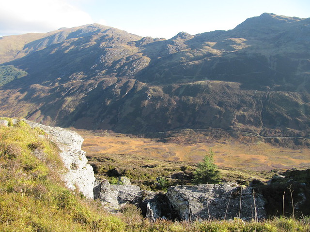
I set off from the layby at 9:45, following the path steeply up through the woods, and onto the proper track leading through Glen Ample. I did begin my ascent onto the ridge along the edge of a forest as soon as I was able; it was probably about ½ km or so past the sign for Beinn Each; I was headed for the highest bump I could see from there, Creag a’Mhaidaidh. When I reached its top, I saw another bump in the distance, and carried on toward it. There wasn’t anything on its highest point to indicate that it was a summit of any significance.
back doon the glen and across to Ben Ledi
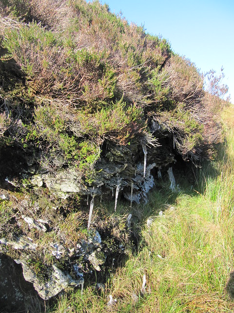
icicles!
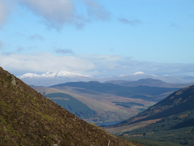
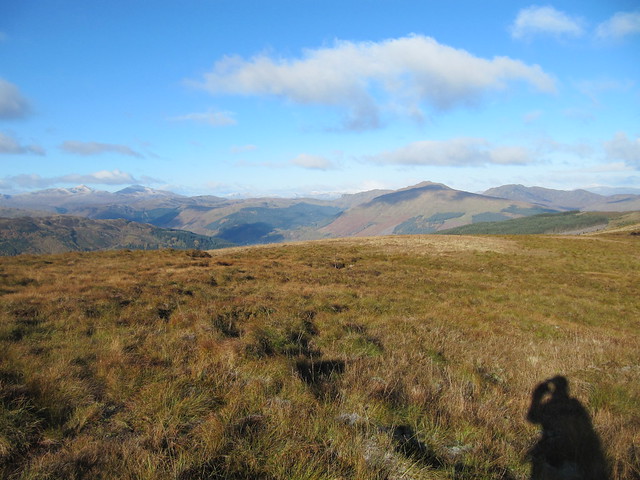
Loch Earn + snow on the Lawers range
Ben Lui, maybe? not sure
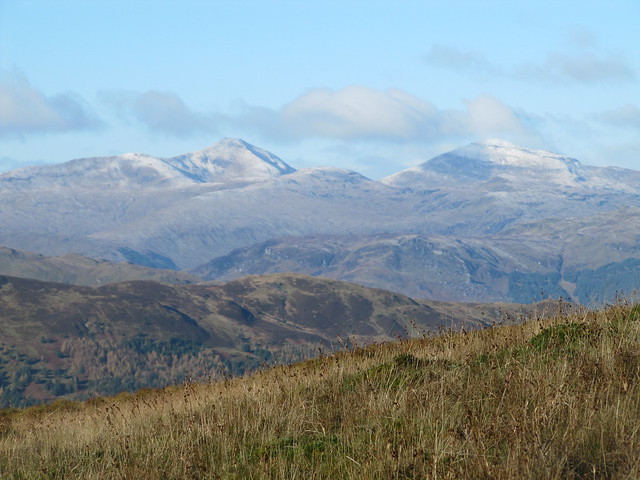
Beinn Each + Stuc a'Chroin
Funnily enough, Sgiath a’Chaise wasn’t marked on the map on my phone. If it had been, I might (
*might*) have remembered that it was the Graham. The more I looked at my map, the more I became convinced that Meall nan Oighreag was my target, even though it was both much lower than anywhere else along the ridge, and still miles away.
I carried on for a short distance along the ridge, past the highest point, until I saw a deer fence in the distance. I zoomed in with my camera, and didn’t see a stile or gate. I couldn’t be arsed, and decided that I’d simply “Nan Shepherd” the day, if you’ll indulge me the verbing of that good name. It wouldn’t be about ticking a top; it would simply be about enjoying, listening, and observing.
Even before I’d consciously made that decision, I’d been full of the joy of hillwalking: the wind was cold and bracing; the ground crunchy underfoot, still crisp from the hard frost of the night before; there was fresh snow on the Lawers range, and the hills further afield; the colours—brown, gold, yellow, orange, and everything in between—stunning; the clarity astonishing.
I spared one wistful glance down toward the glen I was meant to be in, then got over it.
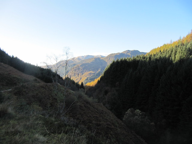
in the general direction of where I'd been meant to be
I climbed up another bump—Meall Mor—that I’d missed on my outward journey, then headed back down to the track at the bottom of the glen.
The wind blowing through the trees sounded like rushing water, and I was startled to hear what sounded a bit like an animal grunt. I stopped, listened again, and realized that the sound was made by one or more of the trees along the edge of the wood making some pretty significant—and alarming!—groaning noises. I scurried toward the more open hillside, just to be safe.
I was back at the car by about 1:15. Not as long a day as Plan A would have been, but I was more than happy with all that Plan B had delivered.
I just couldn’t help looking up what the damn Graham was when I got home: Sgiath a’Chaise. Several walk reports confirmed that there’s nothing but a metal pole and a couple of large rocks on its summit. Thanks to Nan Shepherd for reminding me that it’s about so much more than just getting to the top of a hill. But yes, since you ask, I
will be going off now to add another Graham to the “done” list.

