free to be able to rate and comment on reports (as well as access 1:25000 mapping).
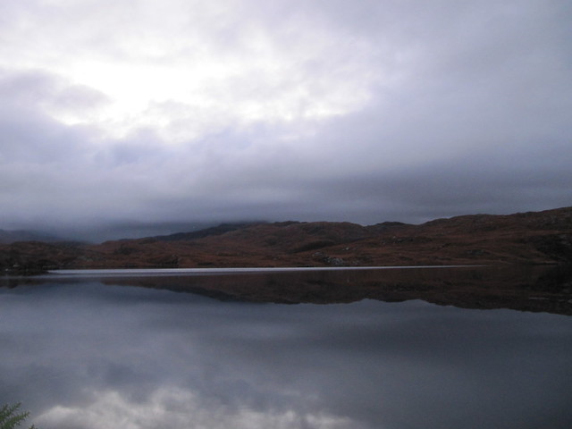
Lots of walking, lots of decent weather, plenty views. Stayed at the same place as at Easter, in Baddidarach, with its amazing shower, lush spa Jacuzzi bath, and a killer view across the loch to Canisp, Suilven, and Stac Pollaidh. I was fully in the holiday, completely undistracted by thoughts of work and everything else (that’s not always the case).
I’ve not been to Lochinver this late in the year before, and it was very quiet. The amount of daylight is noticeably shorter than further south—the sun never gets very high in the sky, so it’s quick behind the hills, and the light throughout the entire day seems like either sunrise or sunset. But it’s beautiful, and I loved it. I peeked out early one morning (~3:30am), and although there was no hint of the Northern Lights (always on the lookout for them!), the brightness and multitude of the stars was astonishing.
I’d taken my laptop; I wish I’d written about each day’s walk as it happened. That was the plan. I’m now faced with the gargantuan task of trying to remember details that are already fading away. At least I have 275 photos to choose from—for me, that’s rather a lot. Incidentally, after a lot of thought, I’ve purchased a Flickr subscription; it sucks that it’s no longer free, but I’m afraid that’s the way of the brave new (cloud) world. I’ve always kept backup copies on data sticks—it was the thought of losing all the links in my blog entries that had me caving in to the ransom.
Sat 10 Nov
Corbett: Beinn Liath Mhor Ghiubhais Li
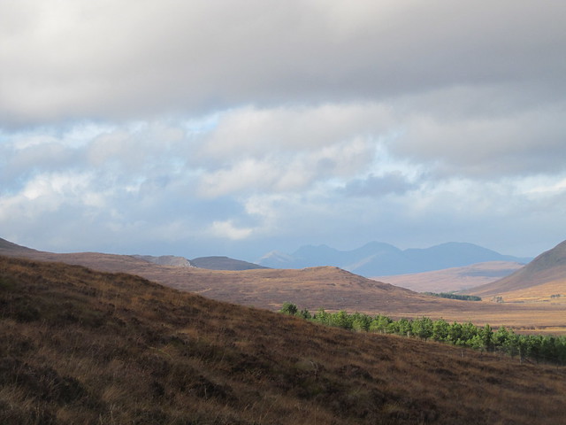
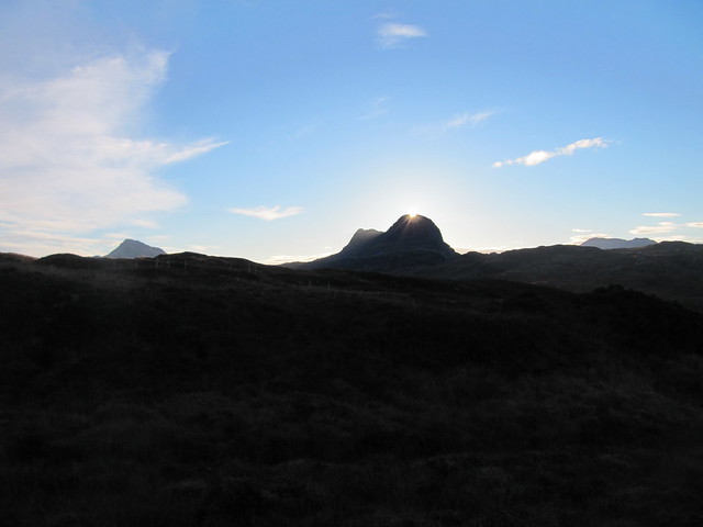
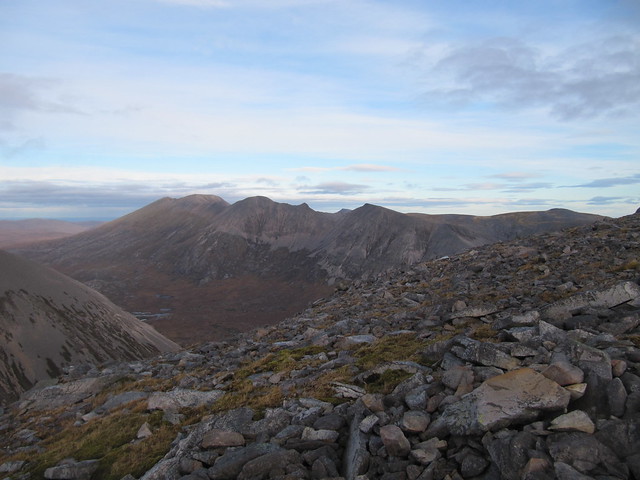
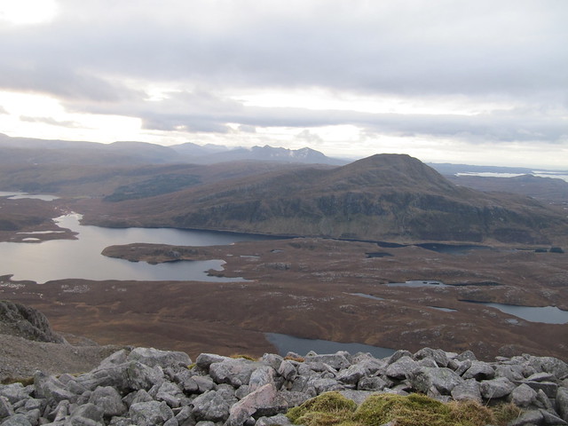
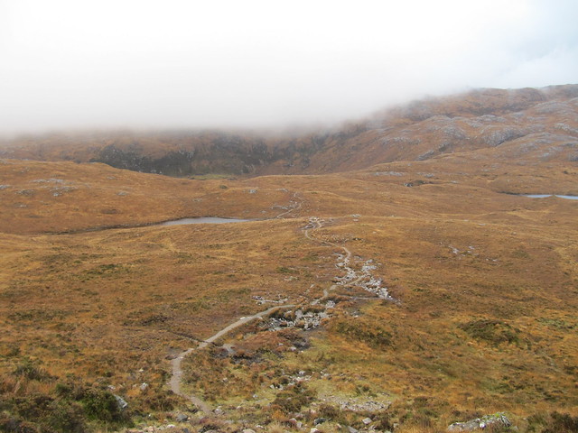
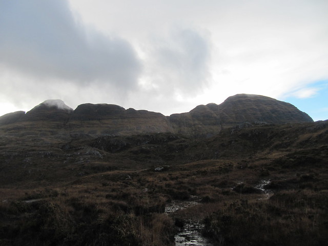
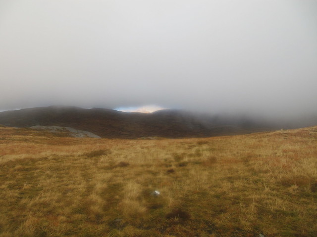
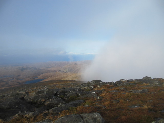
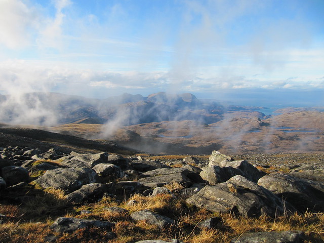
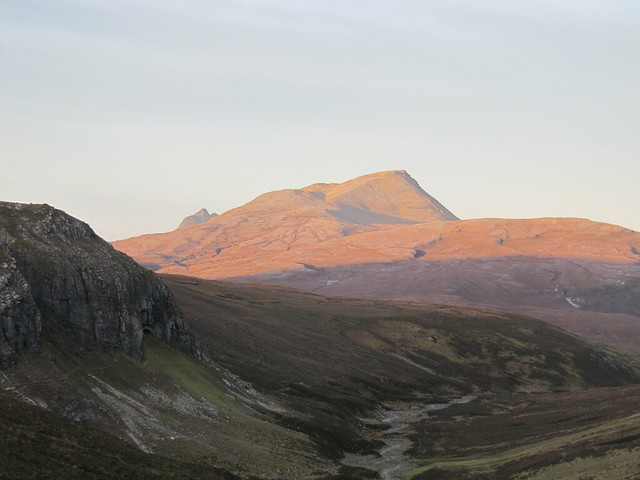
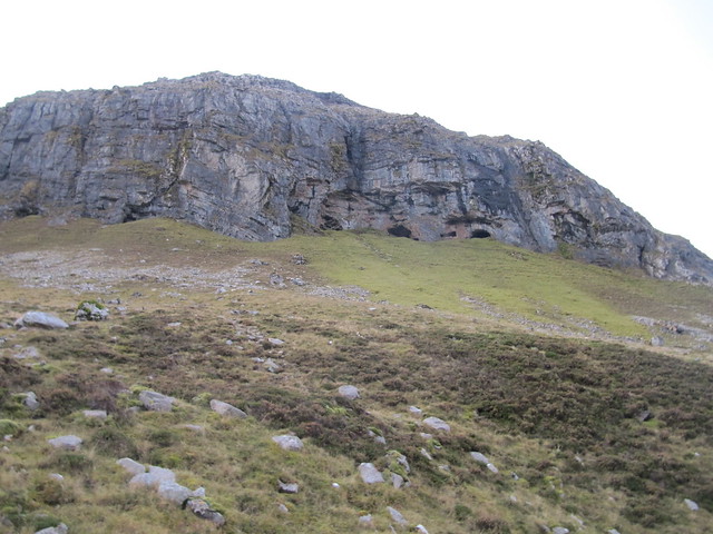
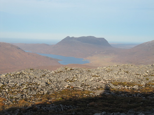
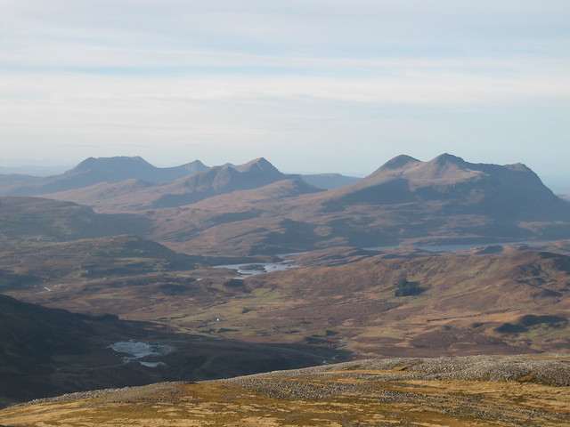
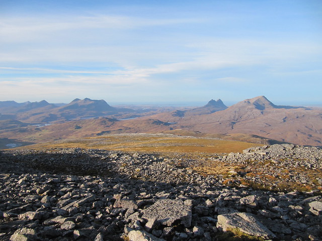
3 hrs / 6 km / 565 m I wasn’t quite sure what I was going to do on the way up. Another attempt at Beinn Enaglair was a possibility, but that was going to depend on what time I neared Braemore Junction. As it was nearly 11am, and as I wanted to pick up a fish supper in Ullapool, and as I’d prefer to arrive in Lochinver and unload the car before it was fully dark, I opted to do the shorter BLMGL instead. It had been a lovely drive all the way up, but as I pulled into the large layby at the NW end of Loch Glascarnoch, it started raining! Typical. I waited for a few minutes as the shower passed by. There’s not a whole lot to say about the walk, it was very straightforward – especially since I decided to simply do a summit-and-back, rather than the circuit as per the WH desc. I wished I’d read the description more closely in preparation, because the reason I didn’t do the circuit was because of the deer fence I’d spied on the map; the gate I’d come over at the beginning of the walk was a known, whereas the state of the deer fence wasn’t (however, the desc does say that there’s a gate in the fence). Next time!
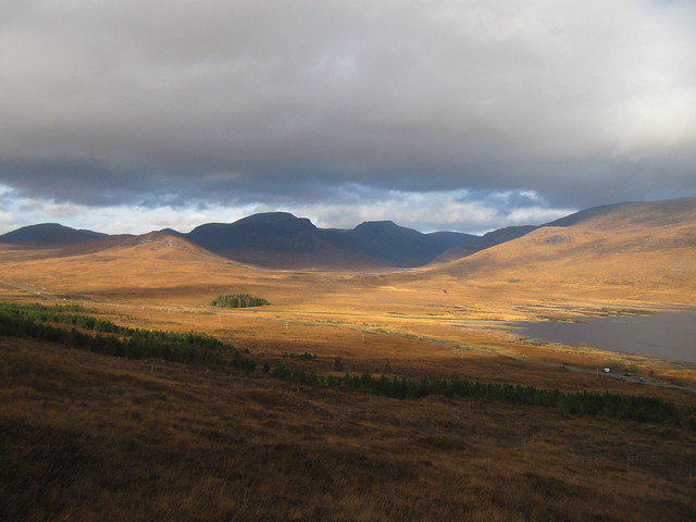
Beinn Dearg + friends
An Teallach in the distance
Wyvis way
Sgur Mor, and the exit route from the eastern Fannaichs
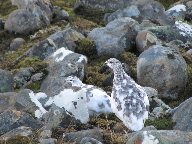
well-camouflaged ptarmigan
one more toward Beinn Dearg group
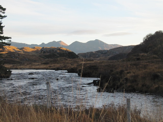
After the late morning shower, it stayed dry. There were great views over the Fannaichs, and especially over to the Beinn Dearg group. I was back in the car and on my way in just a bit over 3 hours.
Sun 11 Nov
River Inver + Glencanisp Lodge circuit (am), Little Assynt/all-abilities path circuit (pm)
4 hrs / 14.5km / 425m I’d planned my day—or at least the morning—around attending the Remembrance Sunday service; I wanted to join the nation in marking the centenary of Armistice Day. At home, there was to be a piper at the War Memorial at 5:45am; I was hoping for the same in Lochinver, but saw only announcements for the service at 11am.
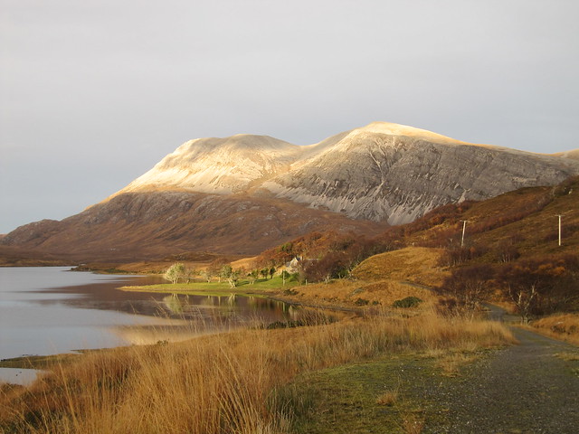
I was up and away at daylight, walking around to do the River Inver circuit in the opposite way I’ve always done it before. It’s just as nice in this direction, offering a few surprises, as Quinag rises up ahead when you reach the point where the river widens, and Suilven appears suddenly from behind the hill when you’re near the ruins of the abandoned/cleared settlement. I just realized that this is the direction in which the WH desc is written.
sunrise view from the chalet
river widens, hello Quinag!
and good morning (again), Suilven
I was back in the village before 10am, and thought briefly about going to church. Just as quickly, that thought was gone, and I went in search of a coffee instead. Fat chance; nothing was open. It felt much like being on Lewis on a Sunday in 2002.
So I sat on the seafront in sunshine that didn’t offer much warmth, and waited for 11am. The service was no longer than 5 minutes, and that was including the 2-minute silence! There were a couple of wreaths laid, a brief prayer, and one tune played by two girl pipers.
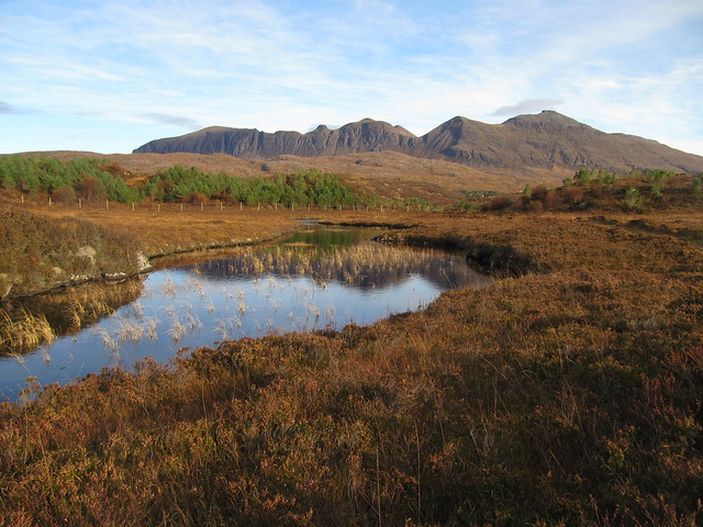
I returned to the chalet, and pondered what to do for the afternoon. I didn’t really fancy the long road walk to Achmelvich, but neither did I want a long drive. I settled on returning to the all-abilities path near Loch Assynt, as I knew it connected to a path/circuit that went all the way to Little Assynt. I’d walked much of the route before, but had never made it all the way to Little Assynt, nor climbed the highest bit (“Ken’s path”), and was keen to do that. A plan was hatched.
It was a nice afternoon, and the path was very good all the way ‘round. The highlight was the spectacular views of Quinag, as well as across to Canisp and Suilven.
Quinag in all its glory, from the all-abilities path
Mon 12 Nov
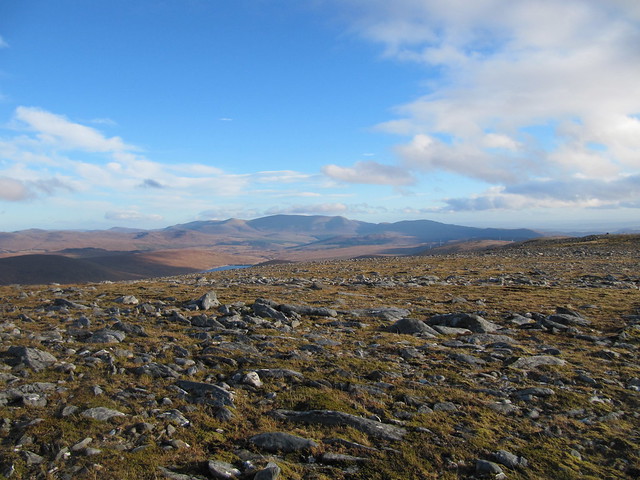
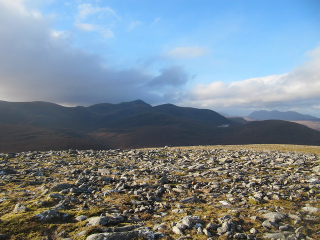
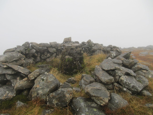
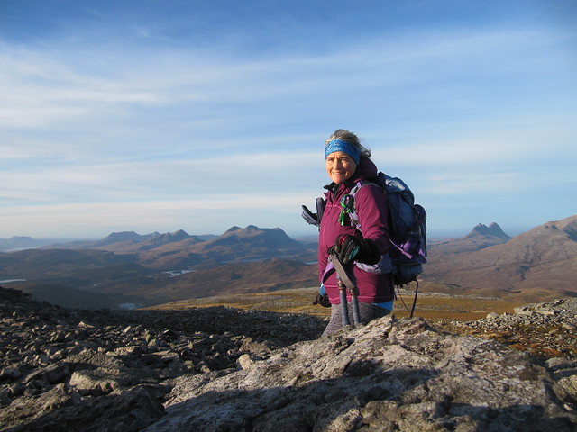
Corbett: Arkle
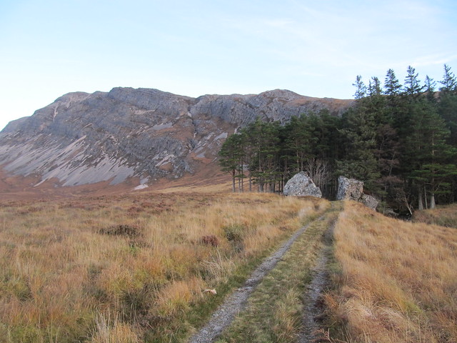
6 hrs / 17.2km / 1042 mToday’s forecast was pretty good, so I’d picked this hill, and was looking forward to it. I was up and away again at first light—around 7:15am or so. It was an hour’s drive to the start point, and I was on my (walking) way by 8:30.
lookin' mighty tasty!
I do wonder how these boulders got here...
There was a lot of high cloud around, but it was dry and visibility was good. I reached the summit at 11:30, after crossing the ridge, including the “one exposed section,” without incident. I kept wondering “was that it?” every time I crossed the slightest tricky bit. As long as you don’t look down, you don’t necessarily realize what “exposed” refers to!
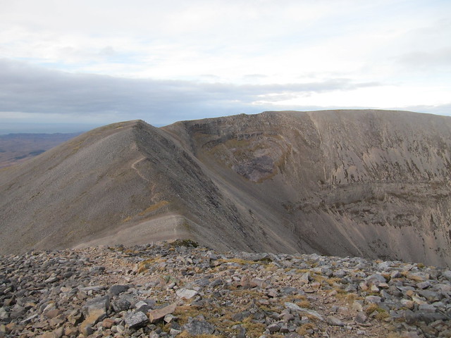
the "exposed" bit is somewhere ahead
but looking over at Foinaven kept me distracted
out to sea, from somewhere near the summit
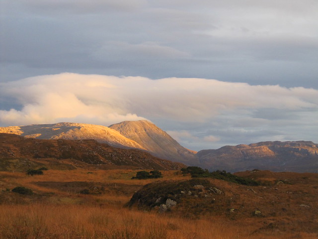
The view back over Quinag, over Foinaven, and out to sea were spectacular. I sat in the shelter cairn and drank my tomato soup—talk about having a table with a view!
yet another one to Foinaven
and over Loch/Ben Stack
"late" afternoon sunshine
I was back down at the car by 2:30, having seen one other walker, but only at a distance. There was some lovely light on the way home, but also some moments of utter blindness when driving directly into the setting sun. Luckily, there was hardly any traffic.
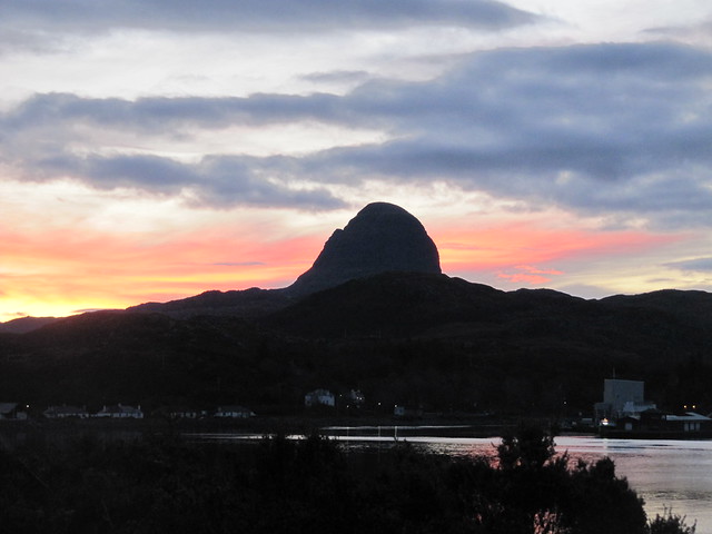
I caught this view of Conival in my rearview mirror, and had to stop for a photo
...and while I was stopped anyway...
Tue 13 Nov
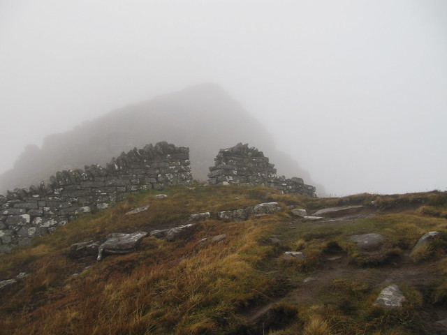
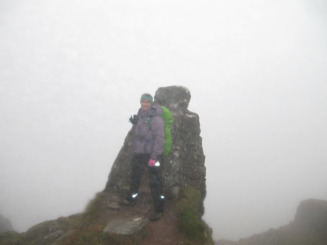
Graham: Suilven
6.75 hrs / 19.85km / 1017 mThis hill has intimidated the hell out of me for many a year. I’ve been across the boggy moor (before the improved path was in place) to its base, and looking up into the gully of the ascent route looked simply impossible. I was primed to do it this past Spring, with Evie, but a twisted ankle the day before put that plan to rest. I was determined to do it during this trip, and it seemed the perfect way to celebrate my birthday, weather permitting. The day before, on Arkle, had been perfect; all I needed was one more day of that.
It didn’t look so good when I set off. I kept hoping it would clear by the time I got there. Interestingly, everyone always talks about what a long walk in it is. But no one thinks or says much about having to cover the same amount of distance in the Cairngorms to reach a hill.
errrrmmm….where's my hill??
I detoured for a nosy into the bothy. No one home. Not surprising, given that it was midweek and well off season. My target remained stubbornly in the mist, and I kept telling myself that I could always turn around and save it for another day. (I knew I wouldn’t.)
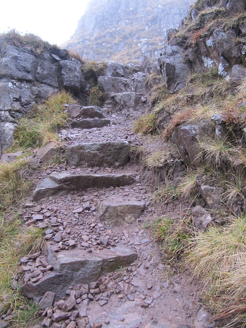
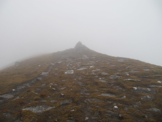
The new path is terrific. I’d thought it only went as far as the two lochans you pass between before beginning to climb. But the improvements have been made all the way up to the ridge. Much of what used to be an eroded trench up the gully has been replaced with large stepped stones; it was much like going up the wee Bookil! There wasn’t a single section that could be considered difficult by any stretch of the imagination.
looking back across the moor at the new path
cloud level nearly down to the two lochans
just keep climbing the stairs
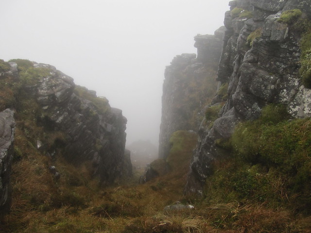
The wind kicked up as I ascended, and I was prepared for it to knock me over when I reached the ridge. I’d gone into the clag at around 500m, and it wasn’t going to shift. I didn’t even care, I was having a great time. I made my way across the ridge toward the western summit, through the drystone wall, and across a couple of short sections with big drops on either side. There was one place that required either really long legs, or a good mid-way foothold. As there wasn’t a foothold to be found, I sort of heaved myself up it inelegantly, feeling somewhat like a beached whale. I was quite grateful that there weren’t any witnesses to this! I didn’t stick around at the summit; there was no point. I’ll be back.
through the wall and over a couple of false summits
nowt to see at the summit!
down, down, down!
pausing in the lee of the wall for some respite from the wind
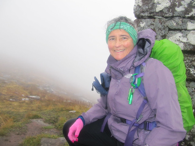
the perfect selfie spot -- there's even a big flat rock to put the camera on. Shame about the (no) view...
I made my way back across the ridge and started the descent. It wasn’t going to take long. Once again, I marveled both at how delightful the new path is, and at how much hard work it would have taken. I was happy to have made a small financial contribution to it.
Not far above the two lochans, I met another walker, the only person I’d see all day. We stopped to chat—he was on his own after his pal had had to return home. He was staying in Ullapool, and lamented that he’d been unable to get an early breakfast, or a packed lunch (even one made from supplies he’d supplied!). We had a chuckle over “good old-fashioned Scottish hospitality.” He’d been on Quinag the day before, and was telling me that he’d met, and had a talk with an older man who’d just had a knee replaced. When he said that this man had been a police officer in Glencoe, I knew who he’d been talking to! I explained that Cathel had been my B&B host for many of my previous visits to Lochinver.
Not half an hour after we parted company, I looked back over my shoulder only to see that the hill—the entire hill, end to end—was now entirely out of the cloud! In fact, when I sat to have my lunch (and a bit of a sulk about my bad luck/timing), I could see him up on the ridge, and as I sat there, I watched him make his way to the summit. I was happy for him that he’d get the view I missed. And thought that perhaps recalcitrant B&B hosts who are unwilling to do early breakfasts might know something that we don’t.
the obligatory shot of the bloody hill NOW out of the cloud!! There's even blue sky on the way!
grrrr. <sigh>
Oh, nevermind. As I said, I have every intention of going back. Often, even. I was back at the car by 2:15.
I returned to the chalet, and was thrilled to find that my wee compleation report had made its way back up to the top of the forum, and had gotten loads more "likes" and nice comments, including one from Paddy, and a very nice PM from Helen. A long hot bath, a couple of large glasses of wine, mac/cheese for supper, followed by chocolate cake and ice cream. Best birthday in ages!
Wed 14 Nov
rest/rain day
I walked nearly to Inverkirkaig Falls in the rain, until the path got really mucky, as I’d only worn my trainers. Returned to have a mooch in Achins bookstore and bought a couple of books.
Drove back to Lochinver, and had a crab sandwich at the Mission (delicious), where I saw the JMT’s seriously nice looking (but young) footpath manager, said hello, and reminded him that we’d had a chat on Quinag earlier in the year. He clearly didn’t remember, and I felt like a dork. Move on, grandma.

Poked around in the Chandlery, which has never been open when I’ve been there before, bought a RSPB watering can at the Rockpool, and a new casserole dish at Highland Stoneware.
I’d emailed Cathel in the morning to tell him about meeting our mutual “friend” on the way to/from Suilven. He’d responded, and said he’d be happy to get together and have a catchup. It was good to see him again.
Thurs 15 Nov
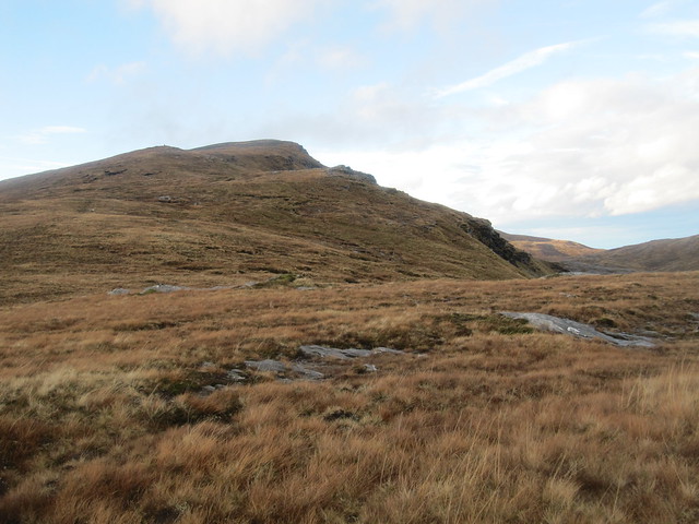
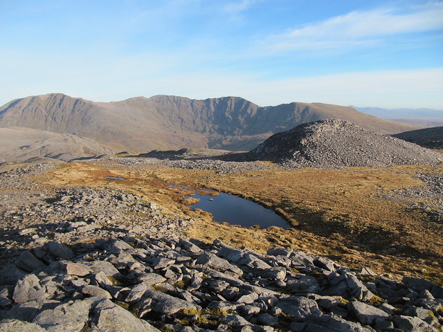
Corbett: Beinn Leoid
Graham: Meallan a’Chuail
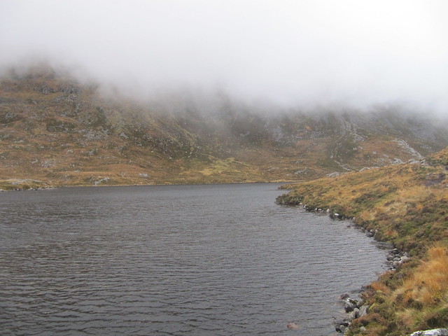
6.25 hrs / 15.5km / 987 mThe forecast wasn’t bad, but as I approached the start point for this hill (about 10–15 minutes south of the start point for Arkle), I could see that the cloud was down fairly low. Sigh. I’d intended to do the wee Graham Meall an Fheur Loch as well, but decided that I’d detour out from the zigzag path to do it on my return. More about that anon.
By the time I reached the point where the zigzag path levels (and peters) out, ~450m, I was into the mist. Oh goody, my nearly favourite walking conditions, bimbling around in the bog and mist, not knowing which direction is up.
I debated whether to carry on, especially when I walked for what seemed a long way, hadn’t started gaining any more height, and was freaking out a bit. Finally, though, I started climbing, and could tell that I was near the very steep crags to the east, and therefore, on target. It wasn’t long before I reached the summit cairn perched on the edge of them. I knew there were two lochans below, but only from looking at the map. I didn’t stop.
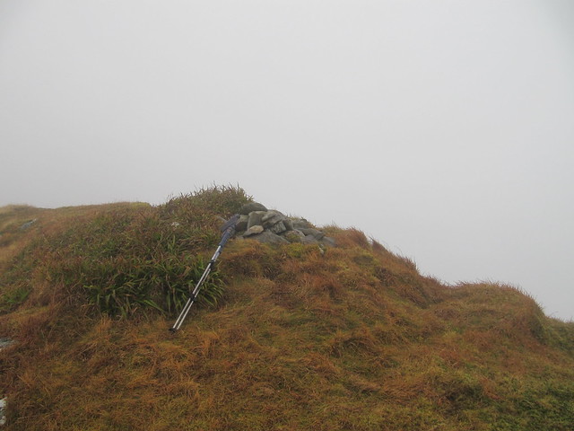
summit cairn, Meallan a'Chuail
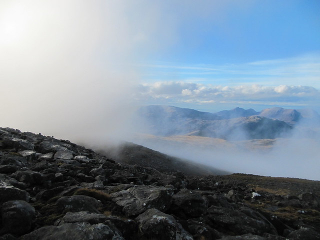
I bumbled my way down toward the bealach. At least that’s where I thought I was heading. But I’d gone slightly off course, and found myself in the flat, peat-haggy, and very wet flat area that was south and west of where I was meant to be. Fun! However, about this time, the cloud lifted just slightly, and simply getting a peek of the lay of the land was a tremendous morale booster. I could see the way ahead, to the summit of Beinn Leoid, and although the cloud returned as quickly as it had lifted, the spring was back in my step as I carried onward up the hill.
HA -- there are HILLS and VIEWS under all that cloud!
About two minutes before I reached the trig point/wind shelter, the cloud lifted again—that just NEVER happens. And it didn’t really this time, either, as it was gone again by the time I summited. But there was blue sky above, and I was determined that I wasn’t going to be robbed again today.
summit shelter/trig point, Beinn Leoid (note views once again nonexistent)
I settled down in the shelter, and waited. It was blowing a hoolie, and the cloud was moving fast. It kept brightening, then darkening, over and over again. I’d get up, walk around a bit to warm up, then sit back down out of the wind. I think I stayed for about 45 minutes, until my fingers were frozen, and my bum was a block of ice.
oh! oh-oh! OH! c'mon....!!!
HELLO!!
goodbye...
hello...(and so it went)
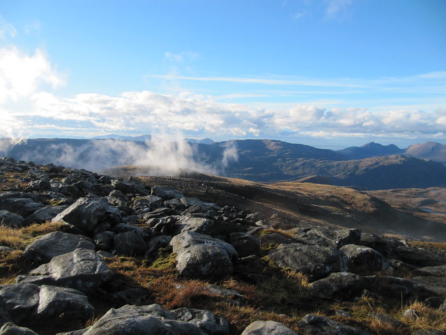
I’d gotten the merest glimpses of views, to Quinag, Suilven, and out to sea. Oh, and Foinaven as well. I even managed to get a picture or two during the brief breaks in the cloud.
I started down, and met a man on his way up. The wind was relentless and very cold. My rain cover was flapping about; I’d debated storing it away when I was on the top, but decided that there still might be showers. When I stopped at the top of the stalker’s path that would take me down to Loch Dubh (saving having to go over the top of the Corbett again), I noticed it was gone. I traced my steps back up to the bealach, hoping its bright green might stand out amongst the autumn browns and russets, but it was nowhere to be seen. I hate losing things.
I carried on, eventually returning to the path I’d walked in on. Time was marching on, and I’d lost a fair amount of time wandering aimlessly in the mist, looking for the rain cover, and oh yeah, waiting for a view from the top. I wouldn’t have time to climb it and still get home before dark. Shame, really, because it’s only ~150m ascent. I did recall reading – malky_c’s WR, I think – that the hill just barely fulfills the Graham height requirement.
It was nearly 3pm by the time I returned to the car. Oh, and did I mention that, looking back up from the bealach, and the rest of the way back, that both the Corbett and the Graham I did do were now fully out of the cloud?
the obligatory shot of the bloody hill NOW out of the cloud!! There's even blue sky on the way!
Fri 16 Nov
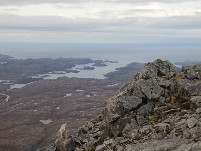
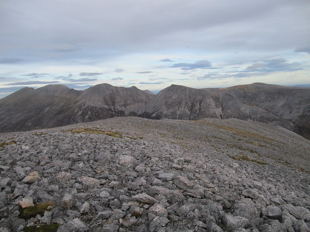
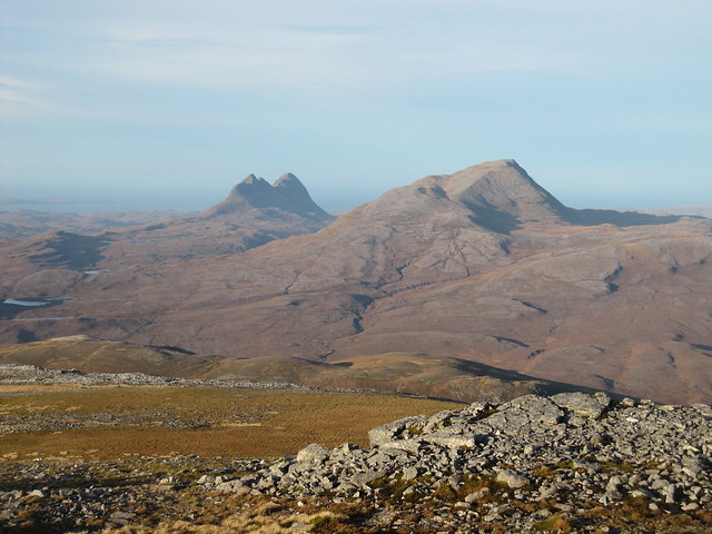
Corbett: Breabag
6 hrs / 11.3km / 754 m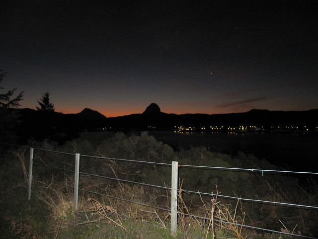
another sunrise shot from the chalet
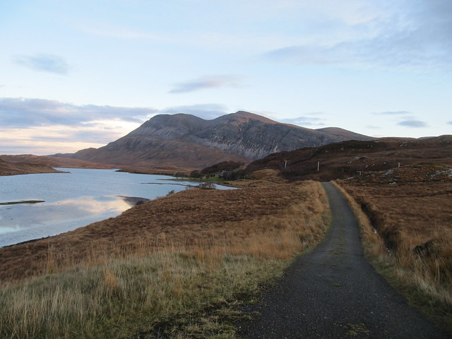
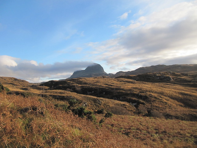
I set off from the Bone Caves carpark at 7:45. After just having driven the 4km of road between there and Inchnadamph—it seemed a very long way even in the car!—I convinced myself that I’d be perfectly happy with an out-and-back to the summit. It was a glorious, sparkling morning, and I took many photos as the panorama opened up behind me as I ascended. Rosy golden “early” morning light on Canisp. Oh, now there’s Suilven, and Cul Mor. Quinag, and the ever-present Conival and Ben More Assynt.
morning light on Canisp, Suilven peeking from behind
hiya, bone caves
It was a glorious morning, and the view was stunning when I reached the summit. Not only that, but the ridge/traverse looked spectacular. The WH desc said 7-9hrs for the entire route, but I also knew that someone else had done it (not including the road walk) in 5.5 hrs. Should I do it? What about just carrying on along it, and then turning back on myself, staying high to avoid the road trudge? I couldn’t decide, so in the meantime, I just plopped down on a rock in the sun and enjoyed the panorama for a half hour or so. I explored several other parts of the ridge—one rocky bump, and another cairn, then started along the ridge. Maybe I’d just go to the high point, then come back. How far was it? I looked at the map and kept debating, all the while knowing that the longer I dilly dallied, the less likely I’d have enough daylight to do the darn thing.
Finally, I just decided that I’d take my time on the descent, sit some more, and leave the traverse for another day. I found a big square rock, again in the sun, and sat on it for a while. I took dozens of photos, many virtually identical.
Loch Assynt and Quinag
zoomed toward Ben More Coigach (and all the hills between here and there)
Conival and BMA, plus some of the traverse
I started getting cold, so I started on my way again.
I’m not quite sure what happened, other than just tripping over a rock. I pitched forward, and suddenly, the ground was rushing toward my face. I managed to turn slightly, and landed hard on my right side, head pointed downward. Ouch. I lay there, stunned, for a minute, before painfully sitting up to take inventory of the damage. I knew immediately that nothing was broken, but there’s no question I’d taken a good knock. Most of my right side hurt, and blood began seeping through my leggings. Ouch, ouch, ouch. I sat, not sure whether to laugh or cry, and ended up with a mixture of both. The moor was almost entirely heather, grass, and peat bog, but I’d managed to fall in the one small area that was full of rocks and gravel. I eventually managed to get back onto my feet, and continued the descent, limping along, now being veeeerrrrry cautious with each step.
I sat again for a while once I’d passed by the caves. I was still a bit shaken, so had my soup and some chocolate, which helped restore my equilibrium. I couldn’t help feeling that if I’d just planned on doing the darn traverse from the outset, with conviction, I might have returned home somewhat less bloodied and bruised.
Sat 17 Nov
homeward bound I couldn’t decide whether, or where, to walk on the way home. It was due to be another brilliant day, and I hated to waste it. Beinn Enaglair was on the radar—again—but I realized, using my superior maths aptitude, (

) that at least 5 hours walking and at least 5 hours drive time just won't fit into the 8 or so hours of available daylight. Hm...maybe Geal-charn Mor, near Aviemore; 3-4½ hours.
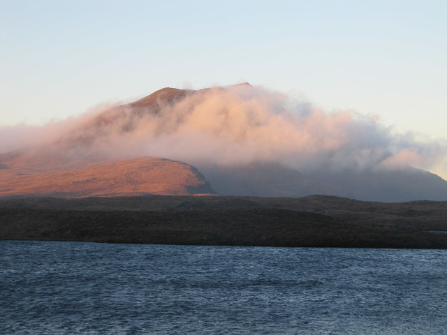
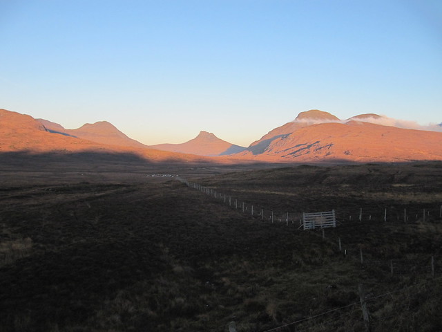
But as I left Lochinver, the morning light, and many cloud inversions proved a huge distraction, and it was one of those drives wherein I was stopping about every km to take photos of various hills from various angles. I’d decided before I even reached Ullapool that I’d prefer those be my last memories of the trip, rather than a slog up a track just to bag another hill.
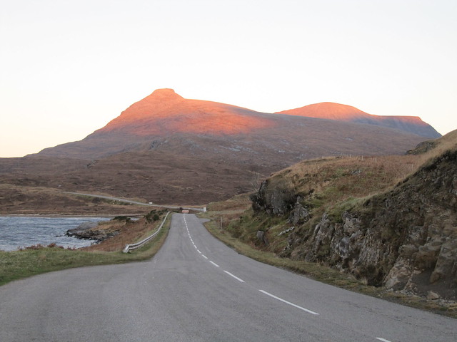
morning glow on Quinag
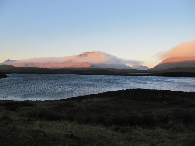
inversion swirling around Cul Beag (or maybe it's Cul Mor; I always get them mixed up); Stac Pollaidh behind
zoomed to same
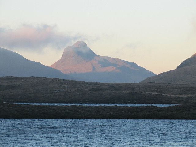
...and to Stac Pollaidh
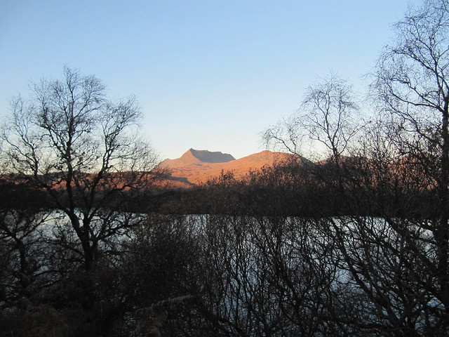
Ben More Coigach through the trees
different perspective (from further down/up the road); cloud now dissipating
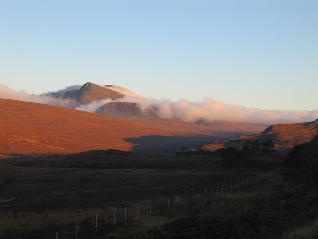
one more...
Even though it was still sparklingly clear when I got to the Cairngorms, I carried on, arriving home in time to unload a fully loaded car before dark. I’d had an amazing week, and I was (am) a happy girl.
