free to be able to rate and comment on reports (as well as access 1:25000 mapping).
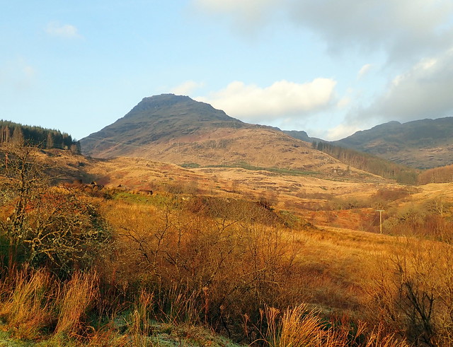
Had planned to go up Glen Douglas today for the couple of Grahams there, but looking at the computer last night I fancied heading to Lochgoilhead for the excitement of Beinn Lochain, with some added Simm action. Forecast was for quite a good day - it was a lovely drive up when I left the house at 7.45 - all pinks and baby blues. But much colder than yesterday - was 10 degrees driving to Glen Fruin yesterday, whereas it was -1 driving up Loch Lomondside. Great bales of mist floated across the loch surface. Drove down to Lettermay and parked by the Cowal Way marker. There's a diversion in place due to forestry work, probably been there quite a while and looks like it shaves some distance off the standard route. I had put on a new pair of boots this morning, knowing that the Cowal Way often requires a schnorkel.
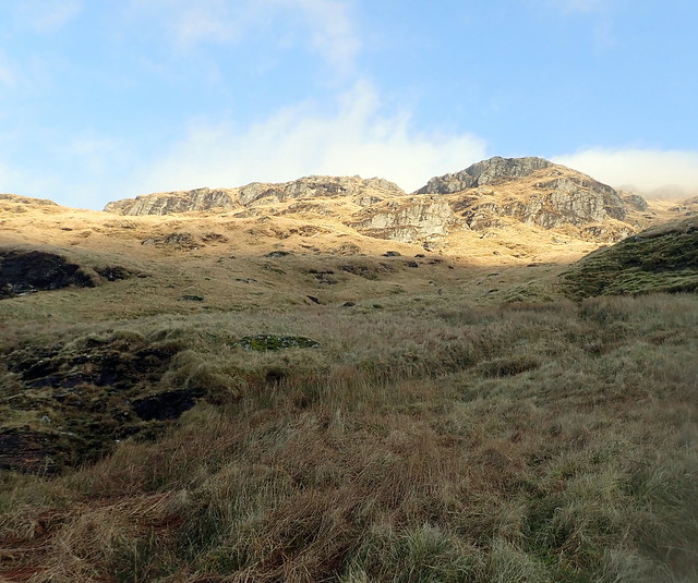
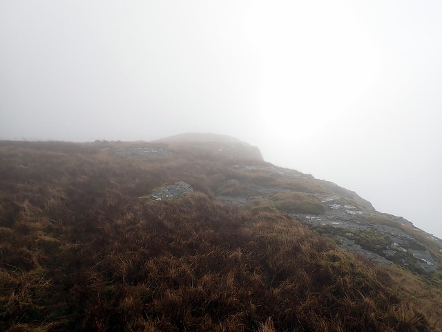
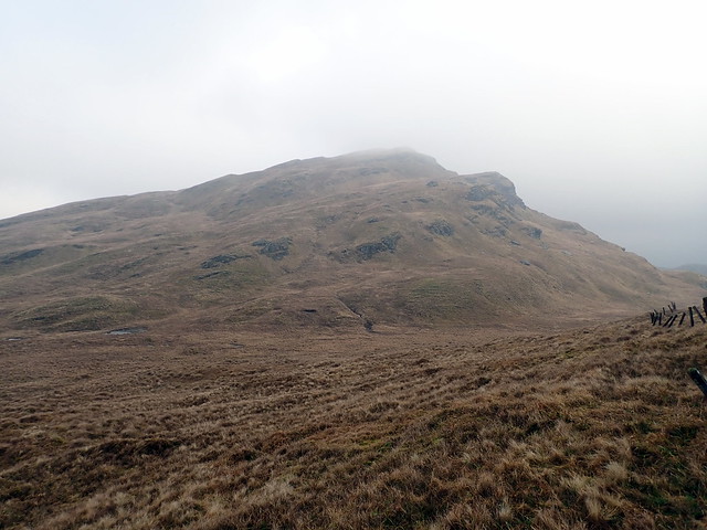
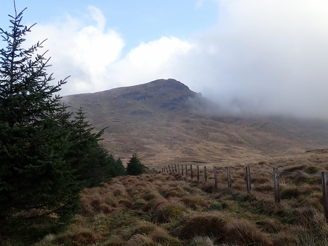
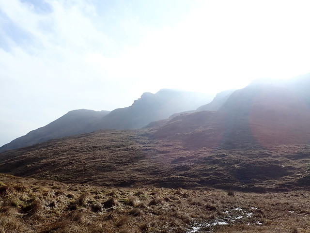
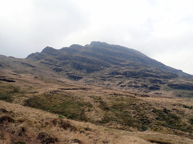
It was a lovely morning, sun warming the winter colours of the hillside. However I could see the clouds were down low, obscuring the top of Beinn Bheula, a taste of what was to come. Good progress made along the forest track then onto the Cowal Way proper to reach Curra Lochain. I recalled the ascent of Beinn Lochain from here as being very steep - we did it in snow conditions too. None of that today however. The hillside was still steep- I picked a line to the south of the crags and wove my way up a gully. Clag closed around me as I neared the summit.
 P2150216
 by
Al, on Flickr
 P2150217
 by
Al, on Flickr
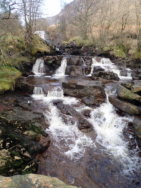
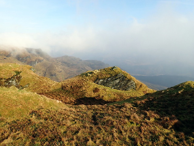
Curra Lochain
 P2150219
 by
Al, on Flickr
The only way is up
 P2150220
 by
Al, on Flickr
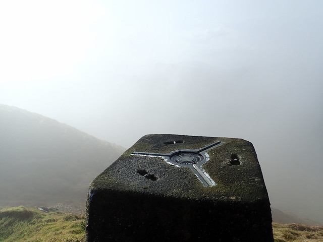
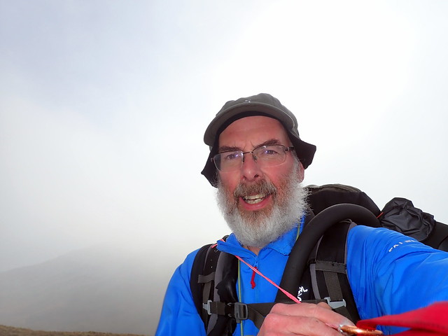
Summit
 P2150221
 by
Al, on Flickr
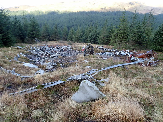
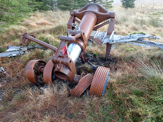
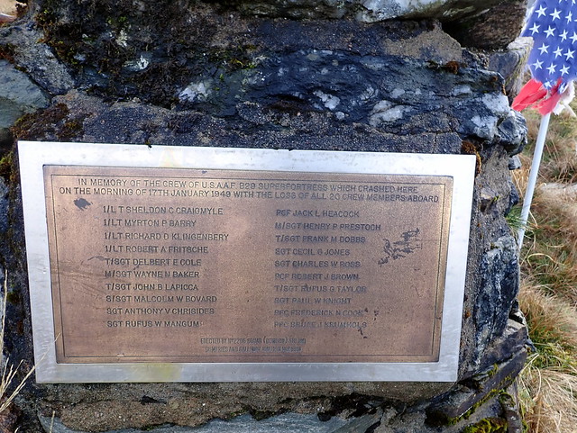
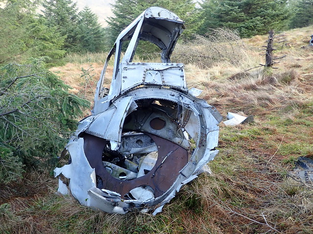
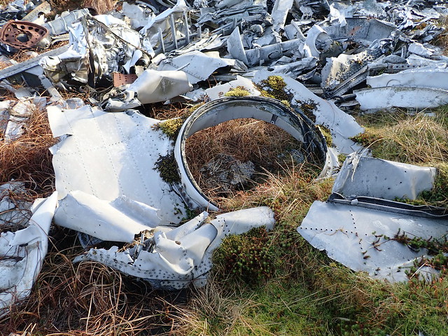
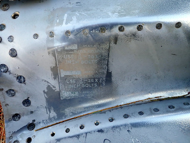
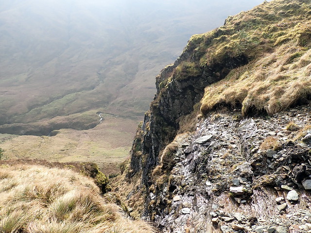
My route from here took me over the next three summits in a craggy ridge - I noted when I got home that all three were Humps - ie with a drop of 100m or more, including the deleted Graham of Stob na Boine Druim-Fhinn. I wanted to visit the crash site of the B29 Superfortress that crashed 70 years ago. Descent was via the northern shoulder, avoiding the crags on the east side of the hill. I climbed Beinn Tharsuinn, crossing some boggy ground on the bealach then started to head north for the corner of the forestry plantation where the aircrash site lies. Just inside the fence is the considerable wreckage from the plane's demise, an event that killed all 20 crew and passengers, I understand the plane was returning home to the USA from its base in Scampton, Lincolnshire via Keflavik in Iceland with another B29. Poor weather was encountered, the second plane turned back but the unfortunate aircraft continued and crashed into Succoth Glen - icing being the probable cause. Some of the metal wreckage was still as shiny as it must have been seventy years ago.
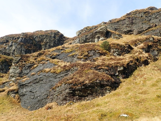
Beinn Tharsuinn
 P2150224
 by
Al, on Flickr
Crash Site
 P2150228
 by
Al, on Flickr
 P2150229
 by
Al, on Flickr
 P2150230
 by
Al, on Flickr
Tail turret
 P2150232
 by
Al, on Flickr
Dorsal turret
 P2150234
 by
Al, on Flickr
Fuel door
 P2150235
 by
Al, on Flickr
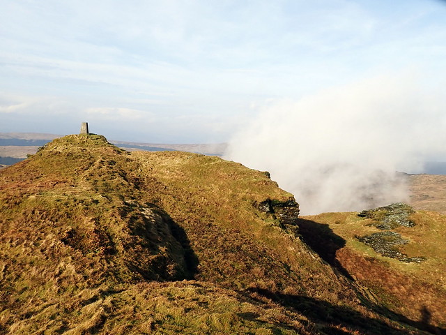
Stob na boine Druim-fhinn
 P2150236
 by
Al, on Flickr
I turned and headed towards the demoted Graham of Stob na Boine Druim-fhinn, pausing in the shelter of a large standing stone to have lunch. Another terrifically craggy mountain this - a shame it's lost its Graham status as it is well worth a visit. Clouds whipped around me like wraiths as I neared the trig - almost got a Broken Spectre but the cloud was moving too fast for that. Next up was Mullach Coire a'Chuir. I was debating whether to continue on to the Graham of Cruach nam Mult, but the main issue was a descent into forest plantation on the return leg - I reckoned it would be more time efficient to return the way I'd planned and drive up Hell's Glen to do Cruach nam Mult if there was time.
 P2150237
 by
Al, on Flickr
 P2150239
 by
Al, on Flickr
 P2150240
 by
Al, on Flickr
I could look back on the morning's hills as they lined up in profile. Mist swirled, revealing then hiding the peaks. I made the summit of a'Chuir and had a bit of fun coming down from it - lots of bluffs and crags to be negotiated, not a good way down in snow or poor visibility. I headed along Coire a'Chuir, the allt having carved a deep gorge in the higher part of the coire. Later I reached an ATV track which I took for a bit til it reached the fenceline - I wasn't sure where the track was headed after this, possibly into the trees. I'd routed my return over the 475m point SE of Stob na Boine, not appreciating that I'd have to regain about 150m height to go that way. It's one thing drawing a route out on a computer, another to ascend it

Mullach Coire a'Chuir
 P2150242
 by
Al, on Flickr
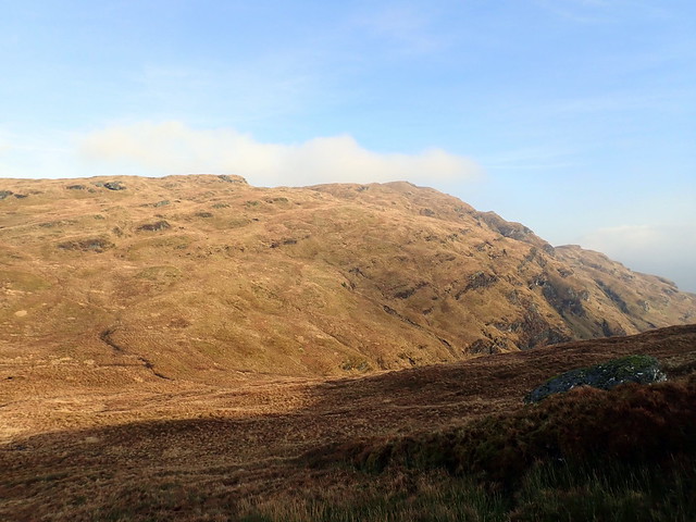
This morning's work
 P2150243
 by
Al, on Flickr
Summit a'Chuir
 P2150245
 by
Al, on Flickr
Some steep bits
 P2150247
 by
Al, on Flickr
 P2150248
 by
Al, on Flickr
Stob na Boine Druim-fhinn
 P2150251
 by
Al, on Flickr
With much huffing and puffing I made it to the 475m point (which isn't even a Tump, after all my effort) and began my descent off Creag Loisgte down the old fire break from when there was mature forest here. Back at the car by 2.30 - time to fit in a wee romp up Cruach nam Mult I think!
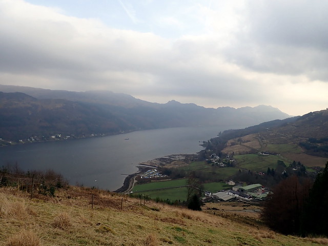
Lochgoil
 P2150252
 by
Al, on Flickr
 P2150253
 by
Al, on Flickr
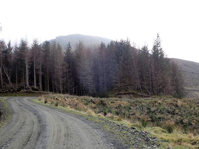
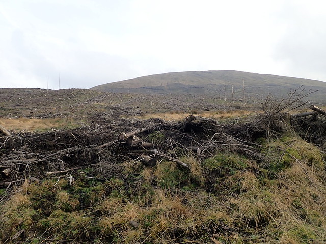
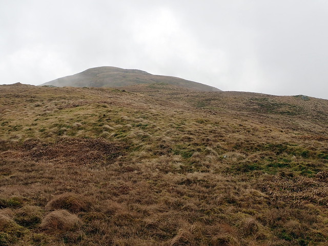
I drove along Hell's Glen, finding one other car at the parking area that served Mult and Stob an Eas. We'd done these two in deep snow last time. Mult is the quicker of the two to climb, I thought we could polish off Eas next time we're down here, doing Beinn Bheula. Since our visit 2 years ago, all the trees have been harvested, meaning a wander across about 100m of felled residue. I tried to keep to extraction tracks where possible, it wasn't the worst I've crossed. I ignored the previous route and headed directly up the northern shoulder - steep but satisfying. Near the top I glimpsed another walker on his way down - we spoke briefly - he'd done Eas earlier but was disgruntled by the lack of views. I said I was happy it was dry and snow free and pressed on to the summit. A couple of stones and a stick marked one possible summit but the actual summit (according to Hill-bagging) is a bit further SE and currently unmarked by a cairn. I trotted back the way I'd come, back at the car before the other walker appeared.
 P2150254
 by
Al, on Flickr
 P2150255
 by
Al, on Flickr
 P2150256
 by
Al, on Flickr
 P2150258
 by
Al, on Flickr
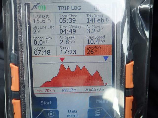
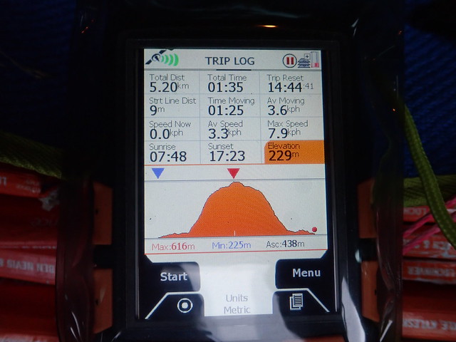
So a grand day out - more ascent than I've done for a while - will no doubt pay for that tomorrow. I should just have brought a tent and stayed up here overnight, but I didn't plan that and - unusually - didn't have kit in the car.
