free to be able to rate and comment on reports (as well as access 1:25000 mapping).
Video of fun:
I was headed west to the shores of Loch Lomond to meet a couple of locals and walk over a couple of fine Luss hills. A late start was planned as the forecast had a weak front moving through in the morning with the promise of sunshine and views later in the day!
Arriving in Tarbet I left my car and met with G and F and we managed a lift round to Glen Douglas where we were dropped. All we had to do now was find our way back to Tarbet. The plan was a hike over Beinn Bhreac then down and up over Ben Reoch, with the promise of fantastic views over the hills and mountains that surround the bonnie banks
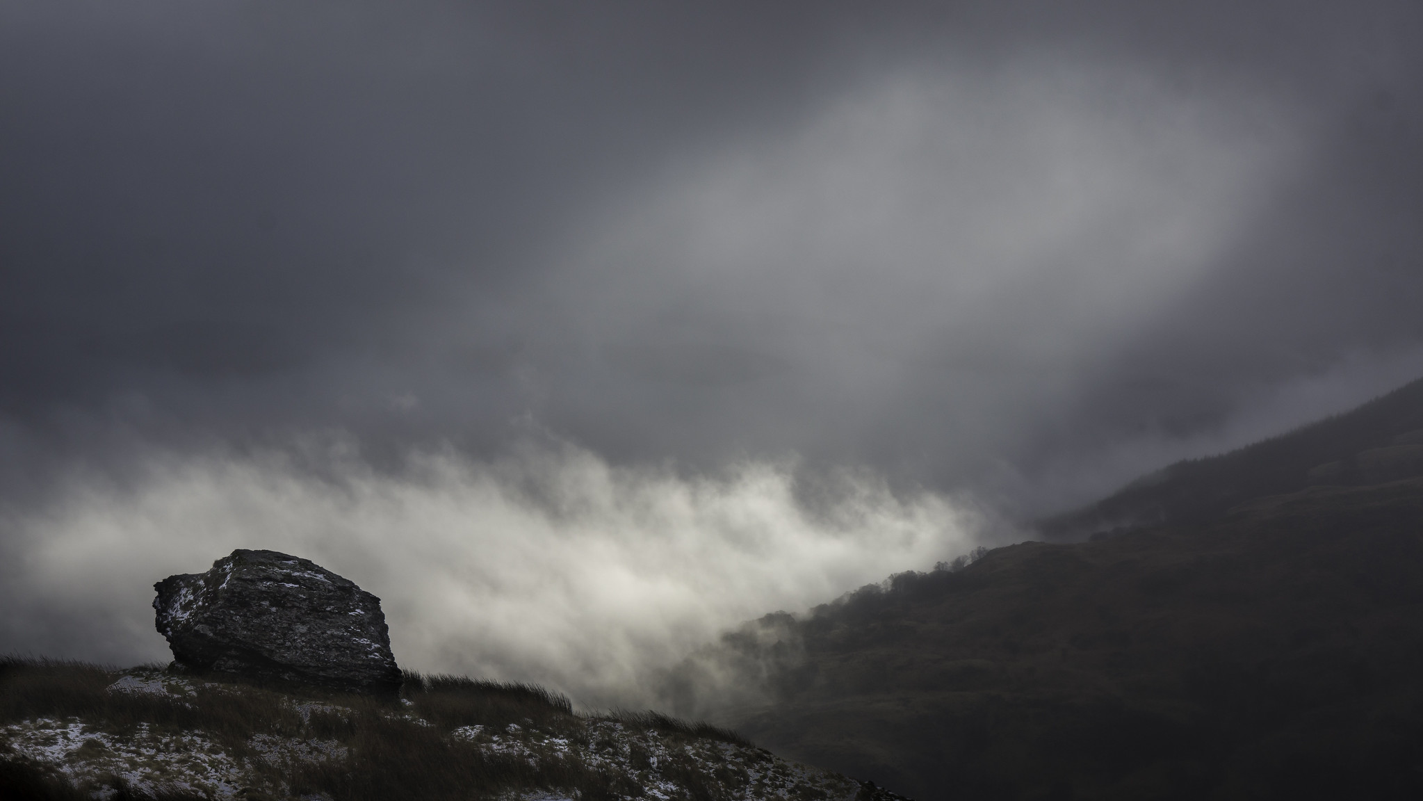
However as we got out of the car at Glen Douglas the hills were smothered in cloud and long ranging views seemed a long way off!!
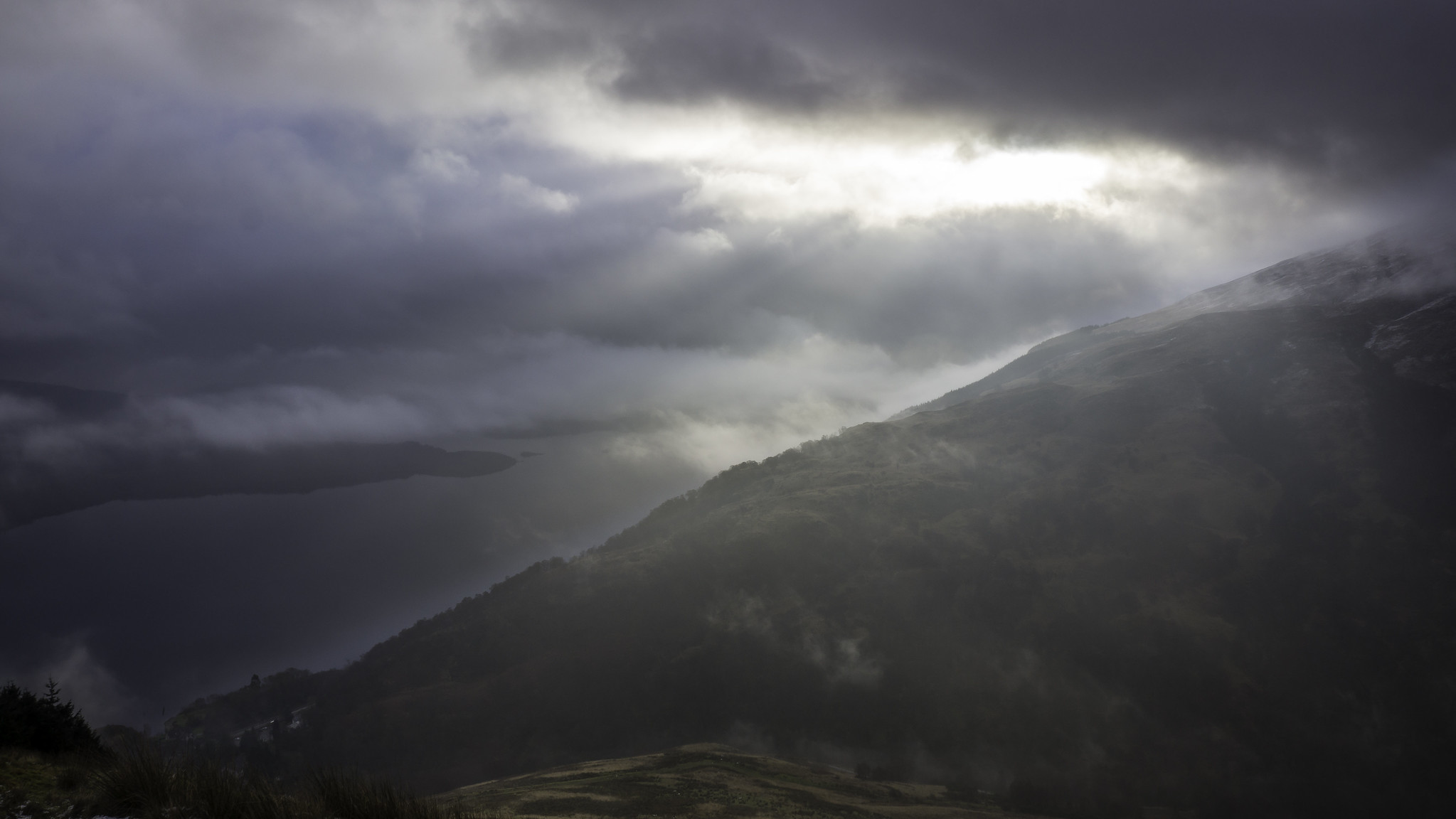
This hike starts uphill immediately on pathless grassy ground, and there aint no time to warm up! The good thing though is that you gain height quickly and we were soon reaching the ridge line (and cloud) however before entering the cloud we got some nice atmospheric shots back down towards the rest of the Luss Hills.
 contrast Loch Lomond
 by
Scotland's Mountains, on Flickr
 morning light loch lomond
 by
Scotland's Mountains, on Flickr
Entering the cloud also saw the ground turn from green to white and we headed on following compass bearings into the whiteness… Before long our readings informed us we were close to the summit. A quick look at the map and we realised the summit was just off the ATV track which we had now picked up. About 20 meters to the east and we were stood on the top of Beinn Bhreac. Disappointingly, the weather front had decided not to budge but every now and again the clouds threatened to break, however after waiting 15 minutes nothing happened so the map and compass came out again and we were set for Ben Reoch.
As sods law usually dictates, about ten minutes after leaving the summit, the cloud cleared in a spell of about 1 minute. From walking through a fogged up, claggy zero vis landscape, we were now treated far flung vistas and blue patches rapidly replaced the scudding clouds. This put a spring in our step and we decided to head to the eastern slopes of Ben Reoch to capture the fine views. And indeed they were fine, we stopped on a minor top at 632m and had some lunch and took some photos. A wee rest and energy levels replenished, we then strode onto the top of Ben Reoch. The views here were almost better than on the minor top with the Arrochar Alps loosing their cloud caps one by one. The Cobbler as always looked mighty fine.
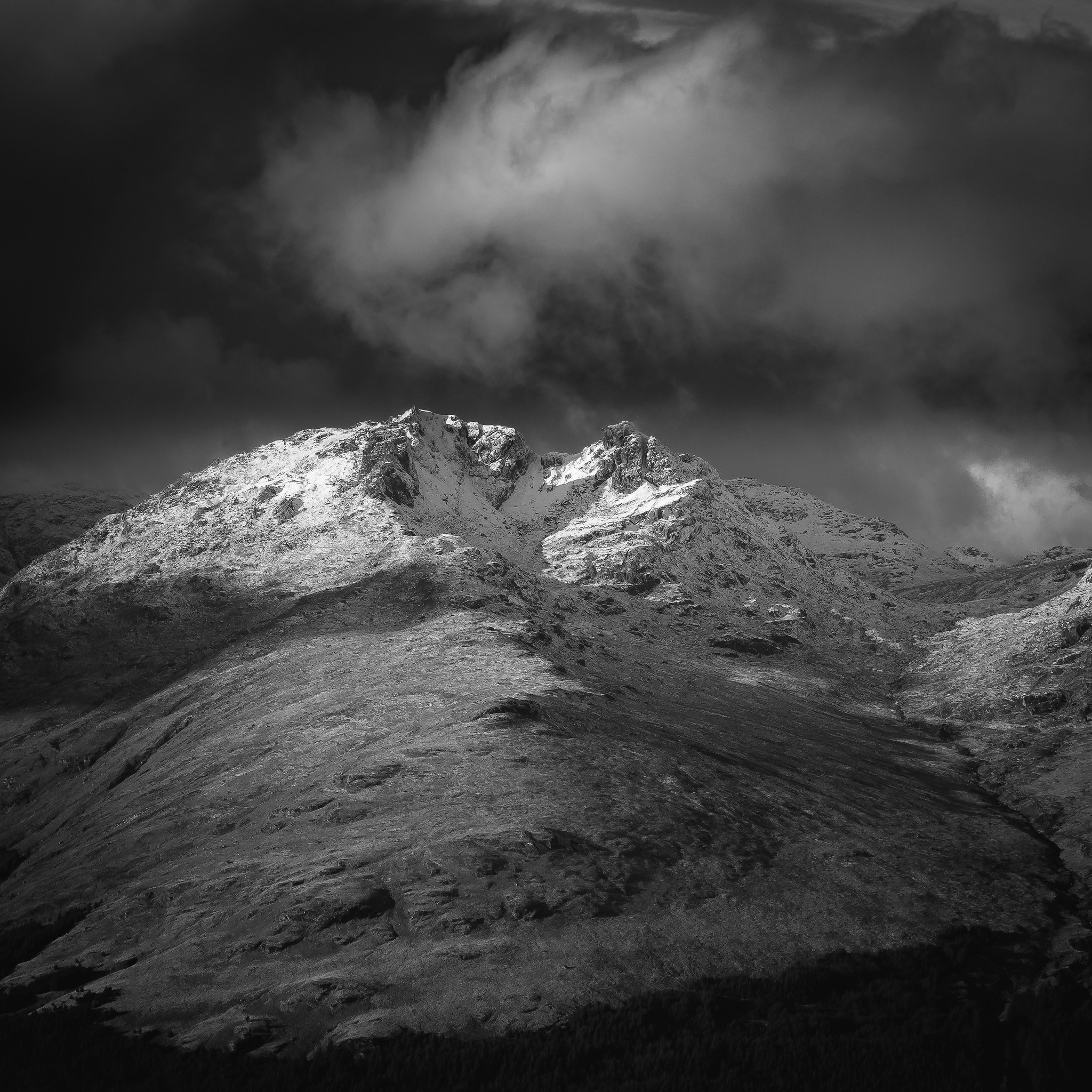 The Cobbler
 by
Scotland's Mountains, on Flickr
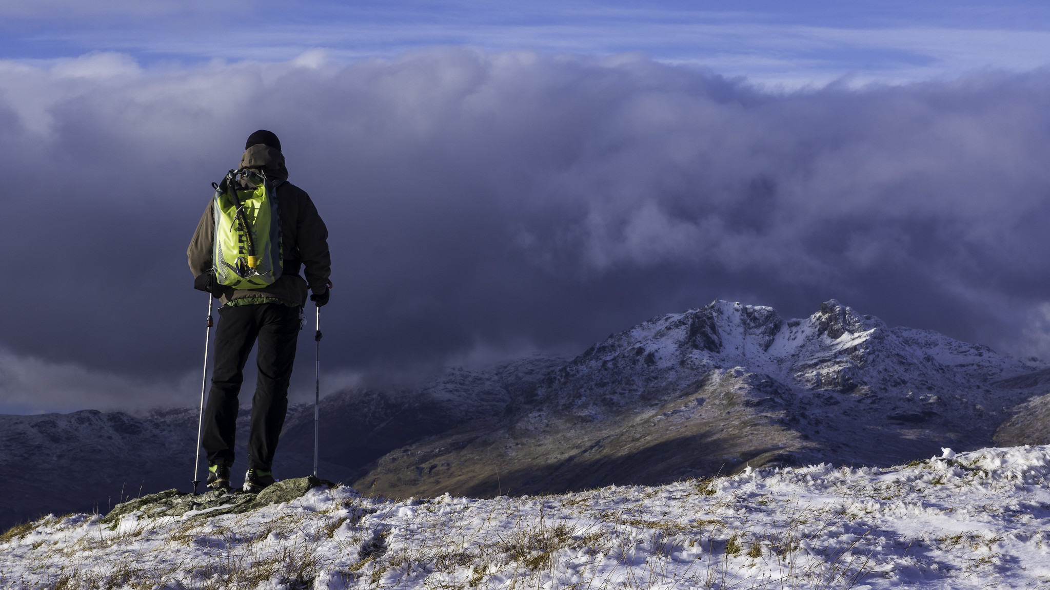 Looking to the Arrochar Alps
 by
Scotland's Mountains, on Flickr
 cobbler
 by
Scotland's Mountains, on Flickr
All that was left was the steep descent to Tarbet. This turned out to be the hardest part of the day. The ground was steep and when it levelled off a little lower down the under foot conditions were rather uneven! lots of bogs and marshes to get through, but we did and soon were back in Tarbet in time for some coffee and bacon buns
a few more snaps :
 dyke
dyke by
Scotland's Mountains, on Flickr
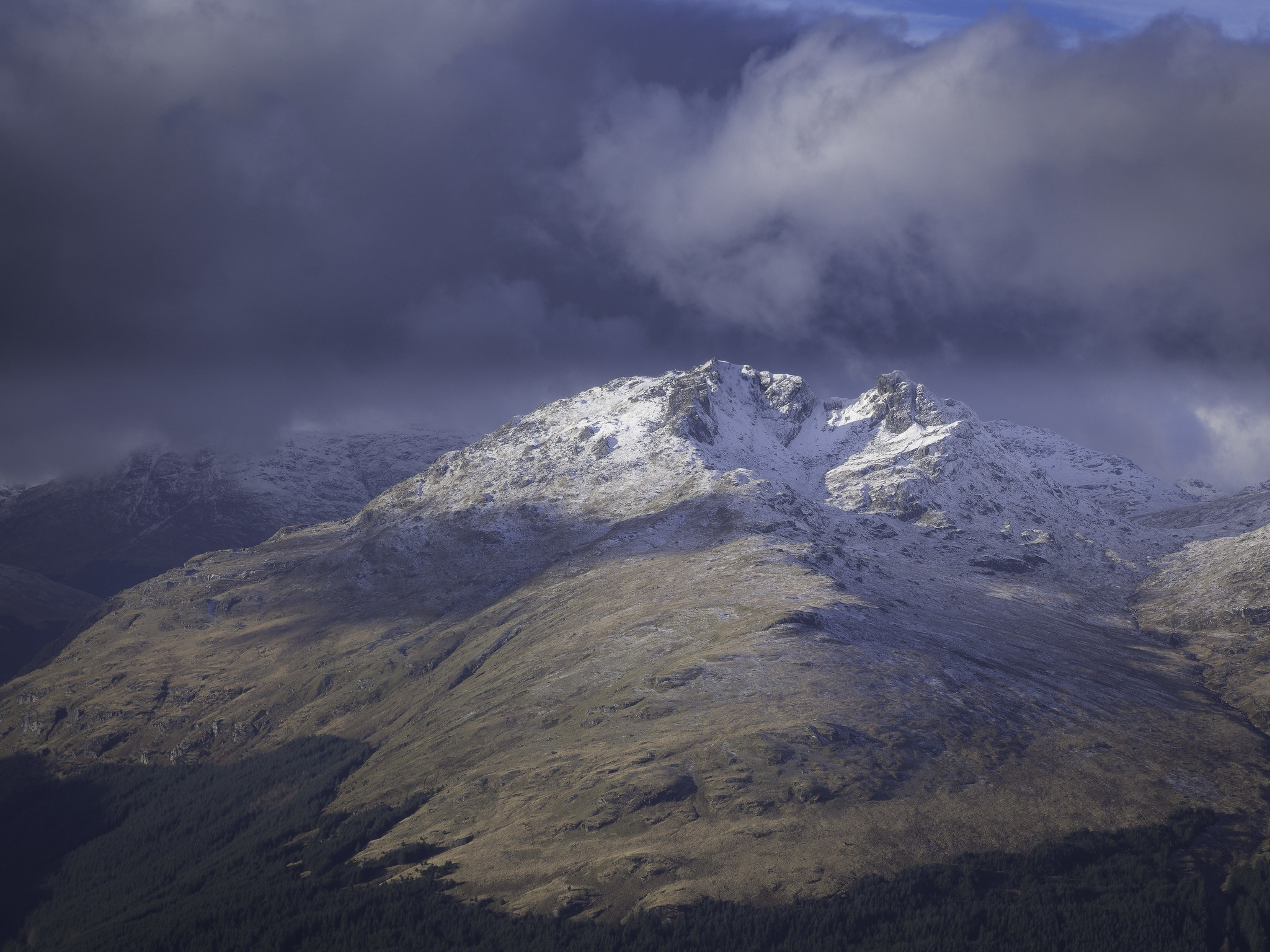
 Beinn Bhreac
 by
Scotland's Mountains, on Flickr
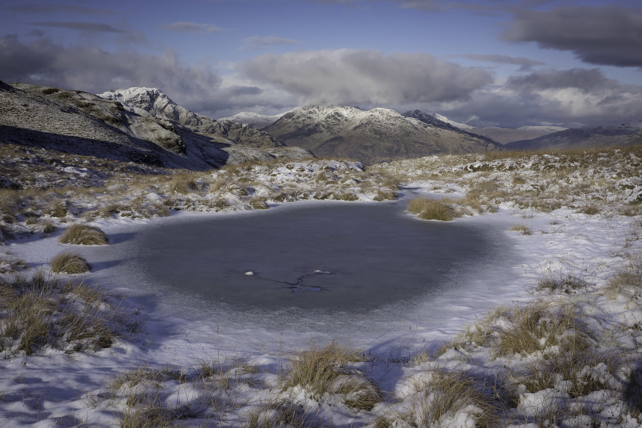 frozen lochan
 by
Scotland's Mountains, on Flickr
 the cobbler
 by
Scotland's Mountains, on Flickr
