free to be able to rate and comment on reports (as well as access 1:25000 mapping).
Sat 13 Apr
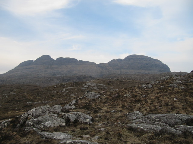
Corbett: Beinn Enaglair
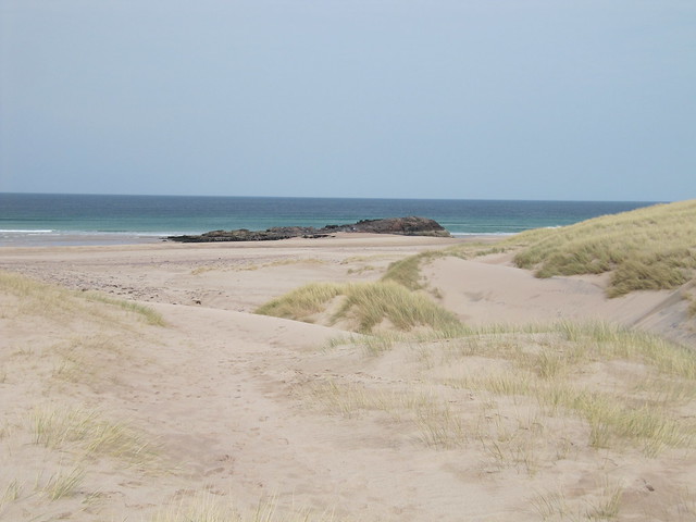
5¼ hrs /16km / 820mWhen I popped out of the car at Braemore Junction, I was quite surprised at how cold and blustery it was; it had been a nice drive up, with lots of blue sky and sunshine. Game on! I booted up quickly, and headed up over the boggy bit – which wasn’t very boggy at all – to Home Loch. I still wasn’t quite sure whether I was on a bagging mission, or simply out to enjoy the day. Once I’d warmed up, after the shock cold start, I was keen to take the stalkers’ path that led around Beinn Enaglair, and take it from behind (oooh, err, missus! I was going to say “go up its backside” instead, but that’s not much better!

). I could say “from the east” but where’s the fun in that?

across to the Fannichs...
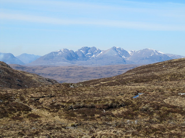
...and to An Teallach
I went slightly awry by blindly following the track. When it began to lose height, a quick check of the map told me that I’d missed a fair bit of the path. This was confirmed by also seeing two men who’d left the car park just before me far above me – I’d seen them leave the track much earlier than I did, but I assumed that they’d be doing the route the anticlockwise way ‘round. Nope. A steep uphill heather bash soon saw me right, and it wasn’t long before I’d caught them up. We had a quick chat before carrying on, me now ahead of them. They’d come up the track by the estate lodge/offices, which used to be blocked by a large gate, and I was keen to know how they’d gotten on. No problems, they said, so I said I thought I’d probably come down that way, just as a variation on my outward route.

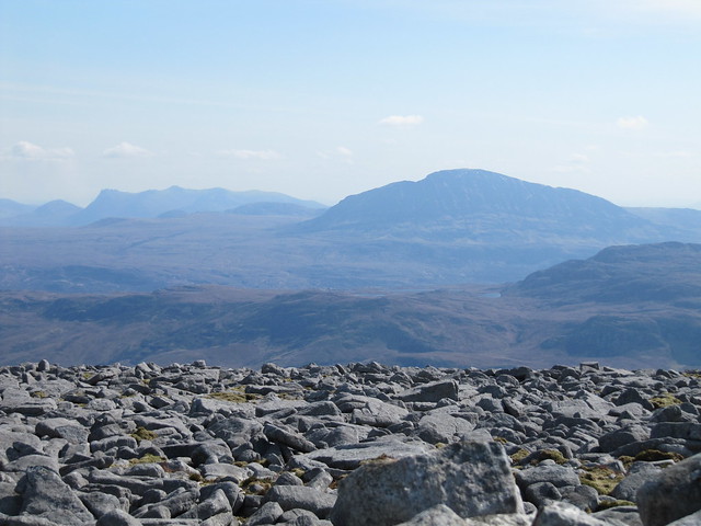
Beinn Dearg looking very impressive!
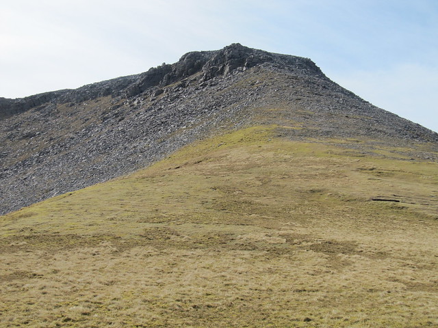
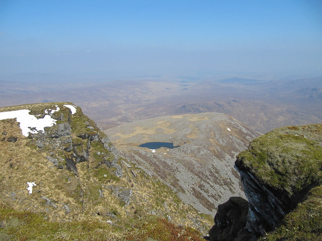
It was a good path, all the way up to (then around) Creag Bac na Faire. I don’t think there was a cairn marking the point to leave the path, and it was soon lost in boggy ground. But I thought I could see a bit of path zigzagging up the steep slope in front of me, and sure enough, once I reached it, the very good path continued nearly all the way to the summit. It was a short pull; the original path had ascended gently over the kms, to nearly 700m by the time I left it!

hello, weird and wacky Assynt hills

arty farty Fannichs
It was extremely blowy on the top, and although I did hunker down behind a rock for a few minutes, it wasn’t long until I was on my way again, descending over heather and rocks until I picked up the stalkers’ path once again (the “ring road”

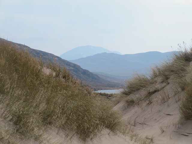
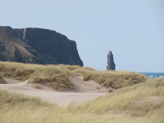
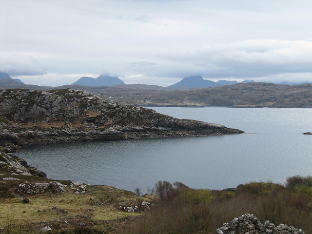
), not far above the Bealach nam Buthan. I did keep eyeing Meall Doire Faid, and wondered from where I’d make my approach. But I’d read about a longer route (the SMC book, I think) that started from closer to Loch Droma, and took in the entire ridge, rather than only the summit; it looked to be another good route to save for an “on the way north” walk.

nice waterfall on the way down; Meall Doire Faid (next time)
I was back at the car in just over five hours. I stopped in Ullapool for the usual fish supper (I LOVE that the Seaforth chippy is open all day

), and then on up the road to settle in.
Sun 14 Apr
Corbetts: Cranstackie, Beinn Spionnaidh
6¼ hrs /13.5km / 1079m It was windy again today, and as I set off toward Rhigolter, I stopped several times and pondered whether I was in the mood to fight it again all day – I knew it would be much worse on the tops. But I carried on – mostly by telling myself that I’d already made the drive around, and I’d already walked a couple of kms, so I might as well get on with it. So I did.

Foinaven from Carbreck

my targets -- Cranstackie on the right, Beinn Spionnaidh left
The NW face of Cranstackie looked quite steep and intimidating, so I was relieved to discover that the usual route carried on not only up to the Chalbhach Coire, but through it as well, and that the summit could be approached from further east.

much steepness up into the coire
It was fairly calm in the coire, but the wind picked up considerably as I approached the bealach between the two hills. I made my way up to, then through, the boulder field that guards the summit, eventually stashing my poles so I could use both hands.

there were boulders...

...but views, too

Foinaven again
Once I’d gained most of the height, it was still another 100m or so to the summit cairn, across more boulders that were large, uneven, and wobbly enough to be ankle-busting, but mostly too small to hold onto. It must have taken me at least 20 minutes to traverse that 100m. I’m not great at boulder-hopping under the best of circumstances, nevermind when the wind is blowing so strongly I can barely stand up! I did consider calling it quits (it felt rather unsafe), but instead lowered my center of gravity as much as I could, and did a weird shuffle to the cairn that was part crawl, part crab-walk, part bending down to hold onto rocks. I collapsed gratefully on the side of the cairn that was slightly out of the wind. I am glad there were no witnesses to this!
After catching my breath, I emerged back into the maelstrom to make my way back across that 100m. It was a relief to reach the steeper boulders that I could once again hang onto.
looking back up, from near the bealach
The wind had eased – a bit – by the time I’d returned to the bealach, and started making my way up Beinn Spionnaidh. Here, too, were many boulders to cross on the way to the summit, but at this point, I was only feeling wearied of them, rather than that they posed a danger. There was a shelter cairn here, with its white trig point inside, so I took a few minutes to have some food.
there were boulders on Beinn Spoinnaidh, too
The WH route carried on over Cioch Mhor, but I didn’t see any reason to add more ascent; I also didn’t fancy the steep steep descent straight back down to Rhigolter. I’d done a recce on the way in – it looked like it’d be more enjoyable (and gentler, certainly) to descend back down into the Calbhach Coire, and meet up with my inbound route higher up the track. It was.

one more back up at Cranstackie
In spite of the wind, I did enjoy the day (mostly), and felt a great deal of satisfaction at both having decided to go for it, and at successfully and safely managing it.
Mon 15 Apr
Lochinver wander
~4 hrs / 14.4km / 432m It was still very windy. Plan A had been Suilven, but after seeing a forecast of 70-80mph gusts on Conival, I decided to give it a miss! At least for today.
River Inver circuit, then out past Loch Drum Suardalain, nearly to the top of Cnoc nan Each (but for the wind!! Again!!), back to the Inverkirkaig road, then through the Culag Woods, before returning to the village, then back to the chalet.
No pictures, because I was travelling light. I’d really set out only to do the river circuit, but ended up staying out longer than I’d planned because I was enjoying the outing, and because the normally very boggy areas were unusually dry. I sat for a while at the White Shore in the Culag Woods, looking across to Baddidarach. It was a nice and peaceful interlude.
Tues 16 Apr
Graham: Sabhal Beag
Corbett: Meall Horn
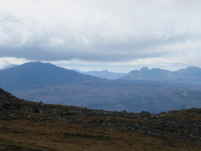
7¼ hrs /23.7 km / 1129m It was a dry, but dull day, and there wasn’t much of a view from either of the tops, although I did manage a few glimpses of both Arkle and Foinaven on the way down.
I was roughly following malky_c’s route for these two hills, with a few tweaks. I came down over Creachan Thormaid -- ala the SMC Graham/Donald book -- rather than going over Creagan Meall Horn as he’d done. I was also following the track that heads southeast about a km after Lone (*not* the one that goes through the huge boulders that everyone takes a photo of), and stayed on it all the way to the Bealach na Feithe before beginning the ascent proper, rather than cutting off ½km or so earlier and taking Malky’s “steep as hell” option.
It was a long walk up the track, about 6km, to the bealach. Even as someone who’s decided to eschew sleeping under canvas, I could appreciate that there were some really lovely camping sites along the river (Abhainn an Loin).

nice walk along the river. that's
not my target hill ahead

keep walkin'.
that's my target hill, dead ahead centre.

nice old stone bridge that I'd remembered seeing in Malky's writeup
I saw nuffin’ at the summit of Sabhal Beag, and lost my way trying to find the bealach between the two Sabhals (Beag, which is the larger of the two, and Mor, which is the lesser, in spite of their names. Gaelic confusion strikes again!). Seriously, d’you really think that I could spend 10 days in the Highlands without getting lost at least once?!
It’s almost always because of the damn mist.

interesting summit cairn, comprising flat shingle-y stones

I have no idea where I took this pic (perhaps near the bealach?) or which direction it's in. I just liked the composition
I got there in the end, only to find a brief, but very steep, mostly grass, re-ascent staring me in the face. I stopped at the bottom of it to eat my sandwich. Powered and emboldened by egg mayonnaise, I found that it was much easier than it looked, and was quickly done and dusted. The map suggested that it’d be an easy walk from Sabhal Mor to Meall Horn, and it was. I didn’t stick around there, as there still wasn’t really anything to look at.

summit Meall Horn. still nuffin'

ah! there's Foinaven. sort of.

and Arkle.
The descent down the southwest shoulder of MH was pleasant, although after traversing just below Creachan Thormaid, there were a few peat hags to contend with, and a couple of steepish down bits. It was also further back to the (original) track than I’d anticipated, followed then of course by the last few kms from Lone back to the car. Nonetheless, it was another satisfying outing.
Wed 17 Apr
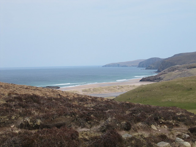
Sandwood Bay, with Cathel
6 hrs / 15km / 271m Beautiful weather, lovely beach, entertaining company. Cathel drove, which was a real treat for me, to be able to fully gawp at the surroundings, rather than having to keep (at least) one eye on the road.
It’s a good track/path in, without much up or down. I’d forgotten how beautiful the bay is on the approach. We walked along the beach, and found shelter from the breeze amongst the rocks to the north—just past the inflow/outflow to Sandwood Loch. It was just perfect, sitting there in the sun, chatting, and having our lunch. We sat for a couple of hours, putting the world to rights! I’ll let the photos do most of the talking for this one.


At one point during the afternoon, Cathel asked me what I was going to do when I got home on Monday. I realized that I had no idea…
Thurs 18 Apr
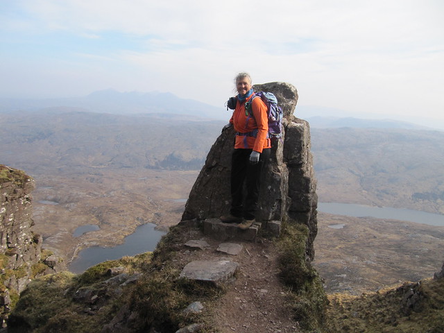
Graham: Suilven (again!)
7 hrs / 19.8km / 1021m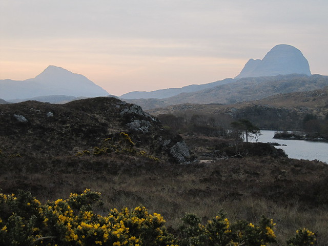
Such a good day – views from the top this time; well worth the effort of climbing this magnificent hill again. I set off early, only to be passed early on by two runners. Not long after beginning the serious ascent, I was passed by two more lads who, whilst not exactly running, were certainly keeping a faster pace than I. The good news is that they were all on their way back down by the time I reached the ridge.

even from close up, you cannae see the path winding up through the gully
The ridge! (Remember that I saw nothing on my initial foray up this hill, about six months ago.) As you climb up a very steep gully, you’re looking at pretty much nothing but the hill in front of your face; you might occasionally peek upward to verify that you’re making progress. But then you poke your nose up over the flat bit, once you finally reach it, and all of the hills and lochs of Coigach lie before your eyes. Wowie.

first view from the ridge; Cul Mor prominent, Cul Beag (I think) behind it

and panning to the right, to Stac Pollaidh and Ben More Coigach (it was quite hazy, the pics say/show)

panning to the right again; out to sea

*that* view, to the other top
I sat on the summit, drinking it all in, for a good 15-20 minutes. Yet another runner, a woman this time, showed up, took a few quick pics and went on her way. WhatEVer.


Quinag

zoom down to Lochinver
the perfect selfie spot; on my way down
I spent a fair bit of time and had my lunch near the lochan that’s at the foot of the steep part; it was much more sheltered from the wind than the summit had been. Nothing left then but the long walk back out. What a day, what a hill!
Fri 19 Apr
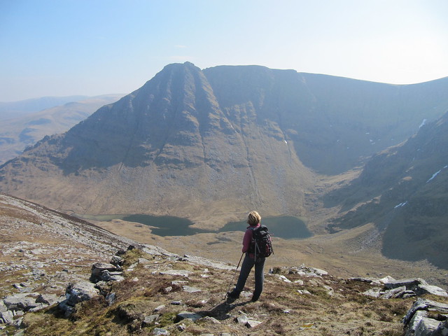
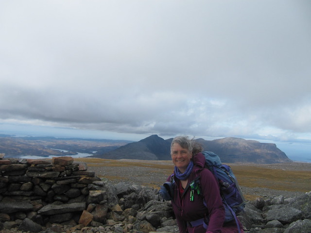
Munro: Seana Braigh, from Strath Oykel, with Evie
8 hrs / 20.7km / 891m I don’t understand why WH doesn’t advocate this approach as the primary route for this hill. SO much easier, SO much more scenic, and SO much more enjoyable than the neverending slog from Inverlael. It must be because the road to Corriemulzie Lodge isn’t open year round – admittedly, an additional six miles or so, either walking or via bicycle – would probably have killed some of the joy.
It was a cracking day, wall-to-wall blue sky. Truly a Good Friday! We sat on the top, in the sunshine, for probably close to an hour. I’ll let the photos do the talking for this one, too.

it was a long march up the track, but the view of what lay ahead kept us distracted -- stunning from this side!


Just for laughs, here's the summit pic of Jimmy and I a few years ago (2014) after the slog in from Inverlael. It was one of *those* walks/days -- we'd no idea of the magnificent coire just below us!
 Sat 20 Apr
I needed a rest day, but did manage a quick jaunt to my “secret” cove
~2 hrs / 7.2km / 290mI’ve decided that my secret cove isn’t really all that nice after all; there’s a ton of rubbish that’s washed up onto the rocky beach. The best thing about it is that it gives a bit of coast, without doing the long road trudge to Achmelvich, and avoiding the holiday hordes that I knew would be taking advantage of the dry day.

 Sun 21 Apr (Easter)
“At the Loch of the Green Corrie”
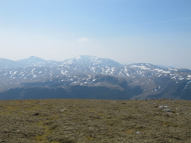
Corbett: Glas Bheinn
6½ hrs / 18.1km / 919m SUCH a good day to finish on! The early forecast had been for light rain for most of the day, but improved to predict a rain-less window for a few hours during the middle of the day. My main goal for this walk was to visit the Loch of the Green Corrie, from the eponymous book. I knew I’d looked down on it from my first visit to Glas Bheinn, but I really wanted to sit on its shores, and do some up close and personal exploration. I’d loved the book, and it all became even more interesting to me when I found out that Cathel had been the ghillie for the BBC programme based on the book, featuring Billy Connolly and Aly Bain.
I couldn’t decide whether to approach from the high point of the Kylesku road (A894) or from Inchnadamph, and didn’t make my decision until I’d reached the junction. The longer, but very pleasant stalkers’ path from Inchnadamph won out over the unknown approach from the opposite side (next time). The mist was hovering at just about the height of the Bealach na h-Uidhe (~630m), as soon as I followed the path down from the cairn, I was back out of it again.

first look at the loch (most of my pics are rubbish)

looking across the loch, and up into the corrie

and further afield the other way (in the general direction of Eas a' Chual Aluinn)
I spent a long time at the loch, walking all the way around it, and up on to various surrounding bumps and knobbles. It’s pretty, but to be fair, I’d probably have not given it a second thought were it not for the book. I started working my way back up toward the bealach, but found a bit of shelter next to a large rock, so stopped to have some lunch. The rain was still holding off.

a better shot of the entire loch, once I'd started ascending back up toward the bealach (my lunch spot)
When I reached the bealach, the cloud looked to have lifted from the summit of Glas Bheinn; it was less than a km and only around 150m of ascent. Seemed rude not to visit it again, and I was happy that I did; the view over Quinag, which doesn’t appear until you actually reach the summit cairn, was magnificent. I didn’t remember it being so completely “in your face” when I climbed this hill the first time.
on the approach to the summit; Canisp, Stac Pollaidh, Suilven

Quinag in your face
The descent was without incident, and it was a happy girl who returned to her car after yet another successful outing.
It’s been a glorious week, with little rain, and lots of sunshine and blue skies. I’m knackered but appreciate that I’ve been very lucky with the weather.
