free to be able to rate and comment on reports (as well as access 1:25000 mapping).
I’d been hill-less for nearly a month, stopped in my tracks (hahaa, see what I did there?) by first a general lack of motivation, followed by a nasty head cold that was accompanied by a cough that still lingers. But the forecast for Monday morning was quite good, and even though I wasn’t at 100% physically, I was feeling as though if my return to the hills was any more prolonged, I risked falling into a vicious cycle of lack of inertia, and too easily talking myself out of going. Ever again.
I’d considered doing a M/C combo of Meall Ghaordaidh/Beinn nan Oighreag and started reading walk reports. The Rodmiester had done BnO from the Ben Lawers NNR road, rather from Glen Lochay. Hm, interesting. Further reading led me to discover that I could also easily combine Meall nam Maigheach into the mix to make the drive a bit more worthwhile. A plan was hatched. Tidying MnM made sense; as it was likely to take not more than 2 hours, it’d be a good one to do “on the way somewhere,” but it’s not really on a beaten path to anywhere, and hardly worth the drive to do on its own.
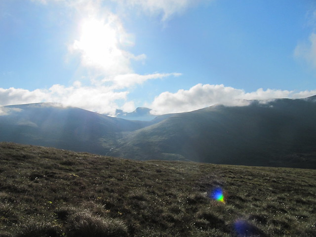
It was only as I drove along through a brutal combination of both fog and rising sun that I realized, with some amusement, that I’d picked a “soggy, featureless, uninspiring ascent” (as close to damning as any WH desc gets!) for my 100th Corbett. A few months prior, I’d hoped that one of the FF Beinn Deargs would get the honour, but I didn’t quite make it, and they’d ended up being #98/99 instead. MnM will probably remain memorable for its very un-memorability!

soggy. featureless. uninspiring.
I set off at 6:45, and was at its top less than an hour later (~50min). I pondered on the juxtaposition of having to walk 6 hours to gain access to the most recent Corbetts I’d climbed, versus this one being perhaps the quickest I’d ever do.

view across to my second target, summit still in cloud

Lochain na Lairige and the Tarmachan Ridge
There were good views across to the Glen Lyon Munros, and both the Lawers range and the Tarmachan Ridge were playing tag with low lying cloud inversions. I was in the sun, though, so I sat and enjoyed it for a few minutes.

Corbett #100!
Lawers hills in and out of the cloud
I made my way back down to the road via the drystane dyke. Several of the WRs I’d read had made mention of its steepness, but I didn’t find it particularly steep at all (and I AM the queen of moaning about “steep”) – I’ve certainly done worse!

(not steep)
As I trudged down the road to the footbridge that would take me to the landrover track up to nearly the summit of BnO, I was very aware of the height I was losing, and how much I’d be hatin’ life when it came time to trudge back up! I had considered briefly moving the car to the bottom of the hill, but decided against it because 1) I wasn’t sure I’d be able to find anywhere to park, and 2) doing so was pretty much the epitome of laziness.
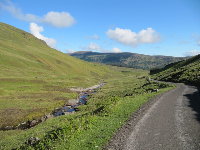
doon the road; FB just visible at centre
It was a long slog up the slopes of BnO, and I found myself stopping to rest every couple hundred meters (or even less). I definitely wasn’t in top form! I debated, from nearly the beginning of the ascent, whether to simply return the same way, thus making the long slog back up the road, or whether to head “cross-country” back to the car, which was a much closer option, as the crow (eagle) flies. It wasn’t a no brainer, because of the ~150m ascent from the bottom of the glen, up over the Bealach na Cuinneig. Also, although there was a “FB” marked on the map, near the car, I hadn’t seen it with my own eyes, and wasn’t sure whether it actually existed, or, if it didn’t, whether I’d be able to get across the Allt Baile a’Mhuilinn. Dithering about this kept my mind occupied during much of the ascent.

Lawers Munros
I finally reached the summit of BnO (10:45am).

finally, the summit!

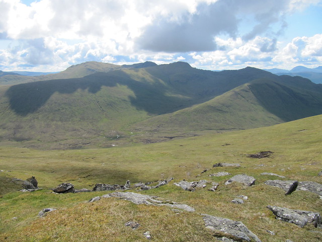
Meall Ghaordaidh dominated the view, as you’d expect.
But the Tarmachan Ridge was still very much in on the act, as were Stuc an Lochain and Meall Buidhe (with Loch an Daimh between them).
Tarmachan Ridge

Loch an Daimh, etc.
Oh, and there’s Loch Lyon, too. The Crianlarich hills lay “behind” Meall nan Tarmachan, etc., and although several walk reports mentioned Ben Nevis, I couldn’t discern it in the distance.

Loch Lyon, Creag an Tulabhain in the forefront
I thought the spur of Creag an Tulabhain looked intriguing, and might have contemplated a wander out to its edge, if it didn’t mean also descending all the way down into the Lairig Luaidhe first, and then climbing back up! Yeah, that's just not happening.
I was already in energy-saving mode, having decided that the least painful way back to the car would be the known slog up the road. But as I left the summit, I had a wander over and to have a little look-see at the descent to the bottom of the glen. Before I quite knew what was happening, I was well down it, contemplating the best route through the bogginess and peat hags, as well as picking out the best line of ascent up the other side.

from the descent; pondering the hags and reascent
It was fairly soggy at the bottom, and I took many extra steps to avoid the water holes of unknown depth. The ascent I’d been dreading wasn’t too bad, as long as I stopped often. When I reached the bealach, I was a bit surprised—not only to see the car—but also that it just wasn’t very far away. Result! The only challenge remaining was to get across the river, but I was soon relieved to see that the “FB” indicated on the map was indeed still in place.
I got back to the car at 12:30, retrieved my trainers, and returned to a small burn to soak my tootsies, which nicely rounded out the outing. I was pleased at the day’s effort, and am always smug-satisfied when I go a bit off-piste successfully, but I was also completely shattered. It was a real effort to get myself to Alison’s birthday festivities later in the evening.
