free to be able to rate and comment on reports (as well as access 1:25000 mapping).
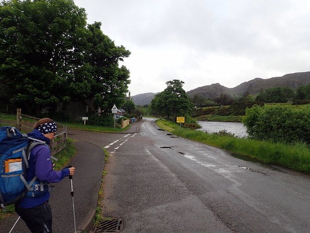
For the second week of our holidays we'd planned to get the remaining Corbetts around Loch Maree/Fisherfields done. I'd designated Monday 3rd June as a rest day - to allow us to drive down from Durness, re-stock in Ullapool's Tesco and get to Dundonnell or Poolewe. I'd feared that it would be a scorching day, wasted not being on the hills, but I needn't have worried, it was a stinker with pouring rain and really strong winds. We got to Ullapool mid morning and re-stocked our fresh provisions, also taking time to check the weather for the week ahead. Originally I'd intended to head to Corrie Hallie and walk in to Beinn a'Chladheimh and the Beinn Deargs, but with all the new rain I feared the river crossing would be problematical. In all the years we've been hillwalking we've never yet walked in to Shenavall and faced the river crossing, so it's become something of a fabled beast. Maybe not the best day to try it for the first time. So instead I thought we'd do the Fionn Loch hills from Poolewe - Airidh Charr, Beinn Lair and Beinn a'Chaisgein Mor. I'd scoped the route out at 60k, which included some Simms. We'd not been in that way before, so although I knew there was a track, I didn't know whether it was a real or "theoretical" one and therefore was a bit uncertain how long it would take.
Whilst we were in Ullapool, we'd got a text from our friendly guide, Paul Tattersall, who has a strange knack of seeming to know when we're near where he stays (Gairloch way) and sending us texts out of the blue. Anyway, I suggested we catch up over a coffee - he suggested Sands campsite cafe, after he'd been for a dip in the sea. Yes, in the sea - it's gusting 40mph winds, pouring and freezing cold and he's going swimming. We drove slowly around the coast, stopping at Mellon Udrigle (cos it's such a fab name) for our lunch, sadly in the rain and wind.
 P6030179
 by
Al, on Flickr
 P6030181
 by
Al, on Flickr
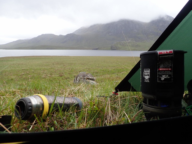
We reached Poolewe, pitched at the campsite there (very posh, small caravan club one, £8 more than the other sites we'd used too) and drove round to Gairloch to meet Paul. After he's defrosted we chatted, shared sadness over the death of Martin Moran in the Himalayas and he talked about his upcoming adventures. Then back to the tent in the rain to prepare for the next few days hiking.
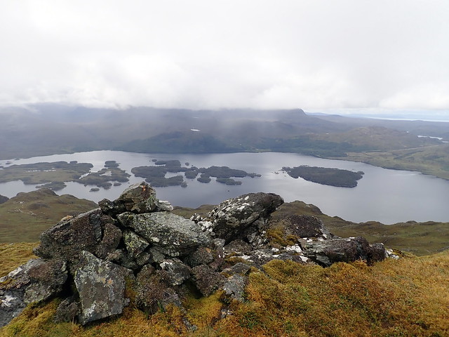
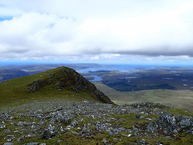
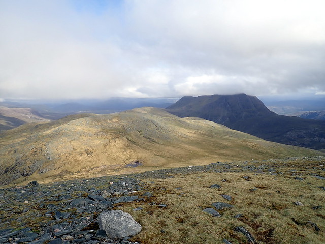
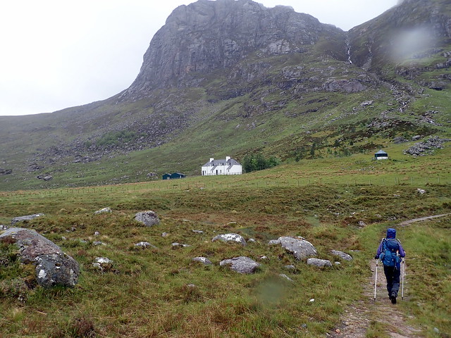
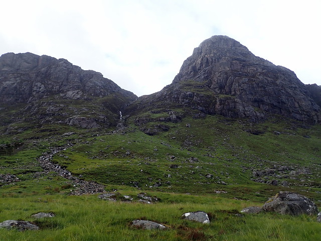
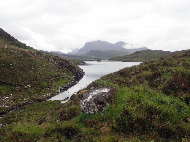
We set off about 8am from the car park at the start of the track to Kernsary on what was to be a long day. The forecast promised dry but cloudy - we got rain instead, which was irritating. The start of the track is proper road all the way to Kernsary, then good track up til the turn off for Airidh Charr. We're struggling with the extra weight of three days' food - but console ourselves to think at least the packs will be lighter on the way out. We turn left at a small cairn which leads us along a stream, through a gorge lined with birch and beech trees and resonating with birdsong and the roar of the waterfalls, into Coire na Dearcag, some glimpses of Airidh Charr through the mist. At the top of the coire I let out a sneeze, which is echoed all around - quite impressive! We head up the first Simm of Meall Chnaimhean, grinning to be able to leave the packs below. Then up to Spidean nan Clach, fine views of the more austere,rocky side of Airidh Charr from here. Then we cross to the main summit - the rain ceases and we have views out across Fionn Loch to the Chaisgeins and to the south, the tree infested islets of Loch Maree.
 P6040184
 by
Al, on Flickr
 P6040186
 by
Al, on Flickr
 P6040191
 by
Al, on Flickr
Loch Maree
 P6040194
 by
Al, on Flickr
Fionn Loch
 P6040197
 by
Al, on Flickr
 P6040198
 by
Al, on Flickr
 P6040199
 by
Al, on Flickr
Beinn a'Chaisgein Mor
 P6040202
 by
Al, on Flickr
 P6040203
 by
Al, on Flickr
 P6040204
 by
Al, on Flickr
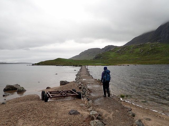
The causeway
 P6040205
 by
Al, on Flickr
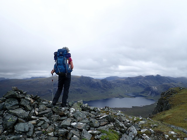
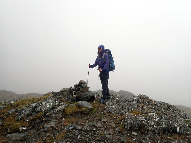
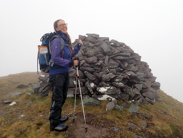
Summit Airigh Charr
 P6040206
 by
Al, on Flickr
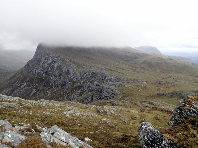
We drop a desperately long way down to the bealach with Meall Mheinnidh - down to 250m for heaven's sake, in the full knowledge we have to go straight back up again to 722m. For a hill that's not even on our target list. As we descend towards the bealach, a lone walker comes by, heading towards Letterewe. Slowly, painfully, we haul ourselves up the steep slopes of Mheinnidh, using deer tracks to avoid the crags, arriving at the summit more quickly than I expected - one advantage to a steep mountain - less steps to the top. The bealach with Beinn Lair is sighted below - I decide we should get to that bealach, pitch the tent and have our tea, before heading up Lair. It's not such a drop to this bealach, only 250m and we soon have the tent up and the tea on. We tuck greedily into noodles and Tofurky sausage.
Mheinnidh
 P6040207
 by
Al, on Flickr
 P6040209
 by
Al, on Flickr
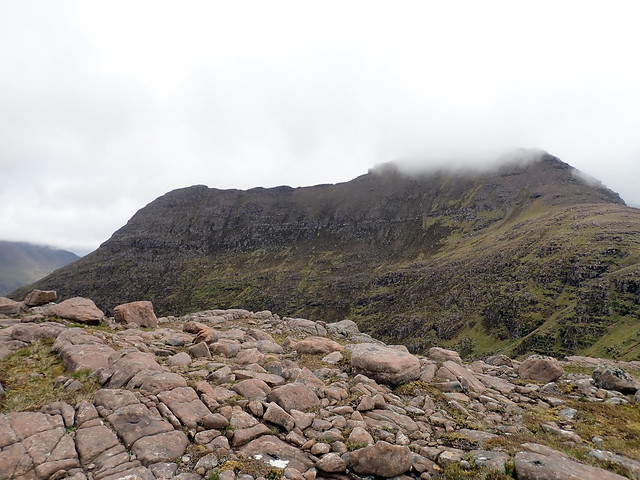
Beinn Lair
 P6040212
 by
Al, on Flickr
With lightened rucksacks we set off again up the modest slopes towards the summit of Lair, only a couple of km away. Trouble is, there are two Simms further east, which puts another 5k onto the distance and maybe 300m extra ascent. Allison just loves Simms

It is, however, a nice evening and why wouldn't you relish a walk along the back of Lair, the only disappointment is cloud lying along the tops of the higher peaks - Slioch and a'Mhaigdean. There's no noise up here other than the faint churning of the waterfalls far below. This is the life. Out to the cairn, impressively large on Lair itself, then out and back to the two Simms followed by a canter back down the hillside towards the tent, 3 hours in all. But we're not done yet - I think we should camp nearer the causeway, to make tomorrow a shorter day, plus - at 300m lower altitude it should be a bit warmer overnight. We pack up the tent and follow the track/stream down to Poll Fraochain. The ground here is tussocky and boggy, fewer places to camp than I'd thought. The setting is impressive though - the fearsome face of Chaisgein Mor across from us, on our right the cliffs of Lair and the interesting looking Beinn Tharsuinn Chaol - one for another trip. Rain is starting midges are coming out, so we have to hurry. We manage to find a rather lumpy spot beside the path and pitch up (actually there is a good spot immediately on the other side of the causeway). After we've pitched I realise there's a substantial lump where I'll be lying. But after a long day I've almost ceased to care...
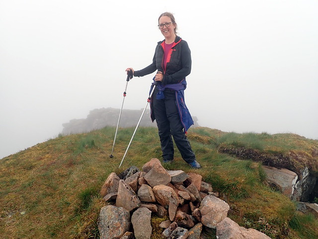
Summit Lair
 P6040215
 by
Al, on Flickr
The 2 Simms, Slioch beyond
 P6040216
 by
Al, on Flickr
 P6040218
 by
Al, on Flickr
 P6040222
 by
Al, on Flickr
Fionn Loch
 P6040225
 by
Al, on Flickr
 P6040228
 by
Al, on Flickr
 P6040231
 by
Al, on Flickr
A rather uncomfortable night, and a dreary looking morning with low cloud and drizzle awaits us. Overnight I've been thinking about the route and have decided we'll add on the Beinn Deargs - they're not that far from Chaisgein Mor and I reckon we can leave the tent where it is and travel light - a bonus. Allison is aware it'll be another big day, but gamely agrees. Leaving all the unneccessary stuff from our rucksacks behind, we set off over the causeway, something I've wanted to walk over ever since first looking down on it from the summit of a'Mhaigdean. Soon after we cross, Allison stops to pick up litter some lout has left (a stir-fry sauce packet) - and I notice she hasn't got the map. It must have been jettisoned with the stuff in the tent. Not wanting to be reliant only on GPS in this area I run back along to collect it. Off up the good track past Carnmore Lodge, which has a sign on the gate stating "climbers & hikers welcome to use the barn" - would have been good to know about that in advance

We meet a group of six lads doing their DoE Gold on their way to Letterewe, wrapped up well against the elements.
 P6050232
 by
Al, on Flickr
 P6050233
 by
Al, on Flickr
Carnmore Lodge
 P6050234
 by
Al, on Flickr
 P6050235
 by
Al, on Flickr
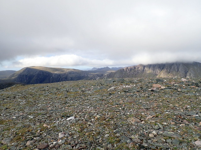
We decide to do the Deargs first, coming back over the easier slopes of Beinn a'Chaisgein Mor. Once we reach the top of the pass, where the path for Ruadh Stac Mor cuts off to the right, we enjoy easy going for the next three kilometres, not even that wet underfoot. We descend to the head of Loch Beinn Dearg, aiming to traverse the southeast slopes of Beinn Dearg Mor towards the bealach with Bheag, then face the steep climb to the almost-Munro height Beinn Dearg Mor. The rain becomes more intermittent, giving occasional views of the top of Bheag and surrounding summits. Once again we make use of deer tracks to weave uphill around crags, the rocks pillowed with moss, patterned by lichen. We pause for food at the bealach - Allison suggests we do Mor first, as this will give (her) a psychological advantage rather than the smaller Bheag. Finding the path through the sandstone boulders we make good progress up the hill, over scree til we merge with the mist near the summit. The cairn is reached, of course we have to go round to the jagged tooth of rock jutting up to the south. We're also supposed to be visiting the 808m top at the end of the northern spur. With poor visibility, it's impossible to make out whether we can descend directly from the summit or have to pick a way round - all I see is a tremendous drop in the swirling mist and decide we're not going to bother going that way. We half heartedly look at whether we can contour round the western side of the summit and rejoin the ridge, but that looks steeply unpleasant, the consequences of a slip serious, and we make a decision to leave the Simm for a better day and press on to Bheag.
 P6050244
 by
Al, on Flickr
 P6050245
 by
Al, on Flickr
 P6050246
 by
Al, on Flickr
 P6050247
 by
Al, on Flickr
Bheag
 P6050249
 by
Al, on Flickr
We leave our packs by a big rock on the bealach and head up Bheag, the summit hidden in chill mist. Quicker than Mor, we return to our packs and retrace our route down to Loch Beinn Dearg - it has taken half an hour or so longer than I reckoned to do these two hills. We pause at the bottom of the climb up Clach nan Frithealaidh for some food to fuel the muscles - it's nice to be on a level path again once we reach the top. Time for one last effort - up the easy curving back of Chaisgein Mor. We're once again enveloped in mist and the ascent seems to take forever, false summit cairn after false summit cairn serving to frustrate our efforts. Finally we reach the real top - I'm feeling weak and hypoglcaemic and need crisps and a snack bar before I can muster the energy to begin the descent. Of course there's the Simm of Sgurr na Laocainn to be done on the way down - looked at from most angles it's a fearsome tower of slabs, but there's easy access from the northeast and fortunately not too much re-ascent. Deer run swiftly across our path, I guess unused to being disturbed up here. We reach the small summit cairn, look down over the lochs and causeway, wish we could just transport ourselves to the tent instantly, but have to make do with getting back to the track. I had planned to do do Carnan Ban, a 640m Simm off a'Mhaigdean, but I'm in no mood to face another 150m of ascent and we write this one off

Instead, we sleepwalk down the track to the causeway in the rain. I wonder briefly whether to get the tent packed up and spend the night in the barn where it will be warmer and drier, but this would require 2km to the tent, then 2km back to the barn - not going to happen. Instead we settle for another night on the lumpy ground. Almost 13 hours have elapsed since we set out, for the second day in a row and we're both pretty fatigued. Thankfully there's enough breeze to keep the midges from troubling us while I get the tea ready and despite the lump I get a better night's sleep.
The Simm we didn't get to
 P6050251
 by
Al, on Flickr
 P6050252
 by
Al, on Flickr
Chaisgein Mor
 P6050255
 by
Al, on Flickr
 P6050257
 by
Al, on Flickr
 P6050261
 by
Al, on Flickr
Sgurr nan Laocainn from below
 P6050262
 by
Al, on Flickr
The following morning I feel refreshed and ready to go after food and rest, Allison however is somewhat more tired. It's been dry overnight and we pack away a dry tent, setting off on the walk out to Poolewe. The track is a good quality one, not even that boggy except for a stretch through the forestry. Mist shrouds the hills we've climbed. We pass not a single person walking in. At Kernsary we take the northern branch of the path, less distinct than the one we walked in on to the south and we're back at the car in 4 hours.
 P6060265
 by
Al, on Flickr
 P6060266
 by
Al, on Flickr
Airigh Charr
 P6060269
 by
Al, on Flickr
We check the weather forecast for the next few days - Friday to be good, wetter after that. What to do? Beinn a'Chlaimheidh tomorrow, Sail Mhor on Saturday, maybe something quick on the way home? We sit in the car - it's only 1.30 and I wonder about going off to do a quick Marilyn - maybe the wee one north of Melvaig - but Allison shoots me a glare that says "that won't be happening". Just as well, as the rain begins in an hour or so. We decide to give Northern Lights campsite in Badcaul a try - basic and small, but ideal for our needs. We get the tent up just as the rain's starting and spend the rest of the wet afternoon reading more Robert Macfarlane, keeping the midges at bay burning incense sticks.
