free to be able to rate and comment on reports (as well as access 1:25000 mapping).
An exercise in Hagiology - No, not that sort of Hagiology - though you would need to be a Saint to enjoy some parts of this walk - there is a lot about Peat hags here

.
Assuming you're not going to cheat by using a bike, Stob an Aonaich Mhoir is a very remote Corbett entailing either a 12km walk (each way) on a tarmac road - no thanks - or a boggy heathery tramp from the end of the track along Loch Garry.
However a close look at the map suggested that starting at Drumochter one could climb (track for a lot of the way) to the bealach between the Munros of Beinn Udlamain and Sgairneach Mhor, continue across the ground to the 625m high point on the road and ascend to the top. A quick look at the optimal route (on the map) suggested about 640m of ascent on the way and 270 on the return and a Naismith time of just over 3.5 hours - slightly less than the route via Loch Garry.
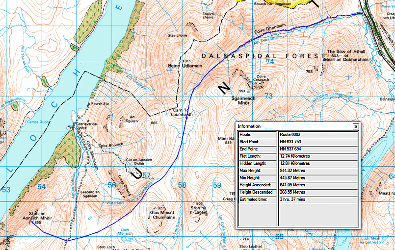 Optimised route
 It all depended on the terrain, so about this time last year I decided on a "recce"
There is good off-road parking at Drumochter, and It's possible- taking due care - to cross the railway quite easily.
 Recce
RecceThe weather was dry with some sunshine, but very hazy so most of the far hills were just silhouettes. The track ran easily up the valley keeping N of the burn - with a couple of side tracks to the L
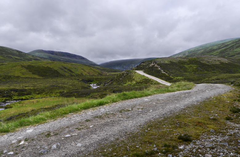 Start of the track

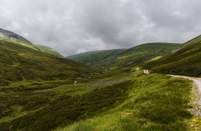 More views up the track
 Looking back
Beyond the head of the head of the track, there were vestiges of a footpath here and there, but nothing obvious. After a few hundred metres the valley started to narrow quite dramatically, and although it was not steep, progress was slow, as I had to keep crossing the burn. In spate it would probably have been impassable.


 views up the burn
 Looking back down
 Again from higher
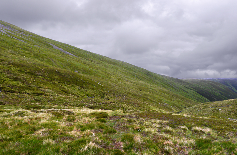 And from the top (809m)
 Looking on beyond the bealach: to start with I thought this was the Corbett - but it's just the 827m Glas Mheall a Chumhainn
I pushed on easily across the flat ground for a while, but then the hags started. It was very dry so they were no great problem, but clearly this would not be a viable route in wetter conditions, so I headed up R to the bald top of Cul an Aonaich Oidhir, where the going and also the views were fantastic

.
Views from Cul an Aonaich Oidhir,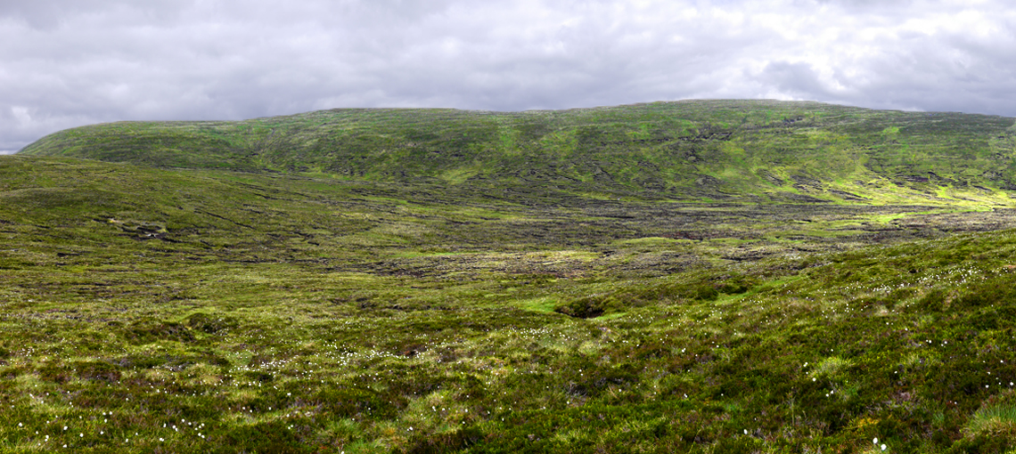 The valley - just a mass of hags
  South East to Schiehallion
 On to Glas Mheall a Chumhainn
  Another view in better light
 North to the Ben Alder massif and Geal Charn behind on the R
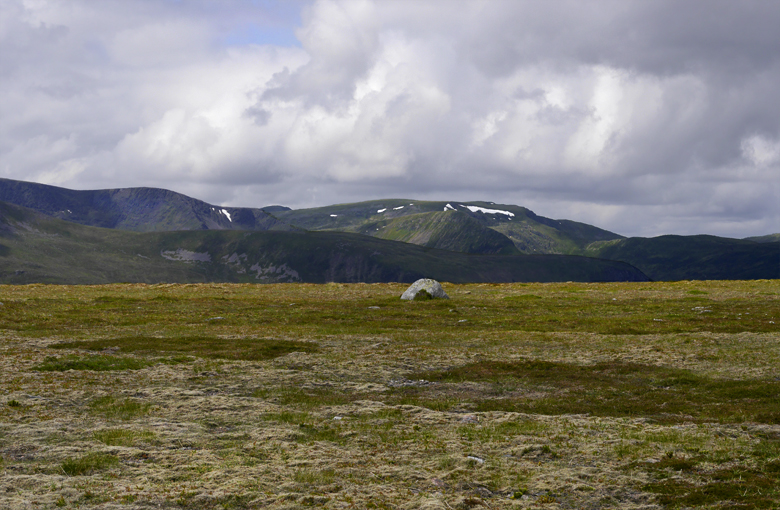 A zoomed view of the Lancet edge
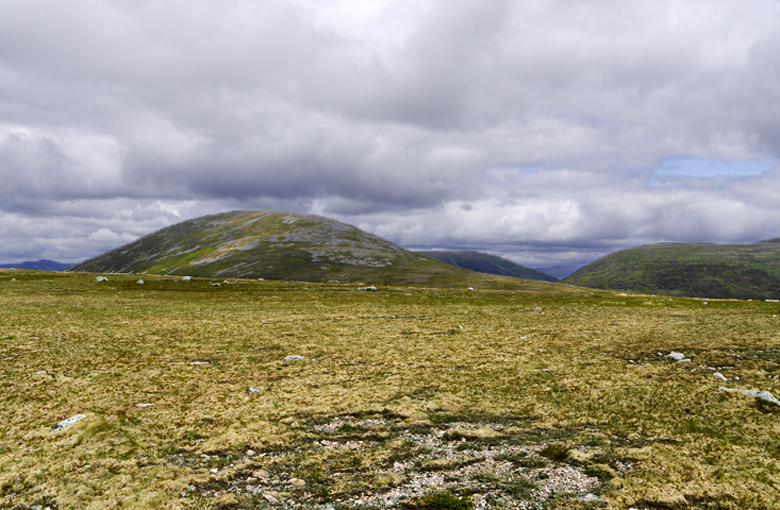 Back to Beinn Udlamain
 Zoomed
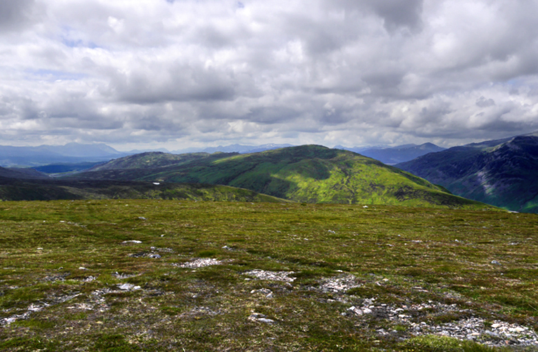 The target Stob an Aonaich Mhoir - it doesn't look that far
 The map shows a (vehicle) track descending to Corrievarkie lodge and signs of it can be seen here on the top
 I returned along the ridge, but not bothering with the 865m cairn at the Eastern end, I headed more or less straight towards the head of the descent gully.
 Gully head again
 It looked much better to traverse the grassy slopes on the L and a number of tracks - maybe animal ones - confirmed this. I continued keeping around 30-40m above the burn until I was only a few hundred metres short of the Landrover track and then descended. There were occasional grassy gullies to cross, but nothing of any significance., and I returned easily to the car. I was now in a position to re-plot the route - Green good Red bad: the only question was the purple (unknown) area

To try and get a view of this I trawled through all the WH reports on this hill, but no-one seemed to have taken a pic of this area
. If they had I should have had a much shorter day.
Stob an Aonaich Mhor I left early in the morning and made it to Drumochter is less an 1.5 hours. A red kite swooped over the car and flew down the road in front of me for 50m.
A black grouse stood by the side of the road near Amulree
: the weather was almost identical to the year before.
I made my way over the railway and up the track as before,
 and started to climb up the Northern slopes once I had passed this gully
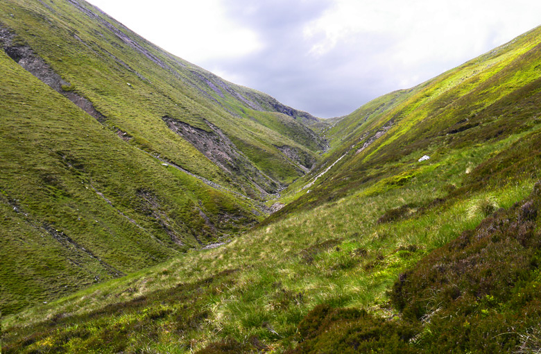 But I didn't get it quite right - it's much easier from above - and wasted a bit of time: this pic from these slopes shows the narrowness of the upper gully
.
 But I climbed a bit higher and reached this lochan which is on the map but un-named - so I knew exactly where I was
 The going beyond this was excellent for several hundred metres and I then descended beside a fence, crossed a slight boggy dip and climbed towards the ridge - Looking back towards Beinn UdlamainPhotos from the ridge of Cul an Aonaich Oidhir
 Stob an Aonaich Mhoir and the Ben Alder massif
 The Lancet edge on Geal Charn again
 Zoomed view to the hills beyond Ben Alder - Sgor Gaibhre perhaps
 Glas Mheall a Chumhainn - it looked a mass of hags
  But this detail suggested they could largely be avoided by traversing across the slope below the lip
 I followed the track down to the burn crossing and headed up and R. Looking down into Coire Bhachaidh
 A wider view showing the target and Ben Alder summit
Traversing a hillside is always slow, though it worked reasonably well, but the big gully that cuts deeply South into the "plateau drove me to the L of the little lochan and that proved an unfortunate move
 I'd class this as a "weapons grade" peat hag
 I continued at near snail's pace but eventually reached the road well to the East of the high point, and had a good rest and some food. At least it was clear that the final 250m ascent was on easy grass and I made my way without incident. I had hoped to make it in around 5 hours, but it was over 5.5
Photos on the ascent The "purple" area - nuf said
 The way back - starting to look rather long
  Butterworts - keep eating the midges guysViews from the summit
 Looking West up Loch Ericht
 Zoomed view - there are further lochs beyond - and more hags on view
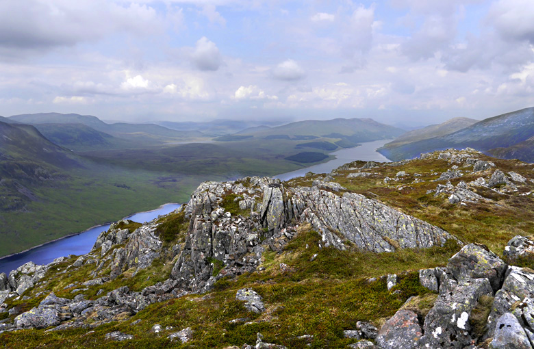 In the other direction - it's a big loch
 Zoomed view of silhouettes to the South - Beinn Mholach
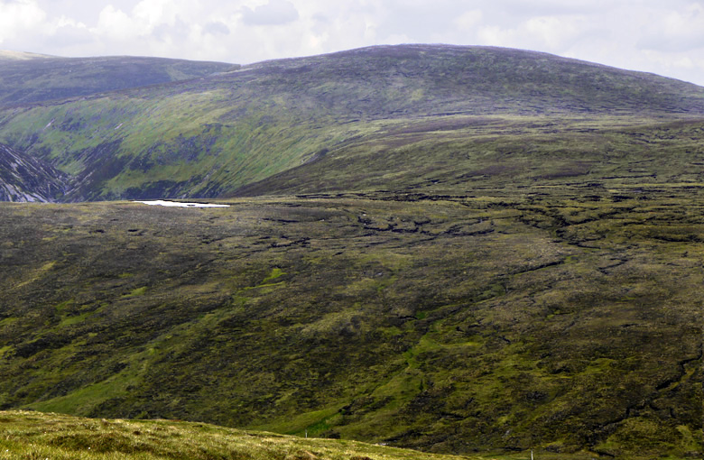 How do I get to Stob an Aonaich Mhoir? Not this way
 I'd already decided that I would return by the track up Glen Bhachaidh - it might involve a few extra metres of descent/ascent, but the terrain could only be vastly better - so I headed down just E of N
 More of the B***** things, but if you can see them from above they're easy to avoid
  I descended to a pleasant lochan reached the road and walked down it
  at about 420m altitude, the road approaches the Allt Coire Bhachaidh: looking up the valley
 I took a few dextrose tablets - an ever present help in time of need, - crossed the burn and traversed diagonally up into Glen Bhuirich: Looking down to Corrievarkie lodge
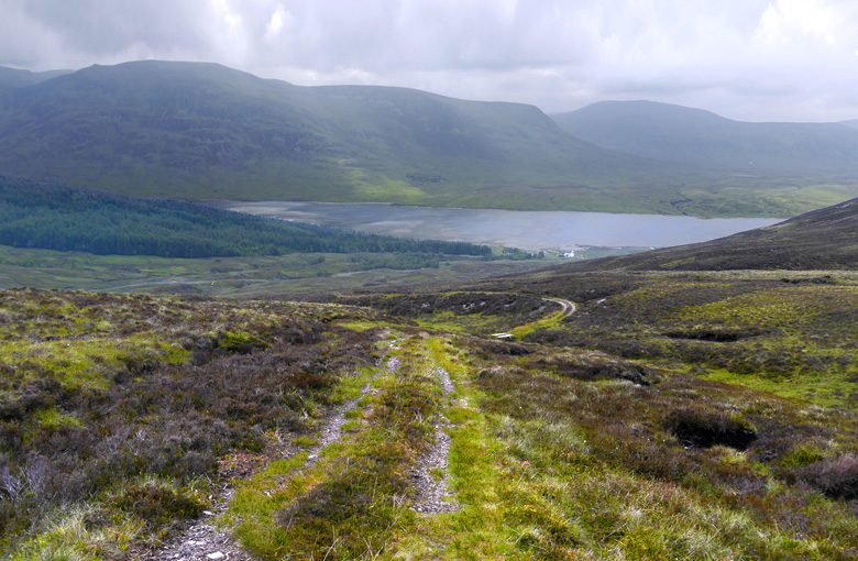 There wasn't a single H** in the whole glen , and I soon came across this pleasant track that led easily up to the ridge: it doesn't look as though there have been any vehicles on it for some time
Once up there I was on familiar ground and I made my way home - though I was a distinctly slow and "tottery" at the end
and climbing the fence onto the railway was quite a struggle
Conclusions Final map of red and green areas
In really dry conditions one could probably follow the optimal line - trudging through the powdery peat, but climbing on to the back of Cul an Aonaich Oidhir adds 100m (each way) to the climbing, and descending the track into Coire Bhuirich adds another 200, but a Naismith time of 4 hr 12 min Is still reasonable
Great to hear the views of others trying it
