free to be able to rate and comment on reports (as well as access 1:25000 mapping).
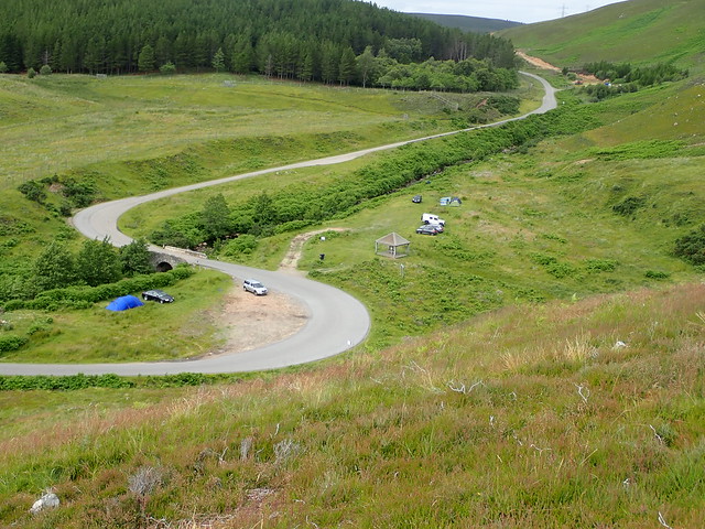
Thursday - Wet on the way up: Creag an Amlaidh; Beinn Lunndaidh; Ben Horn 16.6k, 1069 ascAllison had arranged to visit her dad this weekend, so I decided to take a trip up north to see my brother and family in Caithness. I reckoned I should get some hills in as well - I wasn’t sure whether to add to my tally of second round Grahams or to do some New Marilyns, of which there are quite a number up this way including the small but ferociously steep Meikle Pap. Setting off at 7 on Wednesday morning, I thought I’d be able to get a few smaller hills climbed on the way up to Thurso. The roads were pleasantly quiet at that time in the morning and I got to Dornoch for just after 11. My first target was Creag an Amalaidh, a recent addition to the Marilyn clan, sitting right by the road as you come to the causeway at the Sound of Fleet.
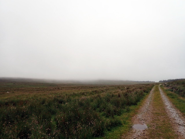
I parked on the causeway and walked back along the road a little, turning down the road to Lochbuie. Quickly the noise of the A9 was left behind. Impenetrable looking vegetation screened the cliffs of the hillside; I kept on walking til a track split off to the left, rounding the end of the crabs and heading for a farm. Vegetation was much more manageable here, although the hillside was initially steep. I made my way up, following deer tracks in the thick heather, eventually coming to a large cairn, where I sat and had part of my lunch. I decided to head down to the southwest, to take advantage of the track leading back to the start. The descent is steep - I made for the “antiquities star” on the map, which turned out to be a desecrated chambered cairn. From there, quickly along the track and a short section of walking alongside the A9 back to the car.
 P7170168
 by
Al, on Flickr
 P7170170
 by
Al, on Flickr
 P7170172
 by
Al, on Flickr
 P7170176
 by
Al, on Flickr
 P7170174
 by
Al, on Flickr
What next? I was doing ok for time and thought I’d try the pair of Marilyns to the west of Golspie: Beinn Horn and Beinn Lunndaidh. Drove to Bridge of Horn, where there’s parking where a track to the loch, used by fishermen. This was most useful in accessing Beinn Horn, a starting elevation of 220m then track up to around 350m. A locked gate to climb at the end of the forestry then up into the mist; sadly the rain was starting and visibility was poor. Once again making use of deer tracks I got my way to the summit without much bother, followed my outward path to return to the car. However, Beinn Lunndaidh was just across the road. I thought for some reason that there wa forestry track to follow for part of the way, and could see no sign of track where my route headed down, just chest high bracken. I decided to walk along the road a bit, as ther was a diversion sign for wind farm traffic- however no track visible there either and I ended up just cutting down through the ferns and vegetable obstacles, trying to avoid drainage ditches and other holes in the ground.
Ben Horn is to the left, hidden in mist, helpfully
 P7170178
 by
Al, on Flickr
Intrepid...
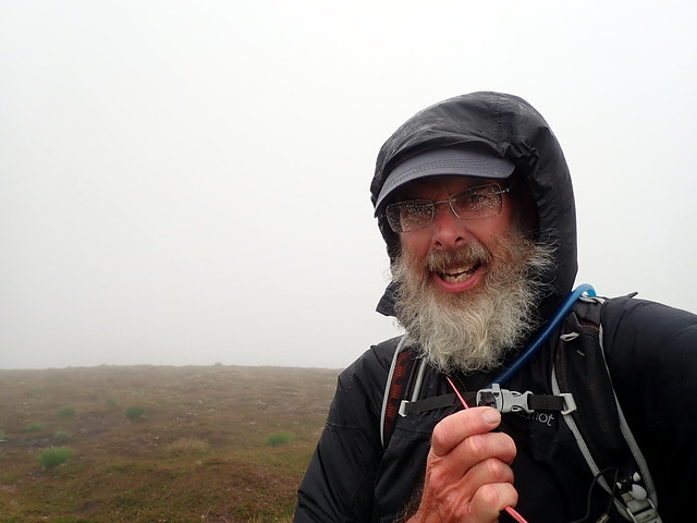 P7170180
 by
Al, on Flickr
View towards Beinn Lunndaidh from path to Ben Horn
 P7170181
 by
Al, on Flickr
 P7170182
 by
Al, on Flickr
I tried to head towards the route I had on my GPS through the trees, which should have been a track or at least a fire break. My battery was running low, which didn’t help with accuracy: no fire break, just various deer paths leading into the trees. I kept losing y sense of direction in the depths of the woods; a new battery installed in the machine showed me I was off course. Every time I thought I was heading to a clearing it ended in dense firs, I was floundering about in endless branches, swamp underfoot and being accompanied by a squadron of annoying black flies: not a biting or stinging kind, just a buzzy in your ear annoyance. An hour after setting out I was still 50m below where I’d left the car, and no closer to seeing the hill. Not good.
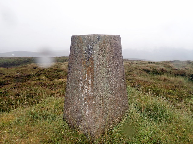
Finally I got myself to a firebreak that actually led upwards in the right direction. How much easier it was to be on open hillside. A small hill to round, then Beinn Lunndaidh lay ahead, further off than I’d expected and still needing some climbing to get to it. Across boggy grass, the rain a continual drizzle and my self wetter by the minute. At least my chums the flies had been left behind in the woods. Reaching the trig-point at the summit I was happy to turn around and get out of here. The initial part of the descent was alright, but once again I got embroiled in forest, with trees being where they shouldn’t be, according to my route. I made it back to the car, this time cutting through the chest high bracken, with the solemn resolution that I never want to see this hill again: if Allison wants to do it, she can do it alone

(A better way might be climing Ben Bhraggie and heading along at high level - cuts out the forestry)
The final push
 P7170184
 by
Al, on Flickr
 P7170185
 by
Al, on Flickr
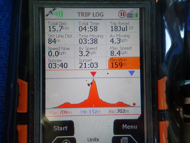
GPS only gives half the story - need to double the distance and time as it had a malfunction half way
 P7170186
 by
Al, on Flickr
Sopping wet, I drove the sixty odd miles up to my brother’s, later than I’d intended to be but with three new Marilyns in the bag. After a shower and a meal I was feeling much better and looking at what could be undertaken the following day - the forecast for Caithness was substantially better than for much of the rest of the country. I decided on the Griams, which would be a shortish day on the hill and more time to spend with my nephews.
Thursday - The Griams are not (quite) Grahams: Ben Griam Mor; Ben Griam Beg 14k, 861 ascI'd been wanting to do the Griams for years - every time we've been up in the far north and I see them sticking up like a damsel's chest from the low flow country. I wanted to do them in good weather, and the forecast for today was to be fine in the morning, with thunderstorms arriving in the afternoon. Up early and away along to Melvich, then down the B897 to Kinbrace: a road I've only driven the southern section from Helmsdale to Kinbrace before. Lots of stick lorries on the roads this morning, I arrived at a parking spot by 7.45. I was using BlackPanther's route for this one. The sky was light blue with white fluffy clouds, enough breeze to keep the midges, if not the clegs, at bay. I set off across boggy tussocks (this was to be a recurring theme of my hills this weekend) aiming for the shoulder of Ben Griam Mor. As I climbed I could see southwards to the Ben Armine hills and Klibreck; west lay Ben Loyal. I just love being in this part of the world. The shoulder of the hill was drier and the ground became stonier as I gained height - made the summit in one hour. I was expecting this to be harder!
The Griams from the east
 P7180187
 by
Al, on Flickr
Ben Griam Mor
 P7180188
 by
Al, on Flickr
Loyal
 P7180189
 by
Al, on Flickr
Beg, from Mor
 P7180191
 by
Al, on Flickr
Next followed a steepish descent to the northeast, losing all the height gained and squelching over very boggy ground towards Ben Griam Beg. There's a stream to cross in the middle - this was fast flowing after recent rain, but some stones made the crossing easier. Onwards towards Beg, aiming for the cleft. Another straightforward ascent, another hour from Mor to Beg.I could see rain showers moving all around me, hiding Ben Loyal behind a silver-grey curtain. Apart from one intense but brief downpour, I managed to stay dry. The return path had me going to the lochans and going around til the boathouse on Loch Coire nam Mang, where there's a good track that returned me to the road, passing above the Garvault Hotel, bigger than I had imagined.
Beg
 P7180193
 by
Al, on Flickr
 P7180194
 by
Al, on Flickr
Looking back at Mor
 P7180195
 by
Al, on Flickr
View north
 P7180196
 by
Al, on Flickr
 P7180197
 by
Al, on Flickr
A curtain of rain over Loyal
 P7180199
 by
Al, on Flickr
 P7180203
 by
Al, on Flickr
With the hills done I drove back to Thurso, earlier than I had thought I'd be. I wondered about stopping off in the town to see the sights, but the rain started, so I drove back to my brother's. Soon after, a thunderstorm kicked off, lashing the house and stable with rain. A few impressive peals of thunder sent the dogs wild.
Friday - Morven with Iain 15.7k, 702 ascMy bro had arranged to have Friday off so that we could do something - however the blacksmith was coming late morning to do the horses. I had planned to take him out wild camping, but that plan had to be shelved - at least for now. I'd reckoned we could do Beinn Dhorain, a Graham down Glen Loth which doesn't involve much hard work if I remember correctly. But after some thought I decided that he should really do Morven - being the highest mountain in Caithness and instantly recognizable from so many parts of the county - he's lived in Caithness for 12 years now and has never been there - in fact Ben Loyal was the last hill he climbed, some 25 years ago...
We dug out his old gear and prepared for the off once the horses had been shod. Very heavy rain as we drove down to Dunbeath - I remembered the boggy section between the end of the track and the start of the climb and wondered just how wet it was going to be now. Dry by the time we reached Braemore however - we found the small parking area was full and parked on the grass opposite. I lent him my walking poles (something that you didn't really see on the hills 25 years ago) and we set off along the track. Midges and clegs were out in force, but otherwise it was a fine afternoon, the sky a clear blue after the heavy rain. The miniature Eiger of Maiden Pap lay to our left - I doubted if there would be time to include it as well. We paused by the ruined cottage at Corrichioch for something to eat, but the midges rendered this a short stop. We could take our time at the top, where there would be a breeze...
Maiden Pap, Morven behind
 P7190204
 by
Al, on Flickr
 P7190205
 by
Al, on Flickr
The track to Mordor...sorry, Morven
 P7190206
 by
Al, on Flickr
Maiden Pap
 P7190207
 by
Al, on Flickr
 P7190209
 by
Al, on Flickr
Iain's progress had been speedy on the level, but as soon as we started climbing he noticed a difference - pauses were frequent and lengthy. I could see him getting frustrated, especially as I wasn't out of breath. It was very warm too. I suggested he take as many pauses as he needed and climb at a slow rate - we'd get there. And indeed we did - once we'd arrived at the little rocky tor before the summit proper he was in much better form, and the exultation evident when he reached the summit was heartwarming to see. Having such a fine view was just the topping on the dessert of course - we would have lingered long ad it not been for clouds of dratted midges - more than I can remember encountering at the top of a mountain before. There was a little breeze, but not enough to deter the beasts, and we were forced to get moving again.
Triumph!
 P7190211
 by
Al, on Flickr
 P7190213
 by
Al, on Flickr
 P7190218
 by
Al, on Flickr
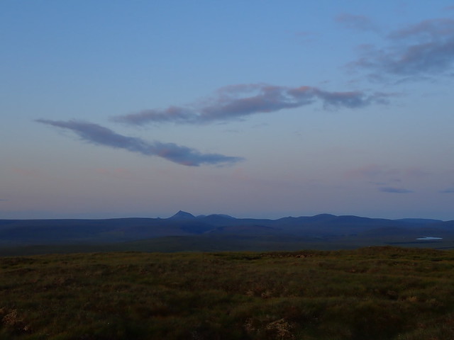
The descent was hard for his tired legs, but he found the poles helpful (except when they became stuck in rocky clefts) and we were fair marching back along the track. Although it had taken less time than I'd initially thought (a shade under 5 hours) it was still 7.30pm when we reached the car and there had not realistically been time for me to nip up Maiden Pap. And after all, the day was about Iain getting back out on the hills. A beautiful evening followed - big skies, big sunset and the prospect of a fine day on Saturday. I'd thought I might do the Ben Armine hills, with a walk in, camp and return out on the Sunday
Saturday - An Otter Encounter: Maiden Pap; Braigh na h-Eaglaise; Cnoc na Maoile; Creag Thoraraidh; Cnoc an Laith-bhaid Mhoir 35k, 1710 ascI awoke to rain and fog: quite a different morning to the one I had been expecting. Well, Ben Armine was out in this weather. I checked the forecast before leaving - looked to be improving as the day wore on. Hmmm. Change of plan then - I thought I might do three Subs down by Helmsdale - not a particularly attractive route as it involved a lot of going out and coming back to get to the summits, but sometimes that's required. Slipping out of the house before 7 I decided to revisit Braemore and get up Maiden Pap on the way down. Three previous times have I almost climbed this hill: on our first visit to Scaraben and Morven we were too fatigued to add it in; I traveled from my brother's on a subsequent visit but the glen was closed for stalking; then yesterday. Well, Maiden Pap, your moment is here.
Maiden Pap...was here??
 P7200220
 by
Al, on Flickr
Except Maiden Pap had disappeared

I walked along the track to find that instead of an insanely pointy little mountain there was nothing, just mist. Undeterred by this absence I followed the route to where it ought to be, following the treeline through very wet long grass and starting to climb the invisible hill. I eventually found a good path that wove upwards: a misty summit rose up in front of me. It hadn't been as steep as it looked, although the path - wet peat - was particularly slippy in these conditions and I wasn't looking forward to the descent. A moment at the top, then back the way I'd come, legs and feet utterly soaked thanks to the wet grass and the swamp underfoot.
 P7200221
 by
Al, on Flickr
 P7200222
 by
Al, on Flickr
 P7200223
 by
Al, on Flickr
 P7200224
 by
Al, on Flickr
Back at the car I changed my footwear and drove down to Helmsdale, parking just to the north of the Ord of Caithness. These three hills, all around the 400m mark sprawled away in a T shape from the road. I found a gate that led round a forestry plantation then another that opened out onto the heather. The terrain was boggy, springy tussocks. This was to be the underfoot condition for the entirety of the walk and was very energy sapping. I passed under a pylon line and as I did so, the largest otter I've ever seen trotted across my line, not more than 10 yards ahead of me. In fact it took a moment for me to register what it was - my initial thought was "why is there a black labrador with a pointy face and a big webbed tail walking out on its own on the hillside?" Otter turned to glance at me once, but didn't change its pace, but by the time I thought about taking a picture it had found cover behind some peat hags. I had a large grin on my face for a wee while after that.
 P7200225
 by
Al, on Flickr
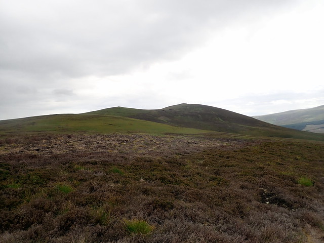
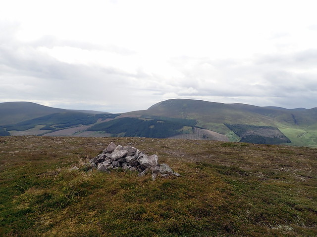
I was making for Cnoc Coir' a' Phuill - a mere 20cm lower than its parent top of Creag Thoraraidh, which I'd finish on later. I paused at the summit for something to eat, then continued a gentle walk onwards, turning to my right to visit Braigh na h-Eaglaise - drop 200, climb 200. A southern view of Morven presented itself from the summit and I had a smile to think of being up there with Iain yesterday. Back down, up again and onwards to Sub number 2; Cnoc na Maoile - the bald hill. Bit like me then. Beinn Dhorain was ahead of me, a higher rounded hill in a landscape of rounded hills. Once again, bands of rain came and went - I thought at one point I was in for a soaking, but again managed to stay on the right side of the rain's edge. Once again down and up to reach Creag Thoraraidh, decorated with its transmitter station and trig point. I was feeling a little tired by this time.
 P7200227
 by
Al, on Flickr
Braigh na h-Eaglaise
 P7200229
 by
Al, on Flickr
Summit Eaglaise, Morven to north
 P7200231
 by
Al, on Flickr
Beinn Dhorain
 P7200233
 by
Al, on Flickr
Cnoc na Maoile
 P7200234
 by
Al, on Flickr
Cairnless summit Maoile
 P7200236
 by
Al, on Flickr
Thoraraidh
 P7200238
 by
Al, on Flickr
 P7200239
 by
Al, on Flickr
Summit Thoraraidh
 P7200241
 by
Al, on Flickr
 P7200243
 by
Al, on Flickr
My original route had taken me back down to the A9, using a track off the souheast of Thoraraidh, but I didn't fancy walking on the roadside, particularly up the steep curve in the road. Instead I headed east, by the radio mast, joining my outward path (no otter this time, sadly) and back to the car. What now? I sat and thought. I quite fancied a high camp, and the weather was looking much improved from earlier in the afternoon. I decided to walk into the Sub beside the Ben Armine hills; Cnoc an Liath-bhaid Mhoir and camp there. Although I'd intended to do this as an add on to the Armine hills, it put another 8km or so onto an already long route, so I saw no harm in doing it alone.
I arrived at the parking area at Badanloch and was getting my kit swapped over from day-pack to overnight pack when an older couple cycled back along the track. "That the Ben Armine hills done then?" I asked - yes, that;s where they'd been. We had a chat for a while - they were doing Grahams and in fact had been on Scaraben the previous day when I'd been on Morven. I shouldered my pack and set off along the track, legs enjoying the firmness underfoot after all the sponginess earlier in the day. A glorious evening: Loyal, the Griams, Klibreck all sitting proud. There was more wind than I'd expected, the waters of Loch Badanloch slopping over the side of the dam. I was hoping the wind wouldn't be too fierce higher up, after my last experience of high camping.
 P7200245
 by
Al, on Flickr
 P7200246
 by
Al, on Flickr
Those Griams again
 P7200247
 by
Al, on Flickr
I followed the track til a turn off on the right, which led ultimately to a boathouse. I passed a grassy area at Breacough which looked camp-able (if a bit sheepy) but I was determined to see if I could find a place higher up. The track terminated at the boathouse: I followed the shoreline of Loch na Gaineimh past the sandy beach at its east end and round onto the slopes of my chosen hill. Boggy and tussocky - I hoped that it might dry out a bit at the summit, but this was a forlorn wish. Trig point reached, fine views of the surrounding hills in the evening sun. I managed to find a dry-ish, flattish spot to the east of the summit and pitched, using some stones to weigh the guys down. I had my Enan, which is more sturdy in wind than the Niak we were in last time in Glen Dessarry, so I hoped even if the wind became stronger that I'd be ok. I read for a bit while the sun slowly descended, got out a couple of times to enjoy the sunset then bedded down for the night. The wind had dropped with the sun and I got to sleep, being wakened about 1am by a resurgence in the wind. The Enan is quite a noisy tent in wind, but it seemed well enough anchored. It was a little cold though - I found my gilet to put back on which helped and settled back into a rather uneasy slumber.
Track, my hill in the distance
 P7200248
 by
Al, on Flickr
Boathouse
 P7200249
 by
Al, on Flickr
 P7200252
 by
Al, on Flickr
Ben Armine hills behind
 P7200254
 by
Al, on Flickr
 P7200258
 by
Al, on Flickr
 P7200261
 by
Al, on Flickr
Morven
 P7200262
 by
Al, on Flickr
 P7200259
 by
Al, on Flickr
Sunday - Fine time in Strath Ullie: Creag nam Fiadh, Beinn Dubhain 24.9k, 736 ascMorning
 P7210263
 by
Al, on Flickr
Seems like good advice
 P7210264
 by
Al, on Flickr
 P7210265
 by
Al, on Flickr
There was some rain overnight - in fact it was raining at 6am which persuaded me to have another hour in bed. Dry when I did get up - I packed the tent away, fighting the wind as I did so, and set off back the way I'd come. I was thinking what to do now - I wondered about doing Beinn Dhorain and the Sub beside it - then I decided to do Creag nam Fiadh, the crag of the deer - down at Borribol Lodge, which was on my way out anyway - I could decide what else to do after that. An easy trot back along the track, a short drive along the road and parking just at the turn in to Borribol Lodge. There's a level crossing to be negotiated, then a track past several houses. I hadn't really decided on a route for this one - I ended up letting my feet take me up by the start of Borribol Hill and across trackless ground towards Windy Hill. Not as wet underfoot as I had feared. An ATV track assisted slightly with the ascent up Creag nam Fiadh, views dominated by the Griams and Loyal once again. I decended towards Loch Ascaig, then used the track to head back to the car. Another lovely morning, this is a pretty part of the world.
Borribol
 P7210267
 by
Al, on Flickr
Fiadh
 P7210268
 by
Al, on Flickr
 P7210271
 by
Al, on Flickr
Loch Ascaig
 P7210272
 by
Al, on Flickr
 P7210273
 by
Al, on Flickr
I considered my options. Having already walked some 18km by lunchtime and facing a long drive home, I was reluctant to do another big walk - I'd had in mind Beinn Dubhaig and Creag Scalabsdale. These two hills, on the east of the road, don't really fit together well - there's a lot of upping and downing between them and the route has to be reversed on return. It appeared that Scalabsdale could be more easily ascended making use of a track from Suisgill Lodge anyway. So I chose to do the short option: Beinn Dubhaig from Baile an Or.
I'd noticed the parking area at baile an Or on the way up the glen yesterday, mainly as it seems to be a spot for car camping: there were several tents scattered around the grass. They were still there when I arrived. I chose an easy route up Tom na h-Iolaire and onward towards the graceful summit ridge of Dubhaig. The sky to the northwest was heavy and black, rain was certainly brewing up there. I made the top, happy with my dozen new Subs and set off back to the car. Some cereal and an oat bar provided sustenance before the drive, which was relatively painless as the roads were not unduly busy and I got home in under 5 hours.
Beinn Dubhaig
 P7210275
 by
Al, on Flickr
View towards Creag Scalabsdale
 P7210276
 by
Al, on Flickr
Rain coming in
 P7210277
 by
Al, on Flickr
Summit Dubhaig, view to Beinn Dhorain
 P7210278
 by
Al, on Flickr
Baile an Or
 P7210280
 by
Al, on Flickr
 P7210281
 by
Al, on Flickr
