free to be able to rate and comment on reports (as well as access 1:25000 mapping).
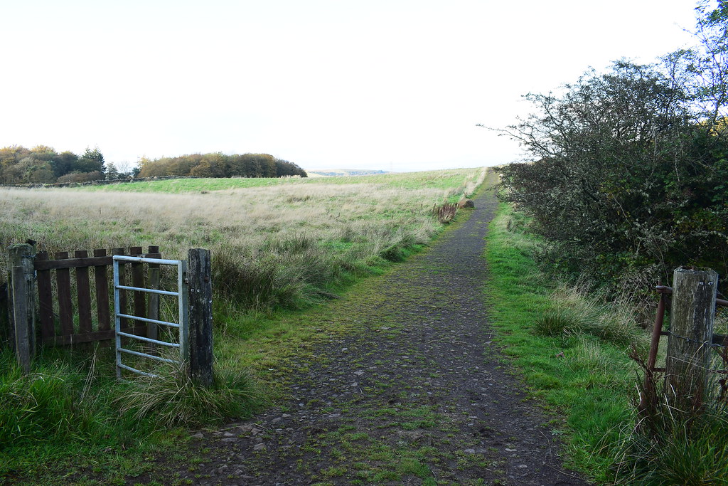
Having just climbed Duncarnock and having seen Neilston Pad looking pretty close, I kept my boots on, jumped in the car and was there in no time, parking at harelaw at the 206m mark on the OS map:
I set off through the gate and along the track:
 Neilston Pad (1)
 by
Chris Mac, on Flickr
 Neilston Pad (2)
 by
Chris Mac, on Flickr
It didn't take long to reach the turn-off point seen here on the left:
 Neilston Pad (3)
 by
Chris Mac, on Flickr
 Neilston Pad (4)
 by
Chris Mac, on Flickr
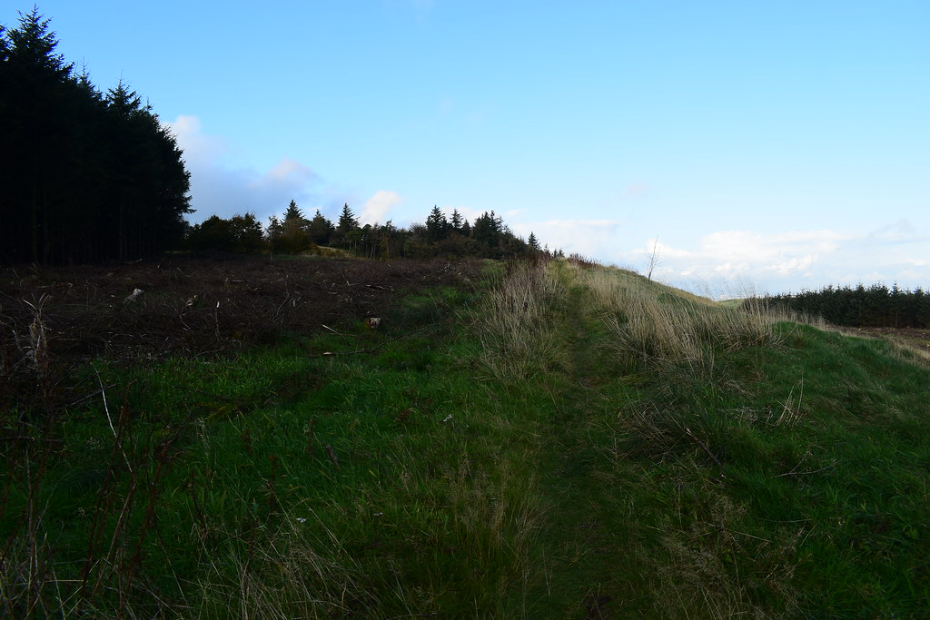
Being a big, flat table top of a hill the ascent was easy on an okay path:
 Neilston Pad (5)
 by
Chris Mac, on Flickr
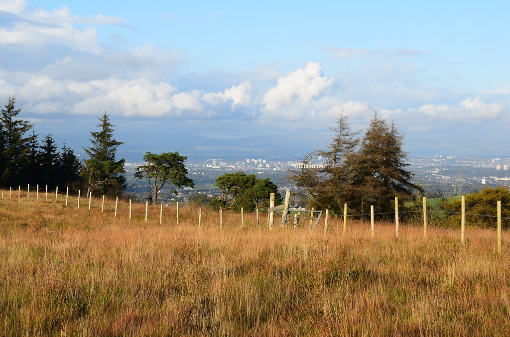
As I went along and gained height I had a good view over to Duncarnock where I had came from:
 Neilston Pad (6)
 by
Chris Mac, on Flickr
James's Hill:
 Neilston Pad (10)
 by
Chris Mac, on Flickr
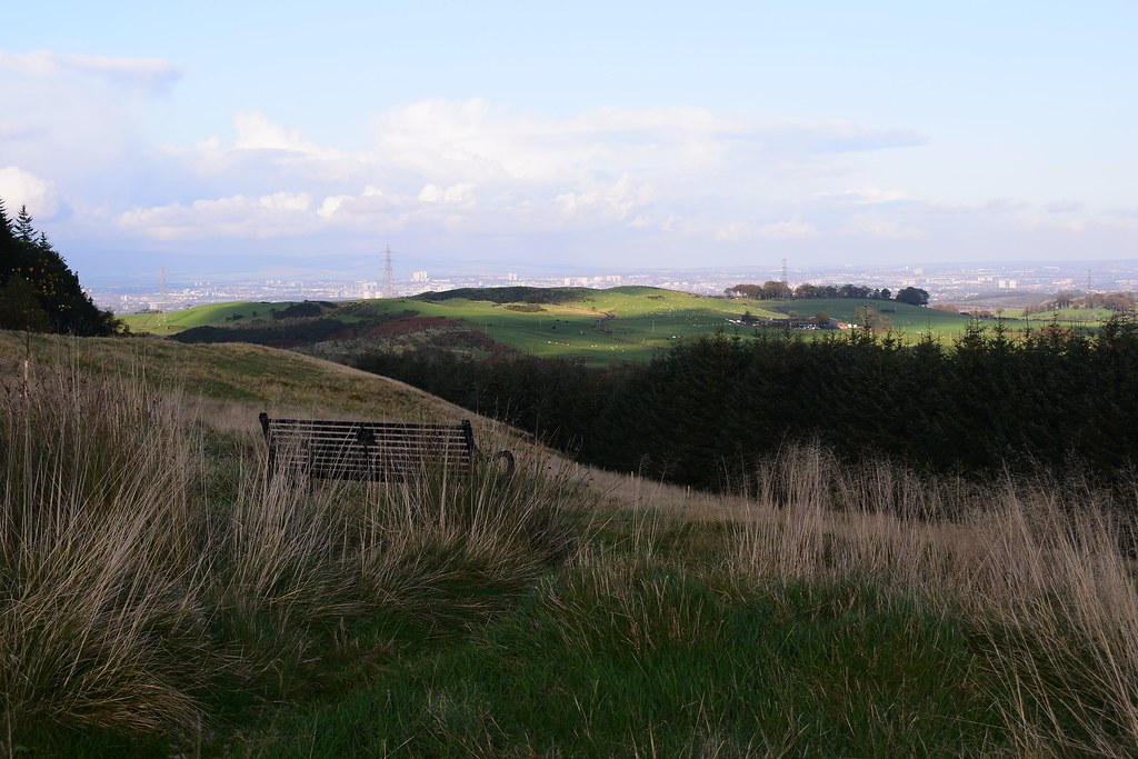
A bench with Glasgow behind it. As far as views go, Duncarnock would beat Neilston Pad hands down:
 Neilston Pad (11)
 by
Chris Mac, on Flickr
Final ascent section, the summit is up in the trees over to the right:
 Neilston Pad (12)
 by
Chris Mac, on Flickr
Approaching a large cairn but this is clearly not the top, it's to the right of this:
 Neilston Pad (14)
 by
Chris Mac, on Flickr
Cloudy again to the north and Dumgoyne, plus the view is restricted:
 Neilston Pad (15)
 by
Chris Mac, on Flickr
Not the summit:
 Neilston Pad (16)
 by
Chris Mac, on Flickr
Neilston Pad summit cairn, hidden in the long grass but not hard to find as it is exactly on the 261m mark on the map:
 Neilston Pad (17)
 by
Chris Mac, on Flickr
Duncarnock through the trees:
 Neilston Pad (18)
 by
Chris Mac, on Flickr
The view from Duncarnock to here was definitely better!
 Neilston Pad (19)
 by
Chris Mac, on Flickr
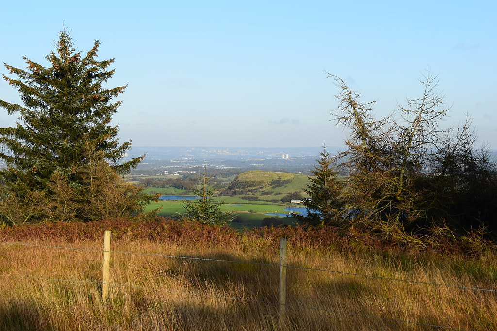
The Pad certainly isn't ideal for a clear view but the glimpses are decent enough:
 Neilston Pad (20)
 by
Chris Mac, on Flickr
 Neilston Pad (21)
 by
Chris Mac, on Flickr
Looking west:
 Neilston Pad (22)
 by
Chris Mac, on Flickr
From summit to cairn:
 Neilston Pad (23)
 by
Chris Mac, on Flickr
 Neilston Pad (24)
 by
Chris Mac, on Flickr
Looking over to East Kilbride:
 Neilston Pad (25)
 by
Chris Mac, on Flickr
Preffering to do a loop and despite there not being a path down the other side on the map, my eyes were not lying and I followed one down, assuming it would join up with the track around the hill at the bottom:
 Neilston Pad (26)
 by
Chris Mac, on Flickr
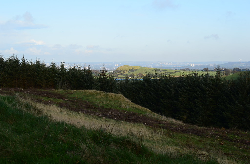
Snypes Dam and Walton Dam, nice!

 Neilston Pad (27)
 by
Chris Mac, on Flickr
 Neilston Pad (28)
 by
Chris Mac, on Flickr
Zoomed to Duncarnock with Cathkin Braes behind to the right:
 Neilston Pad (29)
 by
Chris Mac, on Flickr
Looking north as I descend:
 Neilston Pad (30)
 by
Chris Mac, on Flickr
Neilston down below and the Kilpatrick Hills and Duncolm in the background:
 Neilston Pad (31)
 by
Chris Mac, on Flickr
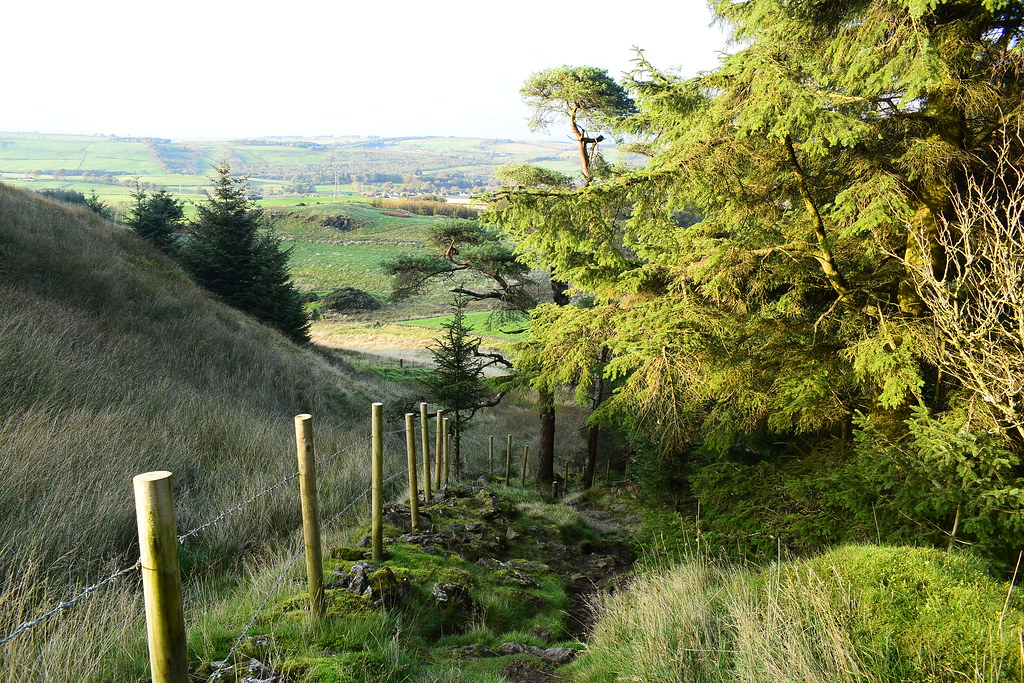
I pass a den in the woods:
 Neilston Pad (32)
 by
Chris Mac, on Flickr
The path down:
 Neilston Pad (33)
 by
Chris Mac, on Flickr
It takes me to the base of the Pad and the view of Glasgow has instantly improved, it's not often that happens!

 Neilston Pad (35)
 by
Chris Mac, on Flickr
I then turn right and join the track as it takes me back to the start of the walk below Neilston Pad:
 Neilston Pad (37)
 by
Chris Mac, on Flickr
It's not the most exciting but takes me back pretty fast, although my new boots were still giving me grief unfortunately:
 Neilston Pad (38)
 by
Chris Mac, on Flickr
 Neilston Pad (39)
 by
Chris Mac, on Flickr
 Neilston Pad (40)
 by
Chris Mac, on Flickr
The turn in the path to go uphill was just before the logging operations so i'm almost finished already:
 Neilston Pad (41)
 by
Chris Mac, on Flickr
The tree covered mound on the right is Knockenae Plantation, another local Tump further west. It looks like I may need to take a chainsaw for that one!


 Neilston Pad (42)
 by
Chris Mac, on Flickr
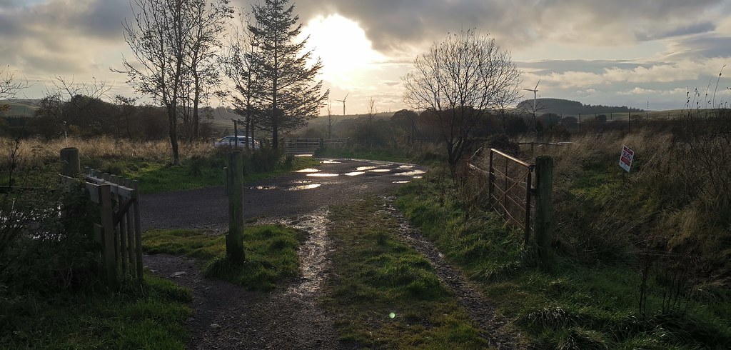
I pass a few folk with a friendly dog then reach the gate and i'm back at the car:
 Neilston Pad (43)
 by
Chris Mac, on Flickr
Just under an hour to climb 117m and taking the long way back covered 3.24km. Add in Duncarnock (with a drive inbetwee so i'm couting these two hills as separate trips) and it's been a decent afternoon of Tump exploring while taking photos and it also had the added bonus of being home in no time.
As for the view, if you do climb Neilston Pad, make sure you visit Duncarnock as well, unless you like tree covered flat tops!

