
The Mystery of the Disappearing Snao
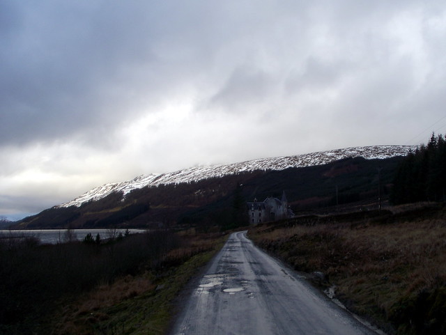
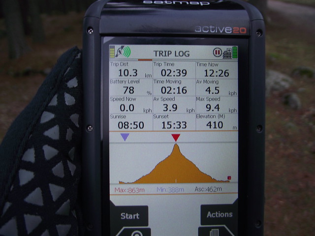
Ever since last weekend's bumper snowfall I'd been apprehensive about getting away this weekend, knowing it would be Dalwhinnie and the Southern Cairngorms. Midweek photos of the snao at Glenshee didn't help much. We made a half-hearted attempt at traveling up on Thursday night, electing to stop over at Comrie Croft again rather than brave what I feared might be snowy roads. The campsite was nicely illuminated with faerie lights. It rained again, heavily, all night. In the morning we continued north, getting to Dalwhinnie around half ten and setting off for The Fara, by the quick and easy route - just along Loch Ericht, up to the tree break and back down the same way. After the slowness of snow last weekend, plans to include Simms were shelved.
But just where was all the snao? Looking over at the hills east of the A9 there was precious little - on The Fara itself we were barely troubled by the stuff, just a wee section in the last 50m or so before the top. The forecast had been for heavy rain during the day, but we were dry with some flashes of sunshine. Not that I was complaining.
An unsnowy Leacainn from Dalwhinnie level crossing
 DSCF5240 by Al, on Flickr
 DSCF5241 by Al, on Flickr
Loch Ericht
 DSCF5243 by Al, on Flickr
Gorse seeds
 DSCF5244 by Al, on Flickr
Sun over Geal Charn
 DSCF5245 by Al, on Flickr
 DSCF5250 by Al, on Flickr
 DSCF5251 by Al, on Flickr
 DSCF5252 by Al, on Flickr
There was a strong wind however, and we hunkered down in the lee of the cairn to have our lunch before retracing our steps, back at the car before two o'clock. That was a bit of luck, as Conachraig was tomorrow's hill and I had no idea where we were going to pitch for the night. headed up via Grantown on Spey, almost all the snao on the Feshie Cairngorms gone too... We motored through Tomintoul and found a nice spot at the Wells of Lecht to spend the night, arriving as the twilight was falling. Thought about going up to the mine at the end of the track - but the track itself was so waterlogged that we didn't bother.
 DSCF5253 by Al, on Flickr
 DSCF5255 by Al, on Flickr
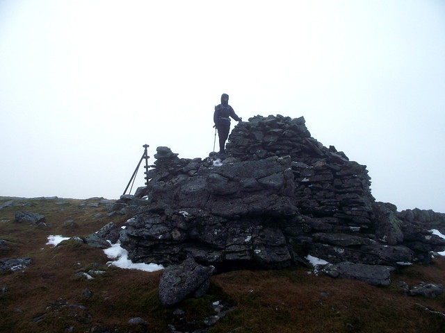
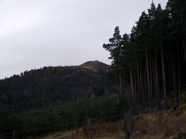
A lovely quiet night, dark sky and very little traffic going over the Lecht. Up when it was still dark and off for the short drive to the Spittal of Glen Muick. Some lovely colours in the sunrise from the top of the Lecht. I had toyed with doing Conachraig by the longer route from Balmoral, but in the end opted for another quick and easy summit. There were already quite a few cars in the parking area, paid our £4 for the privilege and set off, leaving axes behind given the lack of anything to put them in. Lochnagar was largely snao free on this side at least. I'd intended to head up the SE shoulder, returning east over Carn a Damph but Allison suggested keeping to the track for longer and using the path up Conachraig opposite the track running up Lochnagar. Fair enough! The path was quite slippy, ice on granite, but was easier than traipsing through heather. Someone had dismantled the cairn on the higher rocky tor, placing one on a clearly lower rock. An eagle soared off towards Lochnagar as we plootered about at the summit.
Lecht sunrise
 DSCF5261 by Al, on Flickr
 DSCF5263 by Al, on Flickr
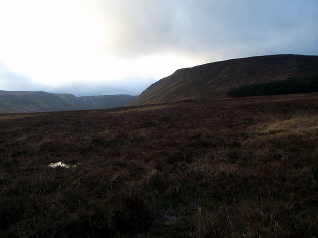
A study in browns, not whites
 DSCF5269 by Al, on Flickr
 DSCF5270 by Al, on Flickr
Lochnagar
 DSCF5271 by Al, on Flickr
Mist coming over Meikle Pap
 DSCF5272 by Al, on Flickr
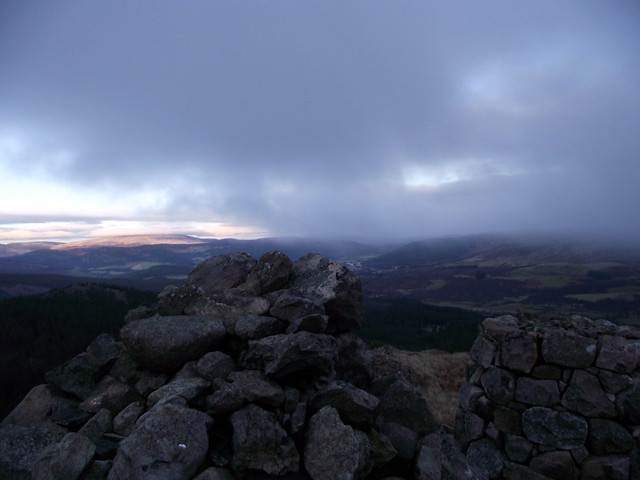
Snowless Conachraig
 DSCF5273 by Al, on Flickr
 DSCF5274 by Al, on Flickr
 DSCF5278 by Al, on Flickr
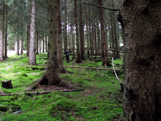
We returned to the visitor centre where we had lunch. One o'clock - enough time for another hill The Coyles of Muick were nearby, just a few miles back up the road towards Ballater. This was one of my favourite class of hill, a Marilyn that's also a Simm, but not high enough to be a Graham (ie >600m but <610m). There are only 13 of them in Scotland and I have hopes to reach my 2000 Simm and 1000 Marilyn simultaneously on one of the six I now have left. Anyway, back to the Coyles of Muick. I'd borrowed Jaxter's route for this one. We parked at the "road closed" sign and walked over a swollen River Muick, along the road then up into forestry. I'll admit I hadn't studied the route and noted with some dismay that there were sections cutting through the trees to join forestry tracks - but for once the trees were not oppressively close together and this turned out to be quite pleasant. Above the tree line we climbed to a large cairn, that looks as if it has been dismantled to build another, smaller cairn beside it. There we met two guys, a local retired fireman and his colleague, who stood and chatted for a while. He revealed that it had been Thursday night's heavy rain that had washed all the snao away. The mystery solved!
Coyles of Muick from the south
 DSCF5279 by Al, on Flickr
 DSCF5280 by Al, on Flickr
 DSCF5284 by Al, on Flickr
 DSCF5286 by Al, on Flickr
View to Mount keen
 DSCF5287 by Al, on Flickr
 DSCF5289 by Al, on Flickr
 DSCF5291 by Al, on Flickr
 DSCF5293 by Al, on Flickr
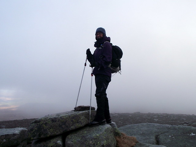
Mist was moving in from the west. The local man told us we were on the highest spot - though the map suggested the cairn to the SW had an extra contour ring. So we made it over there just as our views to Mount Keen were curtailed. We headed down over Meall Dubh, and Allison was filled with glee (not) when I told her it was not only a Tump but a Highland Five
We returned to the forestry track and came out onto the road again, past "Charlie's hoose" just in time to get pitched before the darkness fell. Ended up just pitching in some trees by the closed road, which provided an adequate, if a little lumpy, night's rest.
Heading to the true summit
 DSCF5294 by Al, on Flickr
 DSCF5296 by Al, on Flickr
Sunday - once again we were up in the dark (not really that hard at this time of year) and had plans only for the nearby Marilyn of Craigendarroch in Ballater itself. Parked up in Church Square and set off, sans rucksacks, sans anything really, for what turned out to be a very pleasant walk up a little hill, just 401m (from a starting elevation of 200m). Into oak woods first, where a carpet of golden brown oak leaves deadened our footfall, then into birch and pine woods, moving ever so gently uphill. There was a path and seats to rest yourself upon every so often. Allison admitted it wasn't bad for a Marilyn.
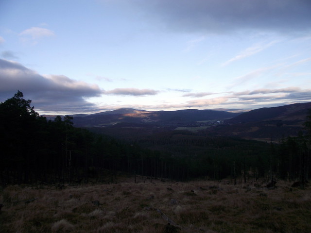
The summit gained, we had a good view over Lochnagar and the village of Ballater. It was looking to be a nice day - I did have a root around on my phone to see if there were any other quick Marilyns on our road back, but there didn't seem to be - anyway the mist closed in, hiding the sun for most of the drive home.
Is it Xmas or something?
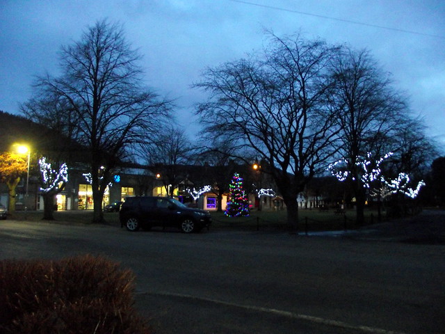 DSCF5297 by Al, on Flickr
Craigendarroch rising as a dome
 DSCF5302 by Al, on Flickr
 DSCF5305 by Al, on Flickr
Birch Polyphore
 DSCF5307 by Al, on Flickr
Allison and a (hibernating) ant-hill
 DSCF5309 by Al, on Flickr
 DSCF5310 by Al, on Flickr
 DSCF5312 by Al, on Flickr
Lochnagar
 DSCF5315 by Al, on Flickr
 DSCF5317 by Al, on Flickr
 DSCF5318 by Al, on Flickr
Ballater
 DSCF5320 by Al, on Flickr
But just where was all the snao? Looking over at the hills east of the A9 there was precious little - on The Fara itself we were barely troubled by the stuff, just a wee section in the last 50m or so before the top. The forecast had been for heavy rain during the day, but we were dry with some flashes of sunshine. Not that I was complaining.
An unsnowy Leacainn from Dalwhinnie level crossing
DSCF5240 by Al, on FlickrDSCF5241 by Al, on FlickrLoch Ericht
DSCF5243 by Al, on FlickrGorse seeds
DSCF5244 by Al, on FlickrSun over Geal Charn
DSCF5245 by Al, on FlickrDSCF5250 by Al, on FlickrDSCF5251 by Al, on FlickrDSCF5252 by Al, on FlickrThere was a strong wind however, and we hunkered down in the lee of the cairn to have our lunch before retracing our steps, back at the car before two o'clock. That was a bit of luck, as Conachraig was tomorrow's hill and I had no idea where we were going to pitch for the night. headed up via Grantown on Spey, almost all the snao on the Feshie Cairngorms gone too... We motored through Tomintoul and found a nice spot at the Wells of Lecht to spend the night, arriving as the twilight was falling. Thought about going up to the mine at the end of the track - but the track itself was so waterlogged that we didn't bother.
DSCF5253 by Al, on FlickrDSCF5255 by Al, on FlickrA lovely quiet night, dark sky and very little traffic going over the Lecht. Up when it was still dark and off for the short drive to the Spittal of Glen Muick. Some lovely colours in the sunrise from the top of the Lecht. I had toyed with doing Conachraig by the longer route from Balmoral, but in the end opted for another quick and easy summit. There were already quite a few cars in the parking area, paid our £4 for the privilege and set off, leaving axes behind given the lack of anything to put them in. Lochnagar was largely snao free on this side at least. I'd intended to head up the SE shoulder, returning east over Carn a Damph but Allison suggested keeping to the track for longer and using the path up Conachraig opposite the track running up Lochnagar. Fair enough! The path was quite slippy, ice on granite, but was easier than traipsing through heather. Someone had dismantled the cairn on the higher rocky tor, placing one on a clearly lower rock. An eagle soared off towards Lochnagar as we plootered about at the summit.
Lecht sunrise
DSCF5261 by Al, on FlickrDSCF5263 by Al, on FlickrA study in browns, not whites
DSCF5269 by Al, on FlickrDSCF5270 by Al, on FlickrLochnagar
DSCF5271 by Al, on FlickrMist coming over Meikle Pap
DSCF5272 by Al, on FlickrSnowless Conachraig
DSCF5273 by Al, on FlickrDSCF5274 by Al, on FlickrDSCF5278 by Al, on FlickrWe returned to the visitor centre where we had lunch. One o'clock - enough time for another hill
Coyles of Muick from the south
DSCF5279 by Al, on FlickrDSCF5280 by Al, on FlickrDSCF5284 by Al, on FlickrDSCF5286 by Al, on FlickrView to Mount keen
DSCF5287 by Al, on FlickrDSCF5289 by Al, on FlickrDSCF5291 by Al, on FlickrDSCF5293 by Al, on FlickrMist was moving in from the west. The local man told us we were on the highest spot - though the map suggested the cairn to the SW had an extra contour ring. So we made it over there just as our views to Mount Keen were curtailed. We headed down over Meall Dubh, and Allison was filled with glee (not) when I told her it was not only a Tump but a Highland Five
We returned to the forestry track and came out onto the road again, past "Charlie's hoose" just in time to get pitched before the darkness fell. Ended up just pitching in some trees by the closed road, which provided an adequate, if a little lumpy, night's rest.
Heading to the true summit
DSCF5294 by Al, on FlickrDSCF5296 by Al, on FlickrSunday - once again we were up in the dark (not really that hard at this time of year) and had plans only for the nearby Marilyn of Craigendarroch in Ballater itself. Parked up in Church Square and set off, sans rucksacks, sans anything really, for what turned out to be a very pleasant walk up a little hill, just 401m (from a starting elevation of 200m). Into oak woods first, where a carpet of golden brown oak leaves deadened our footfall, then into birch and pine woods, moving ever so gently uphill. There was a path and seats to rest yourself upon every so often. Allison admitted it wasn't bad for a Marilyn.
The summit gained, we had a good view over Lochnagar and the village of Ballater. It was looking to be a nice day - I did have a root around on my phone to see if there were any other quick Marilyns on our road back, but there didn't seem to be - anyway the mist closed in, hiding the sun for most of the drive home.
Is it Xmas or something?
DSCF5297 by Al, on FlickrCraigendarroch rising as a dome
DSCF5302 by Al, on FlickrDSCF5305 by Al, on FlickrBirch Polyphore
DSCF5307 by Al, on FlickrAllison and a (hibernating) ant-hill
DSCF5309 by Al, on FlickrDSCF5310 by Al, on FlickrDSCF5312 by Al, on FlickrLochnagar
DSCF5315 by Al, on FlickrDSCF5317 by Al, on FlickrDSCF5318 by Al, on FlickrBallater
DSCF5320 by Al, on Flickr