free to be able to rate and comment on reports (as well as access 1:25000 mapping).
All these weekends of stormy weather are a real pain when one is trying to put together a hill agenda. Midweek snow rendered much of the country out of bounds as far as I was concerned as did the forecast very high winds. In a bit of desperation I turned my eyes east to the cluster of little hills remaining in Fife and Perthshire. I reckoned we could use Comrie Croft as a base for the first 2 days then have a punt on finding somewhere overnight in Fife on the Saturday - the only campsite I could find that seemed to be open - Kingdom Caravan Park in Glenrothes, wasn't returning my calls. Well, to hell with them

Thursday night was dry, if a bit chilly. Enjoyed the night sky at Comrie before it got too cold to stay out. The forecast for Friday wasn't great. I thought we could do Moncrifife Hill at Bridge of Earn, then head up to Kingseat and Craigowl, with the outside chance of sneaking up Turin Hill if we were doing well for time.
 DSC02985
 by
Al, on Flickr
 DSC02987
 by
Al, on Flickr
A soggy start to Friday, as promised. One of the advantages of staying in the populated areas is being able to use Google maps on your phone to get to the start of walks

Made negotiating the way to our first hill, Moncreiffe, a touch easier. Decided to go up from the south, using part of the WH route. About half a dozen cars parked up, despite the weather - dog walkers perhaps. Quite a pleasant forest walk, good views of the Friarton Bridge from the summit. Returned the same way.
 DSC02992
 by
Al, on Flickr
 DSC02993
 by
Al, on Flickr
 DSC02995
 by
Al, on Flickr
Drove to Collace - past Perth Harbour and Perth Airport, both of which were new to me. Parked in the middle of the village, although there is adequate parking at the start of the walk. An info board speculates about the fort on Dunsinnan Hill being the site of Macbeth's Castle. Shakespeare of course, played fast and loose with the facts - King MacBethad seems to have been a brave and decent guy. But I suppose that doesn't make for literary immortality.
I'd expected this to be quite a short walk, but it wasn't. The track leading to Dunsinane (or Dunsinnan) hill is steep and grassy; the fort quite impressive. We rested for lunch on the way over to Black Hill, before tackling Kingseat, which seemed improbably far away. A path snakes through heather and squelch, and there's substantial descent/re-ascent required coming off Black Hill before the top of Kingseat is gained. The hill could be done much more quickly from the south/south east, but that would miss out the hill fort. Two and three quarter hours to do 8km
 DSC02996
 by
Al, on Flickr
 DSC02997
 by
Al, on Flickr
Black Hill, and, in the distance, Kingseat
 DSC02998
 by
Al, on Flickr
 DSC03000
 by
Al, on Flickr
 DSC03002
 by
Al, on Flickr
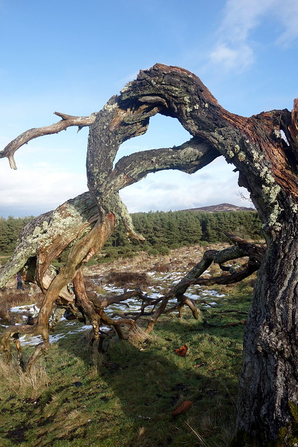
Something sea-monstery about this tree
 DSC03003
 by
Al, on Flickr
 DSC03004
 by
Al, on Flickr
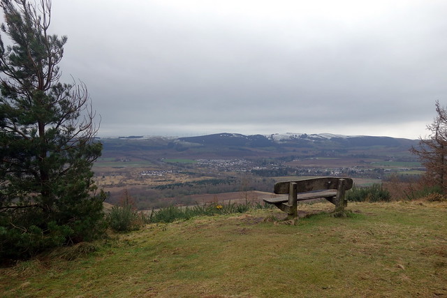
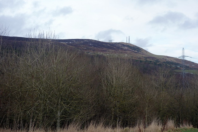
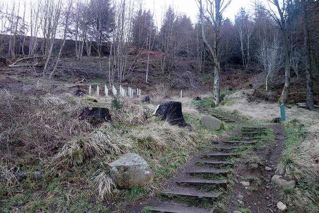
We drove onward to Angus, to Craigowl Hill, once again using part of a WH route. The car park is locked at 5pm during winter months, so don't leave it too late to visit (10pm in summer). More dogwalkers. The route is very wet, muddy and slippy, glad we had boots and gaiters on. Woodland tracks initially then sheep tracks up onto the hillside which is decorated with numerous transmitter masts. It seemed obtuse to be at the trig column, thinking this was the highest point when an enormous mast rears up behind you. Back more or less the same way.
 DSC03005
 by
Al, on Flickr
 DSC03007
 by
Al, on Flickr
 DSC03008
 by
Al, on Flickr
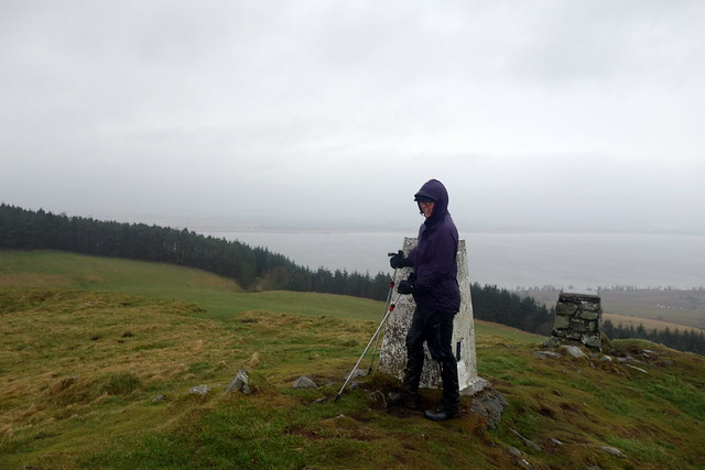
Allison at the highest point...?
 DSC03009
 by
Al, on Flickr
 DSC03010
 by
Al, on Flickr
Too late now to fit another hill into the day, we turned tail and drove back to Comrie via the Co-Op in Creiff. A tasty Quorn curry followed by a quiet night - rain the only sound. Saturday was another dreich looking morning, though fortunately the rain paused whilst we were dissembling the tent. Then it was off to Fife.
I'd thought that these hills might get left for a sunny summer's day, with a camp at St Monans, site of several childhood caravan holidays with my grandparents. But here we were on rainy February morning. There's a cluster of three small hills between Newburgh and Cupar. We probably did them in the wrong order in terms of efficiency, but they're close enough together for that not to matter too much.
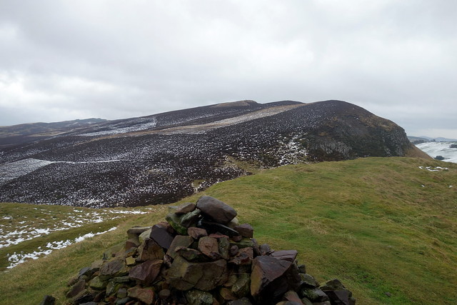
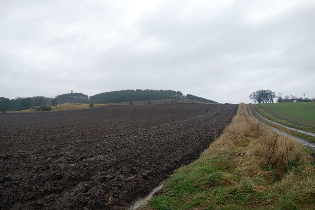
Started with Norman's Law, not using the WH route from Luthrie, but parking to the NW of Luthrie and using the Fife Coastal Path to reduce the distance. Parking for several cars beside a FCP noticeboard, and a colour leafllet about Norman's Law, showing views from various directions - helpful today and there were no views to speak of. Up a muddy farm track, then onto the hillside where a clearer path is picked up. Another hill fort remains at the summit.We took a different way down - just watch where you cross the fence as it's both barbed wire and electric - a devilish combo

Norman's Law
 DSC03011
 by
Al, on Flickr
 DSC03012
 by
Al, on Flickr
 DSC03013
 by
Al, on Flickr
 DSC03014
 by
Al, on Flickr
 DSC03015
 by
Al, on Flickr
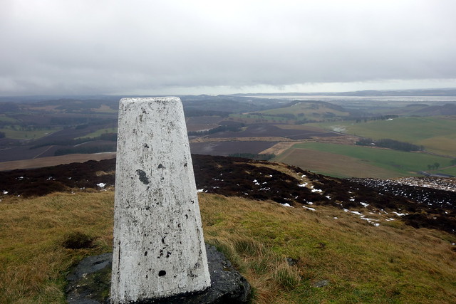
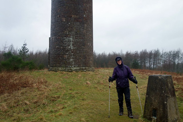
Our next hill was Mount Hill, which we could see from Norman's Law on account of the large memorial tower on the top - the Hopetoun Monument. Quite what John, IV Earl of Hopetoun did to endear himself to the local inhabitants is baffling - I couldn't find anything linking him to Cupar. But there you go - random. We parked just inside the field, where there's room for one car (maybe two if it hasn't been raining for weeks) and walked up the signposted right of way. The monument has a deer fence, so yo have to walk around it to get to the gate. Trig point marks the summit (although the true summit is apparently 0.75m higher and off 50m to the NW if you are obsessional). We were wet.
 DSC03016
 by
Al, on Flickr
 DSC03017
 by
Al, on Flickr
Again - at the highest point?
 DSC03018
 by
Al, on Flickr
 DSC03019
 by
Al, on Flickr
Next was Cairnie Hill, which has neither hill fort nor monument atop it - so not much point going up there, unless you just want to get a Marilyn
We parked across the road by a power station where there's room for one car - it would be difficult to park right at the start of the route without blocking access and the ground was very wet and muddy. Track initially then soggy right of way, then open hillside, then trees, then gorse bushes. There's an oddly shaped rock at the summit. Woo!
Cairnie Hill
 DSC03020
 by
Al, on Flickr
Woo!
 DSC03021
 by
Al, on Flickr
 DSC03022
 by
Al, on Flickr
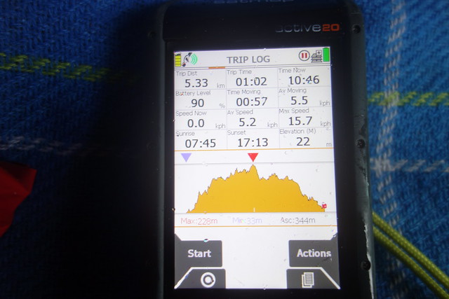
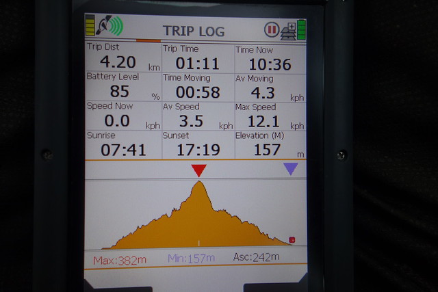
Last on our list was Largo Law. I remembered this hill from a trip to the environs long ago when I took my son for a weekend's camping and he was interested in Robinson Crusoe. Not that we'd climbed the hill, but we had been all around Largo. Parked beside the church (again - there's adequate parking at the start of the route if you wish). I noticed my GPS was playing up just after we'd started out - it told me we'd done 15018 kilometres in three minutes, which - even for us - is pretty good going. I thought that Alteknacker would like that, as he's frequently commented on the apparent speed we do while walking - an average speed of over 13000kmph today mate
 DSC03023
 by
Al, on Flickr
!!!
 DSC03024
 by
Al, on Flickr
More mud and squelch on the grassy track to Chesterstone Farm. There are signs to follow for the walk, up more muddy lanes before the very steep lower section of the hill is reached. I was very glad we'd brought our poles as without them in today's slippy mud, I doubt we'd have got far. Similarly if the hill was clad in snow/ice I can imagine crampons being necessary due to the steepness. What a thought

Anyway, after the steep section there's a false summit - you realize there's more to do before getting to the trig column. The wind was fierce making that a challenge in its own right and on the way down it started to hailstone. ouch!
 DSC03025
 by
Al, on Flickr
 DSC03026
 by
Al, on Flickr
 DSC03027
 by
Al, on Flickr
 DSC03028
 by
Al, on Flickr
Back at the car the rain, which hadn't stopped all day, was getting heavier. We pondered where to go for the night - a brief journey along the East Neuk revealed no suitable spots between Elie and Pittenweem. I decided we'd just drive towards tomorrow's first target, Benarty Hill and see what luck would put our way.
On the wet and windy journey though Fife we did pass signs for Kingdom Caravan Park when driving through Glenrothes, but I was adamant they weren't getting our custom. I wondered if we might be able to find somewhere in Lochore Country Park. Having never ventured there before, I was not prepared for the size of the conurbation of Ballingry and Lochore. Added to which, the road into the Country Park was closed due to flooding. Not a good sign. In desperation we headed up towards the start of the walk and found a parking place at the start of Benarty Wood that had enough room for a tent. at a squeeze. As it was painfully close to a housing scheme, I it was with trepidation that we settled down for the night - thinking about our recent experience with carloads of yahoos when using camping in a wood over near Oban. I just hoped the rain would keep any nutters away.
The road was surprisingly busy, but only a couple of vehicles stopped - dog walkers. Sleep was not forthcoming for either of us - it was a case of just getting through the night. However at 3am a vehicle did pull up and a searchlight shone at the tent - this was the Police. I guess people camping to get an early start on Benarty Hill isn't really a thing
Anyway, they went away, only to return and do the same thing at 5am. They didn't come to investigate, but probably ran the car's reg through their system. It was better than having a van load of yobs with pounding music stop, I'll concede.
Maybe not the best spot for a quiet night
 DSC03029
 by
Al, on Flickr
Refreshed (ha!) after exactly no sleep, we got up at 7 and made a start on Benarty Hill, just along the road, by 8am. There's a set of stairs leading up into the woods, then a forest path. Nearer the summit the trees have been felled, then it's heather and a muddy path to the trig column. Today's wind was coming from the NW and was much colder than the last two days. At least it was dry and almost sunny. Views down to Loch Leven were quite nice.
 DSC03030
 by
Al, on Flickr
 DSC03031
 by
Al, on Flickr
 DSC03032
 by
Al, on Flickr
Loch Leven
 DSC03033
 by
Al, on Flickr
 DSC03034
 by
Al, on Flickr
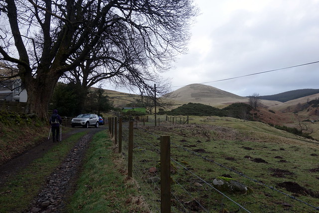
Next it was a short journey west towards Cleish, for Dumglow, which I'd decided to approach via the shorter northern route. There's parking just west of the start near a track leading to some energy plant. We went through a muddy field guarded by two horses, then onto forestry track. Allison asked if I could hear racing cars - sure enough the high pitched note of tuned engines - of course - Knockhill must be close (indeed, only 1.5 miles ATCF). A sneak into the trees on a marked footpath soon brings you our into the open and there's then a short steep climb to the summit, cross a barbed wire fence (which some kind soul has neutered with some pipe insulation foam) to reach the trig column. Big skies from here today, threat of rain or snow on the way. Followed Rodmeister's path on the return leg, mine was drier
 DSC03036
 by
Al, on Flickr
 DSC03037
 by
Al, on Flickr
 DSC03038
 by
Al, on Flickr
 DSC03040
 by
Al, on Flickr
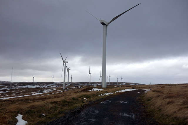
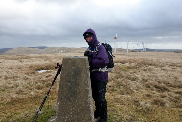
Back to the car, boots very muddy. Last hill of the day was to be Steele's Knowe, over in Glendevon. I assumed I had Rod's route, utilizing the windfarm track, but found I had borrowed an ancient route of Graeme D's. So we started at the Tormaukin Hotel and had a few extra kilometres to cover. Not much option but to park in the hotel carpark, something I don't like doing as a rule. A wee walk along the road then onto the right of way to Auchterarder which heads into Boreland Glen. More mud, more horses, in fact lots of horses. Walked along the track cut into the side of the hill for some way before deciding to cut up towards the turbines and make use of the windfarm tarmac. God it was windy

 DSC03041
 by
Al, on Flickr
 DSC03042
 by
Al, on Flickr
The summit was a considerable distance from where we joined the track - well a considerable distance by the scale of these small hills. And there was no track right to it - some tussock crossing was required. But we made it to the tenth top of the weekend. We wandered back the same way - a better option would have been to follow the windfarm track to Thrush Hill then rejoin our outward track, but that involved more ascent
 DSC03043
 by
Al, on Flickr
 DSC03045
 by
Al, on Flickr
 DSC03046
 by
Al, on Flickr
 DSC03048
 by
Al, on Flickr
Back at the car quite early. We were heading to Glasgow to see Julian Cope, so I wasn't troubled to be finished up as soon. I almost suggested we head over to do Dumyat, which Allison hasn't done, but I thought she might hit me (actually she almost suggested it herself).
Rain and wind in Glasgow made shelter a requirement - some hours to spend before the concert, so we had a coffee in Picnic, a wander round the MoMA and had a good meal in Swadish, "modern Indian Cuisine". The gig, at St Lukes, was all that one could hope for from a Julian Cope concert - good to see that he's back on top form (even if his dress sense has become weirder than usual).
 DSC03049
 by
Al, on Flickr
Crown Prinz Julian H Cope
 DSC03050
 by
Al, on Flickr
Dig those shorts!
 DSC03053
 by
Al, on Flickr
