free to be able to rate and comment on reports (as well as access 1:25000 mapping).
After the positive results from yesterday's experiment into the recuperation of the Sick Kid on Ben Bowie, I decided we'd be a little bit more ambitious and try for the two Menteith hills. This turned out to be too much too soon, sadly. I had originally intended to link Craig of Monievreckie and Beinn Dearg into one loop, a la Jaxter, but - as this involved a lot of rough ground - I decided that doing the hills separately and maximising the time walking on track would be wise.
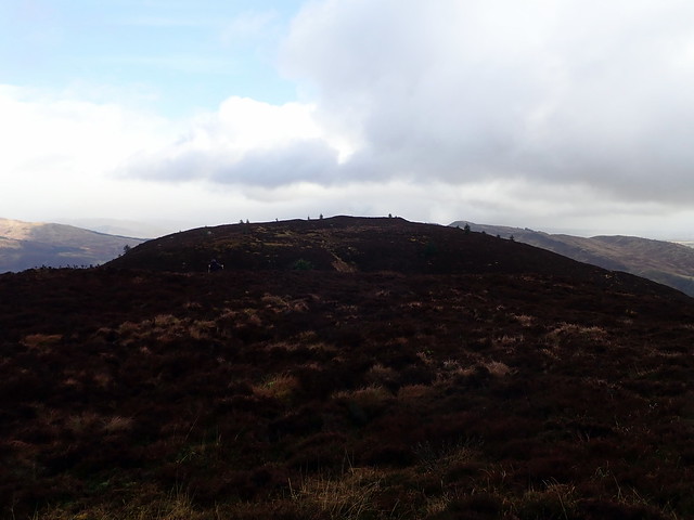
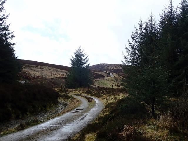
We drove along to Aberfoyle in a mix of showers and sunshine - the forecast for today was pretty much like that all day. Parked in the large Braeval woodlands walk car park and set off along a footpath into the trees, joining onto the main track in a little while and taking it steadily upwards towards the transmitter mast. It's necessary to leave the track and head onto the hillside a little before the mast is reached - going fairly easy on short grass, some heather tussocks later. I made the mistake of thinking the 393m top was the summit (carelessness in drawing my route) and, having dragged Allison up it, noted the trig point was across on the adjacent hump. Oops.
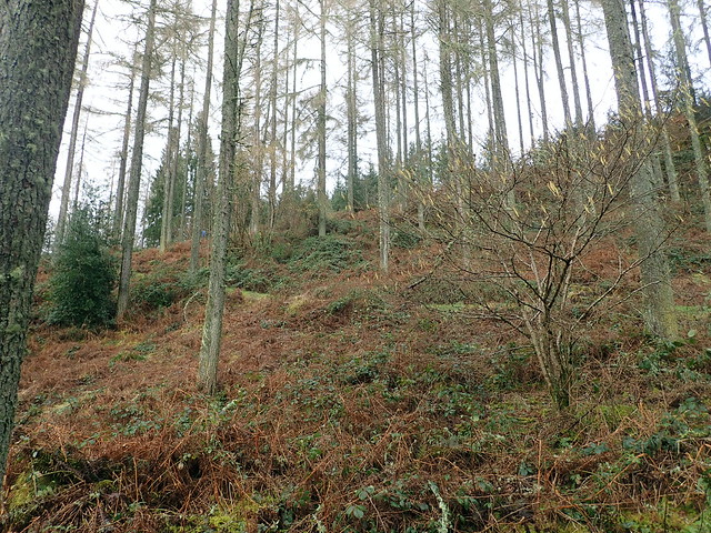 P3080429
 by
Al, on Flickr
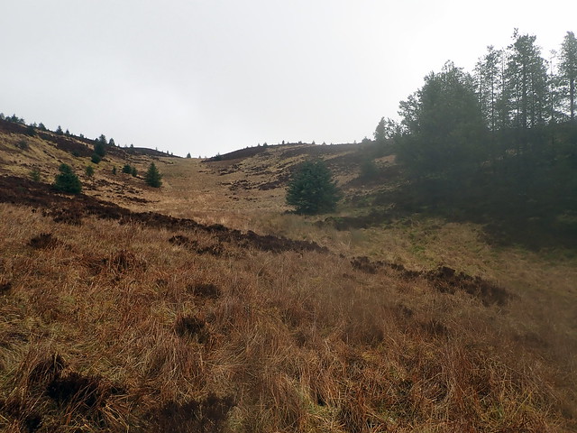
 P3080430
 by
Al, on Flickr
 P3080431
 by
Al, on Flickr
 P3080432
 by
Al, on Flickr
Ben Venue
 P3080434
 by
Al, on Flickr
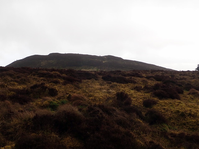
From the top of the (wrong) hump, you can see the trig column on the other
 P3080435
 by
Al, on Flickr
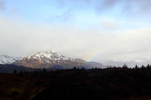
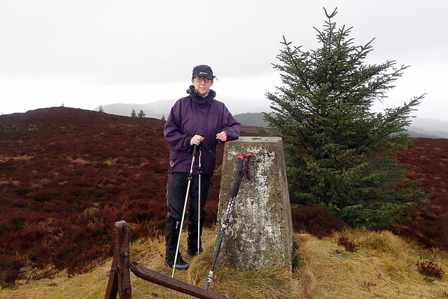
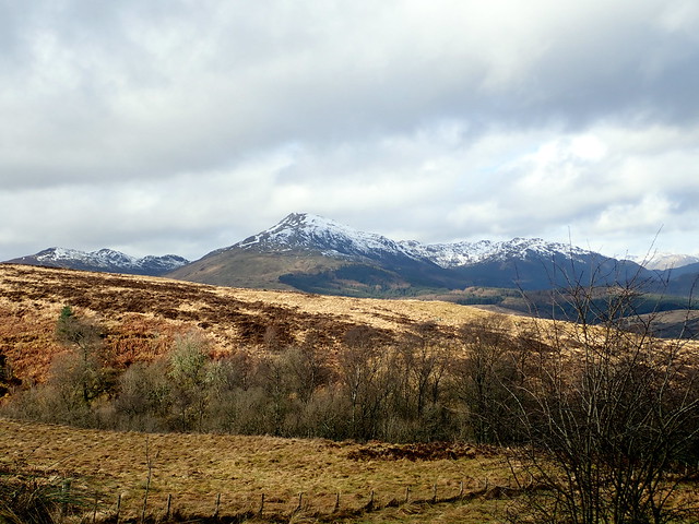
From the trig column there are good views to Ben Venue, still snow capped despite the recent warmer weather and rain. We took more or less the same route down, pausing for lunch before joining the track again.
 P3080437
 by
Al, on Flickr
 P3080438
 by
Al, on Flickr
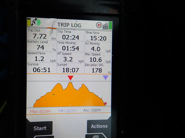
(Please excuse the GPS - I forgot to start it until we'd left the track on the way up)
Back at the car we passed a mum with a group of 5 teenagers, heavily back-packed - looked as if they'd been out doing DofE things last night - well if so they certainly had a wild night for it! We drove along the road towards Callander, passing the pretty Lake of Menteith - yes, the only natural Lake in Scotland, although it's also known as Loch Innis Mo Cholmaig in the Gaelic and was called the Loch of Menteith until the 19th Century... We parked at the start of a track up to the mobile phone transmitter masts on Ben Gullipen - where there's room for a couple of cars - and set off up the track.
Allison was struggling a bit on the way up - it's a steady pull up to the top of Gullipen. However, there's then a descent of 50m and a steepish re-ascent of 70m to reach the top of Beinn Dearg - this she found too much and was completely drained. I was cross with myself for suggesting both hills today (although I did ask her if she wanted to sit in the car for this one). Hopefully it won't have retarded her progress unduly. The return to the car was done at a lesser pace.
 P3080439
 by
Al, on Flickr
 P3080440
 by
Al, on Flickr
Ben Ledi
 P3080441
 by
Al, on Flickr
Sadly this didn't seem to contain oxygen...
 P3080443
 by
Al, on Flickr
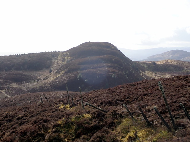
Beinn Dearg from Ben Gullipen
 P3080444
 by
Al, on Flickr
 P3080445
 by
Al, on Flickr
 P3080447
 by
Al, on Flickr
A summit too far...
 P3080448
 by
Al, on Flickr
Monievrekie from Dearg
 P3080450
 by
Al, on Flickr
 P3080451
 by
Al, on Flickr
