
Snowy Tinto & friends
Dungavel Hill
2.4km
247m ascent
51 mins
Another weekend of less than inspiring weather, but Sunday afternoon didn’t look so bad around Biggar. At one point we had thought to try a circuit of Donalds – Malky wants to finish them off now he’s in Glasgow a lot – but in the end we wussed out seeing as the winds were forecast to be high.
Other than some severe potholes, the roads were clear and we had no problems arriving at our start point for Dungavel Hill. The car was rocking in the wind which meant we weren’t hugely keen to get going….but eventually we did, hopping over a gate and walking across some very mushy ground
 Dungavel Hill
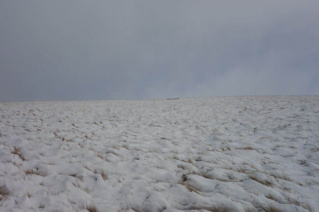
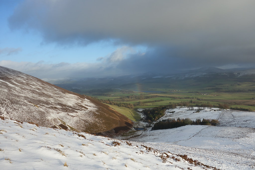
Once we started to climb the ground became a bit more sturdy although there was now more snow starting to cover the tussocks
 Looking back
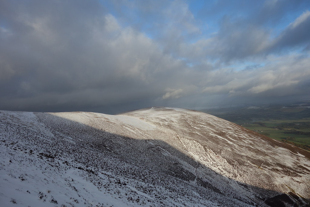
The gradient became a lot steeper and the snow a lot deeper
 A lot more snow
And then a blizzard hit – I managed to get my waterproofs on but not without a lot of snow going up my back We were very glad that the wind was coming from behind us for now, and were not looking forward to the return trip
 Blizzard
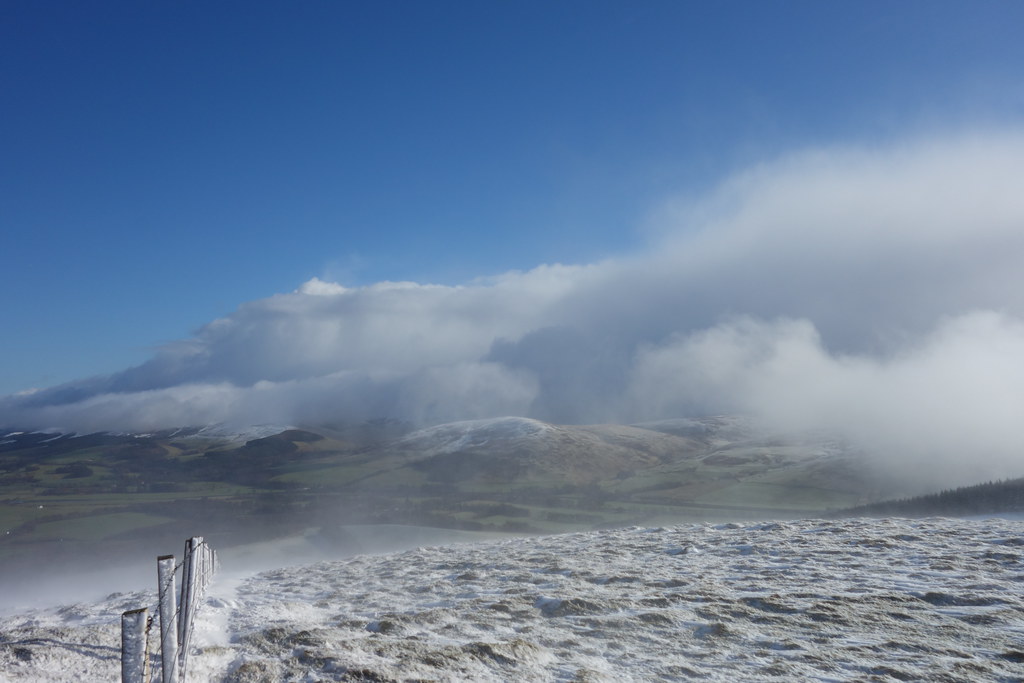
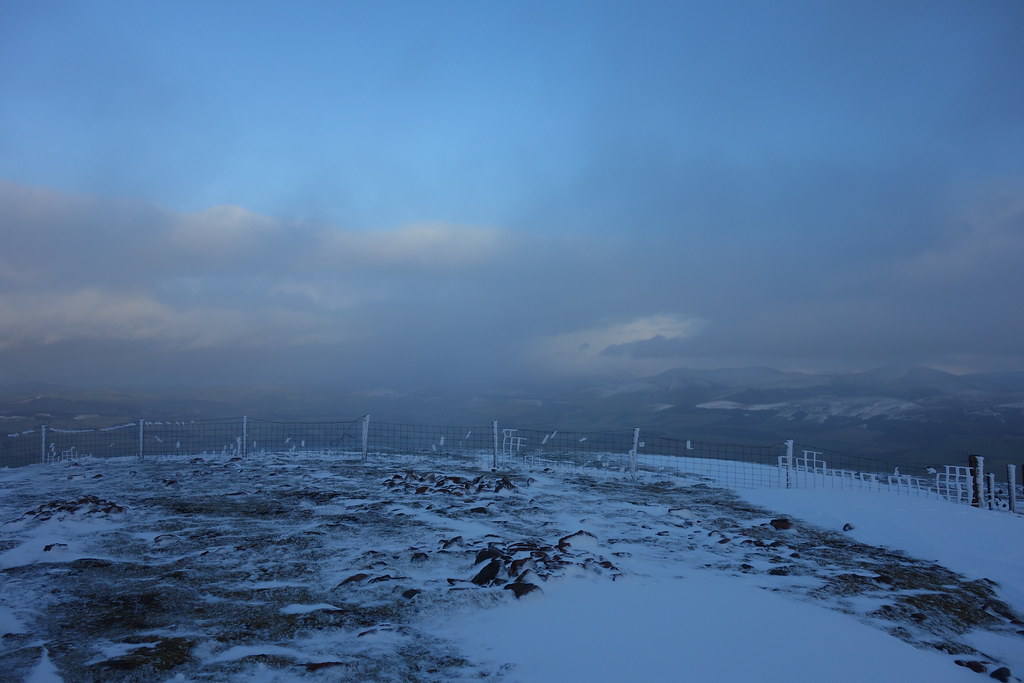
It’s very easy to see how it’s possible to get disorientated even on small hills in a whiteout We were glad of the fenceline to keep us right! Just as we approached the summit the weather started to clear and we could see across to Tinto
 Tinto appearing
Now the gradient had eased, the snow was even deeper and walking became quite awkward!
 Malky leading the way
We were relieved to be at the summit and glad to be able to enjoy some views too
 Tinto
Tinto
 Culter Fell hills
 Biggar
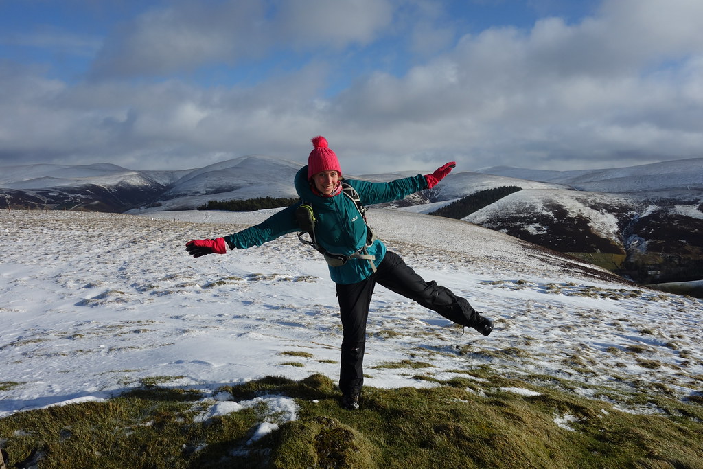
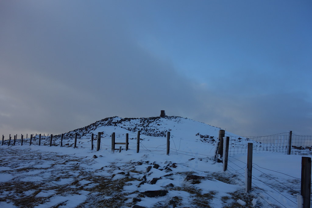
 Summit of Dungavel Hill
Taking my frustration out on the trig
 trig-kicking
Although the snow had largely stopped, the wind was wild and very cold so we beat a hasty retreat back to the car
~~~~~~~~~~~~~~~~~~~~~~~~~~~~~~~~~~~~~~~~~~~~~~~~~~~~~~~~~~~~~~~~~~~~~~~~~~~~~~~~~~~~~~~~~~~
Lamington Hill
6.34km
343m ascent
1 hour 33 mins
We drove 10 minutes down the road to the lovely wee village of Lamington which had a helpful car park next to the church where we had a quick sandwich before setting off along the road past the primary school, crossing the main road and following a track up past some houses.
The views towards Tinto were excellent
 Tinto
Tinto
The route past the houses was well signposted but unfortunately due to the recent heavy rain we had a hop a couple of gates to avoid getting completely soaked
 Water feature
Once past the houses we were on a forestry track for real and the ground was slightly less damp There were various strange looking storage containers and things, possibly connected with forestry or the landowners
 Forest track
The forestry track gained us some good height before dropping us nicely onto the ridge with a wall to follow. We were now out into the snow which was very pretty but my feet kept slipping
 Out on the ridge line
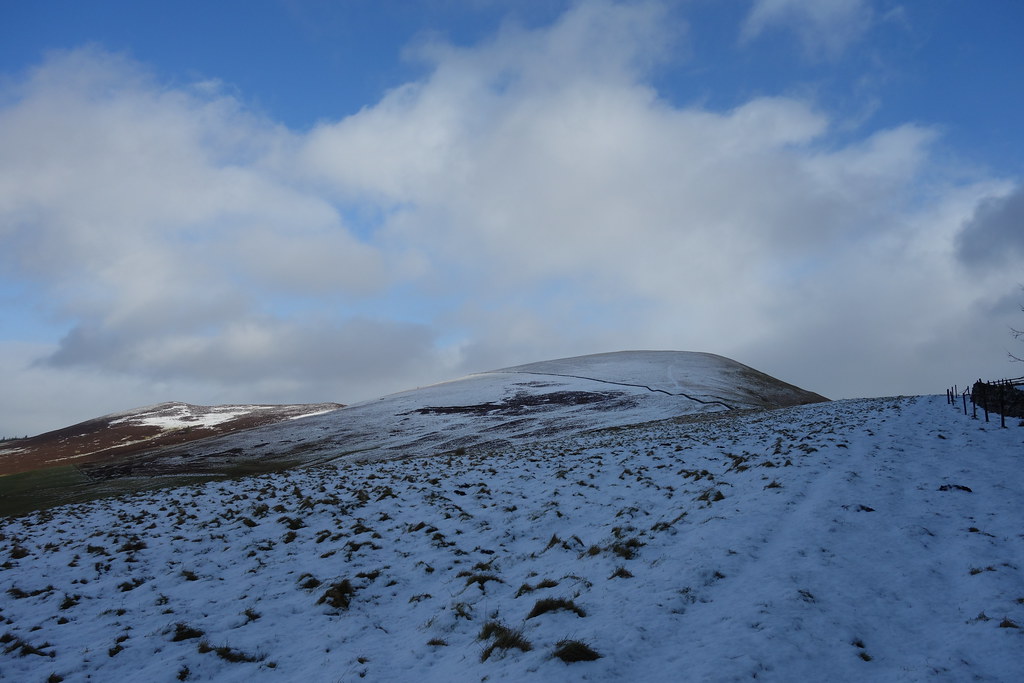
As we continued along the wall we could see the top of Lamington Hill ahead – I’d seen this hill from the other side on my way down from the Culter fell round and had been tempted then. It looked good from this angle too
 Ahead
Ahead
We crossed over the wall and continued up the lovely ridge – soon the summit was in sight
 Trig point on Lamington Hill
Once at the top the views were awesome We couldn’t believe how much snow there was here!
 Culter Fell
Malky got a bit excited when we realised that this windfarm was on “Ewe Hill”
 Wind farm on appropriately named "Ewe Hill"
 Tinto
Tinto
 Summit selfie
 Summit of Lamington Hill
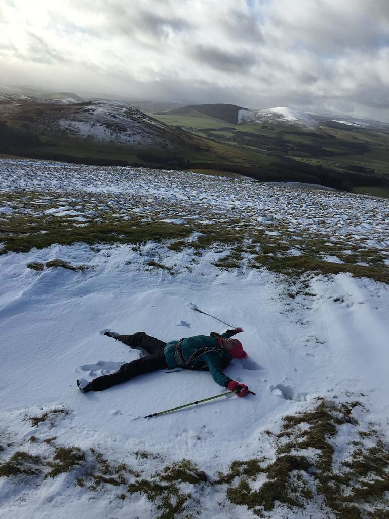 Snow angel
Again it was super windy up top so we quickly dropped off the side – it was very steep to start with but there was barely any snow on this side of the hill!
 Dropping down into the glen
Once on the track it was an easy walk out, but very muddy in places!
 Final hurdle
There were some lovely views of Tinto as we approached Baitlaws
 Lovely views of Tinto
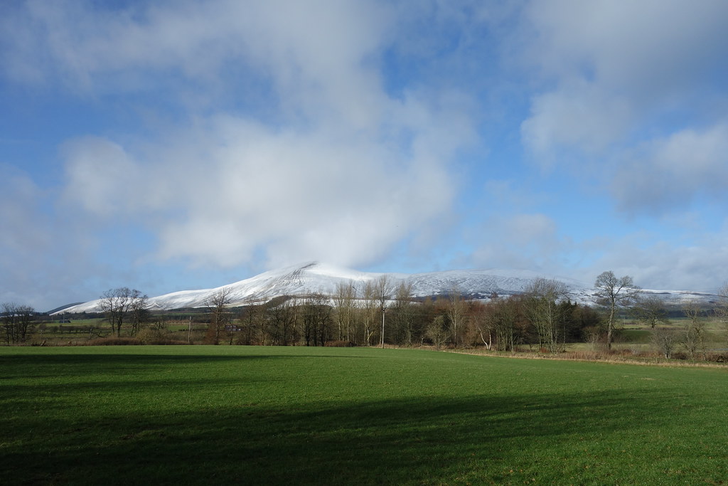
In fact, the views of Tinto were so good that as we walked down the road back to Lamington we decided we could go up it on the way home
~~~~~~~~~~~~~~~~~~~~~~~~~~~~~~~~~~~~~~~~~~~~~~~~~~~~~~~~~~~~~~~~~~~~~~~~~~~~~~~~~~~~~~~~~
Tinto
5.67km
484m ascent
2 hours 5 mins
We decided to go for the less well trodden route from Wiston Lodge which looked fairly deserted when we arrived.
 This way
A few minutes later we found ourselves sliding through muddy fields. I’m sure this route isn’t normally quite this damp but after the large dump of rain we’ve had recently it was a bit mental
We followed a wall or fence across the fields and as we gradually began to gain height the views improved
 Culter Fell
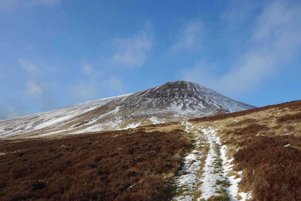
As we looked ahead to Tinto it looked big
 Pap Craig
Soon we were into the snow again
 Ahead
Ahead
As we approached the base of the hill the snow became deeper, the path veered around to the right and it started spotting with rain again, which was being hurled at us by the vicious wind

After I struggled on for a short while I decided to let Malky and his big man legs break the trail as the snow got deeper
 Malky breaking trail
As we climbed higher up the side we were actually relatively sheltered from the wind
 Looking South
 Looking back to Dungavel Hill
Soon the rainclouds (which never really came to anything anyway) cleared and the sun came out
 Sparkly snow
 Rainbow

This route isn’t well used and Malky said he’d managed to lose the zig zag path when he was here before in the summer. In some ways the snow made it more obvious although we still blundered about in places
 Malky on the zig zags
The sun hitting the ridge made it look quite appealing, but given the wind it was probably going to be one for another time
 Scaut Hill


Soon we were almost out of the deep snow and onto the final ascent – it was going to get windy
 Ahead
Ahead
 Towards Lochlyoch Hill - the ridge in the other direction
 Why take the easy way....
 Tinto summit
 Windy Tinto summit
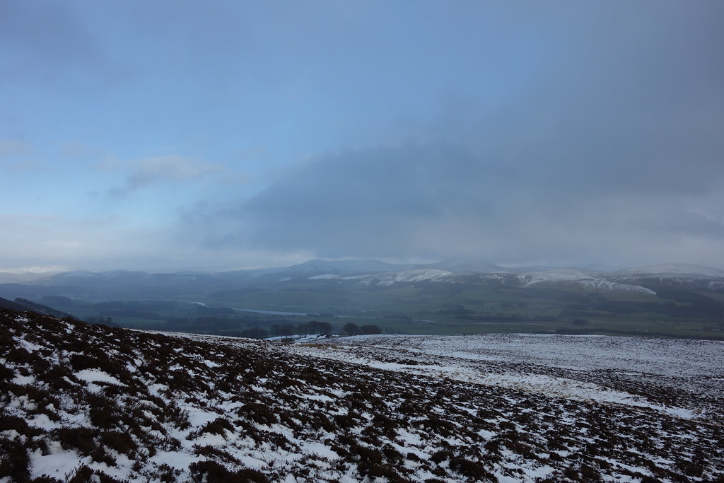
It wasn’t really the weather for hanging around – although we had thought it might be worth hanging around for a sunset but we changed our minds pretty sharpish
 Weather coming in
Time to get going
 Dungavel Hill
 Looking back
 Back into the deep snow
I discovered that the snow was fabulous snow-balling snow which Malky discovered as it smacked him in the back To be fair we both got some good hits in, and we got down a lot quicker than we’d got up
 Malky running away from the snowballs
Back on easier ground we made faster progress – the light was definitely starting to go though
 Looking back to Tinto
 Getting dark
From here it was another very muddy walk back across the fields, which was annoying because all the snow had cleaned our boots and trousers We found a burn near the car to rinse some things off, before a relatively easy drive home. Good to get out, and enough snow to make it nice and exciting 
2.4km
247m ascent
51 mins
Another weekend of less than inspiring weather, but Sunday afternoon didn’t look so bad around Biggar. At one point we had thought to try a circuit of Donalds – Malky wants to finish them off now he’s in Glasgow a lot – but in the end we wussed out seeing as the winds were forecast to be high.
Other than some severe potholes, the roads were clear and we had no problems arriving at our start point for Dungavel Hill. The car was rocking in the wind which meant we weren’t hugely keen to get going….but eventually we did, hopping over a gate and walking across some very mushy ground
Dungavel Hill Once we started to climb the ground became a bit more sturdy although there was now more snow starting to cover the tussocks
Looking back The gradient became a lot steeper and the snow a lot deeper
A lot more snow And then a blizzard hit – I managed to get my waterproofs on but not without a lot of snow going up my back
Blizzard It’s very easy to see how it’s possible to get disorientated even on small hills in a whiteout
Tinto appearing Now the gradient had eased, the snow was even deeper and walking became quite awkward!
Malky leading the way We were relieved to be at the summit and glad to be able to enjoy some views too
Tinto Culter Fell hills Biggar Summit of Dungavel Hill Taking my frustration out on the trig
trig-kicking Although the snow had largely stopped, the wind was wild and very cold so we beat a hasty retreat back to the car
~~~~~~~~~~~~~~~~~~~~~~~~~~~~~~~~~~~~~~~~~~~~~~~~~~~~~~~~~~~~~~~~~~~~~~~~~~~~~~~~~~~~~~~~~~~
Lamington Hill
6.34km
343m ascent
1 hour 33 mins
We drove 10 minutes down the road to the lovely wee village of Lamington which had a helpful car park next to the church where we had a quick sandwich before setting off along the road past the primary school, crossing the main road and following a track up past some houses.
The views towards Tinto were excellent
Tinto The route past the houses was well signposted but unfortunately due to the recent heavy rain we had a hop a couple of gates to avoid getting completely soaked
Water feature Once past the houses we were on a forestry track for real and the ground was slightly less damp
Forest track The forestry track gained us some good height before dropping us nicely onto the ridge with a wall to follow. We were now out into the snow which was very pretty but my feet kept slipping
Out on the ridge line As we continued along the wall we could see the top of Lamington Hill ahead – I’d seen this hill from the other side on my way down from the Culter fell round and had been tempted then. It looked good from this angle too
Ahead We crossed over the wall and continued up the lovely ridge – soon the summit was in sight
Trig point on Lamington Hill Once at the top the views were awesome
Culter Fell Malky got a bit excited when we realised that this windfarm was on “Ewe Hill”
Wind farm on appropriately named "Ewe Hill" Tinto Summit selfie Summit of Lamington HillSnow angel Again it was super windy up top so we quickly dropped off the side – it was very steep to start with but there was barely any snow on this side of the hill!
Dropping down into the glen Once on the track it was an easy walk out, but very muddy in places!
Final hurdle There were some lovely views of Tinto as we approached Baitlaws
Lovely views of Tinto In fact, the views of Tinto were so good that as we walked down the road back to Lamington we decided we could go up it on the way home
~~~~~~~~~~~~~~~~~~~~~~~~~~~~~~~~~~~~~~~~~~~~~~~~~~~~~~~~~~~~~~~~~~~~~~~~~~~~~~~~~~~~~~~~~
Tinto
5.67km
484m ascent
2 hours 5 mins
We decided to go for the less well trodden route from Wiston Lodge which looked fairly deserted when we arrived.
This way A few minutes later we found ourselves sliding through muddy fields. I’m sure this route isn’t normally quite this damp but after the large dump of rain we’ve had recently it was a bit mental
We followed a wall or fence across the fields and as we gradually began to gain height the views improved
Culter Fell As we looked ahead to Tinto it looked big
Pap Craig Soon we were into the snow again
Ahead As we approached the base of the hill the snow became deeper, the path veered around to the right and it started spotting with rain again, which was being hurled at us by the vicious wind
After I struggled on for a short while I decided to let Malky and his big man legs break the trail as the snow got deeper
Malky breaking trail As we climbed higher up the side we were actually relatively sheltered from the wind
Looking South Looking back to Dungavel Hill Soon the rainclouds (which never really came to anything anyway) cleared and the sun came out
Sparkly snow Rainbow This route isn’t well used and Malky said he’d managed to lose the zig zag path when he was here before in the summer. In some ways the snow made it more obvious although we still blundered about in places
Malky on the zig zags The sun hitting the ridge made it look quite appealing, but given the wind it was probably going to be one for another time
Scaut Hill Soon we were almost out of the deep snow and onto the final ascent – it was going to get windy
Ahead Towards Lochlyoch Hill - the ridge in the other direction Why take the easy way.... Tinto summit Windy Tinto summit It wasn’t really the weather for hanging around – although we had thought it might be worth hanging around for a sunset but we changed our minds pretty sharpish
Weather coming in Time to get going
Dungavel Hill Looking back Back into the deep snow I discovered that the snow was fabulous snow-balling snow which Malky discovered as it smacked him in the back
Malky running away from the snowballs Back on easier ground we made faster progress – the light was definitely starting to go though
Looking back to Tinto Getting dark From here it was another very muddy walk back across the fields, which was annoying because all the snow had cleaned our boots and trousers