free to be able to rate and comment on reports (as well as access 1:25000 mapping).
Sunday - another long walk for two small nondescript hills.
Looking for what else can reasonably be done from my front door, I reckoned that these two TuMPs, Creuch Hill and Berry Hill, sitting one on either side of the Old Largs road would be fair game. As happened yesterday, I met with Allison at the beginning of The Cut and we set off along the road. Lots and lots of cyclists out today, also more cars parked with people walking from them - a car at the start of the track to Corlic Hill, and at the next track, and down at Dowries. People are clearly getting fed up with the lockdown restrictions - and after Dr Calderwood decides she can drive 60 miles to her second home - while telling the plebs to "stay at home" then credibility is disappearing fast.
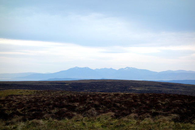
Good walking on the road, we rounded the south end of Loch Thom and continued on the Old Largs road for a bit, then cutting up onto the hillside to our left, going over Garvock Hill before catching sight of Creuch Hill. Not as boggy as I'd feared, some tussocks and heathery lumps to be negotiated. We paused for lunch in the lee of the summit of Creuch Hill, gazing out at the mountains across the water. Good views to the Sleeping Warrior, with little residues of snow left in the coires.
 DSC03229
 by
Al, on Flickr
 DSC03230
 by
Al, on Flickr
Creuch Hill from Garvock hill
 DSC03232
 by
Al, on Flickr
 DSC03233
 by
Al, on Flickr
The summit of Creuch Hill has the remains of an exploded trig column - rumour has it this was a well-directed Jerry bomb during Greenock's blitz. from here we headed SW, making for a track I'd noted on the map. This turned out to be the strangest track we've ever walked on - sheeted aluminium. According to notices, the project is to remove all the old electricity pylons - date for completion March 2020 - I could still see at least half a dozen pylons on the hillside... Anyway, the track made for better walking than the boggy ground and we returned to the Old Largs road. Along a bit to Rottenburn Bridge, at the junction of Inverclyde and North Ayrshire council boundaries. We had a small diversion to do Berry Hill from the bridge - again boasting good views from its meagre summit. Back to the road and the long walk home via the Cut, which was still busy with walkers, including one guy with a very large rucksack. Maybe he was going camping in the hills...
 DSC03235
 by
Al, on Flickr
 DSC03236
 by
Al, on Flickr
Creuch Hill and metal road

[url=https:
//flic.kr/p/2iMeJdH]DSC03237[/url] by
Al, on Flickr
 DSC03238
 by
Al, on Flickr
Berry Hill
 DSC03239
 by
Al, on Flickr
 DSC03240
 by
Al, on Flickr
 DSC03241
 by
Al, on Flickr
Arran
 DSC03242
 by
Al, on Flickr
Export Capital vs Better Life
 DSC03243
 by
Al, on Flickr
 DSC03244
 by
Al, on Flickr
 DSC03245
 by
Al, on Flickr
Maybe this is to be a new way to enforcing lockdown?
 DSC03246
 by
Al, on Flickr
 DSC03247
 by
Al, on Flickr
