free to be able to rate and comment on reports (as well as access 1:25000 mapping).
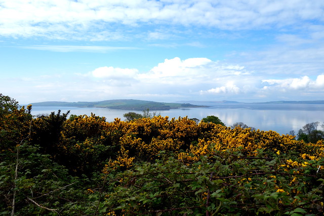
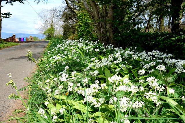
We've now exhausted all the little hills within easy reach from the doorstep, so down the coast a bit. We tackled Knock Hill from Largs - it's been a while since I was last here - used to come down and walk the dog, back in the day. We walked past Largs Golf Club along one of the back roads, past wildflowers at the roadside and some clumps of flowering wild garlic.
After a bit we followed the Coastal Path sign up into the woods. We could see The Knock up to our right, a small deviation off the track to reach it. Nice views over to Cumbrae and Arran.
 DSC03441
 by
Al, on Flickr
Wild Garlic flowers
 DSC03442
 by
Al, on Flickr
 DSC03444
 by
Al, on Flickr
 DSC03446
 by
Al, on Flickr
 DSC03447
 by
Al, on Flickr
 DSC03448
 by
Al, on Flickr
We lunched out of the wind, then continued along the Coastal Path down to Brisbane Mains farm and thence back to Largs. Wandered about along the front, as far as The Pencil before turning back.
 DSC03449
 by
Al, on Flickr
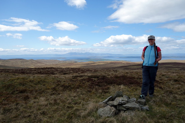
The following day we went up the Hailey Brae along towards Muirhead Reservoir, with the aim of walking over the 6 southern TuMPs in Muirshiel. There's a track that "welcomes walkers" although has a locked gate. Maybe leading to the new road we saw men working on last week. First up to Rigging Hill where there are new plantations just starting out. Easier walking than I'd expected and not too wet underfoot despite the rain midweek.
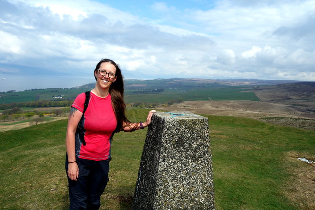
Irish Law
 DSC03453
 by
Al, on Flickr
Rigging Hill
 DSC03455
 by
Al, on Flickr
 DSC03457
 by
Al, on Flickr
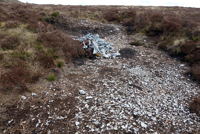
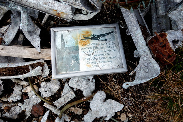
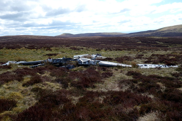
From here we went over to Feuside Hill and then a slog through the heather to Box Hill. We took different routes and both came across plane crashes, which I wasn't expecting. I'd found a smallish fragment from a Wellington Bomber that crashed being ferried up to Lossiemouth in 1941: Allison had discovered a de Havilland Devon, that was the personal aircraft of Sir Richard Jordan, Air Marshall - this crashed without fatalities in 1958. We then made it to the summit of Box Hill and had our lunch in the sunshine.
Wellington Remains
 DSC03458
 by
Al, on Flickr
 DSC03459
 by
Al, on Flickr
Devon crash
 DSC03460
 by
Al, on Flickr
 DSC03462
 by
Al, on Flickr
 DSC03463
 by
Al, on Flickr
Box Law
 DSC03466
 by
Al, on Flickr
 DSC03467
 by
Al, on Flickr
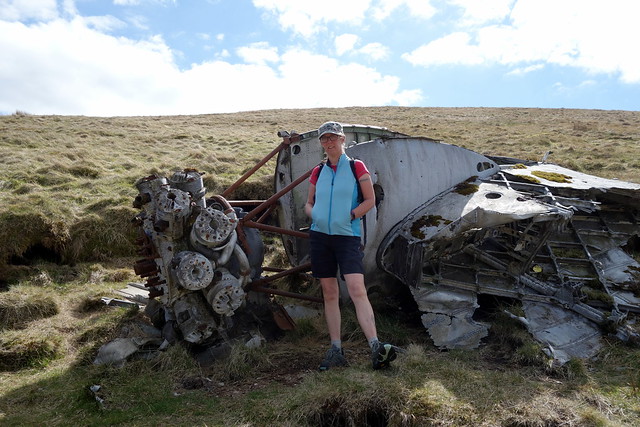
From here it was a bit of a traipse over to Windyrise, then onto Black Law, with a large and strange cairn that incorporates fishing nets, barge poles and a wing mirror. Down again for a walk over to Irish Law - I was hoping that this was going to be a HuMP but no, only 80m ascent. On the way we encountered yet another aircrash, I couldn't recognize the plane at all - turns out this was a civil plane, a BEA Viking that got it wrong on approach to Refrew Airport in 1948 - miraculously the four crew and 16 passengers all escaped, despite the fuselage exploding shortly after the crash.
Black Law from Windyrise
 DSC03468
 by
Al, on Flickr
 DSC03469
 by
Al, on Flickr
 DSC03470
 by
Al, on Flickr
 DSC03472
 by
Al, on Flickr
The Viking crash
 DSC03473
 by
Al, on Flickr
 DSC03475
 by
Al, on Flickr
 DSC03477
 by
Al, on Flickr
 DSC03478
 by
Al, on Flickr
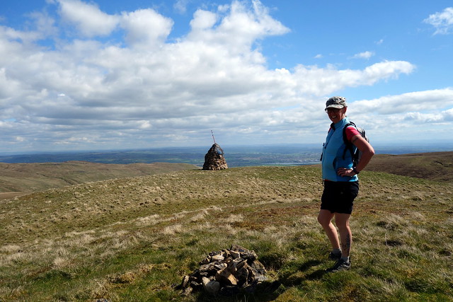
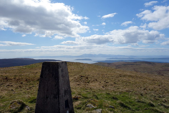
From the trig column on Irish Law we picked a way down the hillside towards the track and returned back to the main road. There's another TuMP across the road, behind the very strange new crematorium that looks more like a ranch style property than a crematorium. We decided to use the wind farm track which added a little distance, but made for an easier ascent. Sheep at the summit.
Crematorium
 DSC03451
 by
Al, on Flickr
 DSC03479
 by
Al, on Flickr
