free to be able to rate and comment on reports (as well as access 1:25000 mapping).
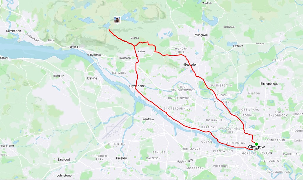
Saturday 30th May: Cochno Hill - 2km, 100m ascent, 1 hour (plus a 23 mile bike ride to get there and back)Finally some relaxation in the lockdown restrictions had come around...conveniently timed with Jackie's fitness increasing back to a reasonable level after a rather nasty bout of Coronavirus in March/April. To be honest, I doubt either of these excursions would have been stretching the restrictions earlier in the year as they barely count as hillwalking and are both pretty local. Indeed I had cycled past the start points for these and other local walks numerous times over the weeks. However it was upsetting enough for Jackie to keep seeing me disappear out on the bike for routes she had no strength to even attempt, so I wasn't going to make her even more jealous by going up some hills as well!
First up was more of a trip to have a picnic in a nice spot than any real effort at walking. We cycled out to Duntocher via Bearsden, finally escaping the busy traffic on Cochno Road (lovely and quiet, and feeling a long way from the city). At the edge of the Cochno estate, we headed up the track by the Loch Humphrey Burn. On our last visit a year ago, we had walked up here, but now Jackie had a bike with slightly wider tyres, it was easy enough to pedal most of the way up to the reservoir. Plenty of people about - the reservoir itself appeared to be a popular place for groups of teenagers to congregate.
 Cycle map
The last section is very scenic with some nice waterfalls. We ditched the bikes at the pumphouse before the final steepening and walked the last minute up to the dam.
 Heading up to Greenside Reservoir
  Track to Greenside Reservoir
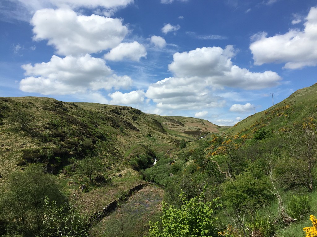
 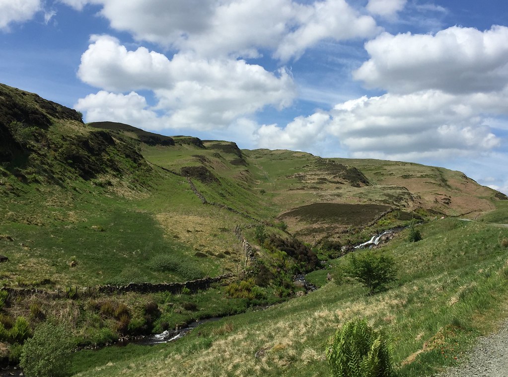 Loch Humphrey Burn
 We had a choice of directions here - around the dam itself there were quite a few groups, but we knew that a couple of minutes up the hill on either side would be much quieter - maybe we'd get some views of the bigger hills too.
 Greenside Reservoir and The Slacks
  Duncolm
 Jackie had no intention of walking any distance as the recent flurry of exercise after 2 months of inactivity had woken some of her old injuries, including her dodgy knee. So we headed towards Cochno Hill for 5 minutes and found a nice place for lunch. It was lovely, with the southern Highlands in view as well as the reservoir and the Campsies.
It isn't difficult to get to good viewpoints in Glasgow - cycle a few miles up into the south side and Arrochar and the Trossachs are easy to spot. Some of it is even visible from Queen's Park much more centrally. So I haven't really been without the hills recently, but this was the first time in weeks I felt I was seeing them from somewhere a bit wilder.
 Cochno Hill
  Duncolm and north to Crianlarach hills
 After lunch we looked at the map and realised we were halfway to Cochno Hill, so I easily persuaded Jackie to go the rest of the way. It didn't take long to reach the summit, from where the view was even better. She was a little concerned about her knee on the descent, wearing only trail shoes and not having brought her walking poles along, but we were fine and back at the bikes before too long.
 Glasgow and Tinto on the horizon
 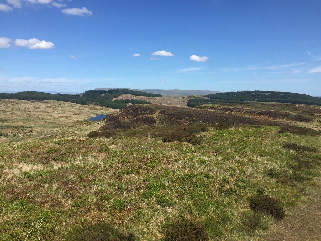 Jaw Reservoir and the Campsies
  Looking back to The Slacks
  Ben Lomond to Ben Ledi
 We passed many more groups on the way back down to Duntocher - there was probably a party or two up at the reservoir later on in the evening. Just to make a circuit, we went back through Clydebank.
_____________________________________________
Sunday 7th June: Meikle Bin - 3km, 290m ascent, 1 hour, 40 minutes (plus a 37 mile ride to get there and back)One week on, and Jackie was keen to push herself a bit more. She had joked about cycling up the Crow Road a couple of weeks earlier (when a 50m ascent would have finished her off), but things had moved on a bit since then, and it turned out she was actually ready to give it a go.
 Cycle map
We headed north through Springburn and Bishopbriggs before leaving the city behind and getting to Lennoxtown. From there, the Crow Road is a pretty signicant pass - 250m of fairly well graded ascent across the middle of the Campsies. After the initial steep section out of Lennoxtown, it went extremely well. I had been over a couple of times already during lockdown and back then, the viewpoint carpark 2/3 of the way up had been closed, blocked off by piles of gravel. Today it was open and busy, and we almost hit a cycling traffic jam!
 Kilpatrick Hills from the Campsie Glen viewpoint
  Catching up on a traffic jam on the Crow Road (or more likely being overtaken!)
 While the more normal route to Meikle Bin starts at the eastern end of the Carron Valley Reservoir, we were intending to take a shortcut through from the Crow Road, saving quite a few miles on the bike. Turning off at the high point on the road to join a forestry track was probably a false economy (as there was more up and down and it was pretty rough), but it was quieter at least.
 Forestry track to Meikle Bin
 Turning off the main track onto a smaller one, we dumped the bikes in a clearing at the end and headed for Meikle Bin. Although Jackie was in trail shoes again, she had brought her poles this time - probably for the best as our first move was a steep descent down a fire break and an even steeper river bank before crossing the Bin Burn. When I had originally thought of this route a year earlier I had imagined it untrodden, but having seen how much traffic the local hills get, I was now unsurprised to find a faint trodden route.
 Bin Burn
  River crossings are a thing again!
  Holehead
 We followed an old fence up along the edge of another plantation before emerging on the usual Meikle Bin route just as it steepens to the summit. This was great, and felt like being on a proper hill. Quite a few people about, but it was nowhere near as busy as we expected. On my last visit the weather had been a bit iffy, so I had only got a faint impression of how good the views were from here, but today they were excellent - particularly NW towards the Crianlarach hills, Ben Lomond and Arrochar. However we could also see right up to the edge of the Angus Hills, down to Galloway and out to Ailsa Craig and Arran. Not bad at all!
 Carron Reservoir and the Ochils
  Ben Lomond to Ben More
  Carron Valley
  Cruach Ardrain to Ben Vorlich
 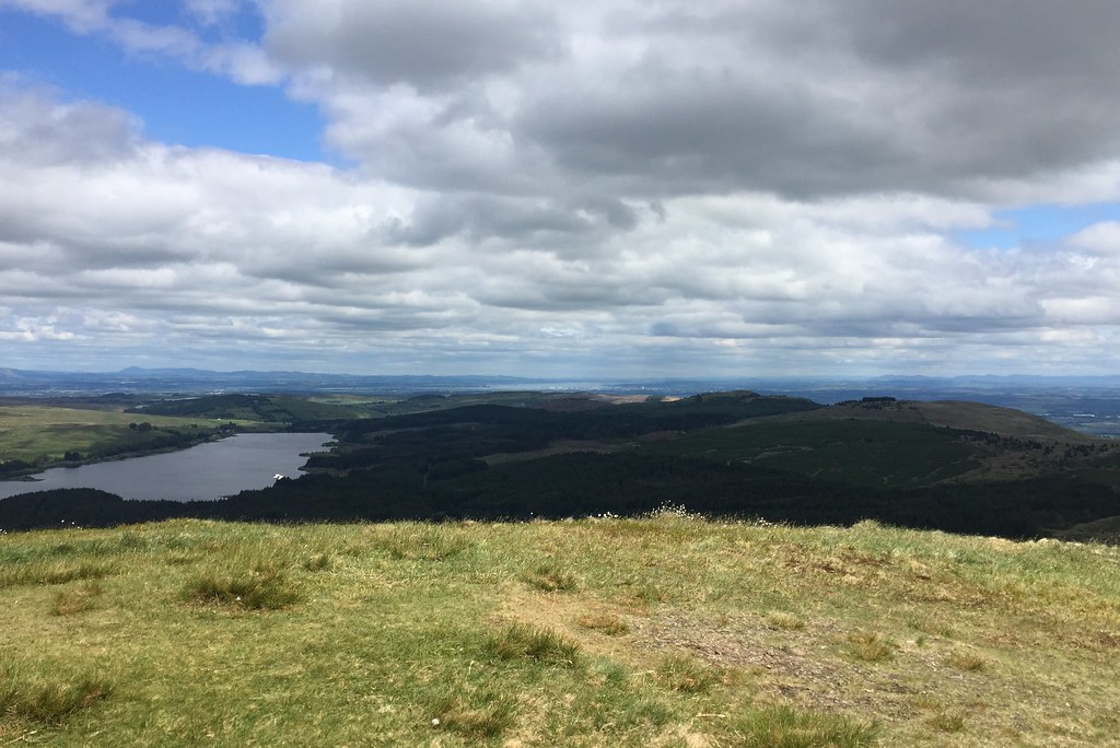 Firth of Forth
 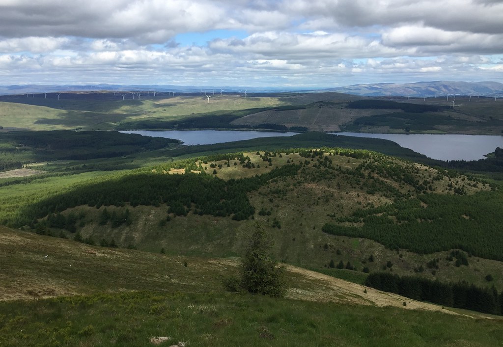 Perthshire and Ochils
 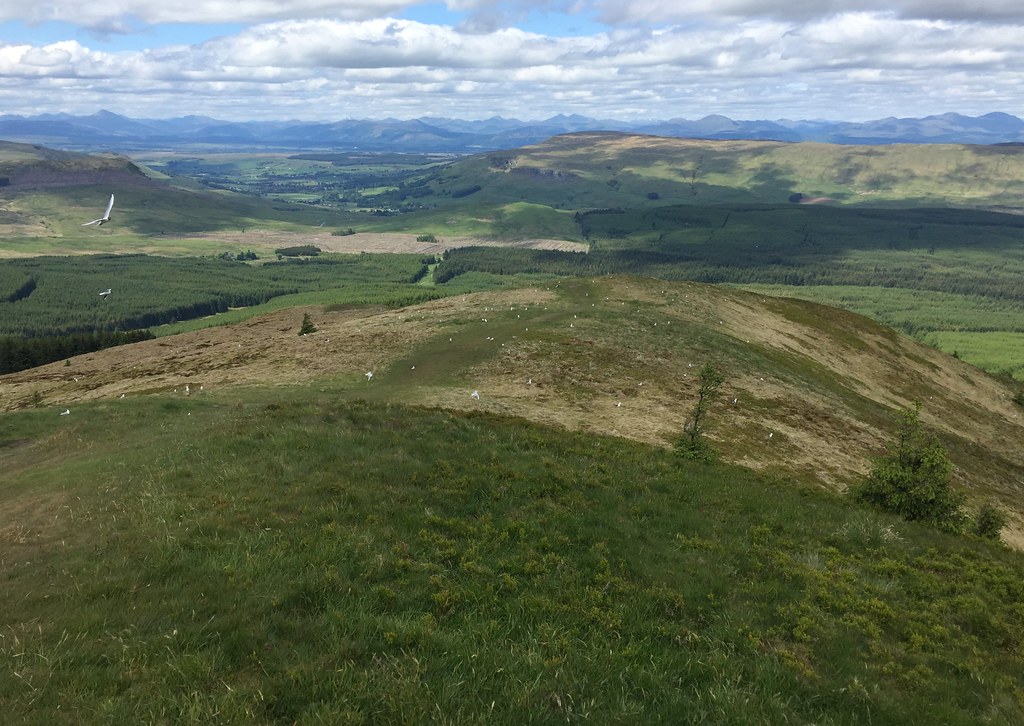 Stronend with Highlands behind
 I had considered a circuit over Lecket Hill, but Jackie didn't want to push things too much so preferred a retrace of steps for once. Nice and straightforward descent back to the bikes.
 Bit of plane wreckage
  Lecket Hill
  Heading through the woods
  Ride home
 We decided that even though we would have to climb back up a bit of the Crow Road, it would be easier to descend to Waterhead Farm than follow the long arm of the forestry track back.
 Near Waterhead farm
 After a fun descent of the Crow Road, we were back in Lennoxtown, where Jackie was easily persuaded to add a bit more cycling to the day. So we picked up the cycle path to Strathblane and climbed up the short but brutal road to Mugdock Park. An ice cream in Milngavie rounded off a pretty great day.
 Cort-ma Law from Strathblane
  Dunglass - contains some cool basalt columns
  Dumgoyne from Mugdock
Hopefully some more of this sort of thing to follow - I think there is more than sufficient interest remaining in the local hills to keep us occupied until travel restrictions ease a bit further (at which point we hope to head up to my place in Inverness).
