free to be able to rate and comment on reports (as well as access 1:25000 mapping).
With the easing of lockdown restrictions in late May I was keen to venture on to my local(ish) Marilyn of Blaeloch Hill while waiting for further relaxations in the travel guidance. I’d tackled this hill three times already over the years and the plan had been to try out various different approach routes and get a different perspective on the hill. My aim was to remain within the “broadly 5 miles” guidance for my starting point, although I must admit this might have been pushed on a few occasions.
The plan was to be driven to my chosen starting points by MrsR and then make my way over the hill and then back home. Each walk would be committing me to some long hard miles, with a mixture of access tracks, ATV tracks, open hillside and tarmac. All in all four separate and quite different routes unfolded. Each a pleasure in their own right and worthy of some sort of repeat when the mood might take me.
30 May 2020 – Blaeloch from the Community Wind FarmFor the first trip I chose as a starting point the entrance to the Dalry Community Wind Farm. This is on the single track Moor Road between Dalry and Hunterston. This would be a reasonably easy walk, utilising access tracks through the wind farm and then tarmac for the long walk home once the hill was climbed. It was a scorching day though, so I might just have had a bit too much sun by the time I wearily arrived back home......
 P1150095
 by
Pete Riedel, on Flickr
Start of the walk P1150098
 by
Pete Riedel, on Flickr
One of the locals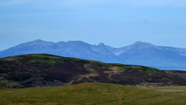 P1150121
 by
Pete Riedel, on Flickr
Early view of Arran P1150143
 by
Pete Riedel, on Flickr
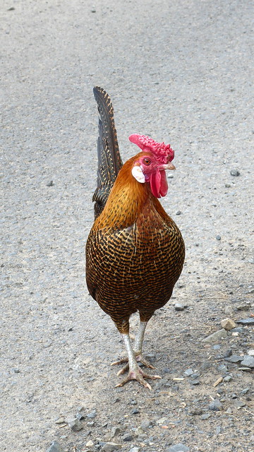
Met this little one on the way up the access trackThe walk through the Community Wind Farm was on a substantial access track. A few inquisitive cows had to be dealt with first, but thankfully no Bull was in the field. Once free of farm animals it was just a steady walk to the final wind turbine on Kebbuck Law. Working up a good sweat in the morning sunshine. From the turbine I was able to hop over the barbed wire fence and pick up a boggy ATV track that brought me to the northerly of two Kelburn Wind Farm turbines on Langside Hill. From here it was easy walking to the wind farm building with the point 409 cairn visible on the hillside just above. Easy walking on the hill to the summit proper above the Blae Loch.
 P1150147
 by
Pete Riedel, on Flickr
Not the most photogenic countryside unfortunately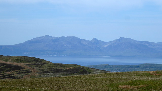 P1150152
 by
Pete Riedel, on Flickr
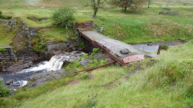
But views like this make it worth the effortFourth time on the hill and this was the first time I’d actually seen the plane wreckage en route the hill. Stopped there for a short while to take a look.
 P1150167
 by
Pete Riedel, on Flickr
 P1150168
 by
Pete Riedel, on Flickr
 P1150173
 by
Pete Riedel, on Flickr
Summit "cairn" P1150185
 by
Pete Riedel, on Flickr
Blae LochOn a clear day, such as I was having, Blaeloch Hill is a great viewpoint across the Firth of Clyde to Arran, as well as the surrounding area. The stellar views though can be had from Kaim Hill. It might be lower than Blaeloch, but really is the highlight of the area and certainly more popular, as I met more people on that hill than Blaeloch. So, from Blaeloch I made my down the track that leads into Fairlie Glen to skirt past Lairdside Hill, from where I made a bit of a meal of slogging up the side of Kaim. It was shorts weather, but wading through the heather made a good job of leaving plenty of scratches on my shins. It was quite a relief to find myself on the other side of that and picking up a path to the summit trig on Kaim Hill.
 P1150190
 by
Pete Riedel, on Flickr
Superb view of Arran en route to Kaim Hill P1150206
 by
Pete Riedel, on Flickr
Bit of a slog up on the Kaim P1150219
 by
Pete Riedel, on Flickr
View back to where I had come P1150222
 by
Pete Riedel, on Flickr
A more impressive summit furnature P1150227
 by
Pete Riedel, on Flickr
And views to ArranSpent a while on Kaim, although better views seemed to be available slightly away from the summit at point 380. Sat here just enjoying the views across Hunterston to Arran, big and little Cumbrae, Largs, Cowal and a hazy Paps of Jura. Ok, so Blaeloch Hill might not be a sexy, honeypot destination, but I think it and it’s little brother or sister pack a fair punch with the views they deliver.
 P1150237
 by
Pete Riedel, on Flickr
 P1150241
 by
Pete Riedel, on Flickr
Old boots P1150243
 by
Pete Riedel, on Flickr
Arran......again P1150250
 by
Pete Riedel, on Flickr
Set off sort of this way to descend off the hillMy descent to the Moor Road was a vague affair just dropping down off Kaim Hill and seeing where I went, but I think I eventually arrived somewhere around Knockendon Bridge. I then started the loooooong, sweaty walk to Dalry.
 P1150267
 by
Pete Riedel, on Flickr
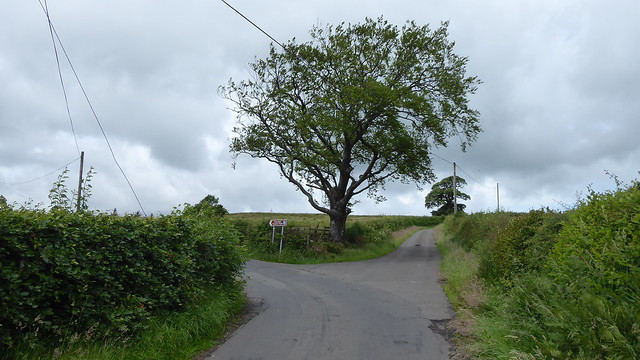
I do like a nice treeWasn’t too bad really, but it was some relief to finally arrive in the town. I had a few options for the final 4 or 5 miles back home, but in the end opted for the straightforward and more direct route alongside the A737. Not the most interesting end to the day, but by now my feet were sore and my legs were aching and I was just to get home.
7 June – A Farlie enjoyable return to BlaelochOk, so I was pushing the “broadly 5 miles” guidance here, but descending off Blaeloch the weekend before had led me on to the path heading down into Fairlie Glen . Of course, this got me thinking......and so it was that concocted a plan to have MrsR drop off in Fairlie early on Sunday morning. Beyond the main road that runs through it I don’t really know Fairlie, so ended up being dropped off at the train station. From there I was able to follow a path to the starting point for the glen. And a very pleasant walk it was up the glen, past the ruin of Farlie Castle. A nice walk through the trees and although height was being gained it didn’t feel particularly arduous doing so.
 P1150297
 by
Pete Riedel, on Flickr
Early bit of wildlife P1150300
 by
Pete Riedel, on Flickr
Castle ruin P1150303
 by
Pete Riedel, on Flickr
 P1150305
 by
Pete Riedel, on Flickr
Out above the tree line and I followed the path as it continued to gain height. I knew it went all the way up to Blaeloch Hill (I’d come down in part way the weekend before), but I was hoping there might be a path up on to Kaim Hill. Well, there was definitely a sign suggesting this to be the case, but ended up just heading up Lairdside Hill, from where I took a fairly direct dogs breakfast rout up on to Kaim Hill.
 P1150308
 by
Pete Riedel, on Flickr
 P1150321
 by
Pete Riedel, on Flickr
Another chance to enjoy the views from there again before dropping off the hill and making my way up on to Blaeloch. Again, as with the previous weekend, I was headed for the cairn at point 400 before the short walk past the plane wreckage to the summit proper. Got recognised on the summit........my lockdown locks that I’d posted on social media from the previous weekend had been remembered.....
 P1150355
 by
Pete Riedel, on Flickr
Oh look, Arran.......again P1150372
 by
Pete Riedel, on Flickr
LargsNice to have a chat will a fellow hillwalker on the summit, before we parted ways. My initial route off was the reverse of my route up the previous weekend. Walked to the wind turbine on Langside hill, picking up the boggy ATV track to the turbine on Kebbuck Law. I varied things from here, following the access track over Cockrobin Hill and Baidland Hill. Hoped over the fence and picked up the track from the communications mast that brought me out close to Baidlandhill Farm. I was keen to avoid walking through the farm itself, given sensitivities that might still exist in rural communities. So instead I hoped over a gate, and skirted a field to another gate and then on to the minor road.
 P1150398
 by
Pete Riedel, on Flickr
Well......it is a windfarm P1150456
 by
Pete Riedel, on Flickr
Another long walk back to Dalry, before varying the route home.
 P1150461
 by
Pete Riedel, on Flickr
Not sure it gets much use, by the looks of the grass growing through itThis time I chose the B714 passing Lynn Glen, which seemed to be heaving with locals. I’d walked the B714 a few times during lockdown and it’s a busy road, so there was plenty of stopping to dive into the hedge to avoid oncoming traffic. Eventually arrived at the minor road at Tower that heads toward Dalgarven Mill on the main A737. Avoided that road by taking another minor road to a local viaduct and then home.
 P1150467
 by
Pete Riedel, on Flickr
It would be all change for the next outing..........
14 June – time to raise the StakesI was definitely pushing the “broadly 5 miles” guidance by now.
I’d originally been looking at the map to see what other routes I might find for Blaeloch Hill. But I got a bit sidetracked. I started following the course of the Garnock on the map to see where its source might be. Turns out it’s close to the summit of the Hill of Stake. Which got me thinking. Was there a chance I could combine the bog infested cesspit of Hill of Stake with Blaeloch Hill in a single trip?
Turns out there was........well, a couple actually.
I chose to plot a route from the end of the minor road at Muirfauldhouse farm outside Lochwinnoch. Was worth it just to see MrsR have to drive up it........ Once dropped off I followed the rough track on to Mistylaw Muir and eventually up on to Misty Law itself.
 P1150469
 by
Pete Riedel, on Flickr
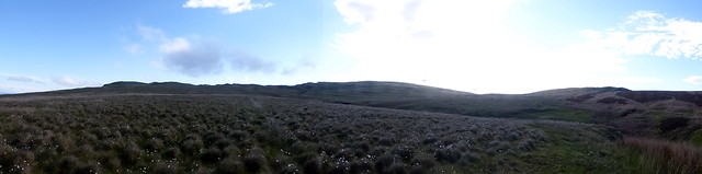
Start of the walkI’d hoped for a bit of blue sky, but was greeted by clag. Felt a bit of a wally kitted up in shorts and sunglasses. Despite being close to human habitation, and possibly amplified by the mist, there is a real feeling of remoteness here. Kind of got me thinking about all those long drives I’ve had over the years so I could walk in remote areas and here was one not a million miles away from where I lived.
The initial track, once I could locate it, was pretty good, although there were quite a few waterlogged sections that required a bypass. Plenty cottongrass to admire, even in the clag. Other than that there wasn’t really much to see, as I walked the track to its end at the fott of Misty Law. I’d thought there wouldn’t be a path up the hill, but pleasingly there was........let’s face it, it wasn’t the most arduous climb.......sadly it was still misty, so it was a case of head down and carry on.
 P1150483
 by
Pete Riedel, on Flickr
Pretty much the views I was to enjoy for a chunk of the walk P1150484
 by
Pete Riedel, on Flickr
Smashed up gate P1150488
 by
Pete Riedel, on Flickr
Misty Law in the gloomGiven the conditions there wasn’t a great deal to see as I traipsed from Misty Law and Totterie Law across to East Girt Hill. From there it was a short climb to the summit of the Hill of Stake, where the cairn and trig pillar appeared suddenly out of the gloom. My original visit to this hill had been via the Brisbane Glen approach. What a bog-fest that was. I’d vowed never to return. Yet here I was......and I’d be back again within the week!!!!!
 P1150499
 by
Pete Riedel, on Flickr
Somewhere en route to Hill of Stake P1150511
 by
Pete Riedel, on Flickr
Summit trigSadly the clag still remained stubborn and refused to lift all the while I waited at the summit. With no suggestion it might clear I decided to head off. My initial route would see me following the fence line to Slaty Law, from where I’d have a choice to make. The choices were to continue to the main road over Irish Law and the Knockside Hills or more gentle option over Box Law and the track I could see marked on the map.
 P1150523
 by
Pete Riedel, on Flickr
Events were to dictate my decision. Heading off Hill of Stake and over West Girt Hill I managed to tweak my right knee. Don’t know what I did. I didn’t stumble, didn’t twist awkwardly, didn’t plonk my foot down heavily. I was just walking over the boggy ground when I felt something go “twang”. An immediate burst of pain followed and had me a little worried that I might be in trouble. Hobbled slowly for a while trying to assess how bad my situation might be. Thankfully I was mainly ok, with just the odd burst of pain here and there as I caught the nerve in just the right place........ It certainly wasn’t debilitating though, but for 20 or 30 minutes I was treading carefully and in typical blokey style........hoping it went away.
Then, things took a further turn for the worse.
The ground was pretty boggy in places and as I was almost off Box Law one particular step in the boggy ground was followed by a concerning “flappy” sound immediately afterwards. Didn’t take a genius to discover the sole of my left boot had come away from the leather.
Bugger.......I thought
I was then treading very carefully for the final few hundred yards to the track, before taking a few moments to effect a rudimentary repair to the boot which would enable me to continue. To be fair these were old boots that I was simply eeking out as much use of as I could. I just hadn’t expected the sole to come away like it did.......nor quite so far from home either.
P1150523 by
Pete Riedel, on Flickr
Arrived at the main road at Blairpark and despite my tweaked knee and precarious boot situation decided to continue with my planned route over Blaeloch. This was the “dog walkers” route from the Kelburm Wind Farm entrance. A few cars were parked up, but the place was not overrun. There’s not much to say about this approach up to the summit. Aesthetically not the most pleasing, but at least it was quick. Cloud was still hanging about, obscuring views from the summit. I had initially planned a repeat of Kaim hill, but knee, boot and cloud decided me against the additional effort. Instead I decided to make straight for Dalry. For ease I chose to repeat the route to Langside Hill and then across to the Kebbuck Law and the standard route to the Moor Road via the Community Wind Farm that had been my ascent route two weekends before.
 P1150551
 by
Pete Riedel, on Flickr
Not the most exciting route up Blaeloch from this direction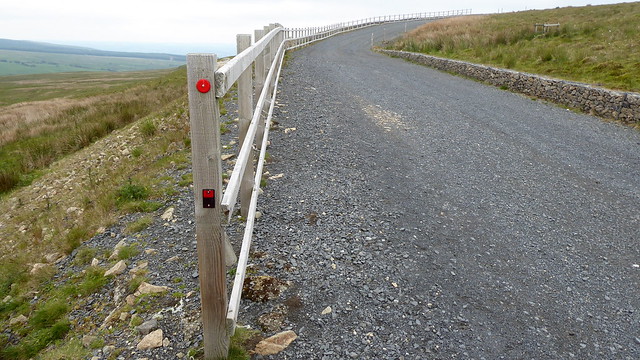 P1150565
 by
Pete Riedel, on Flickr
 P1150568
 by
Pete Riedel, on Flickr
Looking back toward the way I had come earlier in the day P1150579
 by
Pete Riedel, on Flickr
A different perspective on the Arran view P1150595
 by
Pete Riedel, on Flickr
Not on your nelly puff would I be hanging up there P1150598
 by
Pete Riedel, on Flickr
It was definitely warming up nicely by this pointBy now the sun had won the day and it was getting fair warm. By the time I’d arrived back at the road I was texting MrsR, suggesting she might like to pick me up from Dalry.......thankfully she agreed.
 P1150614
 by
Pete Riedel, on Flickr
Who's the Daddy? P1150619
 by
Pete Riedel, on Flickr
Despite the incidents with the knee and boots this was a thoroughly enjoyable wander. By the time I arrived in Dalry I had clocked up 20 miles in total. This is definitely a route, with a few changes here and there, that I will look to repeat in the future on one of those days where travel further afield just doesn’t appeal.
21 June – a return to the Hill of (mis)StakeGiven it really is a bog infested cesspit I must be a glutton for punishment.
The knee wasn’t perfect, but I decided it would survive another walk of a decent length. I now had my proper boots, with the old pair consigned to the bin. I did, however, have a blister on my left ankle.......and oh, what a blister it was. One of those “If M&S did blisters......” sort of blisters. Following the demise of my old boots I had decided it would be a good idea to order some trail shoes, which duly did – 2 pairs no less. On arrival on the Friday I had been so excited I chose to wear one of the pairs on a walk to meet my wife after her work....... Cue start of blister. Then on the Saturday I thought......let’s give it another go. So I did.........cue a bigger blister.....now about the size of a 50 pence piece.
So, on the Sunday, with a fair bit of padding on my heal I was dropped off by MrsR on another minor road outside Lochwinnoch that would see me walking the 3 miles or so to the Muirshiel Country Park (as suspected most of the parking was closed off). From there I would follow the good track to the old Barytes mine.
 P1150621
 by
Pete Riedel, on Flickr
And so it began P1150626
 by
Pete Riedel, on Flickr
Nice views on the initial walk in P1150635
 by
Pete Riedel, on Flickr
 P1150637
 by
Pete Riedel, on Flickr
Old bridge over the River Calder P1150639
 by
Pete Riedel, on Flickr
New bridge over the River Calder P1150641
 by
Pete Riedel, on Flickr
On my way to the old mine works P1150643
 by
Pete Riedel, on Flickr
I was getting a soaking by nowDespite the Met Office suggesting the weather would improve, it was chucking it down. For some strange reason I had retained the shorts, although the sunglasses had been exchanged for a waterproof jacket. And I certainly needed it, as I was getting drenched by the time I arrived at the former mine works. Can’t tell you how pleasantly surprised I was to discover a shelter there......well and old container, decked out with a table and chairs. I was able to hide away while the worst of the rain passed over and let my shorts dry out as well. Wasted a bit of time though, as the rain lashed down, rattling off the container roof.
 P1150650
 by
Pete Riedel, on Flickr
A father and his two sons passed by around the time I was thinking the worst of the weather might be over. They were also aiming for the Hill of Stake. I’d suggested, to their amusement, that the sun would make an appearance. There was then a period of socially distanced walking together toward the summit.......that we couldn’t see. Eventually I pushed on ahead of them, but as with the weekend before there were to be no summit views. Thankfully it had stopped raining though.
 P1150654
 by
Pete Riedel, on Flickr
A nice little waterfall as I headed up past the mine shafts P1150661
 by
Pete Riedel, on Flickr
Not much to see once out on the open hillside P1150673
 by
Pete Riedel, on Flickr
A soggy Hill of Stake summitMy three socially distanced companions arrived eventually. They were returning the way we had all come, but I was planning a reverse over Misty Law and then back to Lochwinnoch via Muirfauldhouse Farm.
The sun eventually appeared as I was approaching Totterie Law. That made for an enjoyable walk back over Misty Law and then on to the Farm. The only downside was the blister......it was starting to hurt quite a bit by this point and I knew it wouldn’t be a pretty sight once the boot and sock were removed.
 P1150691
 by
Pete Riedel, on Flickr
A view of what I'd missed the previous weekend P1150697
 by
Pete Riedel, on Flickr
The backend of Misty Law P1150698
 by
Pete Riedel, on Flickr
Starting down the waterlogged track back to the minor road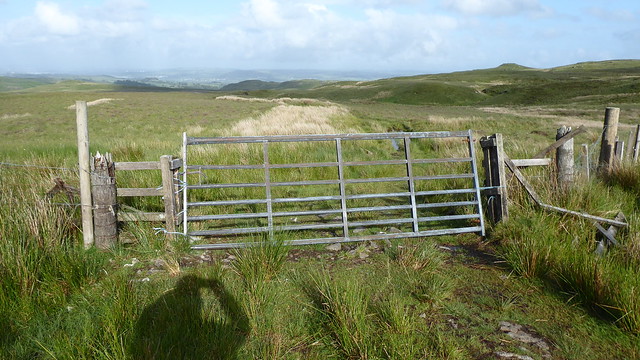 P1150701
 by
Pete Riedel, on Flickr
The beat up gate from the previous weekend had been replaced already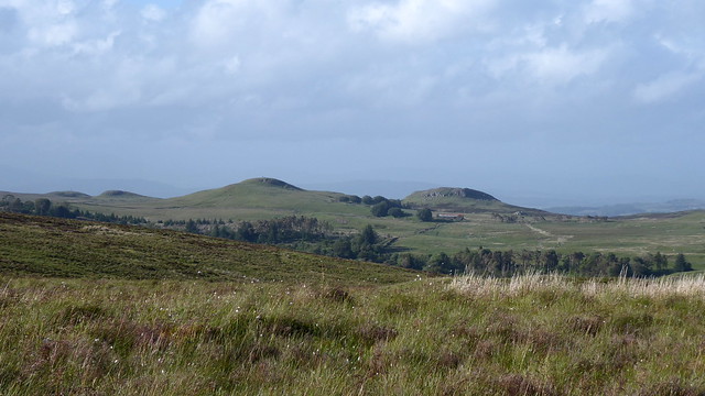 P1150703
 by
Pete Riedel, on Flickr
Nice views that suggest I will be returning again sometime P1150717
 by
Pete Riedel, on Flickr
I gladly obligedThere were a few text messages with MrsR as I was walking back off Misty Law to arrange a pick up from Lochwinnoch Golf Course. Despite some slight communication issues we both arrived around about the same time.
 P1150719
 by
Pete Riedel, on Flickr
Smelt amazing as I walked pastRemoval of the boot and sock did indeed reveal a blistery mess, with skin removed and a new blister seemingly developing in the original blister itself. Thankfully the weather in the last weekend of the month was pish, so any thoughts of a final Stake/Blaeloch walk ahead of the further easing of travel restrictions were binned to allow the wound left by the blister to heal.
Blister aside, this was another enjoyable route and another I would like to repeat, perhaps with a bit of variation. An explore around the Barytes mine would be interesting too, as it was far too wet when I was there.
So that ended the phase 1 lockdown walking. With phase 2 restrictions allowing travel further afield I can hopefully look forward to ticking off some other hills, while remaining sensitive to local communities.
