free to be able to rate and comment on reports (as well as access 1:25000 mapping).
Freedom, in the lifting of the “5-mile limit for leisure or recreation” guideline, had come a few days before, but typically, the weather since then had been rather grotty. But Monday’s forecast was fine and dry, and I deemed it suitable for a first proper outing. Where to go, what to do? I wanted to ease back in gently, both in the walking and in the driving sense. I quickly dismissed heading north, as I was unsure what the roads would be like, whether car parks would be open, how busy the hills within striking distance would be, and so on. Go south, then, and it doesn’t even necessarily need to be a hill.
My gaze fell on the WH description(s) of the River Ayr LDP. I’d looked at this route before, intrigued by the idea of following a river from its source to the sea, its length easily doable in one go with an overnight stay or two. I thought it might be something that Alison would be interested in doing over a weekend, and in fact, it’s quite possible that she’s even mentioned it before, explaining why it was in the forefront of my brain.
There’s no public transportation from its beginning at Glenbuck, to Muirkirk, a distance of about 6km. I could easily walk that, and back again, and be in a better position to secure transportation from Ayr to Muirkirk. I then saw a nice circular route for Cairn Table, an obscure-except-for-locals sub2k with a start point directly from the River Ayr route. Thus was hatched a plan, both knocking off the unserved-by-buses section of the LDP, and adding in a wee hill for a bit of excitement/ascent.
I left early (pre-5am), after waking up even earlier, and not being able to get back to sleep. I was actually quite stressed about the whole venture. Being house-bound for nearly 4 months, except for the occasional trip to the grocery store, has taken a toll, and it would have been far easier to take my long early-morning local walk, followed on by the rest of my daily routine – a bit of French study, some stretching/yoga, some reading, some sewing perhaps, maybe a movie or a bit of gardening. “The longer you put it off, the harder it’s going to get,” I told myself. “Get yer lazy arse outta bed!” And so I did.
The drive, down the M74 to Jcn 11, was fine. The car initially sounded quite rough, but those noises seemed to sort themselves when taken up to speed. I worried that I should probably have checked the air in the tyres—and yes, I should have—but that was fine, too, and I arrived at the start point, near Glenbuck Loch, and set off walking at 6am. The first order of business was to wander up the road (the gate was closed when I arrived) to the historic village of Glenbuck, for a wee nosy. It’s a lovely green and peaceful spot at present, and it’s quite hard to imagine an entire village, and mine works there, and how it would have been very different in the day.
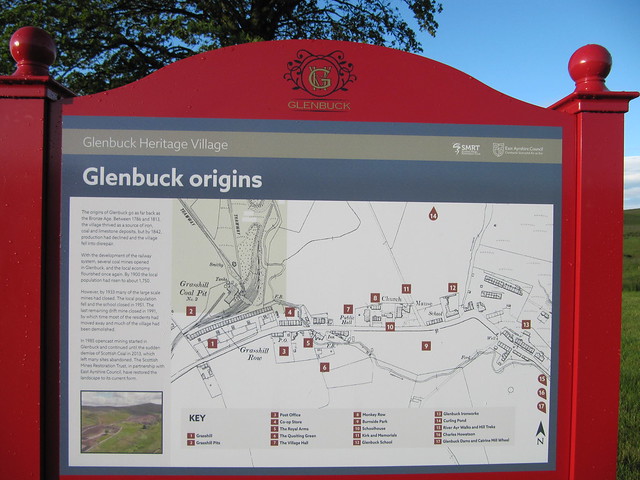
one of the signboards explaining the history of Glenbuck

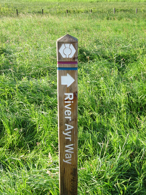
the official start point, just above the loch:


...where there are a LOT of rules!
these are my markers (subtle!)
There’s not much to say about the first few kms of the River Ayr walk; it’s along the old railway track, flat and just next to the A70, which is loud with lorry noise. The path was overgrown in places, and very wet; my boots were sloshing before I’d finished the first km—I gave into that, and concentrated on trying to keep my trousers dry instead. Gaiters would have made a good add-on.

the baby River Ayr
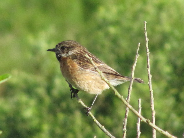
practicing bird photography

approaching Muirkirk
I reached the walkers’ car park in Kames in an hour and a bit. I started up Cairn Table doing the WH route in reverse, thinking that doing the pathless section first would give me an easier descent. (ha) The ascent was fairly wet and muddy, but nothing like the descent! I should have read some of the walk reports more closely. But I’m getting ahead of myself.
With a bit of imagination, the west side of the hill could be in the Cairngorms—a lot of heather, and the odd small conifer, seeds perhaps carried from the forest that graces the east side of the hill.
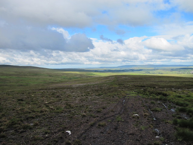
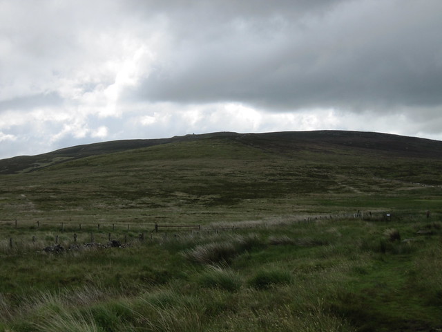
looking back, toward the coast
I followed a very faint atv track, until I merged with the tourist motorway ~½km from the top. At this point, I was strongly reminded of the ascent of Tinto, and to a somewhat lesser extent, The Cheviot.
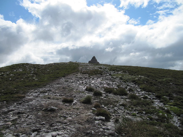
approaching the summit

the well-built cairn
The summit is, as advertised, rather cluttered, with an enormous cairn, an enormous other pile of stones, a normal-sized trig point, and a smallish viewfinder. I’d only been there for about two minutes when I was joined by another walker, the first person I’d seen thus far. He immediately and bizarrely commenced regaling me with his life history, which included myriad medical mysteries and miracles, liberally laced with conspiracy theories.


All I’d done was say hello…
If I’d felt a little more adventurous, and if it had been a little warmer, I may have headed back toward Glenbuck staying high rather than descending to repeat the trudge along the River Ayr path. But it was cold and blowy, and the odd encounter left me uneasy; I didn’t want to stick around long enough to have a good look at the map.
The descent was oh so wet. There ARE the odd duck boards scattered about, but more often than not, they were surrounded by water and mud that you had to go through just to gain one or two easier steps. Much easier to try and avoid them altogether, leading to an ever widening and ever muddier track (of sorts). One or two of the boards were even fully submerged. (I thought I'd taken some pictures of the worst/best of them, but it appears not.) I’ve said it before, but there is a certain carefree-ness (carefree-dom?) that comes with having boots that are already filled with water. That said, I was looking forward to the dry socks and shoes that waited in the car.
looking back up
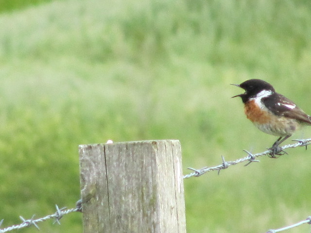
more practice -- hey look, he/she's singing!

another local

nearly there...
If there wasn’t much to say about the first few kms the first time, there’s even less to say about the repeat of them. The weather was pleasant enough—high cloud, and cool and breezy enough to keep the wee beasties at bay. It was only 12:30 when I returned to the car, and only an hour’s drive home. Not a particularly long day, but nonetheless, it had been an early start and I was shattered. It wasn’t a great day, but it was a good one.
