free to be able to rate and comment on reports (as well as access 1:25000 mapping).
Firstly, apologies for the rather erratic nature of the above gpx track - especially for the first half of the walk. Not sure what was going on there but my Garmin was obviously struggling pinpointing my location.
So, Day 5 of the John Muir Way. The forecast for Friday was for hot sunshine wall-to-wall, so I drove to Linlithgow Bridge, parked up and then walked into Linlithgow itself via the Palace to catch the train back to Falkirk and the start of the walk. From Falkirk High station it's just a matter of finding tree-lined Kemper Avenue and looking out for the JMW waymarkers that lead you to Callendar House.
 Callendar House
The house itself was shut, but there were plenty of people out and about enjoying the grounds. The promised sunshine was proving elusive, occasionally popping out but mostly staying behind a thick bank of clouds. Equally elusive was the path out of the grounds and towards the Union Canal. The basic idea is to walk around Callendar House and climb through the woods behind it, but it is not well signposted and I found myself doubling back a few times before I reached the exit at Woodend Farm.
 Callendar Wood
 Exit from Callendar Wood
Follow the exit from the wood until you reach a main road. Cross the road to reach the pavement and head right for a few hundred metres until you reach a track off to the left that heads into some woodland. Looking at the map I assumed I'd be crossing over the railway line, but actually you go under it, sharing the tunnel with a small stream. The narrow walkway is carefully angled towards the water at an angle just enough to make you feel uncomfortable...
 Tunnel under the railway line
Shortly after negotiating this the path climbs up and joins the Union Canal - about an hour after leaving Falkirk High. I guess the advantages of doing it this way rather than just sticking with the canal towpath all the way from the station are 1. you get to see some nice parkland, woodland and the impressive Callendar House and 2. you avoid the rather spooky looking canal tunnel that runs for about half a kilometre under Falkirk at this point.
 Looking back along Union Canal
 The way ahead
There now follows roughly 10km of walking along a narrow towpath, hemmed in for the most part on both sides by rampant vegetation - often so high that you couldn't see the canal itself. There are some urban stretches and some rural bits, but it mostly all looks the same and is very busy with cyclists, most of whom seem totally unaware that the path is barely four feet wide with no escape on either side and just whizz past as best they can without even considering slowing down and being a bit careful.
There are no locks, jetties, benches or anywhere else to stop and have a rest for a few minutes, so all in all I found this stretch the least enjoyable so far of the whole JMW. But on the plus side, this was also the first stretch of canal I'd actually seen any boats travelling.
 Barges on the Union Canal
Very occasionally the vegetation opens up allowing you to see where you are - such as here around Polmont that offered views of belching gas over Grangemouth with the Ochil Hills in the background.
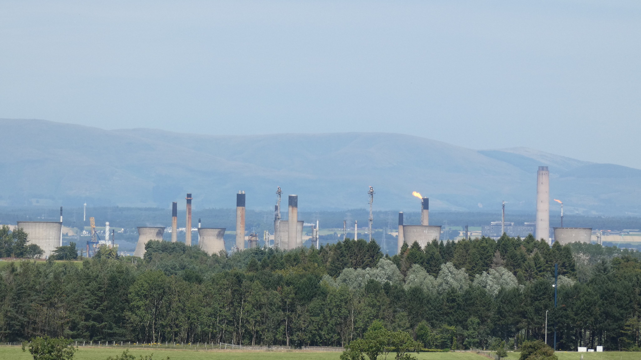 Grangemouth
The undoubted star of this section of canal walk comes right at the end, where you cross the River Avon on the Avon Aqueduct. The path is narrow and cobbled, and again the cyclists ignore the signs and just cycle along their merry way ringing their bells and squeezing past rather than getting off and walking as instructed. Anyway...it's a spectacular structure and gives decent views of the river below.
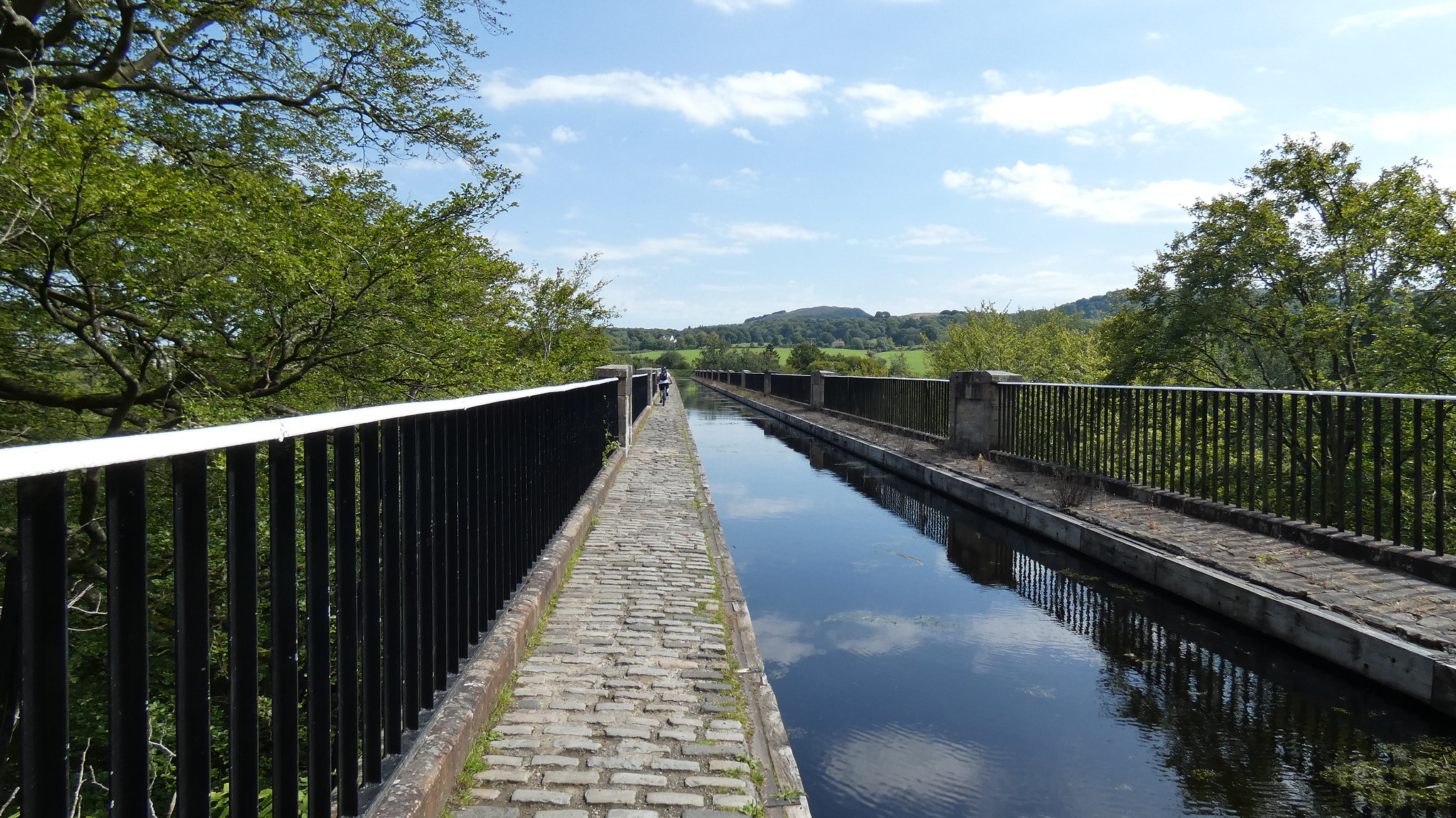 Crossing Avon Aqueduct
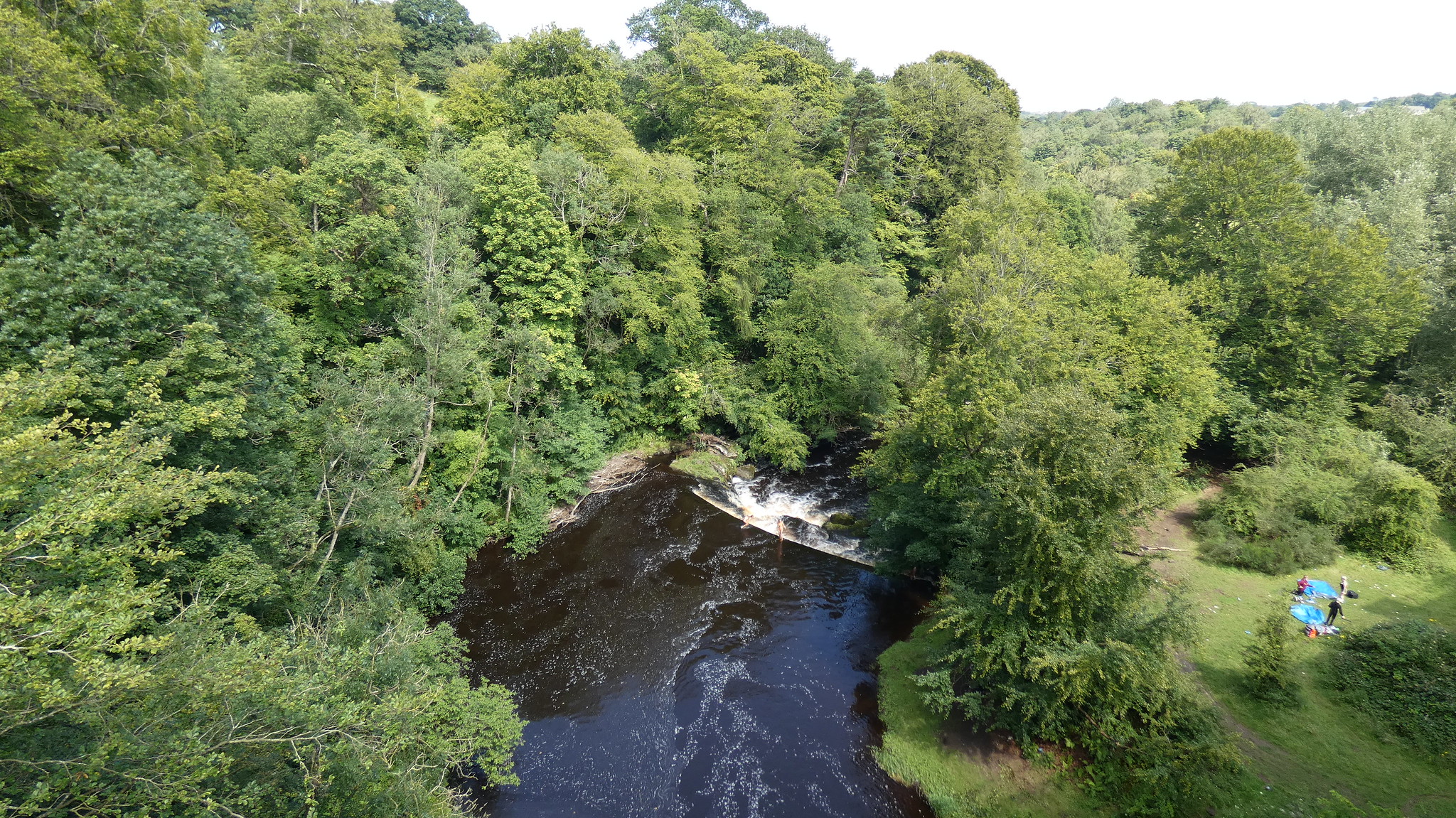 River Avon from the aqueduct
Shortly after crossing the aqueduct, the first bench - or indeed the first anything worth sitting on - appears. Ironically it also marks the point where you leave the canal...almost for the last time on the JMW. Looking ahead, the route does rejoin the canal in Edinburgh for a brief period, but to be honest I'll not be sad to see the back of it. Anyway, I took advantage of the bench to stop and have a spot of lunch before leaving the canal behind and descending towards the River Avon and the final stretch of this leg of the John Muir Way.
 The point where the route leaves the canal
The path down to the River Avon is initially a set of steep steps, and gradually descends through some pleasant woodland on a well-made path to reach the bottom of the valley.
 The path down to the River Avon
 River Avon
The path gets gradually busier as you approach Linlithgow, with lots of teens out enjoying the sun especially. The Avon Viaduct, which carries the main Glasgow to Edinburgh rail line over the River Avon, is a spectacular sight towards the end of the walk. There must be thousands of people who cross this every day without realising what an amazing structure it is.
 Avon Viaduct
Just after passing under the viaduct, the path climbs away from the river and into civilisation in the form of the outskirts of Linlithgow and the end of this stage of the John Muir Way. This was my least enjoyable section so far, mainly because of the nature of the towpath along the Union Canal which accounts for the majority of it.
Next stage is Linlithgow to South Queensferry, which promises to be much more interesting and diverse - albeit quite a bit longer! I might wait until after the summer before tackling it though.
