free to be able to rate and comment on reports (as well as access 1:25000 mapping).
Thursday 6th - Friday 7th August 2020Days off once more, and a last minute check of MWIS changed my plans from the South Etive ridge to the Ben Alder area. My sister (Christina) and her husband (Sam) were also able to join me for some of the trip, so a plan was hatched to meet at Dalwhinnie at 9am to cycle in to Culra. My plan was to do the 6 munros and hopefully camp on the summit of Ben Alder, with Christina and Sam joining me for a couple of munros before heading back to retrieve their children.
So, slightly later than planned, we set off from the small parking area near the level crossing on Ben Alder Road. One major benefit of having company was that I could offload my tent and water platypus into Sam's rucksack and save weight in mine

. 5kg saved, we all set off on our bikes at speed towards Culra. I was super excited, I had wanted to visit Ben Alder for so long, and it was great to have company midweek for one of my trips. Oh, and what a day we had for it...
 Christina, Loch Ericht and the track into Ben Alder Estate
The track is perfect for easy cycling, almost tarmac smooth in sections, it is never technical and relatively flat aside a few ups and downs. The sky was blue, hardly a cloud in the sky, and it was brilliant to be out in such good weather. A couple more pictures from the ride in..
 Looking back down the track on the gentle climb up towards Loch Pattack and the junction towards Culra
 A sight I had been longing to see, Ben Alder and Loch Pattack ahead
 The junction to join the singletrack towards Culra (that avoids the rickety bridge)
 Sam after crossing the bridge over the river and approaching the bothy
After stopping for numerous photo stops, and after 1 hr 10 mins cycling time, we dumped our bikes around a kilometre past the bothy. This would allow me to retrieve it quickly the next day on my descent from Beinn Bheoil, and make a convenient spot for Christina and Sam later in the day. My initial plan had been to batter up the slopes of Carn Dearg from the bothy, but Sam talked me into an ascent of the Lancet Edge first, which would then leave me an 8km out and back to summit Carn Dearg after Geal Charn. At typical Sam walking pace (jogging for most people), we hammered on to the bottom of the Lancet Edge, which looks pretty daunting and impressive from below.
 A beautiful walk in to the Lancet Edge
 Sam, Christina and the Lancet Edge
Like most steep ascents, we gained height incredibly quickly, despite feeling like you're going at snail's pace up the steep inclines. The ground was fairly boggy and there is no path towards the bottom, just pick a line and aim for the sky! After gaining some height, we stopped for a wee breather and Sam was keen for me to drink some of the water that he was carrying for me
.
 Sam looking back at our route in
 Christina cracking on ahead, zoom in centre!
 Me enjoying the sun and views, but not my rucksack. Very grateful to Sam for taking some weight though!
As we climbed higher and got towards the ridgey part of the ridge, the views really opened up on both sides. Ben Alder and the Leachas ridge to our left, and Loch an Sgoir steeply down to our right. The views (and the gradient) were absolutely breathtaking.
 Down to Loch an Sgoir below. Stunning!
 Sam eyeing up the ridge ahead as it became more fun and narrow
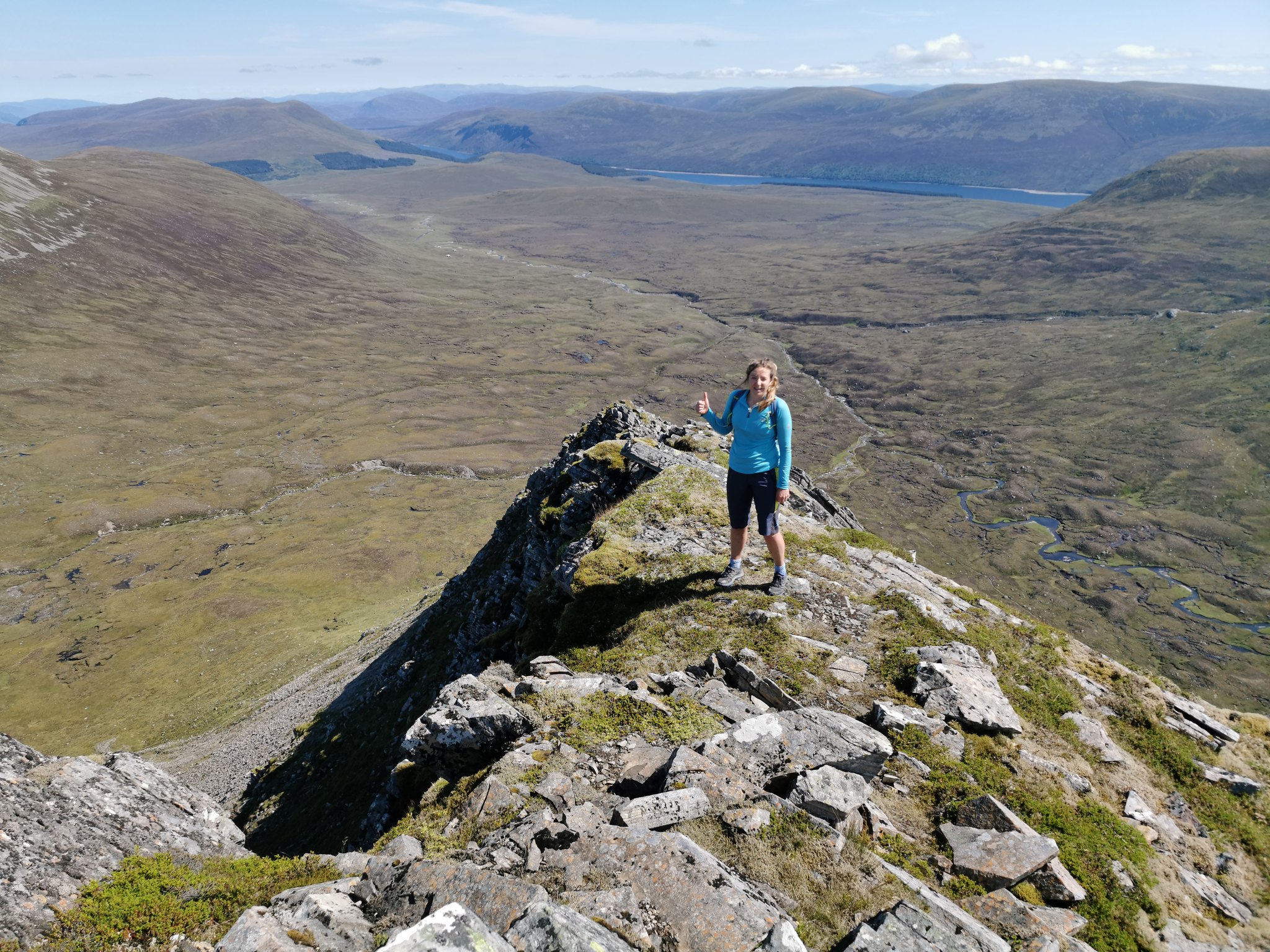 Looking back down the ridge, very impressive.
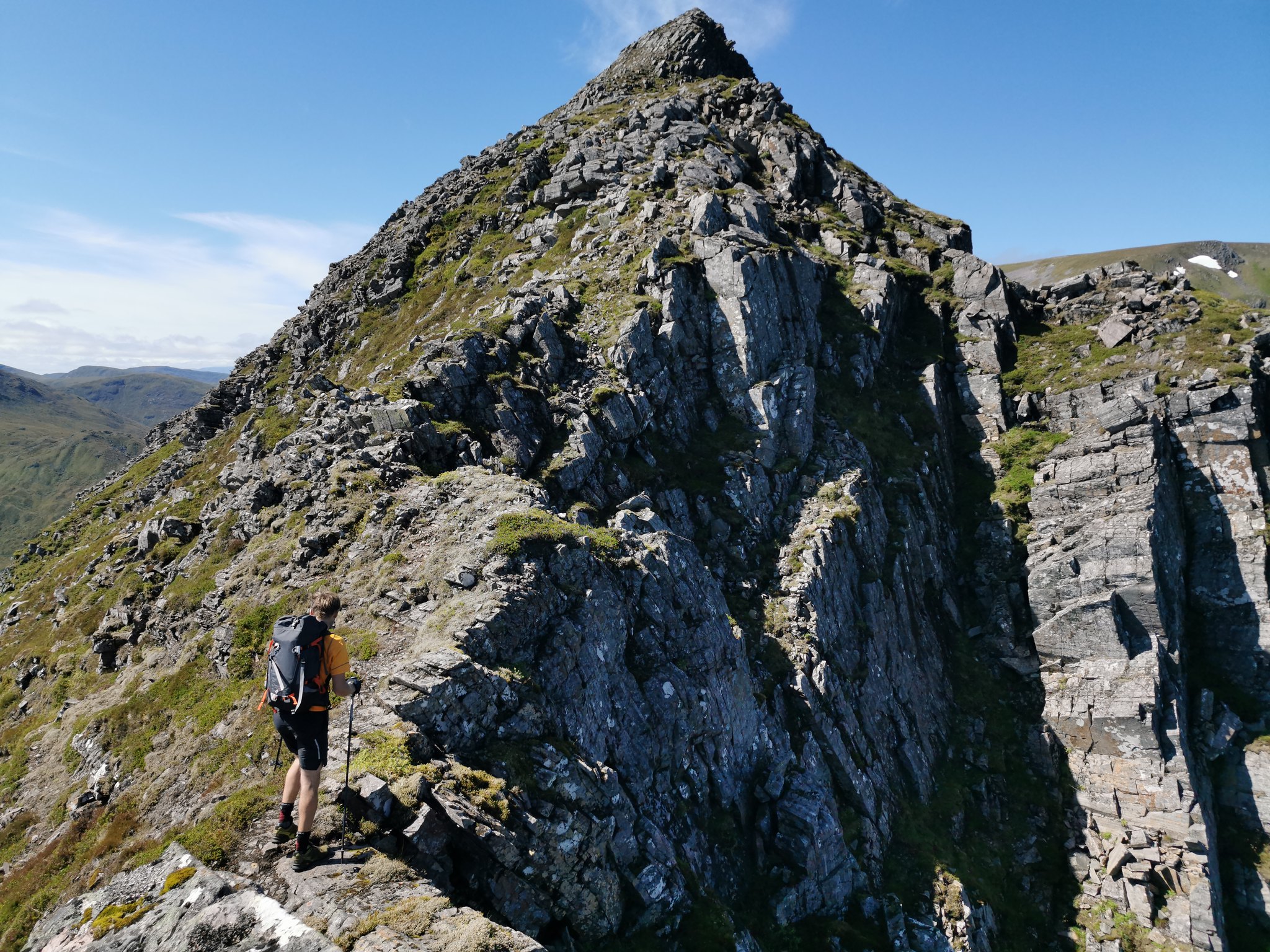 So glad we came up this way. There are a few narrow sections where you definitely don't want to trip, but it's pretty straightforward and not technical
 Sam about at the top of the ridge
After reaching the cairn that marks the top of the ridge, you then have to descend down to a bealach before hiking back up towards the summit of Geal Charn. Timing wise, we reached the summit just before 1pm, so it had taken 3.5 hours since leaving the cars. We were all starving so grabbed a seat and got fired in to our lunch. The weather was fantastic and the views in all directions were superb, very clear air indeed.
 Geal Charn - munro 1 of 6.
After a much needed pit-stop, I downed a bottle of water before leaving my rucksack, now with tent and water added, near to the summit. My 4km each-way trip to Carn Dearg looked easy walking for the most part and the weather was set. I'm not gonna lie though, the descent down to the bealach was far steeper than I had anticipated and knew I was going to be thirsty by the time I re-climbed Geal Charn to retrieve my pack and carry on the route. The views continued to be sublime, so there were zero complaints, other than to wind up Sam about how much extra distance I was doing! Secretly though, I was so glad that we had done the Lancet Edge, it is by far the most exciting way of getting up into these hills.
 A surprisingly large snow patch, taken for the snow patch Scotland group
 The long out and back to Carn Dearg
After an easy walk along the wide ridge, we arrived at the summit of Carn Dearg at 2.10pm. The skies were still blue but the wind was really getting up and it was proper jacket weather after a few minutes sitting about. This was also the point that we would part company, with Christina and Sam taking a nosedive down towards the bikes, and me re-tracing my steps back to Geal Charn. After a couple of quick summit snaps in the wind, we bid each other a fond farewell and marched off our separate ways. It really was brilliant to have shared the experience of the Lancet Edge with family and very like-minded people.
 Summit selfie
 Very rare pictures of us all up a hill together. Great times!
Re-tracing my steps gave me another aspect of the impressive corries of Geal Charn, and the various ridges, lochans and distant munros in all directions. You could see well north of Knoydart, a huge array of peaks in the north-west Highlands, over to Ben Wyvis, Cairngorms, Lawers range, Glen Coe hills, Mamores...it was probably easier to think of what I couldn't see from here! I took my time walking back, taking in the views and trying not to get too thirsty by walking too quickly.
 A stunning vista and great side on view of the Lancet Edge.
 Zooming over the various ridges towards Alder and Schiehallion behind in the distance.
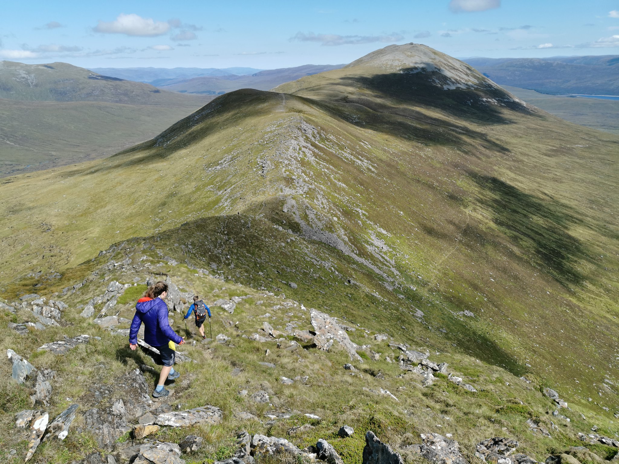
At 3.20pm, I was re-united with my backpack and mosied straight past the summit cairn, keen to cover some more ground so that I wasn't rushing about hungry at the end of the day trying to find a pitch on an empty stomach. The next summit was Aonach Beag, which looked like it would take about 20 minutes, and then a similar time to the 4th summit of Beinn Eibhinn, they are pretty close together, which is always a relief! The terrain was very easy walking, pretty decent paths and no rough, rocky or boggy ground. A very enjoyable ridge walk. I never saw a soul either, my last human was seen on the descent from Geal Charn and I wouldn't see another person until about 9pm on Ben Alder!
 The path on to Aonach Beag and Beinn Eibhinn beyond.
 Aonach Beag summit - terrific views out towards Glen Spean and the west Highlands
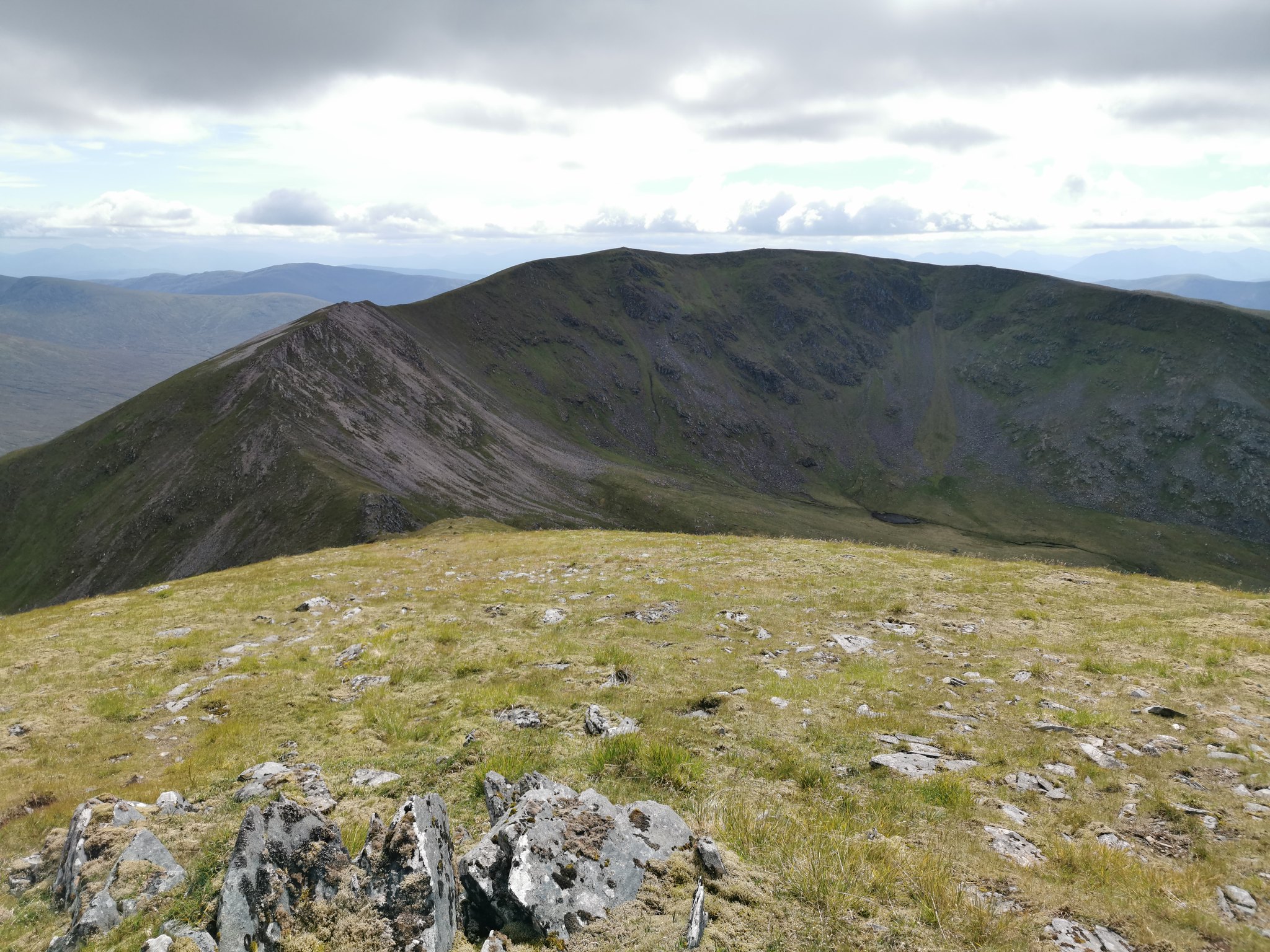 The view ahead to Beinn Eibhinn from Aonach Beag
Once again, I took the opportunity to dump my backpack on the ascent to Beinn Eibhinn as this is another fairly short out and back section. I find every little helps when carrying heavy bags, it makes walking feel so effortless while it lasts. At 4.30pm, I was on the summit of Beinn Eibhinn and my 4th munro of the day. Sadly, it looked like clouds were starting to form a bit more, so my chances of Alder summit sunsets were looking numbered. All summits were still clear at this time though, and the views down to Loch Ossian were nice to see (particularly after my winter epic there in February when everywhere was a winter wonderland -
https://www.walkhighlands.co.uk/Forum/viewtopic.php?f=9&t=95665).
 Summit panorama from Beinn Eibhinn, looking back on my day so far.
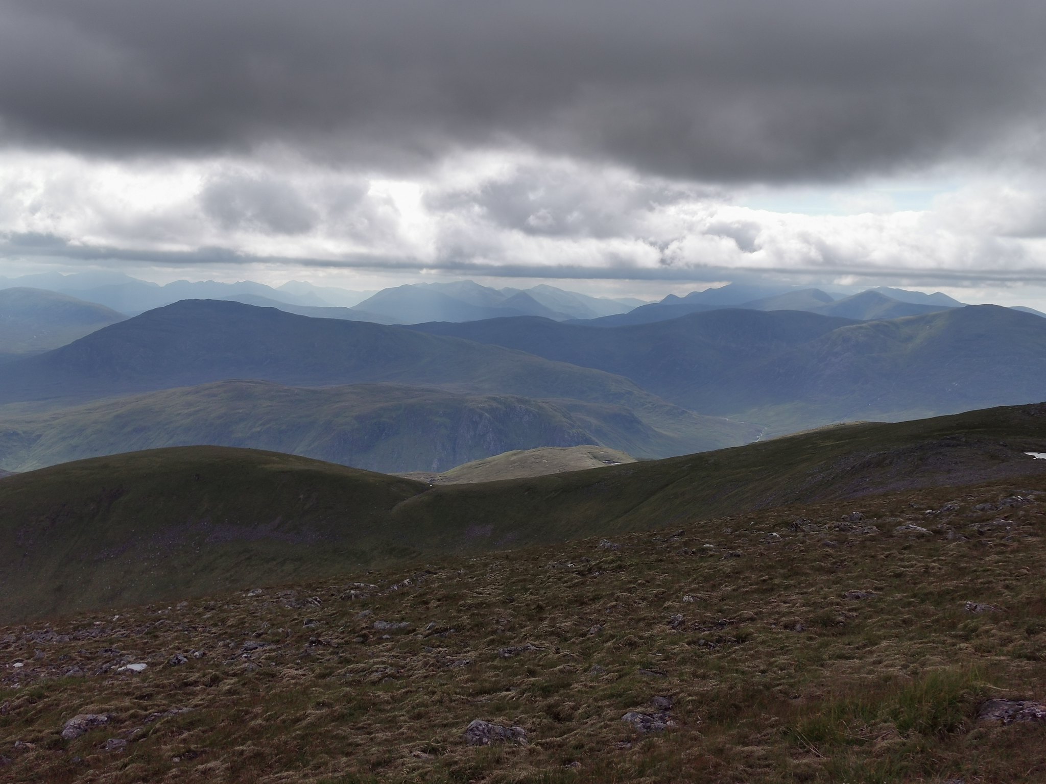 West towards the Mamores and Grey Corries (in cloud).
Re-tracing my steps back to my rucksack, I picked out a descent route towards the Uisge Labhair river far below in the glen. Needless to say, the descent would be pathless, fairly steep and pretty wet after the very heavy rain over the previous two days. Still, it looked the best option I could see, and the rivers looked easily crossable.
 Descent straight down the shoulder here, across the river, and ascent up Alder was basically a straight line up the other side
.
I took my time to avoid any silly slips on the way down, and crossed the river with no real issues. Starting up the wet lower slopes of Ben Alder did not fill me with glee. I followed a couple of tiny burns flowing down the slopes so that I could carry minimal water until I filled up for the evening ahead.
 Looking back to Beinn na Lap and Loch Ossian from the ascent of Ben Alder
 Munro number 5 of the day, Ben Alder. Disappointed to be in the cloud after high hopes of a summit sunset pitch.
From the river, it took me almost exactly one hour to reach the summit of Ben Alder. Sadly, I entered the cloud about 1050m, and that was the last time I saw anything but cloud until around 9am the next day. Hopes of sunset dashed, my biggest concern now was finding somewhere to camp for the night. It was blowing a proper hoolie up there and camping anywhere near the summit was not an option. Looking at my map, it looked like my best option was a hollow, shallow-corrie feature to the north of the summit. Visibility was almost zero however, so I had to faff about and navigate myself into it, before scanning about the boulder fields for some grass to pitch on. Thankfully as I descended, I escaped the worst of the wind, and also found some boggy grassy areas. After walking about in the mist for a few minutes, I found a flat, dry patch of grass which would do nicely. Thank god! After quickly pitching the tent, I fired up the stove to get dinner sorted, which was much needed by now.
 Not too bad a pitch in the end at around 1030m, and importantly sheltered from the southerly wind....ish.
Dinner was an Xtreme Foods 800 calorie chicken tikka, which I almost made an arse of by adding too much water. Still hit the spot though! Entertainment for the evening was via Walk with Wallace and Thomas Heaton on Youtube thanks to the zero views outside of the tent. Pity, but you can't win them all. While getting ready for lights out, I spotted a couple of walkers in the mist above my location, who saw me and waved down. I half expected them to join me nearby at my camp spot out of the wind, but they continued and disappeared into the mist. I set my alarm for 4.30am, hoping for some better weather...
Friday 7thAs my alarm went off at 4.30am, I eagerly leaned over to unzip the tent door, miraculously hoping for pink skies and an inversion. Nothing of the sort unfortunately, visibility was horrific at about 20m into a cloud. Saaake! Ah well, snooze until 5.30am it is. I never wasted much time when I woke up again, breakfast and coffee while I packed up my gear, tent down and away as quick as I could. My morning route was back up to the summit of Ben Alder, and then following the summit ridge down to the bealach and up to Beinn Bheoil. Sadly, the visibility never changed so these amazing views will remain a mystery for now. At 8.25am, I reached the summit of Beinn Bheoil and my 6th and final munro of the trip. Zero views and still windy, so I took a quick picture and headed northwards down the ridge towards Culra again.
 Looking a bit damp on the summit of Beinn Bheoil after a morning in the clouds.
 Finally back below the clouds again on my descent
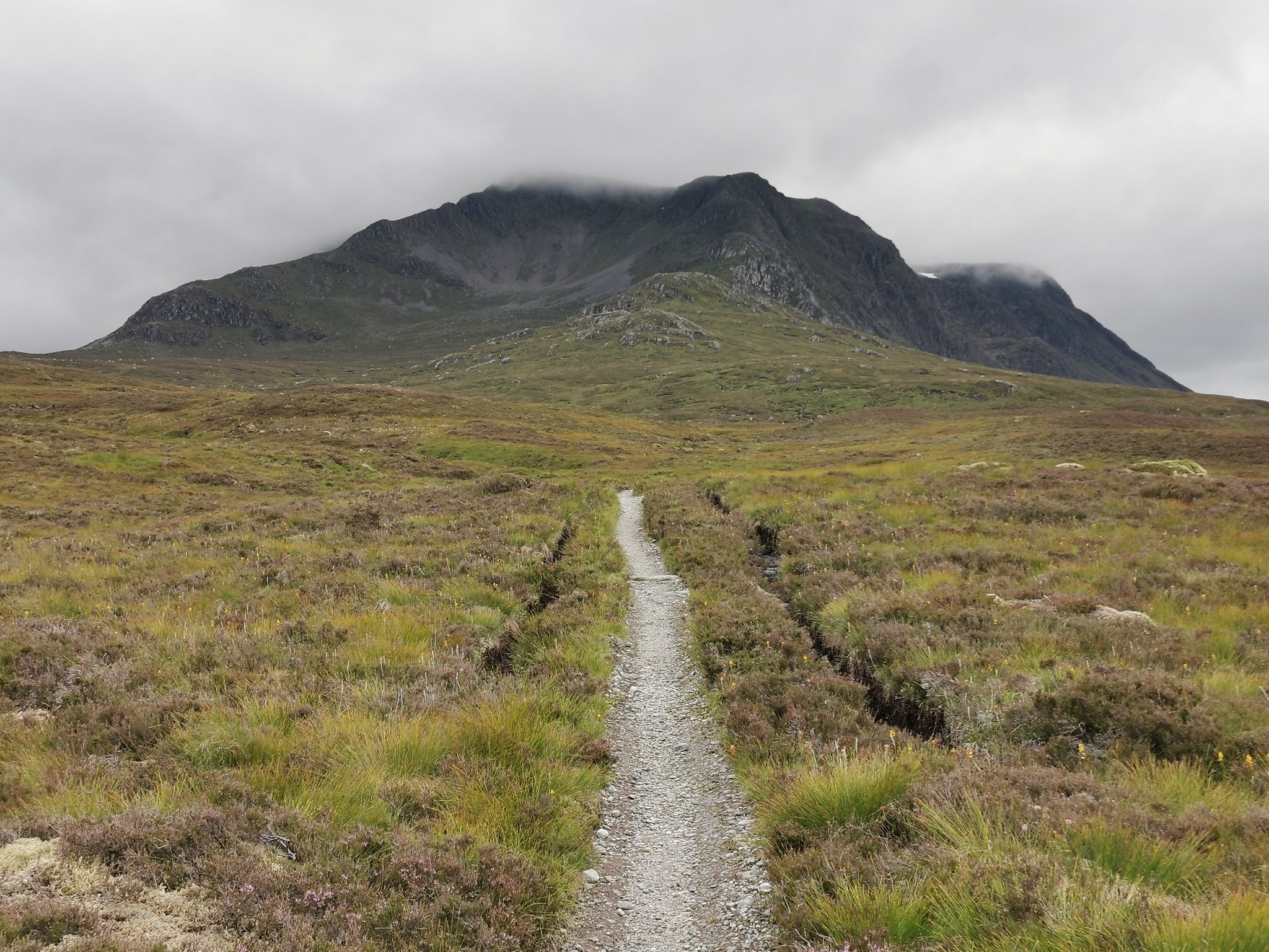 Looking back at Ben Alder and watching the cloud lift. Standard.
My last minor obstacle was to locate my bike on the other side of the river, and then find a suitable spot to cross in order to reach it. I couldn't be bothered with the faff of taking my boots off to cross, so took a few minutes to find a spot that was crossable. I managed, just, after a fairly sketchy long-jump from a mid-river boulder which almost ended in tears. I was looking forward to being re-united with my bike and having some easy miles back to the car. A chap on a mountain bike then appeared along the track and stopped to ask where I had come from. It transpired that this was the chap I had waved at the night before, who had climbed Ben Alder twice with his young daughter via different ridges. Some effort from the young lass! They had camped higher on Alder and found a wee spot out of the wind. We all then set off to Culra and both planned on an early lunch stop there before cycling back to our cars.
 Back at the bothy to fire up the stove for a re-fuel.
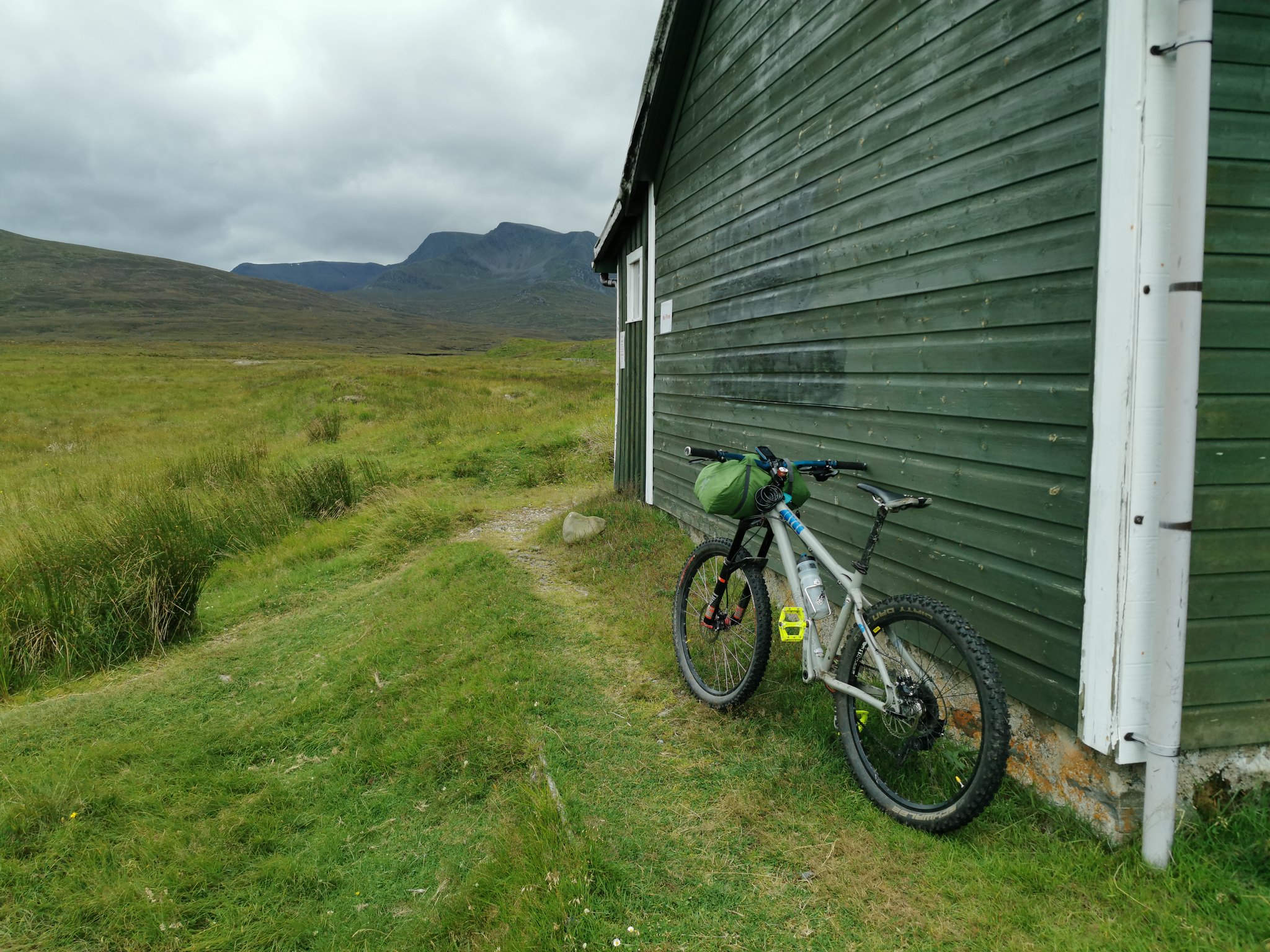 Tent strapped to the handlebars to save weight on my back
After a quick King size pot noodle and cup of tea, I was off on the bike again. I took the main track to Loch Pattack on my return for a slightly different experience. The track is definitely more up and down and I preferred the singletrack option that I had taken on my way in (when it's relatively dry at least). On the plus side, I had the pleasure and faff of crossing the rickety bridge with my bike, which again almost ended in tears a couple of times. I think the three wild horses enjoyed watching me make a mess of it while being fed by a lady from the estate. I stopped to speak to her for a few minutes, who was very friendly and keen to ask where I had been. From here, after a drag up from the loch, there was some cracking freewheeling back towards Loch Ericht and then some easy miles back to the car. My back was suffering a wee bit by the car, but it was still an enjoyable pedal back, and a nice way to end the trip.
The trip was a bit of a tale of two halves, but the overall experience was absolutely magical. In some ways I was grateful that I hadn't seen everything in perfect weather, which immediately made me hungry to come back to Alder and climb the Leachas ridges and see the summit views another day. I've wanted to go to Alder for at least 15 years, so it was a great feeling to have finally completed the trip.
Some stats:-
Bike in - 16.5km in 1hr 10mins.
Hike - 33.05km in 11hrs.
Bike out - 17.2km in 1hr.
Until the next time...
