free to be able to rate and comment on reports (as well as access 1:25000 mapping).
Moray Coastal Trail: Cullen to Buckie
Date: Saturday 12th February 2011
Company: Myself and BeinnToday I walked a section of my local coastline from Cullen to Buckie.
I parked the car in Buckie and then myself and Beinn caught the 305 Stagecoach Bluebird Bus from East Church Street in Buckie through to Cullen. This allowed us to undertake a traverse without having to walk back to the car.
We started the walk from the Cullen Bay Hotel.
Cullen Bay Hotel:

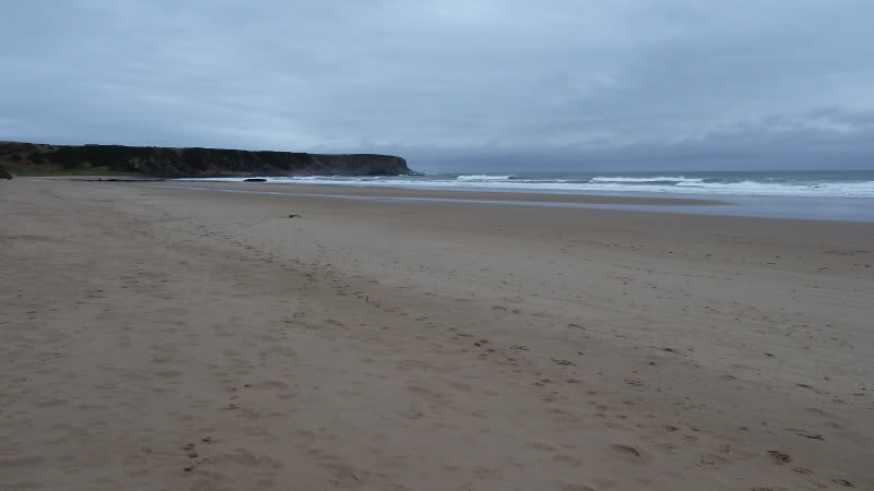
From the hotel we followed a track across the golf course and then headed down onto the beach at Cullen Sands. We arrived at low-tide so there was plenty of sand for Beinn to have a good runabout.
Cullen Sands:
Beinn enjoying the beach:

Looking back along Cullen Sands towards Cullen:

While on Cullen Sands, I stopped to take some photographs of Oystercatchers.
Oystercatchers:

Oystercatchers:

On reaching the end of Cullen Sands, we continued round the shore passing several caves.
One of several caves:

After the caves we passed a small well called Jenny's Well.
Jenny's Well:

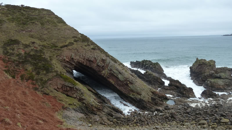
On reaching the arch in the next couple of photos we ascended from the shore to the top of the cliff.
Arch:

Arch:
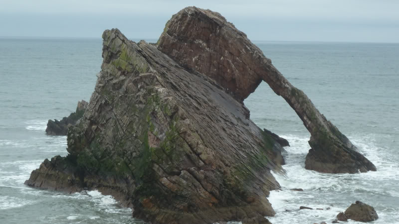
We then walked alongside the clifftops as far as Bow Fiddle Rock.
Looking back towards Cullen:

Bow Fiddle Rock was the highlight of the walk for me. This was the first time I had seen this local feature. I stopped to take several photos.
Bow Fiddle Rock:

Bow Fiddle Rock:

Bow Fiddle Rock:
A couple of minutes after Bow Fiddle Rock saw us arrive in Portknockie.
Portknockie signs:

Fish:

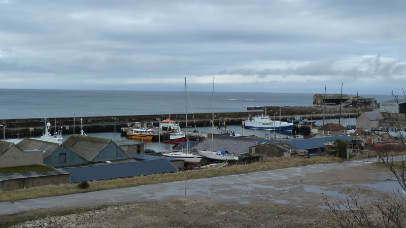
After having a look down at the harbour, we ascended the road leading from the harbour up into the village of Portknockie.
Portknockie Harbour:

Portknockie Harbour:

We then followed a National Cycle Trail from Portknockie as far as Findochty. A National Cycle Trail sign advised that Buckie was still 5 miles away.
After twenty minutes or so of walking along the cycle track, I got my first views of Findochty (pron. Finechty).
Looking towards Findochty:

National Cycle Network sign:

Findochty:

I found the Moray Coastal trail signs in Findochty a bit confusing so I just ignored them and stuck as close to the coast as I could.
Sandy Creek:

The Crooked Hythe:

Findochty Harbour:

Looking back to Findochty:

After passing Findochty harbour, we walked through a small caravan site and then followed the Moray Coastal trail signs skirting around Strathlene golf course.
From Craig Head we stuck to the shore in order to again walk along the beach.
Craig Head:

First view of Buckie:

At Craigenroan I had a good lookout for seals but didn't spot any. Beinn was however enjoying the water and looked a bit like a seal.
Craigenroan and sign:

Beinn and Craigenroan:

Wet dog:

On reaching Portessie, we walked along the pavement towards Buckie. We passed through Ianstown and Gordonsburgh which are now just part of Buckie.
Approaching Portessie:

Entering Ianstown:

I had a look down at the harbour area.
I think I preferred the old Buckie Shipyard building to the new one, even though it is now a bit dilapidated.
Buckie Shipyard (new):

Buckie Shipyard (old):

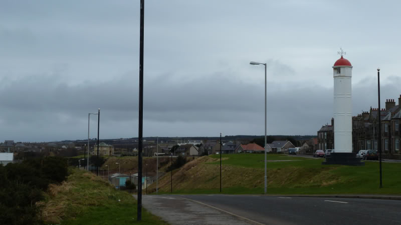
Buckie Harbour:
Lighthouse:
Was great to have my car waiting for me at the far end of the walk. Think I will try to do more traverses using public transport in between.
