free to be able to rate and comment on reports (as well as access 1:25000 mapping).
Sunday morning, up with the lark, thought I'd take a walk technically just inside the Cairngorms National Park.
Changed my mind about walking on Friday despite having driven a fair distance; the windless and midge-filled air had put me off at the start of two possible routes plus the tops looked like they were immersed in cloud rather than above it so I decided to go for a jog instead. Wasn't interested in cloud clearing later in the day either because of the forecast warmth -just no good me trying to climb a hill in the heat.
Judging by some reports I've since seen that was probably a good decision for me. I wouldn't enjoy being bitten, heated and fog-bound. I noticed, though, that Sunday's MWIS forecast had more of a breeze about it. After consulting with the Met Office forecast I just had to triangulate with one other meteorologist in order to commit to a Sunday walk:
Kiki alludes to her forecasting work in at least two episodes so her advice is probably hard-wired into my brain somewhere. Ok, it's gardening forecast advice but I extrapolated to the day's conditions: climb up to get out of the rain and descend to get back into it. It turned out that this was not far off the reality of the day!
I got the the car park for 4am and set off fifteen minutes later, happy to find that there were few midges but doubtful again that the tops would be clear. From what I could make out in the dark it looked as though the cloud might just be sitting on these tops. Should I have gone to the Cairngorm ski centre again, I wondered. Never mind, I would make the most of it and get some exercise.
The air was acceptably cool and there was a breeze to keep our biting friends at bay but there was also a steady and light but penetrating drizzle. I wonder if that resulted from the humidity level. Anyway, after tolerating the soaking for a while it was on with the waterproof trousers.
My plan was to keep on the main track to the bealach and to head south if the way was clear. I reached the chicane in the track at the 700m contour and still there was no let up in the cloud. I looked directly above me for tell-tale signs of thinning fog and associated brightening of the sky but there was nothing. To be honest, I was beginning to loose faith in Kiki. I should, by this point, have been looking back down the track to the sun rising over the glen, at least according to suncalc,org:
https://www.suncalc.org/#/56.8653,-4.309,12/2020.08.17/10:17/1/3I got to the bealach still in cloud and decided to head up Geal-charn. I'd been before but not from this point. I reasoned that it at least would give me more exercise and with slightly new terrain to cover.
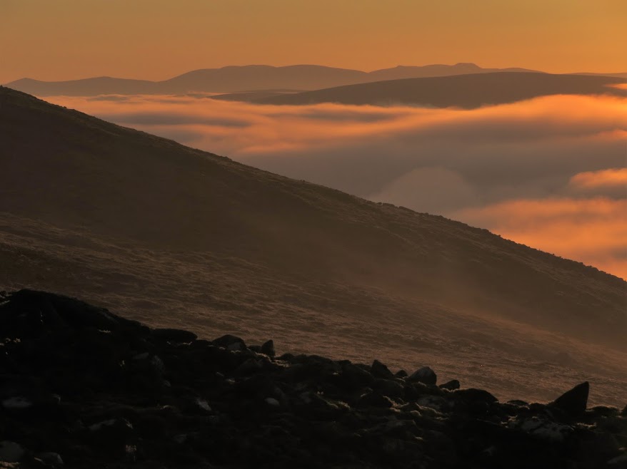
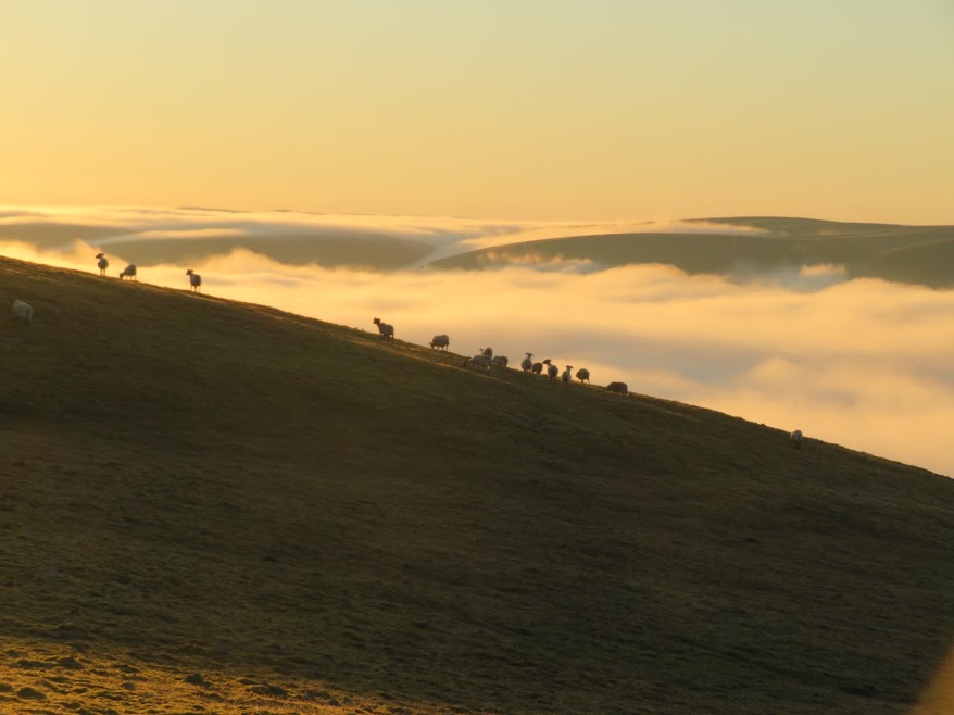
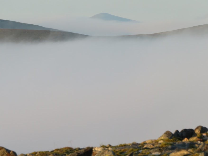
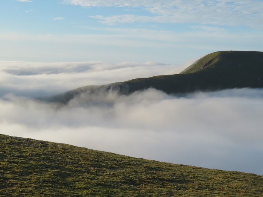
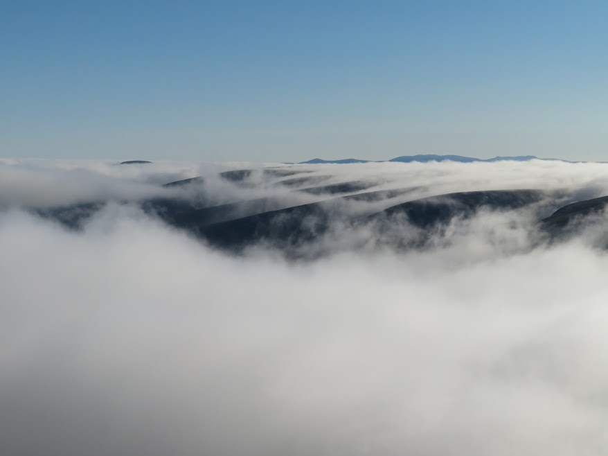
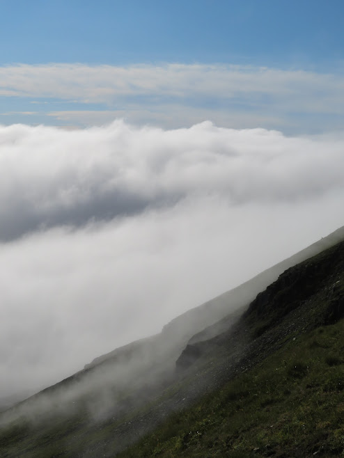
I reached a rise that confirmed there were no views to be had to day. I then, of course, imagined a Cairngorm summit sitting proud of a cloud sea turning red from the rising sun. Oh well.
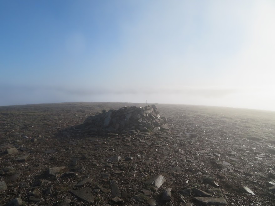
Then I remembered that there ought to be a cairn here but I couldn't see one. Realising that I had probably hit a small false summit I carried on north and, sure enough, the true summit soon loomed out of the mirk. It was also reassuring to get a landmark, to know that the fog hadn't fooled me into some error. It was the first time my compass had seen light of day in years but I thought it best just to make sure I didn't start contouring rather than climbing with it being such a broad slope and there being little visibility -maybe down to 20m at times.
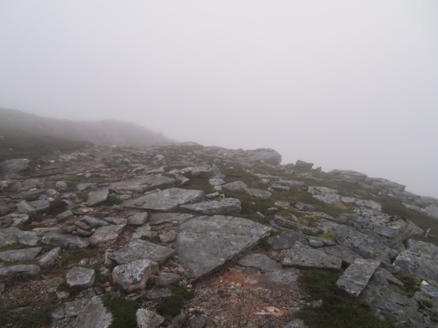
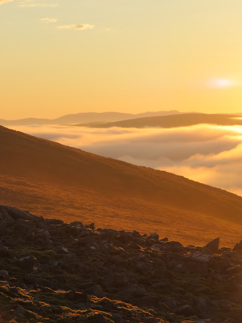
Thought I was in for a disappointment with no sign of the cloud thinning.
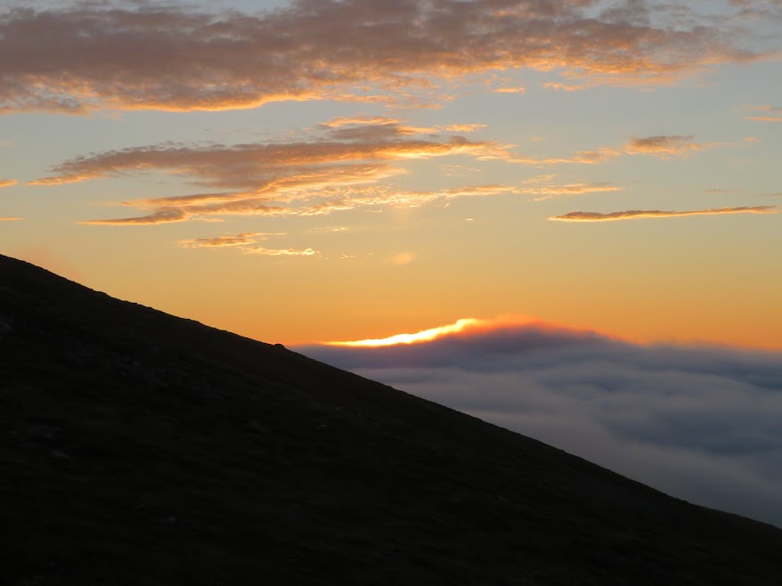
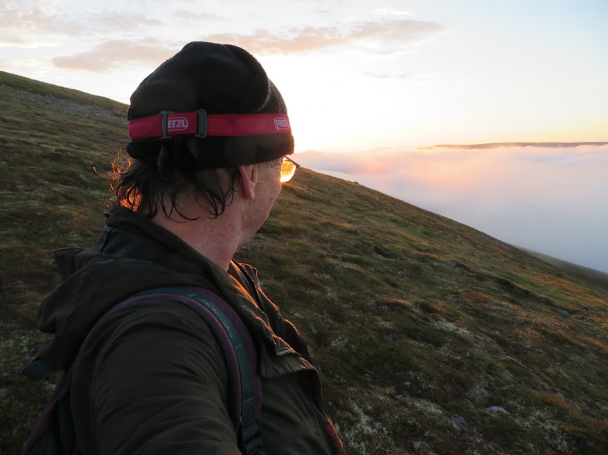
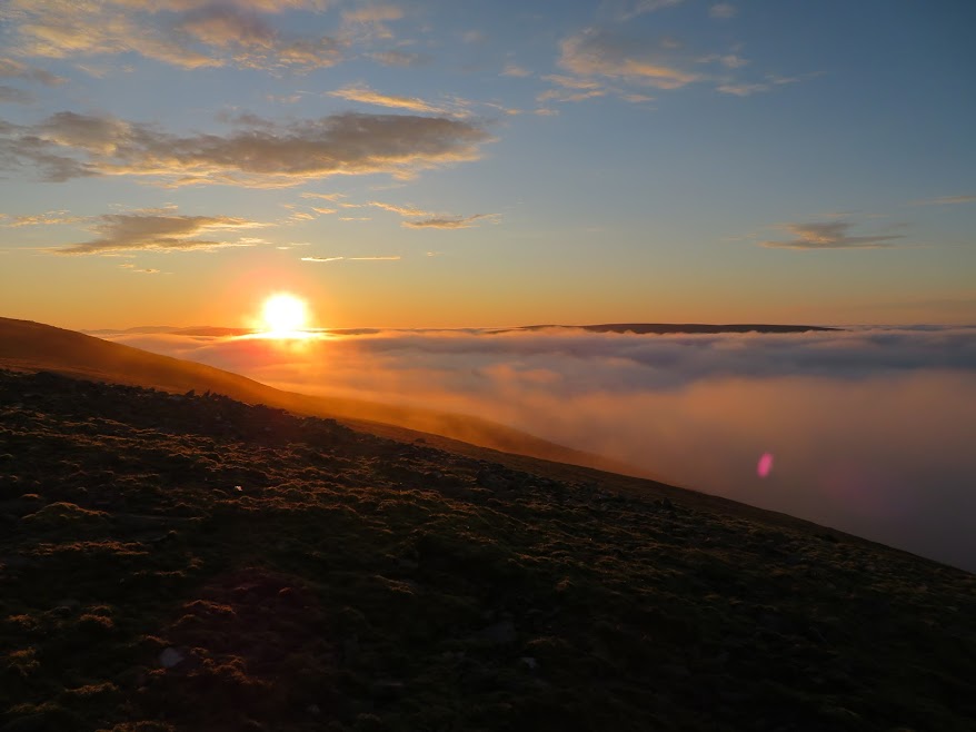
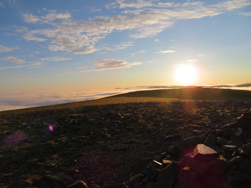
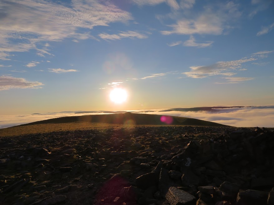
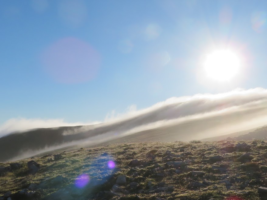
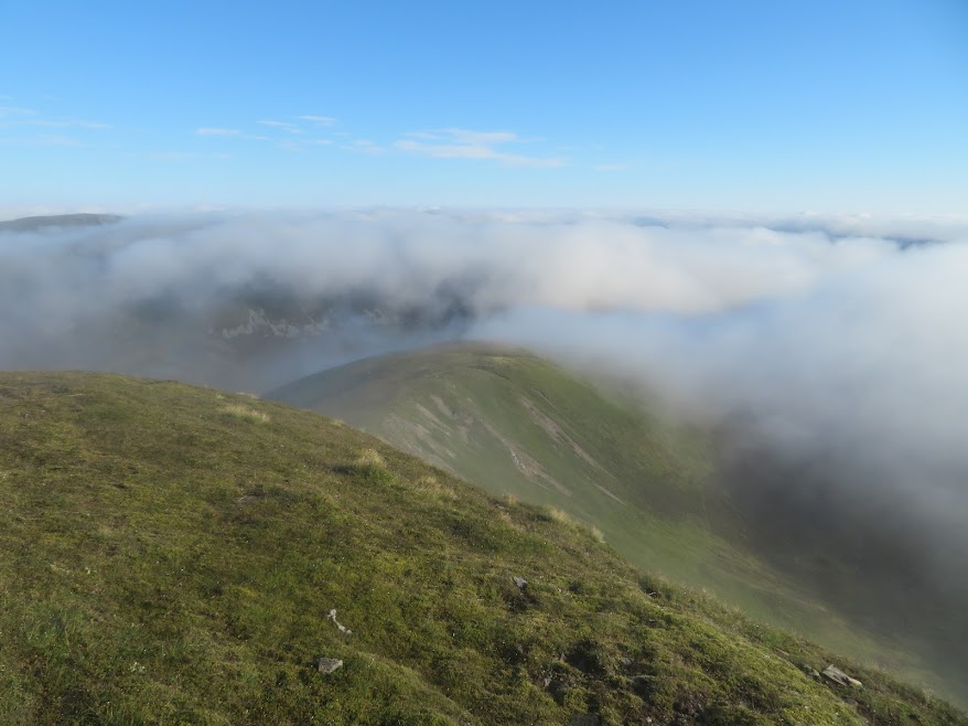
Hooray! After thinking I was at Geal-charn's summit and fog-bound I realised that I wasn't quite there and after a few more minutes' ascent out I popped into the vague border between the cloudy and the clear. A few more steps and I could see that I was not only above the cloud but also in time for the sun rising above the cloud on the eastern horizon.
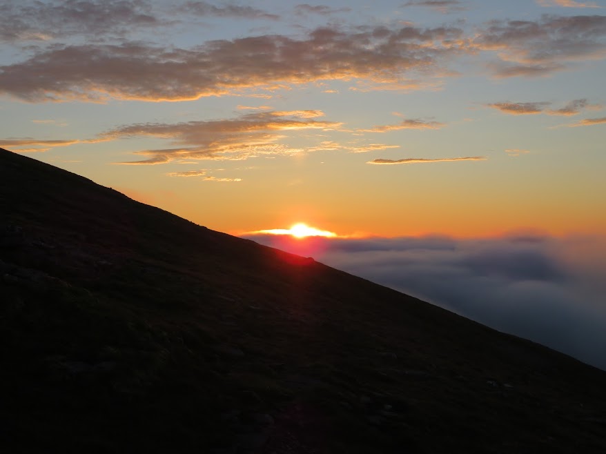
Just in time!
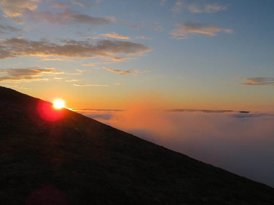
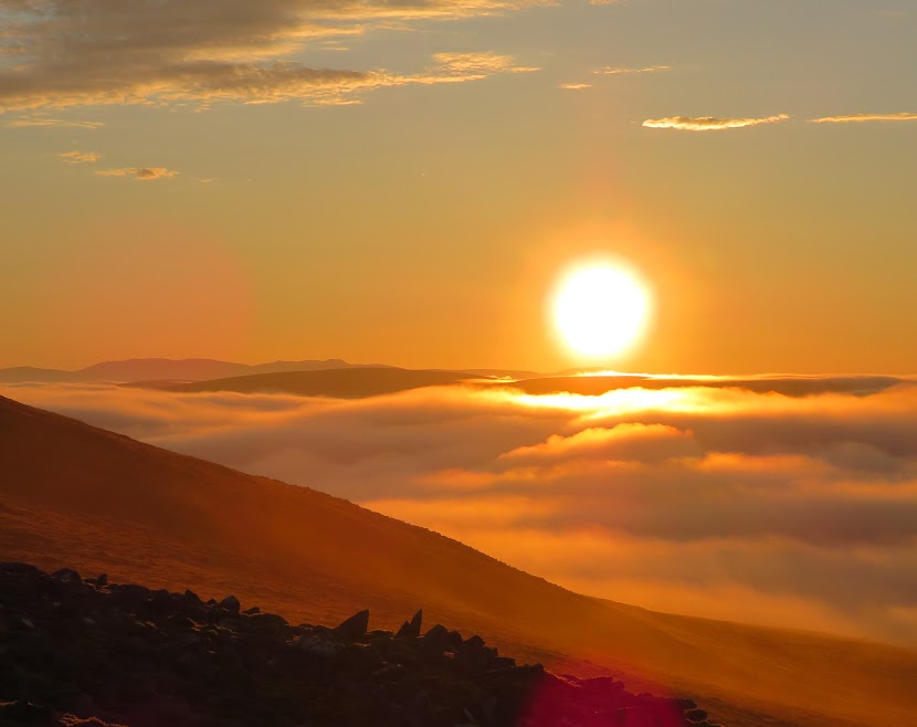
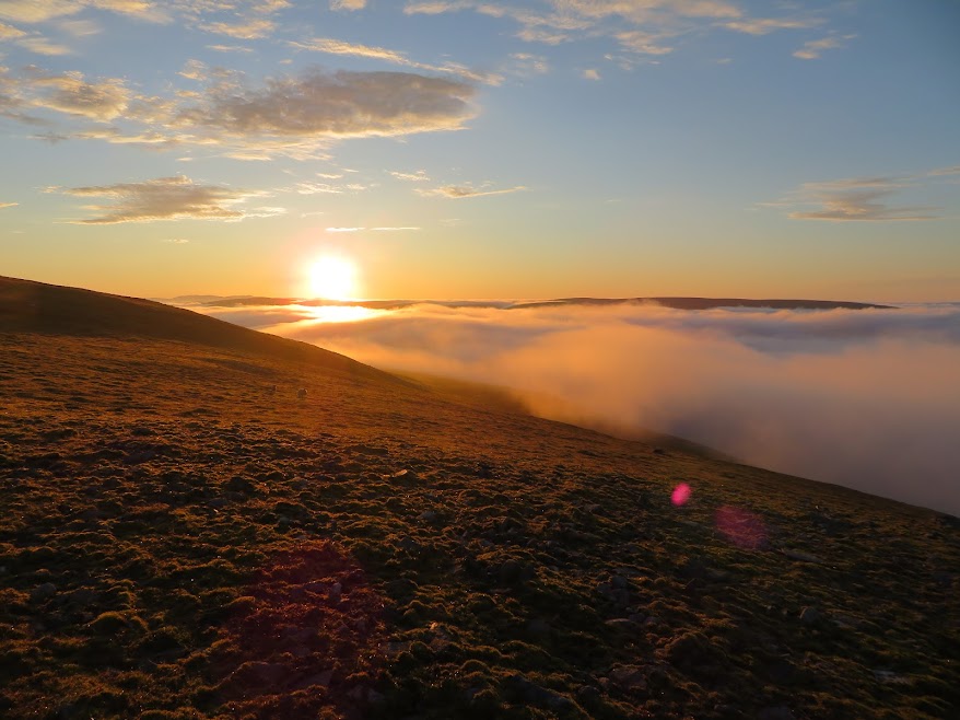
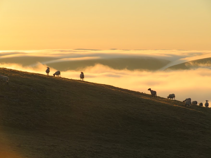
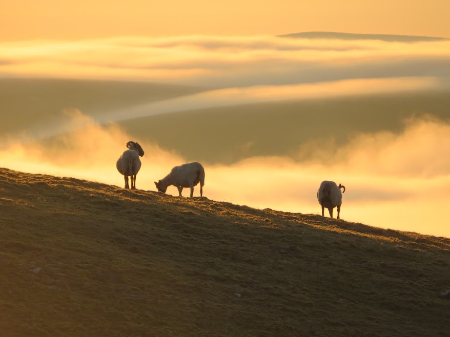
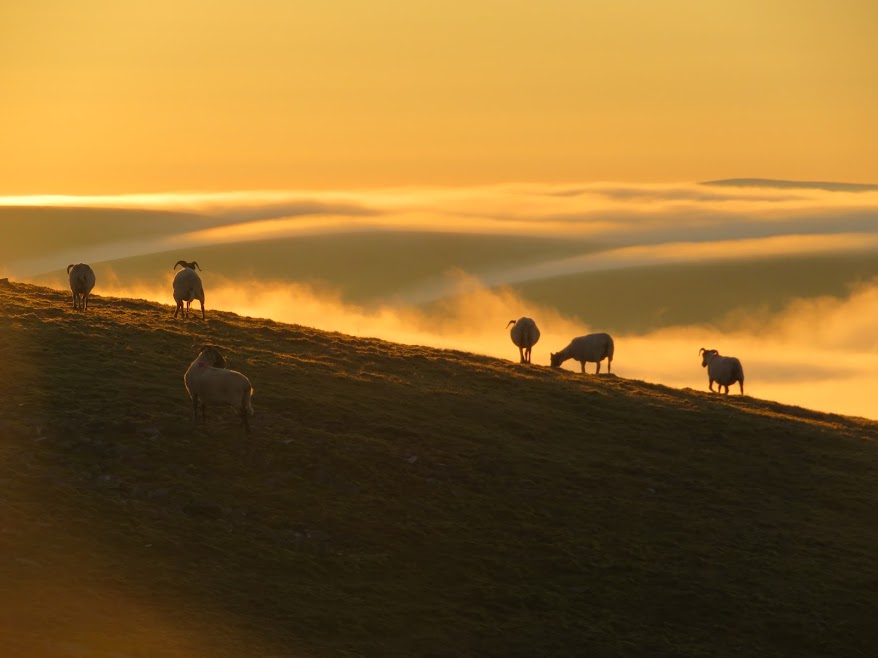
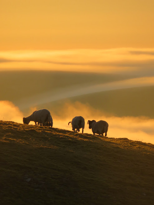
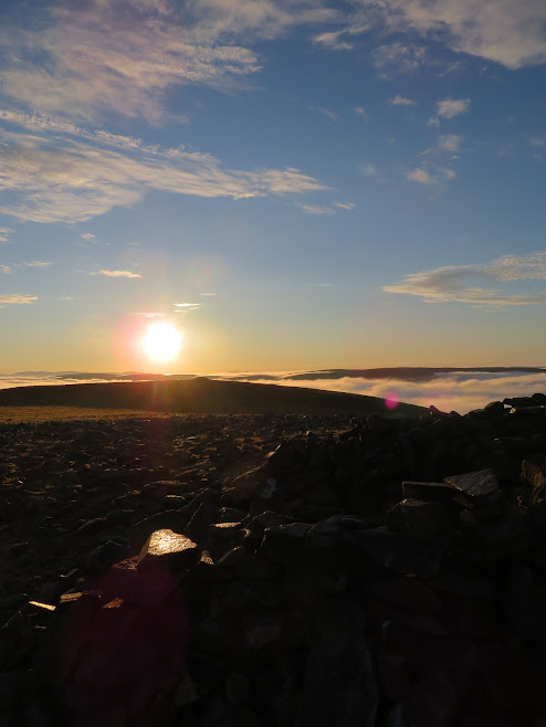
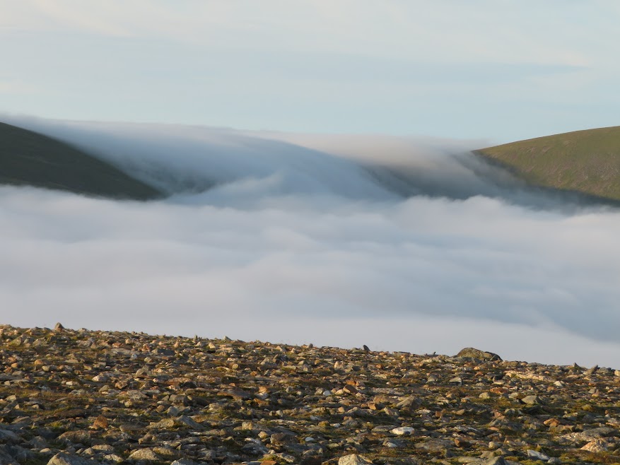
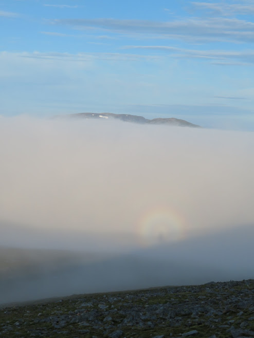
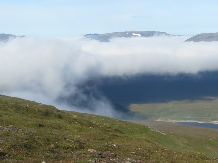
The same sort of cloud waterfall that put me off Croaghaun a few years ago.
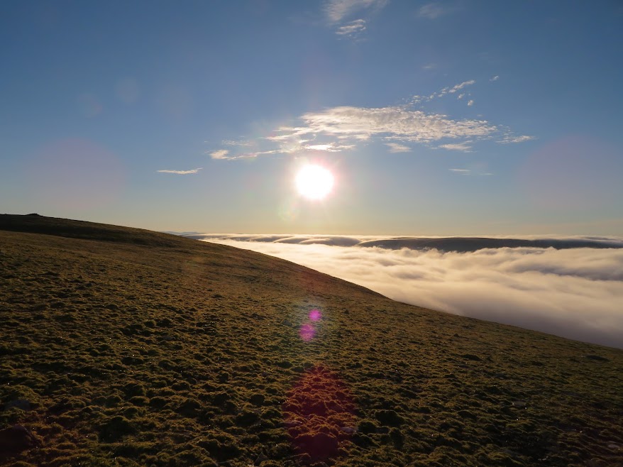
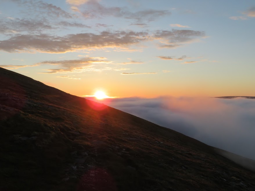
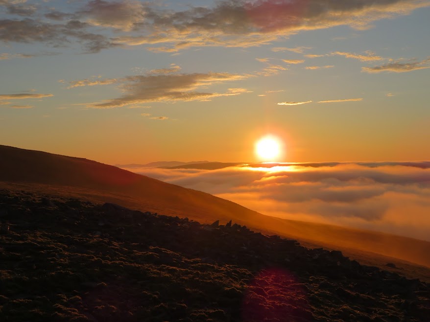
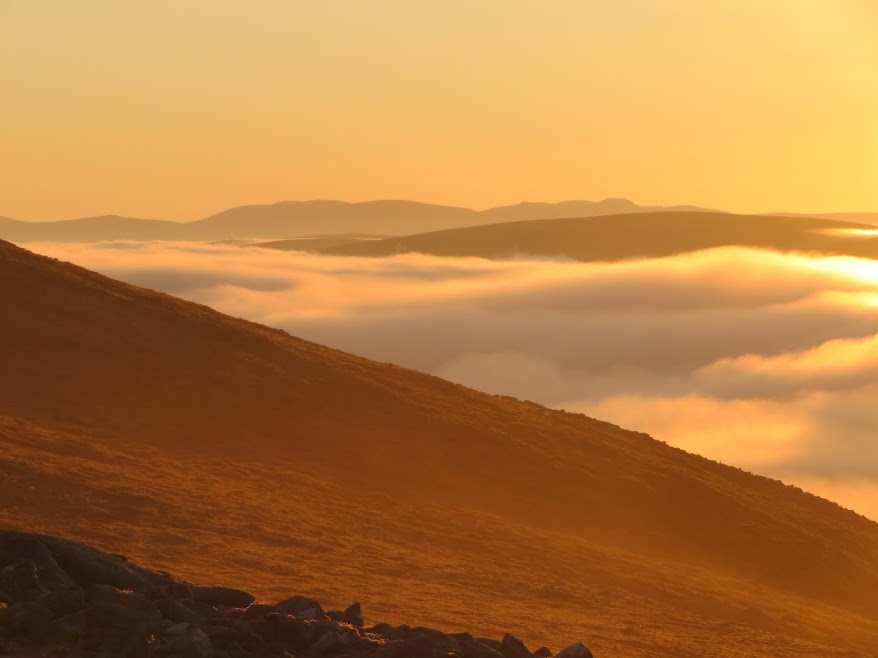
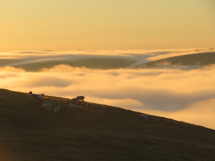
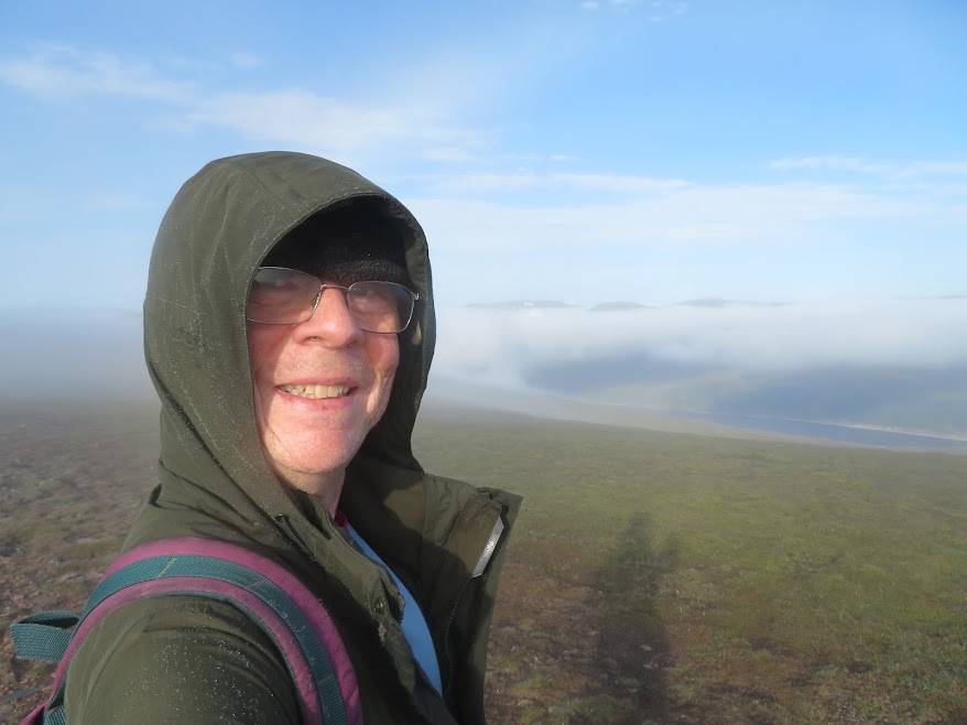
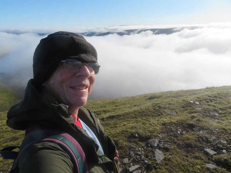
Stayed at the Geal-charn summit for an hour before deciding to include a walk to A' Mharconaich.
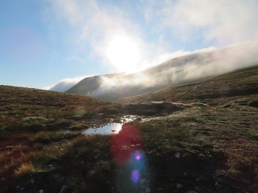
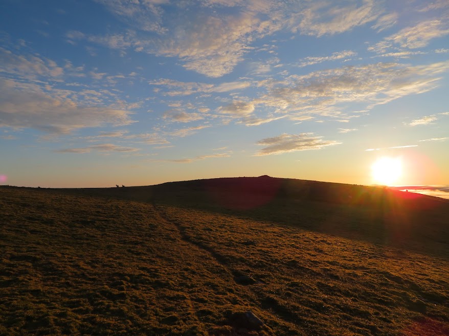
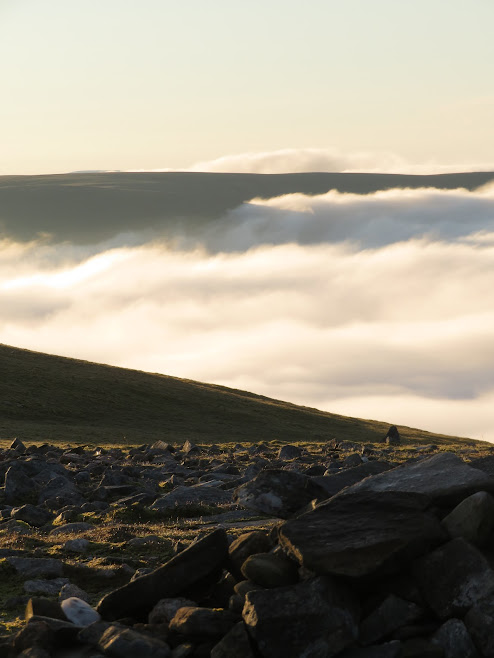
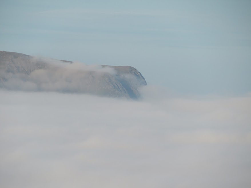
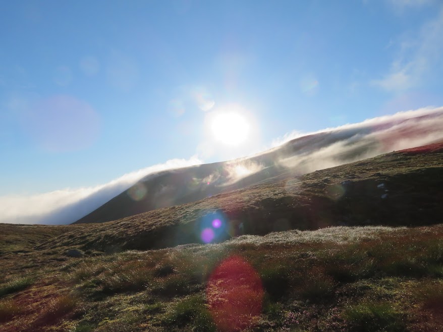
I was briefly back in the cloud at the bealach but nevertheless still following my compass as I could see that there was plenty of scope for heading too far west. Soon enough though I was onto clearer ground but by this time A' Mharconaich looked like it was developing a cloud cap, albeit an interesting one. Up the ladder then!
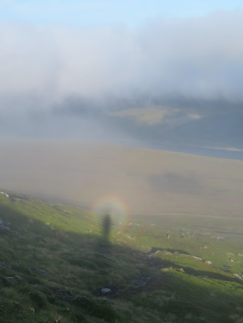
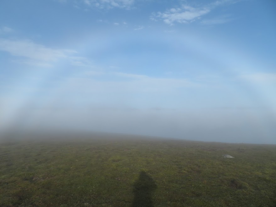
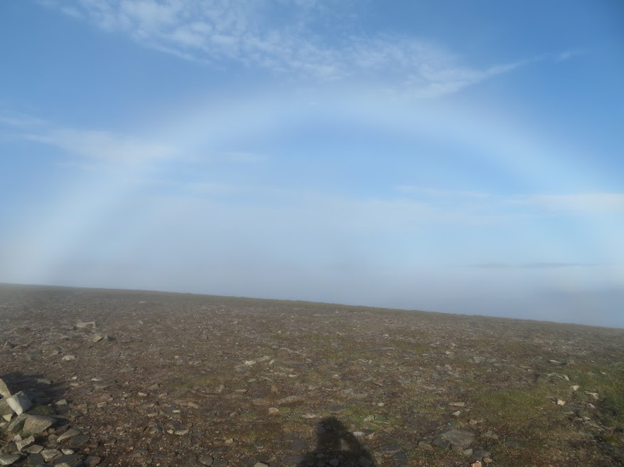
I was pleased to find a good path up to the A' Mharconaich plateau/ridge. That made for a very easy ascent but the drizzle was back on and I kept having to demist every five minutes. However, there were Brocken Spectres and fog-bows to entertain and it was very pleasant going underfoot (what a contrast to the end of my previous walk) so I was quite enjoying the sprinkling I was getting. But still Kiki's words never left me. Up the ladder to get out of the rain, not that there was much up. But eventually, and miraculously, I was at the summit cairn and the mist descended and blew off enough to give me a few minutes of clear views.
I had a short wander along the east facing slope before descending north then north east. Descent path pretty good but will be boggy when wet.
Glimpse of Loch Ericht.
Window wipers on!
Staring to clear.
Look north.
Looking east.
View west.
View south-east.
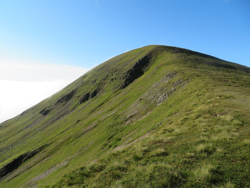
A' Mharconaich from the descent path.
