free to be able to rate and comment on reports (as well as access 1:25000 mapping).
I know that the ladies and gentlemen of the Weather Service try to do a good job, at considerable risk to their safety - going up into the higher atmosphere in their meteorological balloons, assessing the warp and woof of the clouds, decanting sunbeams into goblets for scrutiny, measuring beads of moisture in the high sky - well that is all with the purpose of predicting what it will be like on earth for you and me. And for this weekend's prediction all the signs were that the Northwest was going to be dry, maybe a bit overcast, but the Munro tops were very likely clear. And there would be sunshine!
So I started thinking about making another voyage up to the land of the Fisherfields - having been there for the Eastern Munros a fortnight ago I was longing to get back and visit A'Mhaighdean and friend once again. Perhaps with the three Sims on Beinn Tharsuinn Chaol that I've been coveting for many a year. I wouldn't normally consider driving the 268 miles to Poolewe for an ordinary weekend, especially now that the nights are drawing in again, but throwing caution to the wind I thought why not...
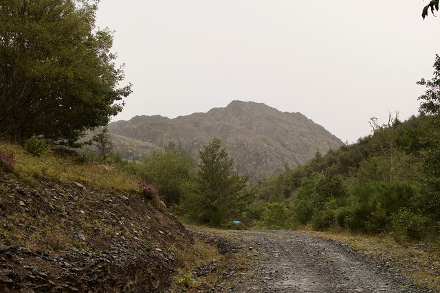
I collected Allison from her place of toil at the back of 4pm on Thursday. It took forever to get through Glasgow - made me remember the empty roads during Lockdown with some fondness. Not that we could actually go anywhere back then, but even so, it's back to normal congestion these days. We pulled in at Ralia to have something to eat at nearly eight o'clock and it was close to 11 when we arrived at the car park in Poolewe. It had been raining heavily for much of the last two hours, including in Kinlochewe and I wasn't looking forward to setting off in the dark and in the rain. Thankfully the rain seemed to have spared Poolewe and we went off into the night with headtorches on. Passed what's presumably a holiday house after the church, with folk sitting in their front garden wishing us well on our travels. That means no midges...
We walked along the track for a couple of kilometres before finding a small flat spot to pitch in the midst of a copse of young trees. Not far from the track, but we'd be up and away fairly early. It did rain overnight, and the midges came to visit in the morning, although nothing like we'd encountered up in Sutherland.
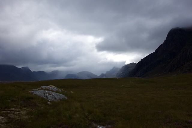
Morning was dry and bright, although cloud was down on the hill tops. My plan for today was to walk in to the causeway, pitch somewhere there and head off to do the two Munros, leaving Beinn Tharsuinn Chaol for the next morning. We thought it might be quite busy, what with the good forecast and it being a holiday weekend. Shortly after the trees at Carn More we met a woman off to do Beinn Lair and Beinn a'Chaisgein Mor - she had 10 Corbetts left. She told us that she really disliked doing hills in clag when on her own, which had seriously affected her ability to get her hills done - she'd just walk away if the clag came down. What an affliction to have on the Scottish Hills.
 2C0A19A4-5770-40E6-AE1F-7E9CCECD8CA2_1_201_a
 by
Al, on Flickr
 88A40F0C-2A85-4A08-8B34-C8B837CBC654_1_201_a
 by
Al, on Flickr
 53619339-12E1-466C-91C0-7EE7B549BEF9_1_201_a
 by
Al, on Flickr
Beinn Lair
 8CB5BC93-37CF-4C45-BBDB-09E15A3E435F_1_201_a
 by
Al, on Flickr
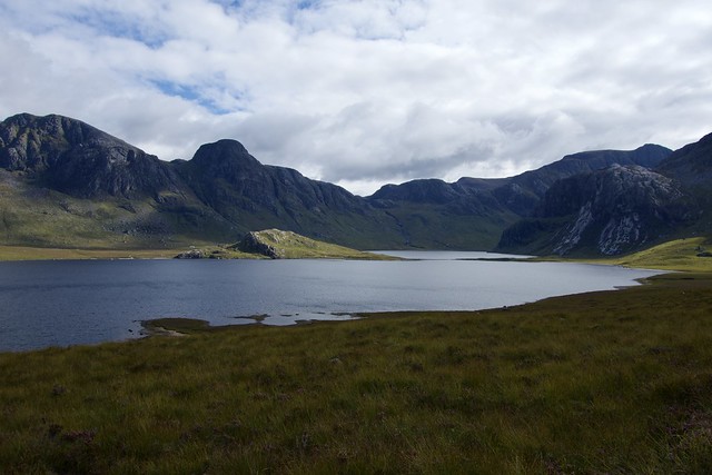
The causeway betwixt Fionn Loch & Dubh Loch
 3BC2383C-A915-49E0-A554-3337AD4AECD6_1_201_a
 by
Al, on Flickr
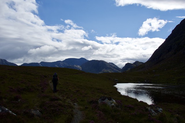
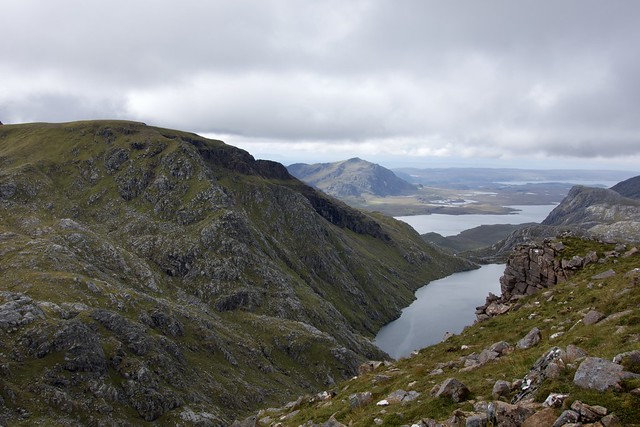
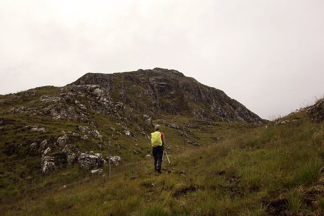
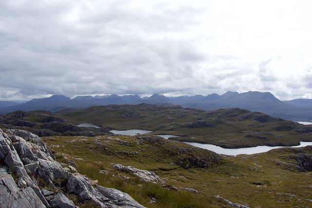
We made good time and found a grassy spot to pitch just short of the causeway at around 11am. I had considered pitching just after the causeway, where there's a nice flat spot, but here we'd be handy for the route up Beinn Tharsuinn Chaol and the other spot might be busy by the end of the day. We continued on, with lighter packs, stopping for lunch on the gravel beach by the causeway. Cloud was coming and going on the mountain tops, but I felt we might get lucky. A few groups of people passed by, not sure where they were making for. We started up the track past Carnmore, which still has its sign out welcoming hikers and climbers to use the barn, no mention of covid restrictions. Up the transverse path, then onto the narrower track that leads to Ruadh Stac Mor - although we'd come this way last time we'd done RSM, I had no recollection of it. Met a couple of older chaps on their way down, who, from their moneyed accent, were likely to be staying at Carnmore Lodge. They seemed very happy with their day anyhow. Found the spot where the contrast between the red stone of RSM and the white of A'Mhaighdean is most obvious.
 D0B83162-2C38-4C19-BF70-0A7E70AA0A0F_1_201_a
 by
Al, on Flickr
A'Mhaighdean
 304F81BD-D9FF-427F-86D3-E6CB6DCADADC_1_201_a
 by
Al, on Flickr
West along Fionn Loch
 1C2AA25D-8380-4021-9806-1C30ED5363F4_1_201_a
 by
Al, on Flickr
Ruadh Stac Mor
 9487CF29-7993-4E32-B8CC-78299541DE04_1_201_a
 by
Al, on Flickr
Fuar Loch Mor
 F3BB4558-5249-4C65-9ACE-6271480950D2_1_201_a
 by
Al, on Flickr
The division of red and white
 B0B80488-13D5-41EE-8E3A-E7D556B1B0C5_1_201_a
 by
Al, on Flickr
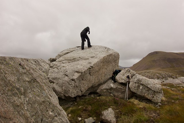
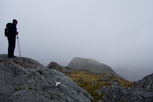
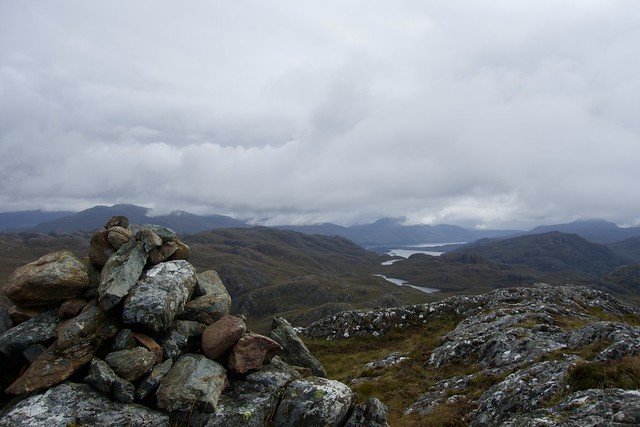
A little scramble up the scree covered path to RSM, the top clear but the views to surrounding hills impaired by cloud. Back down the same way, a short stop for a bag of crisps then on to A'Mhaighdean. Sadly we were encumbered by cloud in the last 100m or so and I didn't therefore get one of the summit views I love to see. That was quite a disappointment. We could have waited I suppose, but it was unseasonably cold in the wind and clag, not a place to hang about in. I had considered coming off the west of the mountain, but having had a good look on the way up, when we could see, it looked a bit fierce, and in clag I wasn't going to attempt it. So we went back the way we'd come up, stopping to take a nip out to the Sim of Carnan Ban which involved a small deviation from the track. Quite a lot of deer up here. We found the boulder that marks the summit, briefly considered coming off to the south then decided it was better to keep to the known track, so we returned to the main path back down to the causeway.
 D9B90D2D-B835-47D8-95BD-52E999179E5A_1_201_a
 by
Al, on Flickr
RSM
 AF2AC437-9F75-4603-8068-FC4E94E0A7F5_1_201_a
 by
Al, on Flickr
The Beinn Deargs
 88BC34CF-38CA-4C12-B8E9-6973E3C3F146_1_201_a
 by
Al, on Flickr
Rain getting nearer
 C179CBE5-91C2-42BF-95C3-026D90B5B2CB_1_201_a
 by
Al, on Flickr
The sad view from A'Mhaighdean
 F7D597AA-1961-40F0-85F9-BAFA6BC66E33_1_201_a
 by
Al, on Flickr
Moody light
 DC4F931C-6335-4A79-85A8-6422526D2F5F_1_201_a
 by
Al, on Flickr
Top of Carnan Ban
 9A82C3A4-A3E2-4B5E-A875-CB30BB4905E6_1_201_a
 by
Al, on Flickr
Clearing on Ruadh Stac Mor
 1DE21206-0529-4767-B1E7-4BFB801E21C5_1_201_a
 by
Al, on Flickr
Beinn Tharsuinn Chaol, to the right of A'Mhaighdean
 A32486A3-CFD0-4BFE-824B-A4FA1D2602C6_1_201_a
 by
Al, on Flickr
 0D37F79F-C745-4DD1-B8F6-9F995A689848_1_201_a
 by
Al, on Flickr
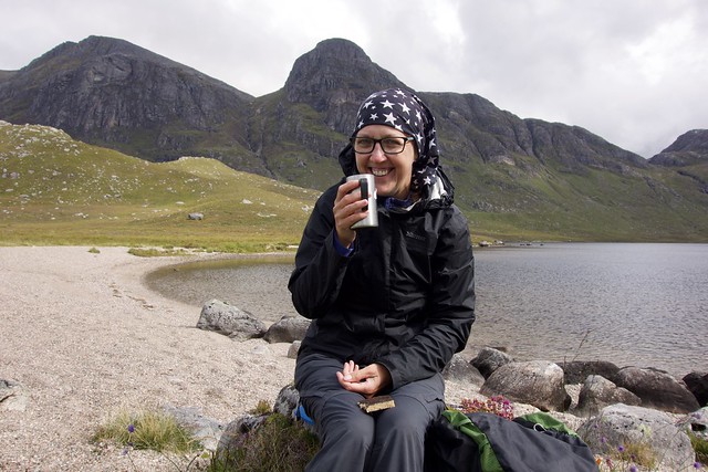
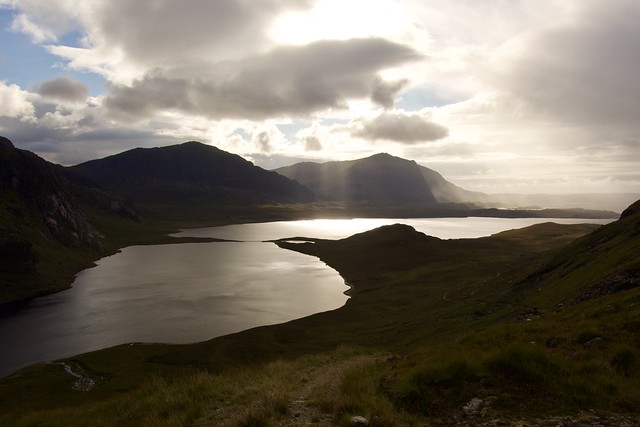
As we walked past the end of Fionn Loch, the wind was whipping up waves to the extent that you could imagine youself by the seaside. We made it back to the tent to find that the Corbett lady had pitched about 100m away, on the spot we'd used last time we were here. Normally I'd consider someone else wild camping nearby and intrusion, but I didn't mind as it was her. We might have had a bit of a natter had it not been for the midges and then the rain.
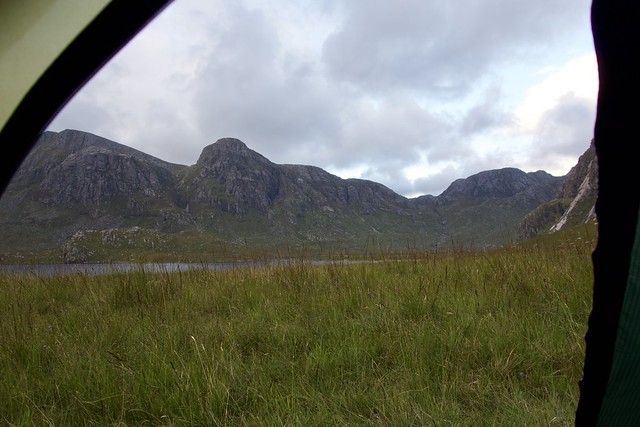
Tent view
 E045C7AE-EC37-4A67-AA23-0C4A56ED1540_1_201_a
 by
Al, on Flickr
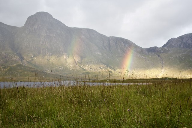
Tent view with rainbows
 18484C8A-1981-4C54-8DCB-A6216A0EEF3D_1_201_a
 by
Al, on Flickr
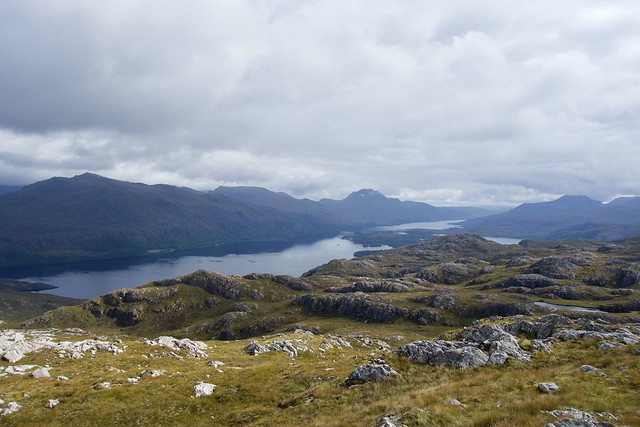
It had been a long day, some 35km, and we were both tired, so an early night and some Lidl Ben Bracken (Islay variety) was in order. Slept pretty well. More rain overnight, and an overcast morning. Allison spoke to the Corbett lady as we were setting off - she was off to try har luck with Beinn a'Chaisgein Mor. We walked up the path that heads to the bealach on Beinn Lair and found a track leading along Gleann Tulacha - not marked on the map, but a clear path with frequent cairn markers. As the geography of this place is a bit complicated, it was nice to have a path to follow under the mighty cliffs of Beinn Lair. Mind you, for those progressing further along the path (which I'm assuming comes out at the west end of Lochan Fada) a hard hat might be a good idea in case of rockfall from those very same cliffs, knowing how the goats nip about up there.
 BDD742D0-E557-400A-906C-82B90101260D_1_201_a
 by
Al, on Flickr
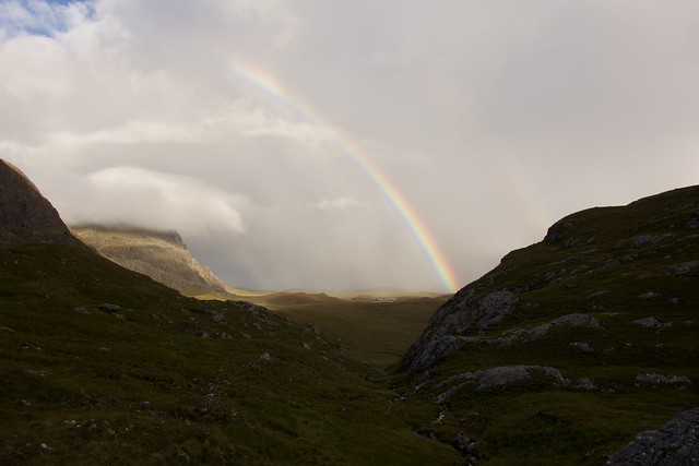
The rain won't be long now
 1B5B0E26-D950-4EB0-BACF-03CB86062372_1_201_a
 by
Al, on Flickr
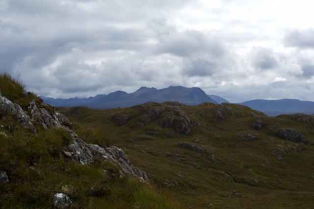
We left the path and started up the steep slopes of our hill. The rain was coming in waves and the cloud was down - we didn't hold out much hope for Mrs Corbett getting her summit today. There was a strange, eerie sound coming from somewhere up on the mist shrouded cliffs of Beinn Lair - was this Allison's doppelganger we'd caught on camera the first time we were there? Perhaps it was only the bleat of a spectral goat. We got up to the 639m top then along to the 652m one. Now this was a real disappointment - from here you can look right along Lochan Fada and Gorm Loch Mor - but all we could see were vague misty outlines instead of having our breath taken away. Sad. We walked back along, stopping to grab the final summit before heading back down to the tent. We had our lunch inside the tent as the rain paid us another visit, and saw Mrs Corbett coming back from her travails sadly without having managed to summit Beinn a'Chaisgein Mor. We both felt bad on her behalf - I suggested Allison should offer to nip back up there with her

 23567934-B0DF-4949-9340-178BF66FD7CB_1_201_a
 by
Al, on Flickr
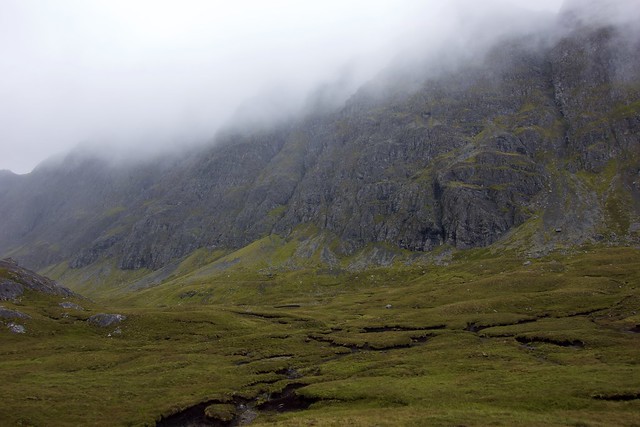
Beinn Lair's misty cliffs
 E01BD0EA-9190-4613-85A3-34B3167508C7_1_201_a
 by
Al, on Flickr
Sim 1 with Sim 2 in the background
 1E300CE2-B1FF-4591-AE8E-AC932C61F4F4_1_201_a
 by
Al, on Flickr
This should have been a breathtaking view...
 3C450400-3254-481F-B757-48DAC80F93BD_1_201_a
 by
Al, on Flickr
Stats - this doesn't include the walk out - add 15k and 250m ascent
 F4CA1C5D-BB68-4592-BE32-09BBC3CAD7ED_1_100_o
 by
Al, on Flickr
Now it was time for the walk out - we met a number of folk on their way in, and saw a clutch of bikes left at the end of the Carn more woods. Allison was feeling tired, I was feeling quite gloomy, so there wasn't a lot said on the way back to the car. We had time to take it easy on the next bit of the project, and motored around to Gairloch then up the wee road to Melvaig, where we parked the car at the parking area. Deciding to have an early tea, I rustled up some dahl and rice, then some coffee and biscuits, then some bananas. We were going to walk up to the sub An Cuaidh, which is the highest point on the Melvaig peninsula. And sleep on it, of course.
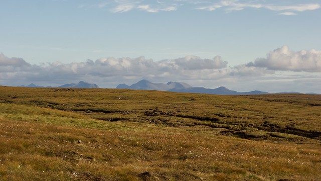
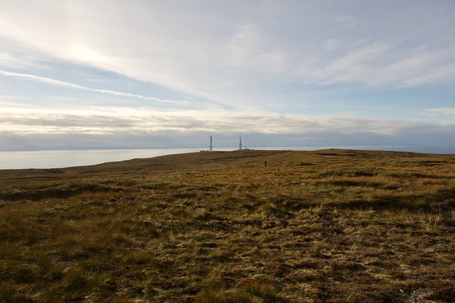
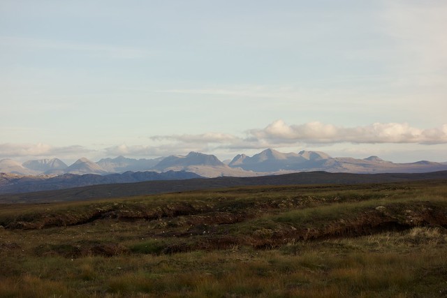
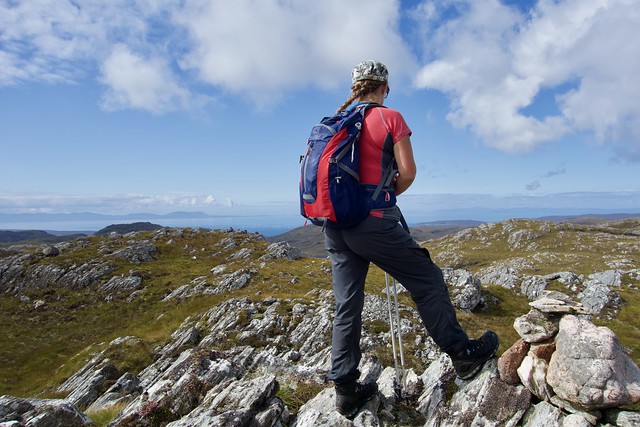
With our overnight packs on we walked along the road, as far at the track up to the transmitters. There is absolutely nothing indicating that you can't drive up to the transmitters - the road is metalled and has passing places, so my advice would be park at the transmitters and save yourself 5km of road walking - although it has to be said it was a good walk with fab views across to Skye and the Western Isles. From the transmitters, it is just under 1km of bog/peat hag territory to cross to get to the trig column that marks the top of this insignificant hill. But my God - what views! From Foinaven in the north, down to Suilven, Stac Pollaidh, then An Teallach, the Fisherfields, Slioch and the Torridon hills, round to the Cuillin and the hills of the Outer Hebrides, all the hills I love were here to feast upon. If I could only climb the hills I could see from here I would still be a happy man - you can keep Glencoe, the Cairngorms - all the hills I love are seen from this one spot.
Sun in Melvaig
 6AC7A2BD-1FEA-48AA-BA31-8B485CE1812E_1_201_a
 by
Al, on Flickr
 04C5B07C-68DA-48E9-BE18-6A3EADD8A721_1_201_a
 by
Al, on Flickr
 A52B196B-694A-4050-84CB-BD1DFAEA58AB_1_201_a
 by
Al, on Flickr
 FD45A2FE-5A67-4EBD-BA1B-EE445C435F1C_1_201_a
 by
Al, on Flickr
 D4857B51-CCC0-4378-8A33-30A01BDC93DA_1_201_a
 by
Al, on Flickr
Many peat hags to cross
 EEF704B6-4E3E-4052-81CA-82060E100B39_1_201_a
 by
Al, on Flickr
Northern friends
 28A805B1-8017-4950-8CEE-873E0B939597_1_201_a
 by
Al, on Flickr
 60D6FB8A-FEA3-4943-BAA8-8E9EF124479F_1_201_a
 by
Al, on Flickr
 3141B07F-18D0-48EC-9E81-EDFA848AA4B7_1_201_a
 by
Al, on Flickr
Sky over Skye
 091952BD-615D-4BC7-9448-11DE4138686D_1_201_a
 by
Al, on Flickr
 398EF580-CC5B-433B-A681-7287B0BECF43_1_201_a
 by
Al, on Flickr
Torridon
 F7F9FDAB-A4C8-4463-85D4-BC84A9AA31E4_1_201_a
 by
Al, on Flickr
 6F8FE776-ACC9-4BF1-AF15-45B3A918C1F0_1_201_a
 by
Al, on Flickr
 5FB15465-4C47-4D79-9155-55C1F3652C01_1_201_a
 by
Al, on Flickr
We gazed at the mighty view for a while, hoping for a classic sunset, but alas, a bank of cloud coming in from the west dampened that option. Assynt was still sunny, and we stayed out as long as the midges allowed, before taking refuge in the tent. A further rainy night, heavy at times, cloud down on the tops in the morning. I had decided that we'd take a more direct route down to the car, rather than returning along the track and road. This did save 2.5km, but at the expense of crossing fairly unpleasant terrain with numerous peat hags to climb in and out of as well as swamps to avoid. I don't think Allison was much impressed. Then the rain started...
 00D07570-B987-4215-A951-57D54077FBC9_1_100_o
 by
Al, on Flickr
We drove back into Gairloch, past the sign that says "Big Sand" and underneath "No access to beach". Past the campsite, which didn't look too busy with tents, but maybe they have a strict numbers restriction in place. Then along to Charlestown where we parked in the large car park for Flowerdale Estate. I had a Malky route for the two Marilyns in here - he'd knocked them off after work one evening in four hours. Hmmmm - we were not going to be challenging that time. The rain had been very heavy as we drove there and it was still raining as we packed up and left the car. Flowerdale Estate looks to be quite an interesting place - seat of the Clan Mackenzie, an arboretum and several other marked walkways. In the rain it was all a bit driech however. We passed several playful horses in a field and took the marked path for the Waterfall, which led us out of the main grounds and alongside the Abhainn Ghlas. Several craggy peaks came into view - Sithean Beag which joins onto our intended target of Sithean Mor; An Groban to the north. Onto a narrower muddy track then across a bridge or two, we had to leave the path and head up the steep slabby hillside to reach the deerfence between Beag and Mor. From here it was another steep pull up grass or rock (take your pick, but the rock was slippy and wet after the rain) til we came out on the craggy top of Sithean Mor.
 85DB8786-5668-46AD-B037-571F82F345A8_1_201_a
 by
Al, on Flickr
 85493A06-046C-4A71-B36A-FF04A7BC257D_1_201_a
 by
Al, on Flickr
An Groban
 29B74FE9-54C9-4A07-8877-2BAB1A5F488E_1_201_a
 by
Al, on Flickr
Sithean More
 DFF85322-2624-43DF-8B43-EF43CFAB98F1_1_201_a
 by
Al, on Flickr
 A814D592-BDC1-498D-B8F1-E9E7C33FFB60_1_201_a
 by
Al, on Flickr
Looking over to Meall an Doirein
 40A8734C-3D8B-48E3-8050-8A5C7483E6DD_1_201_a
 by
Al, on Flickr
By this time it was after 11.30. We pondered what to do. We could make a short circuit, going up An Groban from the east end of Sithean Mor and head down the road, or we could continue on as planned to Meall an Doirein, which we could see as a series of stony faces to the northeast. We had to head off Sithean Mor in the same direction for both, so postponed the decision and came down steep grassy slopes into Gleann a'Ghroban. There was a forest of ghost trees here - new plantation work that looks like it's been killed off in a fire, with only one or two survivors in the bowl like hollow. The ground is wet as you head towards the waterfall, I might even use the term water-meadow. Most of the damp can be avoided by keeping to the east however. We clambered up the right side of the waterfall and made our decision - lets go on to Doirein.
Ghost trees
 1969F345-6298-414D-B7C4-FC166F0550A4_1_201_a
 by
Al, on Flickr
This involved more wet ground, the crossing of numerous small streams and following the occasional deer path that seemed to be going our way. Eventually the ground became firmer under foot and we scrambled up on the rocky sides of Meall an Doirein. There are two cairns, with the smaller one to the south being the true summit. Fine views into Torridon and down Loch Maree, with friendly Slioch sitting bold under a hat of clouds. Malky's route took the west bank of Loch Airigh a'Phuill - I decided we would try a shortcut of going along the eastern bank. This seemed to work well - we picked up a post marked trail that took us past the dam at the far end and round the shoulder of An Groban to rejoin the main track we'd come in to Sithean Mor upon. The day was sunny and warm now, quite a few folk enjoying themselves along the riverside.
 037F298B-7C69-4ED9-A138-F3F7BDDAE674_1_201_a
 by
Al, on Flickr
Towards Meall an Doirein
 214039A5-3CDC-46B7-8360-E72099FC0276_1_201_a
 by
Al, on Flickr
 DE6FC261-F507-4C19-9A90-AF59FB069F88_1_201_a
 by
Al, on Flickr
 3F9D89BC-4C96-4E42-A18C-8E67815FC8F8_1_201_a
 by
Al, on Flickr
View down Loch Maree
 042C5B64-B173-4CA0-B967-A28BAE6B9A3A_1_201_a
 by
Al, on Flickr
 671C414D-AF72-4681-B297-A92C3B6B9B05_1_201_a
 by
Al, on Flickr
Loch airigh a'phuill
 D88048CC-B931-41BC-8262-4A3CF262BDE8_1_201_a
 by
Al, on Flickr
Sithean Mor
 089D4000-04E3-402E-B187-08873018D79B_1_201_a
 by
Al, on Flickr
 5E8E3A17-CA67-4FC0-9FEA-6253EE577E5B_1_100_o
 by
Al, on Flickr
We were back at the car for 3.20, not as late as I'd feared. The journey down the road was good for a Sunday - we even managed to stop and make something to eat at Ralia, rather than surviving on a packet of crisps til we got home.
