free to be able to rate and comment on reports (as well as access 1:25000 mapping).
23 Aug ŌĆō 04 Sep 2020IŌĆÖve found the past few weeksŌĆöpost-full-lockdownŌĆöto be much more difficult than full lockdown was. I havenŌĆÖt had the heart to go anywhere, even though itŌĆÖs now allowed. IŌĆÖve just heard too many stories of overcrowding and bad behaviour, and have seen it for myself. David and I had a grand day in Glen Finglas a few weeks ago, but on my way home from that outing, I came across a car parked IN THE MIDDLE OF THE ROAD. Fair enough, it was a single carriage way rather than single track, but even soŌĆ” (wtf) ŌĆ” it also took me forever to get home that day. Thereafter, I struggled to think of places that were doable in a day trip, and unlikely to be crowded; I didnŌĆÖt come up with any. So IŌĆÖve just stayed home.
Before lockdown, my general plan of attack for the next stage of post-work life was to spend one week a month in self-catering accommodation during non-peak times. IŌĆÖd done the sums, and it was manageable. Apres lockdown, the prices of self-catering have soared (for example, the place IŌĆÖve stayed multiple times in Lochinver jumped from less than ┬Ż400 to nearly ┬Ż600ŌĆöfor a weekŌĆöin November). I started thinking about finding a more permanent place in a location that was better suited for hitting the hills. Long story short, after considering a variety of options, IŌĆÖve taken a room in a shared house in Inverness for at least the next six months, giving me the best of both worlds; IŌĆÖm free to swap between a northern advance camp and my more southern home, as my mood or the weather suits. ItŌĆÖs early days, but so far, this has been a good decision, and I'm a happy happy girl.
Mon 24 Aug
Corbett: Bac an Eich (Strathconon)
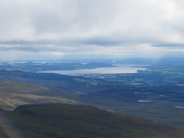
7 hrs / 21km / 868mFirst ŌĆ£properŌĆØ hill since mid-March, and boy, could I tell! IŌĆÖve done a lot of walking during the past five months, but itŌĆÖs a whole ŌĆśnother ballgame when you add ascent, rough ground, schlepping a rucksack, wearing boots on tender feet, and carrying poles.
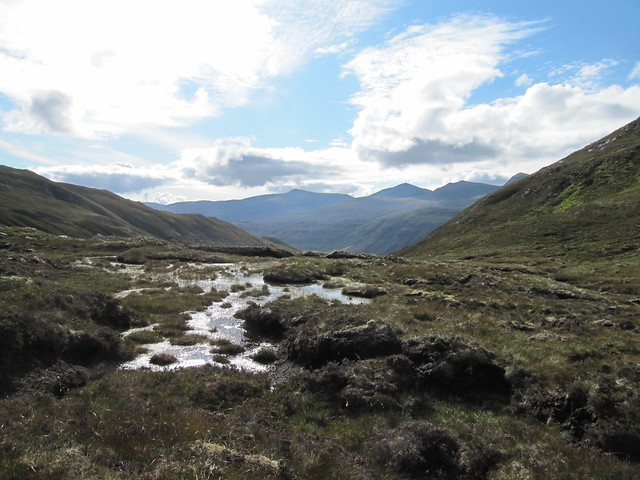
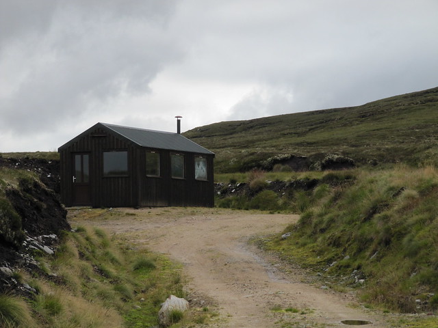
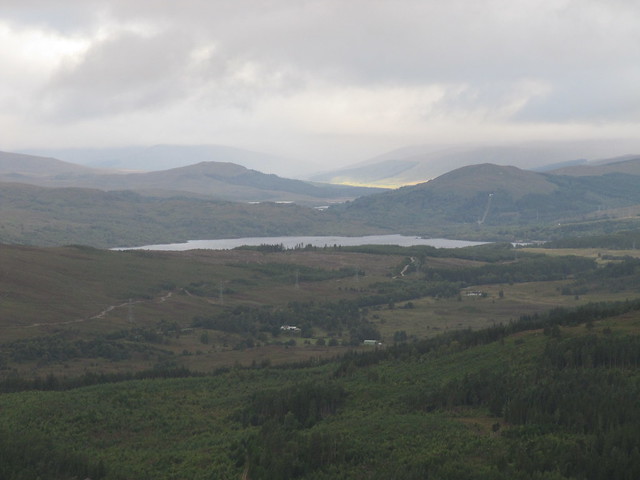
After a loooong drive down 13 or so miles of single-track, I parked up by Loch Beannacharain and headed up past various estate buildings, most of which looked like variously sized self-catering accommodation. There were no signs of any stalking taking place; in fact, I saw no one the entire day, until I was walking back along the loch to the carpark. The morning was crisp and cold; the autumnal nip meant a lie-in for the wee beasties. I was in high spirits. ThereŌĆÖs a good path that leads all the way up to the bealach; thereafter, youŌĆÖre on your own. I thought IŌĆÖd read something about bits and pieces of stalkersŌĆÖ paths, but I saw no evidence of such once IŌĆÖd left the main path.

"still as glass" Loch Beannacharain; looking in the general direction I'm heading

the evocative ruins; what a setting!
Once the serious ascent began (about the last ┬Į km or so before the bealach), I had to stop about every 100 steps to catch my breath. It was like being a newbie hill-climber all over again! The sweat was pouring off me, and by the time I came out of the shadow of Creag Coire na Feola and into the sunshineŌĆöabout the same time the ascent began in earnestŌĆöthe midges and flies had awakened. TheyŌĆÖd quickly find me when I stopped, which kept my frequent breaks brief.

looking up toward the bealach...

...and back down from whence I've come (not sure about the hills -- maybe the ones near Craig?)
from just below the final summit push
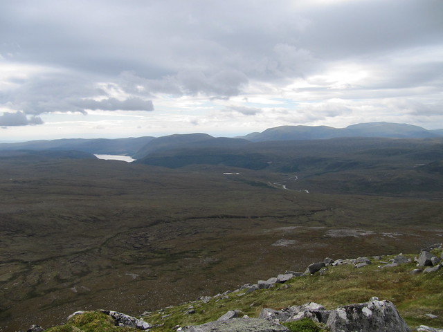
It took me a long time to reach the summit, but it was so worth the effort. There was very good visibility, and I could pick out the Strathfarrars, the Mullardochs, the Maoile Lunnddaidhs (yeah, I know thereŌĆÖs only one of them, but IŌĆÖm on a roll with the plurals, gimme a break), the Torridons, and further afield, even the Fisherfields. Wow, wow, wow.

the Strathfarrars, looking very close

the Torridons
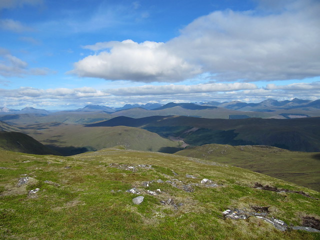
can't remember which direction this is in...or identify any of the hills...but it's a nice pic!

I badly wanted to sit and savour the moment, but The Midge had other ideas. I kept them at bay for a few minutes by settling in a few meters from the summit shelter/cairn, but they found me after IŌĆÖd had about three bites of my sandwich. So I didnŌĆÖt linger for nearly as long as I wanted.

the long road home -- Gleann Chorainn
The descent through Gleann Chorainn was scenic, but long, and my feet were very sore long before I reached the nearly 4km of road walking that would finish the outing. Nowt to do but put your head down and get to it. (Ah, yes, THIS I remember!)
I was happy to reach the car, and comfy shoes, and even happier that IŌĆÖd be back at my new home-from-home in only an hour!
Tues 25 AugHeavy rain was forecast for the afternoon (which didnŌĆÖt come to muchŌĆ”), so I had a lie-in followed by a neighbourhood recce (down past the Culloden battlefield, to Leanach, and back around through Culloden Wood). In the late morning/early afternoon, I had a drive down the east side of Loch Ness as far as Foyers, and then back up.
Wed 26 Aug
Corbett: Beinn aŌĆÖ Chasteal (Strath Vaich)
ŌĆ£thereŌĆÖs nae water in Loch Vaich!ŌĆØ
6┬╝ hrs / 24km / 932mI felt much more like myself today. Perhaps having a rest day was the key. At any rate, I set off from Black Bridge at 7am. The first few kms were tarmacked, which made for easy going. Even thereafter, it was a good track, and as I made my way past the hielanŌĆÖ coos in the middle of it, reassuring them that I meant no harm, that we were all ok, and that I was just passing through, I was still contemplating whether IŌĆÖd go clockwise (WH recommended) or anti-clockwise. The bulk of Meall aŌĆÖGhrianain loomed intimidatingly, and I pondered whether to carry on along the loch (completely empty of water; wonder if theyŌĆÖre working on the dam?) and do a simple up and back.
ŌĆ£Stop being a wussy,ŌĆØ I told myself, and picked a good spot to head across the heather and up to the ridge.

doesnae look so steep... (in the photo anyway!)

(behind me) looking back the way I've come. A much duller day than my previous outing.
The WH route continued along the track to go over Meallan Donn, but I saw little reason to add either the extra distance or the extra ascent. Heather bashing at its best; hard work, but I was making much better progress than the previous day, which kept me in good spirits. As I approached the very steep steepness of Meall aŌĆÖGhrianain, I saw a path that zigzagged up its nose; ŌĆ£thatŌĆÖll help,ŌĆØ I thought. Or it would have, if IŌĆÖd have been able to find itŌĆ”
It was as steep as it looked. I wasnŌĆÖt quite grabbing onto handfuls of heather, but almost.
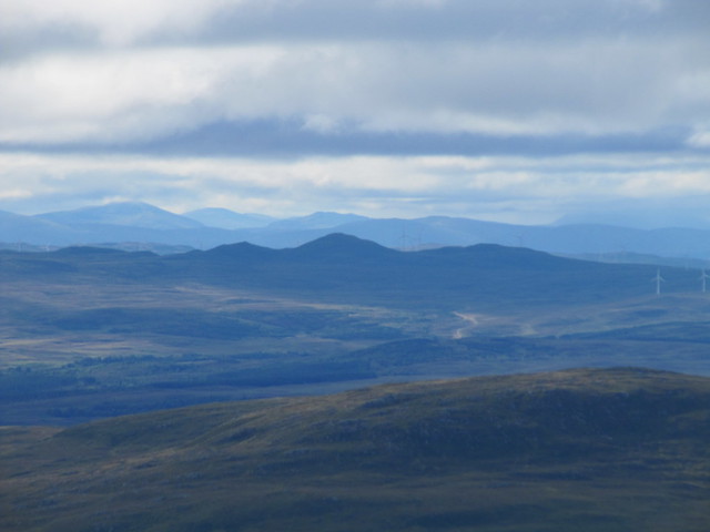
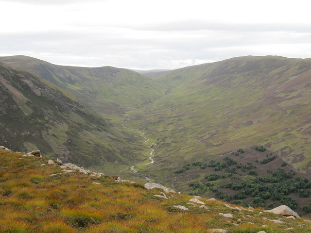
I knew IŌĆÖd still be a fair distance from the summit once IŌĆÖd reached the top of MaŌĆÖG, but it both looked and felt like IŌĆÖd broken the back of the ascent. And I had. There was a drop of 140m or so, but both down and back up was easy walking over short heather and grass, and rocks. There was an impressive drop down into Coire aŌĆÖChundrain, which I think might be part of the Alladale estate. I figured one of the hills I was looking at in that general direction was Carn Chuinneag, another one thatŌĆÖs on my radar, but I didnŌĆÖt bother to identify exactly which one. I read in someoneŌĆÖs WR that the two hills arenŌĆÖt very far apart as the crow flies, but that thereŌĆÖs a long old road distance between the usual start points for each.

still a ways to go

Coire aŌĆÖChundrain

approaching the summit cairn/trig point

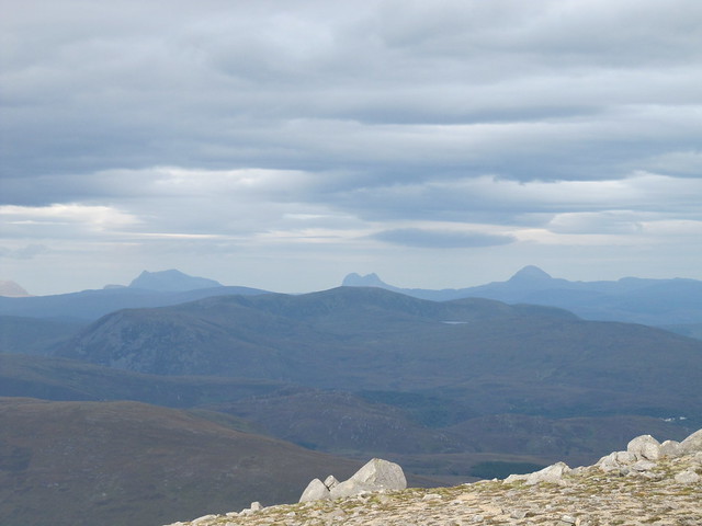
in the general direction of Beinn Dearg, I think, or maybe it's Seana Braigh in the cloud. I could see glimpses of the lower reaches of Suilven, but it's not apparent in any of the photos
It was hazy, and the cloud level was just about Munro height (Seana Braigh and Beinn Dearg were in the cloud; the other Beinn Dearg hills were just below). That, combined with the wide broad summit meant that I didnŌĆÖt get very many good photos. But I didnŌĆÖt care much, as I was happy to just soak it all in. I felt as though I was deep in the wilderness, and that there werenŌĆÖt any people around for miles and miles. I KNEW IŌĆÖd be able to easily find solitude in more northern parts!
Rockhopper had recently done both my hill *and* Carn Ban in the same day, and, looking across at it from where I sat, and taking the both the distance and descent/ascent into account, I couldnŌĆÖt help but be impressed at the accomplishment, even though he did use his bike.

nae water in the loch

the descent was quite steep for a while
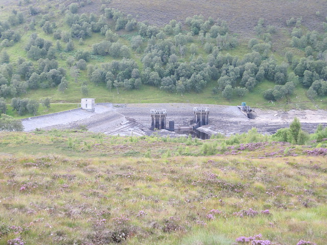
dam works getting an airing
The way back was uneventful; a long march along the empty loch. I kept my eyes peeled for any abandoned and drowned buildings or homes, but didnŌĆÖt see any.
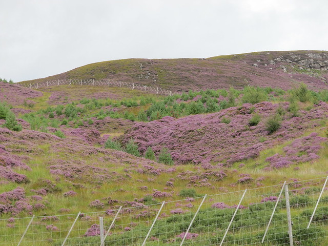
nice heather
Thurs 27 Aug
ŌĆ£recceŌĆØ** on Fuar Tholl
A huge hurrah to the folks in Achnasheen for having their toilets open!
6 hrs / 17.57km / 791m ** To be fair, itŌĆÖs not really correct to call this a recce. Nor was it a fail. It was simply having the ŌĆ£luckŌĆØxury of choosing to not climb this cracking Corbett in the clag. And in the clag it remained, as I climbed up into Coire Lair; there were spatterings of rain as well (there werenŌĆÖt supposed to beŌĆ”!) So I went up as far as the cloud levelŌĆöabout 550m, which is approximately the same place youŌĆÖd generally come back down to the path from Sgorr RuadhŌĆöand when it started raining again, even more enthusiastically, I decided that today just wasnŌĆÖt the day for this hill.

uh...where's Fuar Tholl?
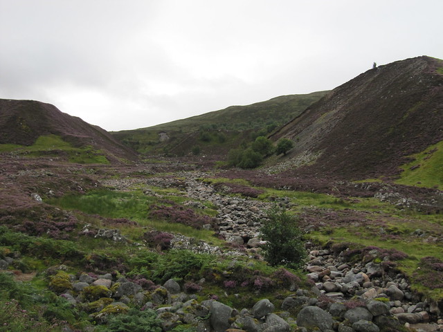
So back down to the river it was. I then carried on across the moor to the Easan Dorcha (The Teahouse) bothy. WasnŌĆÖt sure whether itŌĆÖd be open, but it was, so I sheltered from both the rain and the midges (which are unbelievable; probably the worst IŌĆÖve ever known) for my lunch before heading back the same way.

Easan Dorcha falls

some magnificent Caledonian pines along the way
 Fri 28 Aug
Another fairly grotty day; at least in the morning. So another lazy morning, just pottering around, having a leisurely brekkie and tidying my space. I went out mid-morning for a few hours, mostly to pick up a few things, and to try and learn my way around Inverness. I managed to find my way to Lidl and Go Outdoors (who even knew there was one in Inverness? Dangerous, IŌĆÖm afraid), via the city centre, which IŌĆÖve now passed through several times and am just starting to figure it out. From there, I found the Merkinch local wildlife reserve, which sits right on the Beauly Firth. A lovely spot. I still havenŌĆÖt figured out how to get to Morrisons.
Sat 29 Aug
Corbett: Beinn aŌĆÖ BhaŌĆÖach Ard (Strathfarrar)
ŌĆ£No stalking on Sat or SunŌĆØ
6┬╝ hrs / 16.57km / 949mMy hill was in the clag when I reached the Glen Strathfarrar carpark. (No dragon lady for me today!) I sat in the car for a while; I didnŌĆÖt really need to make an early start. But IŌĆÖm no good at waiting, and I was out of the car by 7:00am, ready to head up the glen. It would clear, I was sure. There was a man whoŌĆÖd stayed in the carpark in his van overnight, and I stopped to chat to him for a bit. HeŌĆÖs working on the Corbetts as well, section by section. As opposed to my complete scattergun approach, with the odd Graham or other hill thrown in from time to time.

some blue sky up there, as I headed up the glen

faint rainbow, green grass, purple heather

over toward some of the Strathfarrar Munros
It took me a long time to get to the summit. I was taking my time, and still hadnŌĆÖt really decided whether IŌĆÖd do an out ŌĆśn back or the complete horseshoe. ItŌĆÖd depend on how things looked once I got up high. There were lots of squalls about, both further up the glen and back over the Beauly and Cromarty Firths, and I enjoyed watching them gather and pass by. The temperature was quite chilly, and the wind had a definite autumnal bite to it. I didnŌĆÖt mind at all; it kept the wee beasties at bay!
Beauly Firth
toward Torridon, I think

bobble hat's first outing
From the summit, I could clearly see the way ahead, all the way down to Loch na Beiste. So I carried on, and thoroughly enjoyed walking along the ridge to Sgurr aŌĆÖ Phollain and then Carn na Ghabhalach. So far, so good.

the route ahead
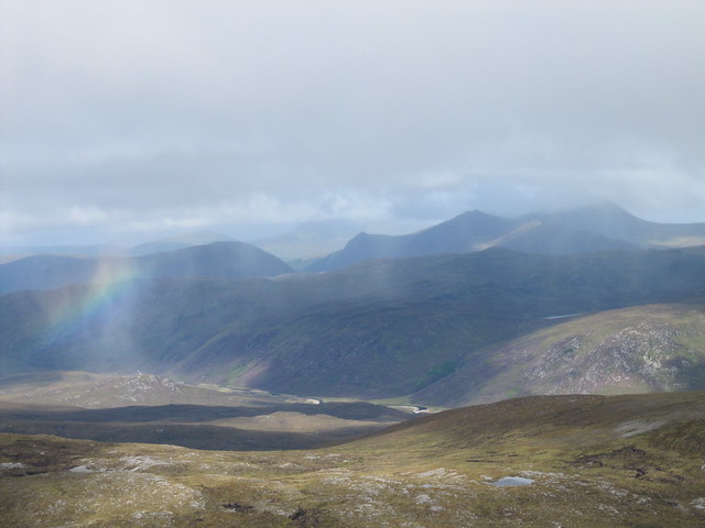
squally showers, dark skies
About the same time I started the descent, aiming for Loch na Beiste, the squally showers that had been passing me by gathered into one rather extended shower, and visibility dropped to zero. It was a long and soggy way down to the loch. There were, as IŌĆÖd read, bits and pieces of a stalkersŌĆÖ path, but I kept losing it. I was quite wet, as IŌĆÖd chosen not to dig out my waterproofs, convinced that the shower would pass. It did, eventually, and I was mostly dry by the time I reached the car.

rain gone off by the time I reached Loch na Beiste
There was a good (and easy to follow) path from the loch back down to the glen. All I had to worry about now was randy stags. I wondered if they knew it wasnŌĆÖt quite yet September, or whether any precocious ones would care. I also wondered if the whole ŌĆ£issueŌĆØ with the stags was a Strathfarrar Legend; from what I could tell, there was only one report of a walker running into difficulties, and that was back in 2009. I did see deer when I reached the lower slopes, but they ran in the other direction. As they usually do.
A good walk, a good day. Oh, I nearly forgot (ŌĆśtil I reread the subtitle). Disturbingly, I heard several rifle shots when I was up on the ridge. I couldnŌĆÖt tell how far away they were, or which direction they were coming from. It made me quite uneasy, as IŌĆÖd chosen to do this walk today because the WH/Head for the Scottish Hills current info is that is NO stalking takes place on Saturdays or Sundays!

Yikes.
Sun 30 Aug
Corbett: (itŌĆÖs a long way to) Carn na Saobhaidhe (via Dumnaglass)
6┬Į hrs / 27km / 702mAnother early start. I arrived at the phone box in the middle of nowhere just after 7am; it wasnŌĆÖt looking too clever in my general direction. And it was drizzling. THAT wasnŌĆÖt forecast! WhatŌĆÖs going on here? I forced myself to sit in the car for a while to see if the situation would improve. And by golly, it did. By 8am, it was looking a whole lot brighter. About the same time I was contemplating making a move, another car pulled up. ThatŌĆÖs our ŌĆ£carparkŌĆØ full, then! I said a brief good morning to the couple who emerged, and started up the track I was going to become very familiar with over the next few hours.

carpark full

osprey gatepost
Before IŌĆÖd gone very far, I stopped to have a chat with a very nice estate worker who confirmed that, it being a Sunday, thereŌĆÖd be no shooting.
Onward and upward. The midges were ferocious as I made my way up the first long ascent, toward the junction where you go left to go to the turbines, or right to drop down to walk along the Allt Uisg an t-Sidhean. Usually, as long as you keep moving, the midges arenŌĆÖt too much of a bother. But on many of my walks over the past week, theyŌĆÖve found me anywayŌĆöand sometimes even when thereŌĆÖs a fairly good breeze! I was sweating buckets, which didnŌĆÖt help the overall situation. I even dug my midge net out of my rucksack, and quickly realized it was the one that uses mesh with holes big enough for the midges to get through.

IŌĆÖm not sure why IŌĆÖve kept it (or, for that matter, exactly where the other one isŌĆ”)
In spite of the beasties, I was enjoying the walk. It was easy going. I spotted the couple behind me at one point, but never saw them again thereafter; I can only assume that they headed off the track to do a route that wasnŌĆÖt the Corbett. Their car was still at the start point when I returned.


I wasnŌĆÖt sure where the Diamond Jubilee hut was; itŌĆÖs not on the map. I was looking forward to having a sit-down in it! ItŌĆÖs only about a km before the summit, at the last ŌĆ£fordŌĆØ marked on the map (but there wasnŌĆÖt oneŌĆöa ford, that isŌĆönot there, anyway. There are several before that, not insubstantial, even when not in spate).
I did sit for a few minutes, but then decided that IŌĆÖd make my summit bid, and return to have my lunch in the hut. I thought about leaving my rucksack there, but in the spirit of training for long days carrying full kit, I took it along. The summit was a funny old thing. Wide and flat, the next hill over looked far higher than the summit on which I stood. So I checked the map just to be sure. Yep, itŌĆÖs bagged. Anyway, looking in one directionŌĆöeast-ish, I thinkŌĆöthereŌĆÖs nothing but miles and miles and miles of empty land. But then when you pan around, thereŌĆÖs a mast just a few hundred metres from the summit cairn, and no fewer than four wind farms visible.

summit cairn

not much going on in this direction...acres and acres of empty land...
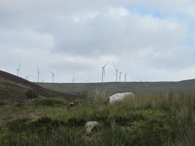
...but these guys are never far away

toward Loch Ness
After my lunch, I started the long walk back, arriving at the car at 2:30pm. Tired, but happy after another lovely day in the hills, with only about a half hour drive to food and a hot shower!

the new lodge, as seen on my return journey; another fantastic setting
Mon 31 Aug
Viaduct recce, from ŌĆ£homeŌĆØ
4┬╝ hrs / 20km / 410m ThereŌĆÖs a huge rail viaduct a couple of miles down past the battlefield. I saw it the other day when I was making my way back from Nairn. I wanted to see it up close and personal, so doing that, and finding access points onto the nearby hills was my goal today. I ended up walking 20km!

big viaduct


HUGE!

I made a detour to Clava Cairns on my way home

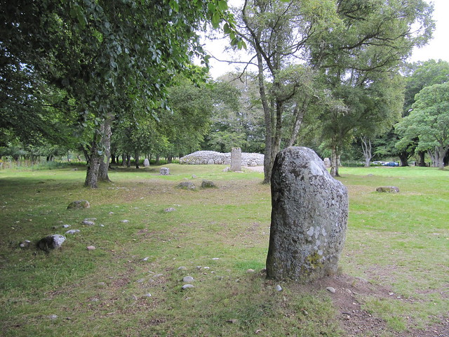
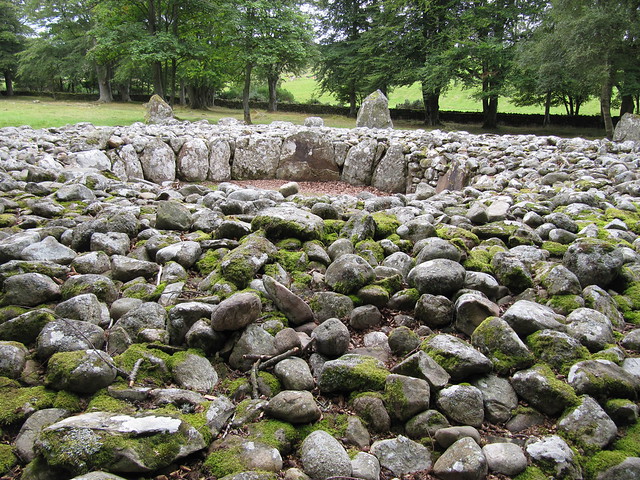
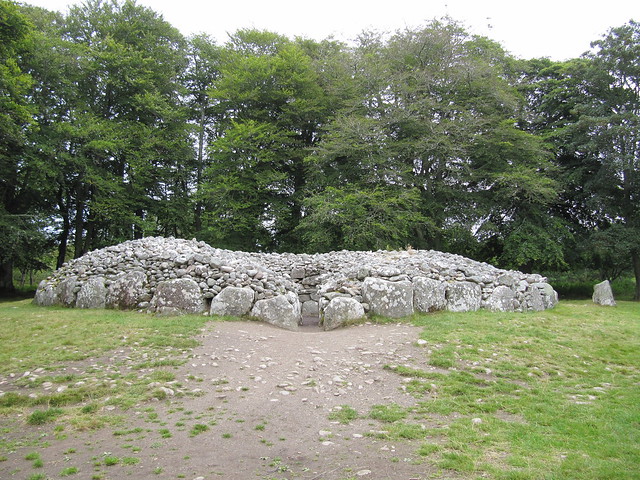
must return at the winter solstice to (perhaps) see the sun shining through the door of this one onto its back wall
Tues 01 Sep
Corbett: Carn Chuinneag
6┬Į hrs / 17.57km / 817mI took several wrong turns getting to the start point. Amongst other errors, I was convinced that I was on the wrong side of the river heading up the glen, so I took the first opportunity to cross over, and ended up at a dead end. So I had to backtrack and continue up the glen until I reached the next/correct bridge. What was meant to be just a bit more than an hoursŌĆÖ drive (although I think google map tends to be a bit optimistic about single track roads) was closer to two; although my own mis-steps added to the time.
I was out of the car and on my way by 8:15. I wasnŌĆÖt sure about stalking, so kept my eyes peeled for any likely-looking activity as I made my way past the lodge, and to the track that would carry me to the bottom of the hill. I was on auto-pilot this morning; there was track or good stalkersŌĆÖ path all the way to the top. ItŌĆÖs actually a bit of a relief to not have to worry about navigation.

a tranquil welcome to Glencalvie Estate

the obligatory photo of the tree house

how the important (or just money-ed) guests arrive

I'm headed up there (but that's not the summit)
Just before I reached the point where IŌĆÖd leave the track, I startled a stag that was no more than a hundred meters or so away. Truthfully, we startled each other. IŌĆÖve heard stags roar, and hinds bark, but this one screeched. Like a girl! I kid you not; it was a noise IŌĆÖve never heard before. He made the same noise a few minutes later, from a bit further away from me.
The path zigzags delightfully up the hill. I was thoroughly enjoying myself.
the dee-lightful stalkers' path
Once IŌĆÖd gained a bit of height, there was enough of a breeze to keep The Midge away (theyŌĆÖd been pretty bad down in the glen, along the river). I stopped often to admire the views back over the glen IŌĆÖd come up, and another oneŌĆöGlen Diebidale opening up in front of me.

looking back doon Glen Calvie; the way I'd come up
...and in another direction, down into the impressive Glen Diebidale
As I gained even more height, all the weird and wonderful Assynt hills got in on the action. I thought one of the hills in my view was probably Beinn aŌĆÖ Chasteal, the one IŌĆÖd done the other day from Strath Vaich, but I wasnŌĆÖt sure which.

them's be Assynt hills!
approaching the summit
I settled in behind a large rock just before the summit to have my sandwich and enjoy the panorama. IŌĆÖd exchanged a couple of texts with Rob, whom I havenŌĆÖt spoken with since before his mum died, so I gave him a ring, fully aware of being one of those annoying people yakking on their phone on a summit, rather than enjoying the moment! But hey, there was no else around who I might be botheringŌĆöand we had a long chat. Until I was freezing, and he had to go back to work.
looking east (Lochain a'Chairn, methinks)

zoom to the Dornoch Firth
toward Assynt

this way (northeast-ish, Loch Chuinneag) looks like another alternative way to descend
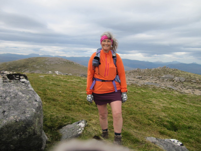
from bobble hat to short skort; welcome to late summer in the Highlands!
one more
I chose to come back the alternative way, popping over the other top, and then traversing around, rather than following the path all the way back down. But I didnŌĆÖt exactly follow the WH route, convinced that I could cut off some distance by cutting the corner. This left me with a LOT of boulders to cross over. I kept telling myself it was good practiceŌĆöwhich it wasŌĆöbut it also took a lot out of me, and I was greatly relieved to reach the tall cairn that marked my return to the original path.
The rest of the descent was uneventful, except meeting two other women who were on their way up; the only people I saw all day. This was a great hill, and IŌĆÖd happily do it again. Maybe not the boulders, though. I was shattered when I got home.
Wed 02 SepI was still tired when I awoke this morning, and could hear the rain on my window, so decided IŌĆÖd do a bit more exploring of the non-walking variety. I was determined to find my way to Morrisons, and I finally did. But the big Tesco is much closer, and much more convenient.
I drove out to Arderseir and sat by the water, just watching, and reading a bit, having a chat with Teresa. On the way back, I stopped in at the Connage Cheese Pantry (who supplies The Rumblie with their breakfast cheese boards), and had a lovely blether with the ladies in the shop, and bought several bits of cheese, including a gouda with garlic and nettles. It doesnŌĆÖt look very nice, and isnŌĆÖt very pretty, and you might think ŌĆ£ughŌĆØ (I did), but itŌĆÖs surprisingly good. They have dozens and dozens of choices, a lot of them made on the premises, so IŌĆÖm sure IŌĆÖll make more visits. (Because I can.

)
Thurs 03 Sep
Corbett: Little Wyvis
3┬╝ hrs / 9.72km (+ another 10 km out to Chanonry Point) / 669mI have to admit that I didnŌĆÖt fully enjoy this little venture from start to finish, which might have had just a little something to do with the midges, the coos, the rain, and the zero viz from the summit. I set off from Silverbridge a bit before 8am. It felt like a bit of cheat, taking the route that has a track all the way to the top, but I really didnŌĆÖt fancy hacking my way over rough ground, and through whatŌĆÖs probably chest-high bracken at the moment. I knew it would be a short outing, and pondered on what I might do with the rest of my day.
Not long after I made my way around the access gate and started ascending, I came across a herd of hielanŌĆÖ coo mamas and babies, planted firmly in the middle of my track. They didnŌĆÖt seem inclined to move, and after a bit of cautious edging forward, they sort of moved. Slightly. They seemed more wary of me than I was of them, but it still didnŌĆÖt make for an easy existence, and I was greatly relieved once I had managed to pass by them without incident.

looking back over what I've done so far; coos are behind the trees to the left of the lochan
IŌĆÖve already mentioned (once or twice) how bad the midges are at the moment. In the past, IŌĆÖve found them to not be too much of a bother as long as you keep moving. ThatŌĆÖs not the case at the moment, and I stopped partway up the hill to put my windbreaker on to cover my arms, even though I was already sweating buckets. There wasnŌĆÖt even a hint of a breeze until I reached nearly 500mŌĆöwhich meant no stopping. Huffing and puffing and sweating for England wasnŌĆÖt very pleasant. Why do I do this?
nice view over Loch Luichart, which I've driven along many times, before I'm into the clag
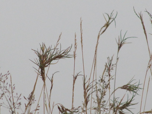
arty grass shot

approaching the summit cairn. Oh, the view!!
I reached the summit in just over an hour and a half. I settled in at the cairn, convinced that the cloud was going to clear. I wasnŌĆÖt in a hurry. After about 20 minutesŌĆöwhich I did enjoy, just sitting and contemplating lifeŌĆöthe rain came on, and I scurried down the way IŌĆÖd come up, with one small detour, to avoid the coos, which were still standing in the middle of the track.
I fell over on my way back down, and somehow managed to rather spectacularly bruise my left bosom.
(I can't help thinking of the incident as "whack a boob".)
The weather was quite pleasant when I reached the Black Water bridge, and I watched the water for a while, wondering if I might see some salmon (I didnŌĆÖt).

lovely Black Water. Must return in a few weeks when leaves are in full colour.
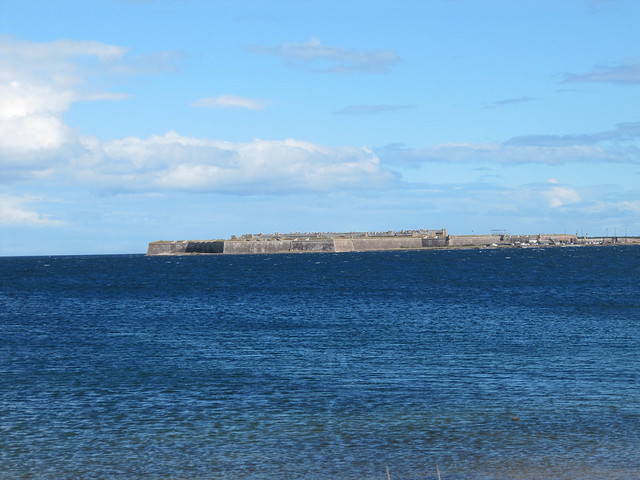
I did my usual freshening up in the car, changing my boots and washing my face, then decided to do a bit of exploring of the Black Isle. So I made my way to Fortrose, walked from there out to Chanonry Point, where youŌĆÖre likely to see bottlenose dophins (I didnŌĆÖt), and then back along Fortrose Bay.

walk along Fortrose Bay

Chanonry Point lighthouse
Fort George is a rather long drive away, but only a short swim

this is apparently THE spot from which to see dolphins
Even though I didnŌĆÖt enjoy ALL of the morning, I did enjoy most of it.
But IŌĆÖm exhausted, and at some point during the day, I decided that IŌĆÖm ready to go home for a while. I feel a bit like IŌĆÖve picked a lot of the low-hanging fruit (i.e., easy ŌĆ£bagsŌĆØ) during this first stay, but then I also realize that thereŌĆÖs still so much more to do and see: Fuar Tholl, An Ruadh Stac, the elusive Meall Doire Faid, Sgorr na Diollaid; spoiled for choice, really. And those are all north of InvernessŌĆöthereŌĆÖs still all of the Cairngorms, and the A82 corridor to consider. And I did manage to get some of the longer day/drive combos done (Beinn aŌĆÖ Chasteal, Carn Chuinneag, Carn na Saobhaidhe) while thereŌĆÖs still enough daylight available.
IŌĆÖm just happy and relieved to discover that IŌĆÖm still physically capable of this malarkey after such a long absence!
