free to be able to rate and comment on reports (as well as access 1:25000 mapping).
My mountain-mad husband has his own way of classifying Scottish hills, developed over the years of walking and climbing. Corbetts, for example, can be divided in three groups: 1. Hardly-worth-a-climb Corbetts 2. Corbetts to climb in winter 3. The F-word Corbetts, where the F word usually stands for FANTASTIC, sometimes for FRIGHTENING and in a few cases it's a word I can't use, murmured in agony during a particularly steep or rocky climb

Quinag was always in the last category. Another mountain on the list, walked on a misty winter day, well worth re-doing in better conditions, if only for the views.
I had a look in Kevin's albums, but I found very few pictures from that cold December day. Yet what I saw only whetted my appetite...
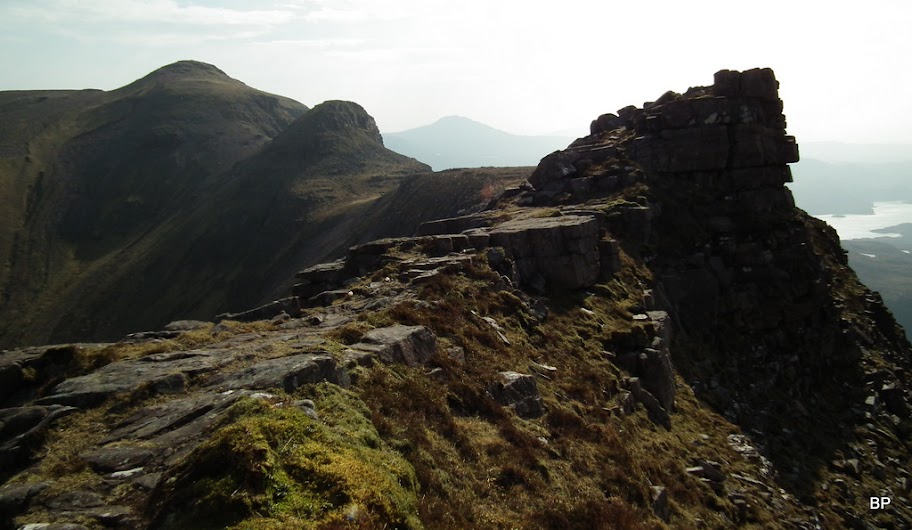
On the ridge of Quinag, Dec 1992:
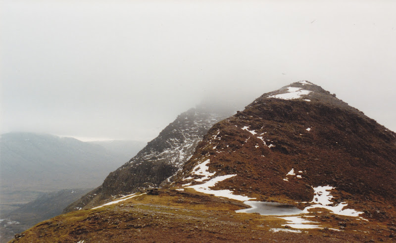
I liked the very idea of conquering the three-Corbetts-in-one mountain, walking all the way along its complicated ridge and gazing down into vertical drops. I used to be a serious vertigo sufferer, but these days are now gone. On the other hand, looking at the narrow, serrated line of Quinag's peaks always gave me goosebumps

Having successfully conquered my all-time menace, Suilven, followed by the two Assynt Munros (Conival & Ben More Assynt) it would be logical to put Quinag next on my list. Sadly, weather was never quite good enough to head for this area and my dreams of testing my vertigo progress had to be put aside. Instead, I tested myself in the Cuilin and did well on Sgurr Alasdair, after which Quinag's rocky paths didn't seem too scary at all.
Last Sunday eventually, my waiting came to an end. Apart from a slight haze in the air, conditions were perfect for climbing - so here we were, driving north past Ullapool and into the weird world of Assynt Hills. I always feel like I landed on another planet when surrounded by these oddly shaped hills...
Quinag (or in Gaelic: Cuinneag, a milking pail), definitely an F-word Corbett, welcome us with its arms widely open... The day looked great!
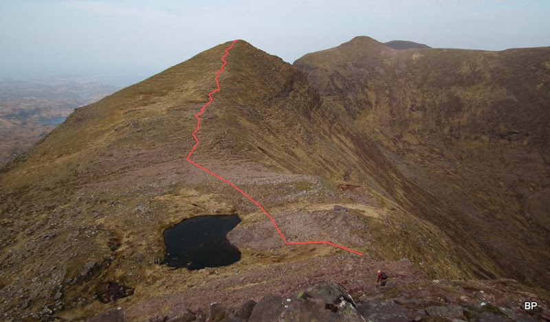
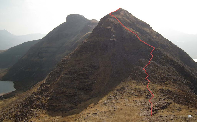
Our route looked like that:
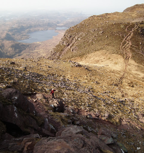
The mountain belongs to John Muir Trust and I have to say I was impressed by the good work that has been done with access paths. In the middle of the picture above, the main descent path is clearly visible, and another branch was also made to ease the access to the slopes of Spidean Coinich.
It was surprisingly warm and I had to apply 50+ sunscreen again. Allergy to UV... I hate it, but there's nothing I can do. It runs in my family... So sticky cream and sunglasses are necessary:
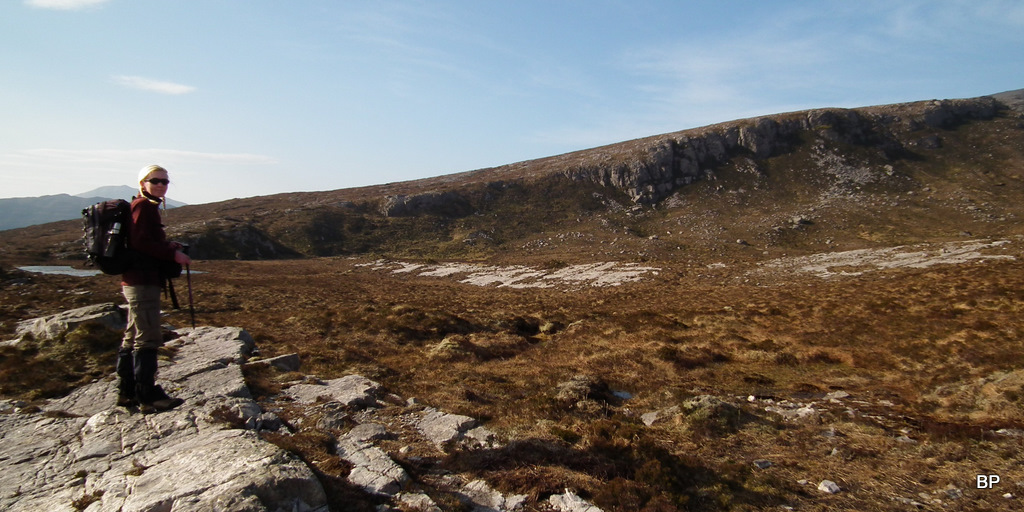
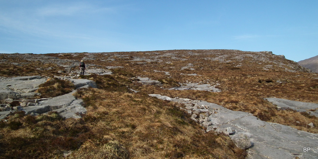
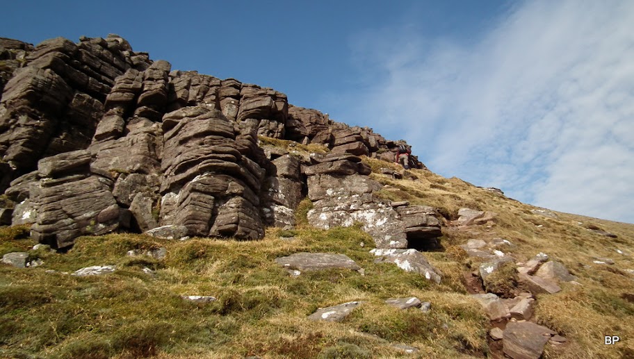
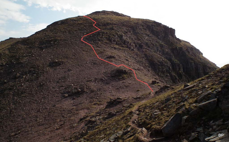
The initial climb is up rocky slabs and relatively dry terrain (may be a whole different story after heavy rain though) and it even felt a wee bit boring, especially that all the views towards the ridge were hidden at this point:
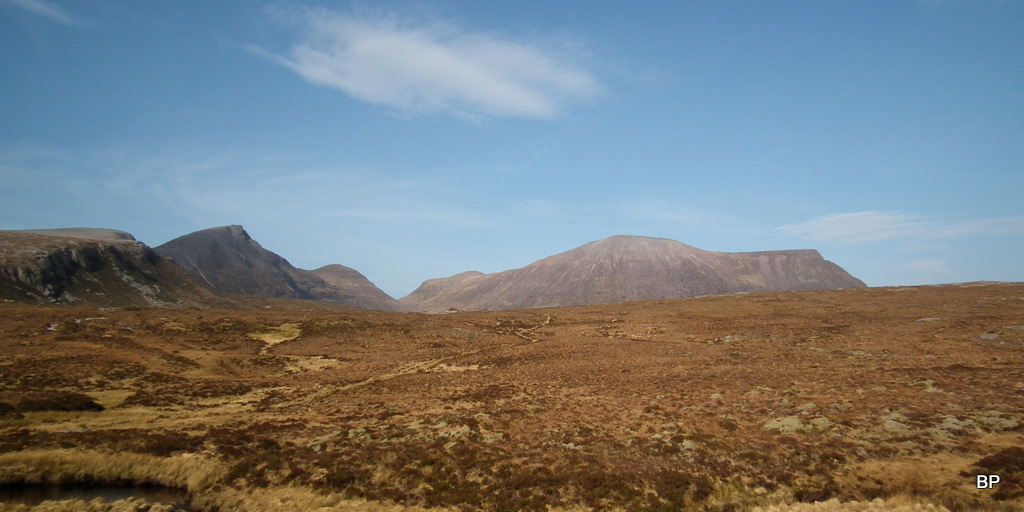
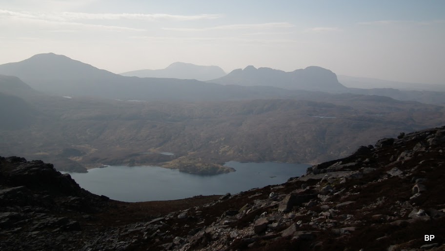
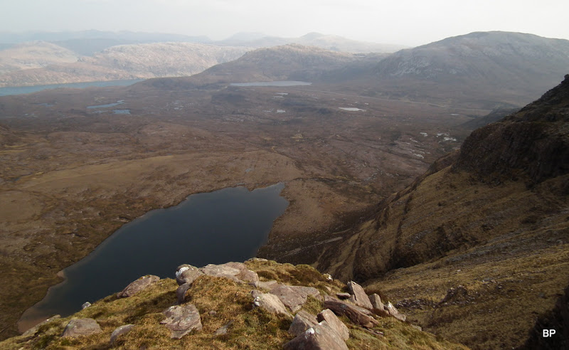
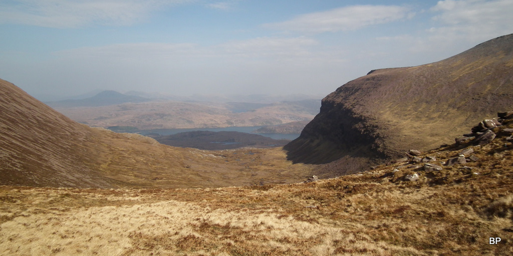
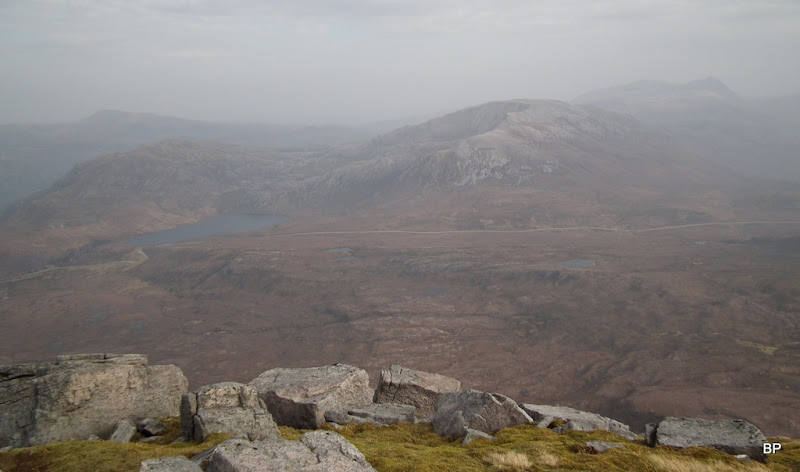
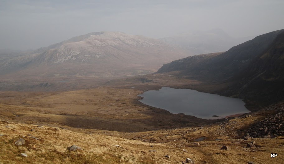
Still, one could admire the somehow hazy panorama of Loch Assynt:
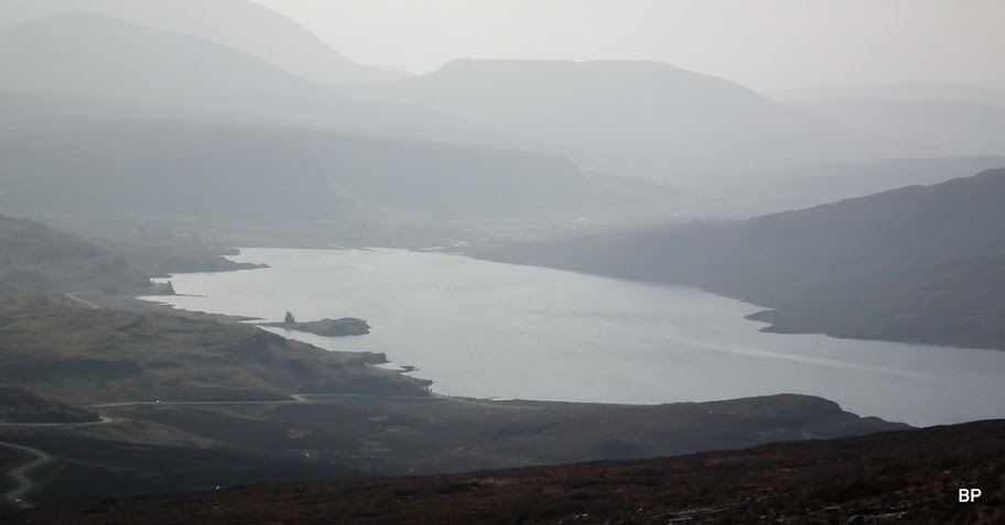
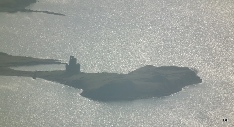
Close-up to Ardvreck Castle:
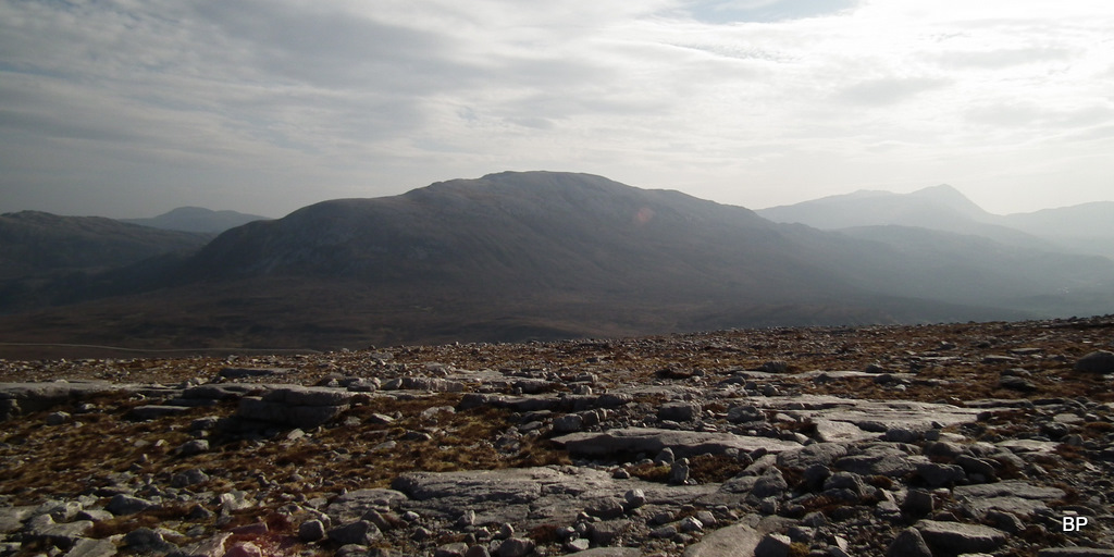
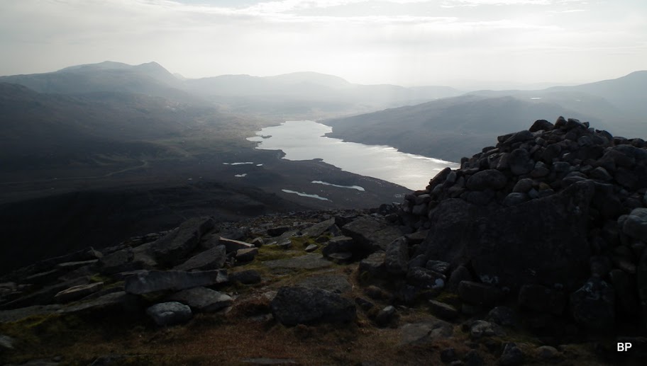
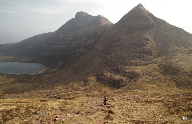
The climb took us to a flatter area (620m point on the 1-25k map) and at last, a proper view:
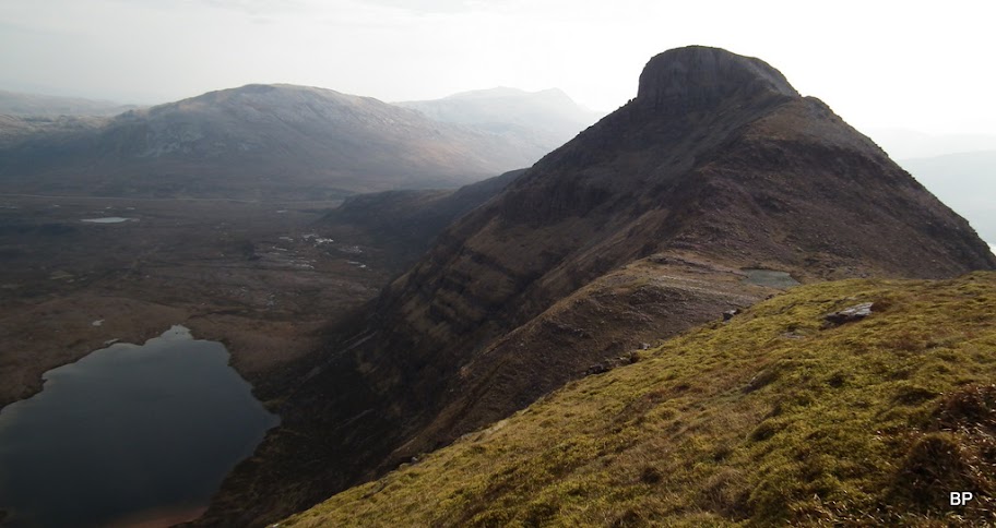
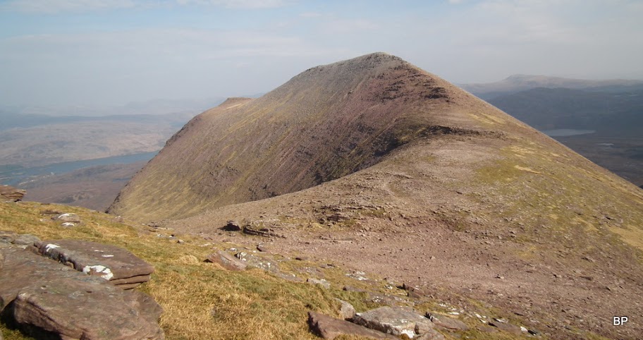
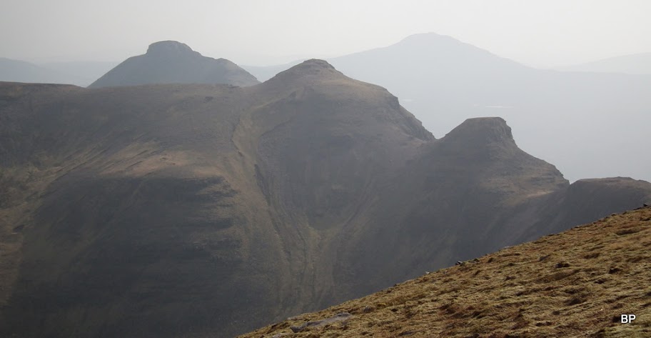
To the very left, he pointy top of the first Corbett, Spidean Coinich (764 m), Lochan Bealach Cornaidh in the middle:
Across the road, another Corbett, Glas Bheinn:
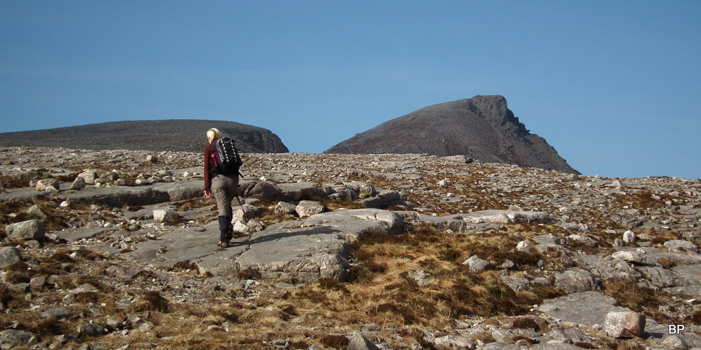
The first, short break to enjoy this moon-like landscape:
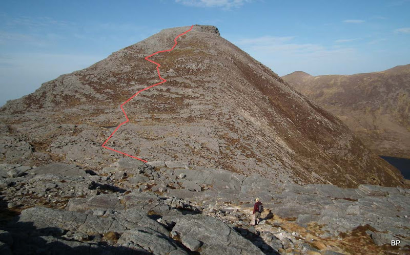
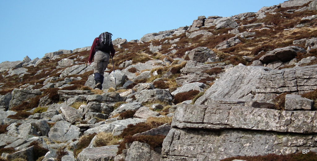
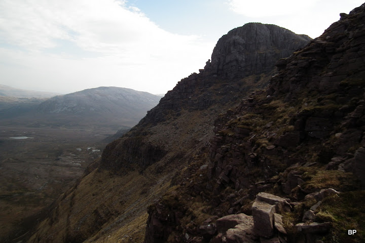
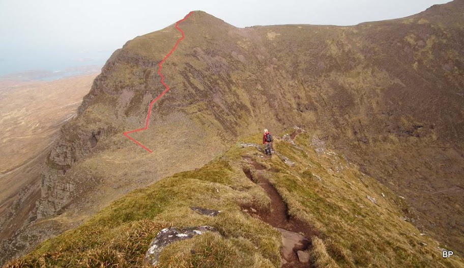
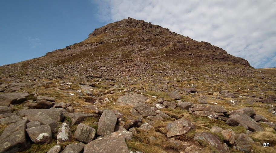
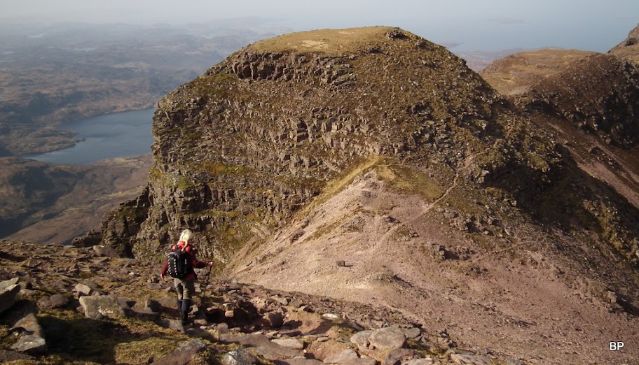
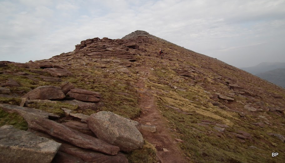
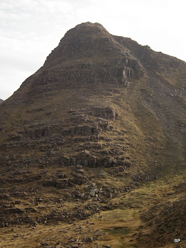
From the 620m point, a small drop down and across some more slabs, before the final, steep and tiring push to the first summit of the day:
There is a well worn path all the way up and at this stage, no scrambling involved. Just rocky... The exact route looks something like this:
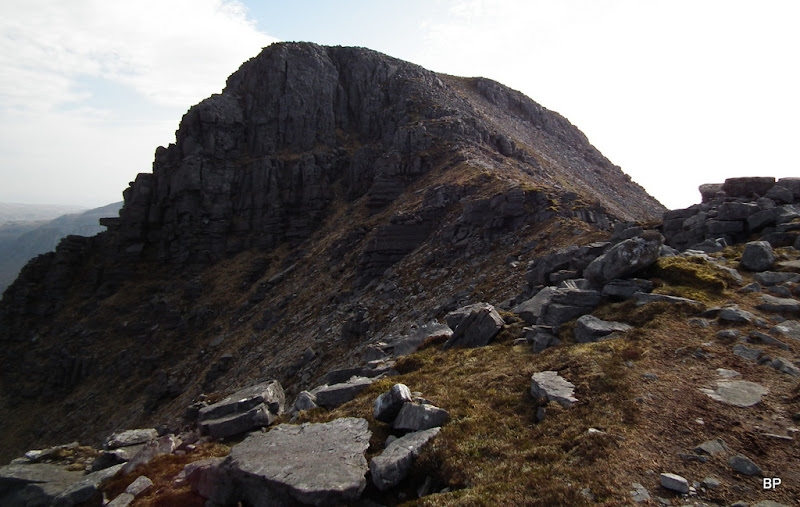
As I sweated up on the way to Spidean Coinich, I kept glancing at my former menace, now clearly visible to the right:
It was like climbing a neverending staircase:
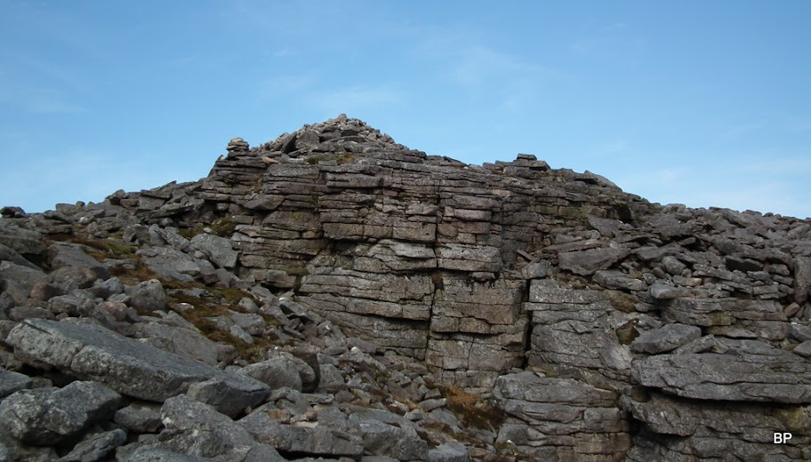
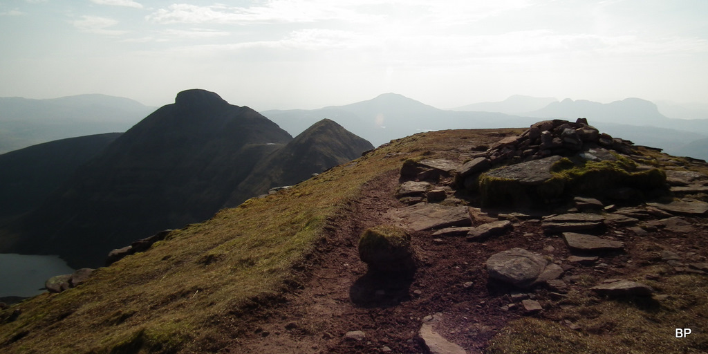
The summit cairn is situated on an impressive rocky outcrop:
I read about Quinag once, that it offers climbers routes that are either easy or completely impossible
This must be the impossible one:
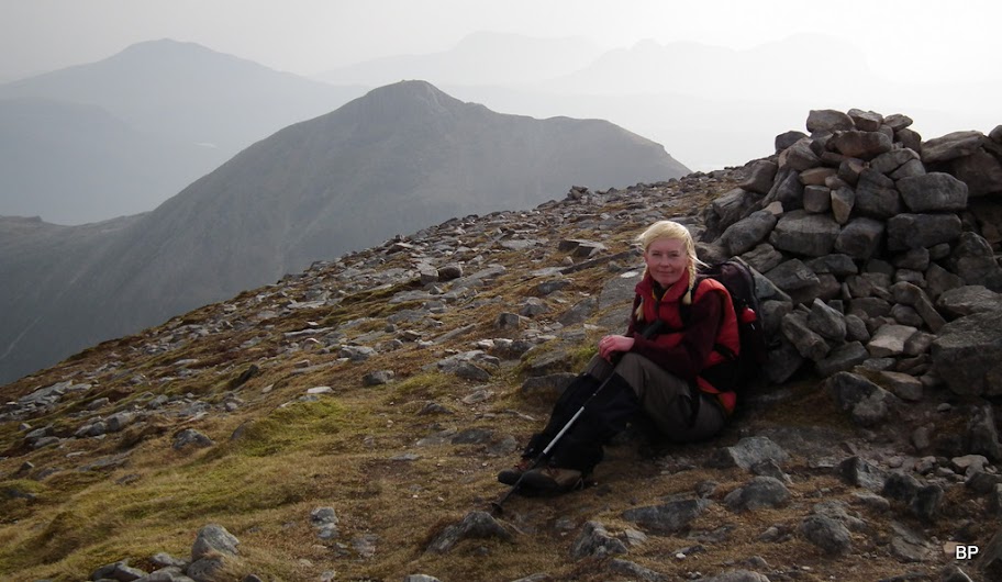
The day was still hazy and actually getting even hazier, slightly more windy than on Saturday, but the wind had no cold edge so even sitting motionless didn't feel to bad
.
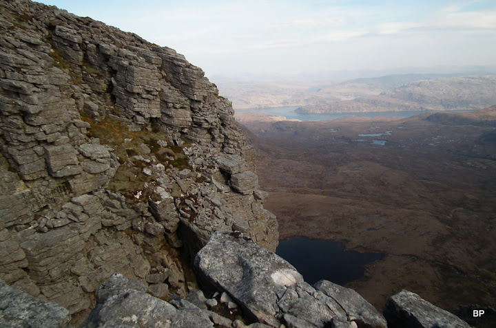
Hazy view towards Loch Assynt from the summit of the first Corbett:
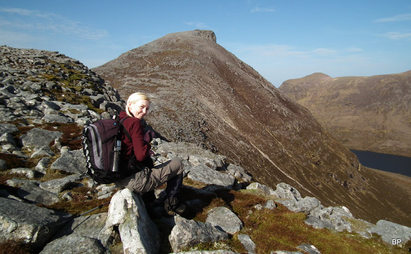
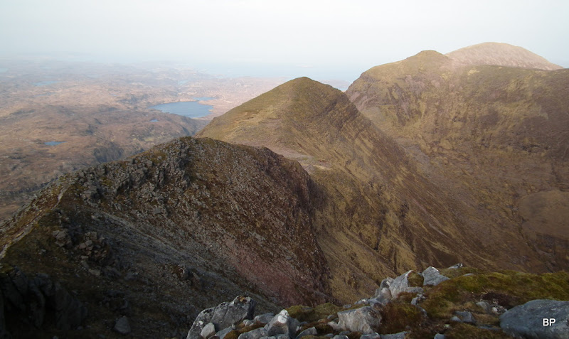
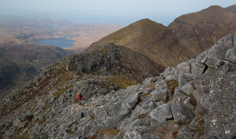
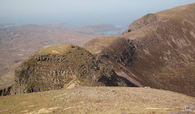
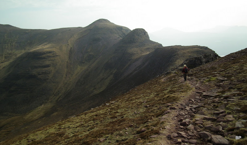
View north towards the continuation of our route. Ooops, looks a bit airy
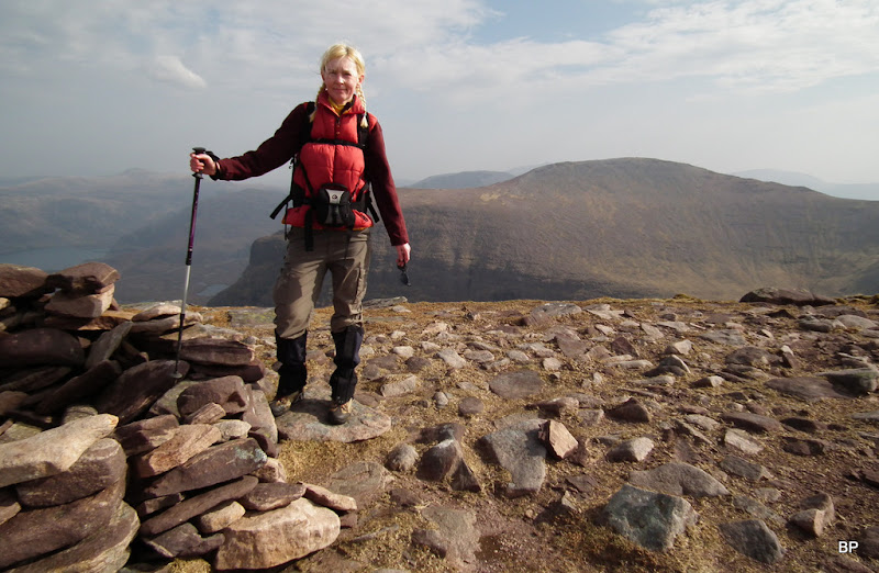
I was still smiling, though Kevin began to question my head for heights:
Well, I can understand why he was doubtful, looking down to the narrow ridge below - can you see the two fellow walkers in the middle? Ha ha ha, gives a good scale to how grand this mountain is!
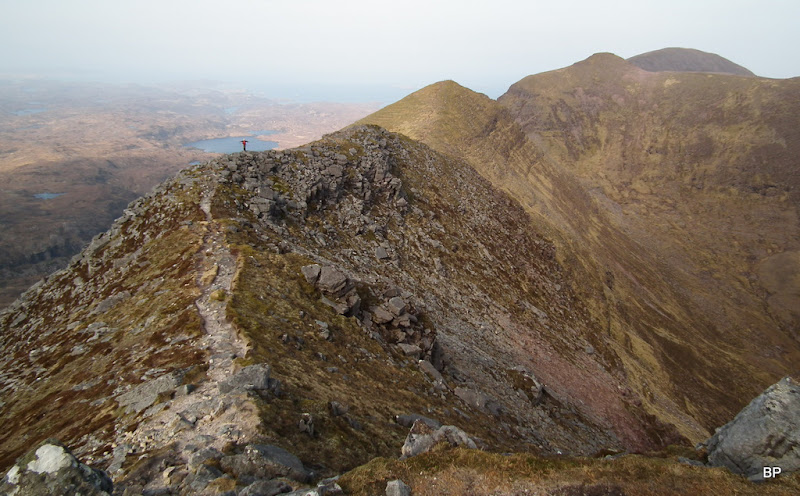
A quick snack by the cairn and we set off towards the second Corbett. Basically, it involves walking all the way along the long ridge of Quinag to its very opposite northern end. And to begin with, some quite exposed descending:
Still better then the impossible route:
Kevin's doubts were short lived. I discovered, i absolutely loved the experience! Vertigo??? GONE!!! I felt like I was given a pair of wings!
A postcard to my dad:
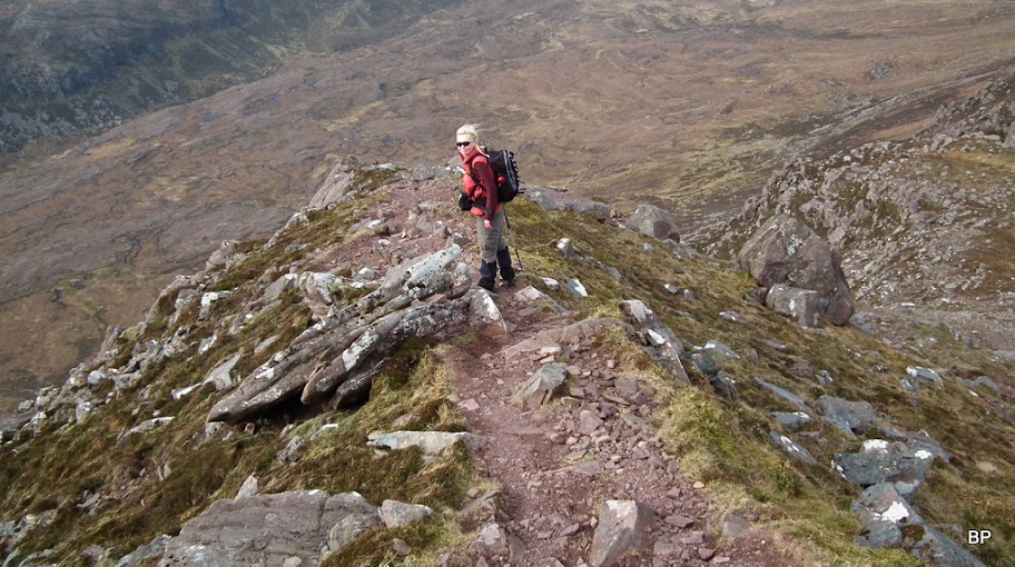
That's the way we walked down. It looks much worse than it really is. There are a couple of places where hands are needed but nothing beyond my reach (and I'm not the tallest of people):
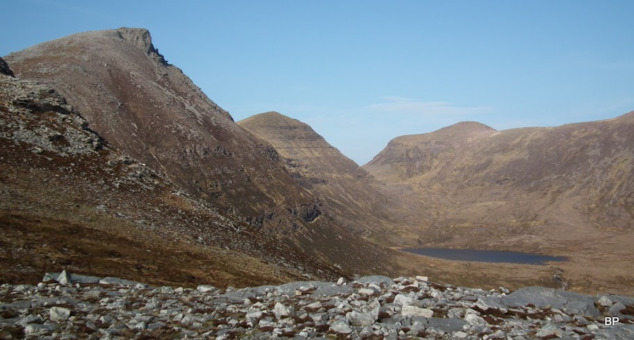
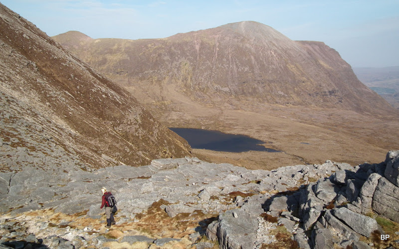
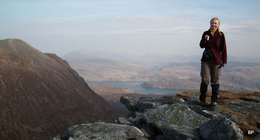
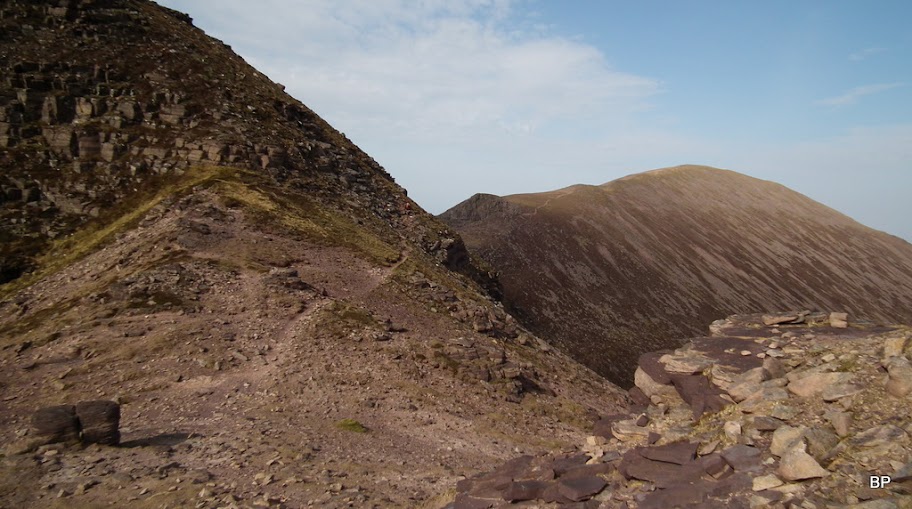
The next stage: past the tiny Lochan Ruadh to another minor top, at 714m it has no name on the map. This part has no scrambling bits:
A glimpse back over my shoulder...
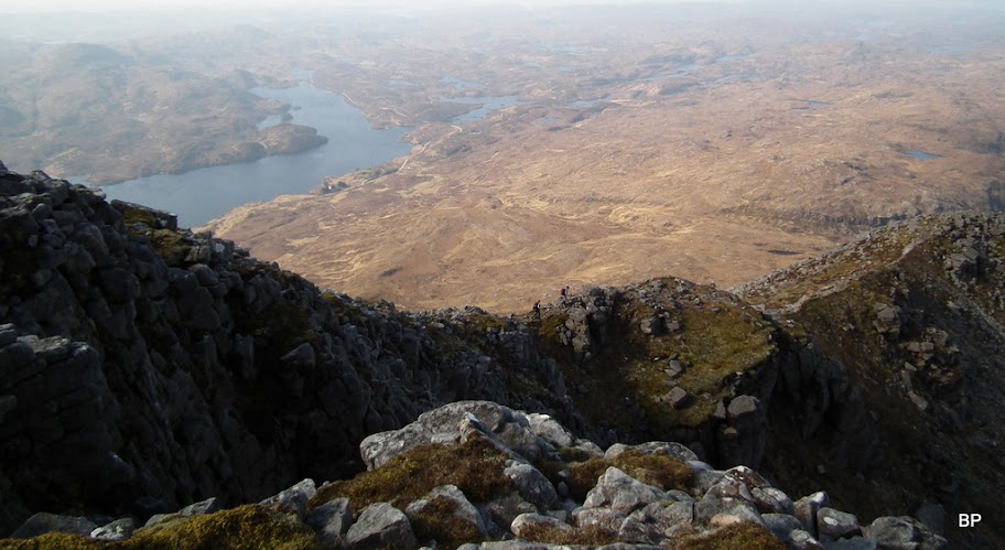
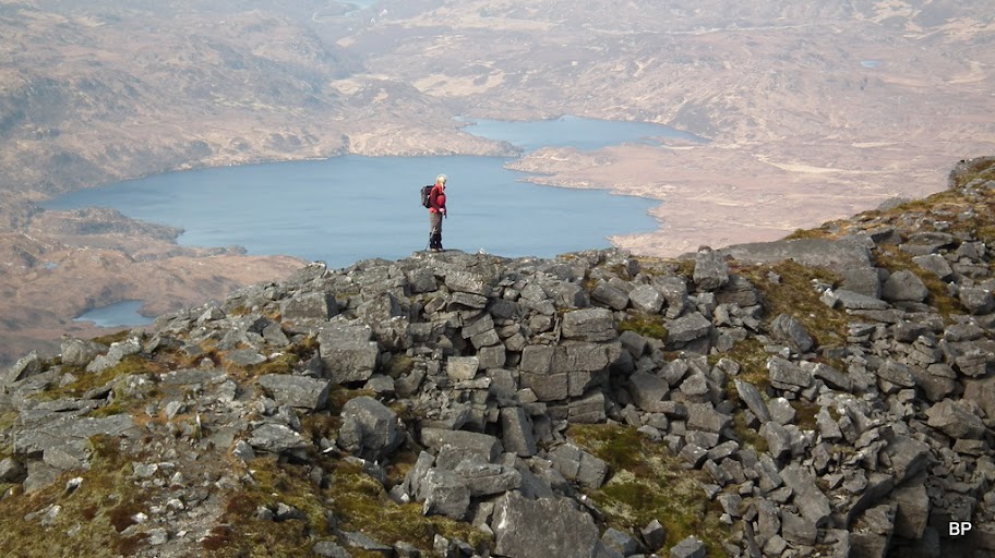
...and down to Lochan Bealach Cornaidh:
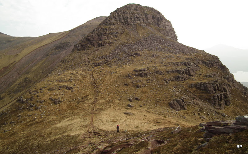
Having negotiated my way to the 714m top, I stood above another steep drop, studying the ascent route to the next summit:
Maybe we should go back?... Eeeeeeeee... No, certainly not!
Again, it turned out to be less frightening than it looked from above:
The highest summit of Quinag, Sàil Gharbh, from Bealach a Chornaidh:
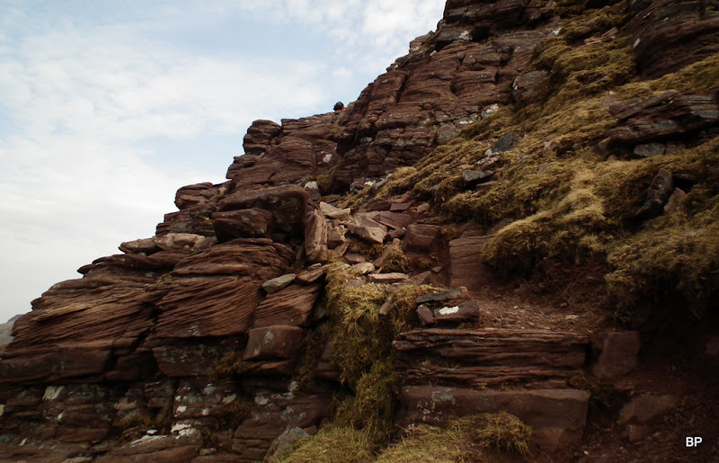
It's steep... It's rocky... And this time its an ascent route...
But looking back, still better than the descent one... Damn it, it didn't feel so bad when walking down... From this perspective it's a gut-twister!
OK, forget what'd behind you, Panther, concentrate on scrambling up!
A few awkward steps - and I emerged onto the next summit, 745m point. It was very windy here and I decided that for a well deserved lunch break it would be better to find a sheltered spot on the opposite side of this top rather than on the very summit. In the meantime, some pictures:
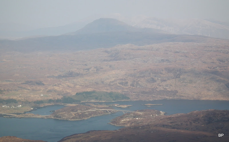
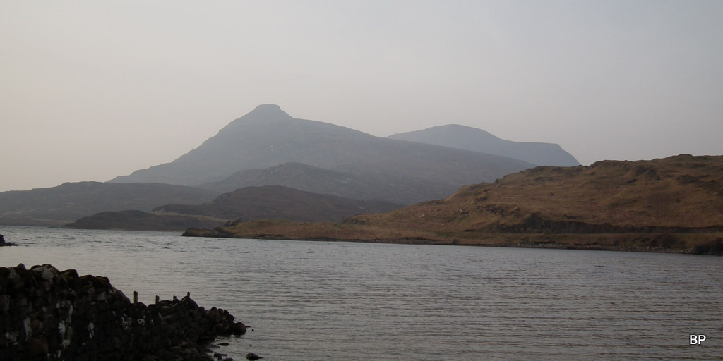
Hazy shapes of Suilven and Canisp:
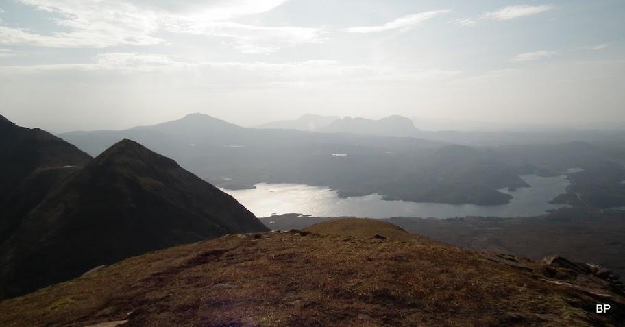
Ben Stack and (almost invisible due to haze) Arkle-Foinaven group behind:
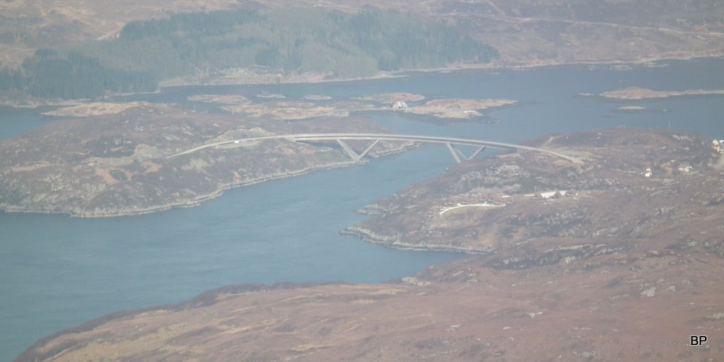
Kylesku bridge:
I sat on a rock, facing north and the remaining ridge to Sàil Ghorm. No need to put a red line to mark the route here, as the path is obvious:
I wish I could fly...

All right, calm down, girl. No need to get overexcited. There is still a long way to go!
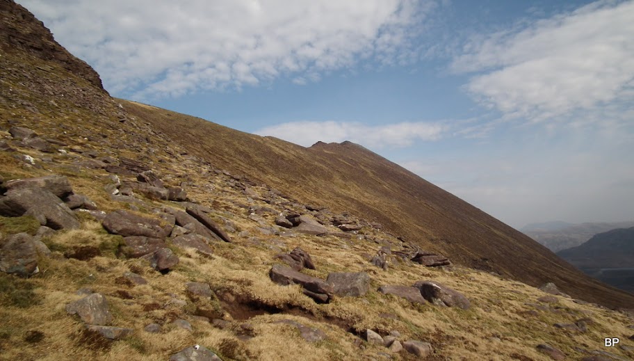
The route looked straightforward:
The descent path from 745m top:
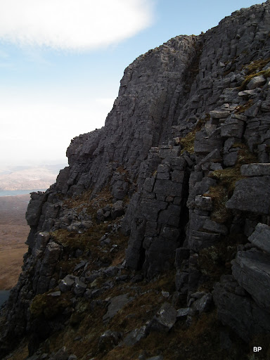
The path bypasses the first rocky top (687m), and only from the other side it becomes obvious why - the opposite face is a vertical drop! The bypass path involves some scrambling on the descent side. Here, Kevin took a picture standing just above the scramble-ish bit, whereas I was already down on more even ground:
View down to Bathaich Cuinneige:
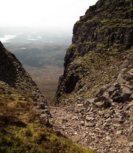
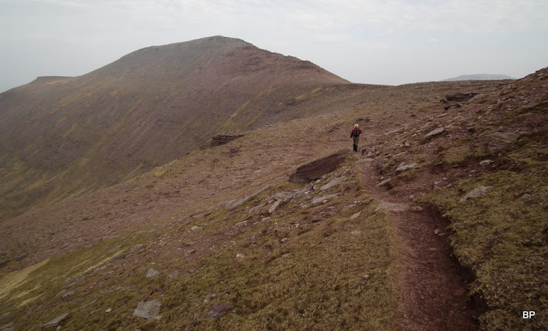
The remaining climb is now a piece of cake, no more scrambling and very steep slopes, just a narrow path all the way to the summit. On the way, we passed a very interesting and very steep gully:
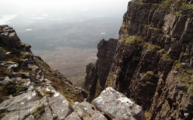
On this mountain, basically everywhere you stop and look around, you will be stunned by the grand panos. And there's always something steep, rocky and scary in sight:
By the summit cairn of Sail Ghorm (776m):
Such a shame about the overwhelming haze... But for that, it would be a perfect day:
Kevin found a bench-shaped rock near the summit and ordered another tea and cookies break (hot-cross buns again... yummy!):
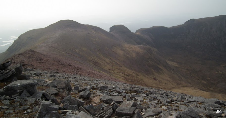
Having enjoyed some rest on the top of Corbett no. 2, we headed for the third and last target. First, we had to retrace our steps back to the notorious 745m point:
The vertical wall in the way... Wait, I forgot there is a bypass path!
Bypass or no bypass, I still needed my hands:

The scrambling bit from below:
There's no need to re-climb the 745m point, as it can be bypassed on the way to Sail Gharbh:
The final push to the last Corbett may look rocky and airy, but it is the easiest part of the whole route. All you have to do is stick to the path and soon you will arrive on the top:
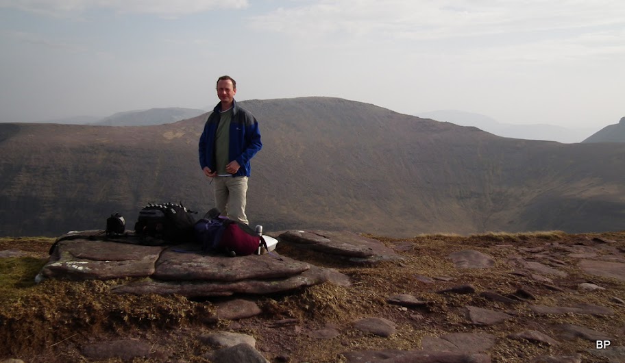
My summit picture:
The road and Glas Bheinn:
Looking back to all the lumps and bumps of Quinag
:
It was windy and cold-ish on the summit of Sail Gharbh, so only after a couple of minutes we turned back and headed back down. Luckily, we didn't have to return the way we came, over Spidean Coinich! Instead of that, we found another bypass path, zigzagging steeply down the slope to the corrie of Lochan Bealach Cornaidh:
One last glimpse up, to the mighty tower:
The bypass path leads down past the loch:
...and finally it took us all the way back to the road and the car park. I checked my watch, just short of 7 hours including countless breaks for photies and videos... Not bad, not bad at all. Honestly, I could't imagine running along the ridge of Quinag without stopping if only to sink in the views! This dream-like landscape deserves some more attention

On the way back, as it was only about 5 pm, we popped in to Ardvreck Castle. It's a lovely spot on the banks of Loch Assynt, and Quinag dominates the view over the loch:
The castle is actually a ruined 16th century tower house, only inhabited by sheep:
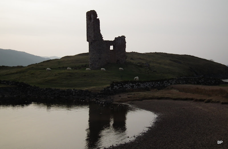
Ardvreck Castle was built by the Clan MacLeod and it witnessed many local wars, it was captured by the Clan MacKenzie in 1672. In 1795 it was struck by lightning and became the ruin we see today:
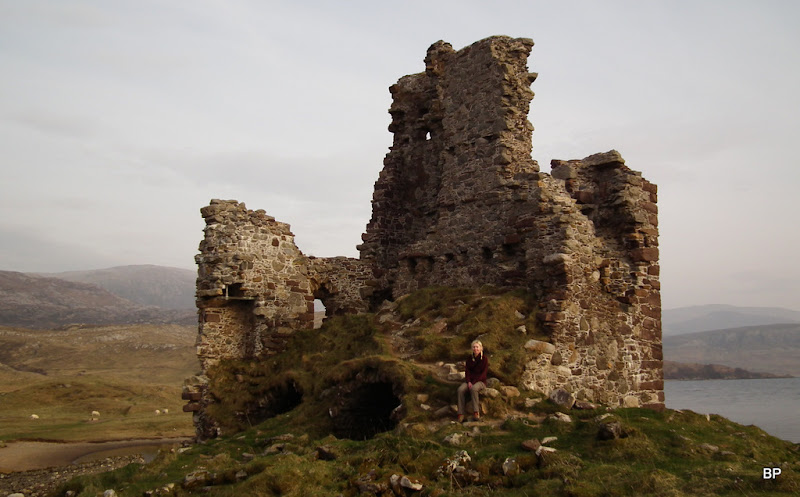
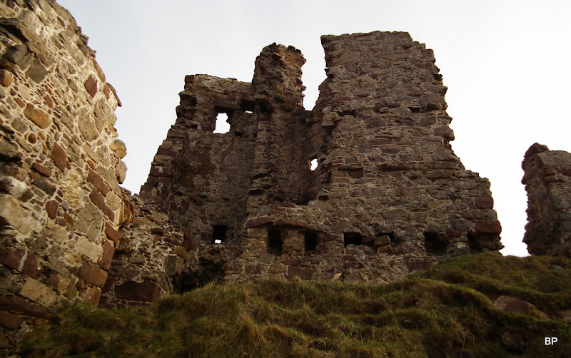
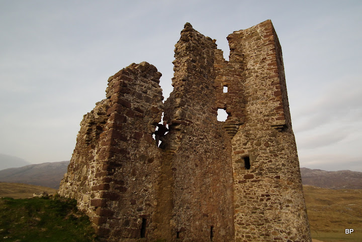
It may be ruinous, but it still impresses:
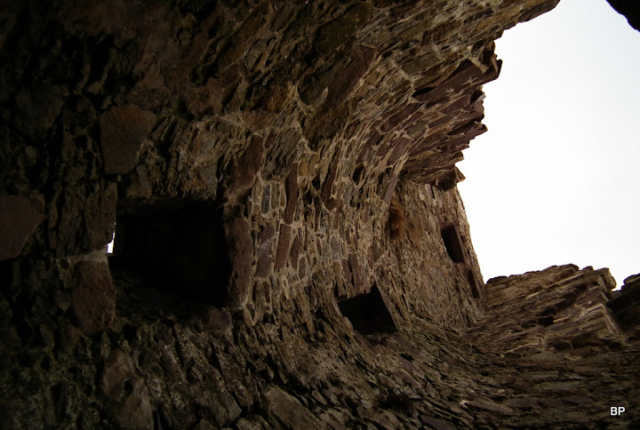
Inside the staircase tower:
There's nothing more left to say about this trip. It was simply FANTASTIC, facing the F-word Corbett
! A dream-coming-true day and one of the best experiences I had so far in Scotland. Life is certainly worth living for moments like this. Meow!
