free to be able to rate and comment on reports (as well as access 1:25000 mapping).
I am struggling to remember where I heard of Achnasheen. A book or a magazine article somewhere perhaps. I'm glad I did hear of it though. One day I may even stop off there. Much of my travelling is done by train and I have pretty much exhausted the Munros which can be easily done (and even those which aren't easy) in a day. I'd stumbled upon Achnasheen and it's solitary Munro Fionn Bheinn by some chance spark, and from there discovered twenty minutes along the line was Achnashellach, with a station, two Munros, lochans, and contours so tight they squeeked on the map. I mentally tucked them away for when I would have time to get away.
The recent hot spell of weather coincided with a long weekend from work. My mate Jim had been off and had headed to my favourite bothy, Culra, which he described as “like a furnace.” I'm not one for walking in overly hot weather, so when I saw a few days of cooler weather forecast I thought I'd take the chance and get away. The weather map indicated a bit of cloud. Little did I know how much there would be.
I dragged myself out bed for the start of my three train, six and a half hour journey to Achnashellach., and the Munros Beinn Liath Mhor and Sgorr Ruadh. The early train was quiet, a mixture of tourists and business people. At Stirling a group of young guys boarded with bikes and rucksacks, illustrating just how unsuitable these trains are for this route. Initially bought for the short Edinburgh to Glasgow route, these trains have little luggage space, space for only two bikes, and nowhere to plug a phone or laptop into. There were around seven people with bikes, two went on the rack, the remainder were all packaged up as 'luggage' and stuffed wherever there was room. At Inverness you change trains for Kyle of Lochalsh, and the same group had to move their gear once more. This train at least was quiet and had a bit more room. As we approached Achnashellach I noticed that they had been busy. Their bikes were now assembled and we got off together. I checked my map and noted at the end of the platform there was a small crossing. I headed for the crossing, leaving the mountain bikers busy, setting up cameras and videos to record their exploits.
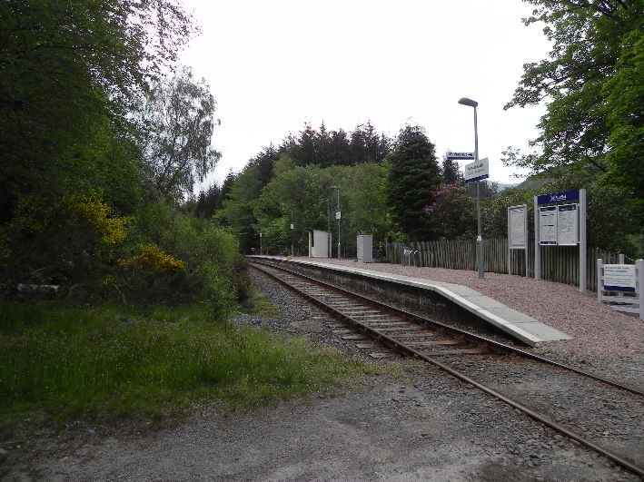 Achnashellach Station
A forestry track climbs up through the trees, and then splits into three. These tracks are often inaccurately marked on 1:50,000 maps and can be the cause of some head scratching. I was glad to see, hidden in the foliage, a signpost showing a right of way to Glen Torridon by the Coulin Pass.
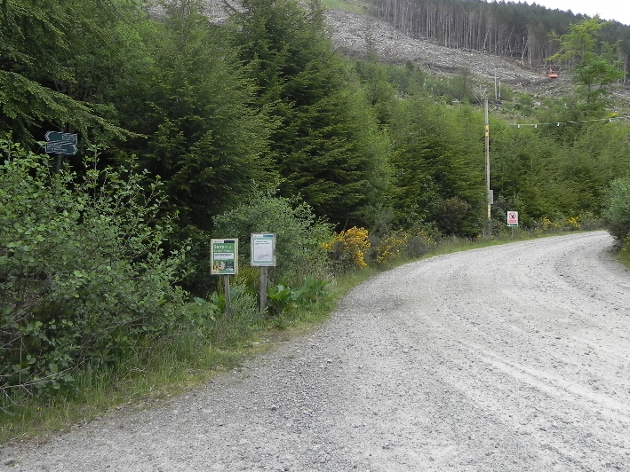 The sign is in there...honest!
Route confirmed, I set off along a forest track lined with pine trees and native plants fighting a losing battle with brightly coloured rhododendrons. Some estates are now actively removing these plants, clearing the land inch by inch to allow native plants to re-establish themselves. This area could do with adopting that policy. The map showed that a footpath diverged from the main track, and someone had kindly used the old travellers marking system of a cross using stones to indicate the wrong route.
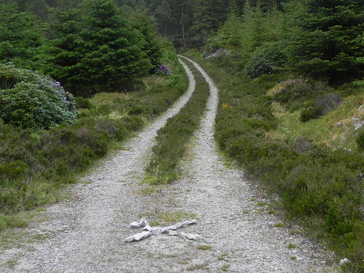 The travelling folks method of signposting.
 When I came down next day someone had obliterated it.The footpath then runs parallel to the River Lair in the shadow of Fuar Tholl, passing close to an impressive series of waterfalls hidden away in a steep sided corrie, surrounded by larch, birch, rowan and pine trees.
 Above the tree line.
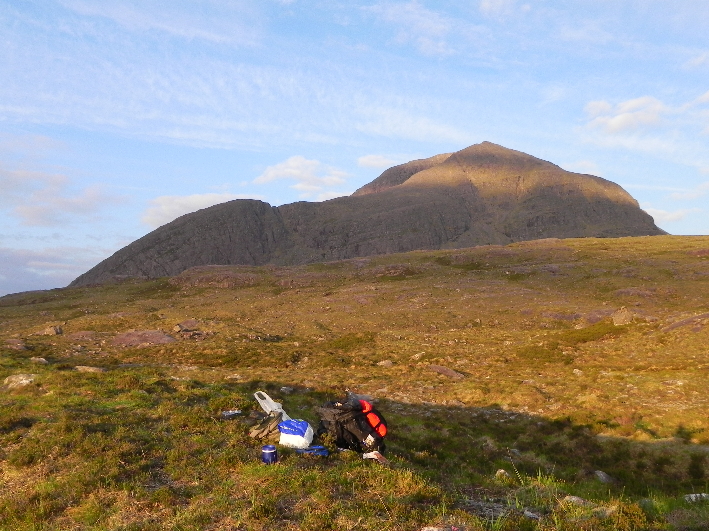
Before long the woodland gives way to rocky outcrops, and after only an hours walking I was at my campsite for the night. In the main the ground here was boggy and sponge like, not really suitable for a tent, but I found a small ridge of dry ground just wide enough, and pitched the tent, clearing my rucksack of all but the essentials. While I took a quick lunch I looked over the map, and looked at the sky. My planned route was up the east ridge of Beinn Liath Mhor, along the ridge to the summit, then down to the bealach and hopefully up Sgorr Ruadh. However since getting off the train the sky had been grey, and a thick cloud had taken up residence atop both mountains and didn't look as if it would move. There was little wind and it was still fairly warm, and I thought that the best option would be instead to head up the Coire Lair to the lochan, then up to the first Munro. Then I'd see how time and the weather were.
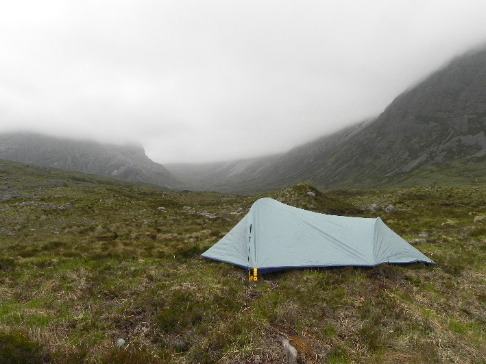 Home sweet home...
Going up the Coire Lair I met a walker from Alness, who conformed there was a faint path breaking off towards the summit from the main path near the lochan. Loch Coire Lair sat at the foot of steep cliffs which disappeared into the murk. I would see them later, but for now I was concentrating on Beinn Liath Mhor.
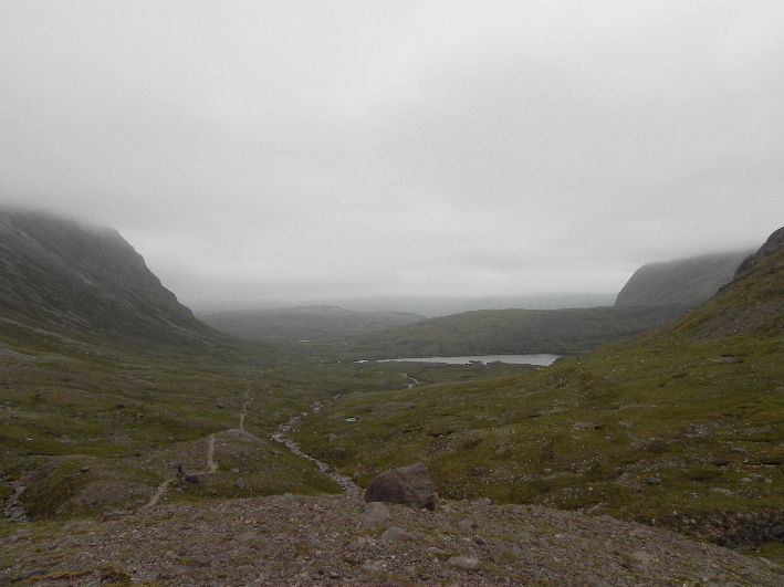 Looking back down Coire Lair
 Rather than go to the lochan I noticed that it looked easier to break from the track and go straight up, bisecting the small connecting ridge between the spot heights 769 and 926 at a small lochan. If I was right any path would go along this tight ridge en-route to the main summit. I set off up the steep slope and had to take a few breathers but I was quickly at the lochan, which lay just a few metres below cloud level, and there, leading up into the cloud like Jack's beanstalk, was a faint path.
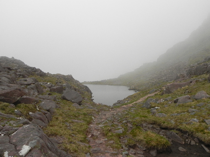 The 'wee' lochan
 The terrain here is very steep, with large crags, but the path wends its way through this to a large flat area of rock where it flattens out slightly. It's vital that you take the right path when descending here, so I made a note on the GPS, just in case.
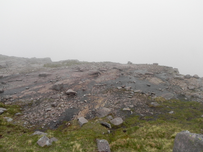 The path descends from this flat rock.
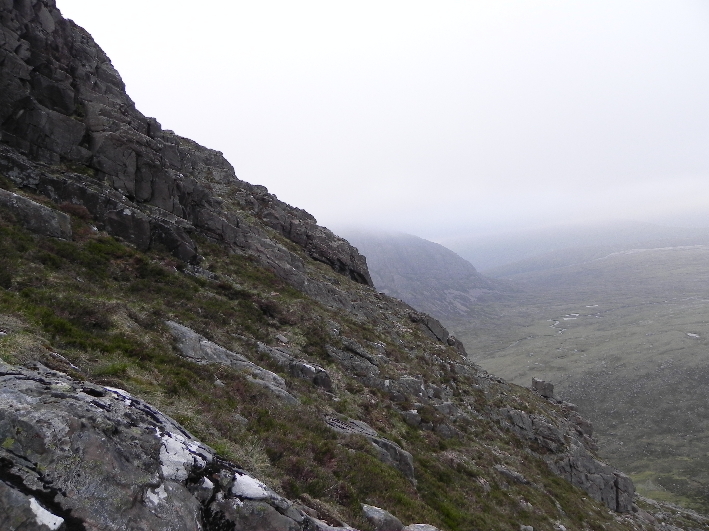
 In the mist it was hard to discern any path, but nonetheless navigation was fairly straightforward, across grass and slabs of rock, before climbing a slope composed of grey scree blocks, until I arrived at the summit cairn. There was no wind, no noise and no visibility.
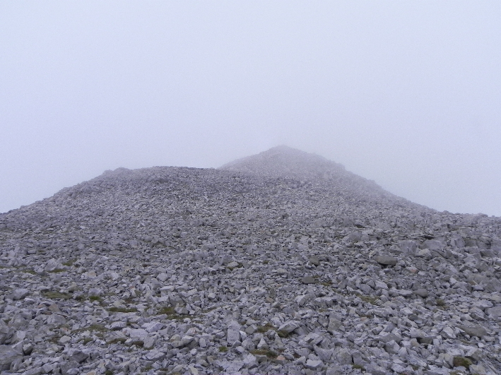 Scree slopes to the summit
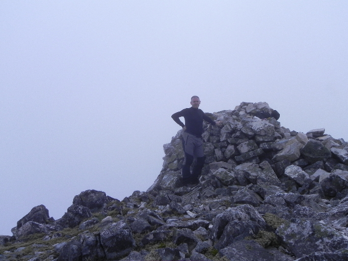 Taking in the vista at the summit cairn. Aye, right...
To the north west there should have been a stunning view of Liathach, and as this was my first visit to Torridon I had hoped to see it. Today was not to be a day for views though. I had three options. East along the ridge to the tent, or back to the bealach and either on to Sgorr Ruadh or straight back along the outward route to the tent. The ridge still looked uninviting, so I decided to head to the bealach, look at the time and judge from there. The scree was hard going.
 Down there? Are you quite mad?
 I quickly located the flat slab where the path descends and dropped down, and from the small lochan I contoured hill 796, following the path. It was hard going and I stumbled a few times, and I was glad I had managed to avoid this as a route of ascent. As I descended I spotted a faint path on the opposite slope. A way up I thought to myself.
 Lochan a' Doch-Luachair (The lochan of the newt) Well, that's what I'm calling it.
The path up to Sgorr Ruadh is on the leftI arrived at the larger lochan and noted the time, 1820. Sunset was 2159, but in these conditions I could perhaps to expect to lose some light earlier. I calculated 40 minutes from the lochan to the ridge, and perhaps an hour from the ridge to the summit. I didn't mind then arriving back on the track and walking back in the gloom as I had a head torch. I stopped by the lochan for a short time, watching the newts swimming in the shallows. No sign of any fish though...
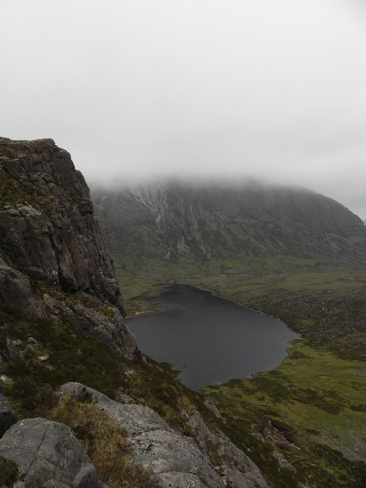
I was on the ridge within twenty minutes, half the time I'd allocated, and I'd gained the summit after another fifty minutes. I'd been teased with glimpses of Loch Torridon, mere seconds had they lasted though. Since then, nothing. I had hoped for a bit more visiblity here to help with my route planning. I could return by the outward route, or head south east parallel with the top of the cliffs I'd seen earlier, then hopefully I could pick my way through the lower crags and round to Loch Coire Lair, and from there to the track. This had the advantage of being shorter, but could be tricky in the mist. Reckoning I had time to play with I chose the latter...
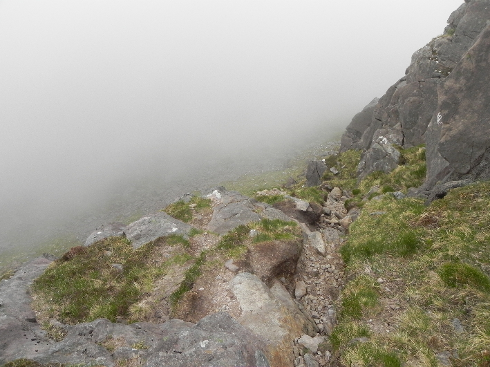
 The way off. Tricky and steep.
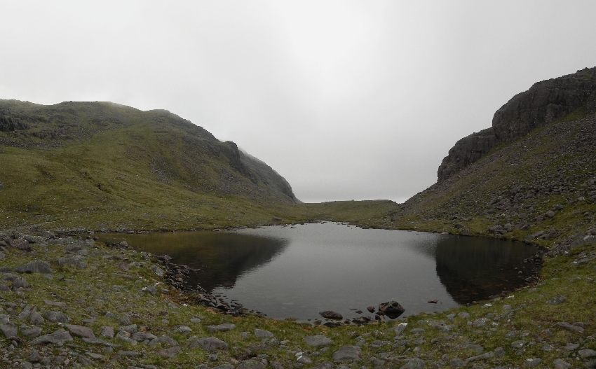
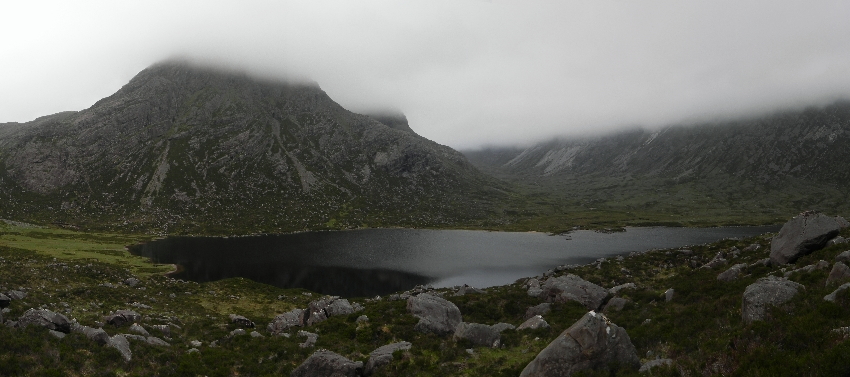
I don't think this is a well used route off the hill. There was, to me anyway, little or no sign of a path. Likewise there was little sign of any lochan either, just a damper patch of ground and the beginning of a stream. The absence of a path suggested to me that this might not be entirely suitable, and the lower I got the more I saw this was an accurate supposition. Grass have way to rock and it was difficult to determine where to go. I could be going down towards a huge drop. Confident I could if necessary still go back up if necessary I continued to pick my way down. Finally I was free of the cloud, and could see detail below. It was slow work though, the way being steep and requiring hands on at points. At one stage I came to a large mass of rock which fell away hundreds of feet to the lochan below.
 Trying to descend this in mist could be lethal...
Thank God I could see! By now my left knee was becoming tender and I picked my way slowly down towards the loch, eyed by a few deer, the first wildlife I had seen all day! On the far side of the loch I had spotted a path across the moor, which I followed to where it met the burn, before crossing a few stepping stones, thankful of the recent lack of precipitation. I was at the tent, one hour and fifty minutes after leaving the summit, pretty good going considering the terrain and the obligatory gammy knee. Looking back at Sgorr Ruadh I was thankful that the way down had been reasonable simple to find, and could have been a lot worse. I silently thanked Mr Garmin as well...
 Looking back at my descent route (left of the left hand crags)
 I ditched my gear and set up my stove at a rock near the tent, before heading over to the burn to fill up my water bottle. As I approached the water I was startled by a stag only thirty feet away, whose head shot upright as I approached. I stopped and for the next minute we stared at each other, neither moving. I cursed inwardly that I had left my camera at the tent. I dropped my head and walked slowly over to the burn. The stag stayed where he was, watching me, I watching him from the corner of my eye. Head down I shuffled back to the tent, passing again within about thirty feet from him, before retrieving my camera and snapping off a few shots, blurred in the fading light. I realised that I was surrounded by deer, and as I prepared my dinner I couldn't help notice them grazing less than a hundred metres away, one stag bellowing out at intervals, unhappy at my presence. Dinner over with I settled down in the tent for the night, reading by the last of the light before slipping into an uncomfortable nights sleep.
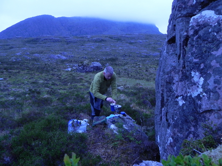 Preparing dinner while hiding from the deer
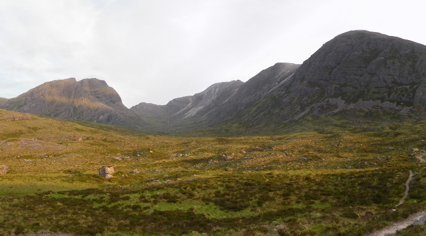
 I awoke around half past four. Looking out of the tent I could almost imagine Jim Bowen's voice mocking me; “Look at what you could have won...” The cloud which had parked across these mountains has silently slipped away, revealing yesterdays walk, and the ridge I'd avoided . As I packed the tent away the sun lit Fuar Tholl and the edge of Sgorr Ruadh, turning them gold as it crept above the horizon. My knee was still tender from the night before, so my plan of catching the early morning train and getting off at Achnasheen to climb Fionn Bheinn was packed into my rucksack along with my other gear. I shouldered my rucksack and began the short journey to the station.
 Morning. Where has the cloud gone?
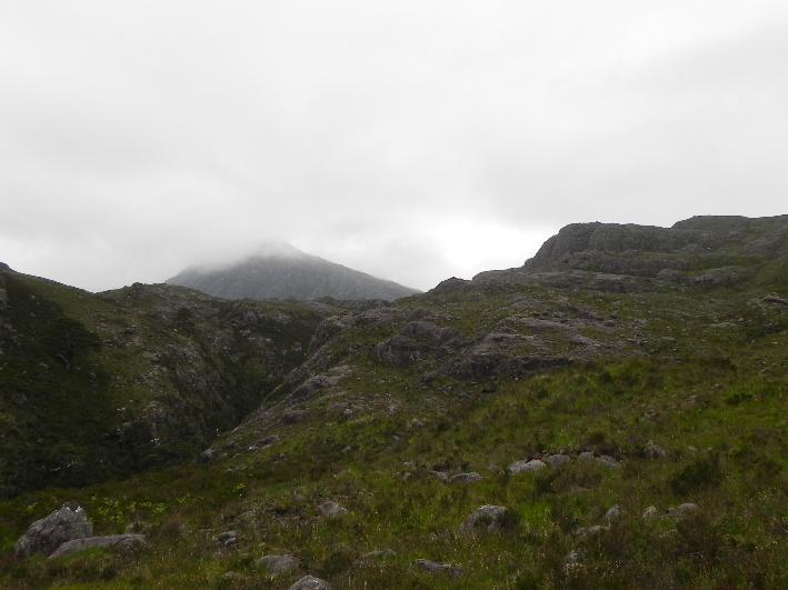
There are some hills which once climbed, you have had your fill of and would happily never visit again. These ones though are fantastic and I would love to come back and see them when the weather is clear. I've had a tiny taste of Torridon and I'm hungry for more!
 Why couldn't it have been like this yesterday?