free to be able to rate and comment on reports (as well as access 1:25000 mapping).
Cape Wrath Trail Part One May 2006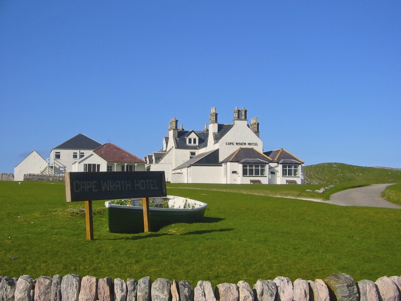 The now defunct Cape Wrath HotelPart One
 Having read a number of reports concerning this long distance trail I thought I would share my own account of this walk.
My colleagues and myself covered this trail over two separate one-week periods walking in the direction from Cape Wrath to Fort William.
There is of course no specific trail and the only pre requisite is to begin or end your walk at the Cape Wrath lighthouse. It is generally considered to end at Fort William but this isn’t necessary. I can give an account of three variations to the end (or beginning) of this walk.
 The KyleCape Wrath to Ullapool May 2006
 A lot of thought and planning went into this hike, we had already completed the WHW twice, the GGW and the Wicklow Way in Ireland and had a pretty good idea of what we did and didn’t need for this one.
We arranged a food drop at the Inchnadamph Hotel in order to keep the pack weight down. Our other main concern was river crossings, but as you will see from the photos this was not a problem for this stage of the walk as the weather was truly outstanding.
We met up at Inverness Airport following flights in from Dublin, London and Bristol and from here we took a minibus to Cape Wrath. We booked this through Ewens of Ullapool who were very good.
We arrived at the now defunct Cape Wrath Hotel and basked in the glorious sunshine. The views were just awesome as was the weather forecast for most of the week.
 Middle-aged and Overweight
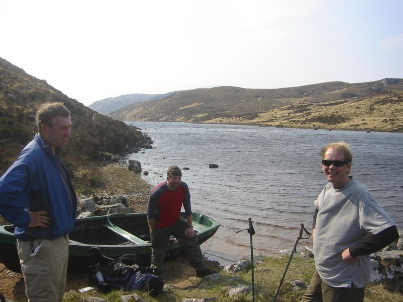
The following day we took the passenger ferry across the Kyle of Durness, it was a busy day and this meant two trips for the ferryman and two trips for the minibus to the lighthouse.
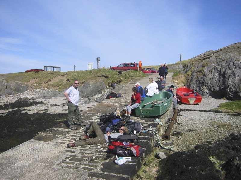 Waiting for the FerrymanCape Wrath to Sandwood Bay
  Cape Wrath Lighthouse
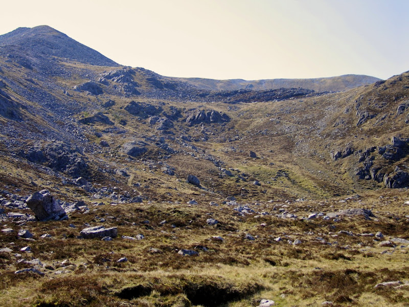
It quickly became apparent that we were the only ones taking a one-way trip to the lighthouse. It is a great spot and the cliffs here are truly massive. We waved off the day-trippers with a mixture of both trepidation and bravado. We were now on our own. The route crosses open moorland and there is no path. It is not easy walking with plenty of bogs to negociate making for sometimes pretty slow going. We headed for the Sheilings seen on the map and then made a beeline for the bridge at Strathchailleach. We then skirted to the North of Lochan nan Sac and down into the bay itself. In the early stages of the walk there were the odd bits of ordinance lying around. I would advise anyone walking through here to key their eyes open and not under any account collect any souvenirs.
 Crossing open moor from the road to the lighthouse
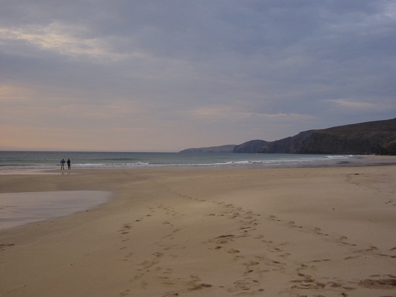
Sandwood Bay when the sun is shining is every bit as good as they say it is. The photos speak for themselves. We caught few sea trout directly in the surf with our small spinning rod and washed them down with a few drams of Talisker courtesy of Jim who had a bottle stashed in his ruck sack, who could ask for anything more?
 Fishing at Sandwood Bay
 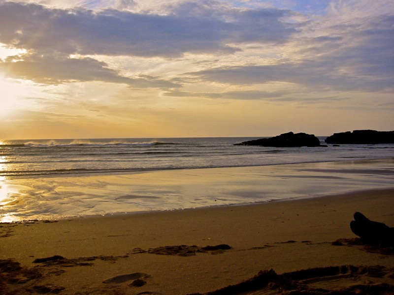 Sandwood Bay SunsetSandwood Bay to Rhiconich
We reluctantly left the Bay and headed inland passing several small Lochs on good paths before arriving at Blairmore.
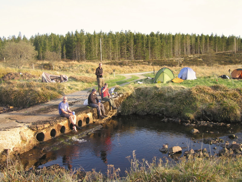
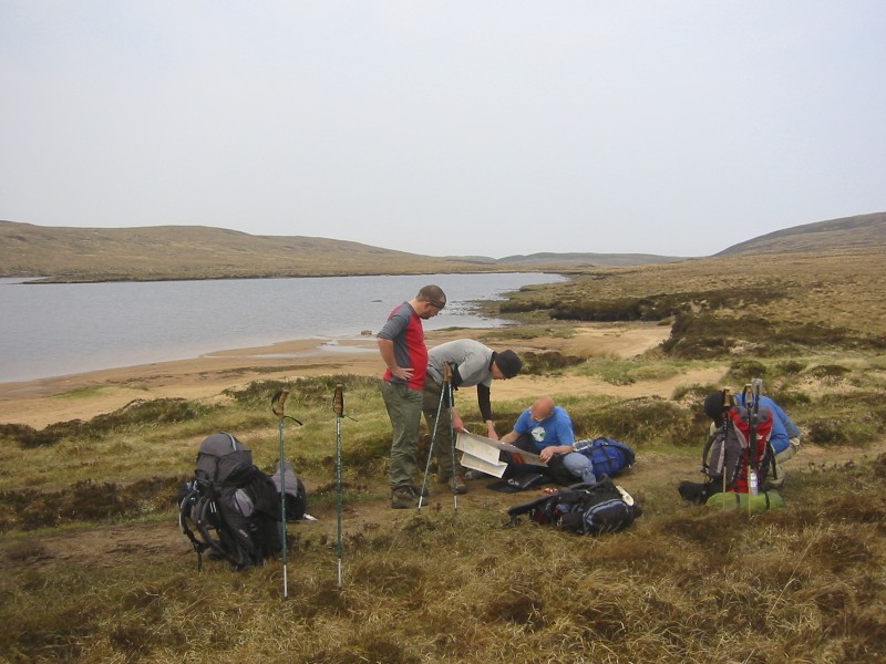 Checking the map (its obvious yet failure to do so almost ended in disaster on Cape Wrath 2)
There are some well placed toilet facilities here. Jim true to form almost felled fellow hiker Stuart who had the misfortune to use them directly after him. Poor guy is still traumatised by this near death experience.
 Stuart in a state of Shock
 I can empathise with him having myself experienced this noxious gas whilst sharing a Beehive with Jim at Beinglas campsite on the WHW. Still Jim is our quartermaster and therefore has to be forgiven. Along with the whisky he always carries a kilo of energy bars.
The walk now followed the public road all the way to the Rhiconich Hotel. I hate walking on roads but the views were pleasant enough and lunch at the Kinlochbervie Hotel was very welcome, however road walking is so dull. One of the problems with a larger group is the walking speeds vary meaning you get very strung out. By the time we reached the hotel Stuart and Simon were a good 30 minutes or more behind the rest of us.
 Road walk to Rhiconich
The hotel was okay and we met up with a few of the Cape Wrath day trippers and the ferryman himself who was well and truly steaming (a regular occurrence I am told). It was a good evening but I was looking forward to some wilderness.
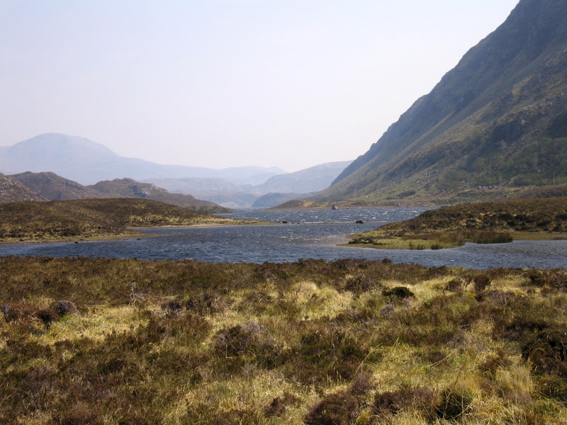
Rhiconich to KyleskuWe set off again, in glorious sunshine, on the path alongside the Rhiconich river. This takes you to the boathouse on the Loch a Gharbh-bhaid Beag at which point you go off piste.
 The Path stops here and is off piste for quite some distance (Stuart suffering a flash-back of the toilet experience, its in the eyes)
The walking isn’t difficult in fine weather, although the wind was really blowing here, forming several waterspouts out on the Loch itself.
 Windswept even on a sunny day
We had been concerned about crossing the Garbh Allt, which is about three quarters of the way down the loch. We therefore planned to cross it as a group, but completely ignored this sensible option and went down the every man for himself route. Several shouts and curses later we hauled Simon out of the water before he sailed off into the loch. A maths degree, two degrees in computing and a medical degree between us, yet not an ounce of common sense. Its not that common though is it?
 Ben Stack ahead
We then headed down the even windier Loch a Gharbh-bhaid Mor before picking up a good path at the base of Arkle. This takes you all the way to the bridge at Stack Lodge over the River Laxford. Duke of Westminster owns the lot apparently. We were accosted by one of his gamekeepers who accused us of Salmon poaching, as if! The spinning rod was safely packed away in Stuart’s rucksack. It wouldn’t hold a salmon anyway. He mellowed a bit when he realized we were walkers, I think the huge rucksacks were a giveaway and pointed us in the direction of the westerly path around Ben Stack.
 Walking up the side of Ben Stack with Arkle and Foinaven behind
This path is reasonably good until it splits at Loch na h-Ath at which point it more or less vanishes. Beyond the loch the path appears again but is clearly not heavily used. We had planned to camp a bit closer to Kylesku, but came to a collective decision that we were all knackered and made camp beside a small lochan. At this point I should introduce some kit talk. Jim was sporting the latest Argos £15 tent after having read a report by Cameron McNeish in TGO where he mentioned the virtues of this tent for summer camping. Hands up all those who think this is not a good idea for Scotland in May. Amazingly enough he got away with it thanks in no small part to the benign weather. But the following years exploits in Cape Wrath 2 resulted in Jim having the weather bite him and his tent firmly on the arse.
 Spot the Argos tent
 The wind from earlier on had settled and it was fairly mild. We spent a memorable evening sitting on small ridge above the campsite swapping stories and drinking yet another bottle of single malt, which Jim had carried from the Rhiconich, no wonder his pack is so heavy. From where we were sitting you could see way out across Duartmore Bay, the views of the sunset were just a delight. We sat there for three or four hours in all, well into the night. In all that time on the A894 below us not a single vehicle, not one, passed by.
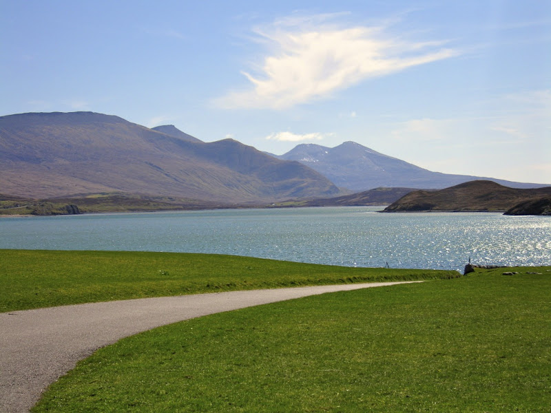
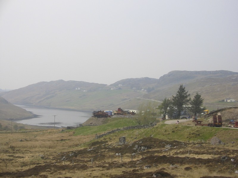
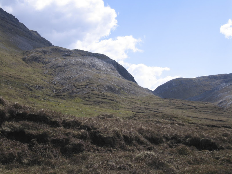
North of Kylesku to Inchnadamph We set off and having checked the map, we knew we were in for some more road walking and were not at all keen on the idea. Having slogged down to Kylesku, a walk made easier by the sight of the mighty Quinag. We crossed that iconic bridge and took a break.
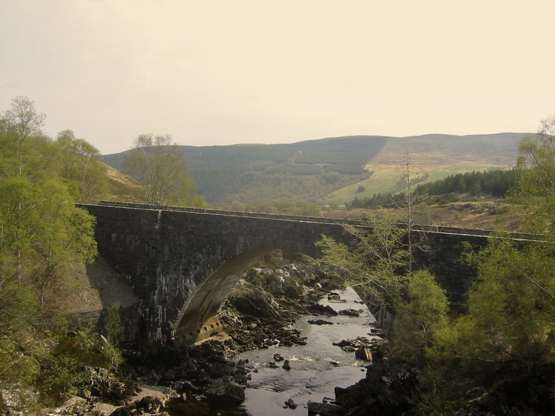
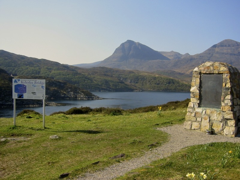 Kylesku Bridge
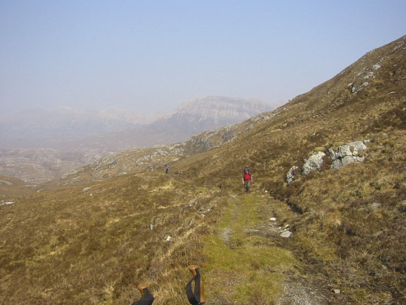
Jim and Rob headed down to the hotel and charmed one of the local fisherman (with a crisp twenty pound note I hasten to add). Ten minutes later we were in his pickup and headed for the car park at Faire nan Carn on the A894, this saved us a good few miles of road walking. However we overshot and ended up in the car park where the path leads up to the Quinag. We didn’t have the heart to tell the guy and after some profuse thanks we waved him off and doubled back down the road before taking the path to the South of Loch na Gainmhich. This is a well-trodden path as it heads to the waterfall Eas a Chual Aluinn. Where the path splits to go left to the falls we went to the right and headed for the Bealach na h-Uidhe. It’s a fair old slog up to the bealach,
 Path Zig Zags up to the Bealach na h-Uidhe
but we were in high spirits following our ‘taxi’ success. Also the weather continued to be hot and sunny. The path beyond the bealach vanished again or we just lost it. Anyway we picked it up again near the Loch Fleodach Coire from where the promise of a bath and an ice cold pint of lager in the Inchnadamph Hotel led to a near sprinting race. It was still a few miles away and we were well spread out on the trail by the time the hotel finally came into view.
I guess the pattern of this walk is starting to come clear, hotel, camp, hotel, camp.
We could have done more camping but didn’t need to. It can be restricting having to reach a certain point in a certain time but the benefits outweigh the restrictions by a long chalk. That was the consensus anyway after several pints of lager.
Inchnadamph to Loch Ailsh 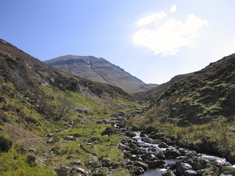 Unbelievably hot along here
The first part of the walk followed the path to Conival and Ben More. It was another hot day with very little wind. The slog along Gleann Dubh following the river Traligill was incredibly hot, literally like walking in an oven. High up above the little knoll of Cnoc nan Uamh, we clambered out of the gully and headed for the Bealach Traligill. It isn’t that obvious however and we spent a good ten minutes discussing which way to go. Finally I won the argument, in fact there was no wrong way just one that involved climbing slightly higher up Conival that’s all.
 Bealach Traligill
Once you cross the bealach and pass Red Well you are greeted with the amazing site of the Garbh Choire, like a giant amphitheatre surrounded on three sides by Ben More and Conival. It is worth hiking in here just to take in this amazing site and I would have dearly liked to camp by the Loch Dubh Mor just to spend more time here. Alas we were on a schedule and would never catch up if we had done that.
 Following the Oykel
  Looking back to Ben More and Conival
The path is a little indistinct but follows along the fledgling river Oykel staying above the rapidly enlarging river on what is easy terrain. By the time we got to where the Allt Sail an Ruathair flows into the Oykel we were on a good landrover track. We followed an easy path from here towards Loch Ailsh. At Kinlochailsh just before Benmore lodge we spoke to the estate manager and requested permission to camp further down the loch. It pays to be polite and as it happened there were some rare nesting birds on the loch that he didn’t want disturbed and so he directed us to the far end of the loch where we pitched camp for the night.
He wandered down later and Jim produced yet another bottle of single malt, Jim’s father was a gamekeeper on a highland estate and the two of them spent several hours discussing the ins and outs of estate management. We all had a long conversation on salmon fishing for which the Oykel is well known. Each fish is reckoned to cost the fisherman £500, at that price I will stick with the trout.
 Loch Ailsh outflowLoch Ailsh to Oykel Bridge
After chatting to the estate manager the night before, we took his advice and walked along the Oykel instead of using the main forest path. I don’t think this was any easier but it was more interesting. We picked up a path just beyond the area marked Salachy on the map. From here it was a gentle stroll along the river down to Oykel Bridge and the Hotel.
 The Oykel Bridge
We got to the hotel in the early afternoon and headed straight into the lounge bar to get some lunch. The place was full of people of the sort who would spend £500 catching a salmon. For the very first time in my life some obnoxious woman actually looked down her nose at me, like I was a turd she had just had the misfortune to stand on. Stuart who has been known to spend £500 catching a salmon himself on occasion, took charge. I just sat down incredulous and speechless that someone would actually do such a thing.
Dinner in the restaurant that night was quite amusing. The food was served carvery style ie help yourself. There was half a deer on the table and various fisherfolk were removing dainty small slices. Furthermore absolutely no one was talking, it was like being at a wake. Along came Stuart clearly not impressed by this approach, he duly sharpened the carving knife and hacked off a huge haunch for Jim and himself. He duly obliged for two fellow female hikers and then did the same for about three quarters of the restaurant engaging as many people in conversation as he could. That broke the ice for sure and the rest of the evening was very pleasant indeed. We finished up in the public bar where I could have sworn I saw a bottle of single malt exchanging hands over the bar in Jims direction.
Oykel Bridge to KnockdamphI absolutely recommend the breakfast in the Oykel Bridge Hotel, mainly because being frequented by posh fisher folk, it does a self service packed lunch. I am not sure if you are supposed to pay for it or not, but our new found fishing chums made absolutely sure we all left with one. They were all right really once you got to know them.
For the first time the weather was becoming changeable necessitating waterproofs for a brief spell. The track to Knockdamph was an easy one and clearly well trodden. Met only a few cyclists en route one of whom informed us the bothy had been full the night before with some youth group doing a walk. We saw no sight of them but on reaching the bothy, it was clear it had been their last night as there was a lot of food left behind. As most of it was perishable we swapped it for our trail rations, which would probably survive a nuclear winter intact.
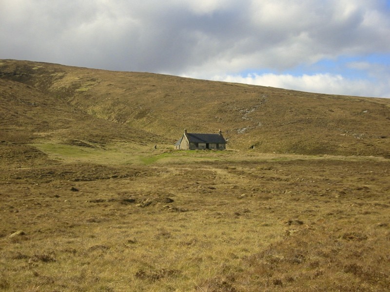 Bothy at Knockdamph
We scoured the area for firewood of which there is none. We had to hike a fair old distance to get enough. Jim cleaned up the place and Stuart caught a few brown trout in the loch. The wind died down and we watched the moon rise over the loch into a clear night sky. It was pretty chilly but we were fortified by a bottle of single malt, now where did that one come from?
It was so quiet and we had the place to ourselves. This was our last night and we reflected on how fortunate we had been with the weather. None of us wanted to go home.
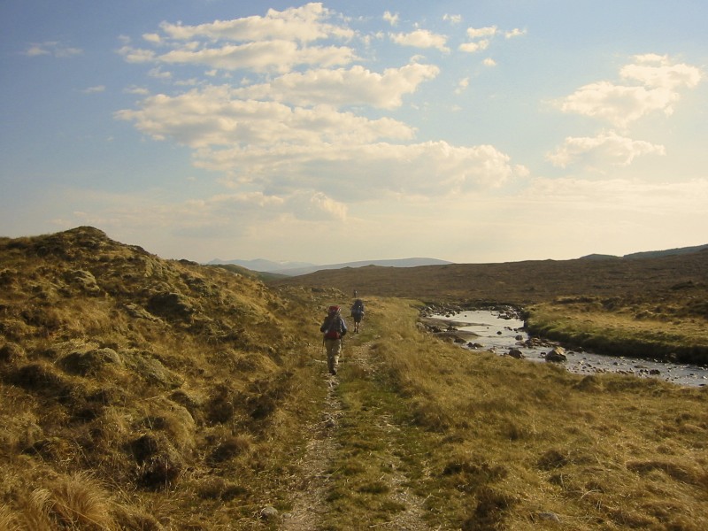
Knockdamph to UllapoolWe awoke early to find the loch absolutely flat calm. It looked just like a giant mirror. It was quite extraordinary.
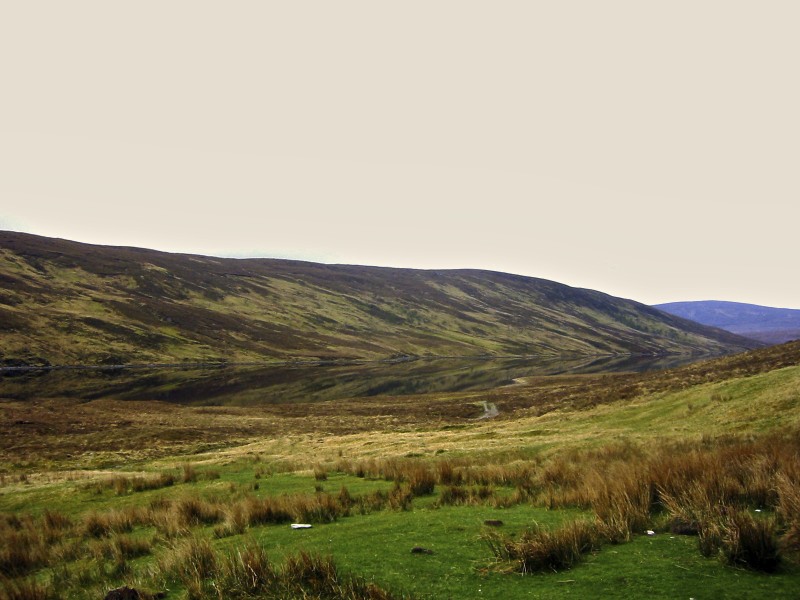 Spot the Loch
The walk out to Ullapool was an easy one and we did it for the most part in silence. There were no difficult bits but it is a reasonable hike.
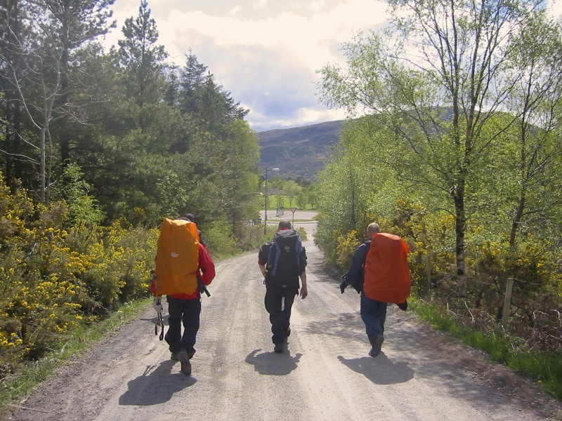 Walking out into Ullapool
We discussed part two of the walk mainly because we couldn’t decide on which way to finish it. Over the next two years we tried three of them. They were not without incident to say the least.
If you want to see all the photos of this stage of our walk they are on Picasa there are no captions but its pretty easy to work out - follow this link
https://picasaweb.google.com/113454864887539914988/CapeWrathOneMay2006
