free to be able to rate and comment on reports (as well as access 1:25000 mapping).
Some hills slip on and off the radar. An article in a magazine may spark some interest which if not acted upon, falls out of sight, before being discovered again. Bheinn Mhanach is such a hill. My first attempt on this hill had been a number of years ago, on a winter outing with Glasgow HF Outdoor Club. We had approached up Coire Achaladair, a boggy mess even on a dry day. There were high winds forecast, but we were unaffected by these in the lower reaches of the corrie. However as we got higher we began to feel it's force, pushing us back down. With the wind came a party of walkers who had given up; “We were on our hands and knees on the ridge” said one as they passed us. 'How bad can it be' we thought, pressing on towards the bealach between Beinn an Dothaidh and Beinn Achaladair. We huddled together to discuss a plan of action, before agreeing that we would go as far as the bealach, and try and judge from there. We pushed ahead, the higher ground now snow covered, arriving at a wind scoured bealach where things didn't look promising. Suddenly a gust of wind tore across the hill, lifting myself and another guy clean off our feet. My knee met the hard snow with a thump and I lay, windswept and winded. There was little need for further discussion. We turned and set off back down the corrie, picking our way through the snow and icy rocks, an early visit to the pub with it's open fire and real ale a consolation prize. [youtube
]
My knee took a while to heal, keeping me off the hills for two months. Beinn Mhanach slipped off the radar, surfacing occasionally when looking for a day walk, before losing out to the likes of Sgor na h-Ulaidh or the Aonach Eagach ridge. Being off the beaten track, and by that I mean the railway, I would be reliant on going with my mate Jim, or with a club. Then I noticed the walk back on the Glasgow HF programme, coinciding with my day off. Time to bag me a Munro.
Beinn Mhanach is usually approached either from Achallader Farm or by the Auch Glen. The Auch Glen route is slightly longer, and climbs very slightly over the first four and a half miles, before a sharp ascent to the summit. This has to be weighed up against having to ford the Allt Kinglass, which can be tricky, especially in wet weather, of which we have had much this year. The Achallader Farm approach involves gaining height for around five of its six miles, bog trotting and crossing backwards and forwards over the same burn three or four times. I know which one I'd prefer. Beggars can't be choosers though, so Achallader Farm it was! There had been some changes since my last visit here, to Beinn Achaladair and Beinn a' Chreachain. A gate barred the way to the farm, however a new car park had been laid. Beyond the car park a home made sign, an arrow and the words “TO HILL”, indicated a new route bypassing the farm. I've always enjoyed parking at the farm, seeing the ruined tower, with its links to the Massacre of Glencoe. I would have to see it from afar today though, as this path cut south of the farm, across the hill, before picking up the old path just before crossing the railway. The new section is fairly decent, and with a few alterations should give the folk in farm some peace from walkers of a weekend.
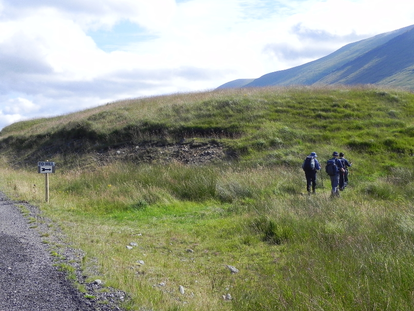 'To Hill' sign and alternative path
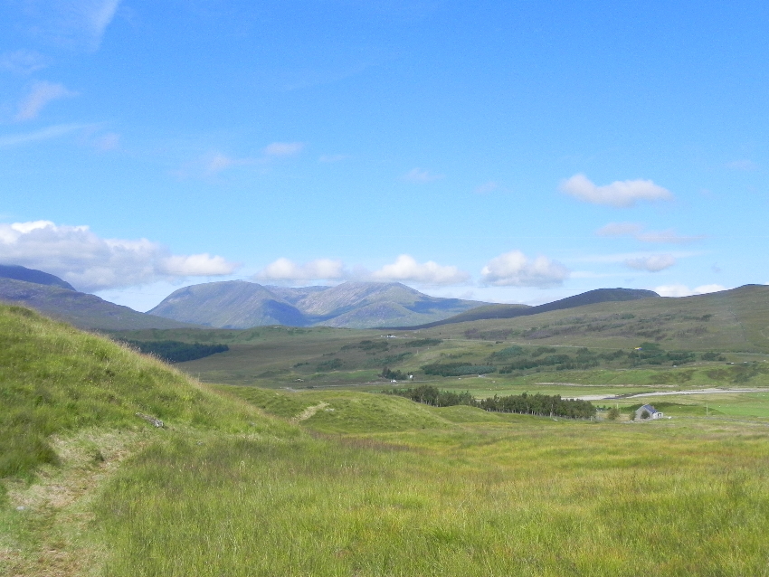 Looking back down the new path
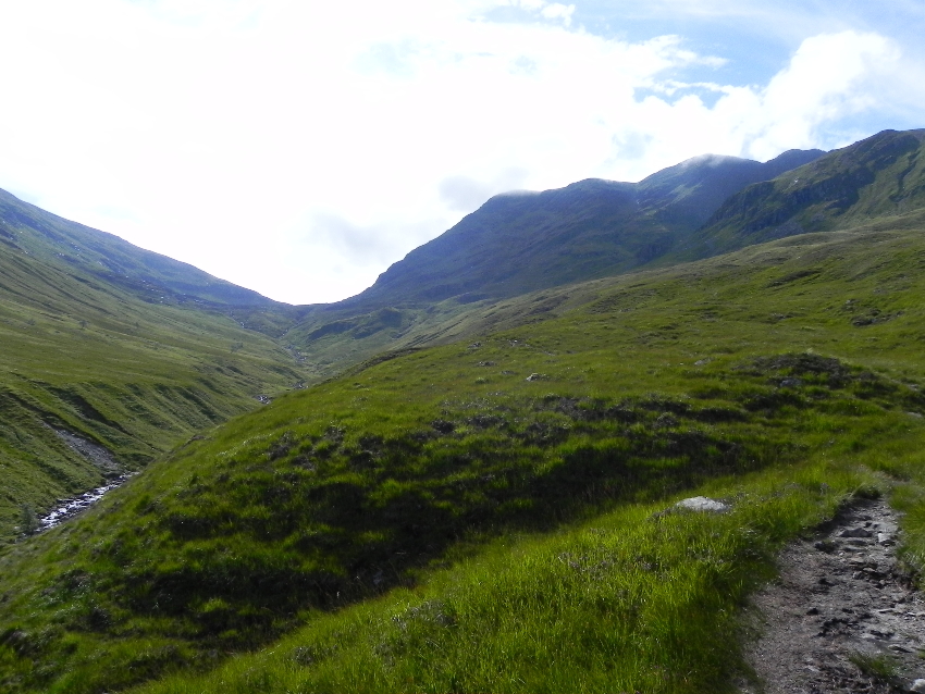 Coire Achaladair
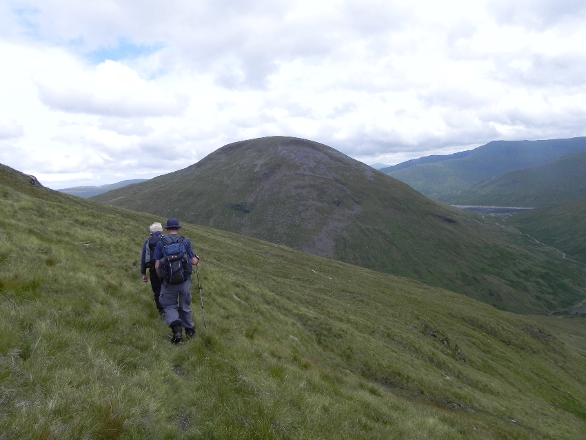
Coire Achaladair hadn't changed a bit. Still boggy, it becomes more enjoyable as you ascend. There are a few trees dotted around, and as it gets craggier you have to negotiate the 'bad step'. I exaggerate slightly. This is a very small drop down some rock to cross the Allt Coire Achaladair, and can be slippy in wet weather. Today it was fine though, the weather was warm and sticky, and for one of the party 'skin was in'.
I could smell the factor 30 and feel it as it nipped at my eyes, the sweat carrying it down my face. Sunhats and sunglasses were the order of the day, a welcome change from Goretex and Paramo.
 Looking across Coire Achaladair
At the bealach you are confronted by a drop dead ahead, and two ridges leading off, Beinn Achaladair to the north east and Beinn an Dothaidh to the west. You can see the eastern flanks of Beinn Dorain, but of Beinn Mhanach there is no sign. It's not known as the hidden mountain for nothing. There's a faint path which skirts around the side of Beinn Achaladair, and we take this, traversing the hill, dropping only slightly. Below me I could see the Allt Coire a Ghabhalach making its way down the Coire a Ghabhalach. I had attempted to Climb Beinn Dorain by this route many years ago on a blazing hot day. It was like climbing in a furnace, the rocky corrie walls invoking newsreels of Russian soldiers in Afghanistan, sweating while the Mujahadeen lay in wait above them. That day all that lay in wait for me was the sun, which ground me down to a plod. By the time I reached the bealach above Coire an Dothaidh I was done in, and it was time to descend to Bridge of Orchy for the train home.
 Beinn a Chuirn creeps into view
We sat in the cool of a deep cleft in the hill and had lunch. The sky was changing, the wind was rising and it seemed that our earlier fine weather was in danger of disappearing. Back to business, and we set out along the hill. The path began to peter out, and at this point we cut down to the soft ground between Beinn Achaladair and Beinn a Chuirn, the western top of Beinn Mhanach. There's a county boundary marked on the map going up Beinn a Chuirn, and as I've found in the past, where's there's a county boundary there's a fence. No matter how steep or difficult the terrain, some poor sod had the job of putting a fence up an arbitrary line on the ground. We follow the fence line for a few hundred metres and then break away from it towards the bealach. On the hillside above us I spied a flash of red in the crags. Being naturally nosey, I headed up towards it, noticing it start to move. My binoculars revealed it to be a helium balloon, which having escaped from a birthday party somewhere was due to come to an end on this remote hillside. What a let down...
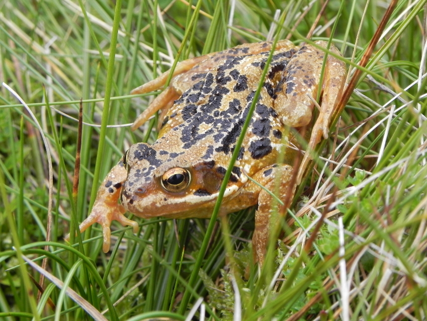 Common Frog
 The fence runs up the hillside
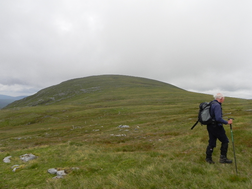 The final slope to the summit
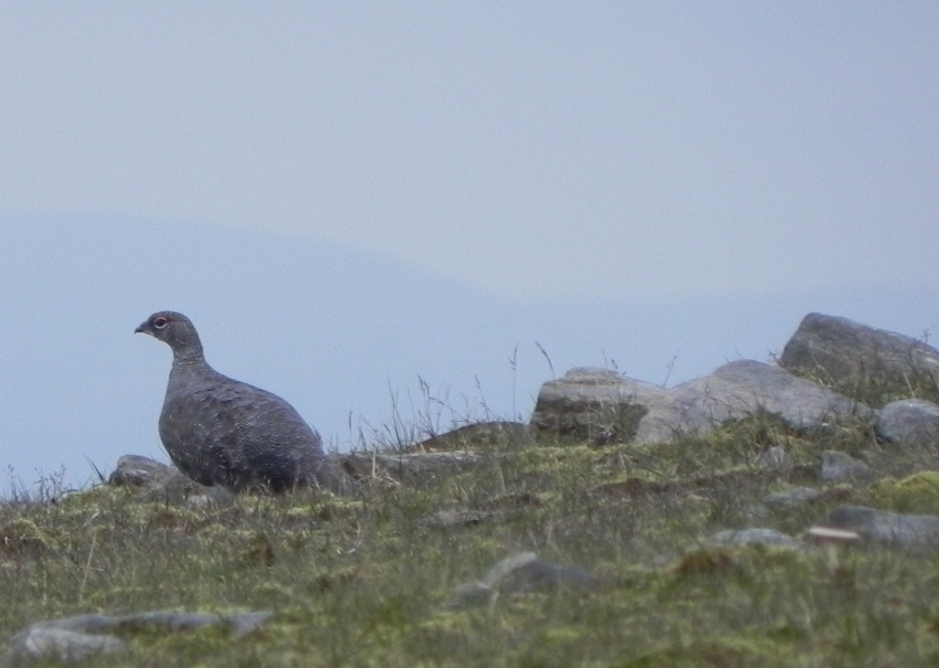 I'm out of here!
The last part of this route was neat, short grass, kept trim no doubt by the ptarmigan which I saw creeping off over the edge of the hill. As the ptarmigan disappeared into view came a silhouette I was now becoming more adept at spotting, the bealach between Ben Alder and Beinn Bheoil. Beinn Mhanach is pretty well hidden. It's often referred to as a round lump, which hardly sets the pulse racing. However as I came to the summit the views from it certainly did. It's a commanding position, with 360° views, taking in Beinn Dorain, Beinn an Dothaidh, Beinn Achaladair, Beinn a Chreachain, Creag Mhor and Beinn Heasgarnich, and that's just its close neighbours! With views down the Auch Glen, along Loch Lyon, Rannoch Moor and even to Ben Nevis, it surely deserves better than to be called a 'lump'.
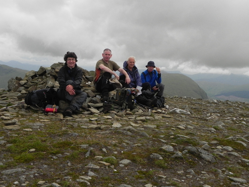 At the summit. Note the clouds...
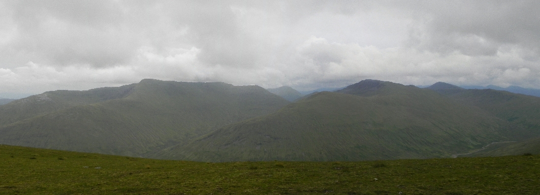 Beinn Heasgarnich and Creag Mhor
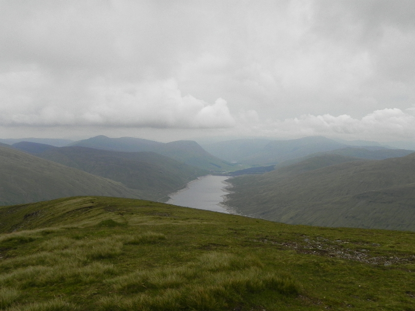 Loch Lyon
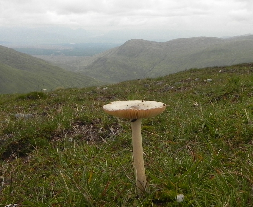 The summit was littered with mushrooms. No idea whether they are edible.
I could have spent longer here, but time was not on my side. Walking in a group can be enjoyable, but you are driven by the group clock. I snapped off a final few photos and dashed off to catch up with them as they descended, taking the same route back as we had came.
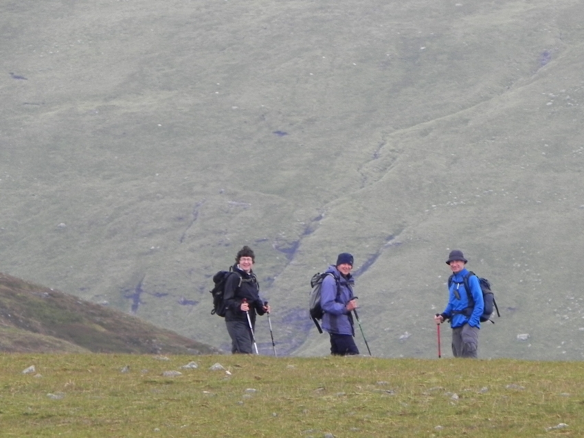 Waiting for the photographer!
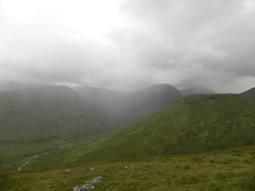 Coming right for us!
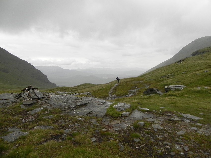 Beating the retreat
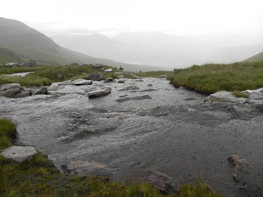 The rain caused the burn to quickly rise
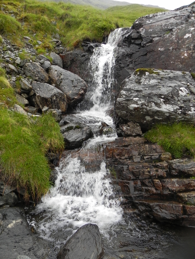 From a trickle to a flood
We quickly picked up the path and made our way back to the bealach, arriving there to feel spits of rain on our cheek. A black cloud, laden with the wet stuff was heading across towards us, and we managed to don our waterproofs just as it broke over us. With the wind and rain thankfully at our back, we set off downhill. The burns were now rising, far higher than they had been a few hours previously, but still manageable. There was little or no chat now, just concentration on avoiding a peaty mess or taking a slip.
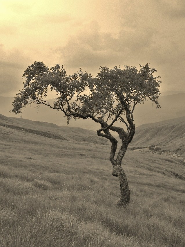 A lone birch tree bent with the prevailing wind
The bog gave way to grass and the new path to the car park. As we picked up the track to the car I noticed someone had pulled down the sign. No wonder some farmers cry “Get off my land!” The urban vandal at work again.
The midges were out in strength as we carried out the time honoured tradition of stripping off wet clothes at the roadside, and we wasted no time in piling in and getting going. Down the A82, windows lowered to shoo the last of the midges out, heading for Tyndrum, where the beer was this time a just reward, not a consolation.
