free to be able to rate and comment on reports (as well as access 1:25000 mapping).
I'd been asked to lead a walk to fill one of the gaps in the Glasgow HF summer walking programme, and had decided to go for something a bit off the clubs usual beaten track. Having recently did Tinto and the Lowthers I thought about Lanarkshires highest hill, Culter Fell. A map recce showed a potential route, taking in Scawdmans Law, Gawky Hill, Culter Fell, Gathersnow Hill and Hudderstone, a nice circular route, something that's pretty much a standard requirement of a club walk. Occasionally a linear walk can be managed, usually by coach, but if using cars it takes a bit of time and organising. Not knowing the area I decided that I would have to actually visit the area and scope out the walk. Navigation on the hills is straightforward, it's the getting there and getting parked which can sometimes cause problems. Turning up with three cars and not knowing where to park wastes time and makes you look a bit incompetent, hardly building trust in your leadership for the rest of the day.
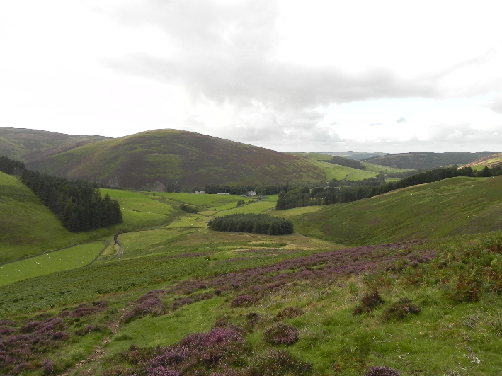
As the walk was starting and finishing at the same point my recce would consist of a visit to check out the parking and a walk up the start of the route. I headed with my daughter down through Lanark late on a Thursday afternoon, passing Tinto, which we had gone up a few months back. Parking spot duly found, we headed through the farm, checking on the way with the farmer if it was alright to bring a group through, before following the path uphill through some wonderful old woodland, a mixture of pine, oak and birch, some with a massive girth. These trees have been here a long time, but not as long as the fort which awaits just off the top of the path. We sat by the fort, taking in the view, from the nearby valleys glowing in the late sun, to the far off silhouettes of Meikle Bin, Stob Binnien and Ben More, around 70 miles away! Culter Fell is on the Watershed of Scotland, along with the nearby Lowther Hills, and I could also see the Blackhill Transmitters near Airdrie, another checkpoint on this ridge of high ground which divides the east and west of Scotland. A quick look down onto the Nisbet Burn to check for a suitable crossing point, and we were done. Back to the car we ambled, setting a hare off on a mad dash through the long grass, and eating berries as we went.
 Black Hill and Scawdmans Hill
I was on the first train to Glasgow to meet up with the HF, the city was busy for the time of morning with runners assembling for the Great Scottish Run. I got to Waterloo Street, pleased to find another four walkers there, including Robert, who I had last seen at the summit of Beinn Heasgarnich, having met up by chance at the cairn on Creag Mhor. Previous walks to the south of Glasgow are seldom well attended, and these were all walkers who could cope with thirteen miles over rough ground and a fair bit of ascent. One snag- none of us had a car! It's a problem which occurs from time to time. Sometimes the group will quickly head for the bus station and set off for Arrochar, but with no other maps with me and no cars readily available, there was no alternative but to cancel the walk.
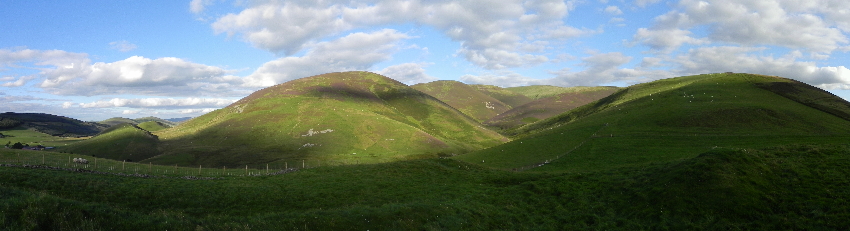
 View from the fort
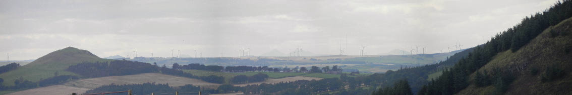
Later that afternoon I arranged to meet up with my old army mate Jim, and we set off down the M74, the conditions windy but sunny, the route lined with birling turbines from the windfarms which scar this part of the country. Every empty space is put to use generating power. At five o'clock we were finally suited and booted and on our way up the hill. A thirteen mile trip at this time wasn't on the cards, it would be dark in three hours, so instead we ascended Fell Shin. I had been tempted by the path up the cleuch, but as we would see later, this led to a killer of a steep slope, and one we were glad to avoid.
 Someone has opened a bag of turbines
The sky was cloudy, but in between the sun broke through, pouring gold down Woodycleuch Dod. Despite the wind many of the turbines sat motionless, generating nothing but annoyance. We paused a few times on the way up, Jim hadn't been out much and was finding it tough. I had brought a pair of boots I hadn't worn in a while and was finding it tender, but even so we were on the top at the trig point in about an hour and a quarter. The wind tore at us as we scoured the area looking for a geocache which was placed near the top of the hill. After checking the GPS and finding I had input a digit one off from what it should have been we quickly located it, and dropped down out of the wind.
 Looking back down towards the start of the walk
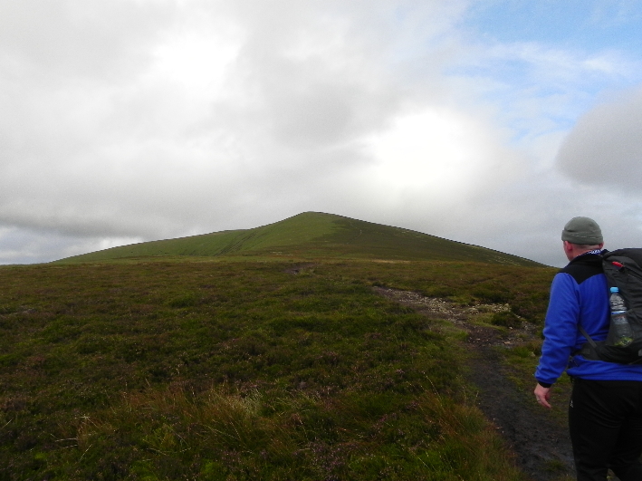 Jim, heading for the top
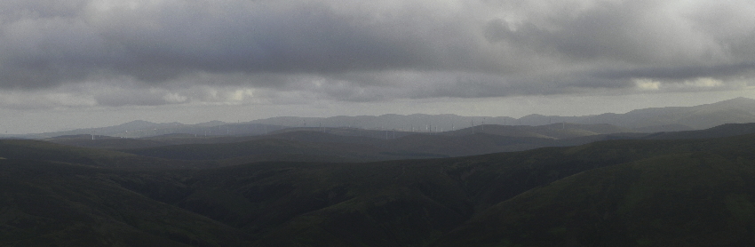
The views were not as far reaching as they had been a few nights back, the distant cloud hiding much of the view to the north, but even so we could still see an impressive amount of smaller peaks, and across to the Pentlands. I wondered if it was as windy on West Kip as it had been on my my visit there last year, when I could barely stand up straight in the gale.
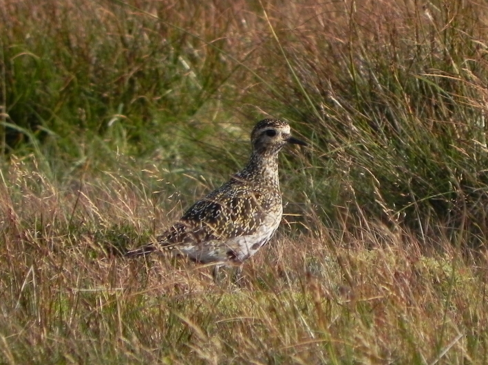 Golden Plover in winter plumage
 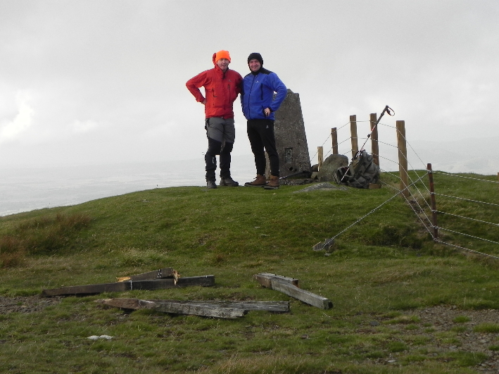 Windswept and interesting- hanging on at the trig point
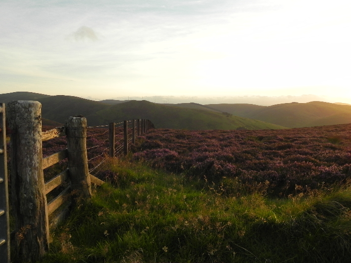 Heading down- both us and the sun
We dropped to Tippet Knowe, picking up the path back to Culter Allers Farm, where we should have ascended that morning, had everything gone to plan. Two hours bang on, from the car to the top and back again. Not a long walk, but an enjoyable one all the same, and a useful recce in case I manage to get back for my original planned walk. Having seen the ground I perhaps underestimated how steep some parts were. In a way it was lucky we didn't manage to get here in the morning, as the boots I had brought would have left my feet in tatters long before the end.
