free to be able to rate and comment on reports (as well as access 1:25000 mapping).
Living close to Ennerdale Bridge means it's a handy place for starting walks without much in the way of driving.
I decided recently that I would climb Steeple via the North Ridge and as my wife decided she would like to join me for fell walks more often (she had only done easy stuff so far) last weekend seemed the perfect time to do this route.
We started off around 10am on Sunday and as with all walks to the deeper parts of Ennerdale Valley, there is the considerable matter of the walk in from Bowness Knott. Cars are not allowed any further up the valley, except to access High Gillerthwaite Youth Hostel
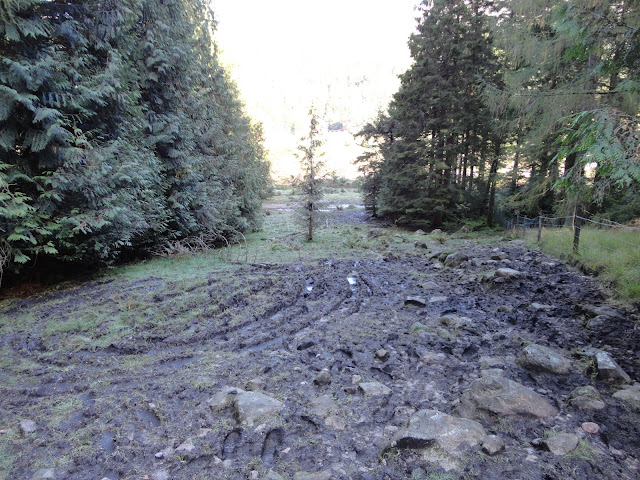
We eventually reached the Irish bridge and crossed the Liza, heading over the footbridge and down to the foot of Lingmell. The 1st 50 yards of the ascent is a complete mudbath and it took a bit of problem solving and getting ankle deep in mud before we found a place to start ascending. We eventaully bent some tree branches down and stood on them to stop sinking into the mud, then kept tight to the left hand fence to avoid the worst of the bog.
The mud eases as you climb and eventually you clear the trees and pass through a broken wall onto a very steep path up Lingmell. The path is not great on the section and veers about on the slope rather randomly. It's very slow going on the section due to both steepness and roughness of the path. I can't stress how difficult this section is, certainly far rougher than I expected and not that easy to ascend, whilst being fairly long.
Much, much later we eventually cleared the slope and crossed over the summit of Lingmell and dropped down to Low Beck. The beck is quite a considerable size considering the reasonably high altitude at which it sits, but the stepping stones are decent enough. I did fall in slightly, but my feet stayed dry. My experience of rivers this high in the fells, is that they are normally small enough to leap, but this was not possible here. There some boggy sections on Lingmell, but nothing too taxing, compared with the walk start.
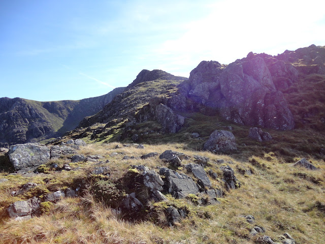
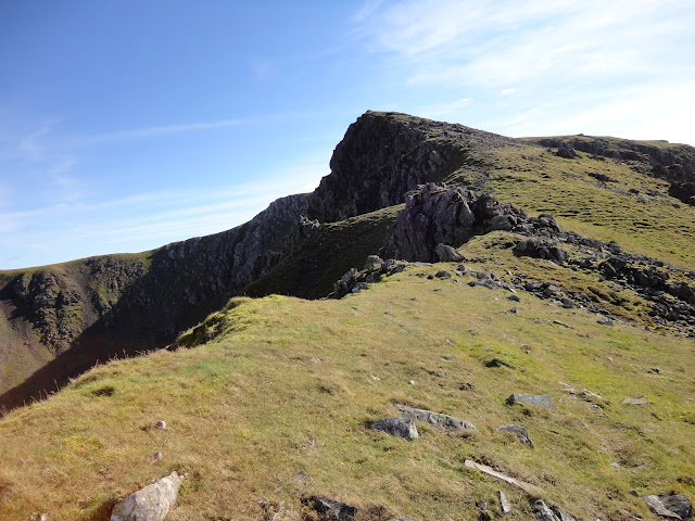
It's then you start climbing Steeple proper. The path traverses a less steep section, before turning and assaulting the mountain straight on. It starts off reasonably rough, but mostly easy to follow and it zig-zags somewhat on its route. After a while you eventually approach the single difficulty on the whole ascent in the form of what looks like a formidable rock-step. When you reach it, it's apparent that it won't take much climb. A single scramble move will get you over the initial 4-5 foot step and it's easy after that.
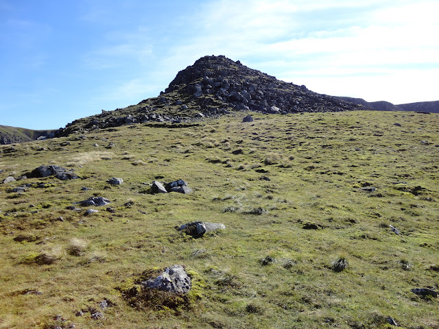
You emerge onto a grassy section and the path makes it's way to a formidable looking tower. We stopped for lunch here as we had been going a long time (it's around 4.5 miles and 2000ft of ascent from Bowness Knott to Steeple) and my wife had found it tough going. It was realtively noisy for our remoteness, with paragliders and helicopters seemingly busy in nearby Buttermere and a fairly low plane breaking the silence. It was very sunny and despite forecast temperatures of 5C at the summit we were warm enough after the ascent to sit around in our base layer tops.
After lunch we made the short final ascent. The rock tower we lunched near was tame in the extreme and just a short and simple walk over the rocks and final few feet on grass on the summit was reached. As always, Steeple was relatively popular and we befriended another walker's dog, which seemed to want us to play fetch with him with bits of moss.
We lingered a while to get the summit to ourselves and took plenty of pictures.
It was the time to tackle the arete. I had done before in both direction and the 1st time I found it awkward. It wasn't so bad this time and though eroded, the only place where care is really needed is the decent off the summit. In dry conditions the rest is simple and the exposure is not so bad. We were soon on the summit of Scoat Fell and made sure we had a look through the wall to Wasdale.
Time was really ticking on now and we made a beeline to the col with Haycock. I had planned to also climb Haycock, but we were way behind schedule so this was left for another day. On reaching the col we took a right for our return route over Tewit How. I would not recommend this route in poor conditions or for beginners The route descend quickly, then passes through a boggy section and into vast heather moorland. It is cairned in places, but can be hard to follow, is very rough in places and is also boggy. There is also marked on some maps a route down into Deep Gill, then through the forest. This would have been ideal, but we could not find it. We had to eventually descend the horrible steep rocky path we came up on Lingmell. It was almost as hard in descent and took some time.
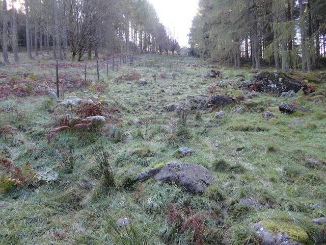
We eventually reach the muddy section at the bottom and not wanting to tackle the mudbath, we crossed the slope at the top of the last section (just below the bench). We headed through an old iron gate and made our way through the trees instead. It took a little bit of grapple through some branches, but we eventually reached the other path that runs from the start point. We dropped out of the trees crossed the path and nipped through the last small section of trees and back onto the track at the bottom of Lingmell. Mud avoided, thankfully.
It was then a very tired walk back to Bowness. We were treated to a flying display by some geese which were flying up the lake and decided to descend and fly just above the surface of the water.
In summary it was a logn tiring walk. We were out for nearly 8 hours in some very challenging terrain, especially for my newbie wife. She wants paths next time!
Bowness Knott car park

Looking down the Liza (there used be a deep pool here which you could swim in)

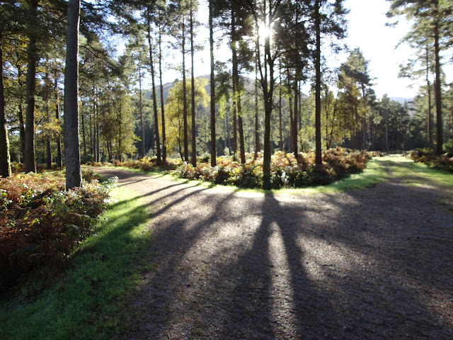
Entering the trees (our path is the left one)
The footbridge takes you to a path which runs across the base of Lingmell

The mudbath. The bottom is the worst of it
The climb carries on. This bit was easy
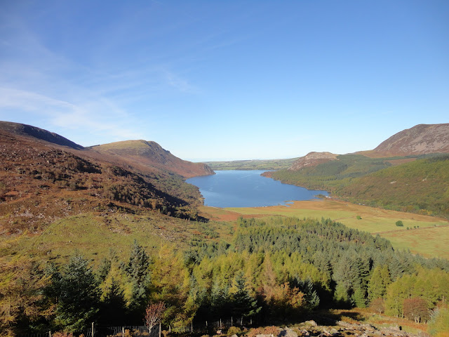
The view of Ennerdale Water once out of the trees
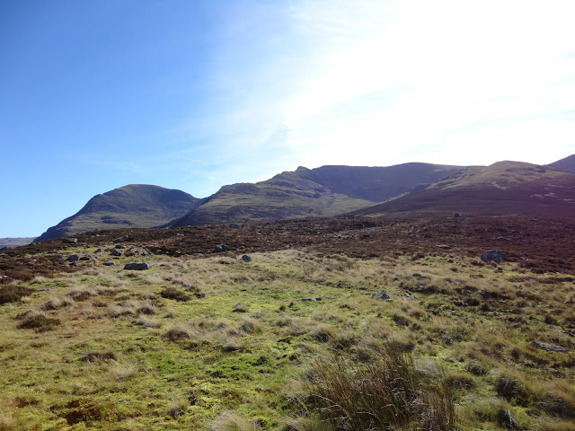
This is where we were heading. Still far to go.
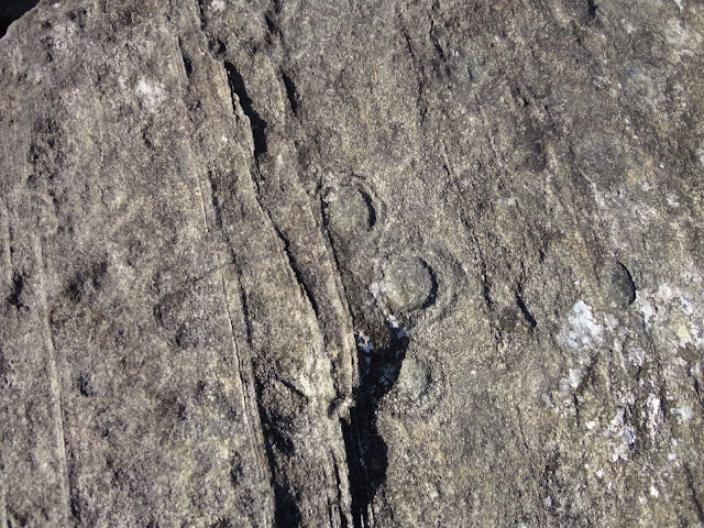
I spotted this weird formation on a blouder. Any geologists know what is going on with these circles?
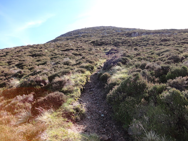
The start of Steeple proper
The ever-so-slightly awkward "rock step"
The tower, which posed no problems
The end is finally in sight

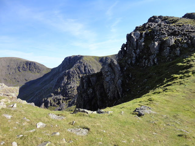
Rock scenery near the summit
The last few hundred feet
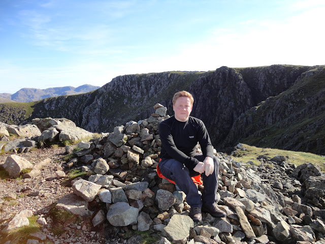
I finally made it
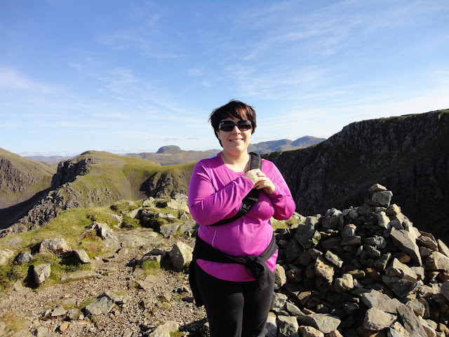
...and so did my wife
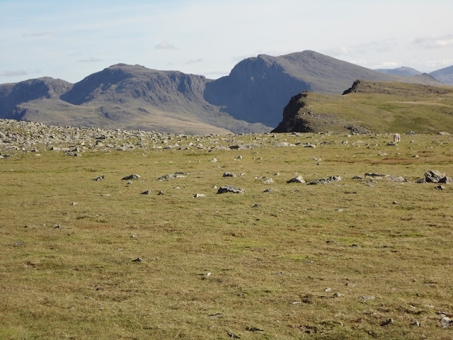
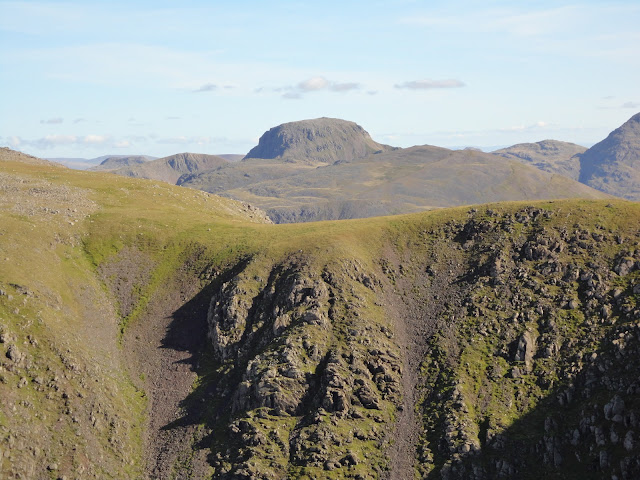
Great Gable looking as magnificent as ever
Looking back towards Ennerdale Water. The car is a bloody long way away!
The arete. It's bark is worse than its bite

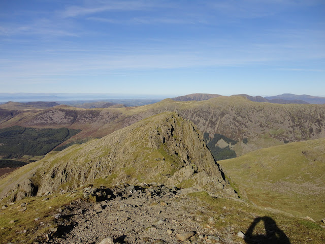
Steeple from Scoat Fell
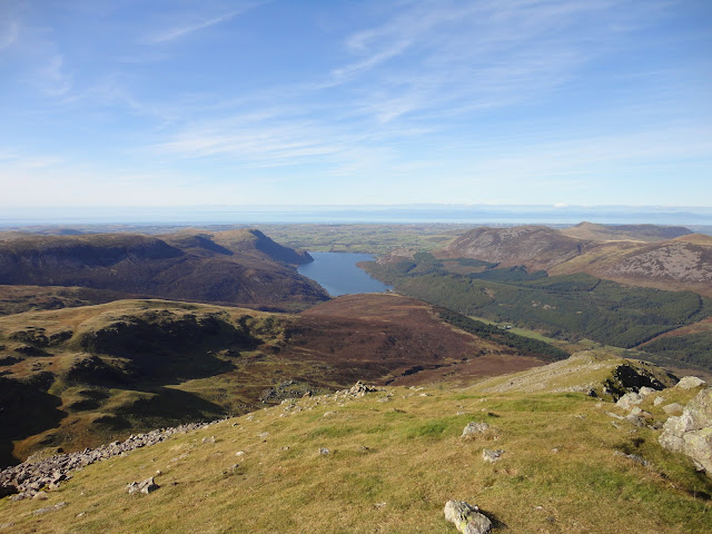
The Scafells with Red Pike in the foreground