free to be able to rate and comment on reports (as well as access 1:25000 mapping).
It's been a long time since I've been up a hill. More than four months in fact.
It hasn't been for lacking of trying or will, things just haven't stacked up in our favour this year. Aborted missions, lack of resource and time as well as a discernible drop in confidence have all featured in the mix.
So as I pointed the car North up the A5 on Sunday morning it was with mixed feelings. The weather forecast was promising and the morning was just beginning to dawn so I quickly forgot about my nagging doubts. Will I be fitter this time? Do I have the bottle not to turn around when things are anything other than dead easy? These factors have after all at least in part contributed to a lack of hill exposure this year.
By the time we reached Glasfryn, about 10 miles south of Betws-y-Coed the sun had risen and all of Snowdonia was bathed in a soft golden light. I've never seen these mountains look so clear and so majestic. Even from this distance I could easily discern the Snowdon Horseshoe, the Glyders, the Carneddau and shapely Moel Siabod. I cried. With happiness.
We parked up in the small, free car park behind Joe Brown outdoor shop in Capel Curig and headed north up the track and past a house to find our path on to the Glyder Ridge.
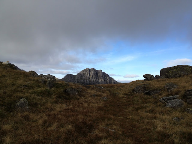
Problem - can't find a path, or at least not the right one. Oh well, there's nothing for it, let's just head up in the right direction following sheep tracks and scrambling over slabs. I was feeling really good. The sun was shining and I didn't turn back at the first obstacle. Eventually after a kilometre of 'freestyling' it, we found a faint path up on to Cefn y Capel.
This is where things started to get really squelchy under foot but the reward for persevering was some amazing views and mountains all around us in hues of gold, green and grey.
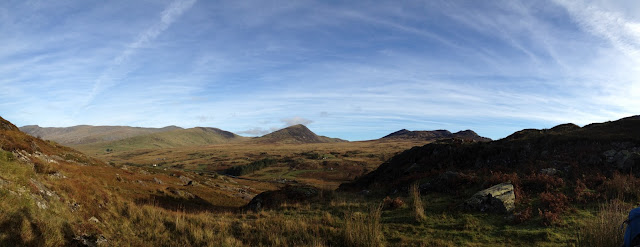
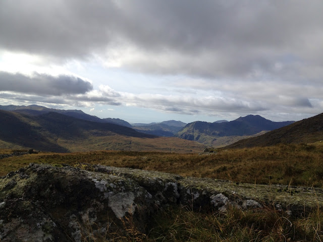
Panorama of Carneddau with Pen Llithrig y Wrach & Craig Wen in the centre
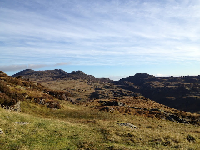
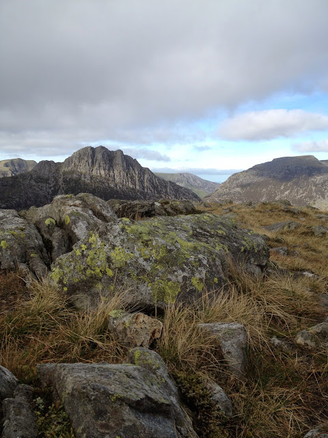
Carneddau from the Glyders - Craig Wen & Creigiau Gleision
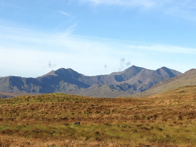
Snowdon horseshoe in the last of the Alpenglow
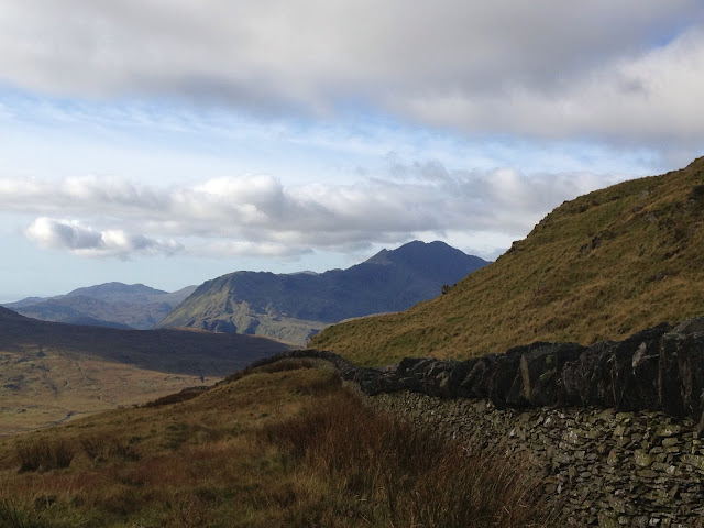
Snowdon
As we wanted an early start we hadn't had breakfast so now was a good time to start the stove and cook up some porridge as well as making the best drink known to man; a freshly brewed mug of coffee. Not long after brekkie we reached our first major peak of the day, Gallt yr Ogof.
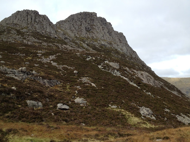
The weather gods really were smiling on us as the mighty Tryfan loomed into sight and all the hills were picked out in stunningly clear light.
Mighty Tryfan looming up from the Ogwen Valley
Tryfan & Pen Yr Ole Wen
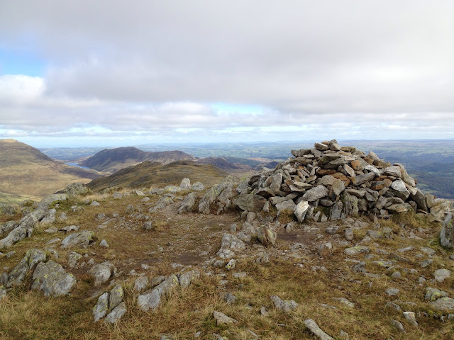
Gallt yr Ogof summit view to the Carneddau
It might be a 'lesser' peak on the Glydera but the views are stunning none the less
Happy to have reached our first summit and somewhat complacent from having negotiated what felt like miles of bog hopping we headed down the hill towards our next target, Y Foel Goch.
The going was incredibly wet and by now I was seriously regretting giving my recently ebayed La Sportiva Raptors their first 'proper' outing. My socks were sodden and I was fully expecting my toes to be webbed by the end of the day. That said they warmed up quickly after each full bog immersion as long as I kept moving. And then it happened. In the blink of an eye I was in bog up to my waist.
What the hell? What do I do? I know... P.A.N.I.C for my iphone life!
I couldn't tell you why I concluded my phone needed to be rescued first but I did. I lent forward and thankfully there was firmed ground right in front of me. After fishing (no joke) in my pocket for my phone I lobbed that on to the ground in a relatively dry spot. It felt like I was sinking further in. Thank goodness I remember reading on some outdoors site that you should not struggle and try to raise your legs so you're in a sort of breaststroke position. I seemed to recall it also said something about taking your pack off, which I tried but failed at miserably.
While all this was going on, Fiona was trying valiantly to get to me without falling in herself. Easier said than done as the bog extended for some distance and there was no point in both of us being stuck. Eventually I managed to pull one leg to the surface but I really had to fight the feeling of panic as the second resolutely failed to be raised. After what felt like ages I finally managed to wiggle it out and was lying flat on the bog. I'll have my snorkel now please! I pulled myself on to the ledge in front of me and heaved a sigh of immense relief as I'd managed to pull me, my iphone and critically both my shoes out of the bog. Walking several miles over rocks and bog in socks was not an idea I relished.
Fiona was understandably shaken but thankfully there was no harm done apart from one very soggy woman and a severely dented ego.
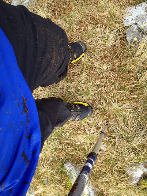
The bog was so saturated that the peaty mud was diluted
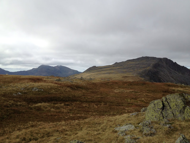
Glyder Fach from Y Foel Goch
Cloud was coming in and the wind picking up slightly so in order to get warmer and try to dry off a little we picked up speed and headed towards a sheltered lunch spot at the base of Glyder Fach. Sandwiches and coffee were consumed in the lee of Bristly Ridge watching and chatting with other walkers.
We potentially had a long walk back to Capel Curig if I'd misread the bus time table again so we decided to drop down in to Ogwen Valley going past Tryfans east flank and then leg it to the bus stop at Llyn Ogwen.
Tryfan up close and personal
I stopped tracking our walk on Viewranger as I was running low on battery so you will just have to take my word for the fact that we hared down to the A5 covering two kilometres in less than 20 minutes to jump on the Sherpa bus with less than 15 seconds to spare. Both of us grinning from ear to ear all the way to Capel Curig because we'd had an amazing day out, the bog didn't claim us, we didn't turn back when things looked unfamiliar and we have somehow got the fitness to pull that final route march for the bus off.
It was a simply brilliant day out!


** I have tried linking my photos from picasaweb but they are not appearing on this post so to see photos and where they were taken simply click on my social hiking map below and then click on photos **
++ addendum to the amendum - thanks to the tech hero who is Malky_C there is now imagery in this report - Thank YOU! ++[socialhiking]http://www.shareyouradventure.com/map/os/Smirnie71/capelcurigtollynogwen[/socialhiking]
