free to be able to rate and comment on reports (as well as access 1:25000 mapping).
I was mostly absent from the forum for the last week and a half and now it's time to catch up. We enjoyed our spring "staycation" as much as we could - well, weather from Thursday on was c***py, but the first half of the week we spent out and about, mostly UP there

So I'm behind with my trip reports once again. Five stories to write, four of them involving mountains. Spring hols 2013 didn't break any records in statistics, but we still managed 3 Munros, 1 Corbett and 1 Graham, walked over 80km... and my Munro No. 100 is coming soon... Only 6 tops away

I can almost see it on the horizon

But before we move on to Munros, the first story to tell, about a certain lower hill. Let me introduce Meall a'Chrathaich. To be honest, before the 3rd of March 2013 I wasn't even aware of it's existence

I don't have photographic memory and I don't remember the whole map of Grahams, where they are (especially the more obscure ones), so this walk wasn't supposed to be a hill climb. Having done some shopping and spring tidying up on Saturday, we planned our first outing for Sunday: from Corrimony to Loch ma Stac. A local walk I had yet to explore. Kevin has done this route before, in 2005. He remembered some good views along the way, across the open moorland to Affric mountains. I checked in his old albums and I found a few pictures that made this walk look promising:
![P4080060.JPG]()
- Panorama of Glen Affric hills from the track to Loch ma Stac in early spring 2005
On Sunday morning, with weather semi-good, cloud gathering in the sky but not too windy, we prepared for the outing. As the whole planned route was along a track and we didn't intend to venture on the hills, we only took one rucksack, packed in some warm clothing, hats and gloves, waterproofs and gaters (the track was said to be wet in places) plus a sandwich box and one small flask with hot tea. We left behind our climbing gear, things like crampons, survival kits and walking poles - we didn't expect we would need them.
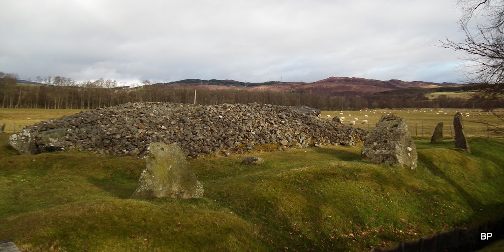
The walk starts at the village of Corrimony, just off A831, between Cannich and Drumnadrochit. For all those interested in ruins and ancient history, there is a bonus place to visit at the very start - Corrimony Cairn. So we will begin from here. All Walkhighlanders must remember by now that I'm a ruin-maniac, obviously I couldn't walk past this monument without having a peek in
There is an ample car park just before the cairn and the monument is signposted:

Just a few steps along the road, by the entrance to the cairn area, an information board:

More info about the cairn here:
http://glenaffric.org/corrimony.htmlThe cairn is an old burial site - basically, it was used as a tomb. Part of the roof is missing but apart from that, it's fantastically well preserved:
The entrance:
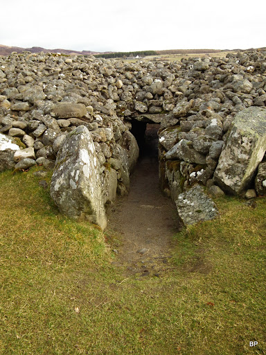
If you're thinking about walking inside, forget it. Was it built for Hobbits?

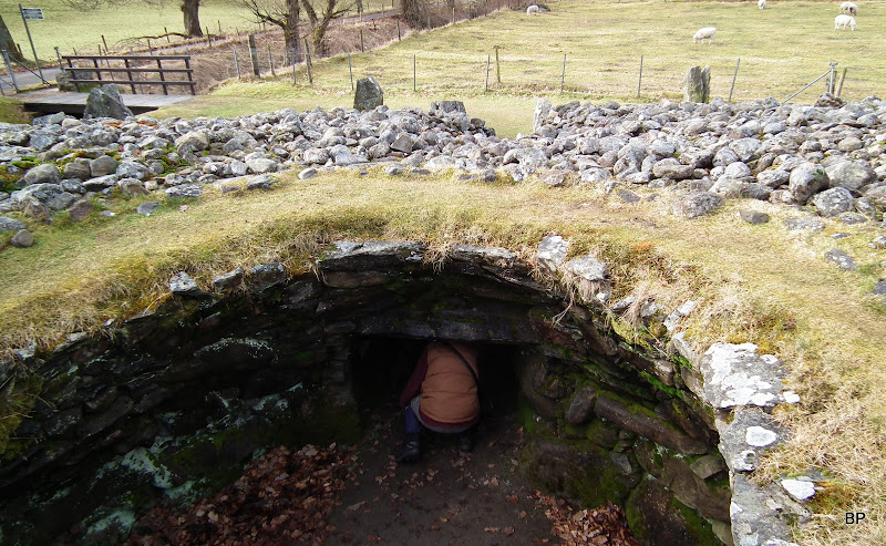
OK, so to venture into the burial chamber, one has to drop down to hands and knees
The corridor is narrow, but guess what! I squeezed in!

Inside the burial chamber:
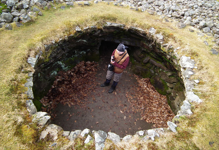
There is only one problem - the walls of the chamber curve inside, so it's not possible to climb out to the roof. The only way out is back through the narrow tunnel
I wanted to spend more time here, but we were only on the very beginning of our adventure...

...so we had to leave the cairn behind and continue along the tarmac road:
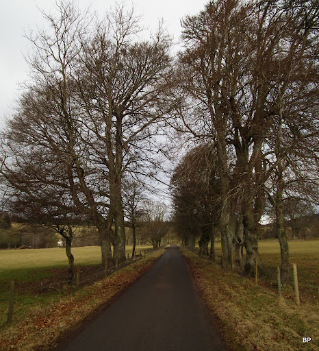
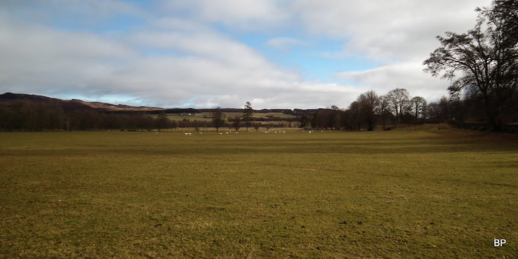
It was a quiet walk, luckily, among pastures and meadows full of bouncing sheep
Sheep wars caught on the camera - in a separate entry in wildlife section:
http://www.walkhighlands.co.uk/Forum/viewtopic.php?f=3&t=29676.
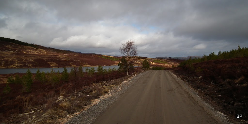
After a couple of km when we turned off the tarmac and into a forest track, we noticed dangerously looking signposts "Lorries turning here!" and "To the building site". The track also looked much wider and much more used than Kevin remembered from his previous visit...
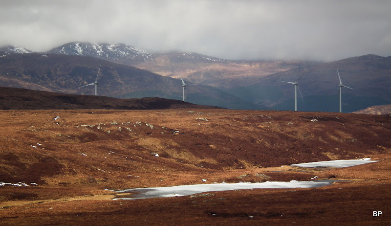
The reason for it became obvious only a short time later, when, having walked through a stretch of forest, we reached the top of a bump in the ground and saw the view to the south and west:


!!!!!!!!!
They are everywhere!!!
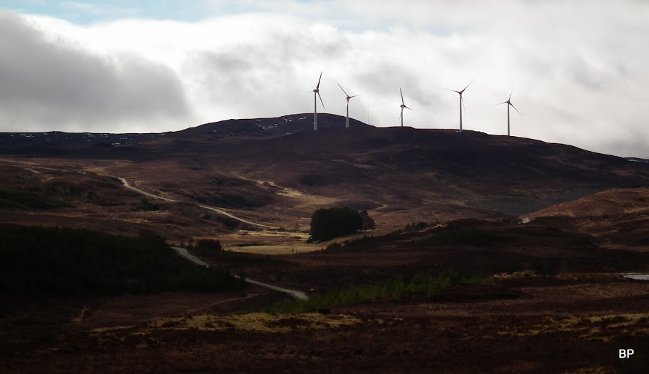
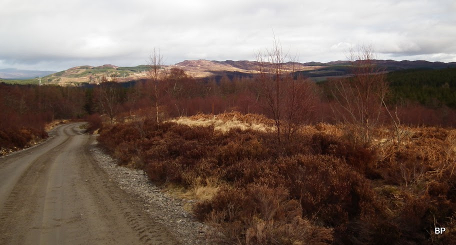
We simply had to ignore the windfarms. Luckily, apart from the bulldozed track, the surrounding landscape seemed unchanged...

A couple of photos from 2005, showing the moorlands and the original narrow track as it looked before the construction works started:
Back to 2013. The road goes past Loch Comhnard...
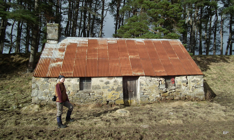
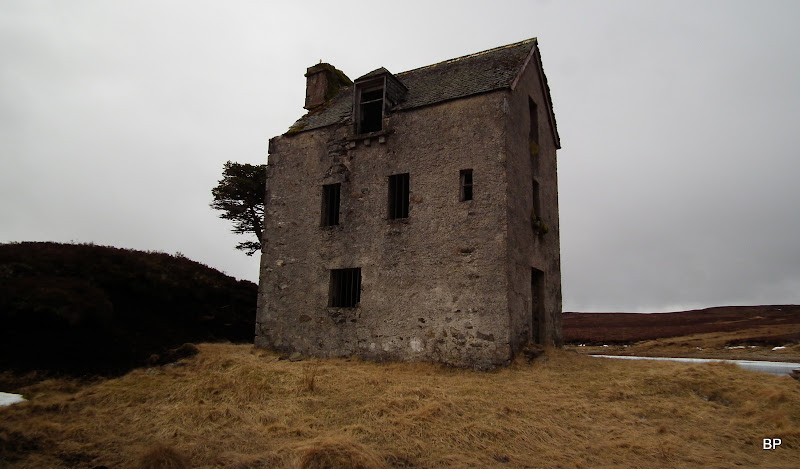
And further along, we took a short detour to visit... eeee... an old cottage.
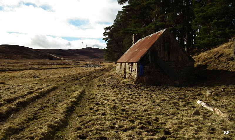
The landscape here looked unspoiled...
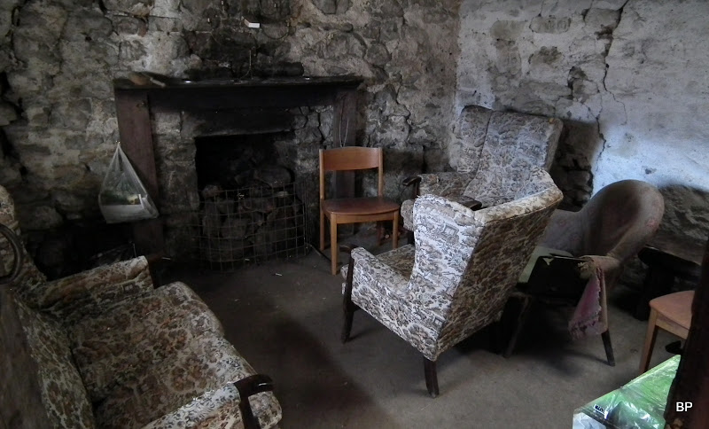
...and inside the little cottage one could even stop for an overnighter
Unless the owner has something against... But we didn't see any "Private" signs and the building wasn't locked.
Just past the cottage we had to return to the bulldozed track and the windfarms...

Looking back along river Enrick. The house is hidden behind the trees:
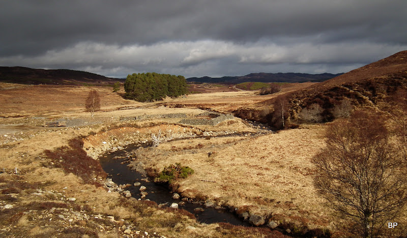
The small advantage of the building site for windfarms - a new bridge was constructed over river Enrick (seen here in the middle of the photo):
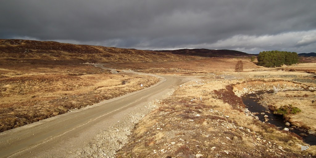
The distant views to Affric hills were not as good as I expected as the day was rather cloudy...

Just before reaching the wind turbines, we located the old track branching off the wider road. At last we could leave the scarred part of the walk behind, though the shadows of the turbines were still upon us...
The old track turned uphill along the river and away from the monstrosities...
...soon becoming a bit wet... Well, nothing we couldn't manage
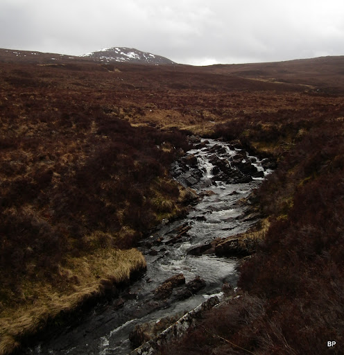
We followed the river for a while...

...running away from showers on the northern horizon...

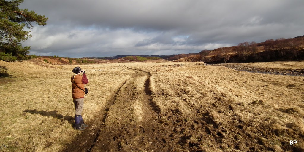
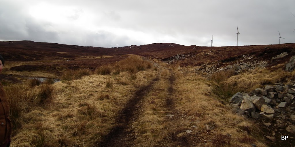
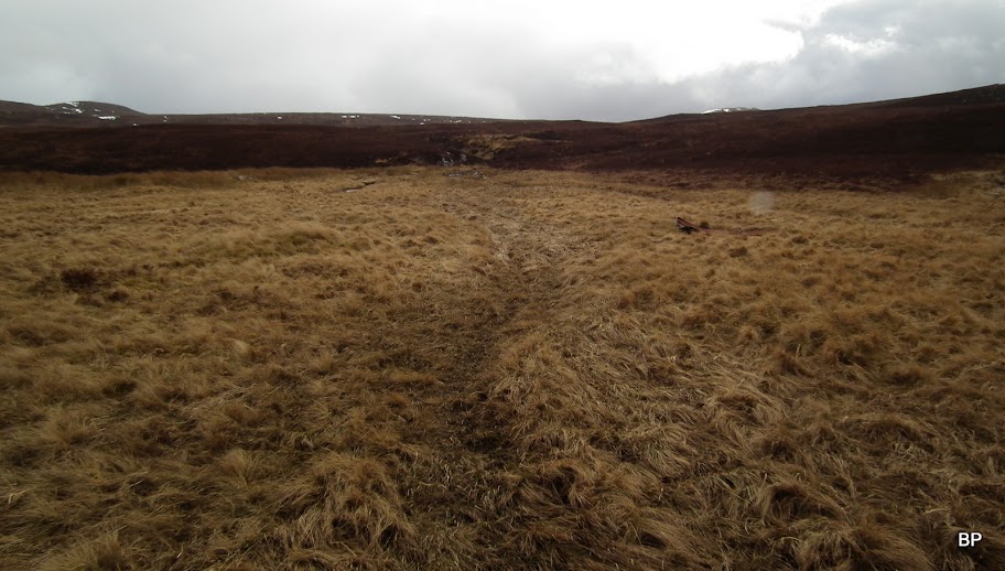
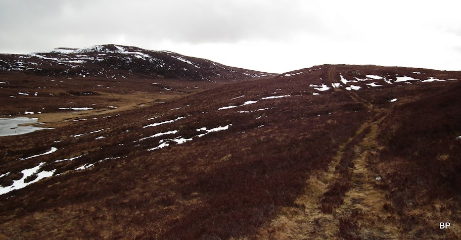
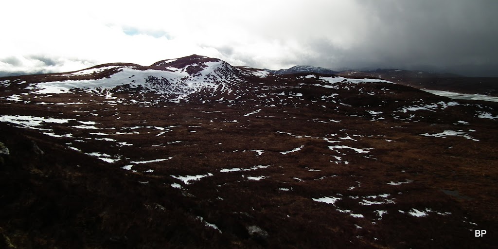
The track may be boggy in places, but it is obvious all the time. It climbs uphill gently, towards higher ground. It was then when we first saw the Graham that wasn't meant to be (climbed that day)
:
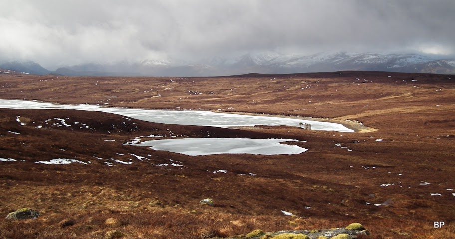
The track passes above two tiny lochans (they have no names on 1-25k map):
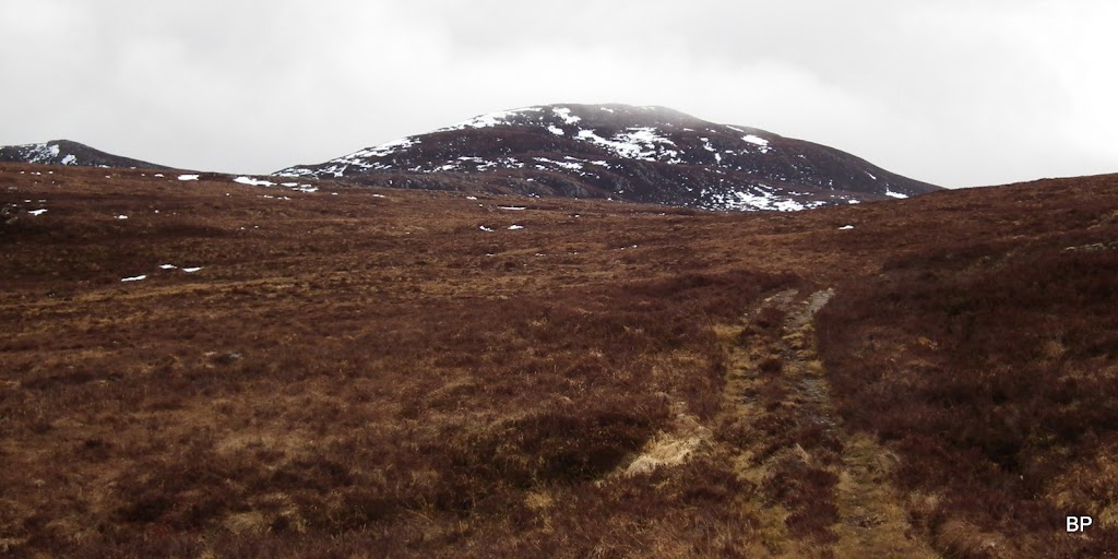
Kevin was intrigued by the hill next to us. Our GPS was showing that we were roughly 500m above sea level, and as the mountain across the river looked at least another 150m higher, we quickly calculated that it would have to be of Graham height. My chum dug up the map and he checked that we were indeed looking at the 679m high top of Meall a'Chrathaich, which logically should be a Graham. Whether it was or not, remained to be seen. Sadly, in this God forsaken place, miles away from the nearest house and proper road, we couldn't log in to Walkhighlands and look at the list of G-hills. Phones stated firmly: NO SIGNAL

It was Kevin who suggested that we could "pop up there, it's just across the river and not much climbing". I was happy to agree with him, the mountain looked easy enough and though we didn't take our climbing gear, it didn't look like we would need crampons or ice axes on the heathery slopes of Meall a'Chrathaich.
But first, we decided to walk to Loch ma Stac, so we stayed on the track for a time being:
Having climbed quickly over a couple more lumps, we saw the loch at last:
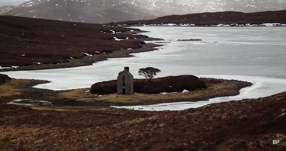
Funny, the old fishing lodge reminded me of tin mines in Botallack. It looked similar to the engine houses built on the edge of the cliffs. Kevin, as born & bred Cornishman, had exactly the same association:
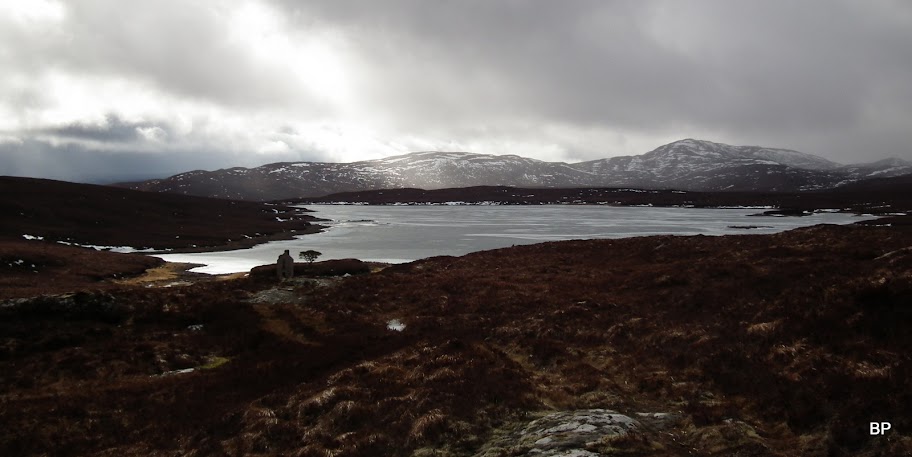
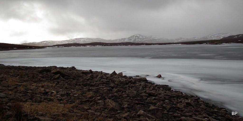
We walked down to the loch only to discover that it was frozen solid:
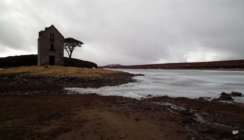
The old lodge:
Views across the loch:
We took a break by the loch, refreshed ourselves with some hot tea and cookies. Then it was time to tackle the Graham that wasn't meant to be climbed that Sunday
So eventually, our daily route ended up looking like this:
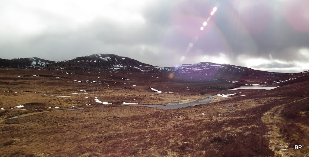
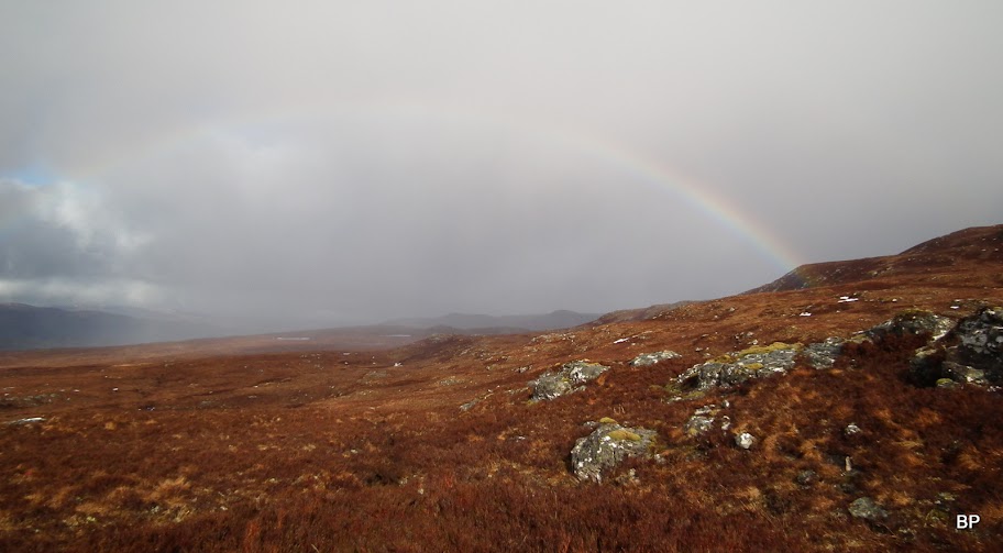
Weather was turning worse and as soon as we set of for the Graham top, it started raining. It was too late to turn back now, so we continued uphill. Our efforts were rewarded with a short break in the rain and a rainbow:
The approach from the loch is pathless and rather wet, but soon we were climbing up the higher ground, where it was easier to pick our way through the grass and heather:
View down to Loch ma Stac:
That's the summit:

Windfarms back in sight!!!
The final 80m of ascent were on steep slope overgrown with heather and scattered with rocks and boulders, but it didn't present too big a challenge for two mountain-maniacs
Even if it would not turn out to be a Graham, the hill was still worth adding to the walk:
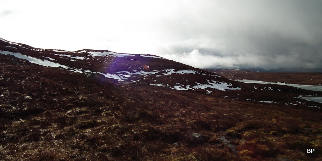
We stopped just below the summit to take some photos and admire as much as we could see of the surrounding vistas, as another shower was coming towards us...

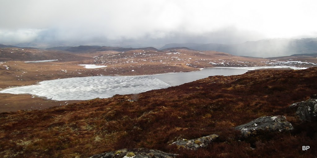
We could now see to the other side of the hill, and though the more distant views were covered by cloud, we were content with half-frozen Loch Chrathaich:

I spotted another rainbow...
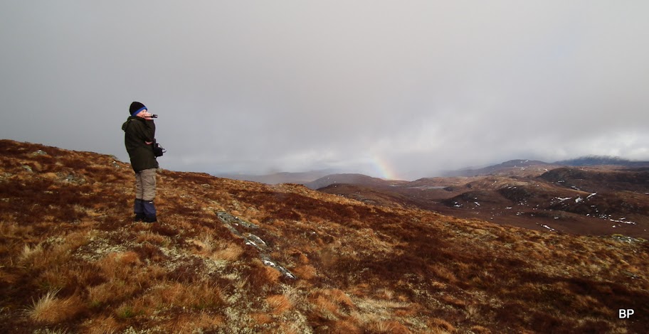
Close-up:

A few more steps - and we landed on the summit, marked by a trigpoint:
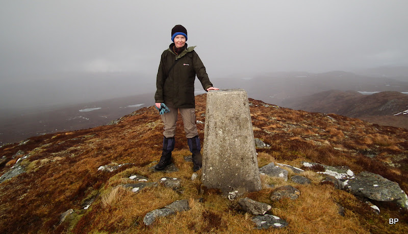
We enjoyed views down to Loch Chrathaich for a short time, but the rain has reached the top of the hill just minutes after us, so there was no point staying here any longer and getting soaked...
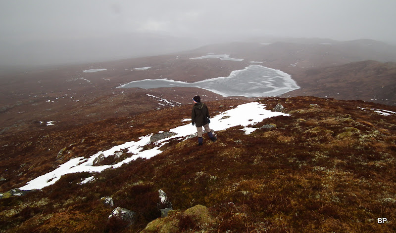
Descending back to the track, with frozen Loch a'Mhuilinn in the background:
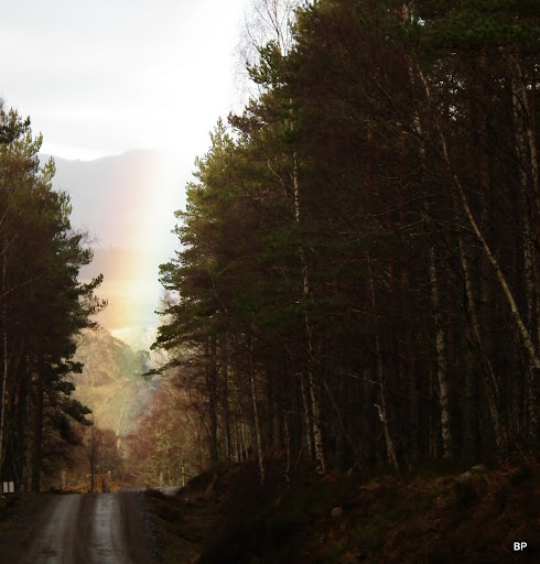
To return to the track, we picked our way don the heathery slopes and walked back towards the two small lochans. The best place to cross the river is between the two lochans, on stepping stones. The rain followed us for another half an hour but it died out eventually as we reached the wind farms. The remaining part of the return route was walked in decent conditions and we even saw another rainbow whilst in the forest:
Having returned home, we were all happy to find out that Meall a'Chrathaich is indeed a Graham. We left home without any intention to climb but returned with a bonus hill ticked off
Our route is probably the easiest (not sure if the shortest) way to climb Meall a'Chrathaich. Shame about the windfarms, but to be honest, if they have to be built somewhere, maybe better to have them tucked out of sight in this very remote and seldom visited corner rather than on the slopes of Ben Wyvis, for example. Yet, the new bulldozed road is a nasty scar on the landscape. Is it worth it?... I don't know... Personally, I don't like the way the turbines spoil the views, but it's just my inner feeling... I don't want to stir in the pot and open another debate, so maybe better to end this right here, right now.
The walk is still worth doing. The new road means it can easily be cycled at least half way to the loch. For those not interested in bagging Grahams, Loch ma Stac by itself is a good target, especially in warmer weather, when one can have a picnic on the shore (swimming in the loch probably not recommended, too cold even is the summer
).
So that was Sunday, just the beginning of our spring hillbagging. On Monday we tackled a Corbett, before moving on to Munros on Tuesday and Wednesday. These stories will follow soon. Meow!
