free to be able to rate and comment on reports (as well as access 1:25000 mapping).
So this weekend, we didn’t really know what to do with ourselves.

We were supposed to be going over to do Ben Alder and chums, but I was struck down with a tummy bug midweek, so it was decided a low level walk close to civilisation would be better than the wilderness of that part of the world. The Cateran trail is close by and convenient, so we decided to go and do a bit of that, knowing we only had 3 days for what is usually a 5 day walk.
The meeting point was a random campsite in Alyth.. I arrived first, but couldn’t find it – completely misunderstood Dougie’s directions

So I waited for him, and we made our way to the campsite together. It was nice, with wifi, and the warmest toilet block ever. Shame they couldn’t do anything about the outside temperature because it was a chilly night with a million twinkly stars.

When I woke up on Saturday for the first time in days I felt able to eat something, and I began to feel that I may enjoy the walk after all.

We drove up to bridge of Cally to start our walk – I know it usually starts in Blairgowrie, but time constraints meant we had to cut some corners!

The trail was conveniently signposted and we made our way up the track toward Kirkmichael.. A few hundred metres on, we realised we had forgot our rollmats, and with things looking pretty snowy, the chances are we would need them, so I waited in a feminist way, while Dougie ran back for them.
Then a couple of km further on, Dougie discovered he had left his jacket at the campsite.. Not good, but he decided to go on without it, so with much faff over we finally got under way proper

It was a pleasant walk through the mixed woodland of Blackcraig forest, the snow not too deep. Once we were out of the woods though, with the sunshine blazing, and my hunger increasing after my 3 day fast, it was all to easy to spend more time sitting than walking and slow progress was made.
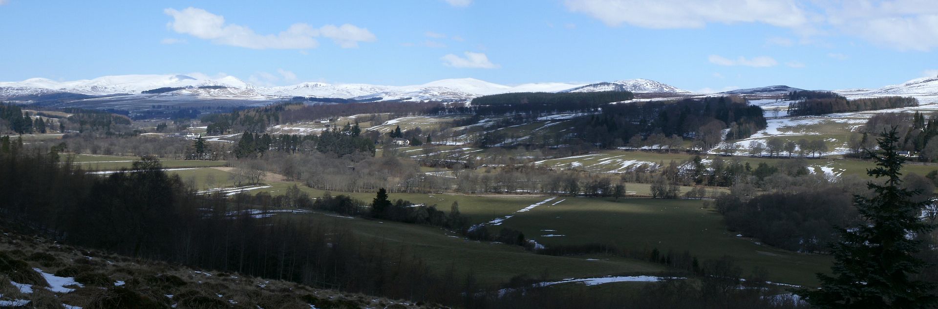
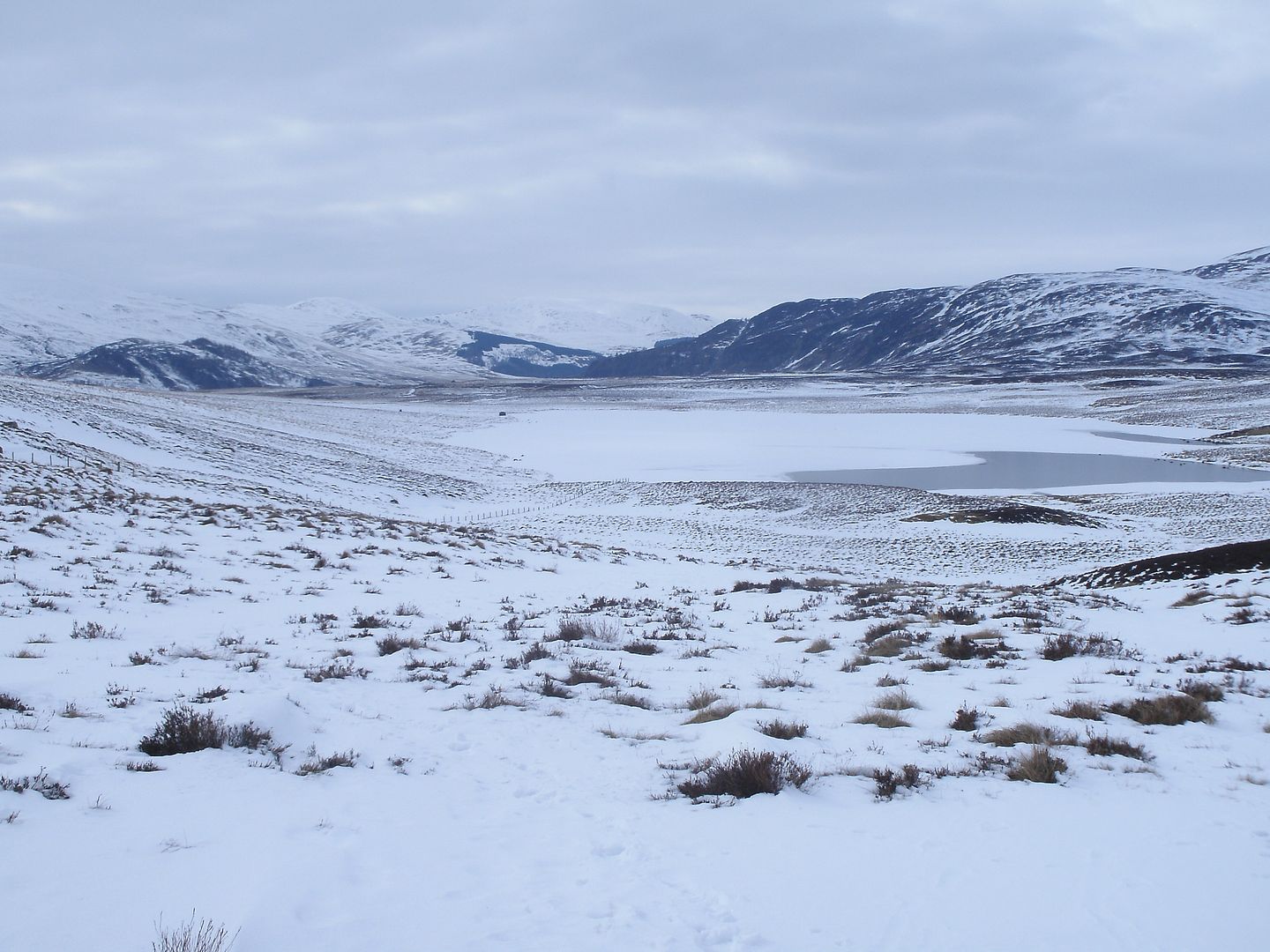
At the end of the track there is a section over some boggy moorland. I could see efforts had been made to put in drainage in a few places, but we were glad that things were quite frozen as it could have been far worse. Across a bonny burn
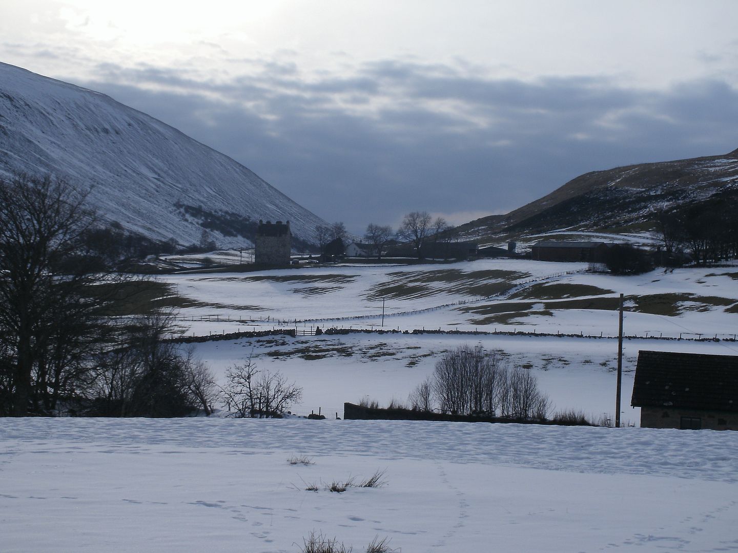
and it wasn’t far before we were back on the track, heading into Kirkmichael. The kirk itself is rather dilapidated, but we found a nice bench by the river to eat some more and take stock of our progress- not good. It was 2PM, and we had only gone 8 miles so far!

It was just a couple of miles along the glen to Enochdhu, some grotty farm tracks leading us up to a bonny path through Kildroggan woods. The snow was deep in the shaded forest. Progress got slower as the feet began to hurt.

After Enochdhu the route took us up the track at an easy camber through Calamanach woods. Each section of forest had a sign telling you when it was planted which was novel. The trail was well broken and it was nice in the sunshine.
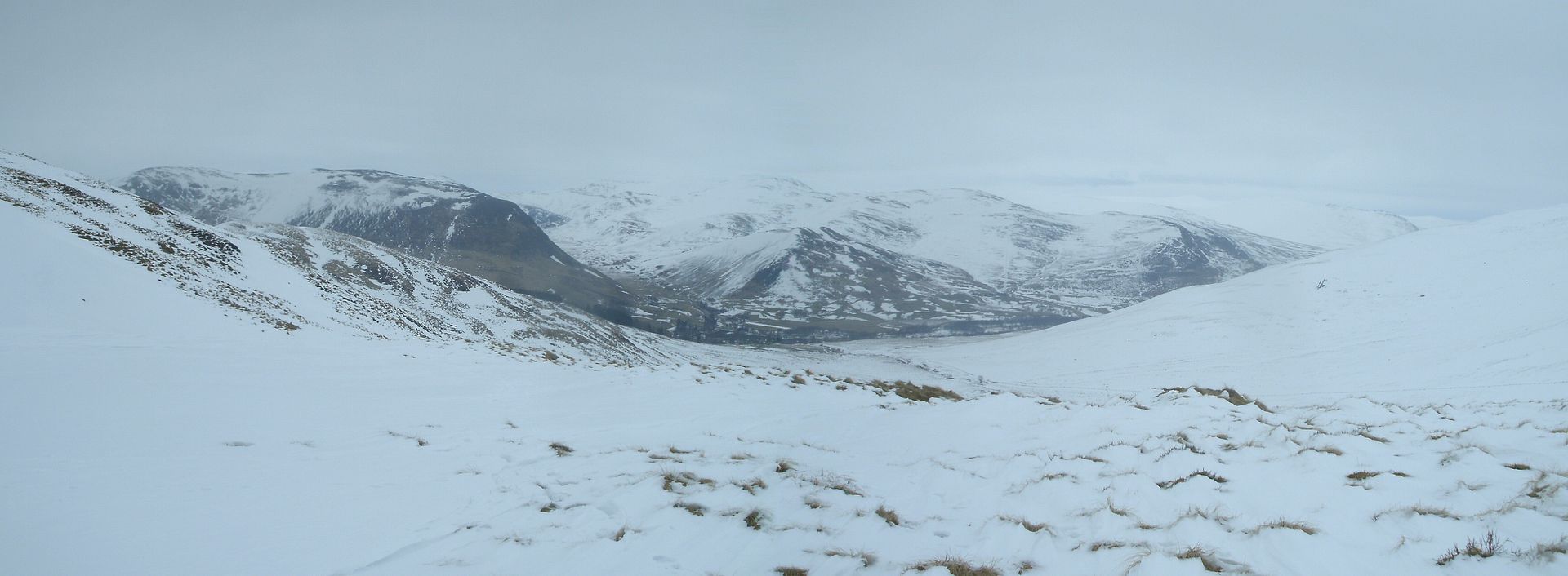
After a break next to an idyllic little burn in the forest, it wasn’t far until we were out in the open moorland and could see right up to the top of the An Lairig pass.
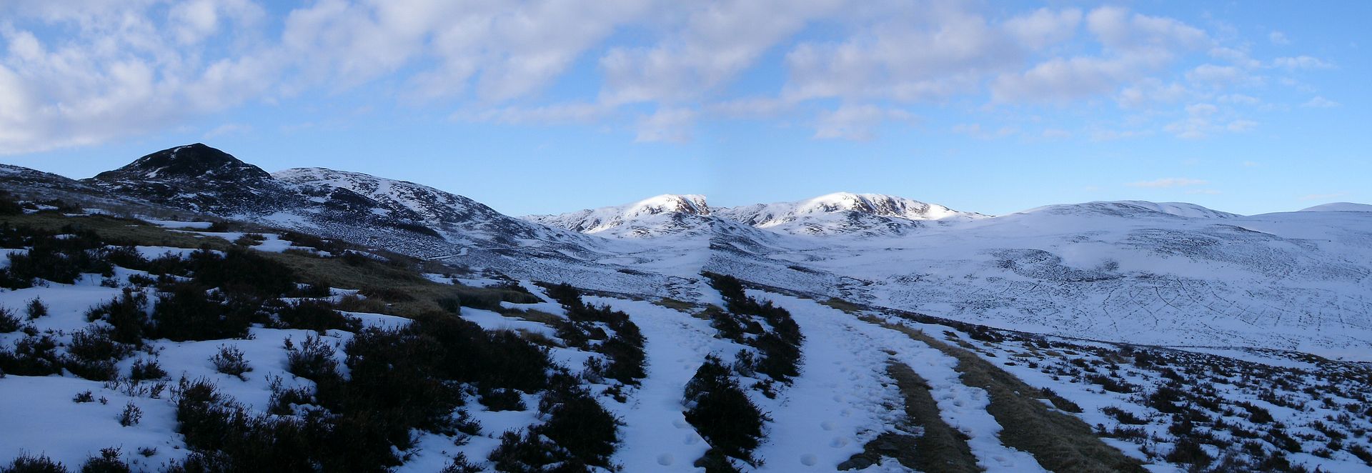
It felt a lot more homely to be up in the heather and snow after the woods and farmland of the day so far.

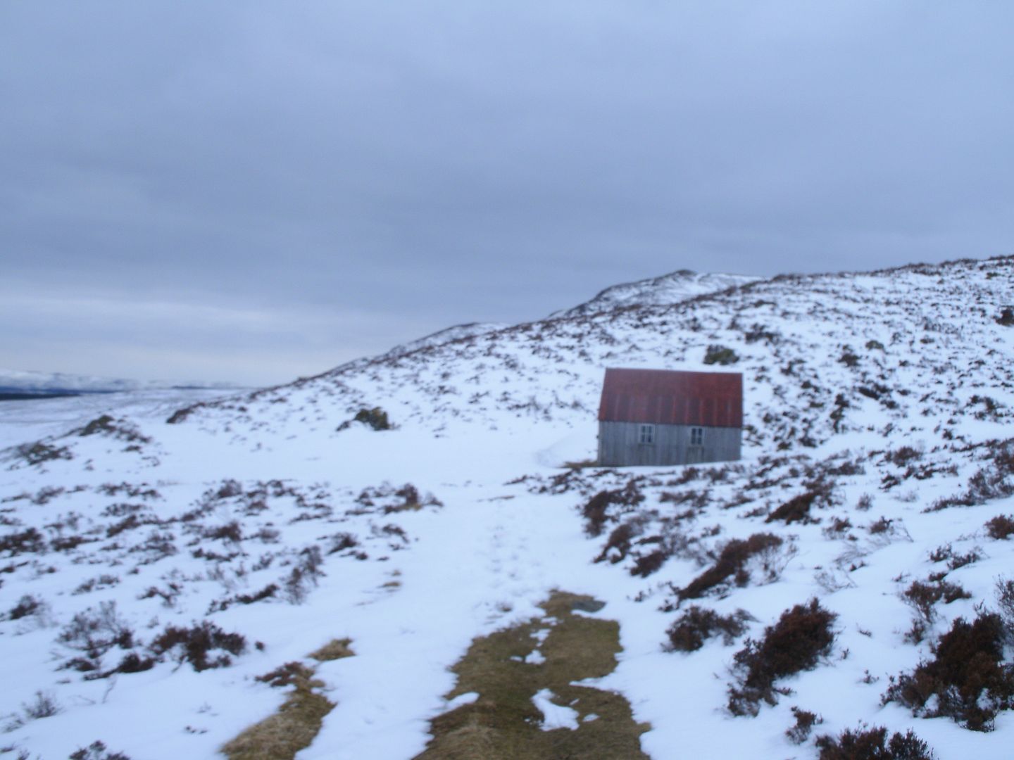
Dougie was struggling with his foot pain, but we both knew it wasn’t long to the lunch hut where we planned to stay the night.

We arrived, and found the hut to be very erm.. basic? – just a big timber shed really.
I’m glad it wasn’t windy, because there was plenty light peeking through in between the wall planks. We pushed 2 tables together to make a big enough sleeping platform, and got in our sleeping bag as the sun went down – it was really cold up there!

I can only remember one night I have spent out which was colder, and I spend a lot of nights out! Our dinner did a lot to warm us, but we were awake at 3AM cold, so I had to make tea to warm us up enough so we could sleep the rest of the night.
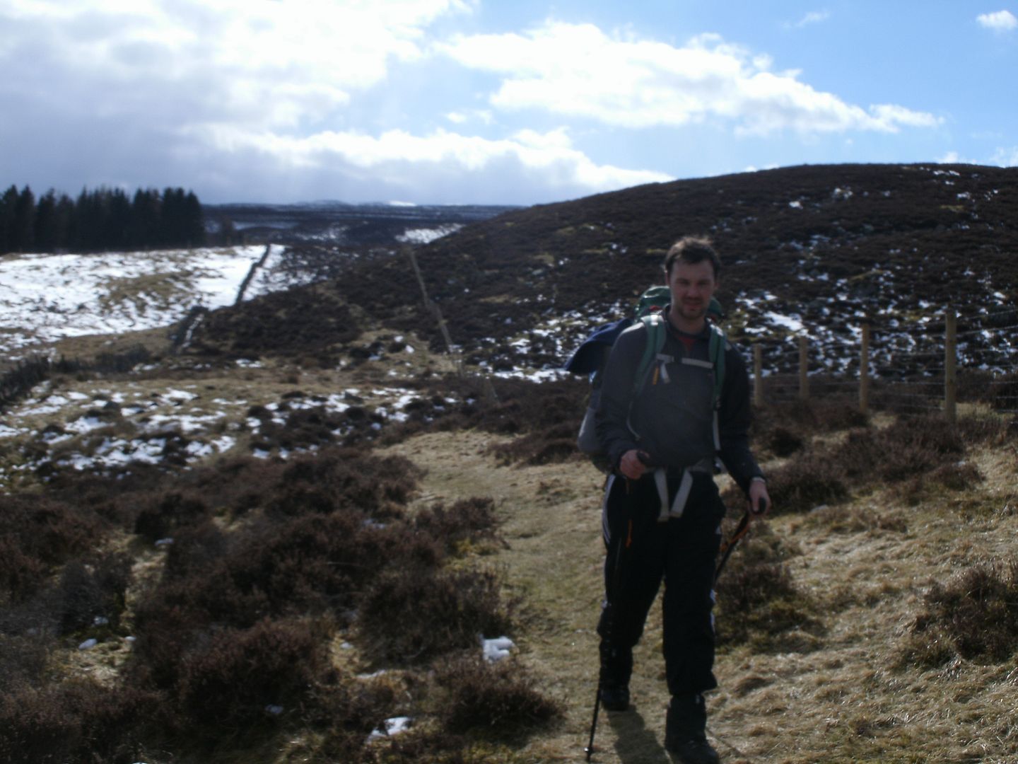
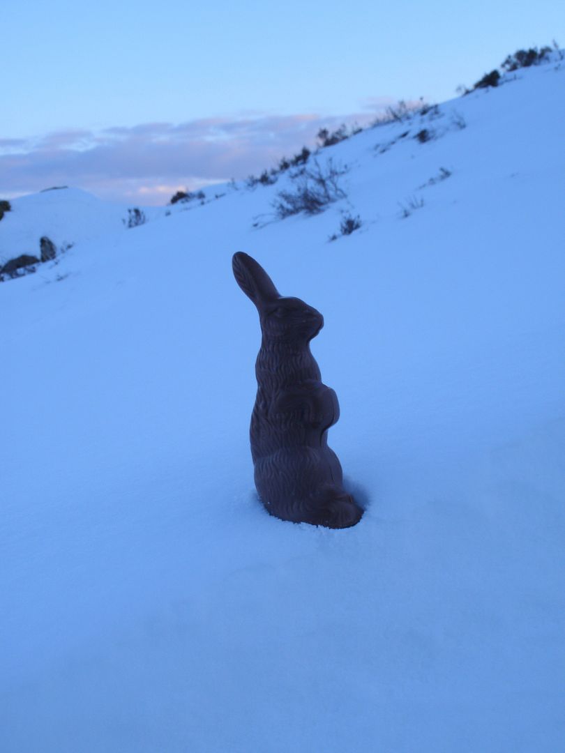
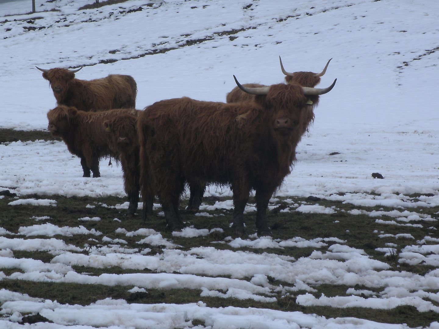
In the morning, we found everything frozen solid. I boiled up some shards of ice to make tea while Dougie beat our frozen boots against the front step to make them pliable enough so we could get them on our feet. We had a wee visitor though!
We were up rather later than planned with the clocks going forward and all, and I think it was after 10.30 by the time we were back on the trail, upward toward the pass above the Spital, thoughts of warmth and a nice lunch spurring us on.
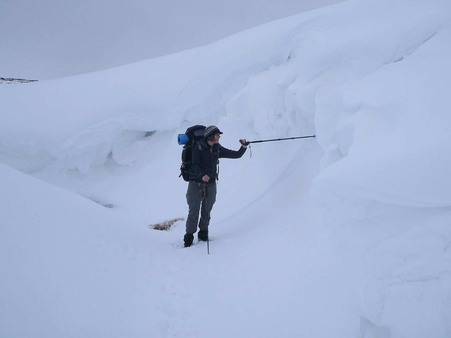
The climb was a fine gentle angle, but the snow was deep underfoot - bad going uphill, but made for a fun downhill,
and we reached the spital at midday, just in time for them to start serving lunch.
The next section was through the farmland of Glen Shee. A nice walk, but there were some exceptionally mud bathy sections past a couple of farms that had a heady country aroma.
We had decided to leave the waymarked trail, skip some road walking and go through to Glen Isla via Loch Beanie. It was a bit hard to find the path initially, but we found our way up to the snow line and passed the frozen loch.
There was a wee shed there, but it was locked, so we took a break sitting in the snow. It was a really peaceful place, and we were well chilled by the time we got going again. The snow was deep so Dougie broke trail as we headed up to the low bealach and through to Glen Beanie.
It wasn’t nearly as sunny a day and there was a small but bitingly cold breeze. We disturbed a massive herd of deer and watched them gracefully make their way up the hillside. Glen Beanie was a delight
It had some beautiful rocky formations and was flanked by interesting little hills either side but as we got to Glen Isla, Dougie informed me it was 5PM already..
We had hoped to get a lot further on by now. Not that we had really put any planning into the trip. We had intended to get to the Lunch hut on the first day, but that’s as far as the planning went.
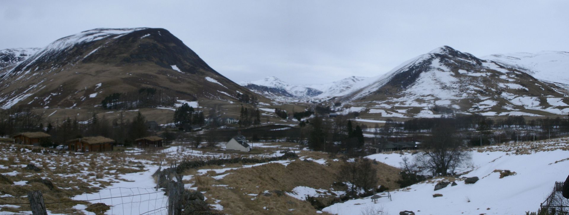
A quick check of the map told us that we had a long way to walk to get back to Bridge of Cally so progress had to be made, and that progress came in the form of walking down the road to Kirkton of Glen Isla instead of the cateran route. It was hard underfoot, but still a very pleasant walk – Glen Isla is a right bonny glen.
In kirkton, we went up to the hotel – but it was hoaching with skiers, so we set up camp cheekily right behind the village hall.

We figured it was nearly dark, and we would be away early, so it was unlikely anyone would ever know we were there and the grass was so flat and snow free and inviting...
So it was the warmest night so far – some shelter from the building meant there was only a little bit of ice in our water bucket in the morning.
Unfortunately though, Dougie wasn’t feeling very well, and took a long time to get going, so another late start, on what had to be the longest day of the walk..
We set off through deep snow, across a rickety wee bridge, and up the hillside. Dougie was struggling, and at that point it seemed like we would never make it back to Bridge of Cally! I told Dougie it was only 16km – a complete lie as I had no idea how far it was, but I hoped it would spur him on
The path went through a wee wood, and gradually dropped height again to another farm track.
Once we were back down in the glen though, the miles seemed to pass beneath our feet fairly quickly. Dougie was feeling a bit better, and the sun was out again. We passed a farmer clearing the track with a JCB – he was pretty much finished, and we were grateful because the snow was deep either side. We gained a bit of height through another forest, meeting a minor road as we descended again down to cross the Burn of Kilry.
The hard road was taking its toll on our feet by then,
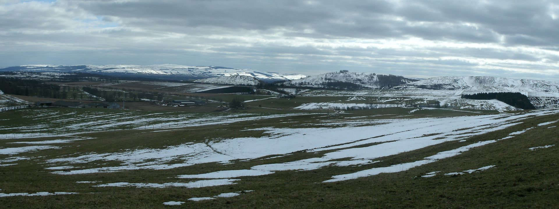
so we stopped next to the road on a pallet of bricks for a bite to eat. It was only a short distance to the end of the road section, where the sign directed us through a couple of fields and up to a path that skirted round Knaptam hill. It was good to get off tarmac, but that meant that we were slowed by the snow again. We passed back out into open farmland, crossed the boundary back into Perthshire and stopped to lie in the hot sun in a not too stinky part of a field.
That’s the trouble with good weather – you get too hot and want to laze about instead of walk! We ate some more and looked at the map and realised that if we took the planned shortcut, there was a good chance we would actually make it back to Bridge of Cally in time for dinner.
It wasn’t far after that until we took our shortcut down through a big farm called Bamff. The map was rather confusing as it didn’t seem to resemble what was on the ground

but we picked our way through the smelly farm mud. Sun still blazing, it wasn’t long until we were stopped again next to a wee burn, under a very comfortable tree. There were lots of deer hiding in the field in front of us and every now and then one would pop up and run off.. Then we saw a chap coming through the field – he was carrying a fair arsenal of guns so I guess he was an unsuccessful pheasant shooter. He stopped to speak but seemed like a bit of an odd character to say the least!
So we made it down to the road, and we were back on the cateran trail having missed out 6 miles or so to Alyth and back. Only 6 left to go.. Unfortunately most of those miles seemed to be along the road
which was a bit of a thought with already sore tootsies..

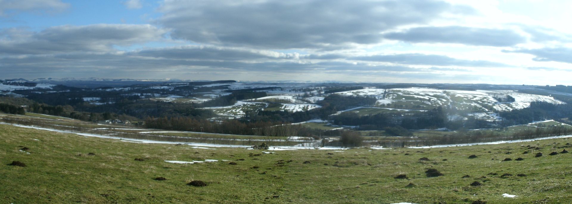
Plenty of time for plenty of stops though.. At the top of the hill, there were a few standing stones marked so I went to investigate them whilst Dougie had a rest by the road.
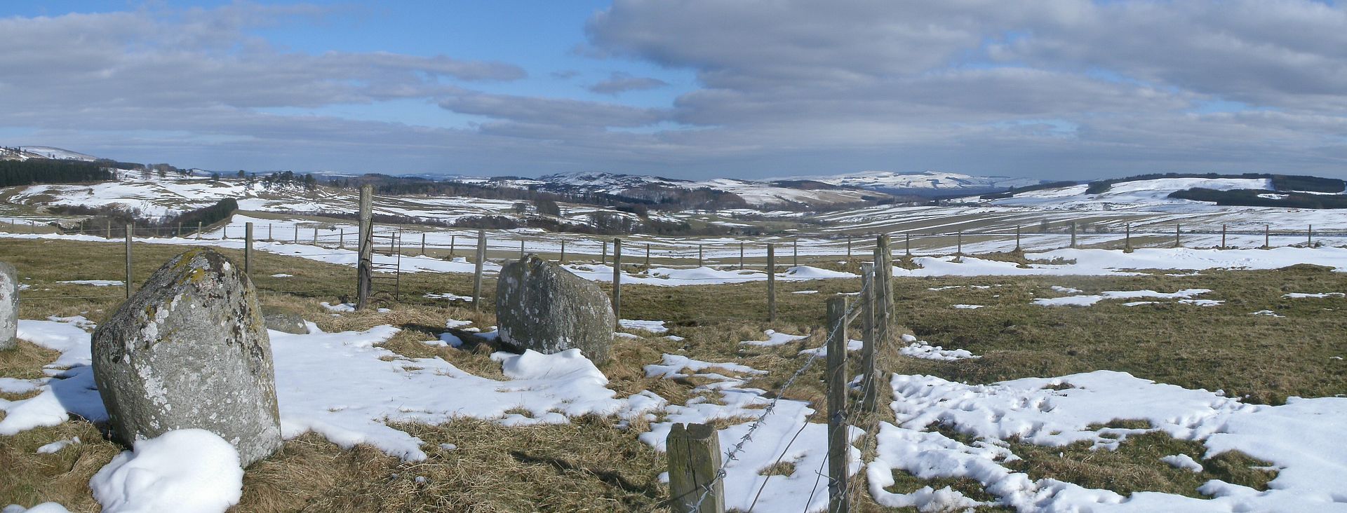
They were a lot more rounded than others I’ve seen and in a spectacular location, with a great view up to the north. They stood in a very interesting enclosure with several other features, but it was hard to make out everything as some snow drifts were still resisting the sun. I could of spent more time there, but I knew Dougie was waiting so we hobbled onward down the road. Just a few more miles..
We passed Drimmie burn and were grateful to get off the road for a way. The path wasn’t too pleasant here though as we were fenced in, with nice green fields either side. It felt claustrophobic, and was still full of snow.
The trail was broken but seemingly by a giant!
I couldn’t use the tracks at all – we later realised that it was a popular run for joggers, which made sense of the huge strides. Once over the brow of the hill, we reached the final section of downhill road into Bridge of Cally feeling footsore and sunburnt. The food in the hotel tasted really good!
Well it was certainly something different to do Easter bank holiday – Better than last year when I fell down the backside of Nevis and was caught in an avalanche in the mamores anyway!
Altogether rather fun tbh – although that may also be due to the cracking banter we had pretty much all the way
It’s a great walk to do if you have even a passing interest in Sheep – I saw more varieties than I ever thought imaginable
