free to be able to rate and comment on reports (as well as access 1:25000 mapping).
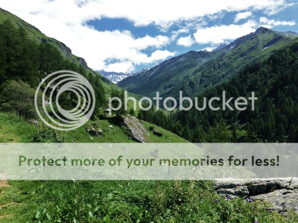
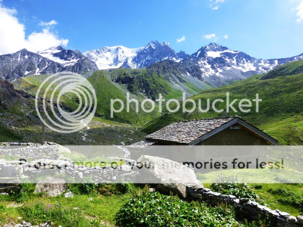
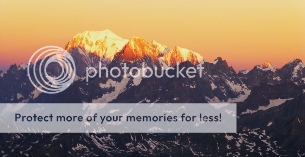
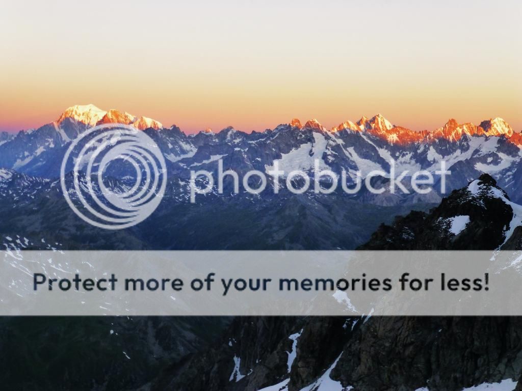
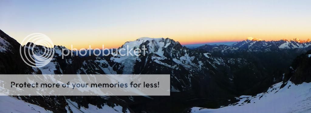
The Classic Haute Route. Chamonix to Zermat.29th July - 2nd August 2013. The Classic Haute Route starts in the village of Le Tour in the Chamonix valley, France, and finishing in Zermatt, Switzerland, the route is 75 miles long and traverses more than a dozen glaciers with a total ascent and descent of 10,000m, it follows a some well defined hiking trails, ascending up into glacial terrain and provides some of the finest views in the Alps. Mont Blanc, Grand Paradiso, Grand Combin, Weisshorn and the Matterhorn are just a few of the 4000m+ peaks that we encountered on this classic traverse of the massif.
The 'Classic' Haute Route trail takes to the glaciers, as opposed to the walker's summer Haute Route which stays at lower levels. The route features the greatest concentration of 4,000m peaks in the Alps, creating the unique vistas and breathtaking alpine scenery which makes the Haute Route trail so famous worldwide. Completing the Classic Haute Route trail simply means stunning mountain panoramas every step of the journey! To complete it you need to be physically well prepared for long days of high-level trail and glacier walking.
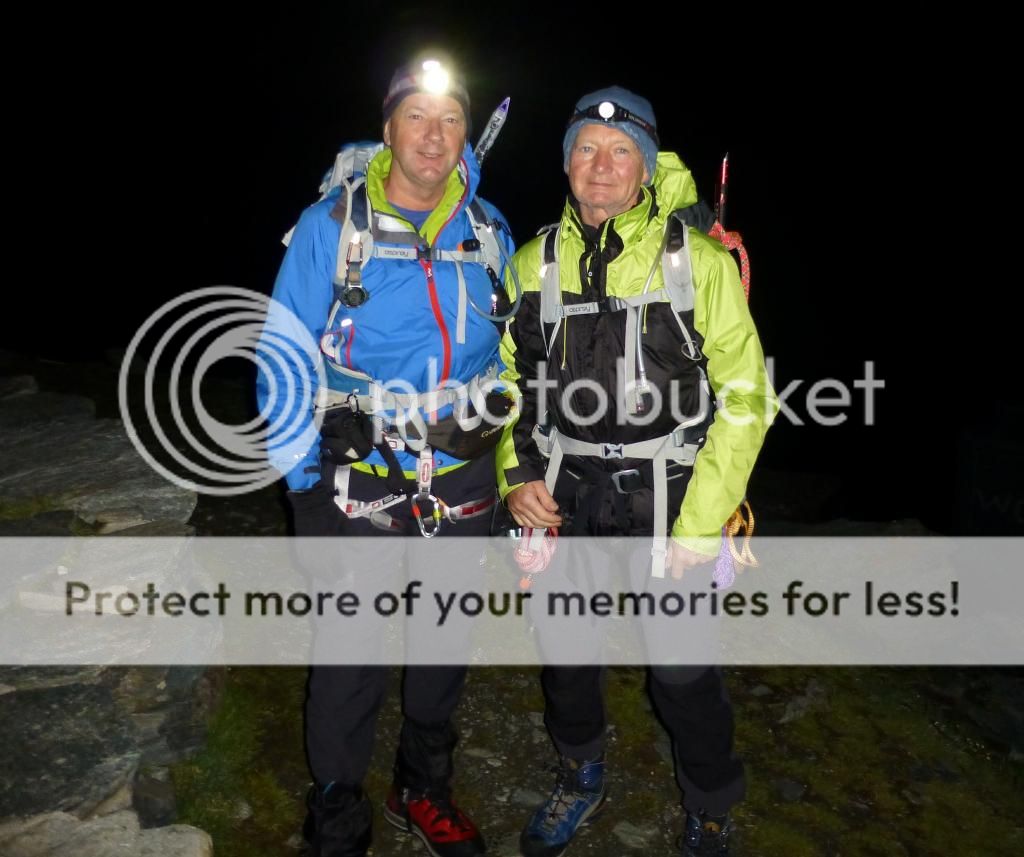
This trek is one I had always dreamed of doing, but really thought it had escaped me until my mate (and personal alpine guide) Keith asked if me and Martin fancied doing it to whilst we were in Chamonix last year …did we just!

Dates were set, and slowly everything fell into place, that was until one week before me and Martin were set to drive to Switzerland… Keith had also driven down on the long journey from Stirling, Scotland. The journey had taken it’s toll on Keith who sadly had a relapse with a blood clot reappearing in his leg and ended up in hospital for 4 days near Interlaken. Any chance of him doing the Haute route was out of the question.

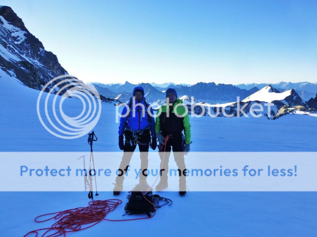
Me and Martin weighed up the options, although we would miss Keith's expertise (He had done all the planning as he had done it before) and company we decided to go for it without him. I was still in good hands as Martin is an ex-mountain guide and RAF rescue member.
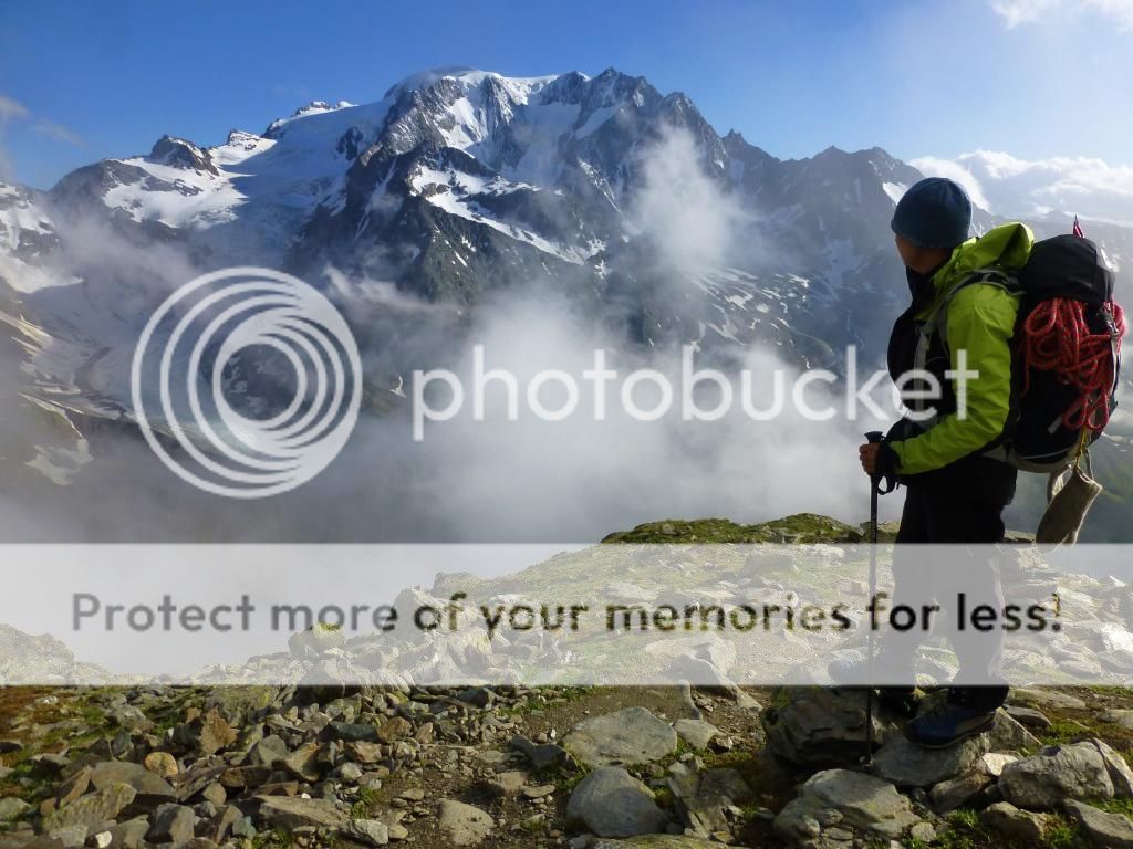
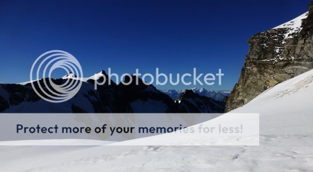
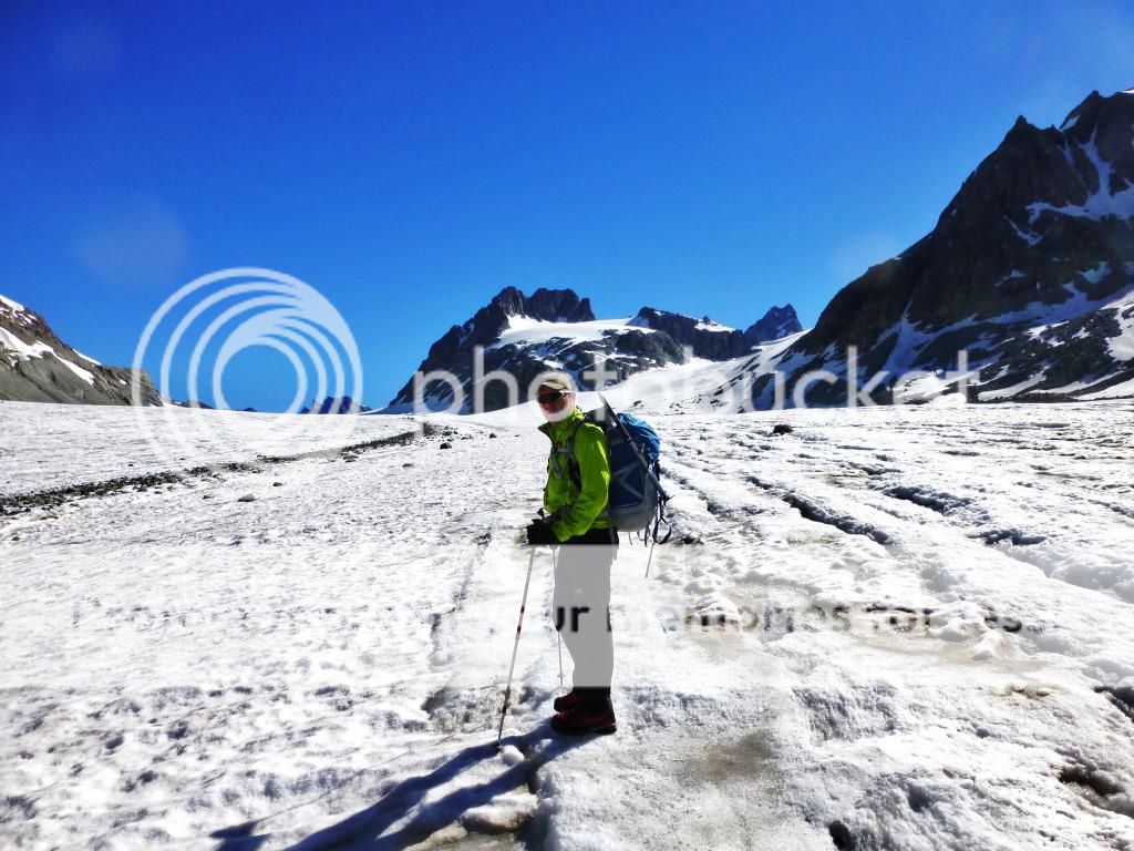
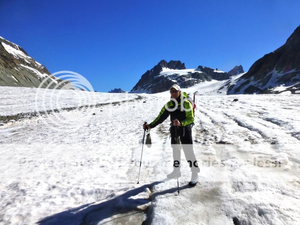
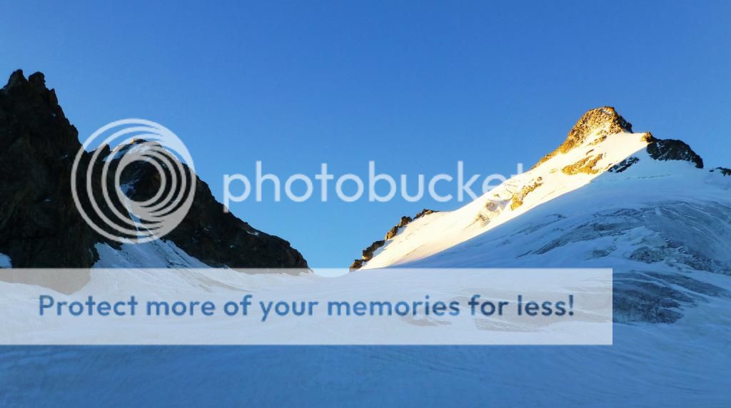
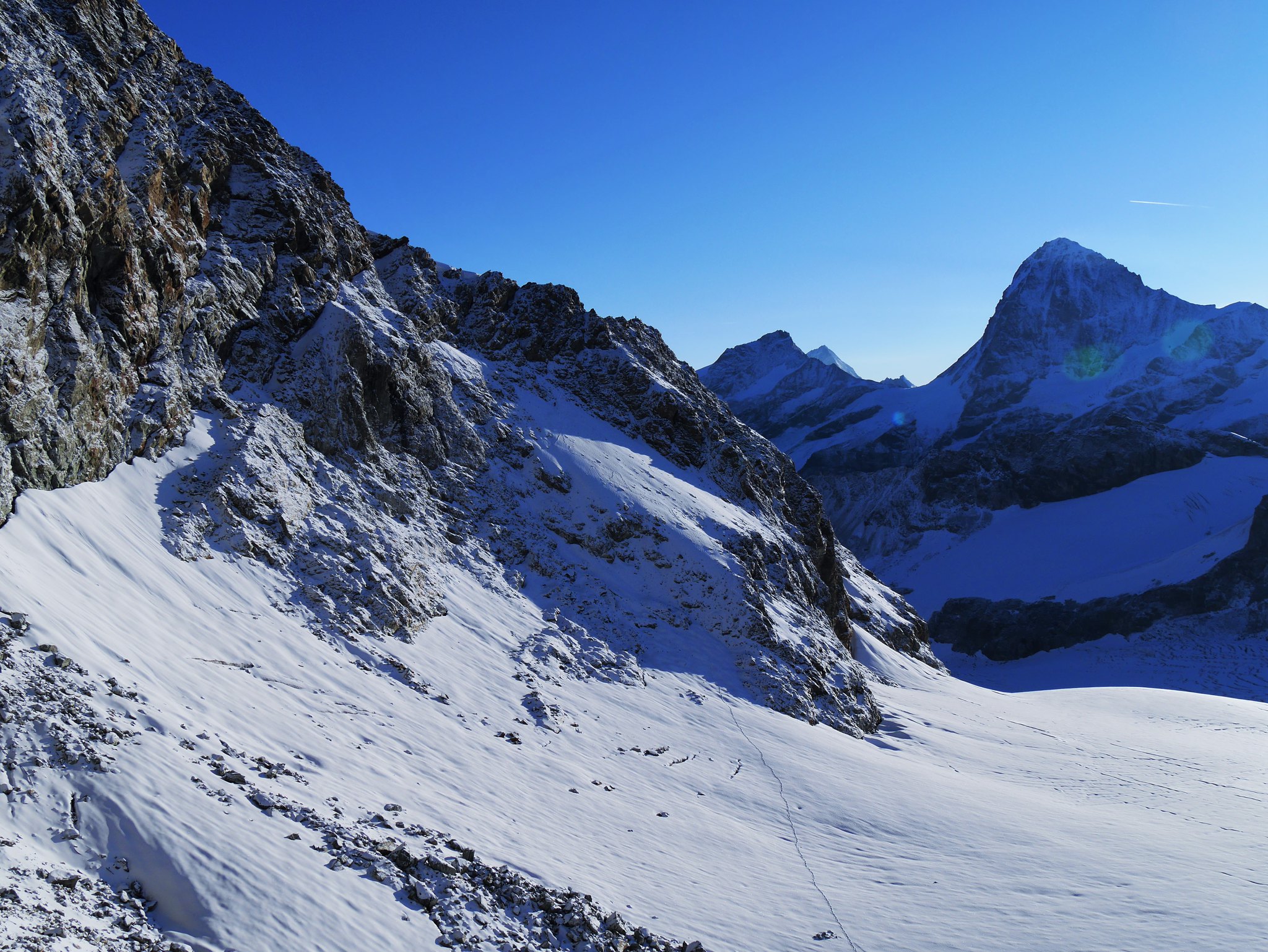
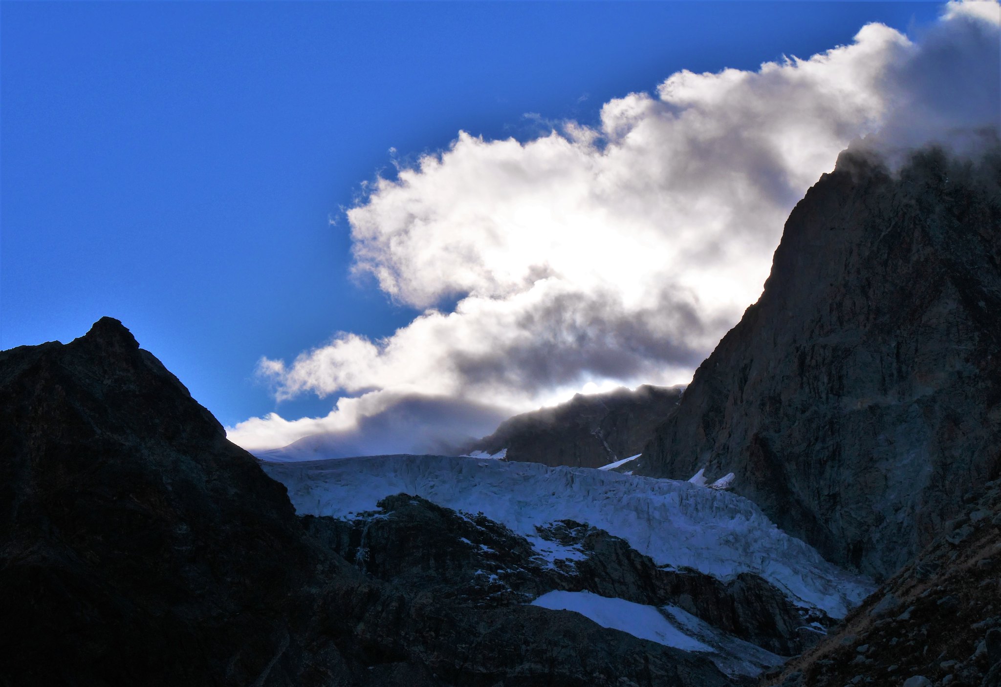
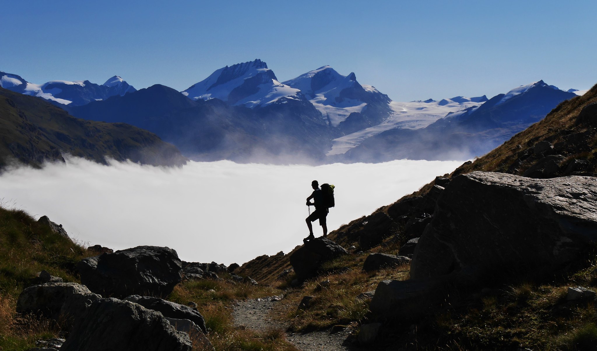
Day 1. Le Tour to the d'Orny Hut.Overview of walk. Starting at the village of Le Tour in the Chamonix valley. A cable car takes us to the Col de Balme, from there a walk to and past the Albert mountain hut onto our first glacier the Glacier du Tour, crossing over the Col Superier de Tour (3288m) then east down the Glacier du Trien Plateau and onto the Glacier d' Orny, to finish at the Cab d'Orny mountain hut. (2811m)Weather.A bad day! Rain at lower levels with thunder and lighting thrown in. Snowing higher up with low cloud and very cold.
We left Saas Grund in Switzerland at 6.30am for the 2 hour drive to Le Tour just as it started to rain, this was forecasted to clear sometime in the afternoon.
Once at a wet and dreary Le Tour we took the cable-car up to the terminus at the Col de Balme (2191m). Off we set at 8.45am in the rain, at least the forecast after today was sun for the whole week, at least we had that to look forward to.
A good track that slowly climbs the hillside up to the Albert hut. There are great views down to the Chamonix valley as you climb this path, with Mont Blanc and the towering mountain peaks in its wake captivating the view, not that we had much of a view today, we had come this way last year on our 2 day trek to Aiguille du Tour (3540m) stopping in the Albert hut en route.
Trip report of that trek here…
http://www.walkhighlands.co.uk/Forum/viewtopic.php?f=16&t=24188)
As my video and camera stayed firmly in my rucksack for the whole of the walk, here are some pictures from last year….
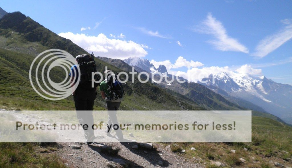 Setting of for the Albert hut
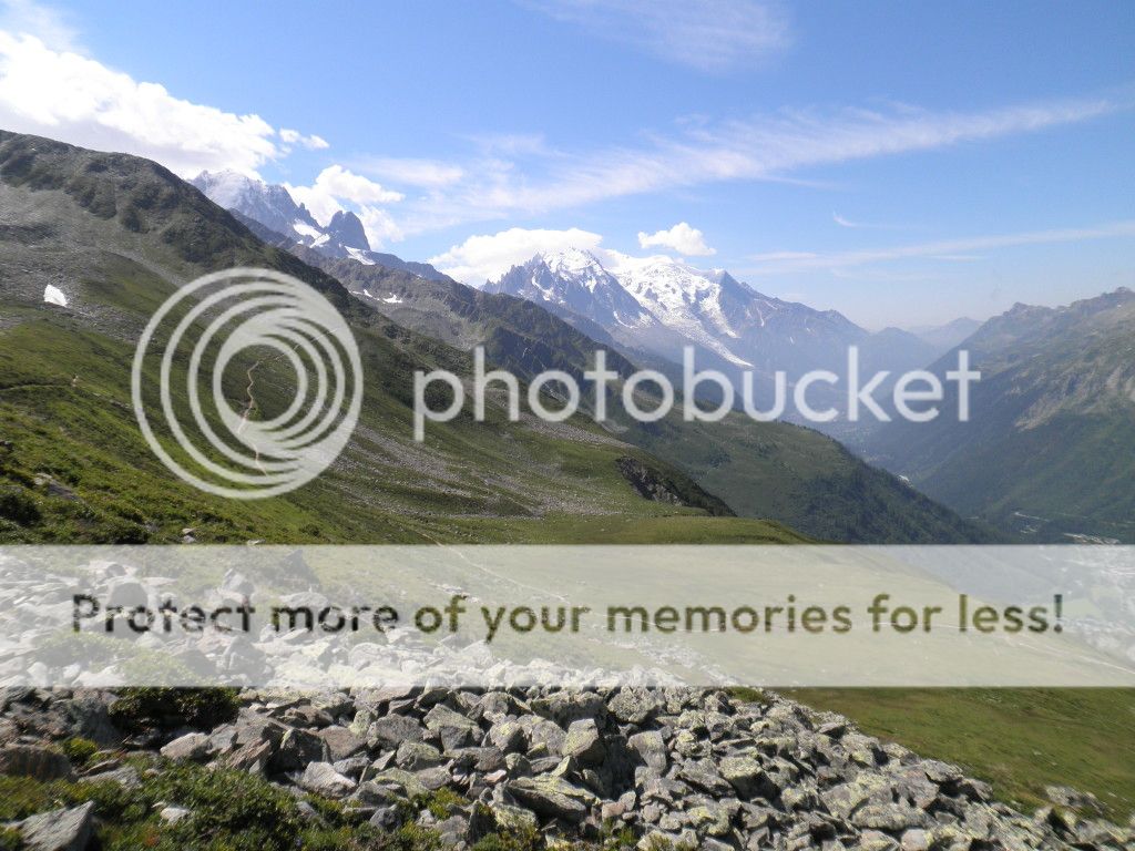 Chamonix valley
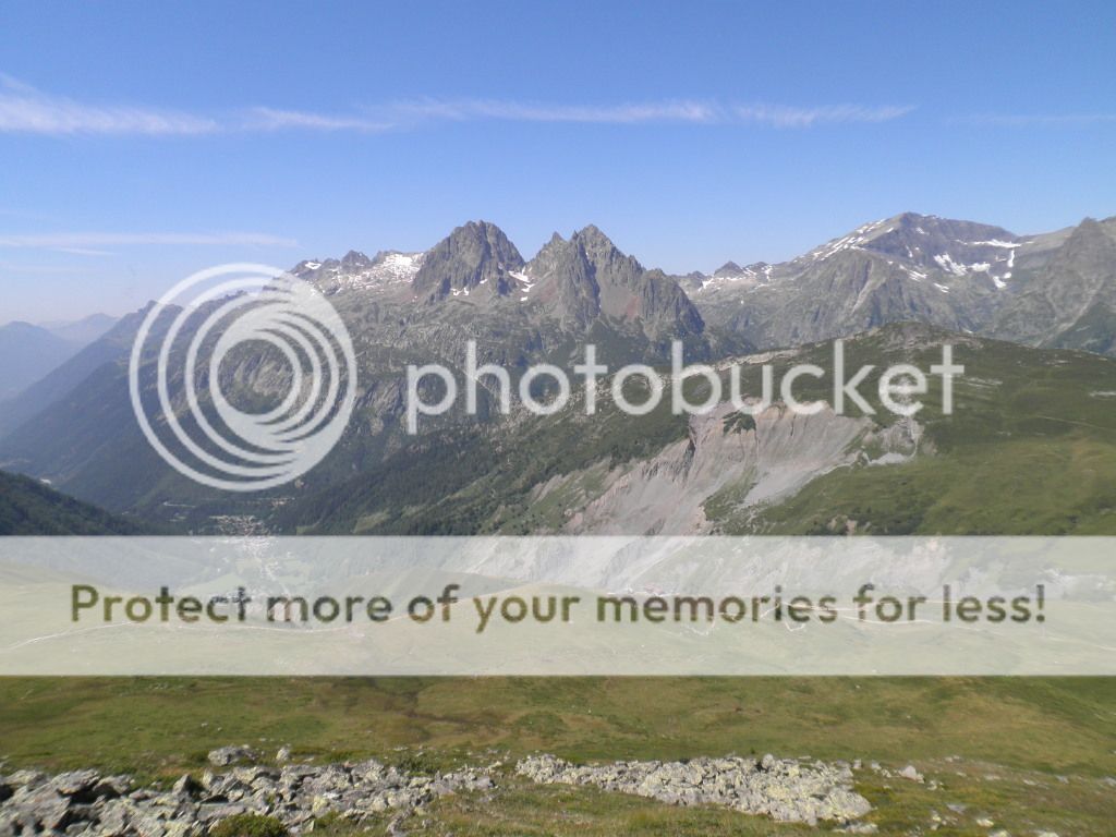 Brevent
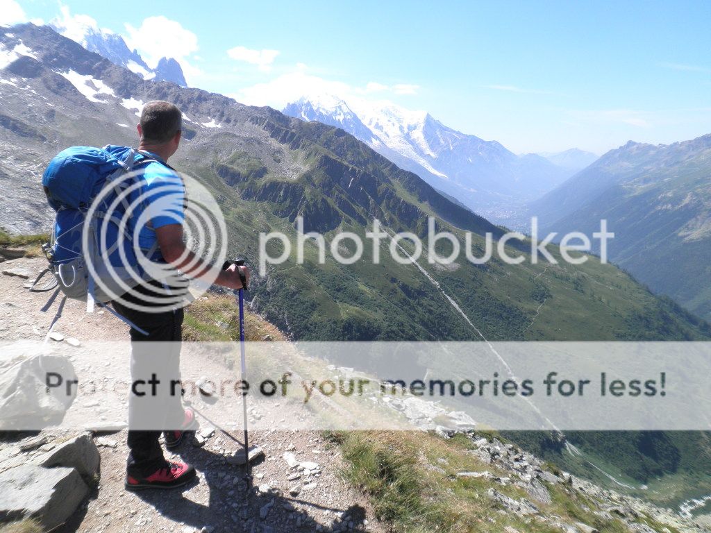 Chamonix valley
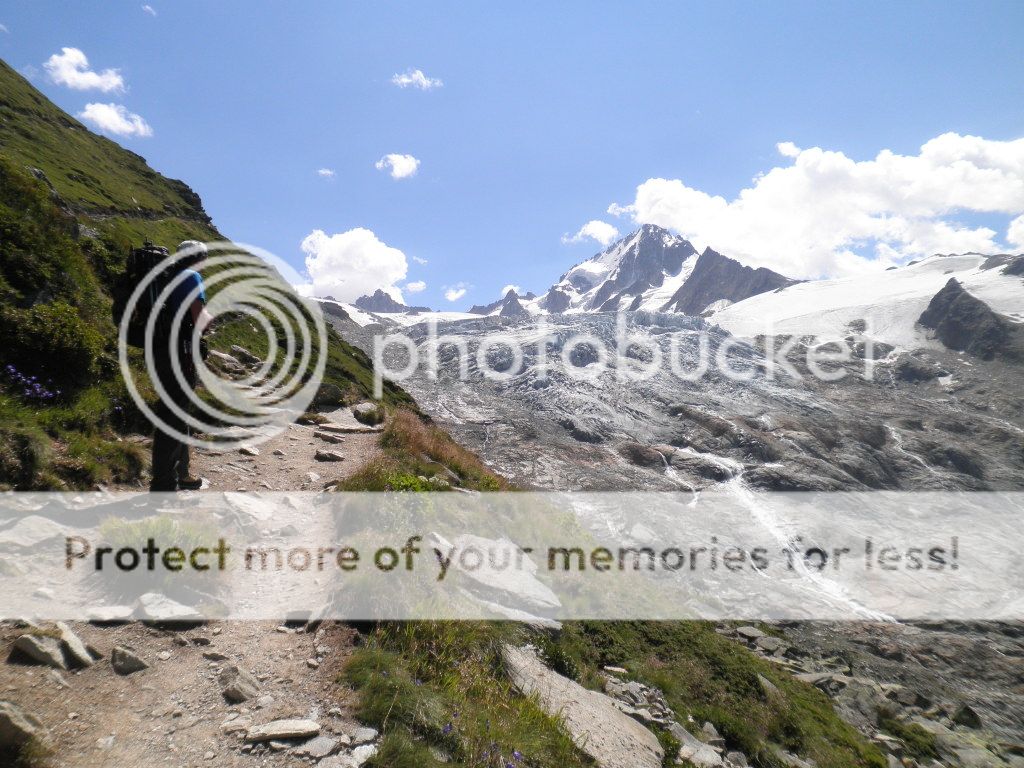 Albert hut path
 Albert hut path
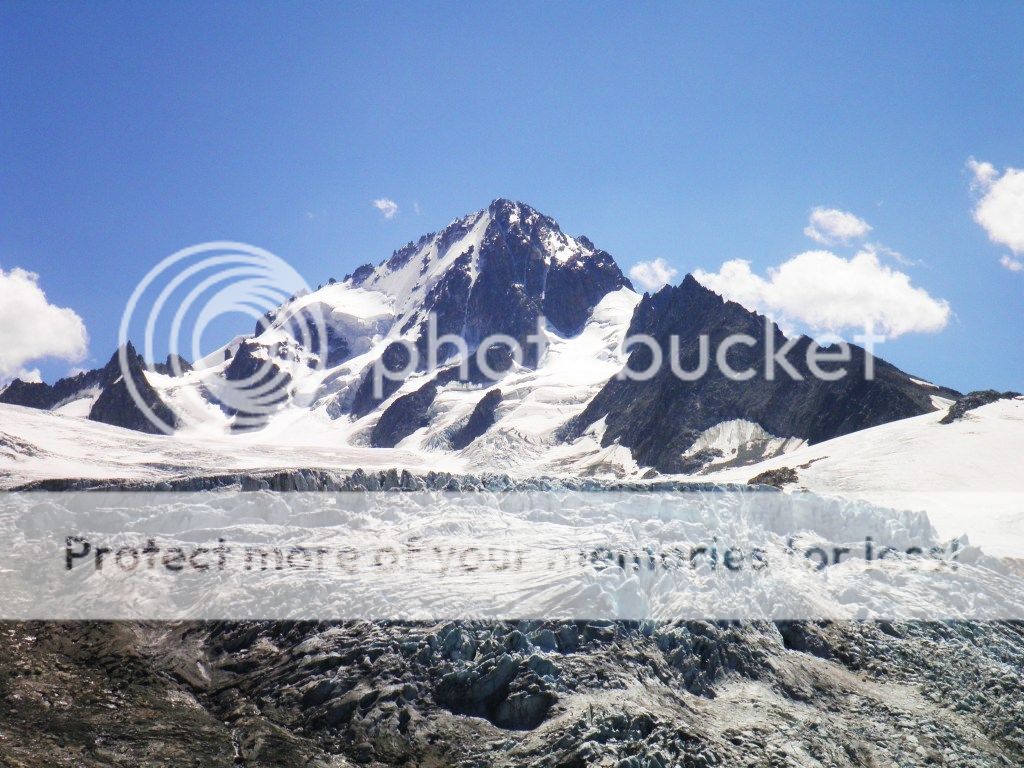 Aiguille du Chardonnet
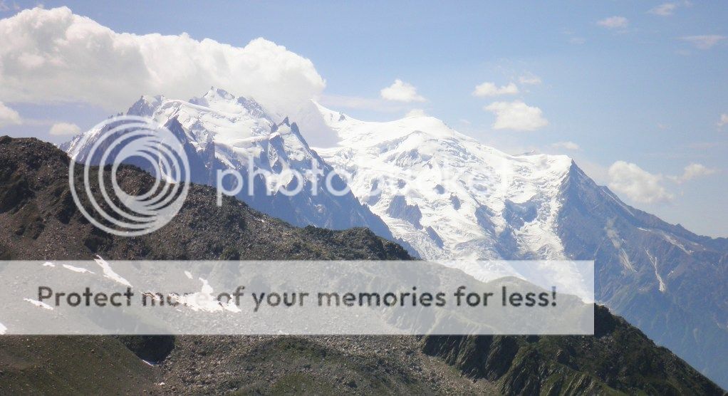 Mont Blanc
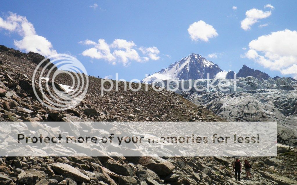 Albert hut route
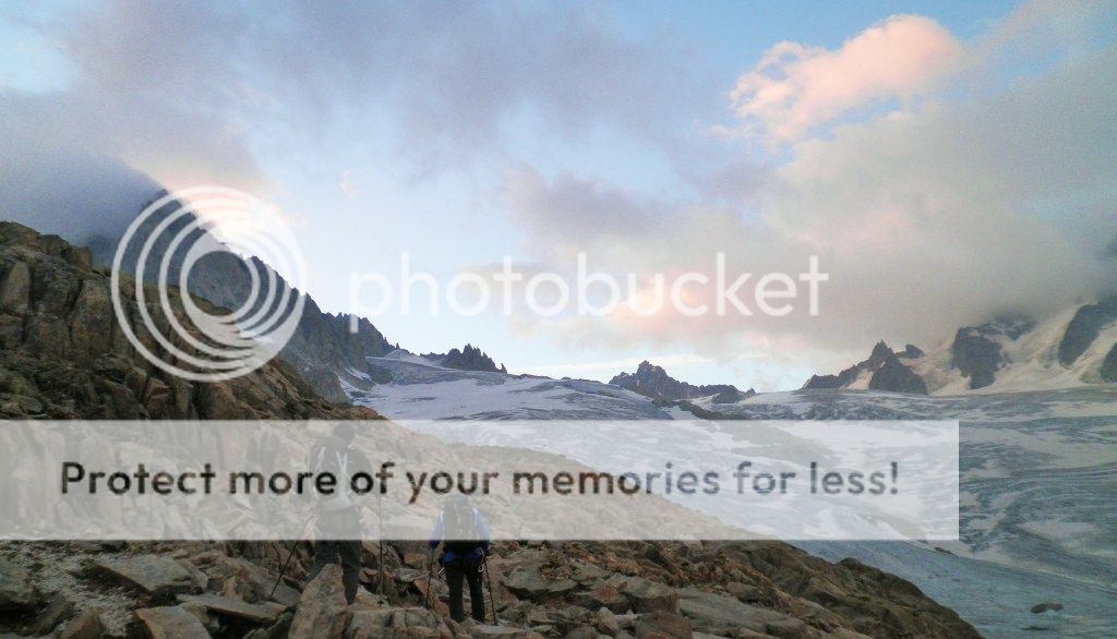 En route to Auguille du Tour
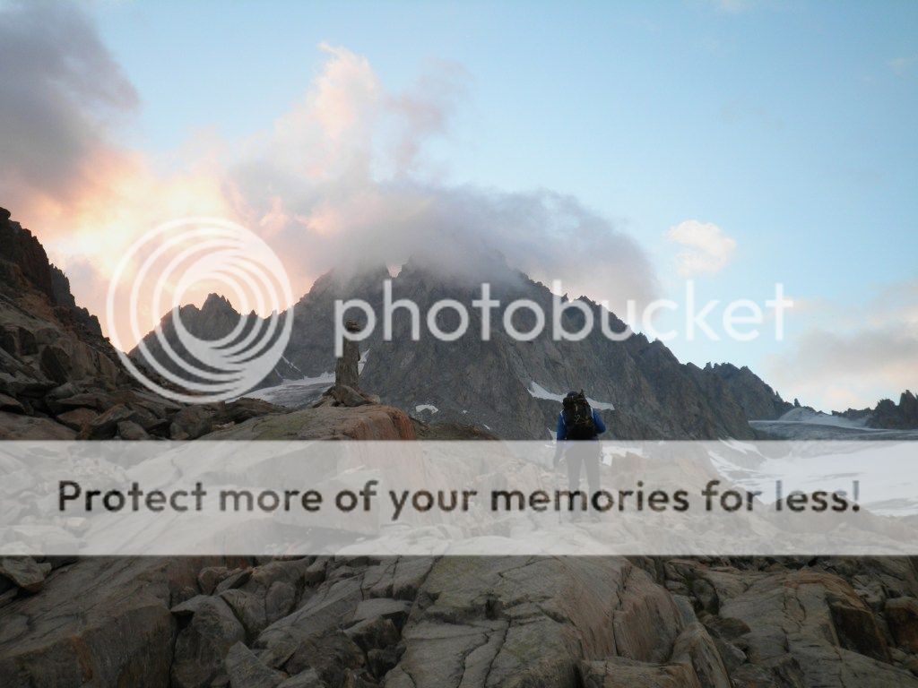 En route to Auguille du Tour
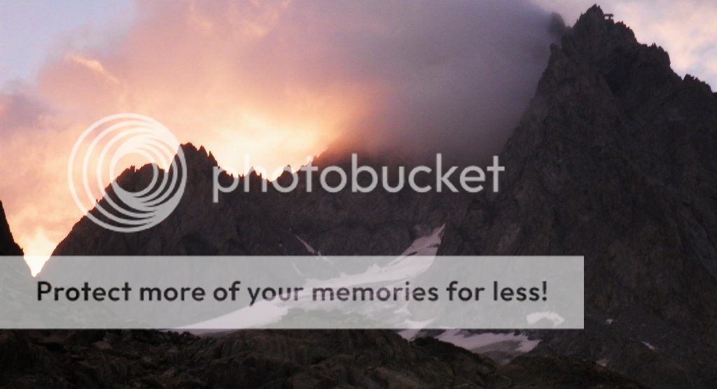 Early morning sun, Auguille du Tour
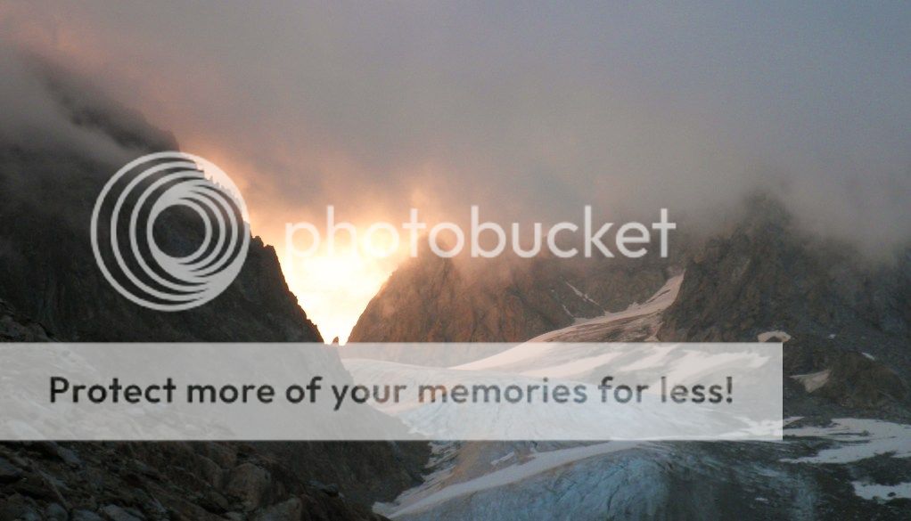 Early morning sun, Auguille du Tour
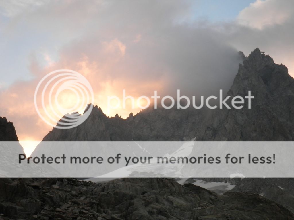 Early morning sun, Auguille du Tour
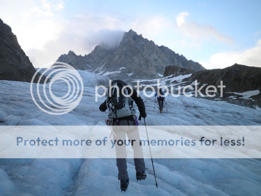 Auguille du Tour
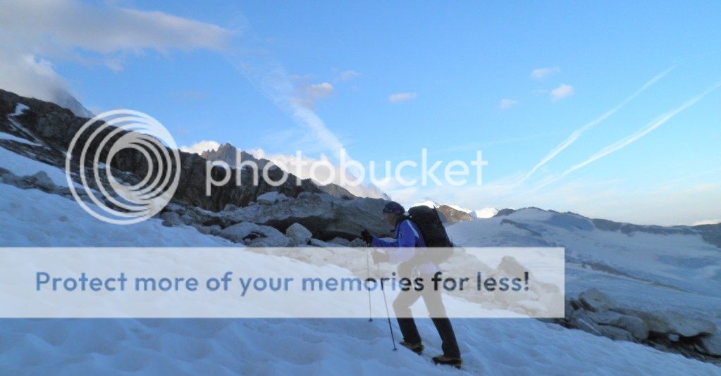 En route to Auguille du Tour
 En route to Auguille du Tour
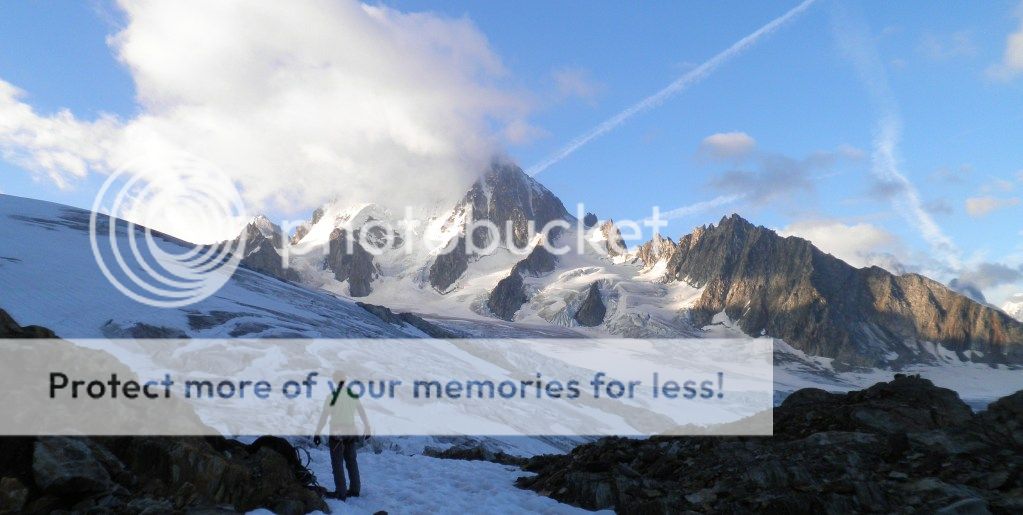 En route to Auguille du Tour
 En route to Auguille du Tour
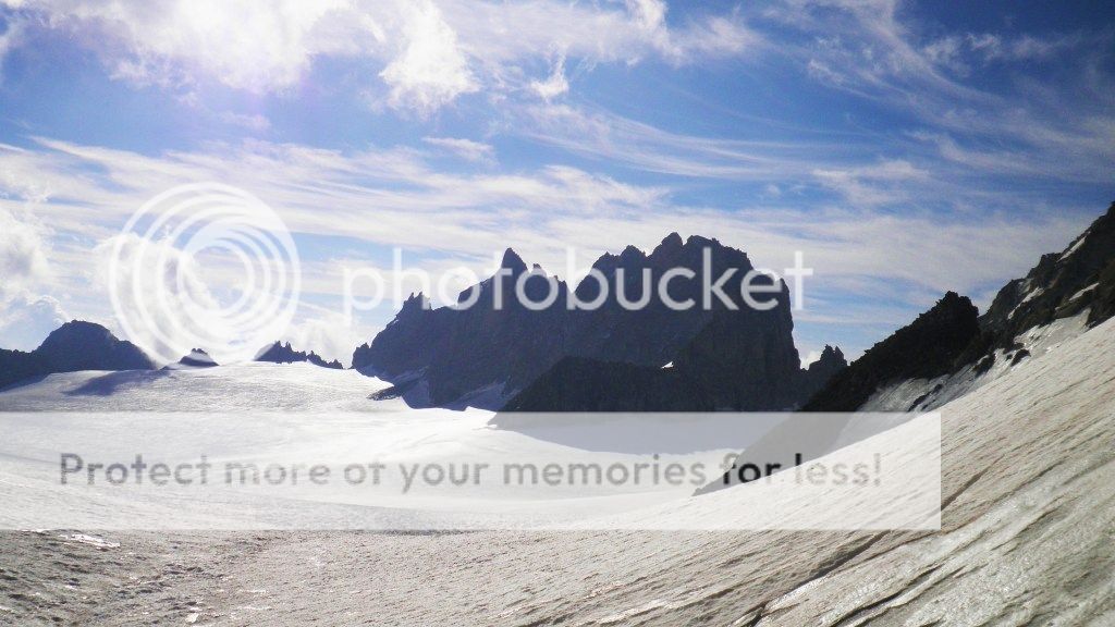
 The Col to Auguille du Tour
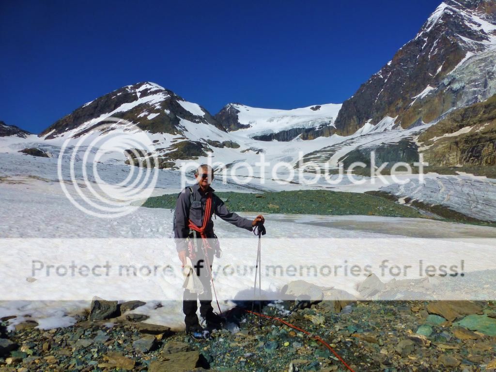
The path is much steeper as we neared the hut, which resembled a mixture of an old monastery and a prison from below, not the prettiest of huts inside and out. We were not disappointed of stopping the night there this time.
We stopped at the hut for a break from the elements, by now the rain had turned to sleet. Inside were 4 other guys getting ready to set off, little did we know that they would be the difference of us getting to the Orny Hut that evening.
From the hut a path takes you further up the rocky terrain and then drops to the glacier. Crampons, ropes etc. donned we continued slowly up the Glacier du Tour where by now the sleet had turned to snow. About halfway up the glacier we caught up the group of 4, they were British and were also doing the Haute route, this was reassuring that we would not be alone later after the Col and into unknown territory for me and Martin in the worsening conditions.
I broke trail as we passed them in ever deeper and steeper fresh snow…about 18inches at the Col…Alpine summers!
This was such a different place from 12 months ago, it was freezing cold with spindrift and white-out conditions, we were cold…very cold, hands numb and shivering we weighed up our options, we were not really equipped for full winter conditions (We had waterproofs, gloves etc. but not up to these extreme conditions) and the prospect of several kilometers of finding our way on a snow covered creviced glacier in white out conditions was not very appealing to say the least.

We both agreed it would be best to turn back.
More pictures of the Glacier from the Col from last year...
 Our way down the glacier
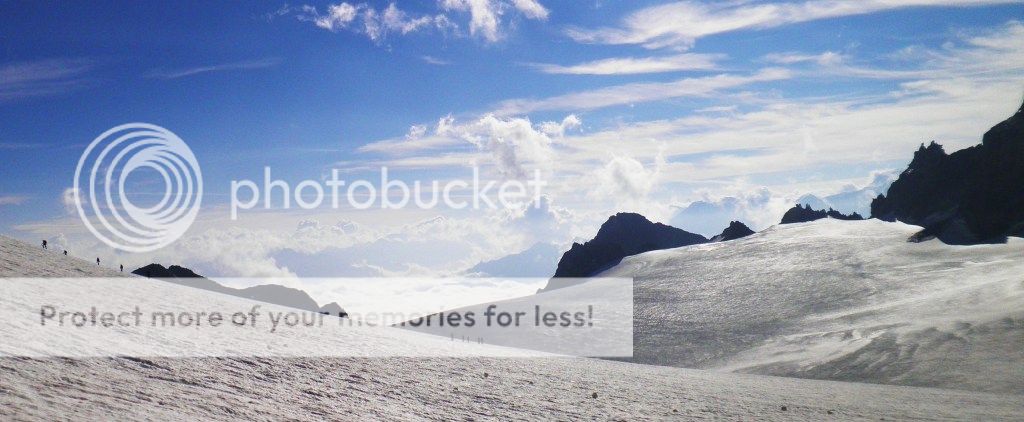 Our way down the glacier
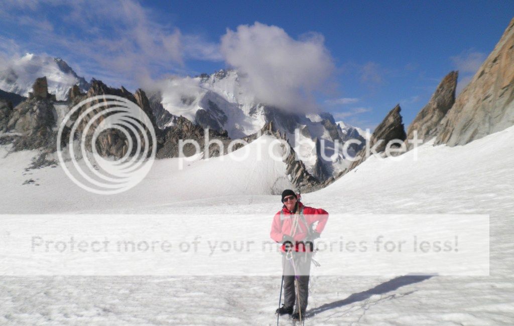 Our way down the glacier
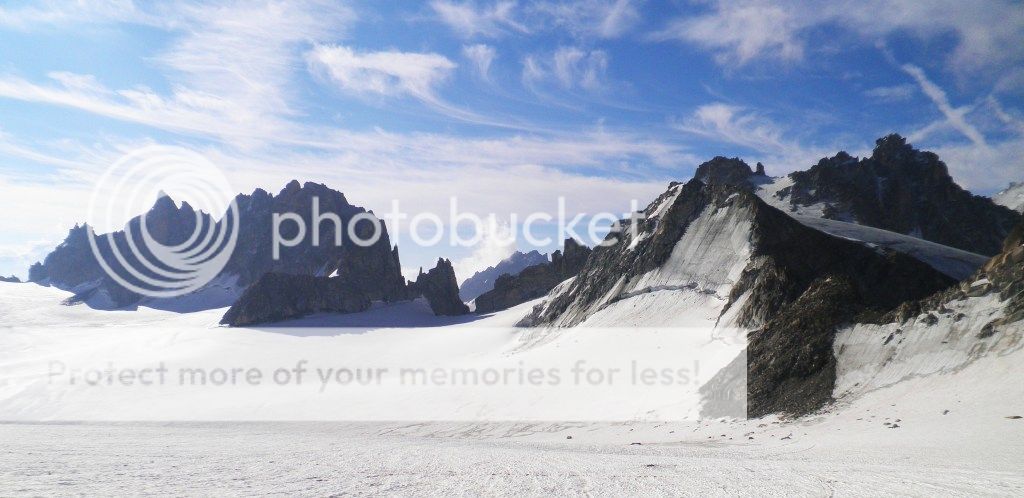 Our way down the glacier
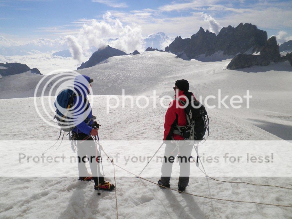 Our way down the glacier
By now the other 4 had arrived at the Col, we told them of our aborting thoughts, they had GPS and offered to lead the way down the Glacier, we jumped at their offer as although it would not be easy getting to the hut, it was an easier and quicker route than turning back, and following their tracks meant they would be the guinea pigs for “finding” any snow covered crevasses.

We were so glad to get moving when they were ready to go about 20 minutes later, as we were shivering uncontrollably…first signs of hypothermia setting in!
Luckily we had no mishaps as we slowly dropped down the “whiteness” without the GPS it would have been a nightmare.
As we neared the hut the snow finally stopped and we had welcome views breaking through the cloud, we left the 4 guys who were struggling with the altitude (their 1st day up high… at least we had done a 4000meter mountain to help acclimatise on the Sunday)
We reached the hut at 6.45pm still cold, within 15 minutes we had hot soup and a hot meal to warm us up, but I stayed cold inside until the early hours of the morning, warming up slowly under the duvet I slowly removed layers of clothes that I had gone to bed in.
Day 2. d'Orny Hut to the Valsorey Hut.Overview of walk. Walk down to the lovely Alpine village of Champax (1466m) Bus to Orsieres and another bus to Bourg-St-Pierre (1670m), then a good track to the Valsorey mountain hut. (3030m) Weather.Hot and sunny.
What a difference in the weather! We awoke at 6.30am to blue skies and warmth.
After breakfast we said our goodbyes and thanks to the 4 guys, they set off 30 minutes before us to walk an alternative Haute route to us for the next couple of days.
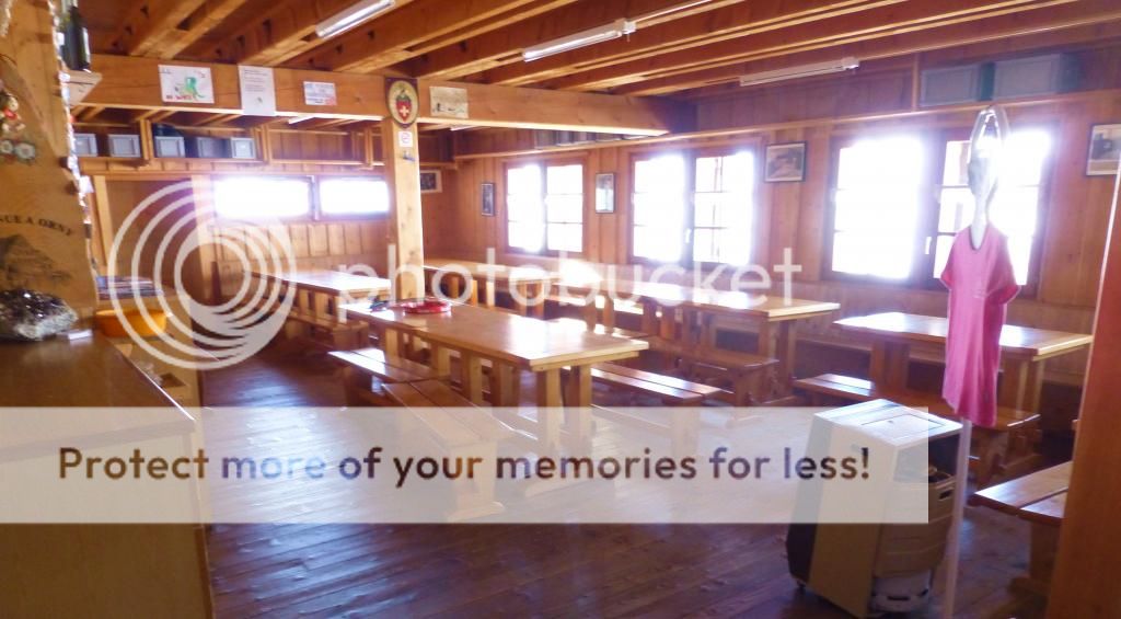
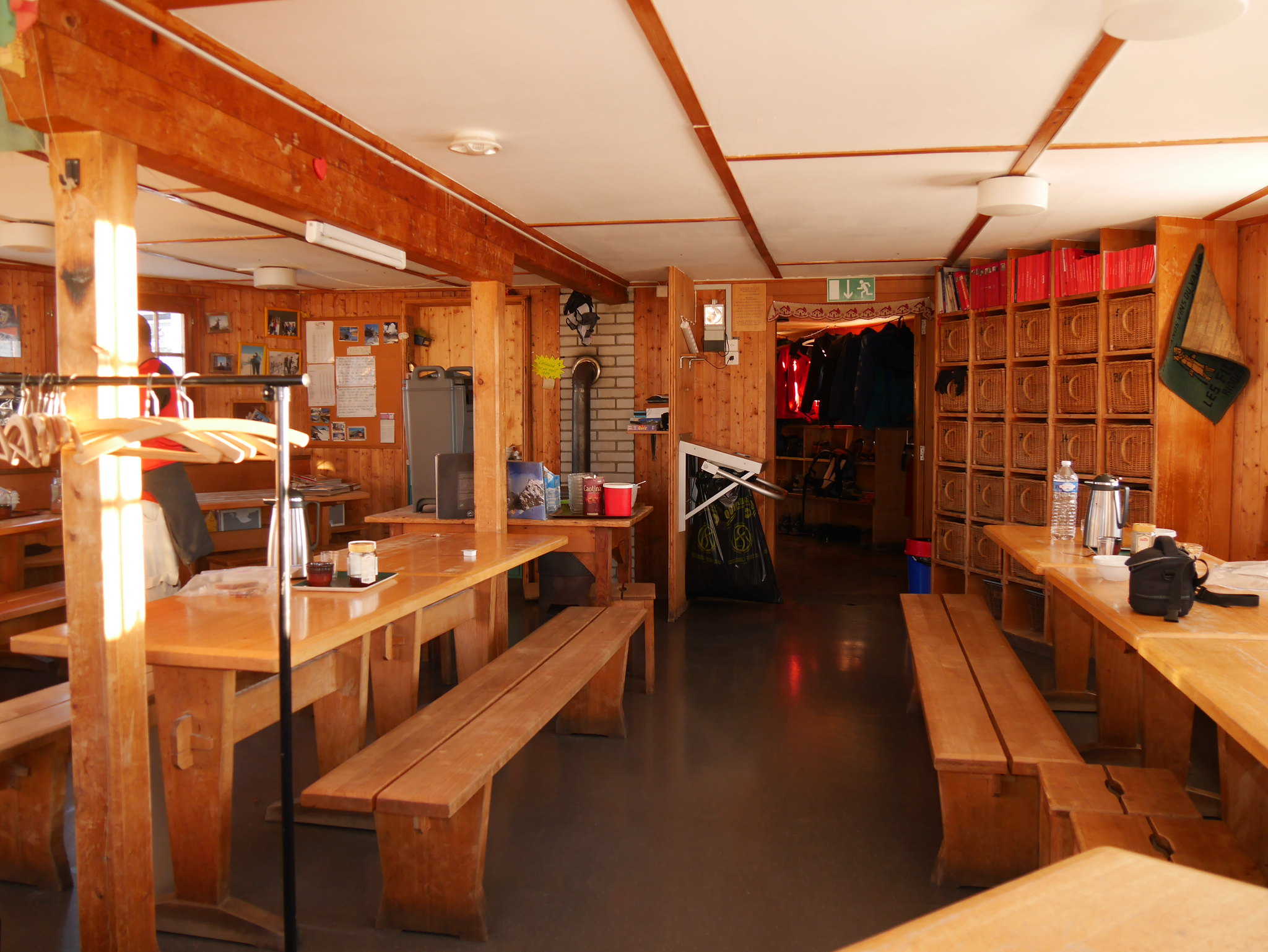
Inside the Orny Hut (2831m)
Orny Hut (2831m)
View from the Orny Hut

Track from the Orny Hut

Marmot
An easy start to the day, our track led downhill to the terminus of the Ski-lift above Champax village, which was out of order due to a fire, so another hour of walking from it got us to the pretty Alpine village at 11am. For the next several miles we would be using buses, but we found that the timetable was not convenient to our needs. First a 1hr 30min wait for a bus to Orsieres about 2 miles away down the valley (We did enquire about a taxi at the tourist office to be told it would cost £50!!!) Once at Orsieres we had another 45 minute wait for a bus up the valley to Bourg-St-Pierre.
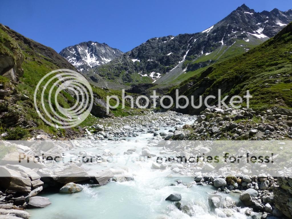
Finally we were off walking again at 3.15pm up a very Scottish looking glen.
Walking up the valley

Walking up the valley
Walking up the valley
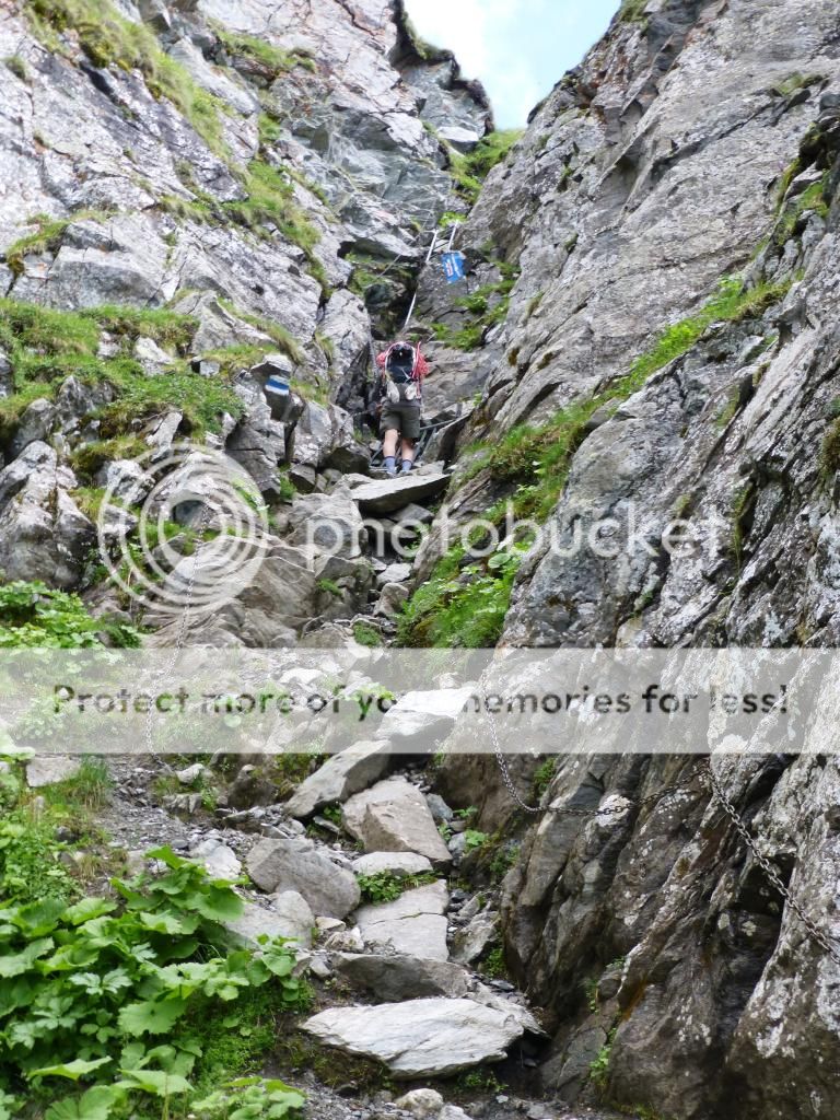
No problems and no glaciers on our walk today, the only slightly alarming bit was a section up a steep rock gorge with 3 ladders to aid the climb, one of which was in a heap having unattached itself from it’s fixings…hopefully when someone was not on it!
Ladder section
Great views
Great views
We reached the Valsorey Hut (3,030m) at 7.15pm, which was busy with people eating their evening meal, we explained our bus problems and were soon served a good 3 course meal.
After a fabulous Alpine sunset we were off to bed early as we would be up at 4am for an early Alpine start in the morning.

Alpen glow

Mont Blanc range beyond the ridge.

Mont Blanc range
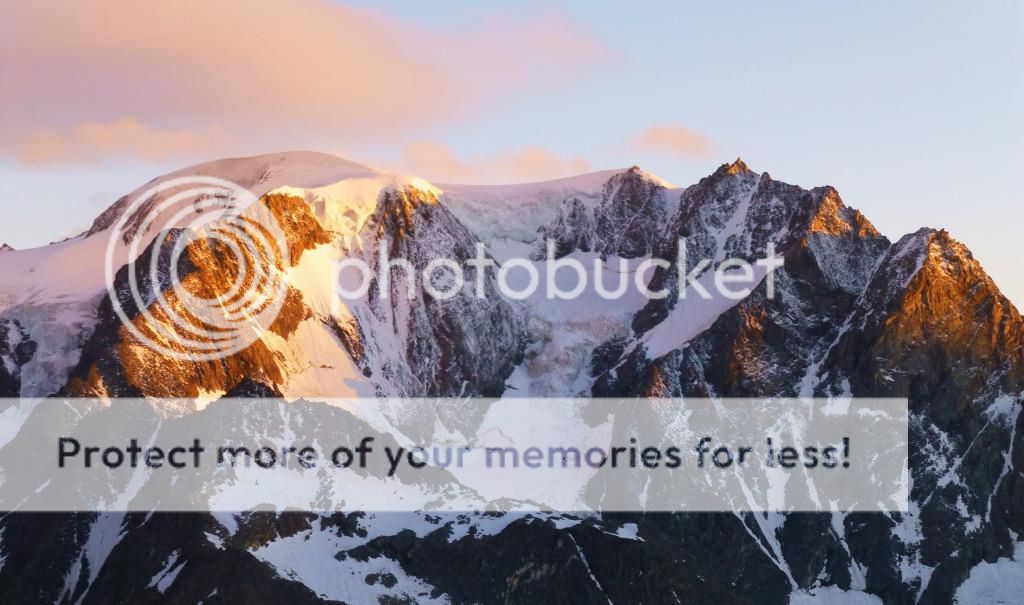
Alpen glow

One last picture before bed.
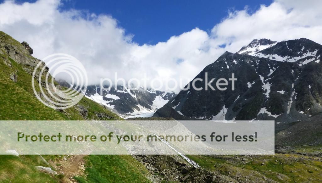
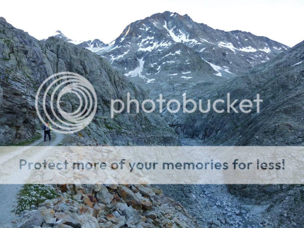
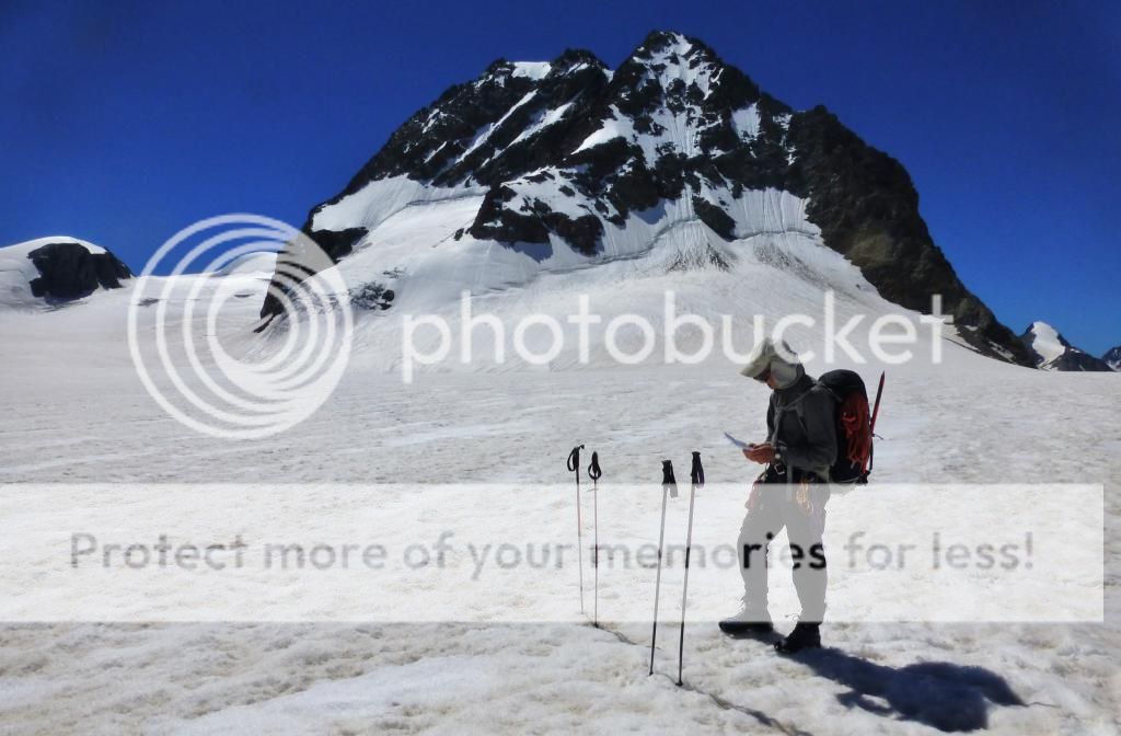
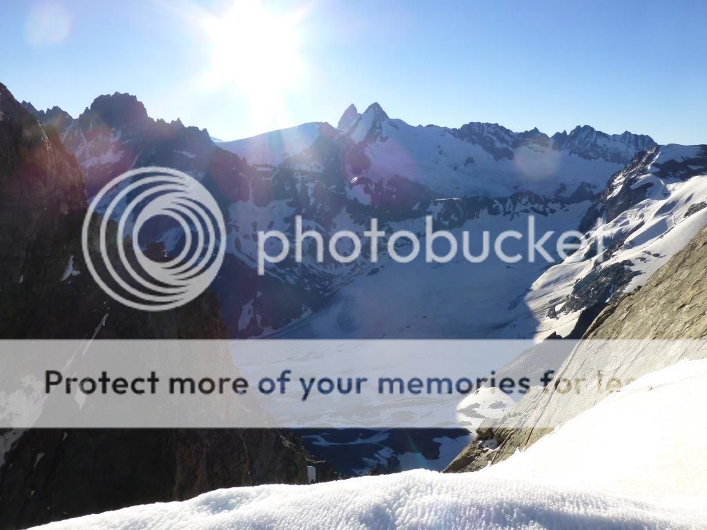
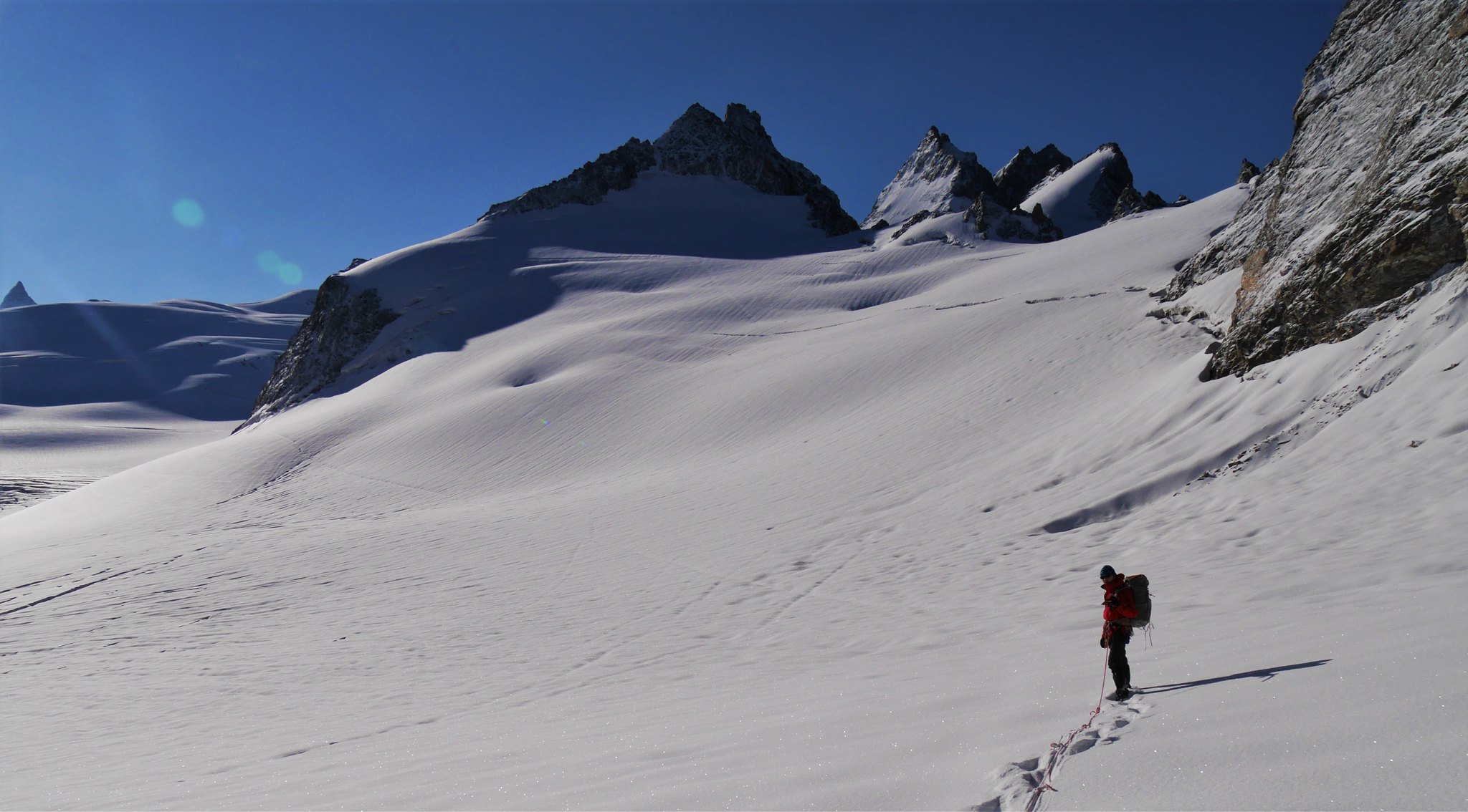
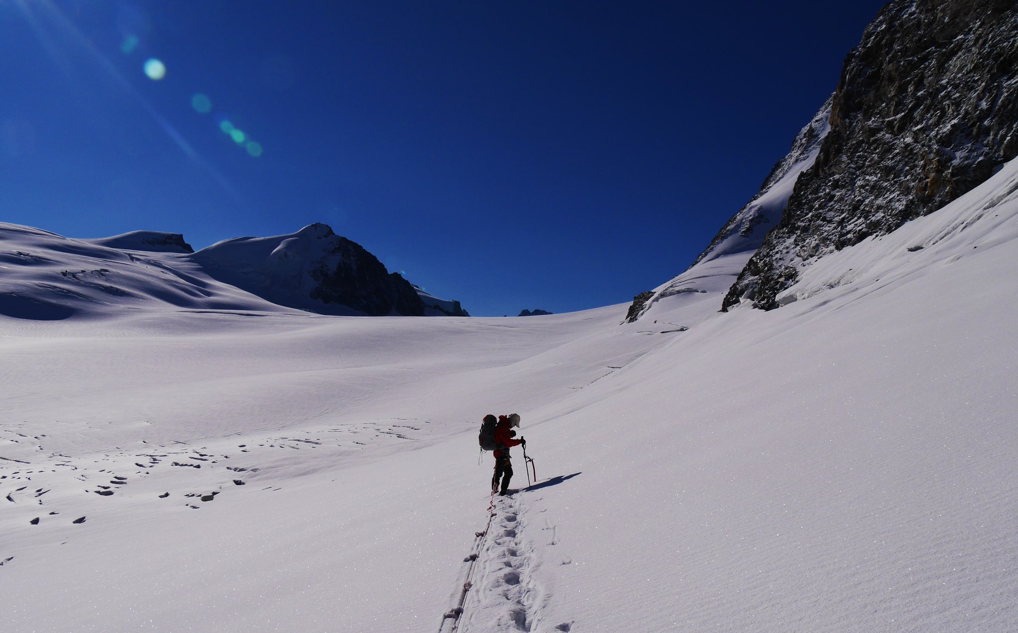
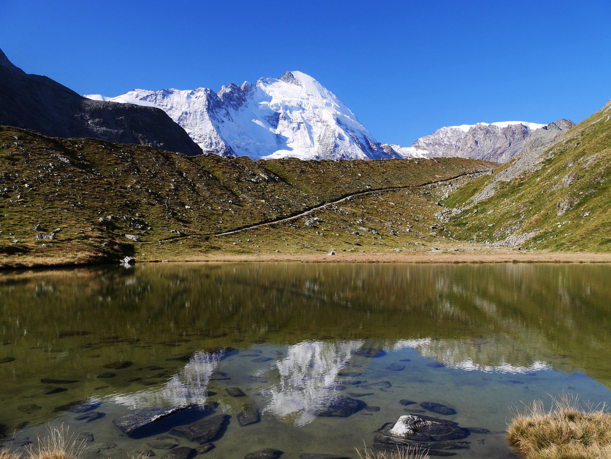
Day 3. Valsorey Hut to the De Chanion Hut.Overview of walk. Onto Glacier du Mietin with a very steep climb onto Plateau du Couloir (3644m) then over the plateau to Col du Sonadon (3504m) then passing between 2 ice falls (1 above, and the other below us) onto the Glacier Mont Durand (with its many crevasses) and onto the Chanion mountain hut. (2462m)Weather.Hot and sunny.
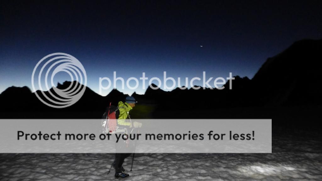
We were off into the darkness at 5am, along with about a dozen others who were climbing the steep 600m slopes above the hut to the plateau, a wonderful sight watching the head-torches weave their way up in the twilight.
Alpine start.
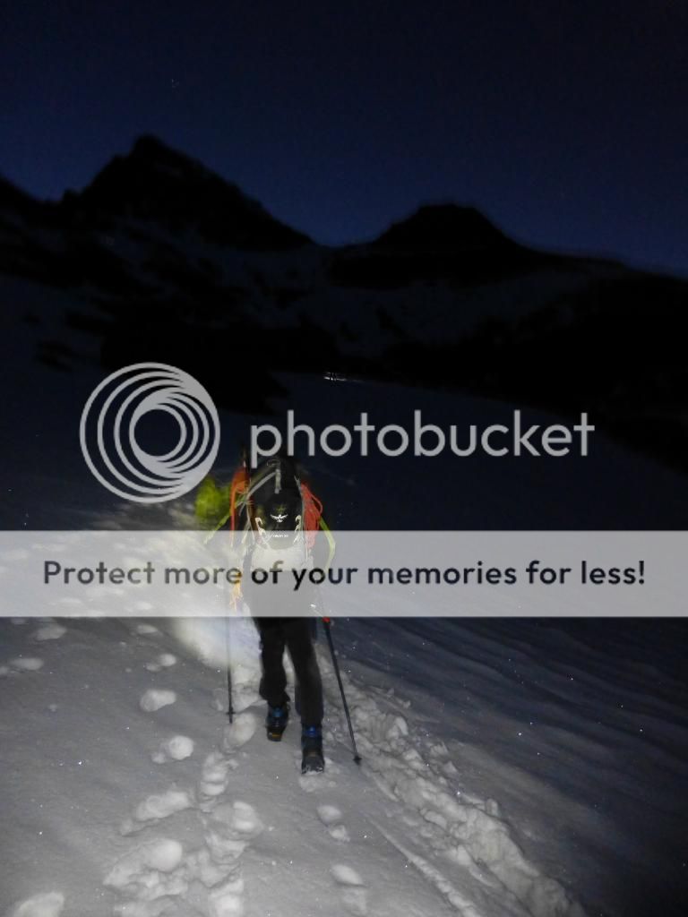
Into the night.
We reached the plateau at 7.15am as the peaks around were catching the Alpine-glow of the rising sun.

First light.
Sunrise


On the plateau
On the plateau
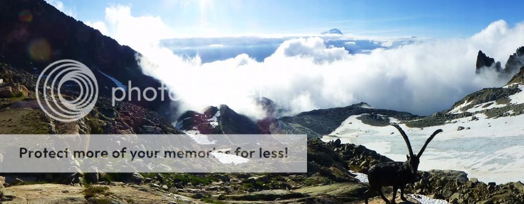
After crossing the plateau we reached the rocky Col du Sonadon basked in the early morning sun and a great viewpoint of our route down the Glacier Mont Durand.
Col du Sonadon
Col du Sonadon

Glacier Mont Durand
Glacier Mont Durand

Glacier Mont Durand

Glacier Mont Durand
It was a joy walking down this fresh snow covered glacier, but once at the bottom of the glacier we hit a moraine boulder field for a knee jarring descent to the valley floor.
Bottom of the glacier

Bottom of the glacier

We stopped at a mountain stream in the valley for an hour or so to rest and wash some clothes and ourselves in the cold but welcoming fresh water.
Valley.
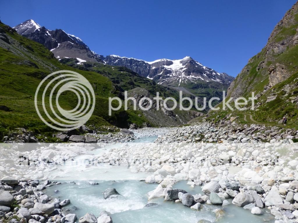
Valley

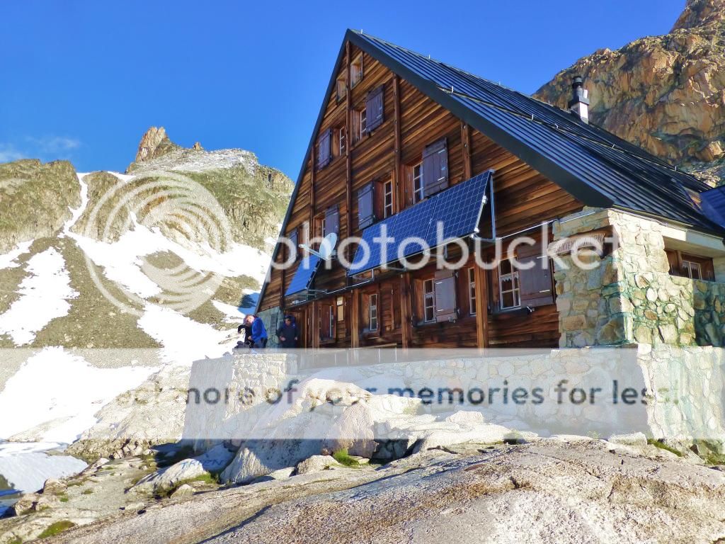
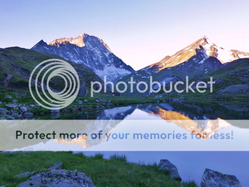
Reluctantly we left our hot sunny haven to climb up to our hut for the night, the Chanrion Hut, it’s a mountain hut located in the upper Val de Bagnes in the canton of Valais in Switzerland. It lies in an isolated area south of Lac de Mauvoisin at an altitude of 2,462 metres, at the foot of Pointe d'Otemma.
Chanrion Hut

Chanrion Hut
This was a busy hut, it is fairly easy accessed and on several popular walking routes.
We talked to several people who were interested in our walk, some were alarmed at our planned route of walking to the Bertol hut via Arolla the following day, saying it was too long and we would lose too much height dropping to Arolla, they suggested we go as far as the Vignettes hut the next day, then take a high route over some high cols and down to the Schonbiel Hut to stop the following night, which would leave us a short few hours walk to Zermatt on Sat morning. This would alter our original plan of doing the rest of the route in 2 long days, this was not a problem as long as we contact our friends in Saas Grund to pick us up on Sat morning instead of Friday evening. Our only other concern was we had photo-copied maps of our original plans, which did not cover a small section of the alternative high route, but the weather was set to be good so we would have no problems with seeing where we were going.
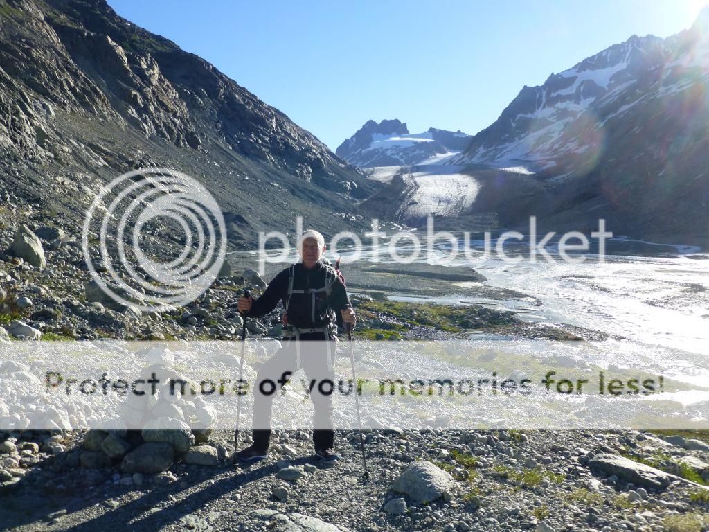
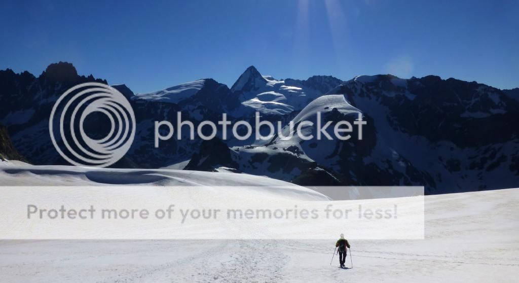
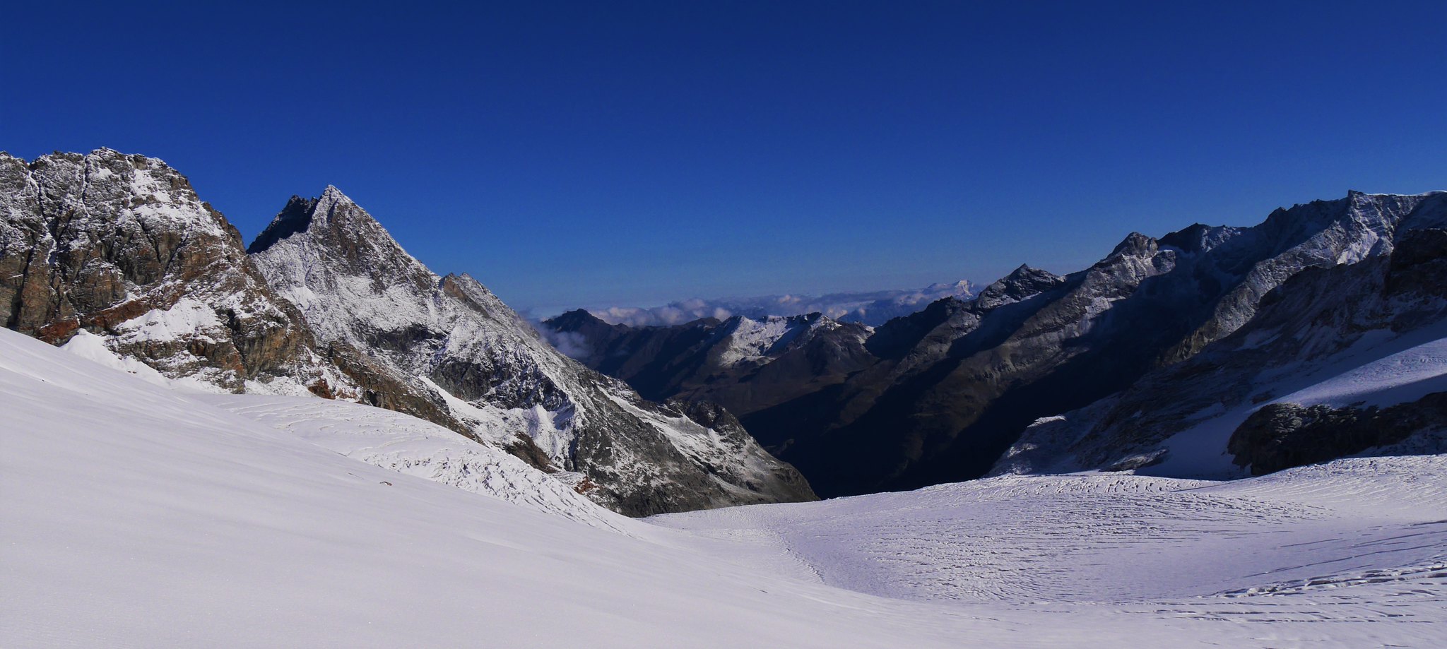
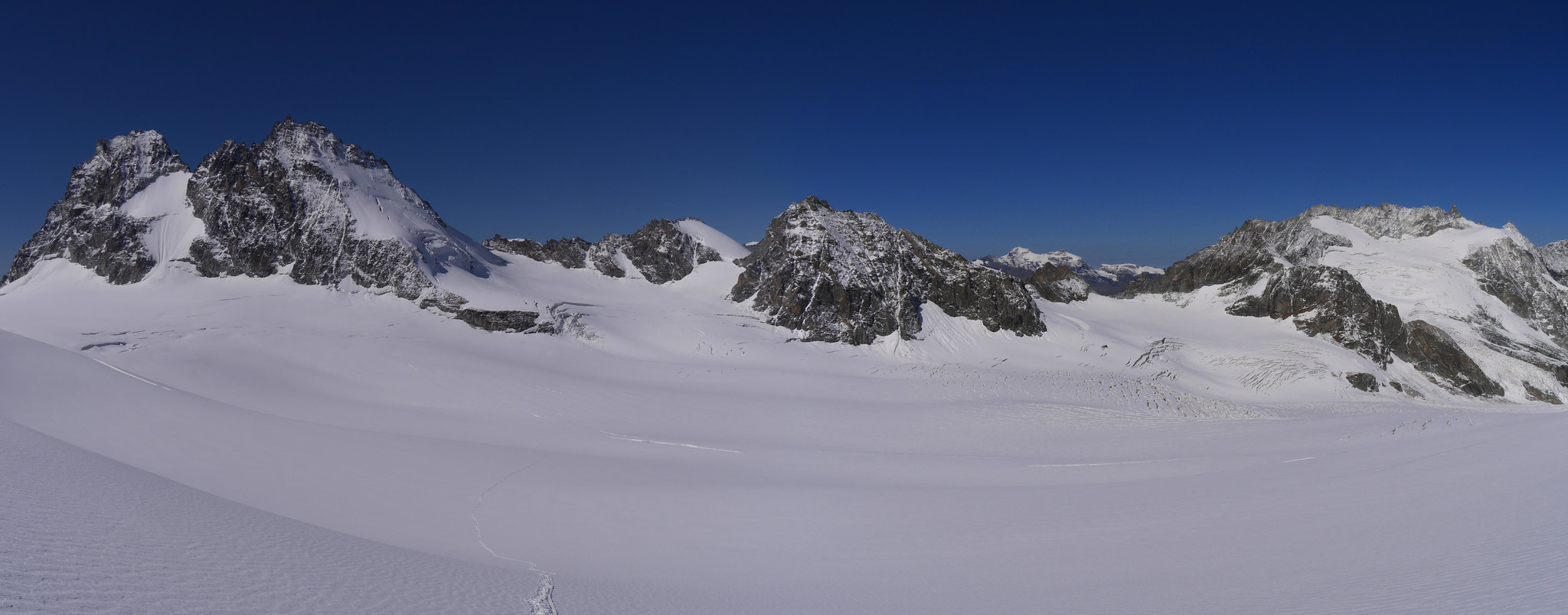
Day 4. De Chanion Hut to the Vignettes Hut .Overview of walk. From the Hut a bulldozer track takes us almost to the snout of Glacier d' Otemma, this is a dry glacier most of the way to the Cab des Vignettes (3160m) Weather.Hot and sunny.
Up at 5.50am for a 6.45am start.

Sunrise
Sunrise
The Gorge

The Gorge
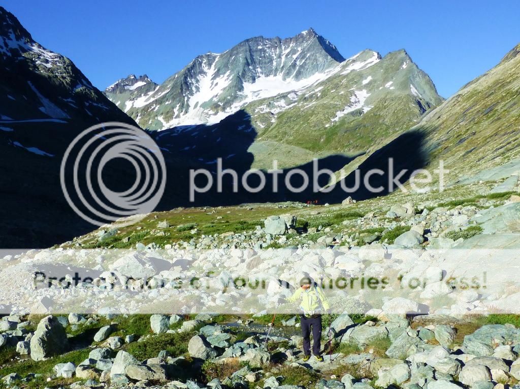
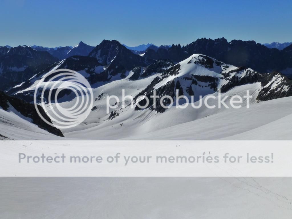
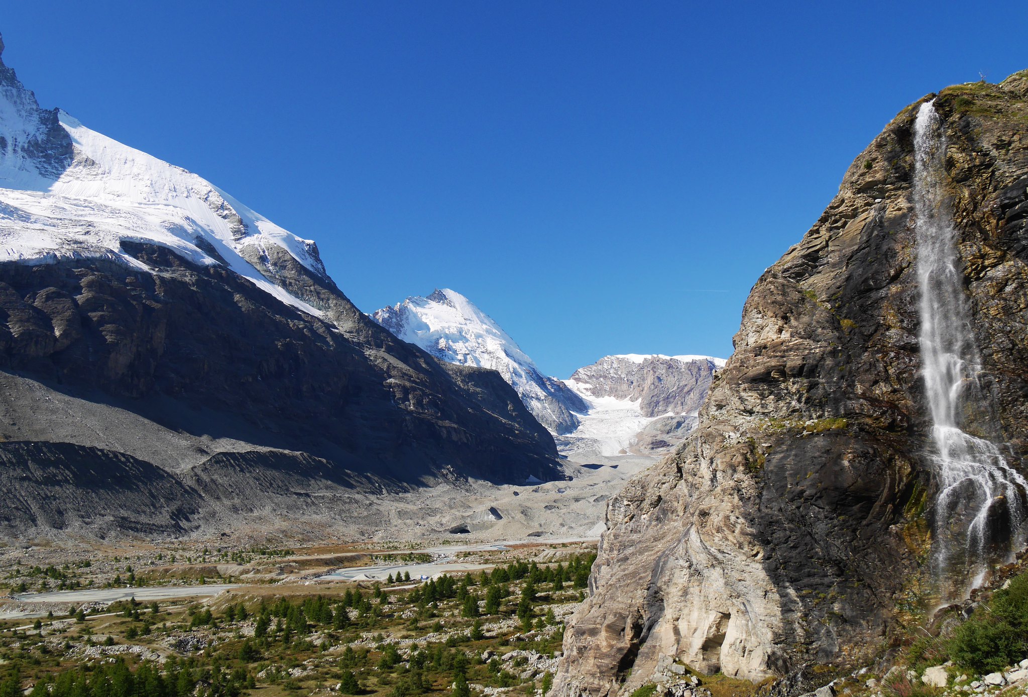
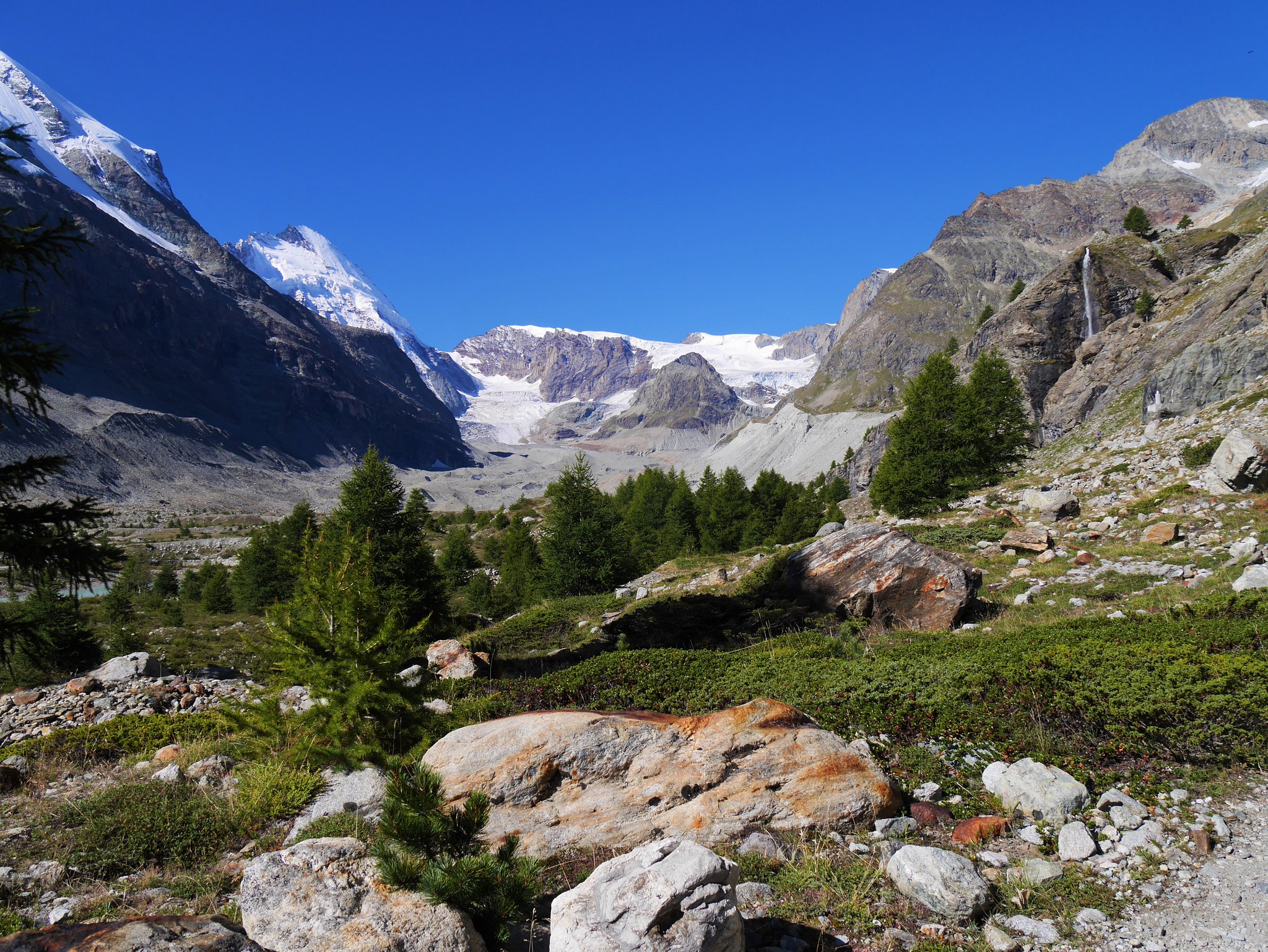
We dropped down to a gorge where a track led us up the Glacier d' Otemma.
Glacier d' Otemma.

Glacier d' Otemma.
Glacier d' Otemma.
Glacier d' Otemma.
Glacier d' Otemma.

Glacier d' Otemma.
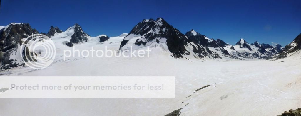
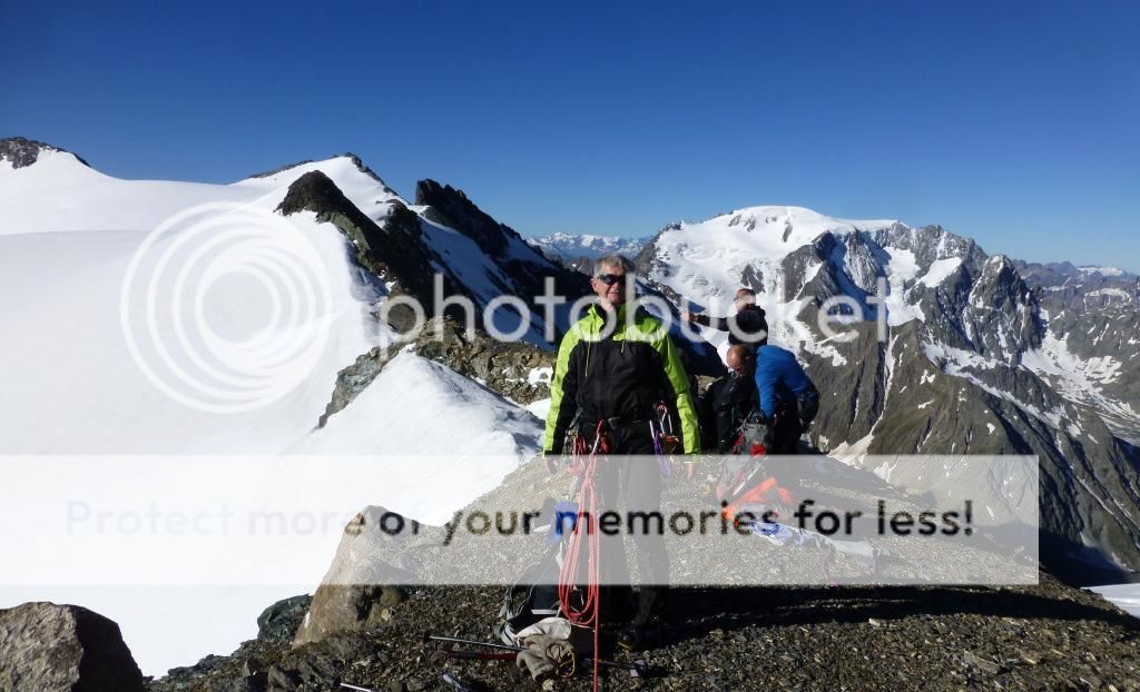
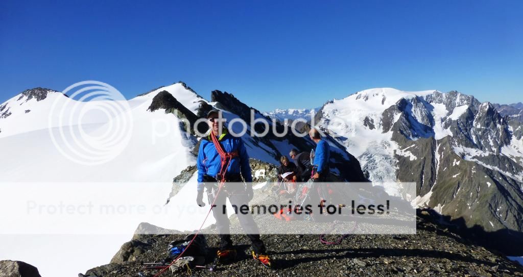
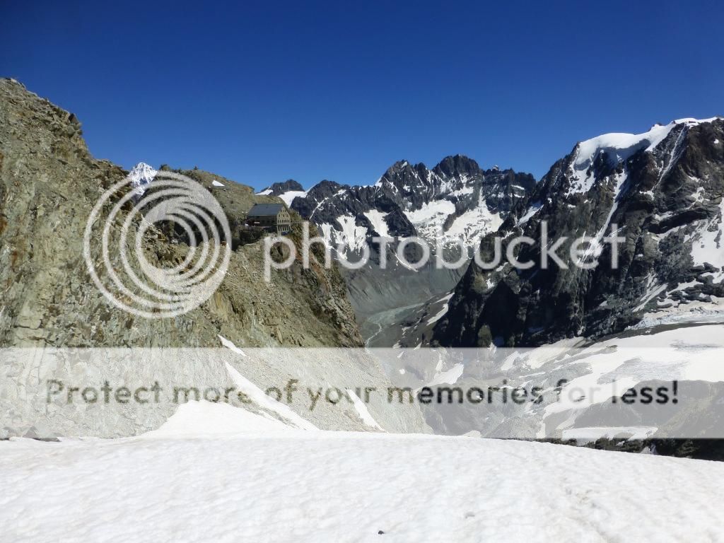
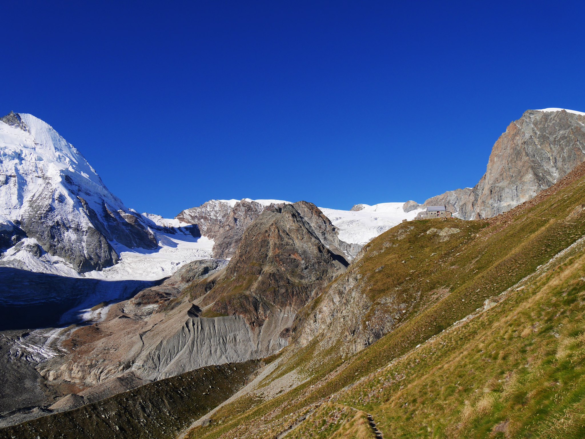
Easy gradients led us up the long and straight glacier, at the head of the glacier at 3053m we spotted our hut for the night on a rocky arête with huge drops on all but one side which was our way to it via a snow and rock arête, superlatives do not match the vision.
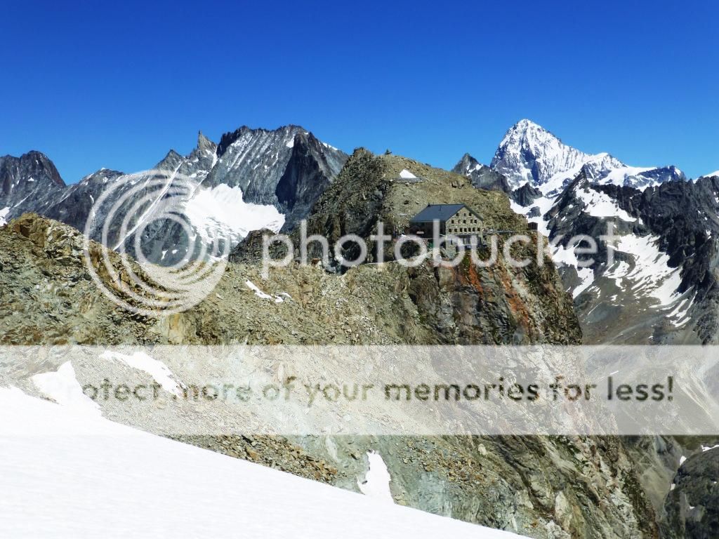
Vignettes Hut

Vignettes Hut
Vignettes Hut

The ridge leading to the hut
After some further climbing, another glacier crossing and the arête we reached the hut at 1.45pm…A little early…we could have gone on.
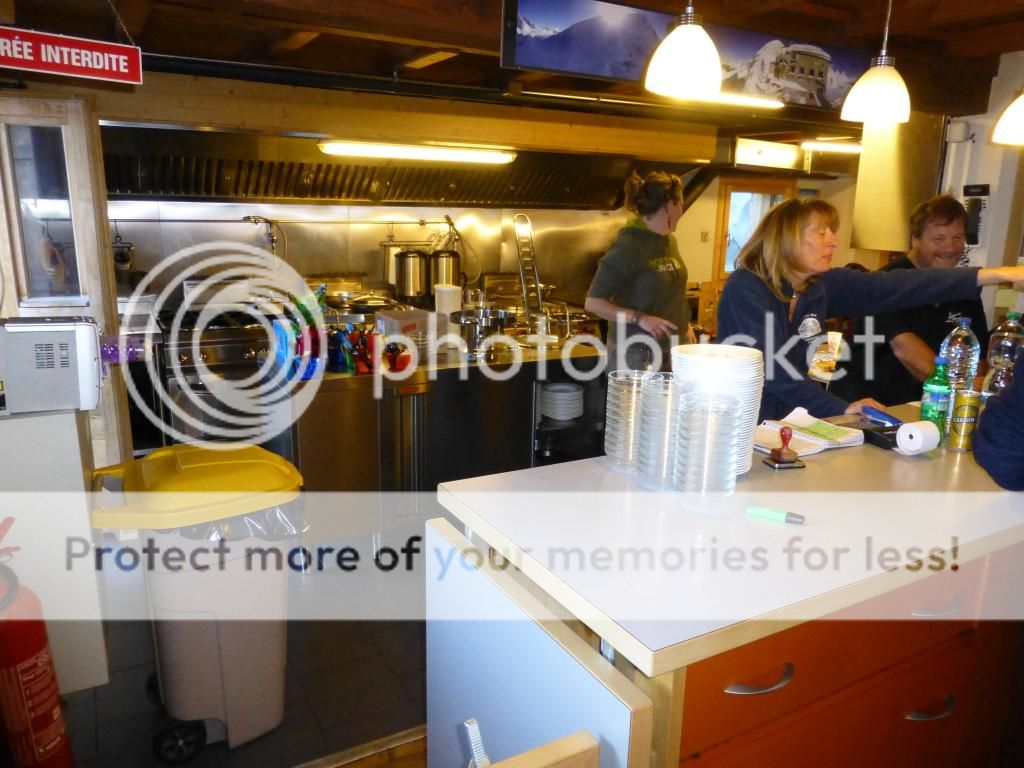
For such a high and remote hut this was the best one we had stopped in…modern interior, spacious, well equipped (even showers!), the best food and a firework display to cap it all at night with free aperitifs! (Swiss National Day celebrations)
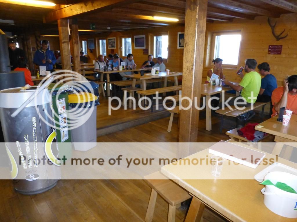
Inside the hut.
Inside the hut

Sunset

Sunset
Sunset

Sunset

Cheers!
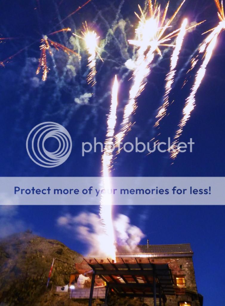
Fireworks
We re-met the 4 guys in this hut to catch up with our tales so far.
We had a late night after partying to the early hours of 10pm! And with another early Alpine rise at 3.30am due the next morning that is a very late night!
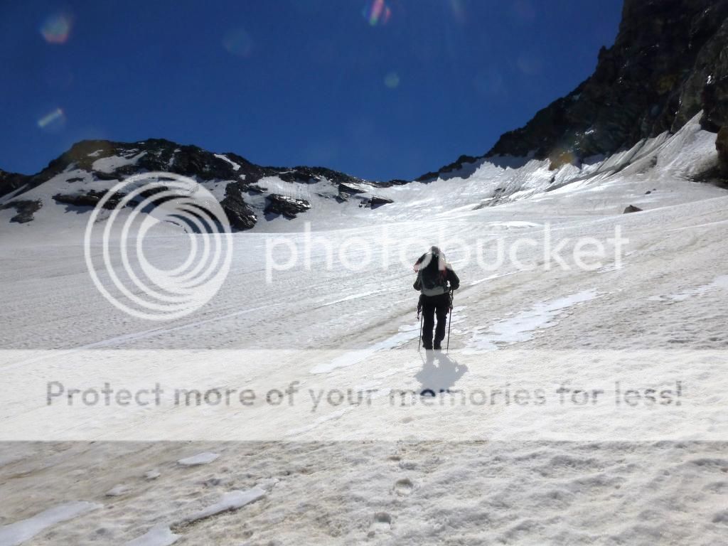
Day 5. Vignettes Hut to Arolla.Overview of walk. From the Hut its back down to the Glacier d' Otemma, over the Col de La’Eveque (3273m) then down to the Col du Petet Mt. Collon and around to the glacier to climb to the Col above (this is where we went wrong) Weather.Hot and Sunny.
So we were up at 3.30am and away under a star filled night sky by 4.30am, retracing our footsteps for the first part of the walk made it easy in the darkness.
Once across the head of the glacier we headed for our first Col (and mistake) of the day, we had seen others coming down thus Col the previous day and presumed they were coming over from the other side, a group of 5 others were following us today, this seemed to confirm we were on the right route (This part of the walk was not on our map)
The “wrong” Col.

The “wrong” Col.
It was steep and hard work getting to the Col. Once at the head of the Col I looked over and down to a rocky void! This was definitely not our way, at that point the group of 5 turned to the right and headed up the mountain above, “Are you going up there” I asked “Yes, it’s the only way” they replied. We turned around with some embarrassment and headed back down the glacier, by now others were heading for what was the correct Col about 1 mile away, we contoured around to pick up the correct line to the correct Col. We had used up valuable energy and time on this mistake, as Martin said at the time “We cannot afford to make another mistake like that” …Famous last words!
Looking over the “wrong” Col.
Once at the correct Col we dropped to the Col du Petet Mt.Collon, again we were missing this small section of map and doubts started creeping into our minds of where we were, even though we knew that we were in the right place.
Dropping to the Col du Petet Mt.Collon.
Surprised to find at the Col were some Austrian climbers and 2 signposts! We asked the Austrians some confirmation on where we were, they confirmed that we were where we thought, but one of them said we needed to go over a huge mountain above us to continue…we ignored him! (He was wrong) The sign posts gave no info on anything we were looking for, just Italian places in the opposite direction, so we ignored them as well!
We continued around the mountain to a steep glacier leading to a long rocky undulating ridge between 2 huge mountains…our Col was somewhere along this…we headed for the obvious (We thought) lowest Col (second mistake of the day)
Heading for the wrong Col.
Another steep climb got us to the rocky Col…I peered over…that sinking feeling again, I was supposed to see a glacier to drop to, instead a huge drop confronted me leading to a green valley way down below. Holy crap! Another mistake! We worked out that our Col must be along the ridge to our left…about 1 mile away and across what looked like a mini Aonach Eagach!
With both mistakes we had now burned up a lot of energy and lost about 2 hours, and we still had a long way to go across 2 long glaciers, and that’s after finding the correct way over this ridge.
We were now doubting if we could go on. One last go we thought, we decided to backtrack down the glacier and skirt along the snow under the ridge to see if we could find the Col, once we were in position to view the ridge from below there were several low points along the ridge that could be the way over, but none of them looked natural routes, and were very steep with scree, rock and snow leading to them. We couldn’t afford to waste energy and climb to another false Col so we agreed pretty quickly to call it a day and drop down the glacier to the village of Arolla, where we knew we could get our friends to drive around and pick us up. It was a hard decision, but we thought the right one considering everything, we could have gone to the Bertol Hut easily from there for the night, but that would have meant a very long day the next day to get to Zermatt, probably arriving by late afternoon. As we had planned on leaving for Chamonix by mid-day on the Saturday, we did not want to hold them up for several hours waiting for us to arrive in Zermatt.
We dropped down the glacier with heads hung low having never completed the route and missing out on great views of the Matterhorn on our last day (Our friend Loz who would pick us up later had soloed the Matterhorn during the week after camping high half way up for a few days and choosing the time to summit, a great achievement, congratulations to him

)
3 hours later we were in the village and our little adventure was over, as Martin said “Not bad for a couple of guys who are nearly on their bus passes!”
The Classic Haute Route: Part 2. Arolla to Zermatt…Unfinished business!Rewind to July 2013…… “We dropped down the glacier with heads hung low having never completed the route” That is how we finished the route, not the best of ends, but we had completed 5 wonderful days of the classic high Haute route (Chamonix to Zermatt) reluctantly we bailed out the last few days due to our “navigational misplacement”
Trip report of that July 2013 trek here…http://www.walkhighlands.co.uk/Forum/viewtopic.php?f=16&t=35095[u]Rewind to April 2015…[/u]
The fact that we never actually completed the Haute had been bugging Martin and I ever since, we had talked about what a awesome trek it had been and how we would have loved to have completed it over a pint or two on many occasions.
One night in April earlier this year over another beer I said to Martin “How do you fancy going back to finish the Haute route next year?” as quick as a flash he replied “Why don’t we go this year?” Instantly replied “OK.” Obviously we were both on the same mindset and within seconds it was game on again!

A few days later we had booked the flight, trains, buses, accommodation in Geneva, Arolla, Zermatt and the 2 huts on our route.
It certainly wasn’t the beer talking; we didn’t have to think twice about this one!
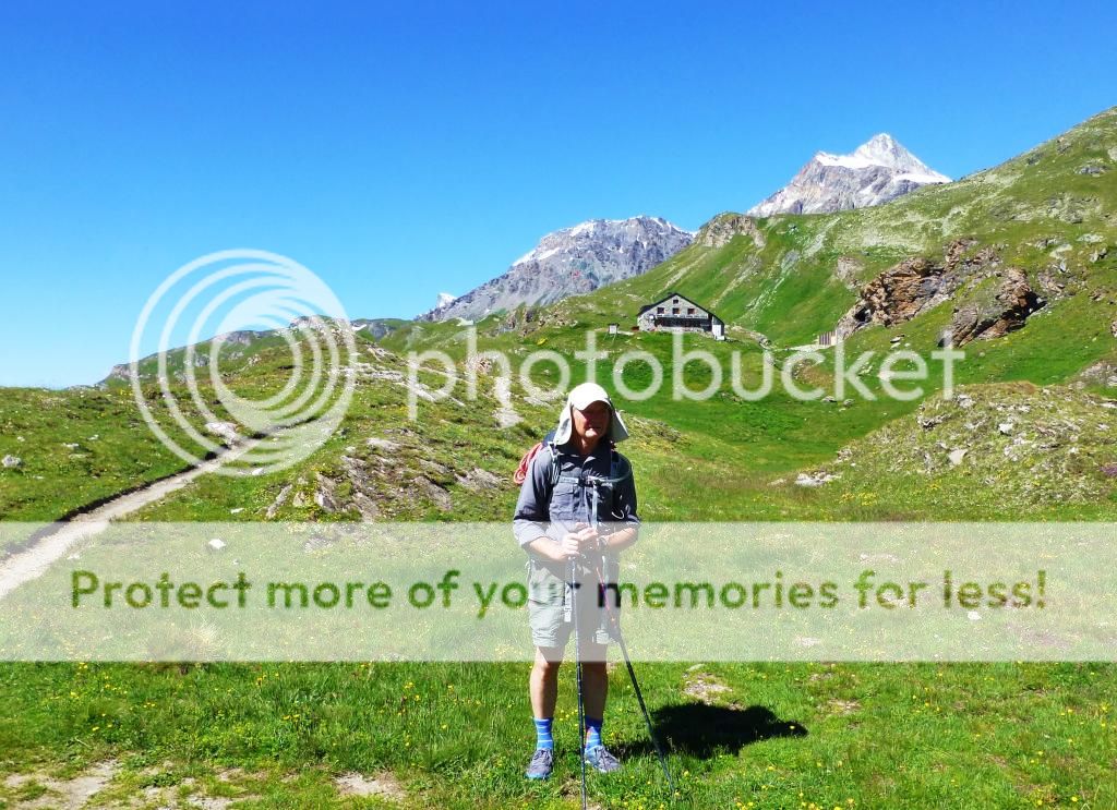
After a flight to Geneva (Hostel overnight), next day a train to Sion and a bus to the charming high (1,371 m) Alpine village of Evolène, we reached out hotel and our base to start the walk the following day.
 Evolène (3)
 by
Alan, on Flickr
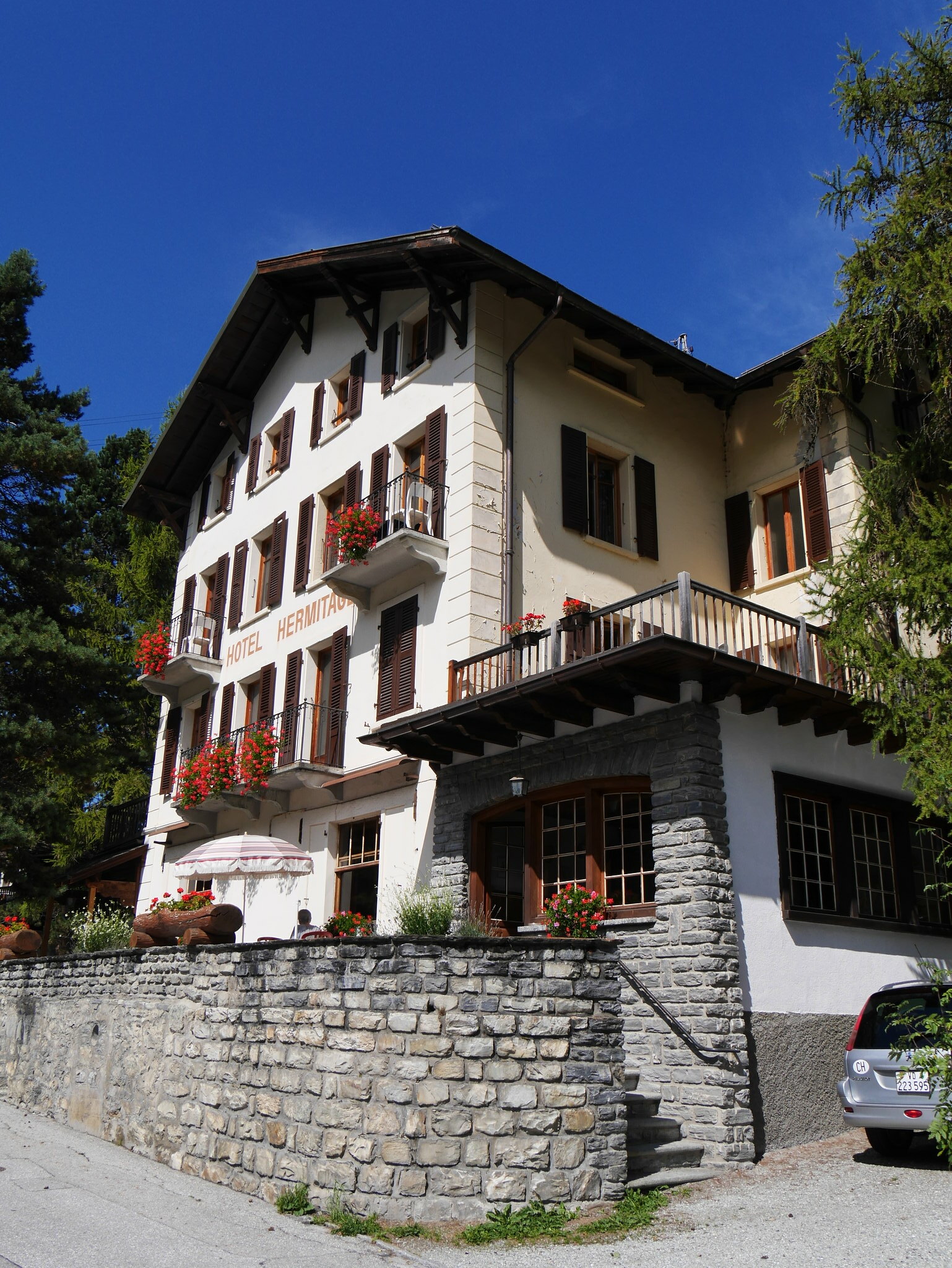
Hotel Hermitage, Evolène. Evolène (5)
 by
Alan, on Flickr
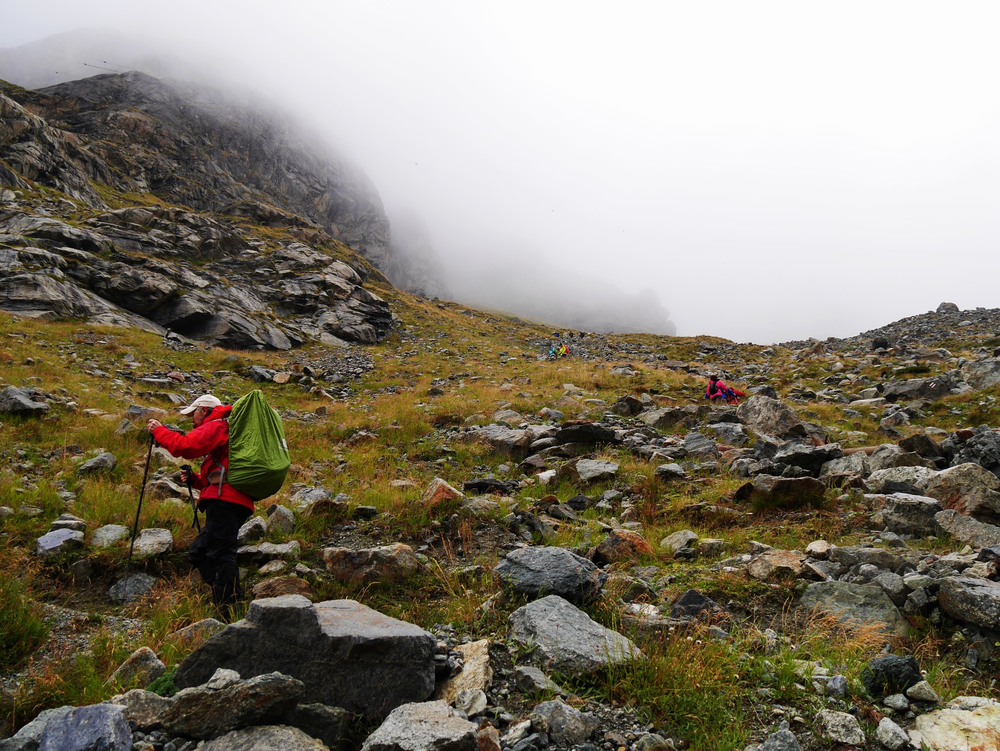
Evolène. Day 1. Sat 5th Sept. Arolla (1371m) to the Bertol Hut (3311m) Ascent: 1300m.Duration: 5.30hrs.Weather: Cloudy, patchy rain, snow up high, up to 4 inches over several hours until the early hours.After a bus to the village of Arolla (Nowhere near as pretty as Evolène) we set off at 10.15am for the Bertol hut with waterproofs donned.
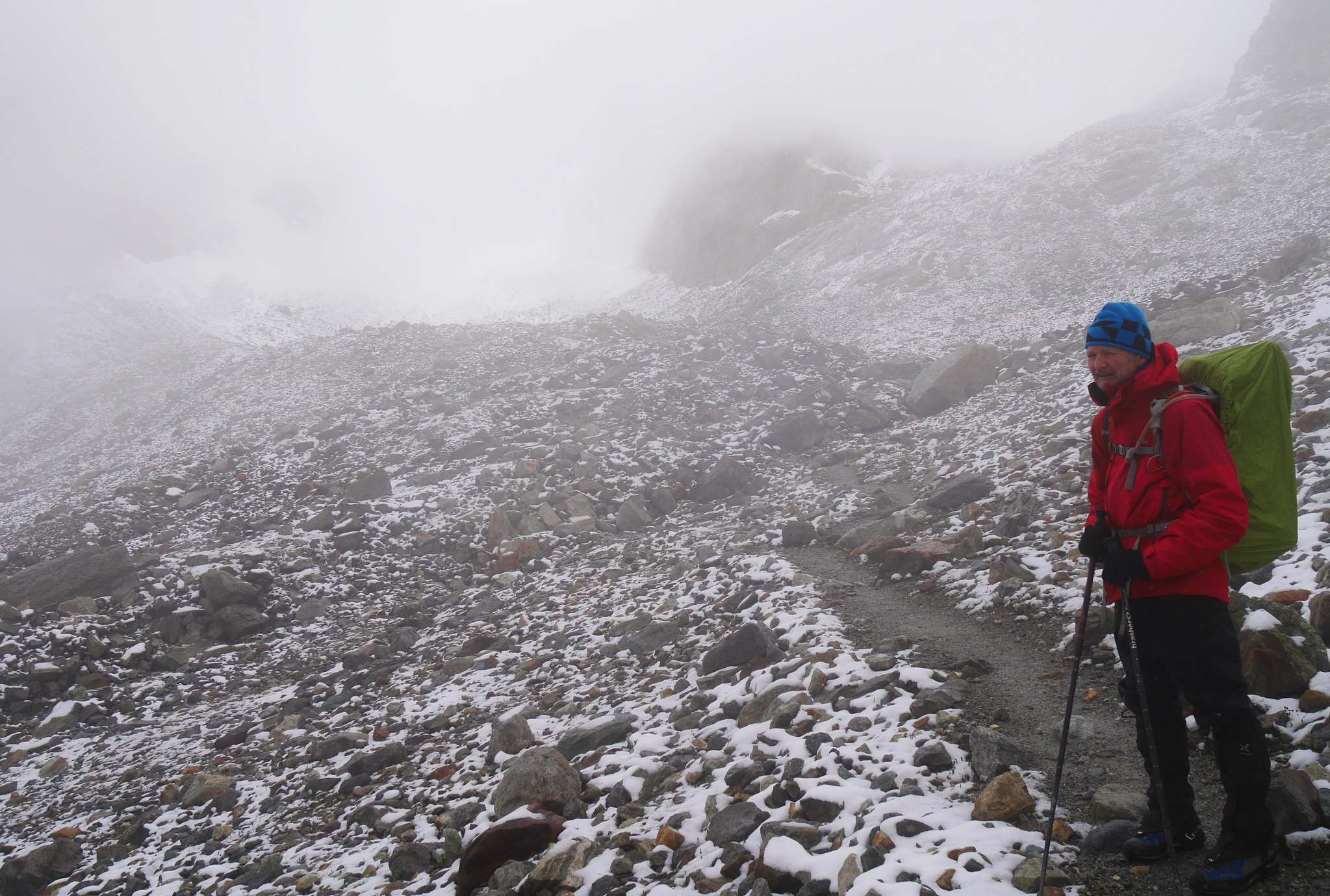
With the weather less than favourable and a grinding uphill slog at a high altitude, it was just grin and bear it as we slowly climbed onto into the cloud and increasingly heavy snow.
 Haute Route. Day 1. Arolla to the Bertol Hut (1)
 by
Alan, on Flickr
 Haute Route. Day 1. Arolla to the Bertol Hut (2)
 by
Alan, on Flickr
 Haute Route. Day 1. Arolla to the Bertol Hut (3)
 by
Alan, on Flickr
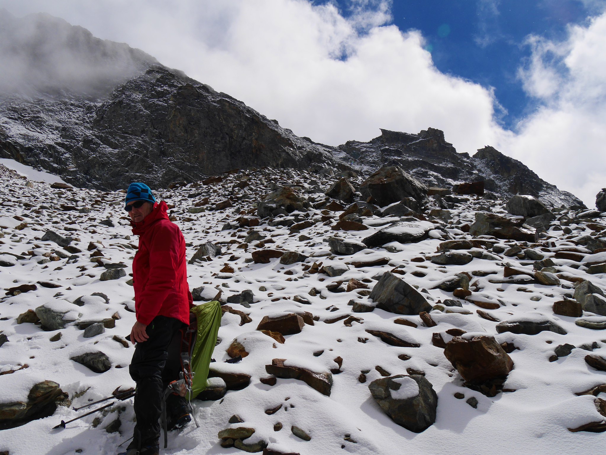
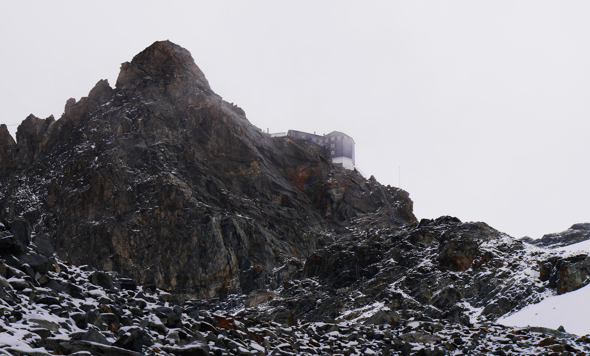
A rare glimpse of blue skyLuckily the cloud lifted and broke as we neared the hut revealing its spectacular location.

 Haute Route. Day 1. Arolla to the Bertol Hut (4)
 by
Alan, on Flickr
The hut comes into view.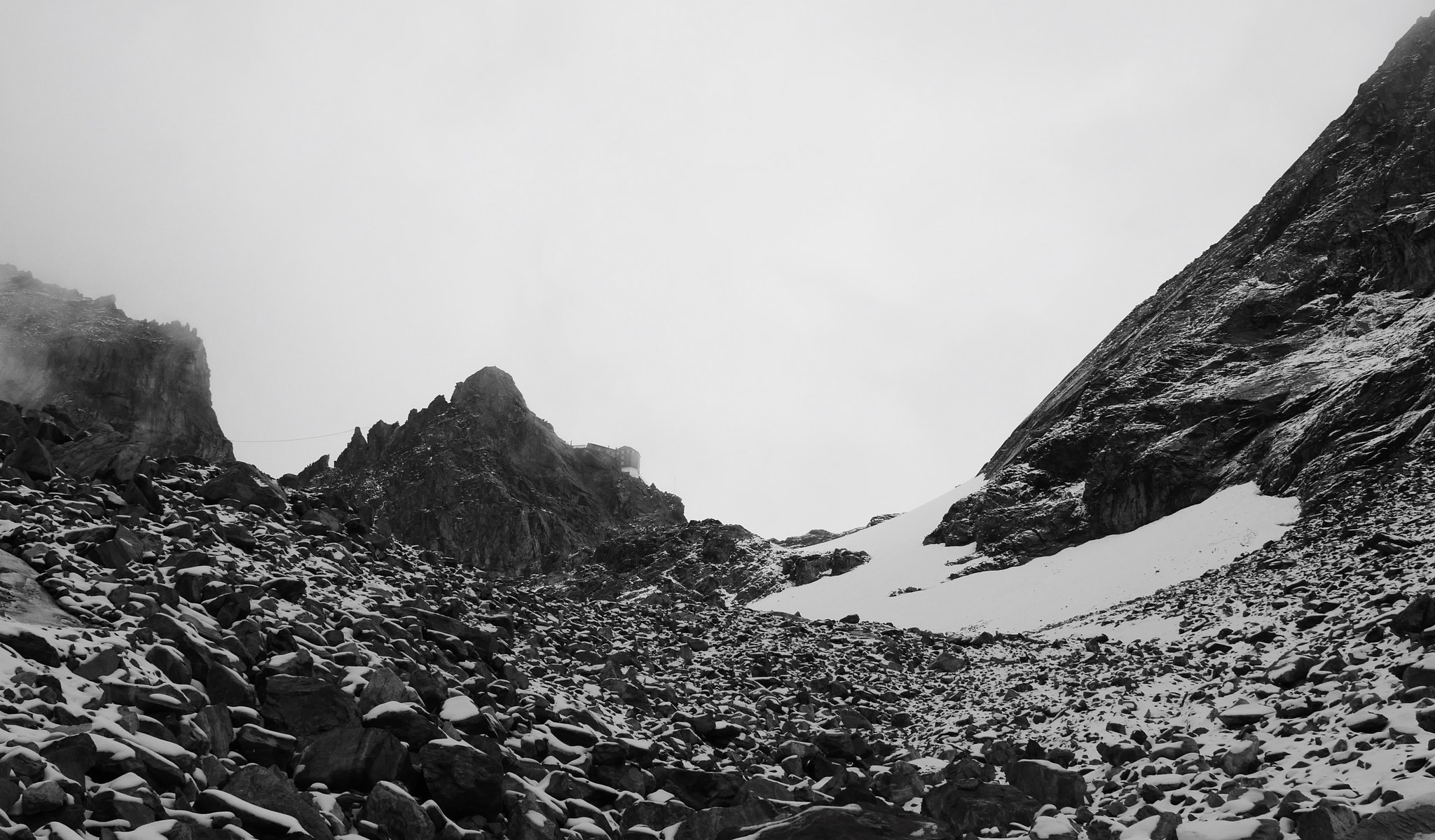 Haute Route. Day 1. Arolla to the Bertol Hut (5)
 by
Alan, on Flickr
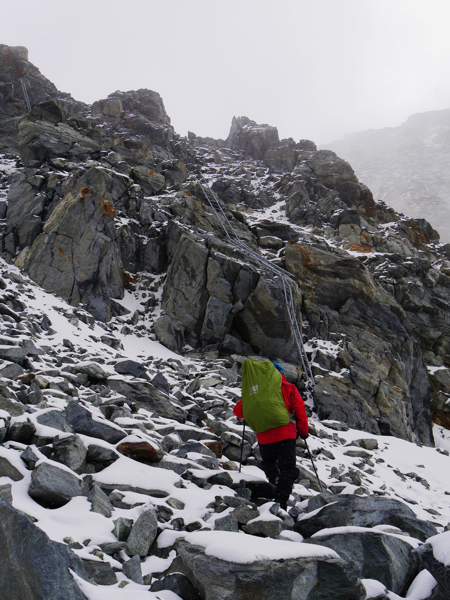
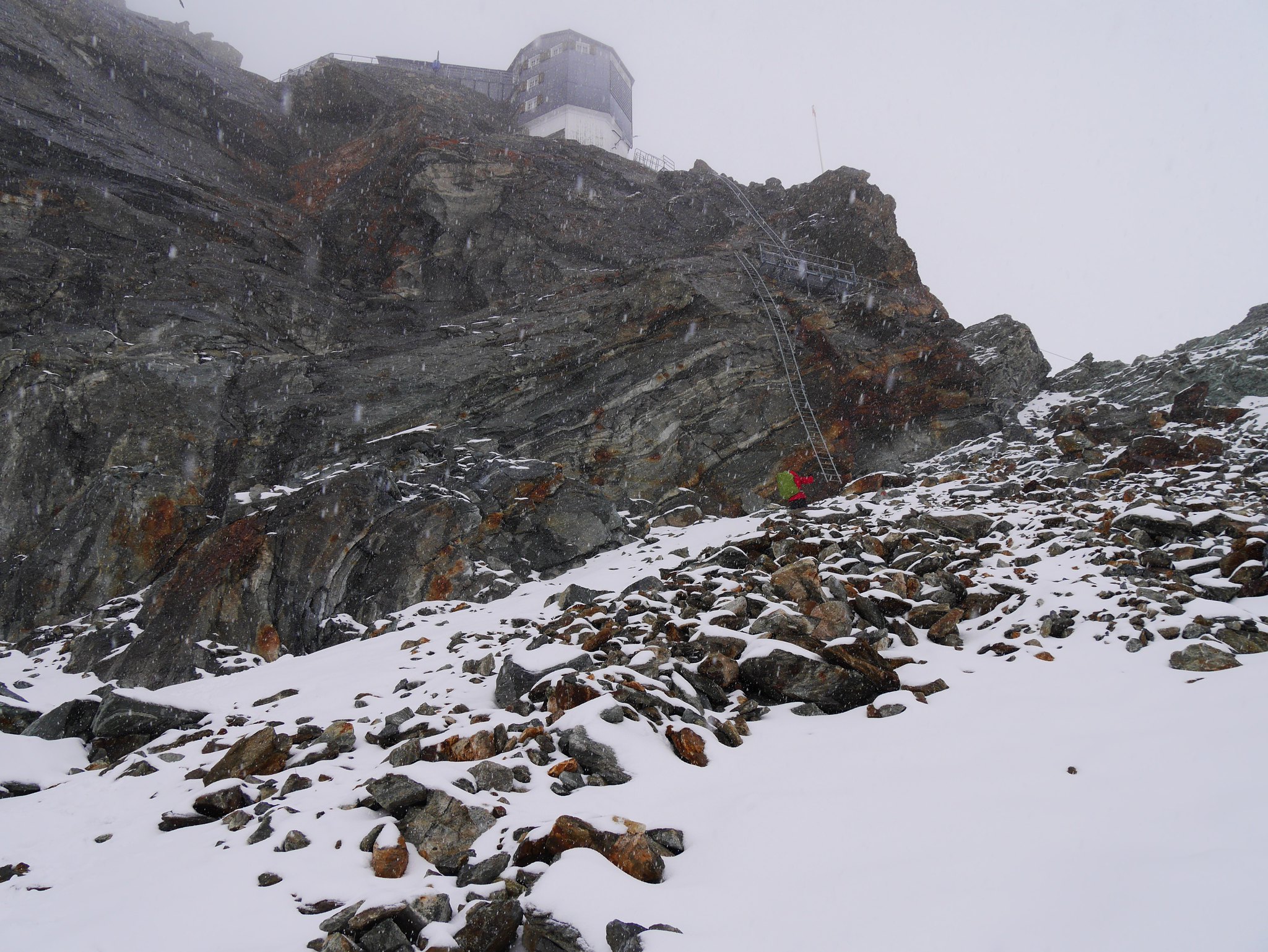
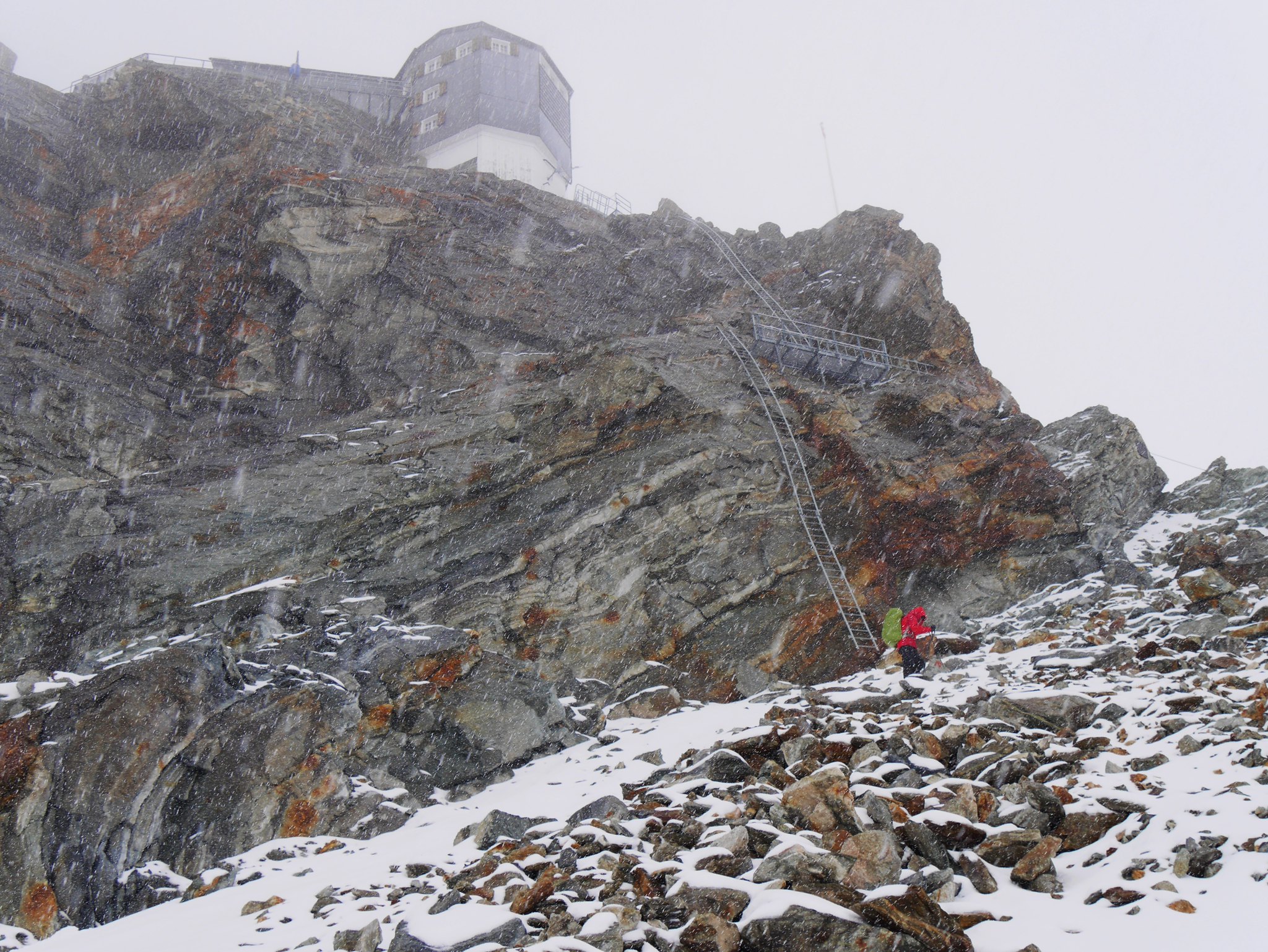
A series of ladders lead vertically up the rock face to gain the ridge, a momentous effort was required to climb these given the altitude and our lack of acclimatisation.
 Haute Route. Day 1. Arolla to the Bertol Hut (6)
 by
Alan, on Flickr
 Haute Route. Day 1. Arolla to the Bertol Hut (7)
 by
Alan, on Flickr
 Haute Route. Day 1. Arolla to the Bertol Hut (8)
 by
Alan, on Flickr
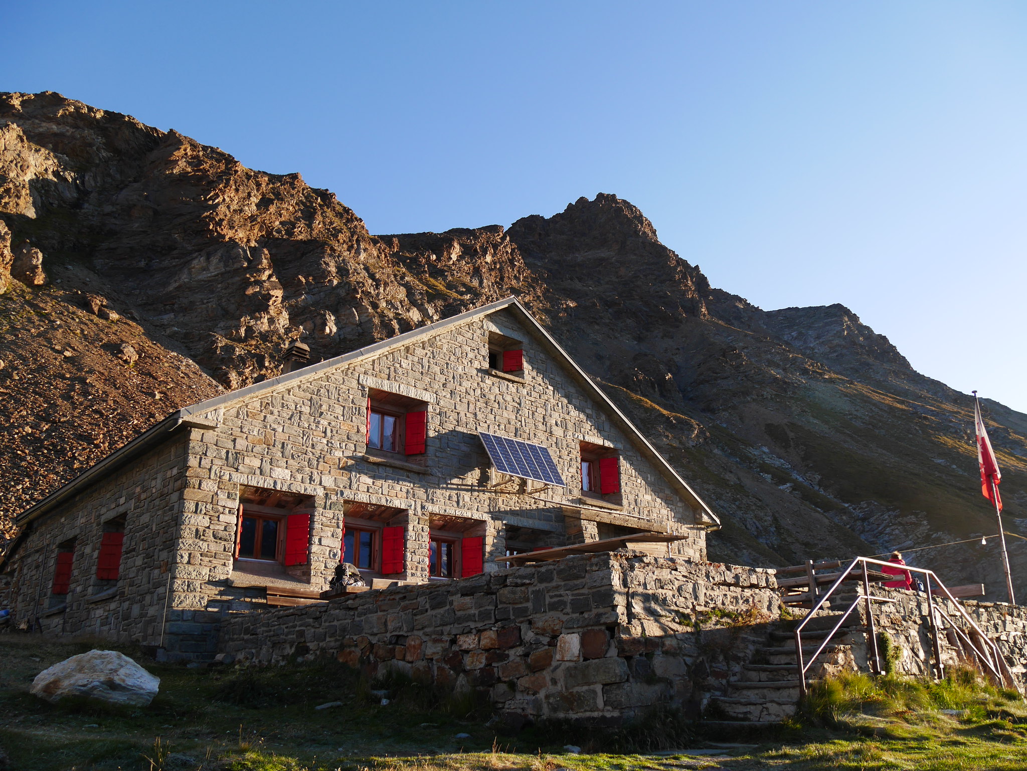
We flopped inside the hut, the warmth so welcoming from the snow and cold winds outside.
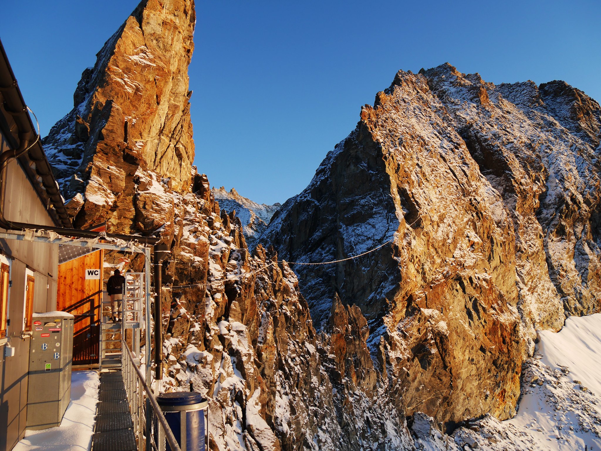
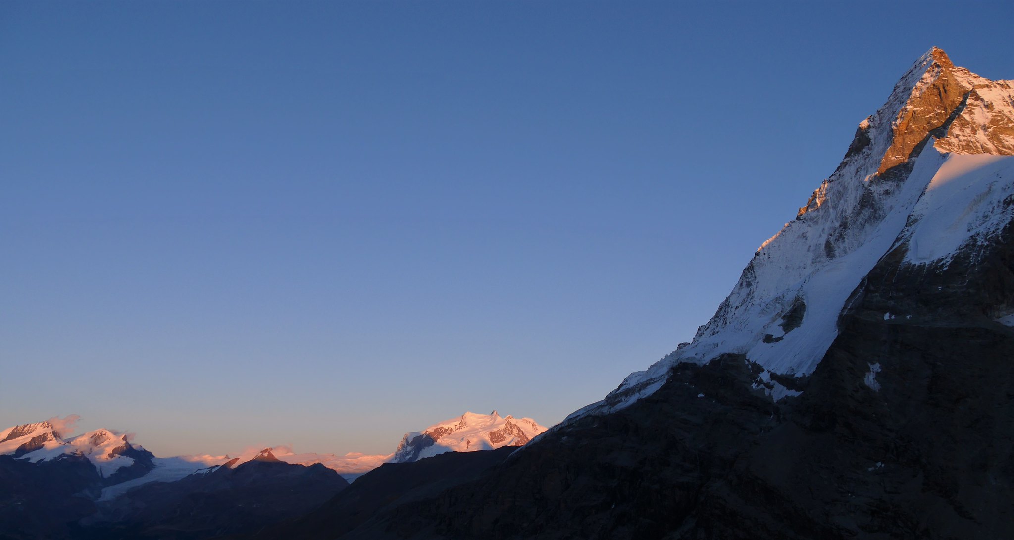
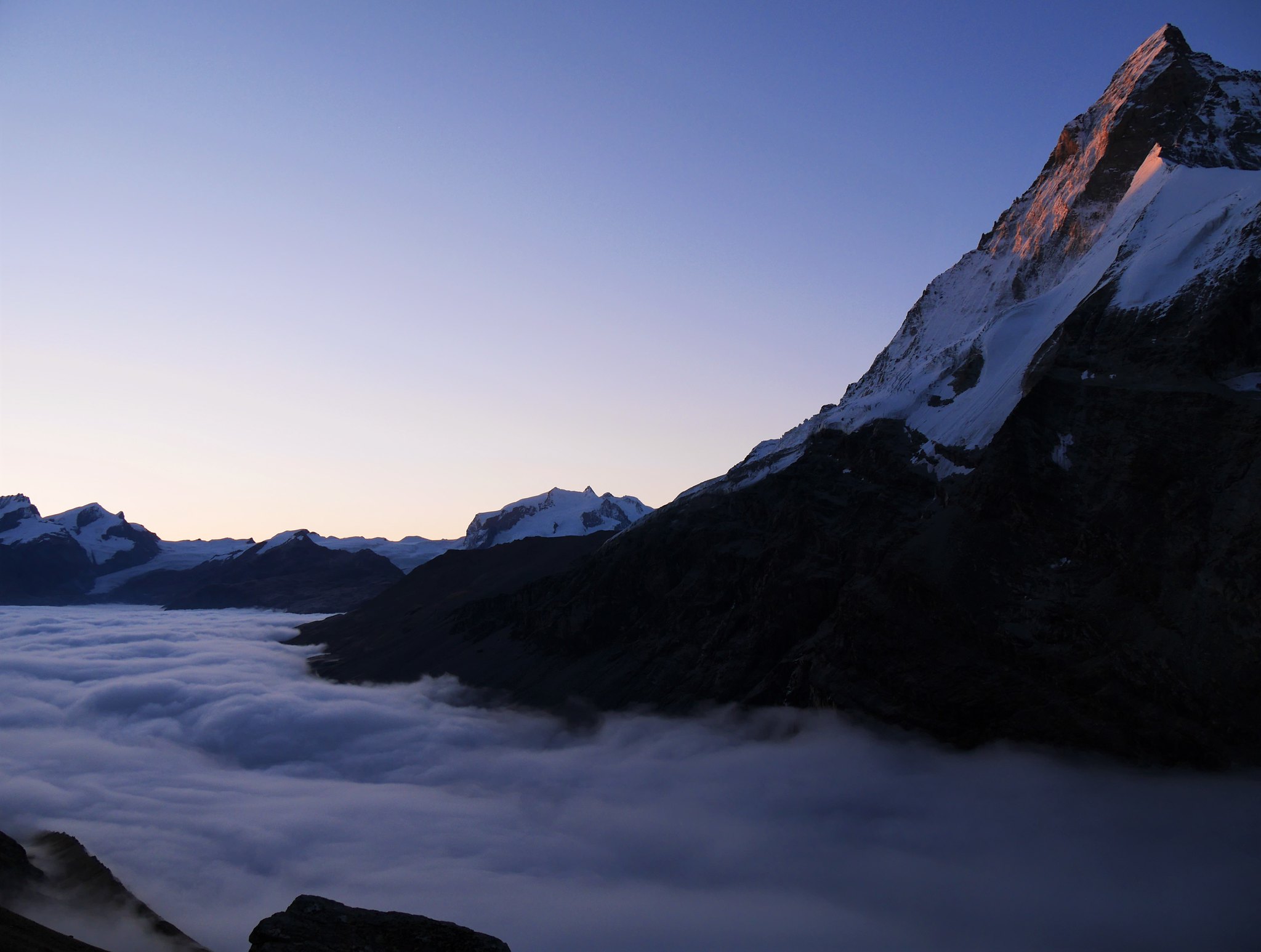
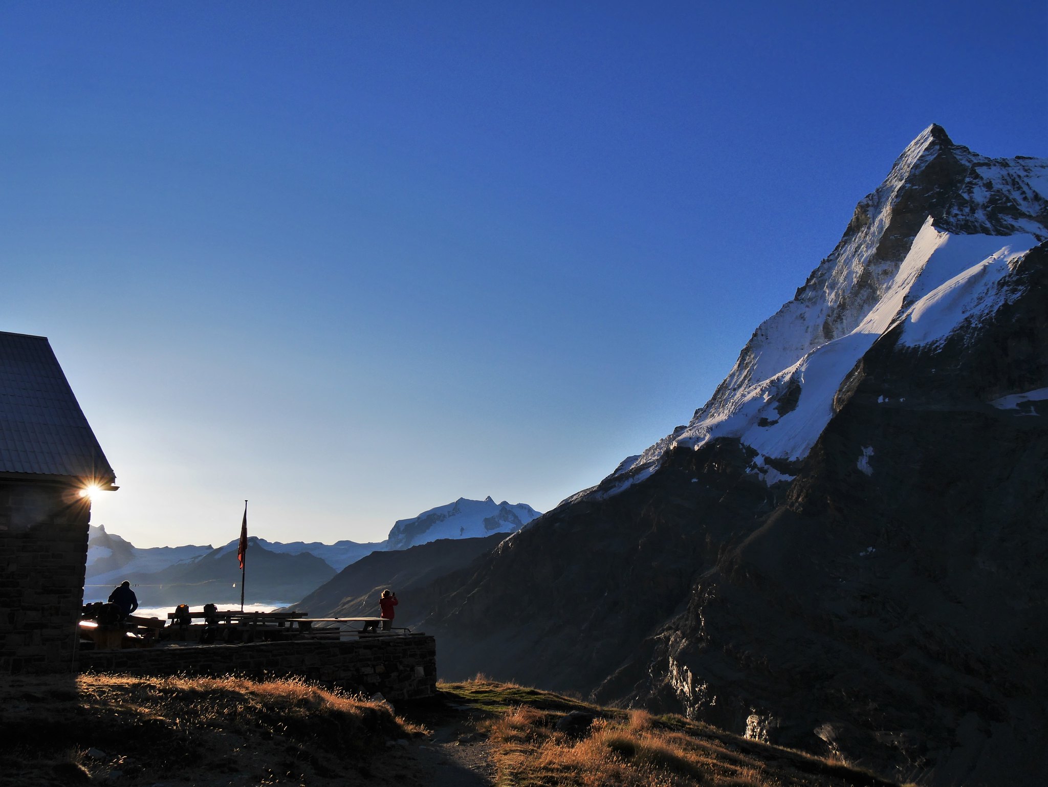
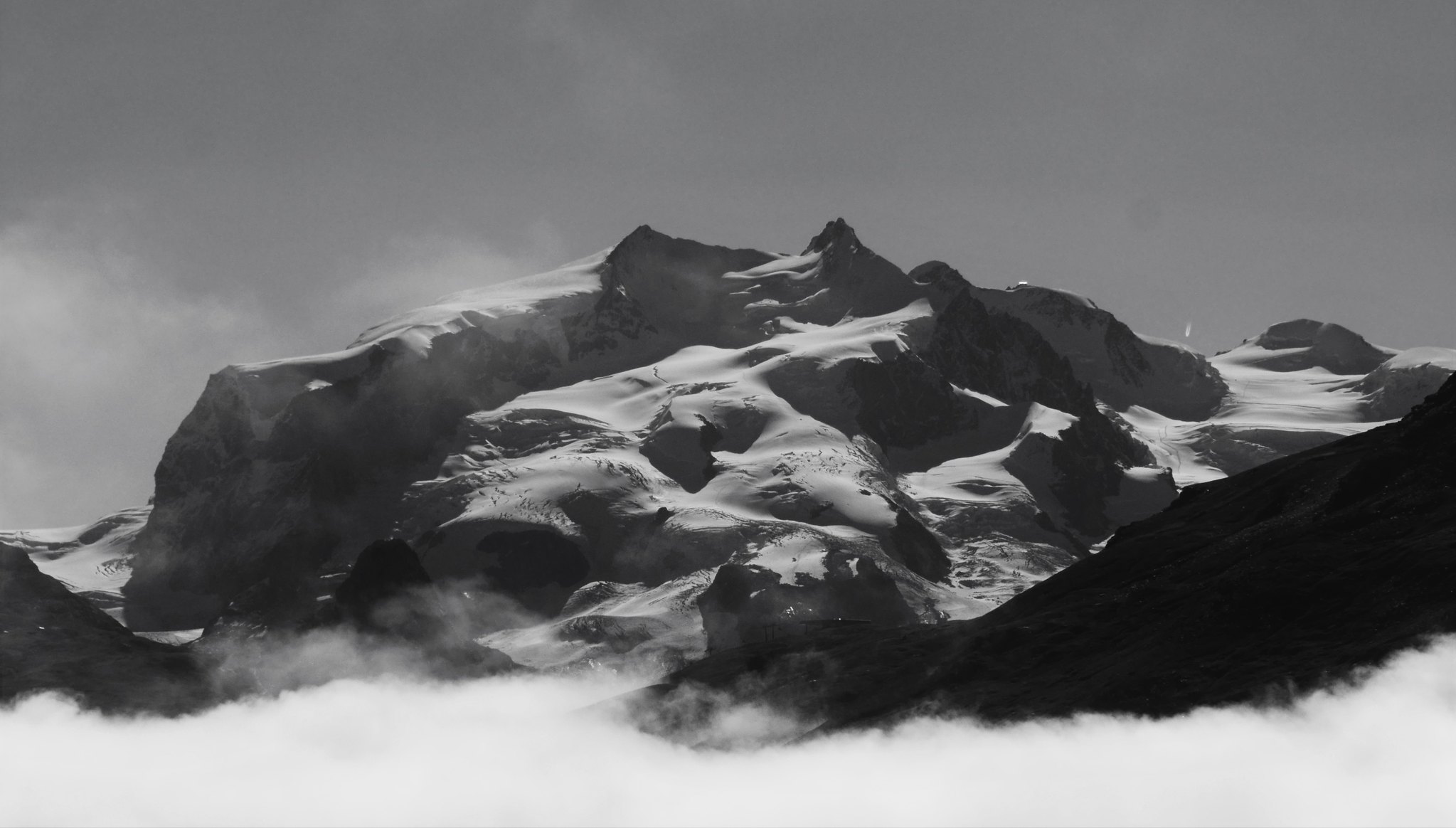
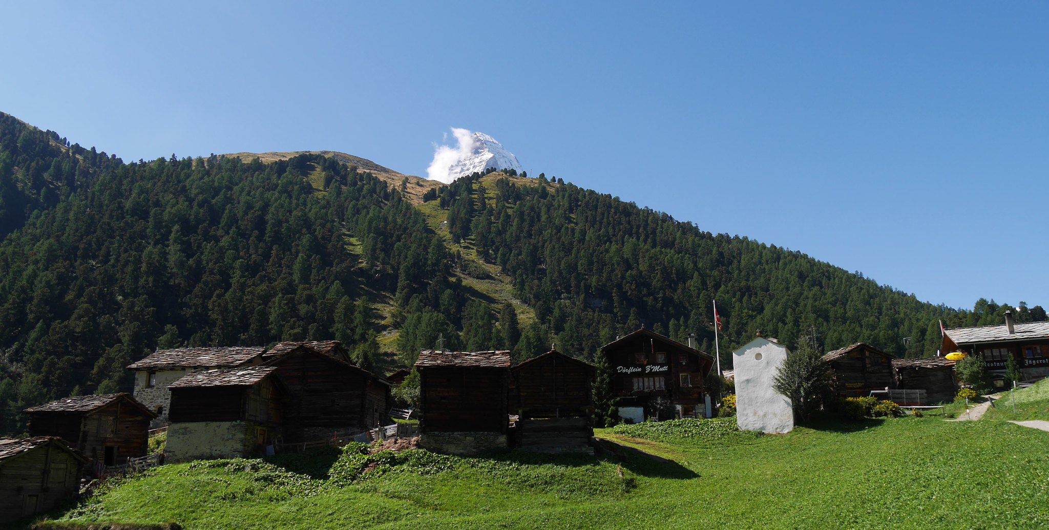
The Bertol hut is perched high on the rocky ridge, and is one of the best hut locations in the Alps. It overlooks an immense glacier plateau to the east feeding the Mont Miné and Ferpècle glaciers. Across this plateau the Dent Blanche dominates the view, and the upper half of the Matterhorn comes in view for the first time...not that we saw much of that during the evening as the snow continued to fall as we retired to bed that night, the forecast was for better weather sometime during the morning…hopefully sooner than later as we had fears of route finding over the high creviced glaciers that we had to cross the following day.
During the night I spent a penny in the outside toilet (Enough to wake you into your senses!) I was so pleased to see stars overhead.
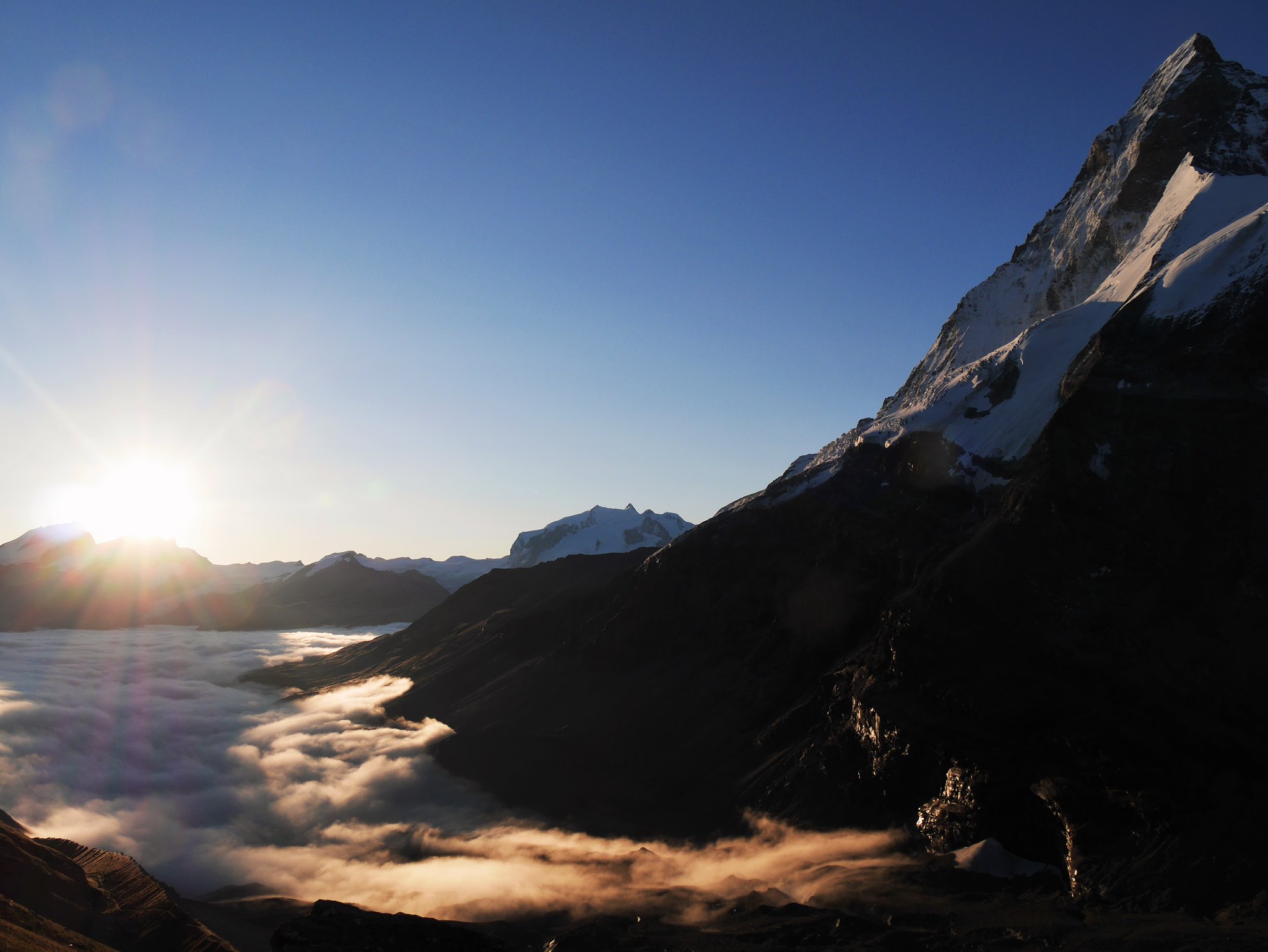
Day 2. Sun 6th Sept.Bertol Hut to Schonbiel Hut (2,694m) via Col de la Tête Blanche (3,600m)Distance: 11km. Ascent: 741m – Descent: 1,358m.Duration: 8hrsWeather: Sunny, calm, cold.Our hopes were answered when we woke at sunrise, the transformation was amazing, pristine jagged mountains rose all around from the fresh virgin snow that had fallen on the glaciers below. Today was going to be awesome!
 Haute Route. Day 2. Sunrise, and what a change in the weather.
 by
Alan, on Flickr
Sunrise…Awesome!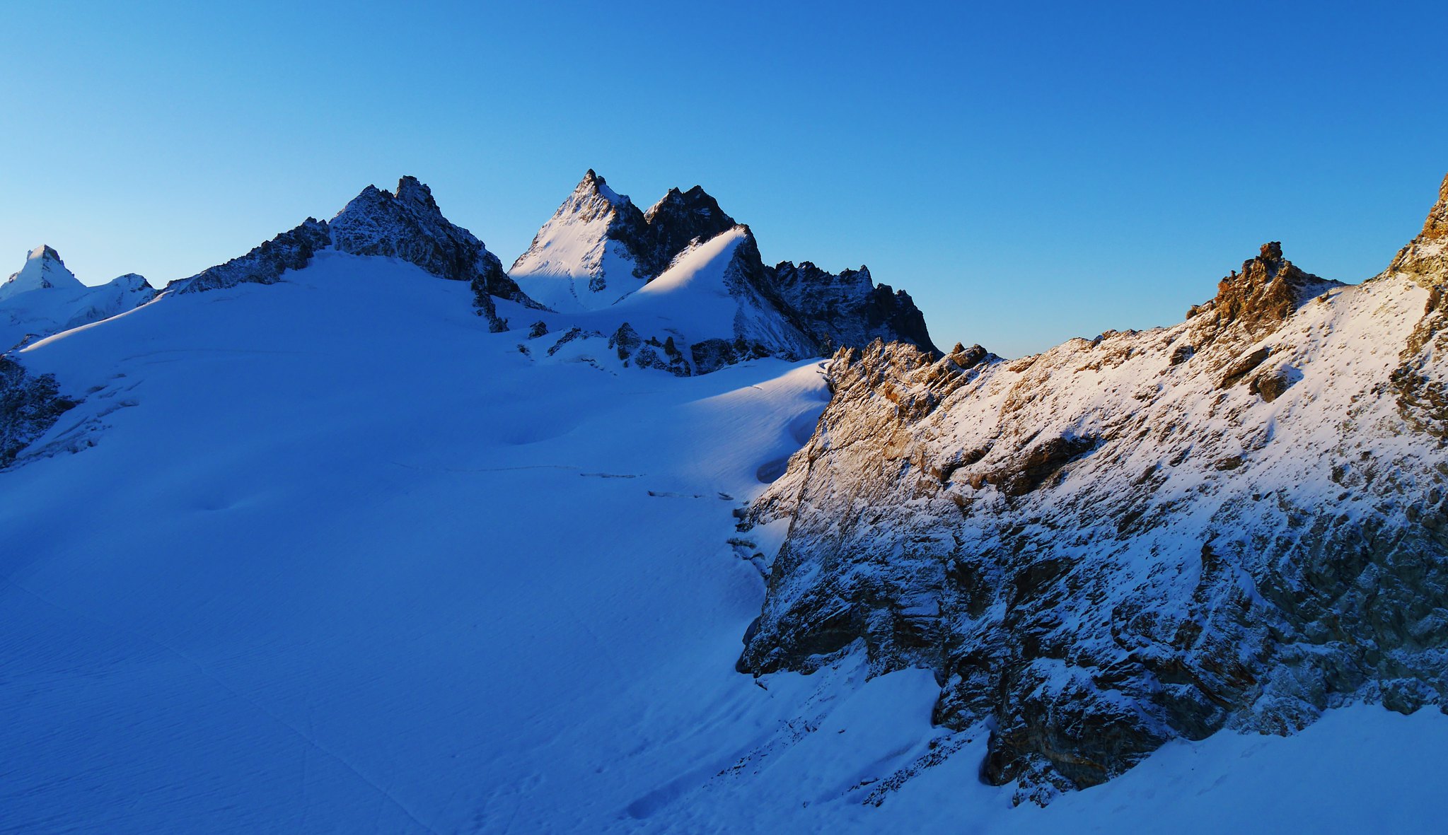 Haute Route. Day 2. Sunrise
 by
Alan, on Flickr
 Haute Route. Day 2. Bertol Hut
 by
Alan, on Flickr
 Haute Route. Day 2. Footsteps of 2 early morning trekkers
 by
Alan, on Flickr
 Haute Route. Day 2.The Bertol hut walkway from the WC, sure to wake you up on yout night time visits!
 by
Alan, on Flickr
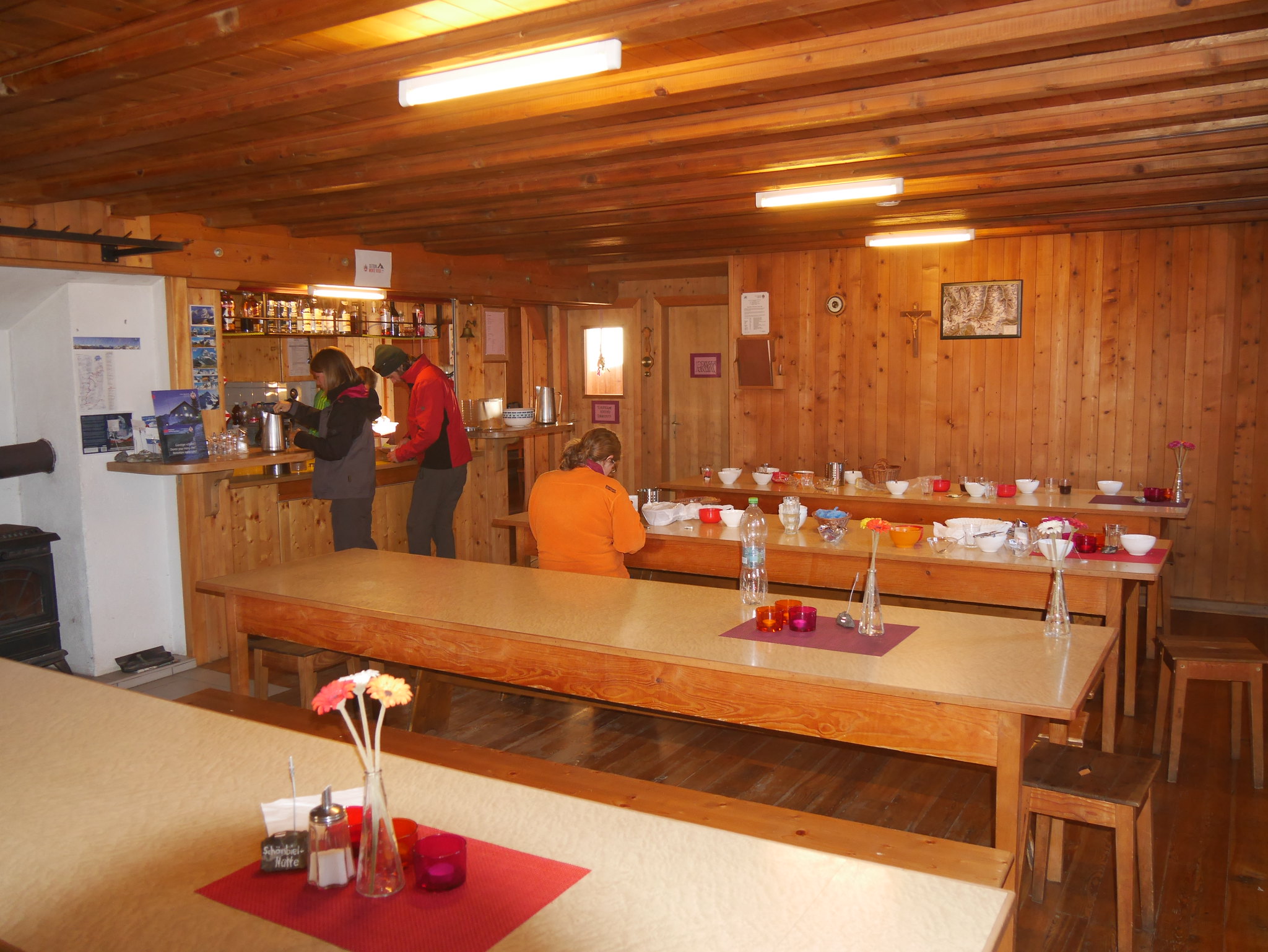
 Haute Route. Day 2. Bertol Hut interior
 by
Alan, on Flickr
Inside the hut.We left the hut by another series of ladders to the slopes of the Mont Miné Glacier below.
 Haute Route. Day 2. Onto the Mont Miné Glacier.
 by
Alan, on Flickr
Onto the glacier.A nice level traverse made the going easy as we rounded the cliffs of the Dents de Bertol, then a steady climb to the Col de la Tête Blanche at almost 3600 meters.
 Haute Route. Day 2. Looking back to the hut from the Mont Miné Glacier (2)
 by
Alan, on Flickr
 Haute Route. Day 2.Virgin tracks up the Mont Miné Glacier
 by
Alan, on Flickr
 Haute Route. Day 2. Heading for the Col, Mont Miné Glacier
 by
Alan, on Flickr
 Haute Route. Day 2. View down the Mont Miné Glacier
 by
Alan, on Flickr
View down the Mont Miné Glacier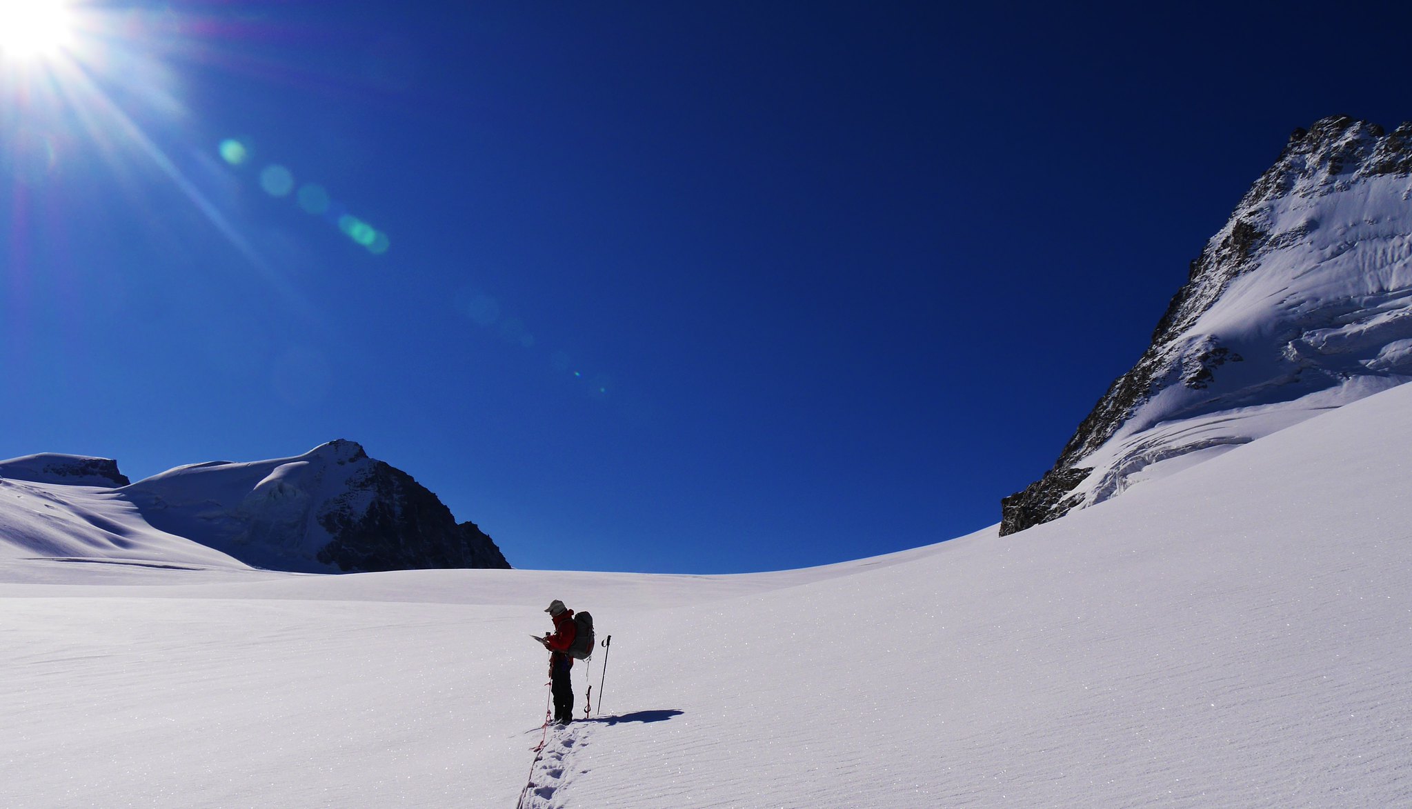 Haute Route. Day 2. Map checking
 by
Alan, on Flickr
 Haute Route. Day 2. Panorama from the Mont Miné Glacier
 by
Alan, on Flickr
Panorama from the Mont Miné Glacier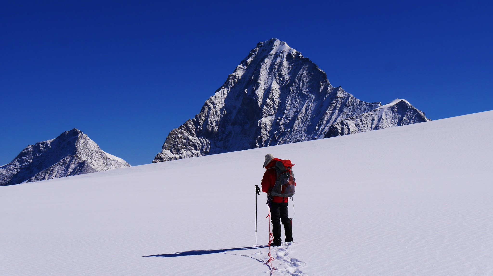 Haute Route. Day 2. Dent d'Hérens and Tete de Valpelline
 by
Alan, on Flickr
Dent d'Hérens and Tete de Valpelline
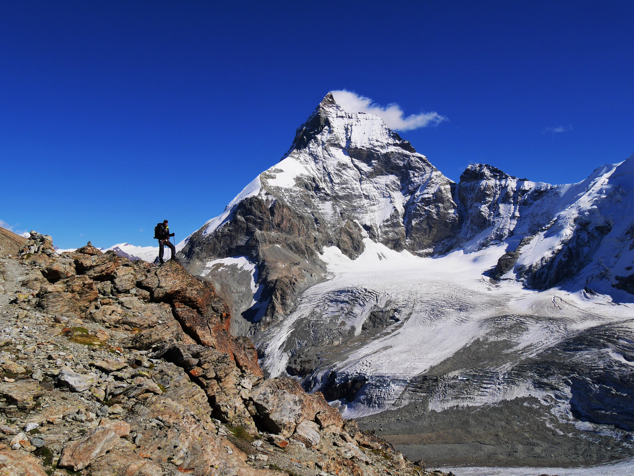
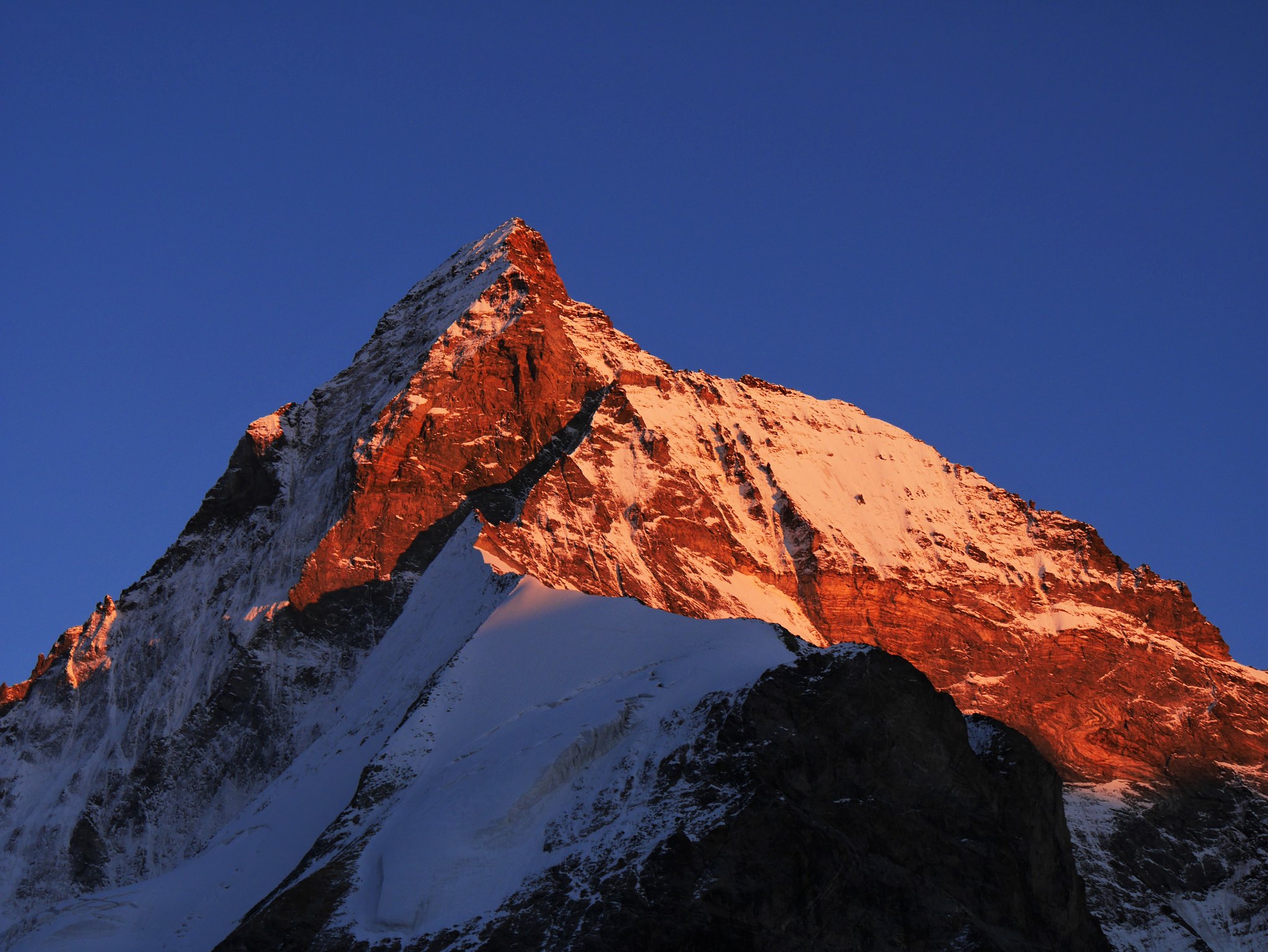
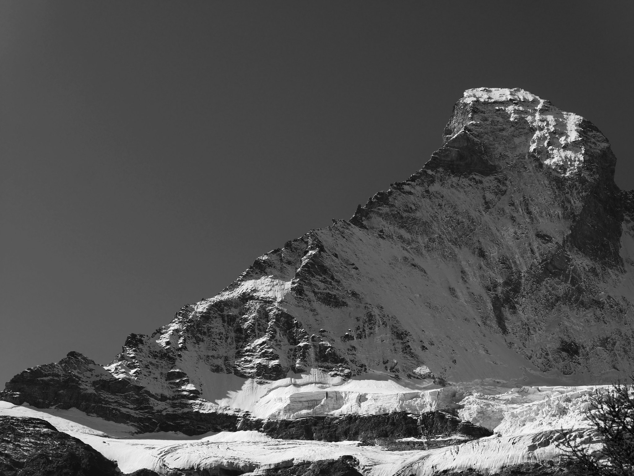
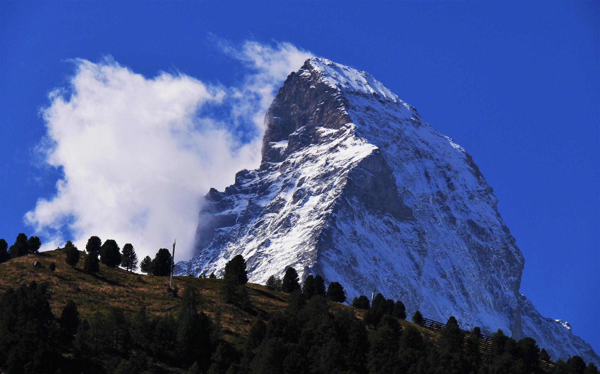
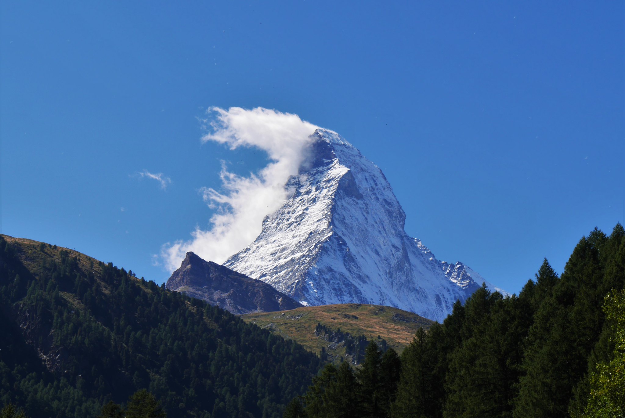
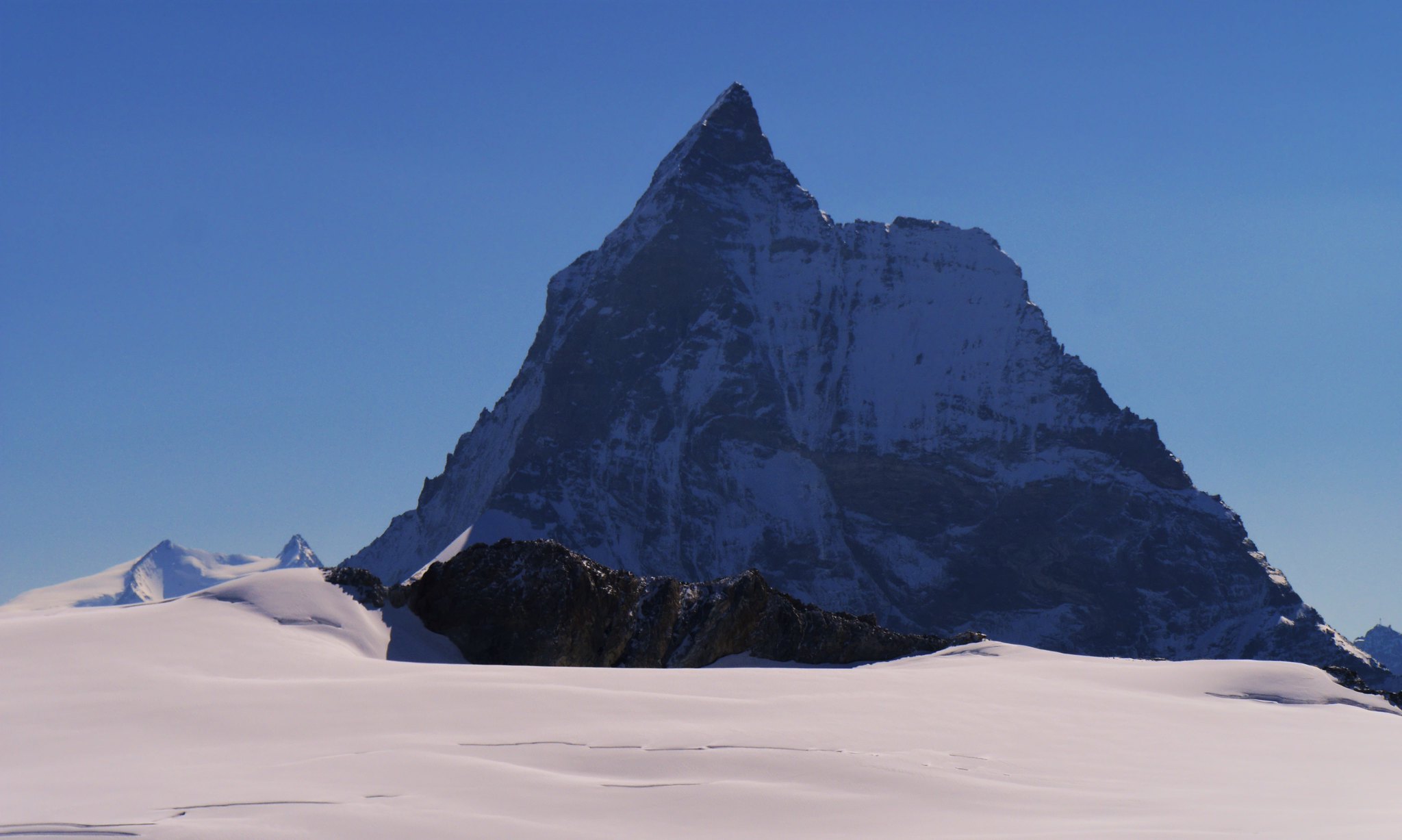 Haute Route. Day 2. The Matterhorn
 by
Alan, on Flickr
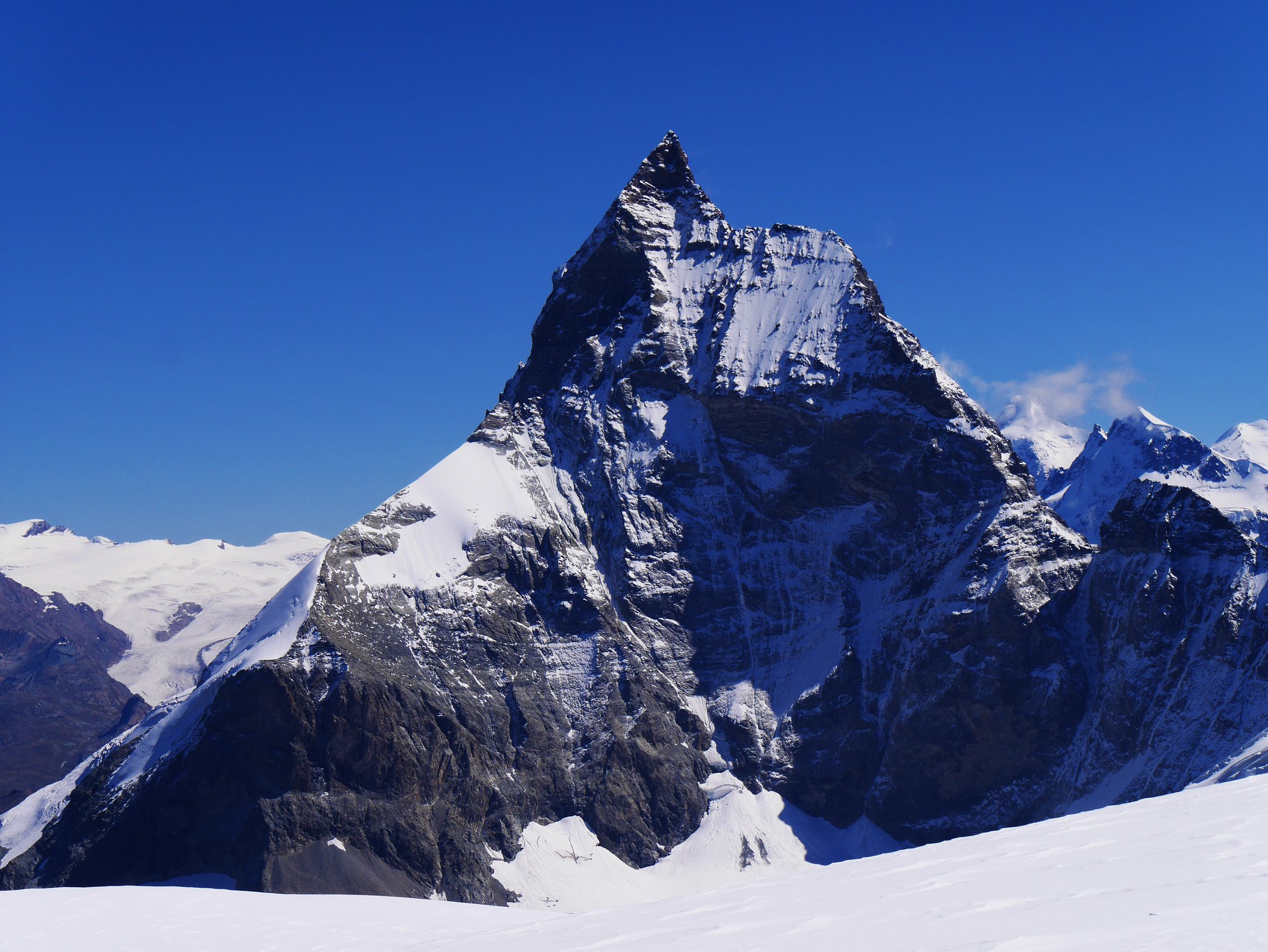
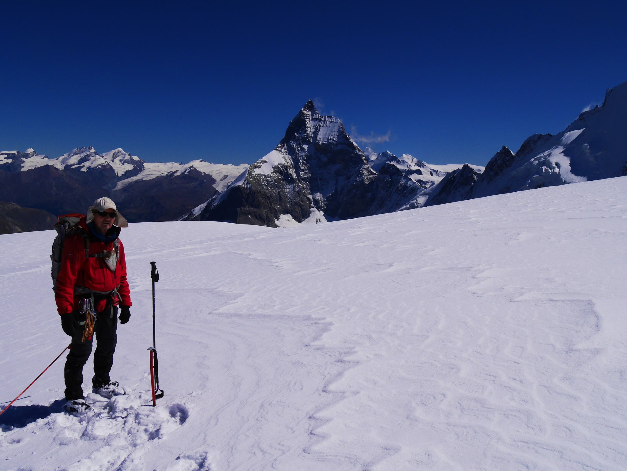
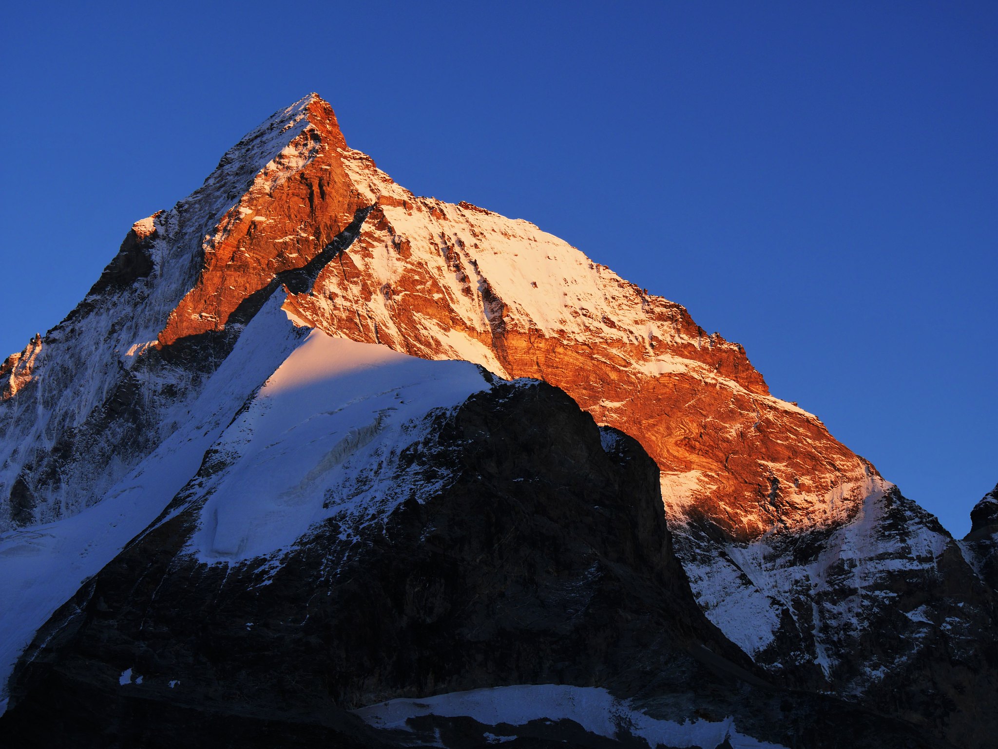
The amazing Matterhorn takes centre stage ahead.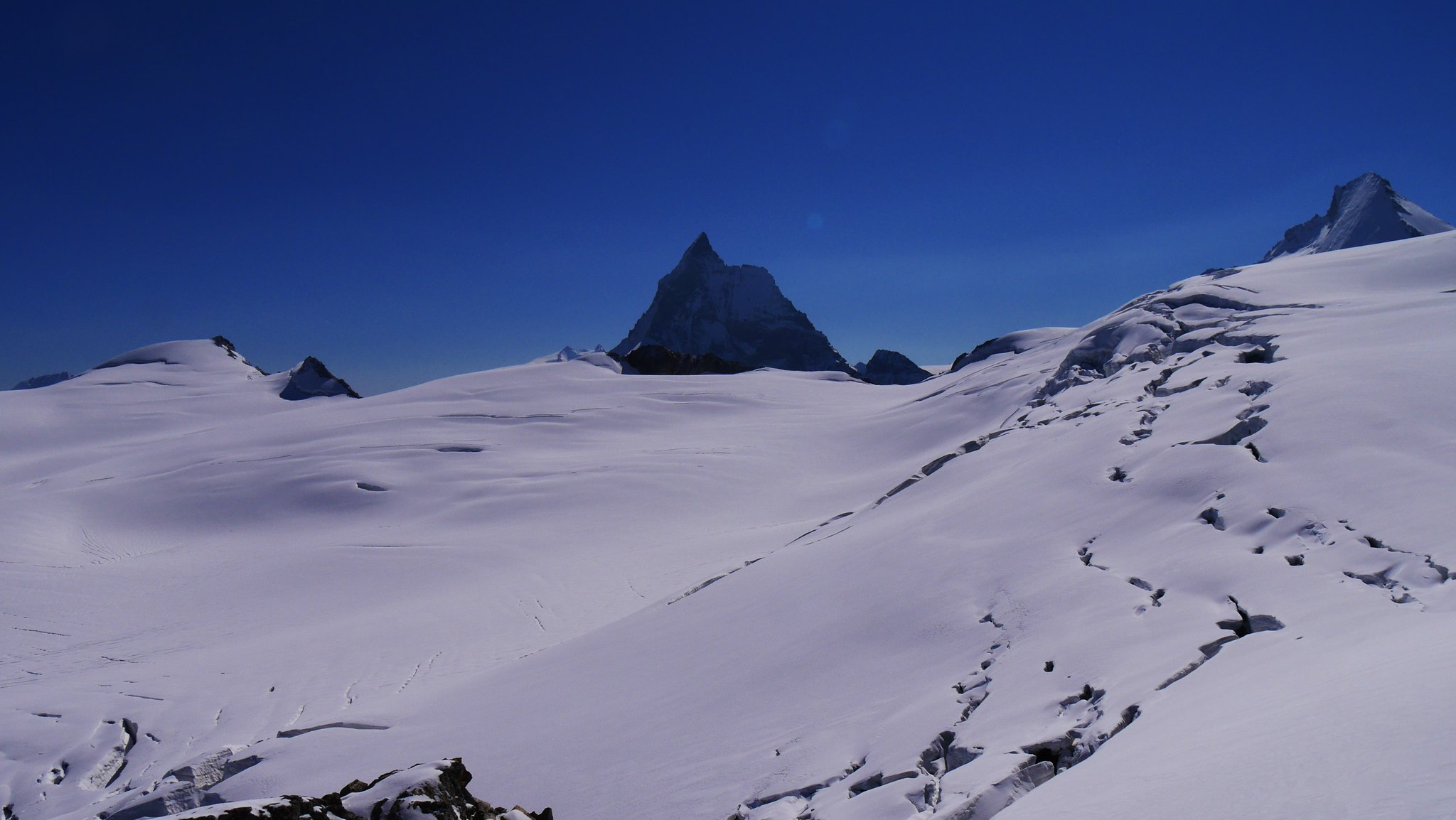 Haute Route. Day 2. The Matterhorn from the Mont Miné Glacier
 by
Alan, on Flickr
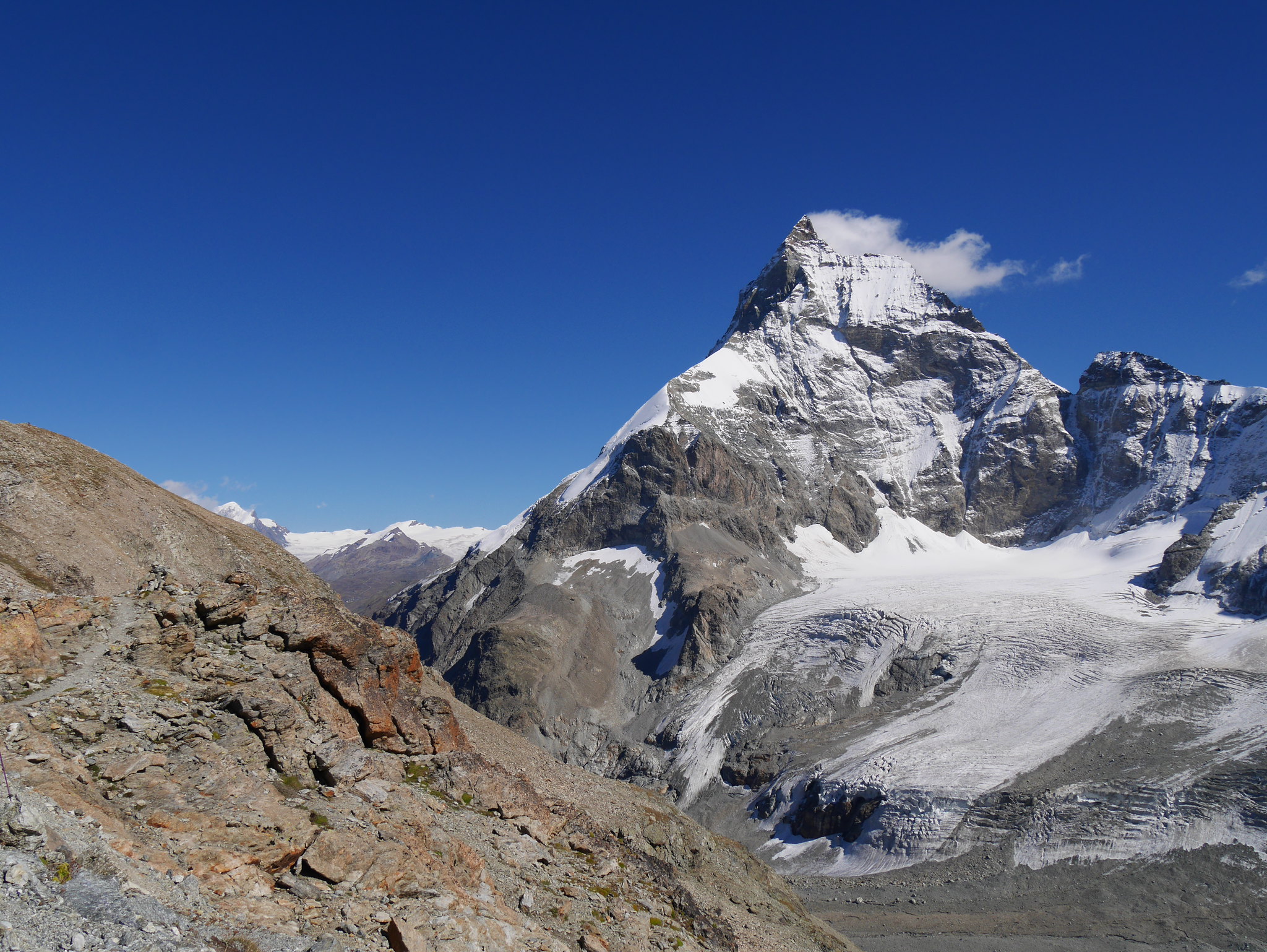
This “Col” is somewhat misleading as it’s more of a shoulder than a Col, the real Col is some 200mts lower to the north east.
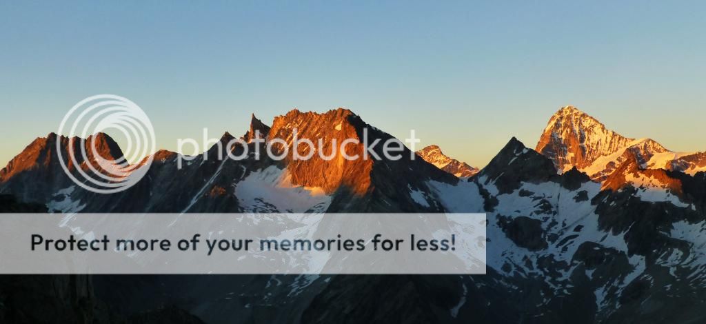
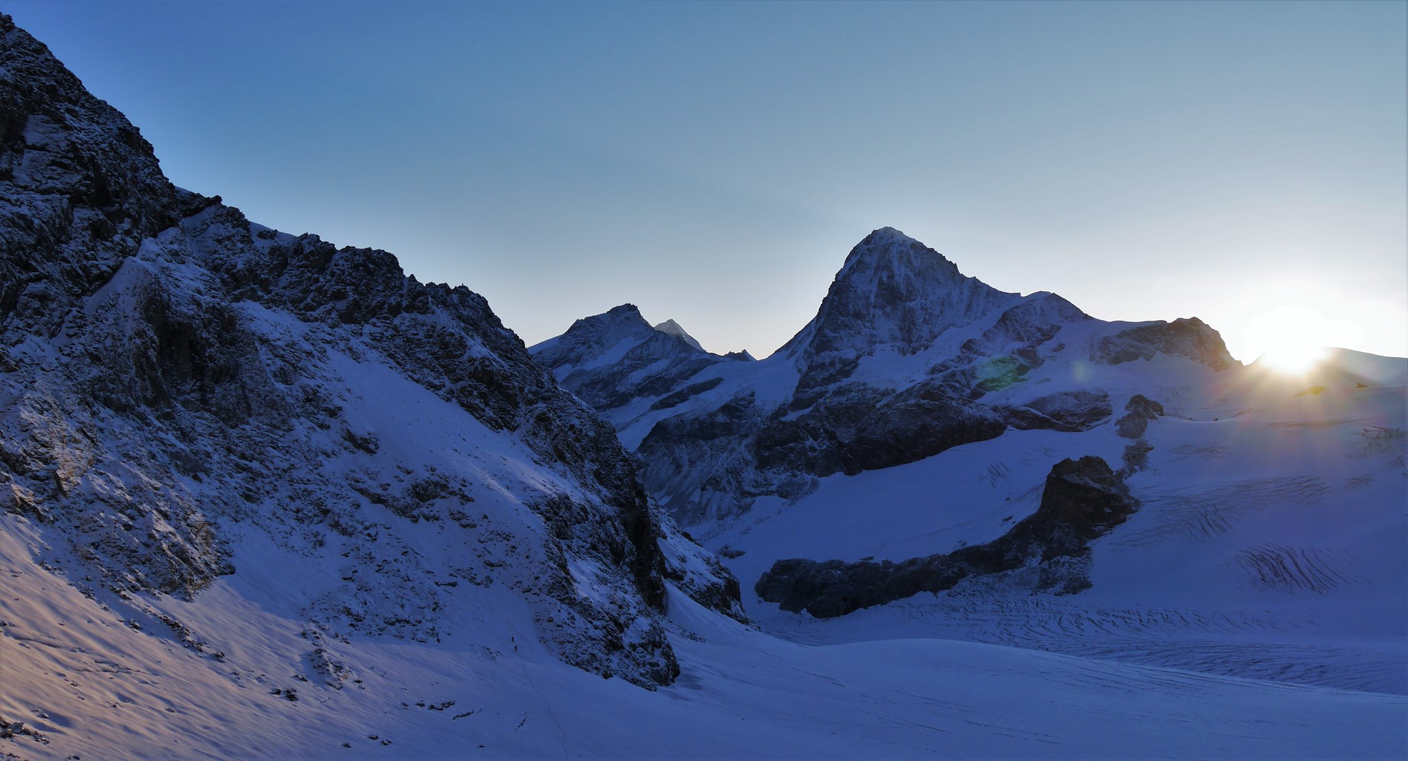
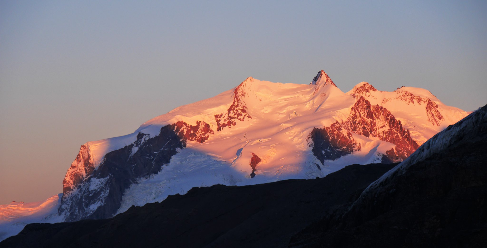
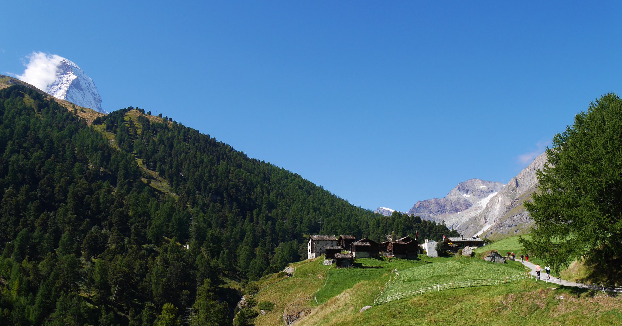
The views from our high point was spectacular, Dent Blanche, Obergabelhorn, Zinalrothorn, Weisshorn, and Dent d'Hérens just some of the mountains savoured, and not forgetting our first up-close view of the Matterhorn.
Simply stunning!
 Haute Route. Day 2. View from the Col de la Tête Blanche (3600mt)
 by
Alan, on Flickr
View from the Col de la Tête Blanche (3600mt) Haute Route. Day 2.Col de la Tête Blanche (3600mt)
 by
Alan, on Flickr
 Haute Route. Day 2. The Matterhorn and Dent d'Heroens
 by
Alan, on Flickr
 Haute Route. Day 2. The Matterhorn (2)
 by
Alan, on Flickr
The Matterhorn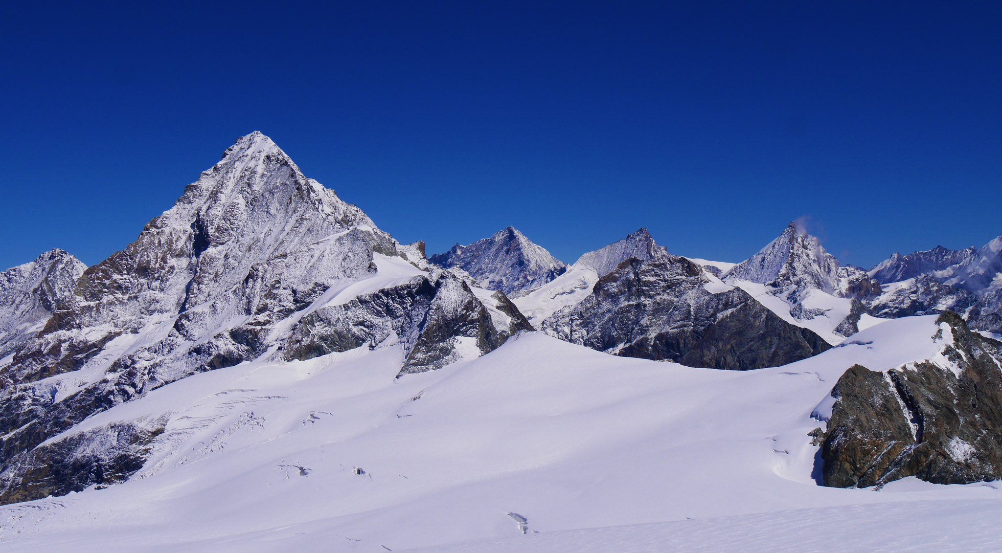 Haute Route. Day 2. Wandfueh lhs
 by
Alan, on Flickr
 Haute Route. Day 2.Posing. but out-posed by the Matterhorn
 by
Alan, on Flickr
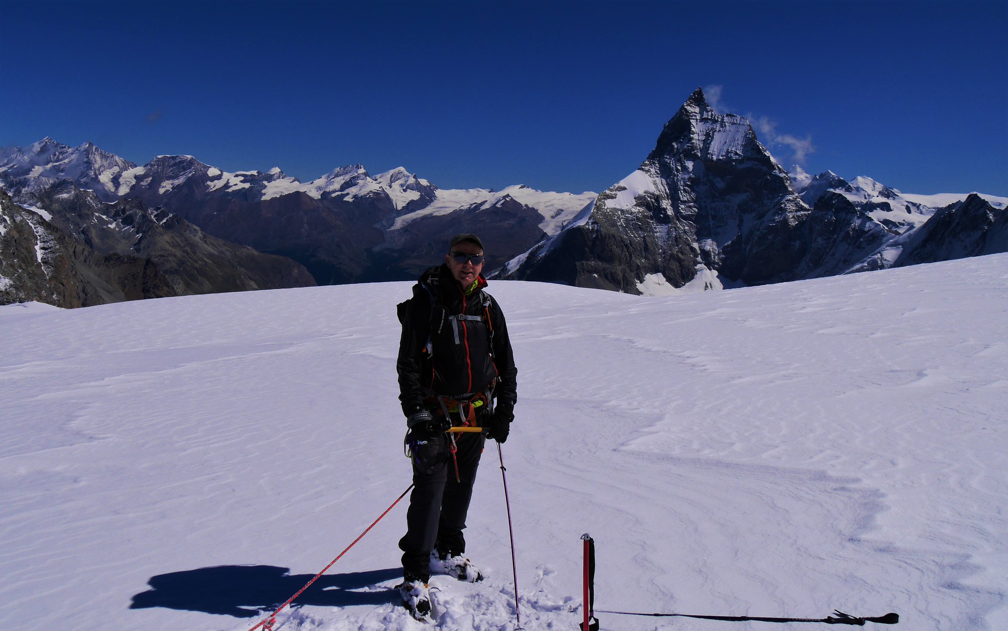 Haute Route. Day 2. Posing. but out-posed by the Matterhorn
 by
Alan, on Flickr
Posing. but out-posed by the Matterhorn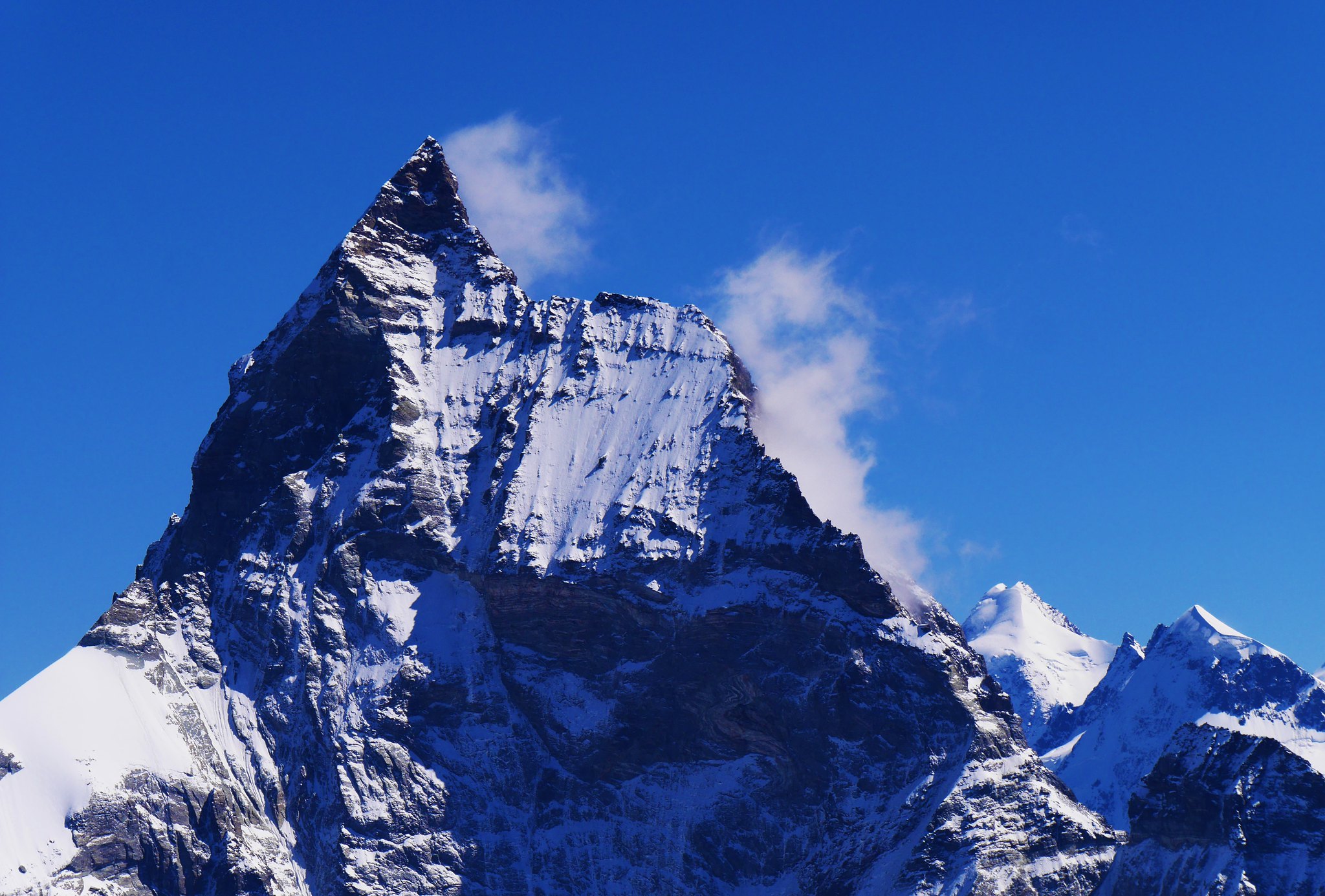 Haute Route. Day 2.The Matterhorn up close
 by
Alan, on Flickr
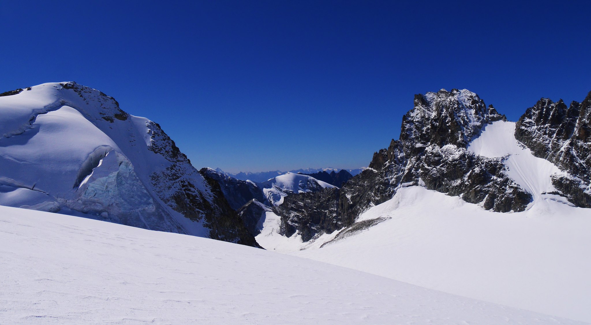
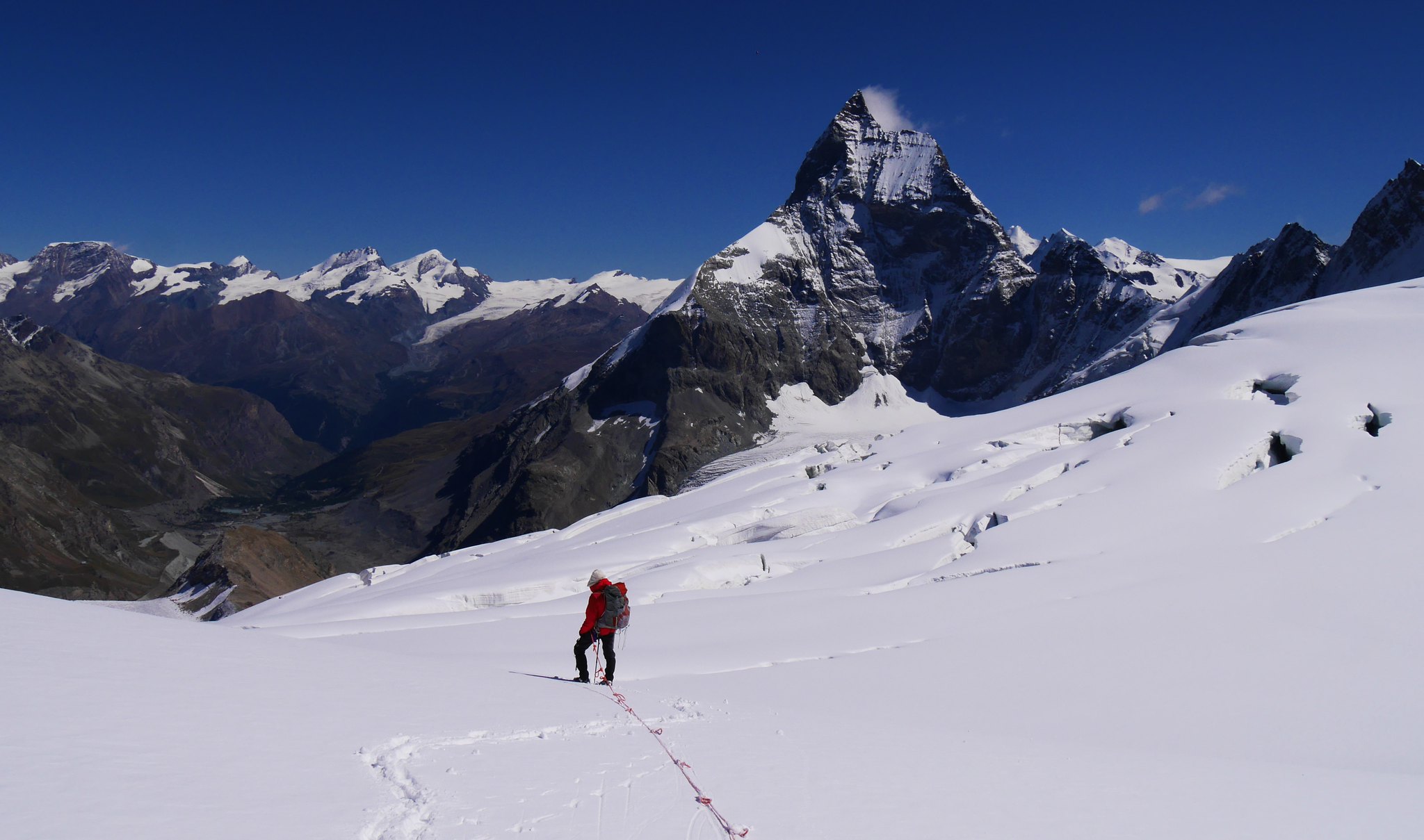
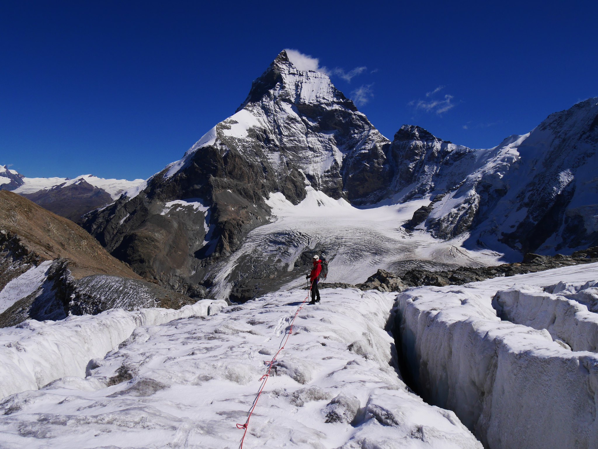
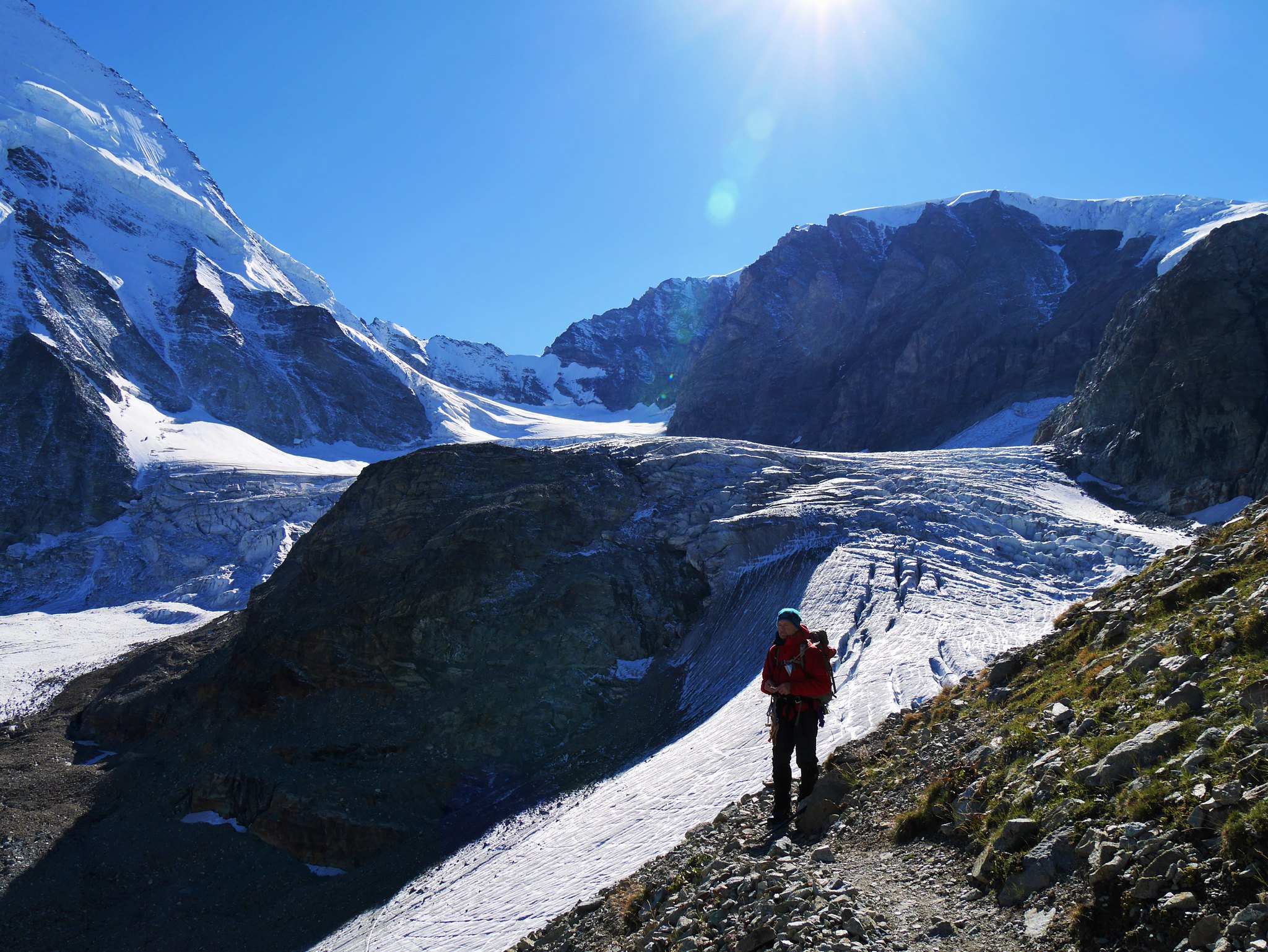
Tearing ourselves away from the views, it was time to descend the crevassed Stockji glacier, we weaved a route through the crevasses which make you feel somewhat alive…being so close to death!
We left the Stockji glacier at a rocky outcrop named Stockji, here a rough path zigzags down towards the lower reaches of the Zmutt glacier.
 Haute Route. Day 2. Heading down the Stockji glacier
 by
Alan, on Flickr
 Haute Route. Day 2. The crevassed Stockji glacier
 by
Alan, on Flickr
 Haute Route. Day 2. Never get fed up of this mountain view!
 by
Alan, on Flickr
 Haute Route. Day 2. The crevassed Stockji glacier (2)
 by
Alan, on Flickr
 Haute Route. Day 2. View up the Stockji glacier, the Col de la Tête Blanche middle top.
 by
Alan, on Flickr
View up the Stockji glacier, the Col de la Tête Blanche middle topA path traverses along the base of the Stockji to the moraines of the Schönbiel Glacier.
 Haute Route. Day 2. A fine view from Stockji (1)
 by
Alan, on Flickr
 Haute Route. Day 2. A fine view from Stockji (2)
 by
Alan, on Flickr
 Haute Route. Day 2. The path from Stockji
 by
Alan, on Flickr
 Haute Route. Day 2. Lower Zmutt glacier and the Schönbiel Hut LHS
 by
Alan, on Flickr
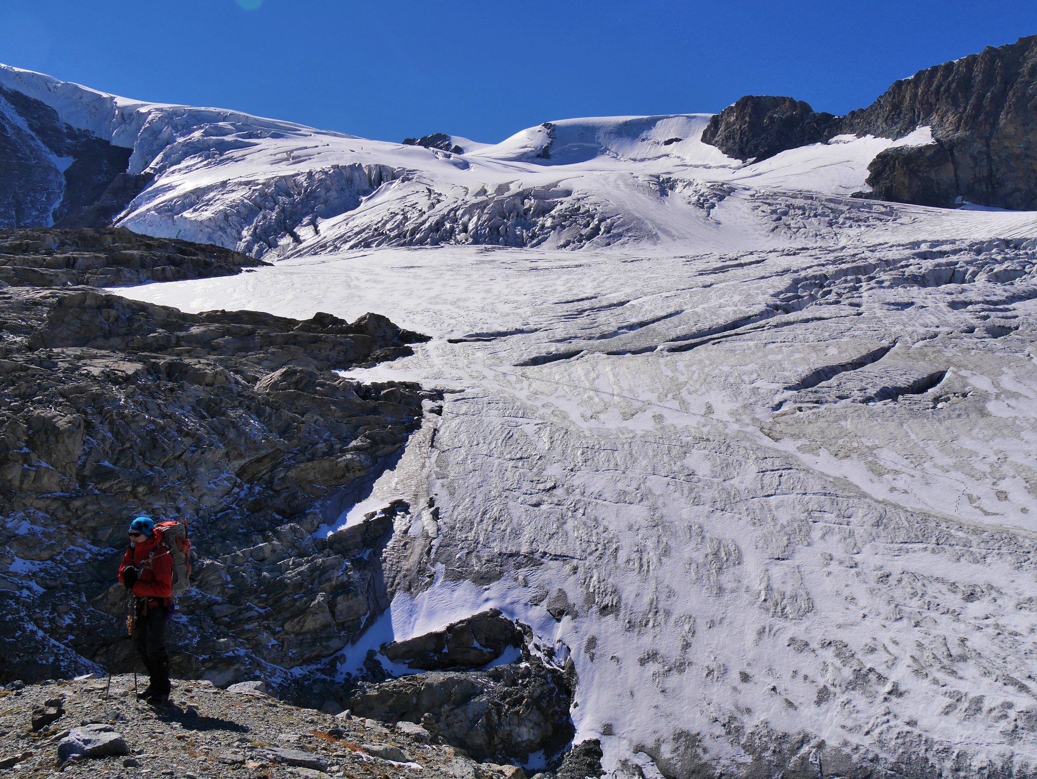
Here was a horrible crossing of the rubble-covered lower reaches of the glacier, every step a balancing act on countless boulders of various size and firmness.
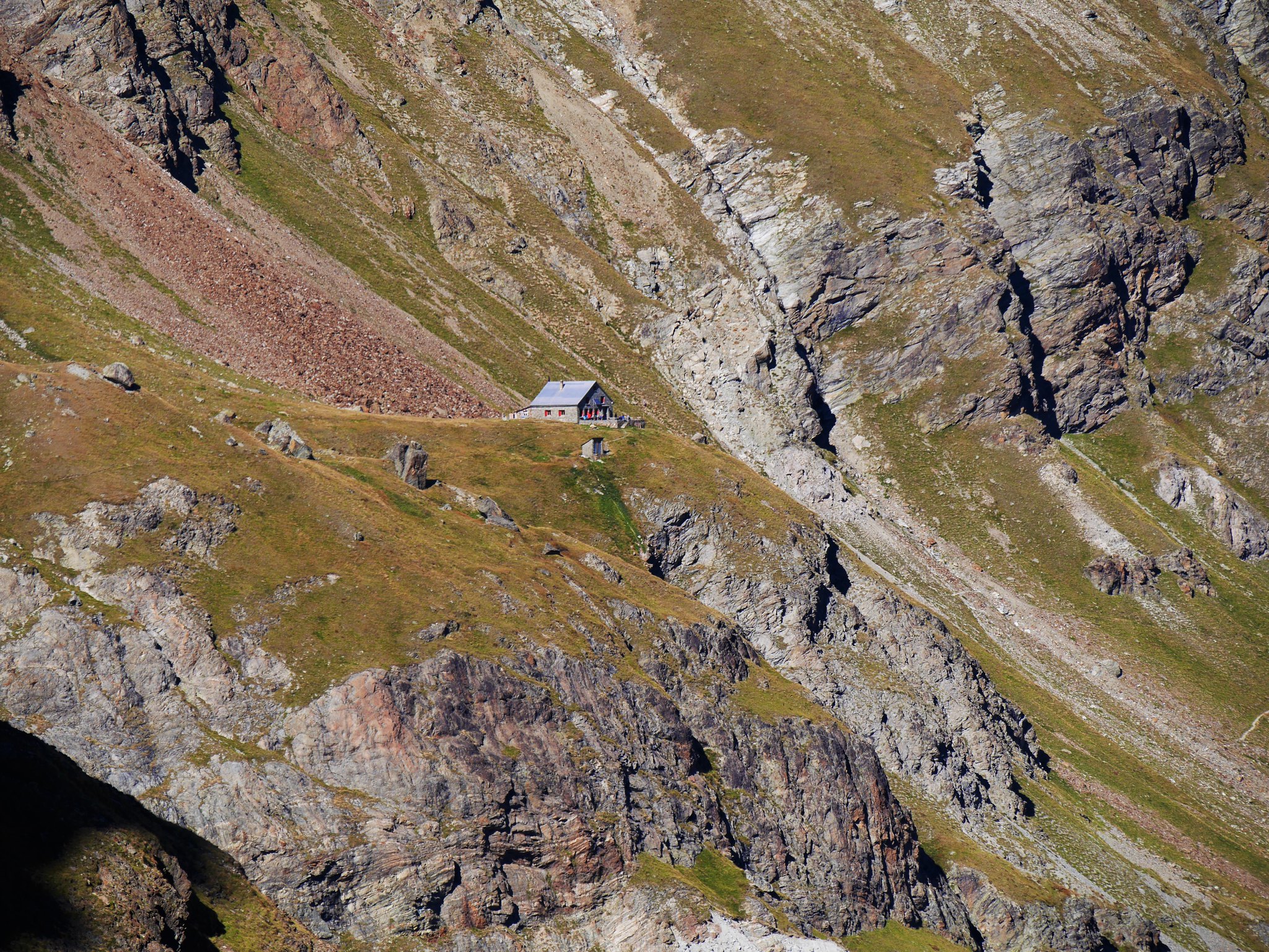 Haute Route. Day 2. Schönbiel Hut
 by
Alan, on Flickr
The Schönbiel Hut is tantalisingly close.The Hut was now tantalisingly close now being just a few hundred meters above us, but steep landside slopes blocked our way, so we had two options, follow a new path that looked equally horrible and a long detour back to the glacier, of try to find a way up the landslide slopes where the old path used to be…we chose the later and what turned out to be the wrong option, it was diabolically steep, loose and horrible, so much so Martin had to rescue me with a rope belay where I became crag (or rather loose rubble) fast, the crevasse were easy-peasy compared to that hell!
 Haute Route. Day 2. View up the lower Stockji glacier
 by
Alan, on Flickr
View up the lower Stockji glacierOnce at the Hut we collapsed with a beer to revive us, which was just the medicine…as well as the stunning views which were enough to revive the soul. As the sun set we were treated to a lovely Alpine glow on the high peaks.
 Haute Route. Day 2.Sunset from the Schönbiel Hut
 by
Alan, on Flickr
 Haute Route. Day 2.Sunset from the Schönbiel Hut (2)
 by
Alan, on Flickr
 Haute Route. Day 2. The Matterhorn Alpen glow
 by
Alan, on Flickr
 Haute Route. Day 2. Relaxing at the Schönbiel Hut
 by
Alan, on Flickr
Happy and contented.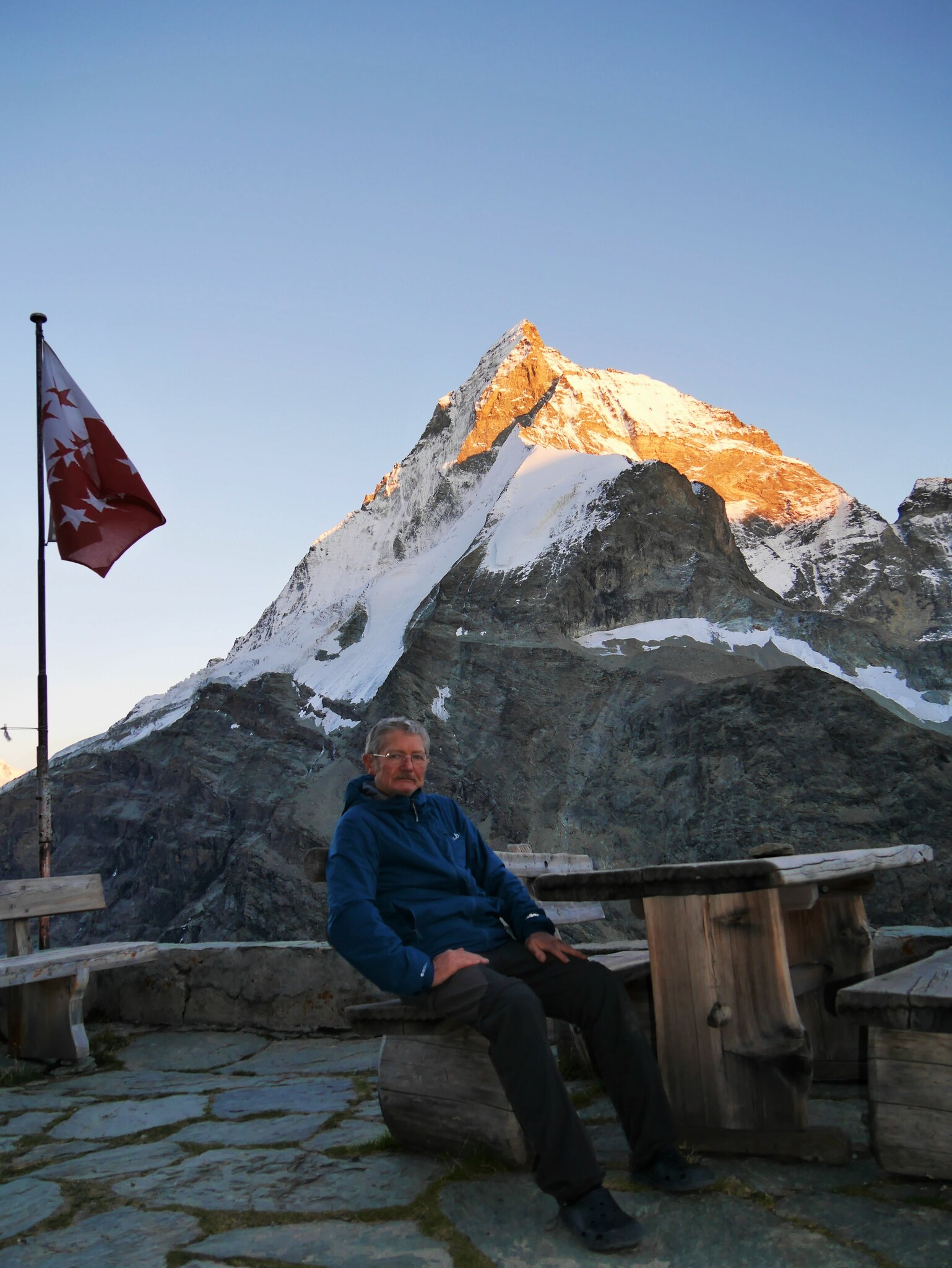 Haute Route. Day 2. It's serious stuff the mountaineering! lol
 by
Alan, on Flickr
Serious stuff this mountaineering!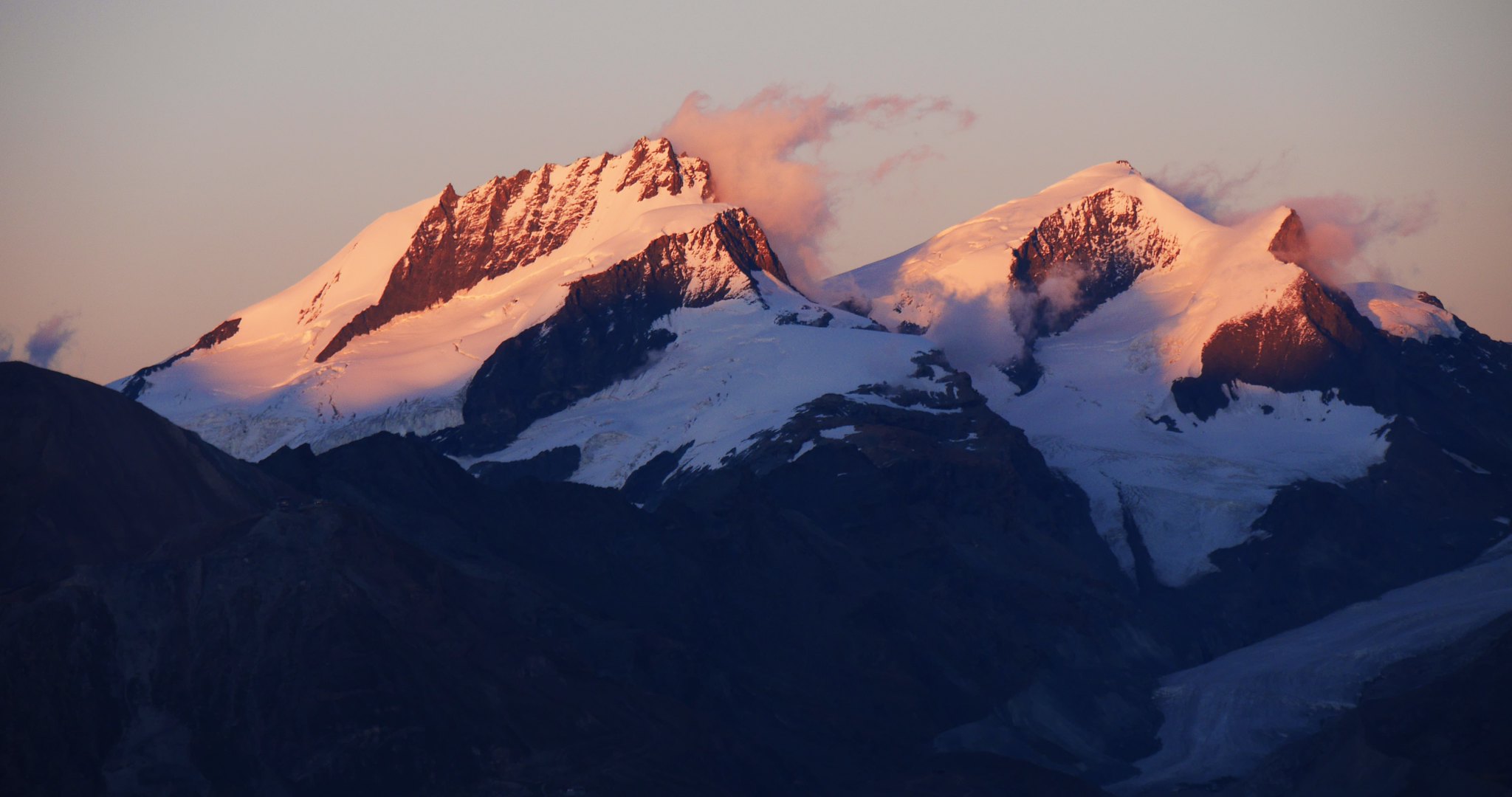 Haute Route. Day 3. Sunrise from Schönbiel hut
 by
Alan, on Flickr
 Haute Route. Day 3. Sunrise from Schönbiel hut (2)
 by
Alan, on Flickr
Haute Route. Day 3. Sunrise from Schönbiel hut (2) by
Alan, on Flickr
 Haute Route. Day 3. Alpine glow, the Matterhorn
 by
Alan, on Flickr
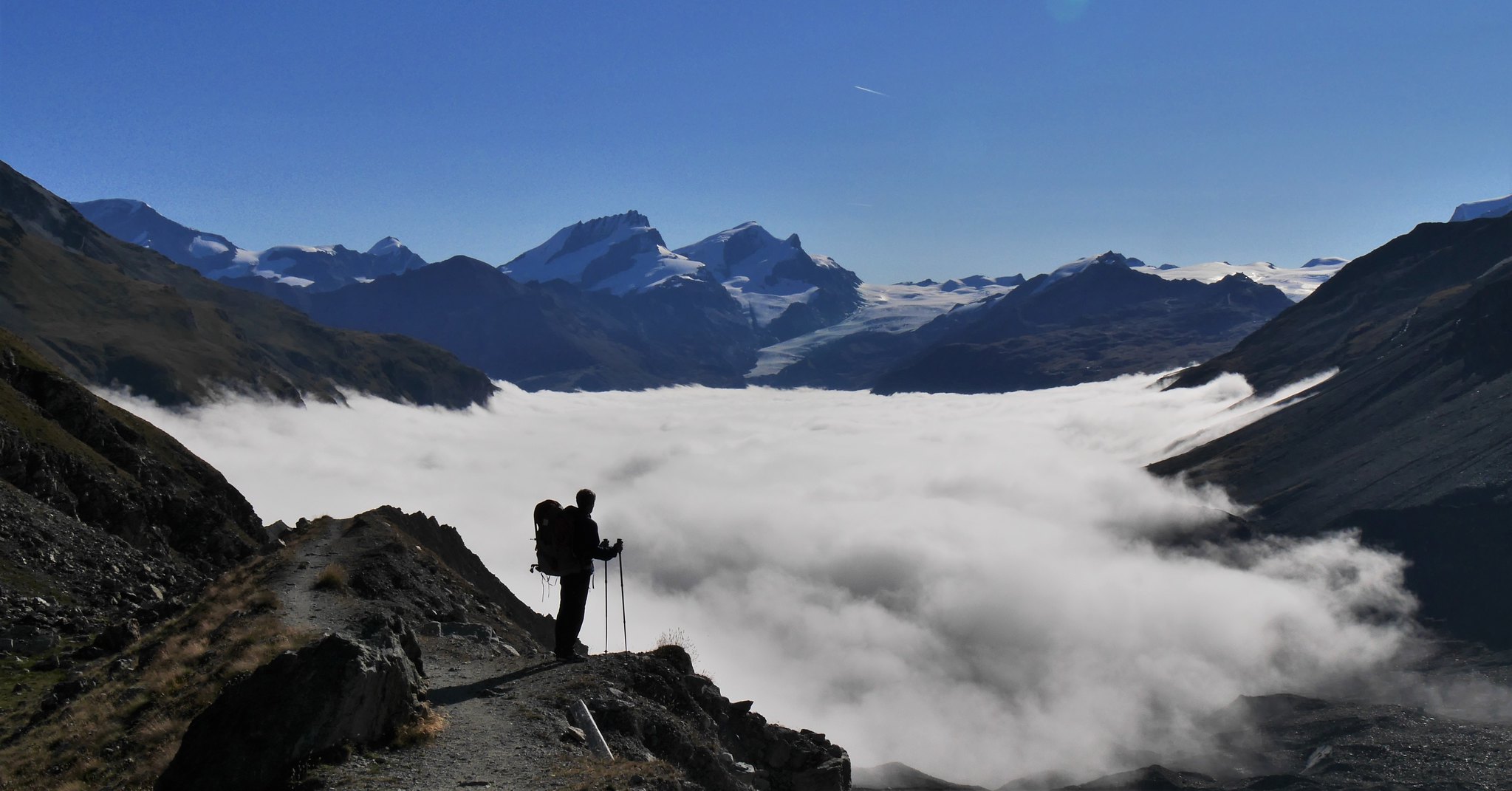
Day 2. Sun 6th Sept.Schonbiel Hut to Zermatt, Distance: 11km. Descent: 1080mDuration: 4.15hrs.Weather: Sunny, calm, warm.We were up as the sun rose across a cloud filled valley…another stunning day.
 Haute Route. Day 3. Valley cloud from the Schönbiel hut
 by
Alan, on Flickr
 Haute Route. Day 3. Alpine glow, the Matterhorn (2)
 by
Alan, on Flickr
 Haute Route. Day 3. The Stockji glacier
 by
Alan, on Flickr
 Haute Route. Day 3. The Stockji glacier (2)
 by
Alan, on Flickr
 Haute Route. Day 3. Schönbiel hut sunrise
 by
Alan, on Flickr
 Haute Route. Day 3. Schönbiel hut sunrise (2)
 by
Alan, on Flickr
 Haute Route. Day 3. Schönbiel hut
 by
Alan, on Flickr
 Haute Route. Day 3. Schönbiel hut (2)
 by
Alan, on Flickr
 Haute Route. Day 3. Schönbiel hut, main room
 by
Alan, on Flickr
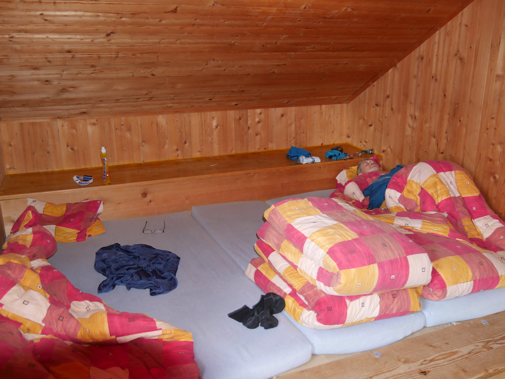 Haute Route. Day 3. Schönbiel hut bedroom
 by
Alan, on Flickr
Martin missed the sunrise as you can see. We were the last to leave, our route an easy walk down to Zermatt.
 Haute Route. Day 3. Schönbiel hut (3)
 by
Alan, on Flickr
 Haute Route. Day 3. Schönbiel hut (4)
 by
Alan, on Flickr
 Haute Route. Day 3. Schönbiel hut to Zermatt path
 by
Alan, on Flickr
 Haute Route. Day 3. Schönbiel hut to Zermatt path (2)
 by
Alan, on Flickr
 Haute Route. Day 3. Schönbiel hut to Zermatt path (3)
 by
Alan, on Flickr
 Haute Route. Day 3. North Face of the Dent d'Hérens
 by
Alan, on Flickr
 Haute Route. Day 3. Schönbiel hut to Zermatt path (4)
 by
Alan, on Flickr
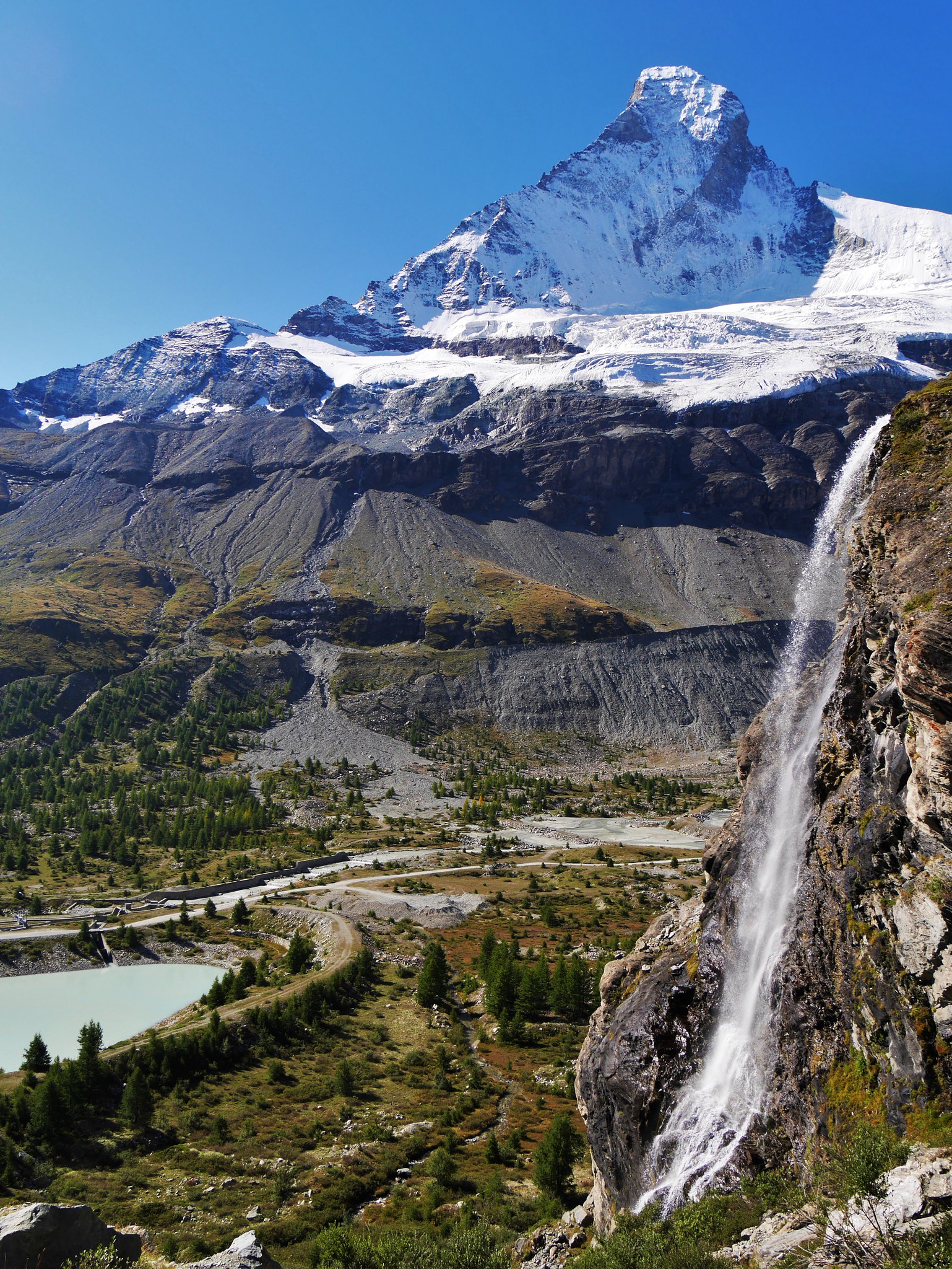 Haute Route. Day 3. Waterfall (1)
 by
Alan, on Flickr
 Haute Route. Day 3. Waterfall (2)
 by
Alan, on Flickr
 Haute Route. Day 3. View back up the glacier
 by
Alan, on Flickr
 Haute Route. Day 3. The Matterhorn's Hornli ridge
 by
Alan, on Flickr
 Haute Route. Day 3. Matterhorn
 by
Alan, on Flickr
 Haute Route. Day 3. Matterhorn's summit
 by
Alan, on Flickr
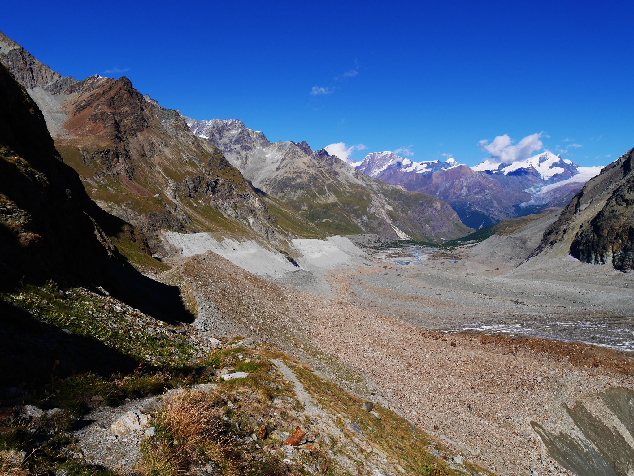
The massive North Face of the Matterhorn loomed above us across the remains of the Zmutt Glacier as we dropped down to Zermatt following gentle moraine crests, grassy trails and finally a well-trodden tourist trail through the charmingly preserved village of Zmutt.
 Haute Route. Day 3. The charmingly preserved village of Zmutt (1)
 by
Alan, on Flickr
Zmutt. Haute Route. Day 3. The charmingly preserved village of Zmutt (2)
 by
Alan, on Flickr
 Haute Route. Day 3. The charmingly preserved village of Zmutt (3)
 by
Alan, on Flickr
 Haute Route. Day 3. The charmingly preserved village of Zmutt (4)
 by
Alan, on Flickr
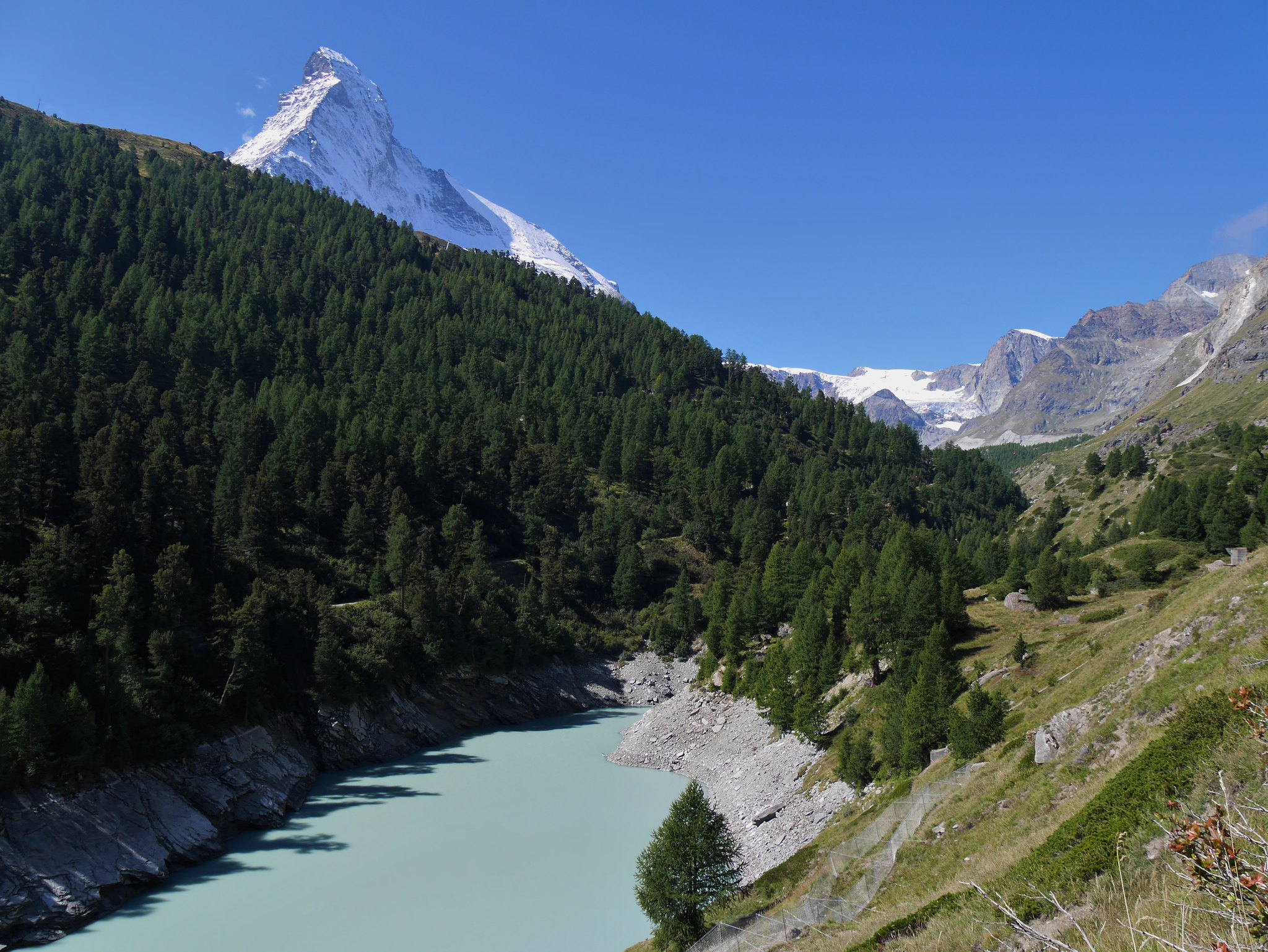
 Haute Route. Day 3. The Matterhorn from Zermatt
 by
Alan, on Flickr
Thirty minues later we were in the hustle and bustle of beautiful Zermatt.
We celebrated with a high five and a beer feeling totally fulfilled, it had taken us 2 years and 2 trips, with some wonderful memories of what must rank as one of the best high level mountain treks in the World.
Not a bad effort for two guys who now have bus passes!
A video I made of the 2nd part of the trek can be seen here…https://www.youtube.com/watch?v=G4-YF470gtU My video of our 5 day trek can be seen here... http://www.youtube.com/edit?video_id=iY36xV2Tno0&ns=1or here if that link does not work....
