free to be able to rate and comment on reports (as well as access 1:25000 mapping).
No, not a sweeping victory for the Tories in the centre of Scotland, nor a reflection on the effect this weekend's cold winds can have on the anatomy but the achieving of my target of getting all the Munros south of the Great Glen climbed by the end of this year.


The Aonachs had been targeted for last week’s Kinlochleven meet, but after 2 hard days in the Mamores in snow, I just didn’t have the energy to tackle them. So another weekend, another set of hills…
Before that, however, there was the issue of the weather forecast. Saturday was awash with severe gale warnings over the whole country and it looked sensible to stay indoors. However, we’re not sensible.

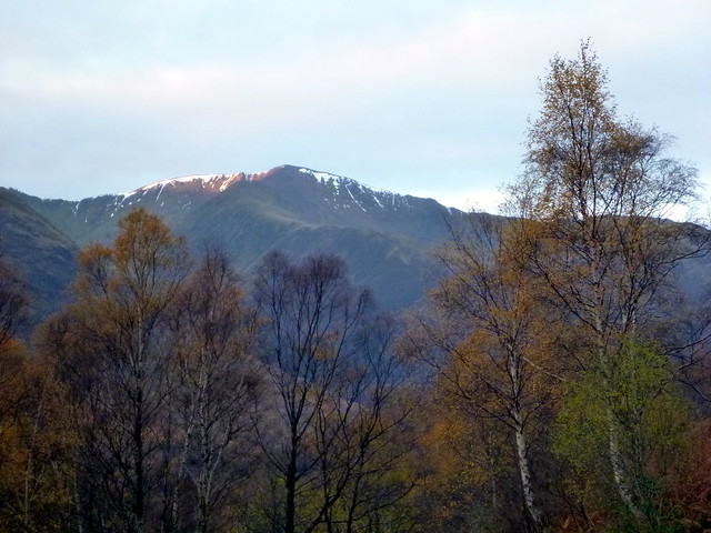
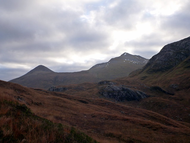
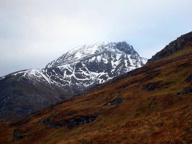
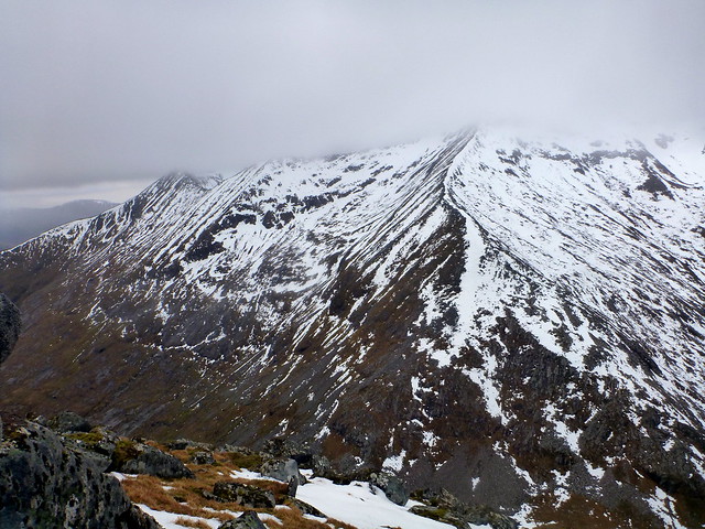
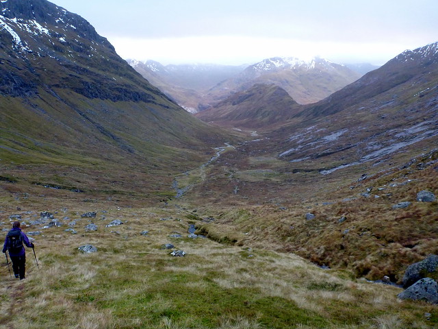
An opportunity for Allison to play catch-up with some hills I’d already done was available, and I thought that Beinn Challuim might be worth a punt – should have a bit of shelter from the west wind from the hills of Orchy and has nothing too scary to get blown off either. I’d done Challuim last December, in miserable weather and had hoped for some views on any re-ascent – but we were not going to get these today.
Waterproofs on at the start of the walk, up past Kirkton farm and the wee cemetery then splodging through bog and bracken.
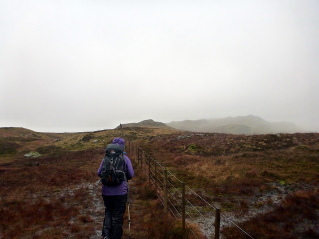 P1050198
 by
23weasels, on Flickr
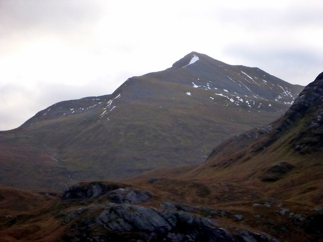
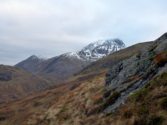
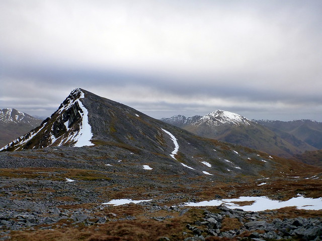
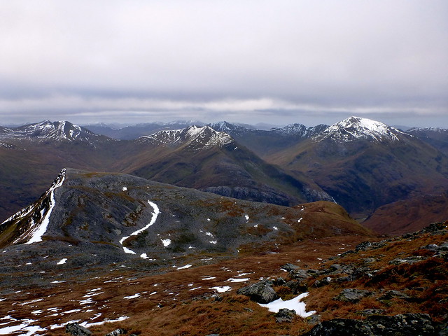
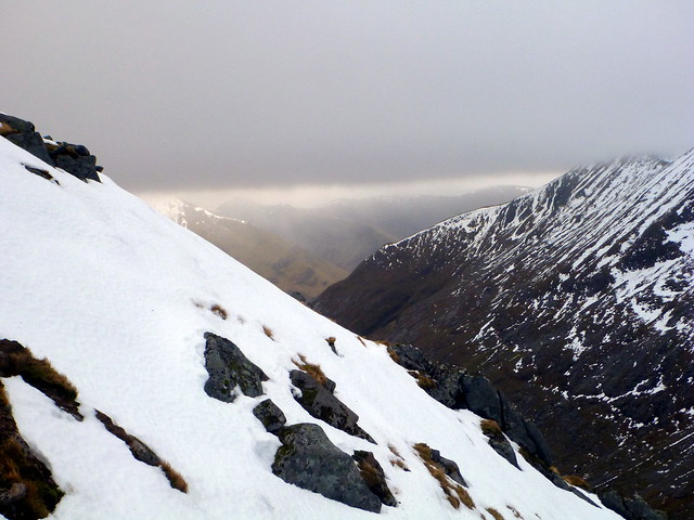
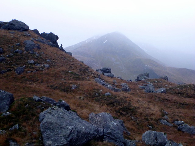
Challuim is a fairly gradual and steady ascent, and at first the wind didn’t seem to be too strong. As we reached the 850m mark however, the full force of the gale was unleashed. We met a woman coming down who’d baled out at this point, but – being us – we pressed on. At times I was brought to a complete standstill, at times Allison was walking forward but travelling backwards “I never knew I could Moonwalk” says she…the zigzags in the path meaning that you were impeded then propelled turn about. Must be that stone in weight I’ve gained in the last few months keeping me grounded…

Up to the cairn at 998m then on to the wee bit of ridge heading for the summit.
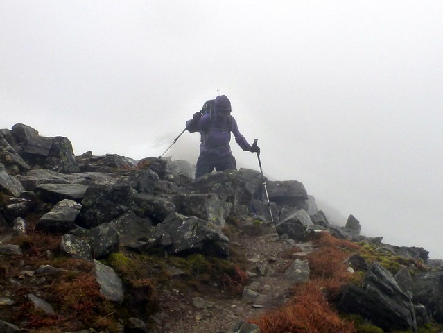 P1050199
 by
23weasels, on Flickr
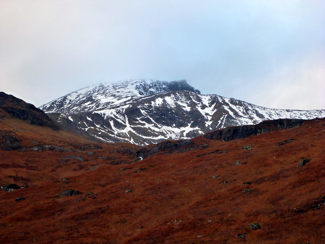
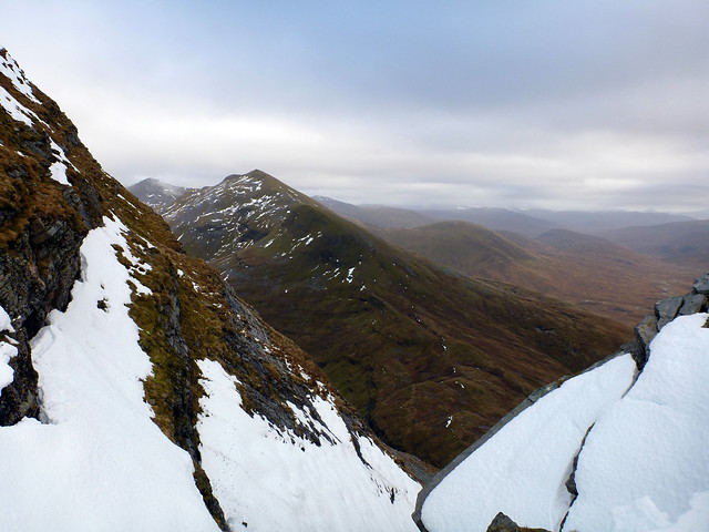
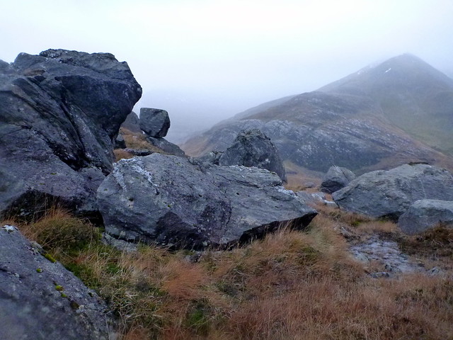
This involved a bit of care, as the gale was blowing crosswise, trying to push us over into Coire Challuim, but we resisted, scrambling over the rocks further down from the crest path and finally attaining the peak. Weirdly it was less windy right at the top and we were able to find enough shelter to have some lunch. No tick for me, but was Allison’s 182 hill, meaning she could start “countdown from 100” mode.

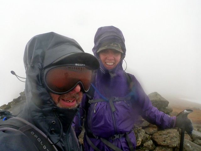 P1050201
 by
23weasels, on Flickr
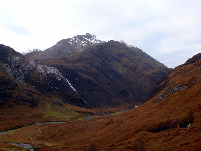
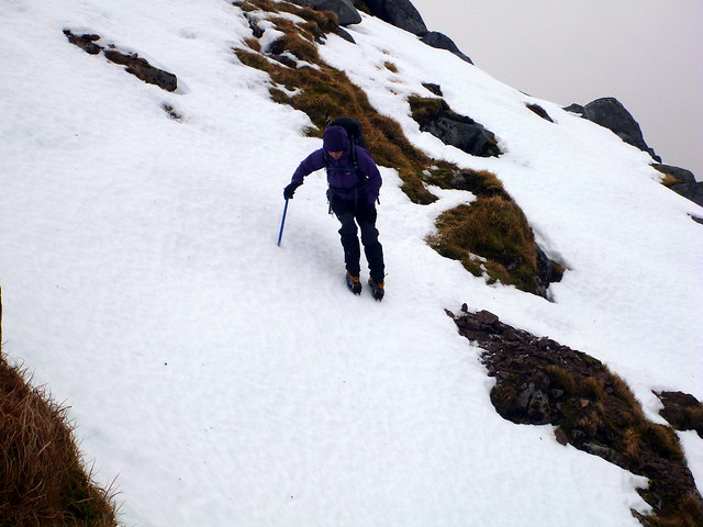
Following the same path back down there were some entertaining pirouettes in the wind and bog – one of which unfortunately twisted the Sick Kid’s dodgy knee. Back at the car, soaked through, with my waterproof trousers failing for the first time to keep my innards dry I was feeling somewhat grouchy. Met 4 guys at the car park who’d given up, also around the 850m mark. Should have kept going, guys! Then it was up to Fort William for stage two. We called into the town centre to get a couple of things – including waterproof tape to effect emergency repairs on Sick Kid’s waterproof trousers, which had developed a 3” gash during our exploits

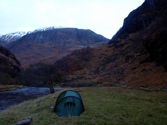
. The main shopping street looked terribly derelict on a wet Saturday afternoon – it seemed there were more shops closed down that places open. Sad. Fortified by a pint in the Grog & Gruel we set off up the Glen Nevis road for Steall Meadows to camp for the night. Had to make the trip from the car park to our camp-spot by the light of headtorches, not even 5pm yet. Below to our right, the Water of Nevis roared and thundered away, its white spume visible despite the twighlight. Pitched in rather more wind than I expected and hunkered down for the night. We were both still feeling pretty wretched from our colds that have been lingering for the last couple of weeks, so there was much coughing and spluttering. About 8pm the tent was lit, as if someone had switched on an overhead fluorescent tube, by the light from a full moon. Too cold and miserable to go out and investigate the views however.

Everything takes longer in the cold. Getting out of the warm sleeping bag, getting dressed, cleaning the porridge pot in freezing river water (thanks, Ally) – it all takes more time. Despite getting up at 6.45 it was after 8.30 by the time we’d got the tent disassembled and back to the car, with rucksacks packed for the day ahead.
 P1050204
 by
23weasels, on Flickr
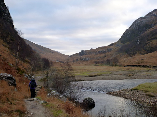
We met a woman who was going to climb Sgurr Choinnich Mor from here – a nice idea. I knew our walk would be quite lengthy – Ceasar had taken 8 hours last weekend and he walks faster than I do, so I’d hoped to be on the hills by 8 – didn’t manage to get back there til 9. Another worry was Sick Kid’s knee – the injury from yesterday had taken its toll and she was clearly struggling along the track to Steall Meadows. I wondered if she’d manage what I assumed would be a steep up and down. She is a stubborn creature and pressed on regardless, but with considerable discomfort, manifest in an unusual lack of levity. She knew that the option was to spend 8 hours sitting in the car waiting for me, I guess
.
 P1050205
 by
23weasels, on Flickr
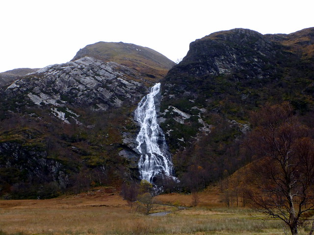
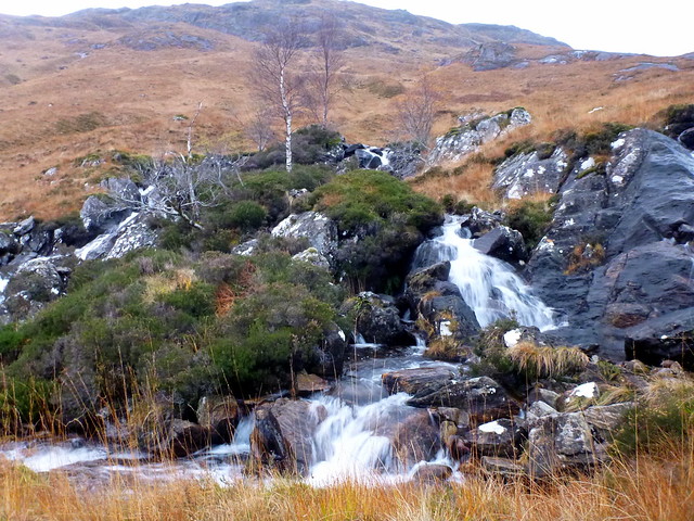
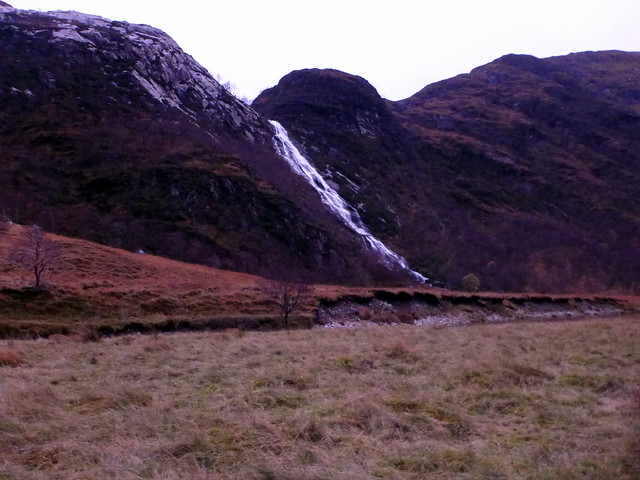
Steall Falls
 P1050208
 by
23weasels, on Flickr
The initial section passes An Steall falls and the Mountaineering Hut with its steel wire bridge we remembered fondly from doing the Ring of Steall. The meadows open out further as you go around the corner at the falls and approach the ruins. The grasses had changed from summer green to autumn rusty brown.
 P1050209
 by
23weasels, on Flickr
Our ascent route on the Right
 P1050212
 by
23weasels, on Flickr
Sgurr Choinnich Beag and Mor were ahead of us, which the bigger hill still looking shapely from this angle.
 P1050215
 by
23weasels, on Flickr
 P1050216
 by
23weasels, on Flickr
To our left, the Ben loomed, with zebra stripes of snow on the iron grey flanks the only vestiges of last weekend’s snowy blanket.
 P1050217
 by
23weasels, on Flickr
An Gearanach
 P1050219
 by
23weasels, on Flickr
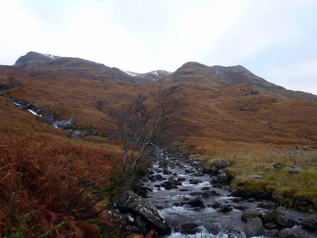
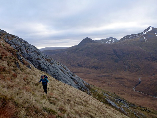
Over the footbridge and into sometimes trackless heather and bog up the shoulder of Sgurr a Bhuic – steep section between 600 and 800m proving particularly testing for Ally’s knee and had us both coughing like a pair of Victorian consumptives.

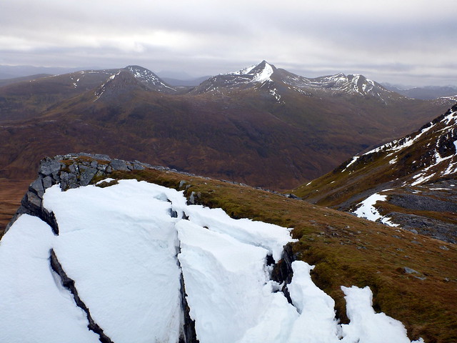
Up onto a flat section to take breath, and take in some good views back to the Ring of Steall and the Ben, then heading round the north side of Sgurr a Bhuic through scree rather than ascend the top (shame!).
"path" up to the R of the stream
 P1050220
 by
23weasels, on Flickr
 P1050223
 by
23weasels, on Flickr
 P1050227
 by
23weasels, on Flickr
Steep hillside
 P1050228
 by
23weasels, on Flickr
Panorama south to the Mamores
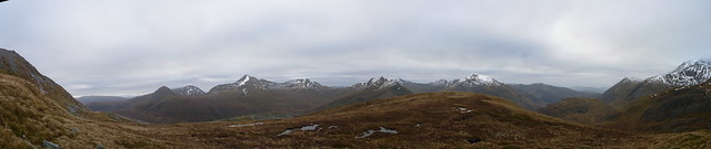 P1050231_Panorama
 by
23weasels, on Flickr
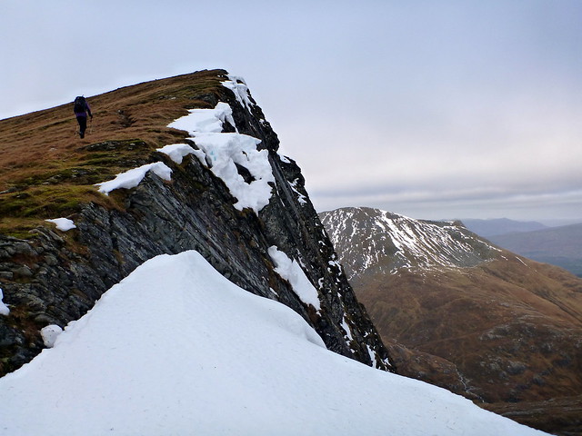
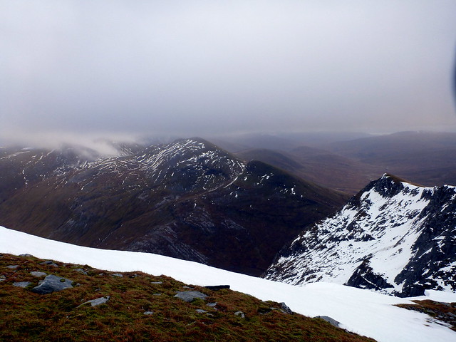
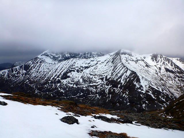
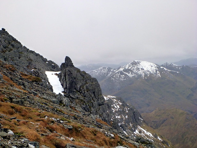
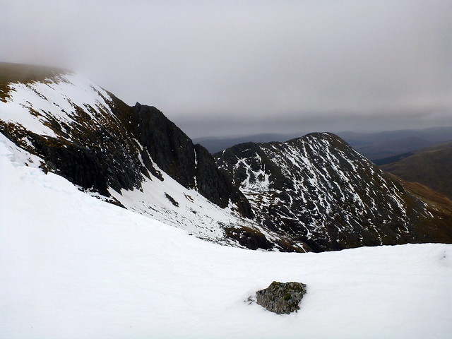
Onwards, to the pointy fin of Stob Coire Bhealaich with views SE to the neighbouring Mamores – Binnien Mor having shed virtually all her snow since we were up there last Saturday.. Some of the cliff faces below us were still plastered with thick plates of snow, and most of the cornices were in perilous state.
Stob Coire bhealaich
 P1050237
 by
23weasels, on Flickr
 P1050238
 by
23weasels, on Flickr
View to Binnien Mor
 P1050239
 by
23weasels, on Flickr
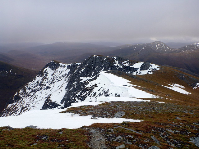
Heading for the top of Aonach Beag itself, there’s a clear path that heads off to the left, appearing to contour the peak – don’t know where it ends up, but we took the fainter path following the edge (not too closely!) with views down into An Aghaidh Gharbh. Crampons were on for the last 75m as the snow was firm and frosty. Spying the cairn on a field of white, we cautiously headed over – mindful of the time Hamish Brown almost led his party of schoolkids over the edge when the cairn was covered in snow and the only identifying feature was orange peel around the summit. No peel today. We headed north a short way before finding some rocky shelter to eat some food – in the process I managed to stand on my compass with my crampons, leaving what looked like mini-aircraft wreckage in the snow.

Up towards the summit
 P1050240
 by
23weasels, on Flickr
 P1050242
 by
23weasels, on Flickr
Grey mist coming over the Grey Corries
 P1050243
 by
23weasels, on Flickr
Looking back along our path
 P1050244
 by
23weasels, on Flickr
Summit Aonach Beag
 P1050245
 by
23weasels, on Flickr
Death of a compass
 P1050251
 by
23weasels, on Flickr
From here we could see over to the summit of Aonach Mor ahead and to Carn Mor Dearg on our left, displaying the full length of the Arete. That mountain looked like it had been decorated very generously with icing sugar.
 P1050249
 by
23weasels, on Flickr
Aonach Mor
 P1050250
 by
23weasels, on Flickr
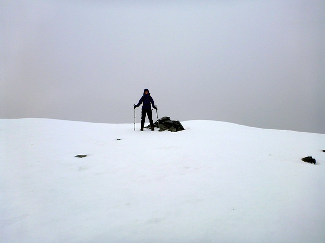
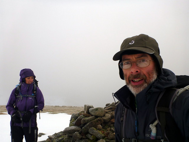
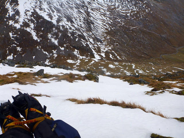
We were joined by another walker who’d been following us, and shortly by a couple who had come from Aonach Mor. Busy hill this! The walk over to Mor was straightforward, as long as one avoided the corniced indentations. Quick pose at the top as my target was achieved then off to find the descent route. This took us down into Coire Guibhsachen but the path wound steeply down, disappearing beneath hard and icy snow, the uncovered rocks also covered with a layer of ice. I got a bit worried here for the state of my companion’s knees having to make this kind of descent. So, unsurprisingly, did she. Crampons back on and axes out, we rather gingerly began to descend a snow chute where the path disappeared. Noting Ally’s struggles I thought it might be easier to descend some of the way on a grassy stripe - this involved some step cutting over the steep snow of the chute, but after dropping a little way it was clear that we’d have to go back over the chute as we were heading for a rocky drop on our current path. This achieved, it was a case of taking things slow and careful until we got more or less under the snow cover. This was first met with some relief, until I mentioned that we were still at 916m elevation – despite the feeling that we’d been descending for a while.

Looking NE from bealach AB/AM
 P1050253
 by
23weasels, on Flickr
About to slip a cornice
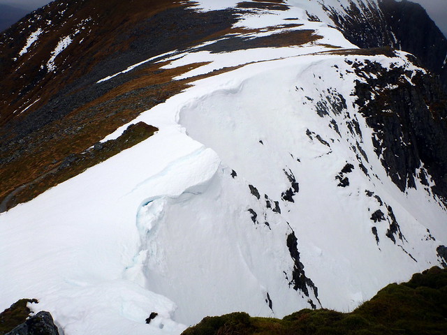 P1050254
 by
23weasels, on Flickr
NE ridge of Aonach Mor
 P1050255
 by
23weasels, on Flickr
Almost there!
 P1050256
 by
23weasels, on Flickr
Target achieved
 P1050259
 by
23weasels, on Flickr
Steep descent
 P1050261
 by
23weasels, on Flickr
NE ridge CMD
 P1050262
 by
23weasels, on Flickr
View to the South
 P1050263
 by
23weasels, on Flickr
Sick Kid "enjoying" the descent
 P1050264
 by
23weasels, on Flickr
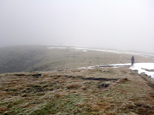
The remainder of the return follows along Allt Coire Guichsachan and passed relatively uneventfully apart from one slip in peaty marsh where I fell onto my back and ended up with a boggy, soggy bum and minor concussion. The rounded grassy hump of Meall Cumhann provided a spot to aim for. The weather was threatening rain, but in fact stayed dry til we got back to the car. Mists swirled round the top of Am Bodach and Sgurr a Bhuic up to our left. Waters whorled and whooshed in the stream beds with numerous falls. With some relief we regained the track at Steall ruins as the light was fading and managed to return without recourse to headtorches. 8 hours and 3 minutes – that seemed not bad for the state of her knees.
View down the return valley
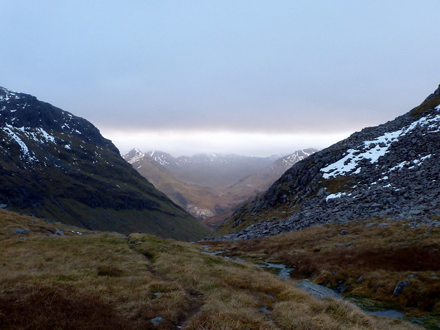 P1050266
 by
23weasels, on Flickr
Hump of Meall Cumhann to the R in the distance
 P1050268
 by
23weasels, on Flickr
Boulders
 P1050271
 by
23weasels, on Flickr
Bigger boulders
 P1050272
 by
23weasels, on Flickr
Islet
 P1050274
 by
23weasels, on Flickr
Nearing the track
 P1050275
 by
23weasels, on Flickr
Steall Falls in profile
 P1050278
 by
23weasels, on Flickr
 P1050279
 by
23weasels, on Flickr
So – target for the year achieved – what ever will I find to do now?
