free to be able to rate and comment on reports (as well as access 1:25000 mapping).
This weekend was meant to include a short day out claiming a couple of Munro scalps for Sick Kid before we went for our work Xmas night out. Ben More & Stobinien had been planned, but the forecast for ridiculous winds had thwarted such plans. Most of the country seemed to be due a similar airborne battering- casting around for southern Corbetts instead brought no better weather predictions. I couldn't stand the thought of doing nothing, so decided upon a walk almost from my house to tackle our nearest elevation in the sub-2000 category, Hill of Stake. The plan was to access the hill from the well trodden Greenock cut, have a look at a couple of aircraft crash sites after climbing Stake Hill then beetle down to Largs and get the bus back home late afternoon, to give us time to get ready for our evening out. As I say, that was the plan.
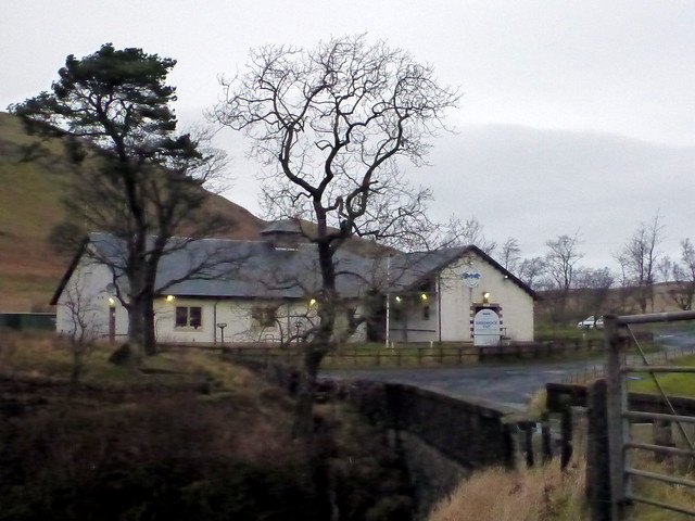
With no distance to travel to get to the start point, we were able to leave at the luxuriously late hour of 8am. It really didn't seem that windy - was it possible the forecasters were all wrong? Left the car at the nearly derelict Ravenscraig Hospital in Greenock and headed up through the trees to join the Cut. A regular haunt of mine in the past when I had a dog but no addiction to the hills. Below us, Greenock was starting to wake up to the day. We made good time along to the visitor centre at Cornalees then left the trail for open highway. Up til this point it had been quite a pleasant - if fresh - morning and I'd made the mistake of mentioning the lack of expected rain. Hmmm - bad move. The rain did now begin in a drizzle that got progressively wetter as the day drew on.
Ravenscraig Hospital
 P1050495
 by
23weasels, on Flickr
View down to Greenock
 P1050496
 by
23weasels, on Flickr
Cornalees
 P1050497
 by
23weasels, on Flickr
Following the back road to Largs under some power lines then cutting up into the hills - oh Lord the ground underfoot was sodden. I should have put boots on rather than approach shoes, which quickly filled with water and ensured my feet were bathed for the remainder of the day. We had agreed we would use the outing as an opportunity to practice navigation skills, and journied to a succession of tops with imaginative variations on the "Burnt Hill" - North Burnt Hill, South Burnt Hill, Burnt Hill (twice). I had to admit the wind was on the strong side even at these modest elevations and acknowledged that we wouldn't have got very far up a proper hill today.
Wind making wavelets on Loch Thom
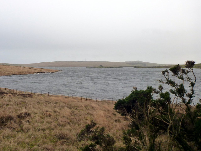 P1050498
 by
23weasels, on Flickr
Crawberry Hill from Ferret of Keith (great name!!)
 P1050499
 by
23weasels, on Flickr
Power Lines in the valley
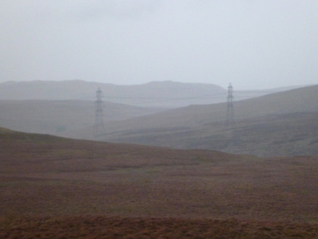 P1050501
 by
23weasels, on Flickr
Atop one of the many "burnt hills"
 P1050502
 by
23weasels, on Flickr
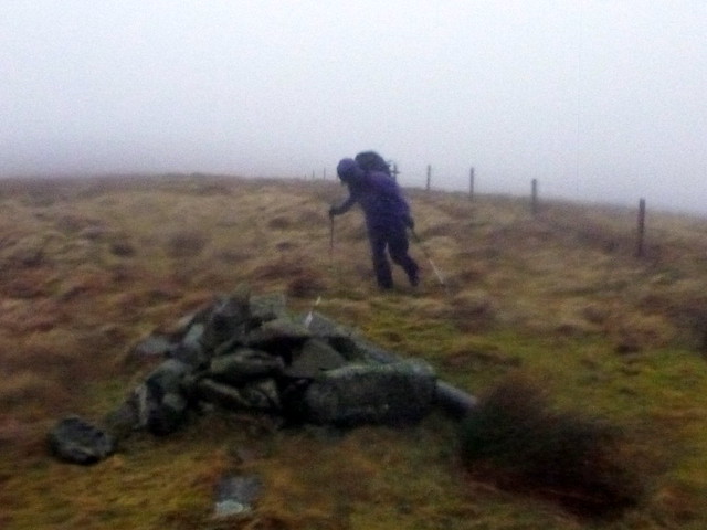
By this time the clag had come down making visual navigation difficult. We followed a fence line over boggy tussocks to the top of Stake Hill - we had been sheltered from the full might of the wind thus far by the hill itself, but on gaining the top we were blasted mercilessly. It was almost strong enough to whip my poles from where I'd planted them in the turf and easily blew me over. I wedged myself on the windward side of the trig point and waited for Sick Kid to join me. Was a good laugh, but we were both glad we didn't have a precarious ridge to negotiate

Fun in the wind - Stake Hilltop
http://www.flickr.com/photos/29312277@N08/11382188866/We almost needed to crawl on hands and knees to progress past the cairn and onto West Girt Hill. We did follow the fence-posts for a while, but found that they began to take us away from the route I'd planned. All this time the rain does not let up and the clag obscures what few features there are in the landscape. I'm soaked through and becoming somewhat miserable, what's more, the time is now about 3pm and I reckon we've easily 8-9 Km to go before getting to Largs

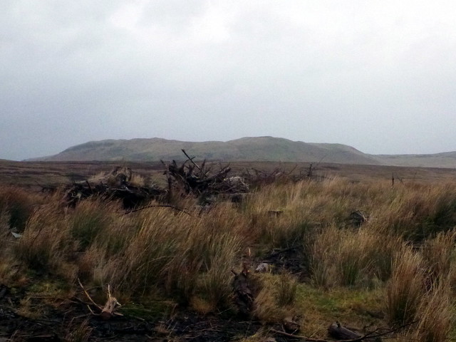
This is where the walk becomes much less fun. Out of the window go any thoughts of looking for the aircraft crash sites, which I had noted down 10 point co-ords for - it is simply a matter of getting down asap. But not just as easy as that. The terrain is truly grim - peat hags, concealed burns, soup-like marsh that sucks your feet away down into the gloop - oh this is fun

Fortunately we've both got our headtorches with us, as very soon we're gonna need them. Once again we follow a fence-post line alongside Slaty Law that seems, for a while, to be going our way, and looks easier to follow in the growing gloom than featureless swamp, but after a while it becomes clear that wherever the destination of the fence is, it's heading south too early. We look at the map and the GPS and consider our options. It is now dark, we need to get to the bridge over the Greeto burn and our current route ain't going to take us there. We decide to head north-west and pick up our original route.
It's quite difficult to make progress over marsh/rushes/tussocks that cover a multitude of nasty surprises when you are navigating by the uncertain beam of a headtorch, you're trying to look at the GPS screen and the rain is battering against your glasses making any kind of vision improbable. We keep drifting off the correct line and end up going in circles. I've asked Sick Kid to lead as it is easier for me to follow her legs than to see where I'm going - she doesn't need to wear her glasses. However, our lack of progress, and the fact that it's now well after 4pm is getting to us both. I call a halt and get the map and compass out, which makes heading in a consistent direction more reliable. Even so, there's a need to stop and re-calibrate every 50 paces. Stumbling in the dark, sodden, every so often falling in a wet hole all for a sub2000 - normally I'd expect at least a clutch of Munro summits for effort like this

After a time we get back on track - not that there's any path to follow, but we are on the GPS (and pencil line on the map) route again. We're also heading downhill and can see the orange glow from the town of Largs ahead. I'd been a bit concerned that the descent down Hare Crags would be tricky in the dark, but it's mostly grass and it's with great relief that we feel the firmness of a rough track beneath our feet and know that we've found the path to the Greeto Burn bridge. The river itself is in torrent, gurgling and gushing on our left. The bridge has a large sheet of corrugated metal across the far side, which we have to crawl underneath, through a deep puddle, but hey - by this time we are past caring about being wet. Onto a good grassy path and onwards to Largs. It's now coming up for 6pm and we are supposed to be in the Indian Restaurant in Gourock at 7

Fortunately, my secretary lives in Largs and can pick us up on the way. We drip into her car, get back home and after an ultra-quick shower and change of chothes, I manage to be at the table, tucking into papodums and pickle along with an very welcome pint by 7.20.
