free to be able to rate and comment on reports (as well as access 1:25000 mapping).
Long, long ago - in December of last year, we were up doing the hills to the north of Loch Quoich and didn't have time or energy to climb Garich on the same occasion. Hating to have a "single hill" outing, it had been in my mind to combine the climbing of Garich with those awkward Loch Arkaig hills, the ones I really didn't fancy reaching by driving the "rollercoaster" road down to Glen Dessary. A report from GMan informed me of the practicalities of doing the circuit and returning by the pathless north shores of Loch Quoich and got me thinking. The original plan had been to camp at the Quoich dam on friday night then do the walk over 2 days, but Allison's earlier than expected availability meant we could leave Ft William at lunchtime and do some of the walk during the day on Friday. i'd thought that the bealach between Sgurr Beag and An Eag looked a realistic option to aim for as a campspot. I was also mulling over another option for the route - namely pitching half way round, heading to Sgurr na Ciche and back then walking down the stalkers path into Glen Kingie and returning along the glen, thereby avoiding the trackless shores of Loch Quioch and the miles of road back to the car. We'd see which plan would win out.
Carrying more weight than usual - partly to protect SK's delicate knees and partly cos I'd been so irritated by the lack of gas on our Loch Carron trip that i'd lugged not only the jetboil, but a whopping 750g gas cannister too - the walk up the easy slope to garich wasn't too bad. We met an elderly English couple who were still pressing on with their objective of finishing the Munros despite two handicaps - 1. living in Southhampton and 2. Only going up hills in good weather. We pressed on and reached the summit without incident. Next followed a depressing descent west, down the zigzagging stalker's path to the bealach with Sgurr na Fhurain. We dropped to around 250m which was a real killer, or would be on the way up! There was no obvious path across the marshy lower ground to begin the ascent proper of SnF so we chose one of several lines of ascent, one that looked steep enough to make upward progress but not insanely steep. Boy, was i feeling the extra weight as I struggled uncomfortably up the steep wet grass. I felt totally miserable and was scunnered that this wasn't one of these puny little 770m Corbetts - oh no, it had to be 900m+. The plan for the return route was made once and for all now - there was no way I was lugging this load over the 3 westernmost rocky peaks - we'd be going for plan B. Grumpily I made slow and determined progress up to the shoulder, where at least the ascent eased somewhat, but I was well scunnered with this hill. All that changed however when I looked down to see the graceful grassy ridge sweeping down and along to Sgurr Mhor - that looks more like it, my spirits lifted instantly and I was off almost (but not quite) capering down the hill.
Garich
 P1010520
 by
23weasels, on Flickr
 P1010521
 by
23weasels, on Flickr
 P1010524
 by
23weasels, on Flickr
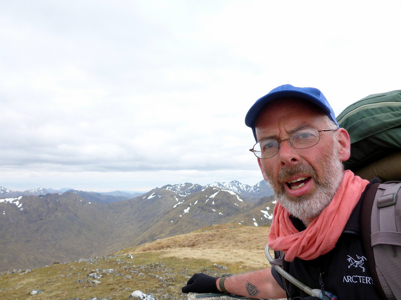
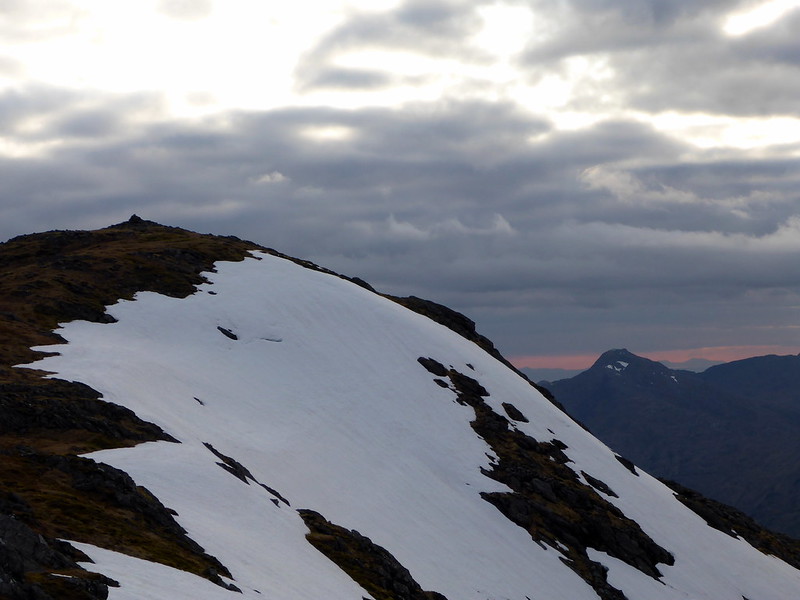
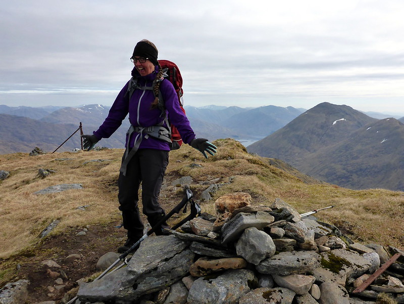
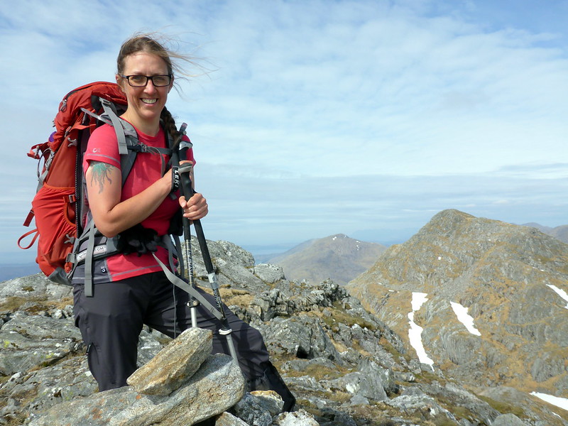
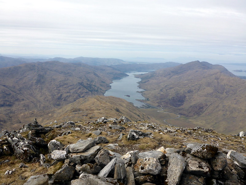
Garich Summit
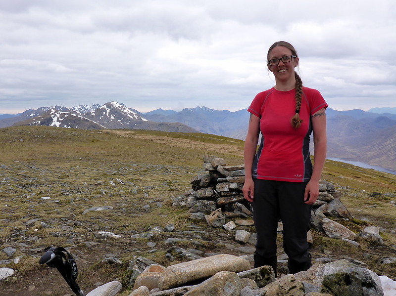 P1010525
 by
23weasels, on Flickr
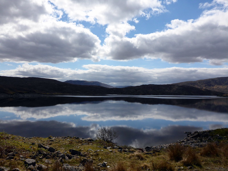
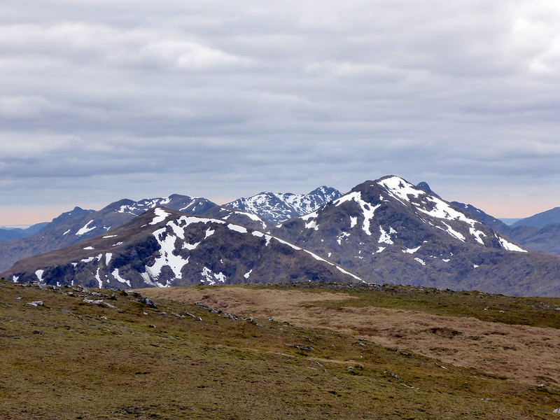
Hills N of Loch Quoich
 P1010526
 by
23weasels, on Flickr
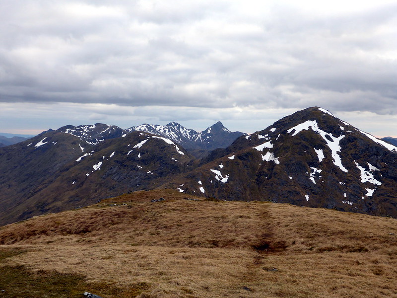
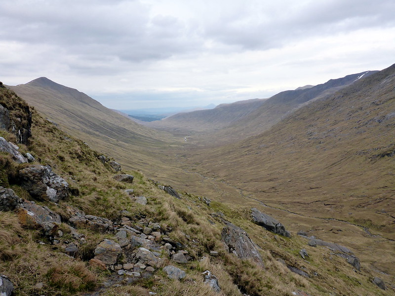
Our route ahead
 P1010528
 by
23weasels, on Flickr
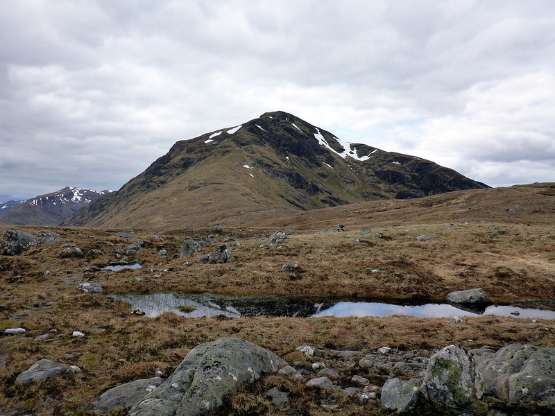
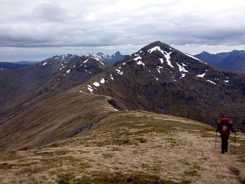
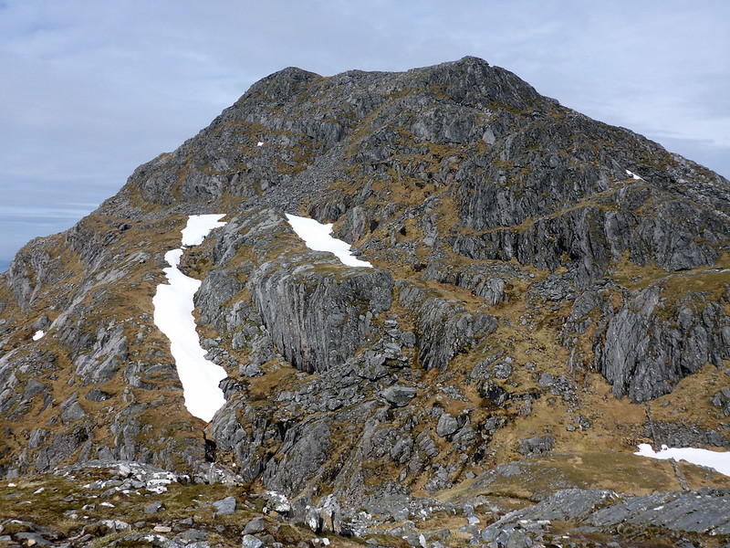
The horrible Sgurr na Fhurain
 P1010530
 by
23weasels, on Flickr
Knackered!
 P1010532
 by
23weasels, on Flickr
View to Sgurr Mhor
 P1010534
 by
23weasels, on Flickr
Nice grassy shoulder
 P1010536
 by
23weasels, on Flickr
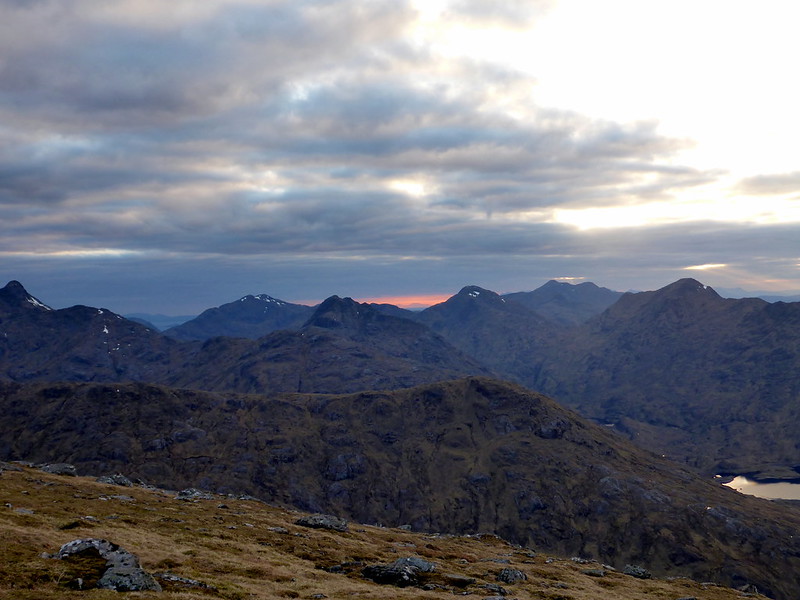
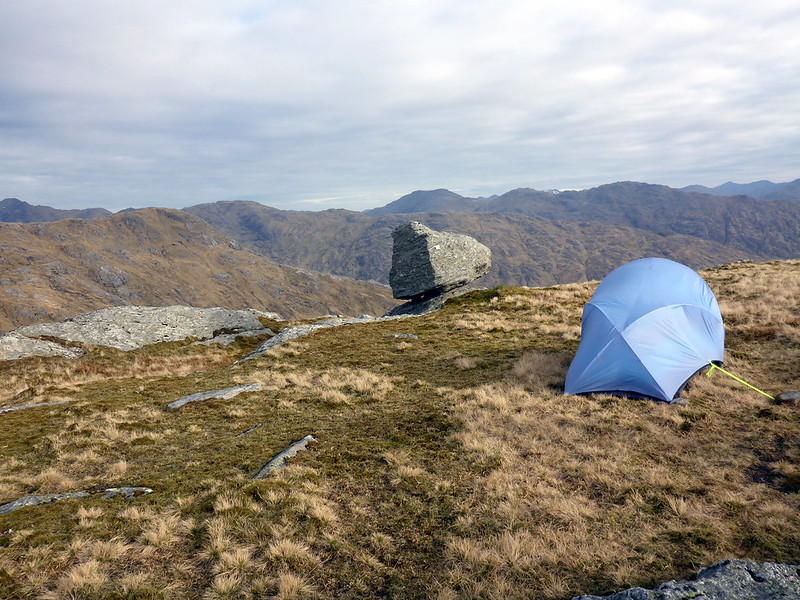
We made it up to the top of SM with ease and enjoyed the views onwards towards Knoydart. A thin red line of sunset above a bank of cloud gave the impression that the hills were glowing in some unearthly furnace. It was disconcerting to see that we still had quite a way to go to our intended stopping point and that there was no bypass route snaking around the side of Sgurr Beag ahead of us - it would have to be over the top again. We did think briefly of pitching the tent at the col between Mhor & Beag, but that would have meant more re-ascending tomorrow, so we endured the discomfort of ploughing up and down another rise to gain our objective. We could see a small group of deer loitering about near the pools, who moved off grudgingly into the descending twighlight as we searched for a suitable spot to pitch. Found an acceptable location with a bit of shelter for cooking and enjoyed a well earned meal at the late hour of twenty to ten. Unfortunately there wasn't much in the way of a sunset, but it was not particularly windy or cold.
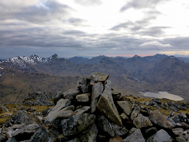
Top SM
 P1010538
 by
23weasels, on Flickr
 P1010539
 by
23weasels, on Flickr
 P1010542
 by
23weasels, on Flickr
 P1010544
 by
23weasels, on Flickr
Descent to Sgurr Beag
 P1010546
 by
23weasels, on Flickr
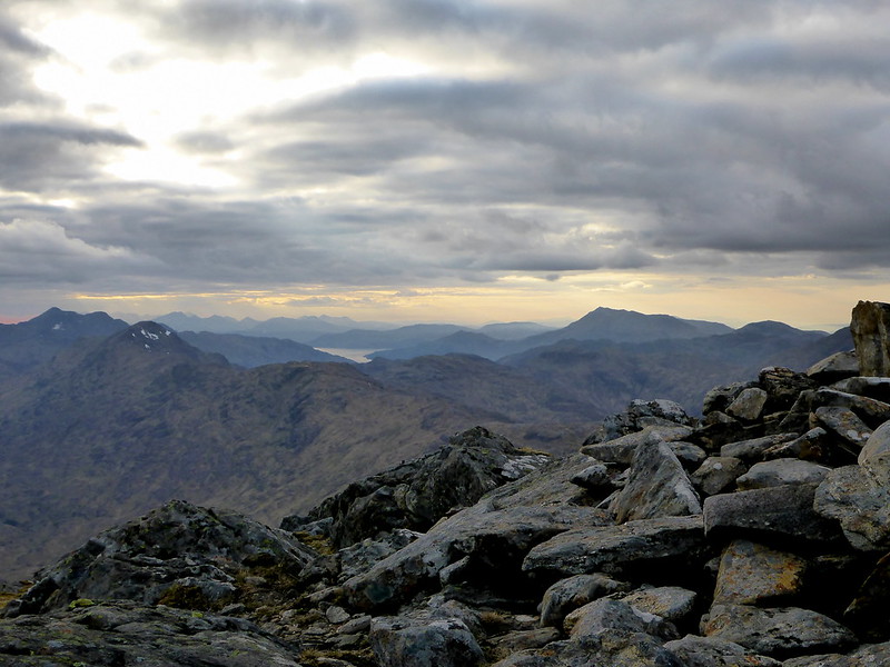
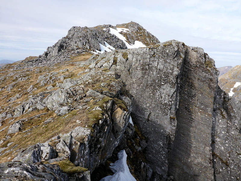
Sgurr na Ciche
 P1010547
 by
23weasels, on Flickr
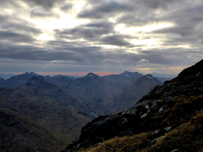
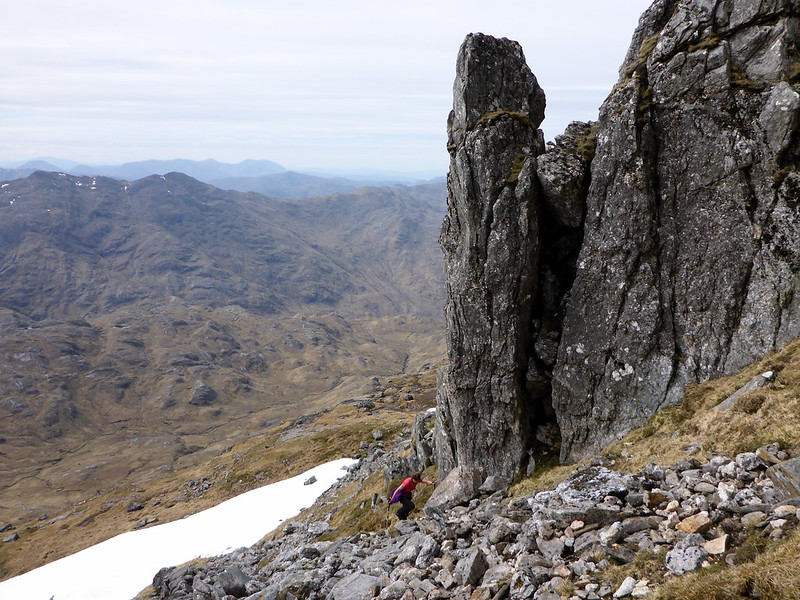
Bealach before An Eag
 P1010548
 by
23weasels, on Flickr
Campspot
 P1010550
 by
23weasels, on Flickr
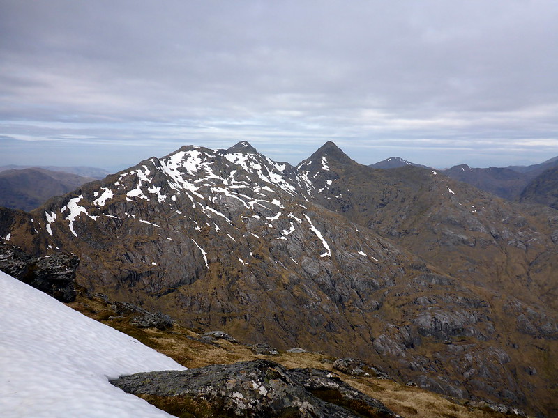
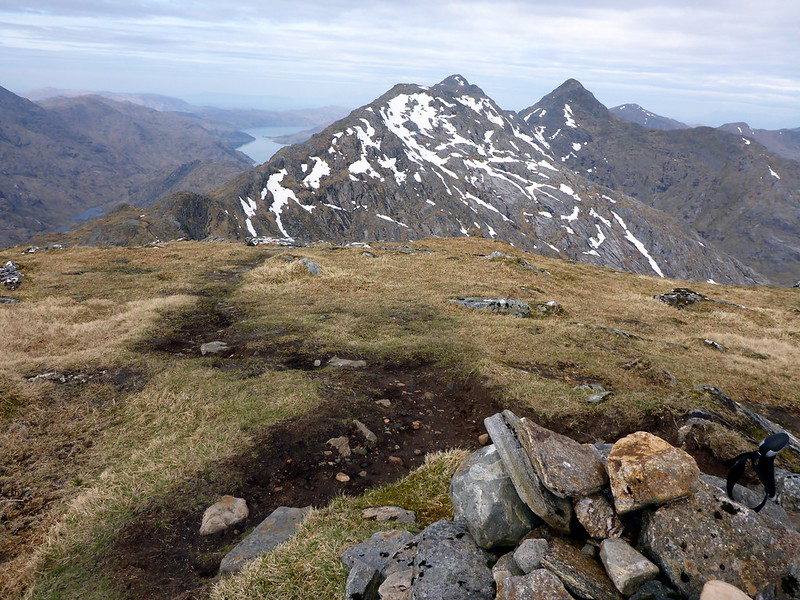
Saturday morning dawned with clearish skies and we breakfasted and prepared to head off, leaving most of our kit in the tent and travelling still with the big packs but fortunately lightly laden. Up over An Eag first of all to see a line of snow along the crest of Sgurr nan Coireachan. Not too much height lost in descending to the bealach and a comfortable jaunt up the northern shoulder, traversing the snaking snowline to the summit cairn, before a steeper descent down the rocky but clear path on the west side. We spotted a group of 3 lads coming up from the opposite side, with overnight packs on, but they didn't stop to chat. Next was the long stretch to Garbh Choich Mhor - rocky terrain underfoot with the occasional wee scramble, over Garbh Choich Beag and eventually getting to the summit - so far this had taken about 2.5 hours, longer thani'd imagined. We stopped for a bag of crisps at the cairn, sheltering from the wind and looked out over the Knoydart hills and, closer to us, the ascent up Sgurr na Ciche. That's Sgurr na Kee-ya apparently, not Sgurr na Keech as everyone we met seemed to pronounce it. Funny, that. Anyway, it's very different in shape close up than the pointed wee pap it appears from afar - a bit like Cheesecake for that matter. We wound our way down the stony path to the col, dropped the packs then headed over a patch of snow before scrambling up a loose rocky section towards the summit. A fairly good path winds through the worst of the scree and the summit is surprisingly flat - you could pitch a tent here and watch the sun sink over Knoydart. The trig point cairn has been completely smashed to atoms, well almost. We enjoyed the views before heading back down, enjoying what we thought (wrongly as it turned out) might be our last bumslide of the season on the way back.
Ascent Sgurr nan Coireachan
 P1010553
 by
23weasels, on Flickr
 P1010554
 by
23weasels, on Flickr
To GCM & SnC
 P1010555
 by
23weasels, on Flickr
Top GCBeag - temporary madness descends!
 P1010557
 by
23weasels, on Flickr
To SnC
 P1010559
 by
23weasels, on Flickr
 P1010560
 by
23weasels, on Flickr
 P1010561
 by
23weasels, on Flickr
Top GCM
 P1010562
 by
23weasels, on Flickr
Ptarmigan posing
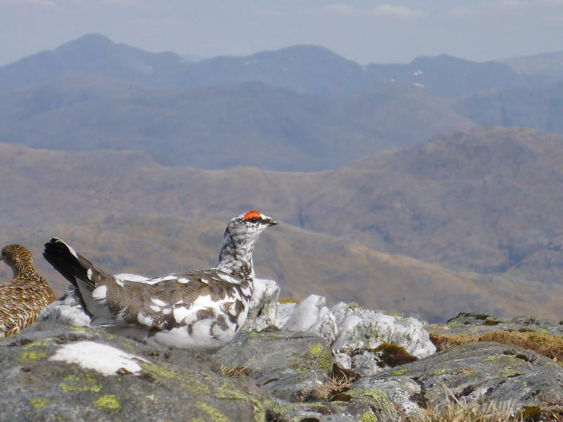 P1010564
 by
23weasels, on Flickr
Na Ciche
 P1010565
 by
23weasels, on Flickr
 P1010567
 by
23weasels, on Flickr
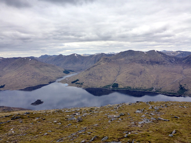
Views to Knoydart
 P1010569
 by
23weasels, on Flickr
Loch Nevis
 P1010570
 by
23weasels, on Flickr
Trig point remains
 P1010571
 by
23weasels, on Flickr
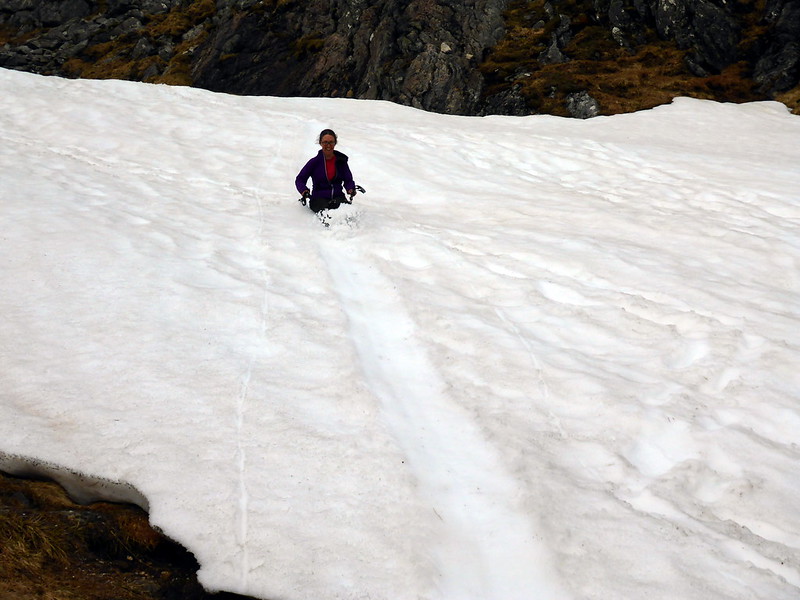
Last bumslide of the season?
 P1010573
 by
23weasels, on Flickr
Now came the one drawback to our revised approach - we'd have to re-ascend GCM (and Beag) as well as Sgurr nan Coireachan. It was hot weather and there's no water on this ridge - something to think about for the walk in - the last filling up place had been at the start of Sgurr na Fhurain and our supplies were fast running out. We met a few walkers coming the opposite way across the hills on our return to the tent, including a group of three doing the 3 Corbetts on the south side of Glen Kingie - the ones I didn't even realise were there...I was tempted to head off up at least one of them, but a glare from SK quickly brought me back to my senses and we pressed on back towards the tent, stopping to fill the water bottle up with snow so that we could at least have a brew before packing up and descending towards the valley, where water would be in plentiful supply.
The path down from the bealach of An Eag is a good one, gently descending into the floor of the glen and easy on the knees. I was expecting something of a quagmire along the glen, but the path is a ggod landrover track, only occasionally boggy. We'd planned to walk for 2-3 hours but the rain came on after a couple and we decided to stop and pitch for the night before it got any heavier, across the river from Kinbreack bothy, who's red tin roof was visible from far up the glen. As we managed to find a not too squishy spot to pitch in we saw the 3 lads from earlier in the morning making an uncertain line towards the bothy. Was a misty morning when we awoke and we ambled easily along the path, into the woods before joining up with the very wet approach path in to Quoich dam. All in, it's a couple of kilometres shorter this way than heading along the shores of the Quoich, and definately easier going, although the need to re-ascend 2 Munros is a bit of a downside. Glad to get these hills into the bag though.
Glen Kingie
 P1010574
 by
23weasels, on Flickr
Being watched again
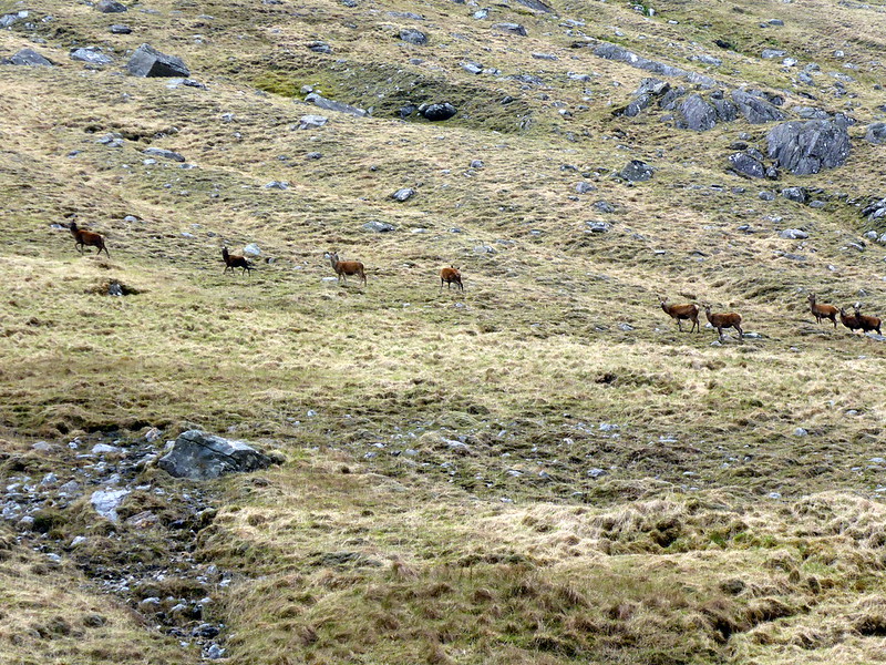 P1010575
 by
23weasels, on Flickr
Kinbreack bothy
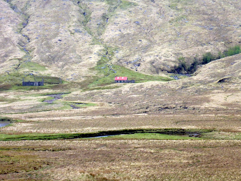 P1010576
 by
23weasels, on Flickr
Campspot
 P1010577
 by
23weasels, on Flickr
Morning mist
 P1010579
 by
23weasels, on Flickr
Stats
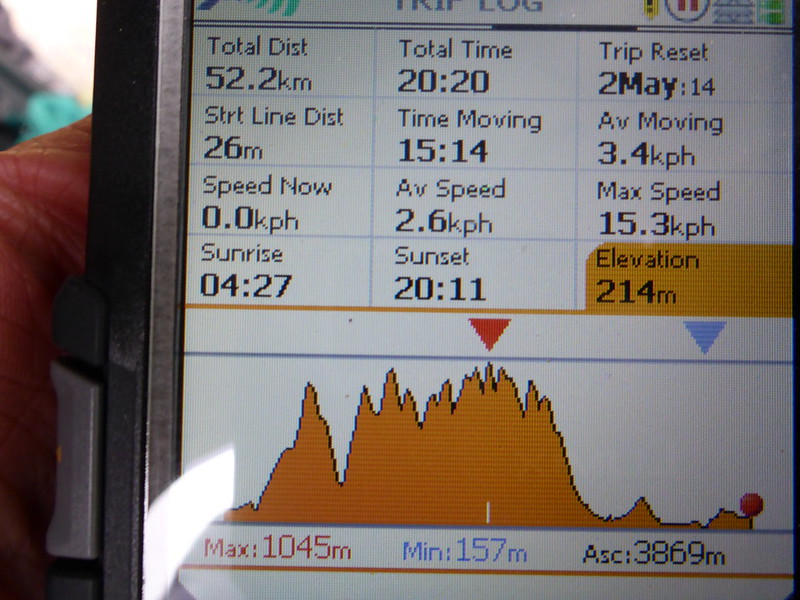 P1010583
 by
23weasels, on Flickr
