free to be able to rate and comment on reports (as well as access 1:25000 mapping).
After a smashing day on Ruadh-stac Beag I felt like adding another Munro to my tally. A quick look at the forecast and we decided to go south-west, where the best sunny spells were supposed to show. We knew it was not going to be as good as the day before, but no pain... no Gulvain in this case

I have never been in Glenfinnian area before, so this was my first encounter with this corner of Scotland, and I really enjoyed it despite the hill itself being a knee killer. This walk can be shortened by using a bike (the track is cyclable basically to the bottom of the mountain), but we decided to walk as the whole distance is hardly over 20km so no need to run for time, especially in June

Kavin hasn't done Gulvain, either, so we didn't really know what to expect, having read a few descriptions we understood it is a long, relentless haul up a grassy slope. Well, it was, so no surprises here
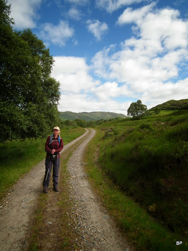
We parked in the layby just off A861, crossed the road and found the signpost "Right of Way to Strathan". It was a relatively bright morning, though the cloud was pushing in from the north and somehow I doubted we would get conditions as excellent as the previous day. Still, I was going to enjoy it!
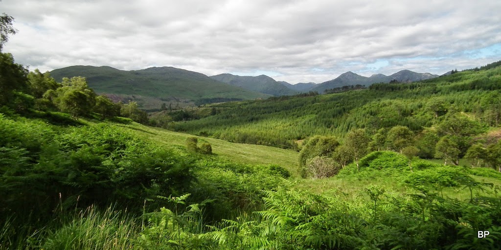
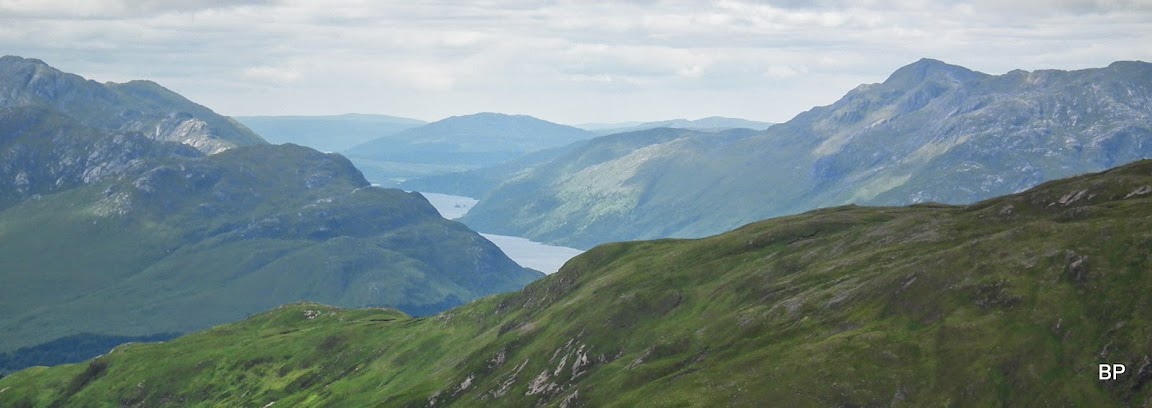
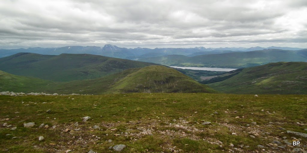
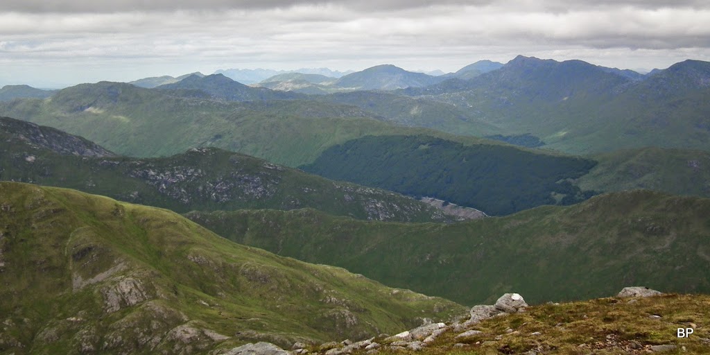
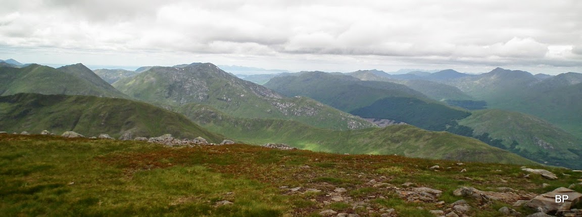
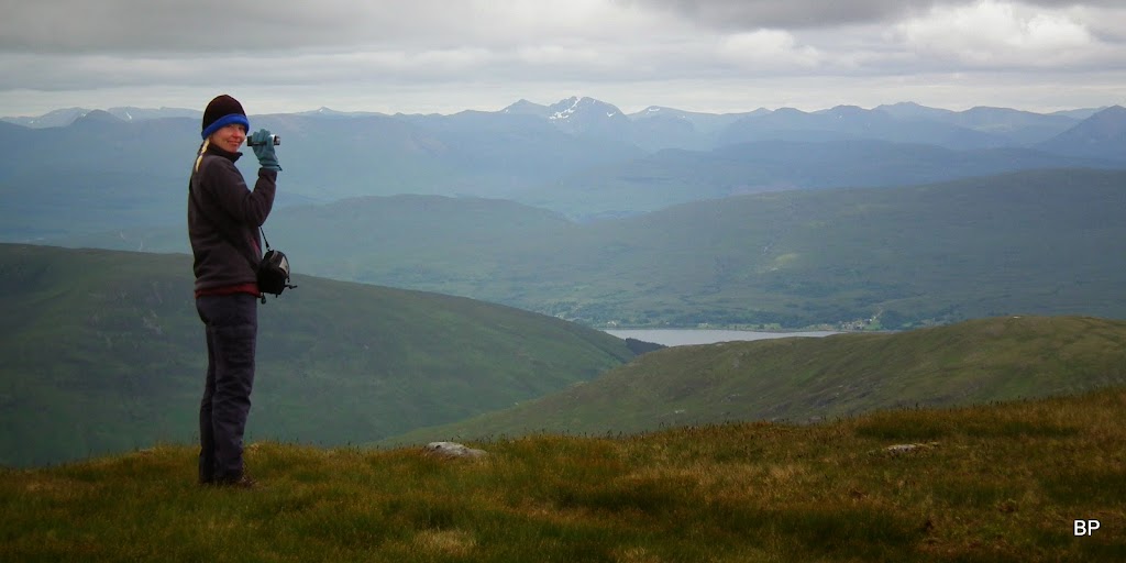
On Thursday we spent some time in very rocky landscape of Torridon, now we were transferred into the world of green. Looking south from the track towards Loch Shiel hills:
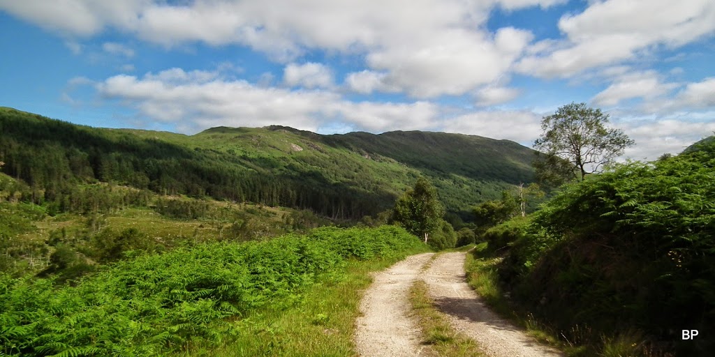
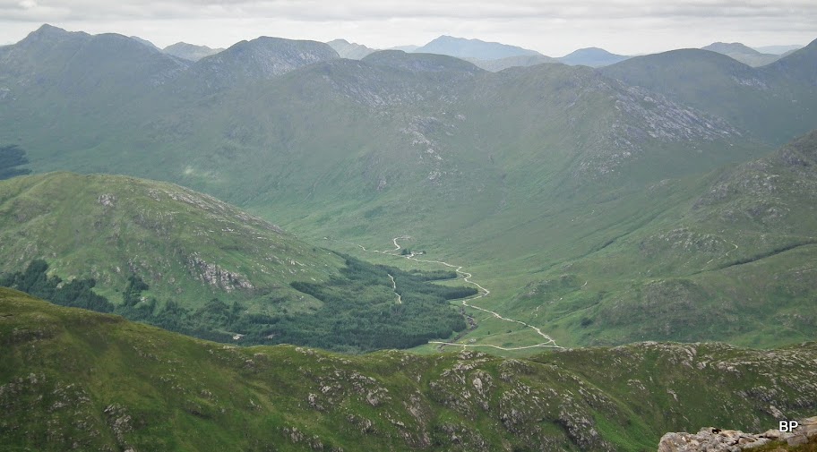
The track continues into Gleann Fionnlighe for about 6 km before reaching the foot of the Munro, and it's a pleasant walk through the wild' with Braigh nan Uamhachan (a Corbett) to the right:
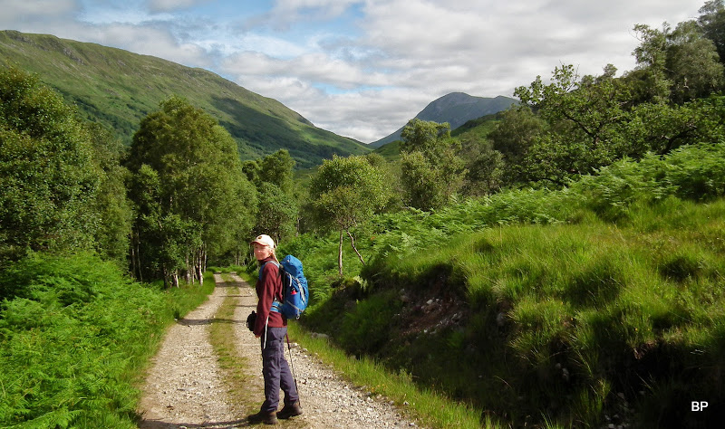
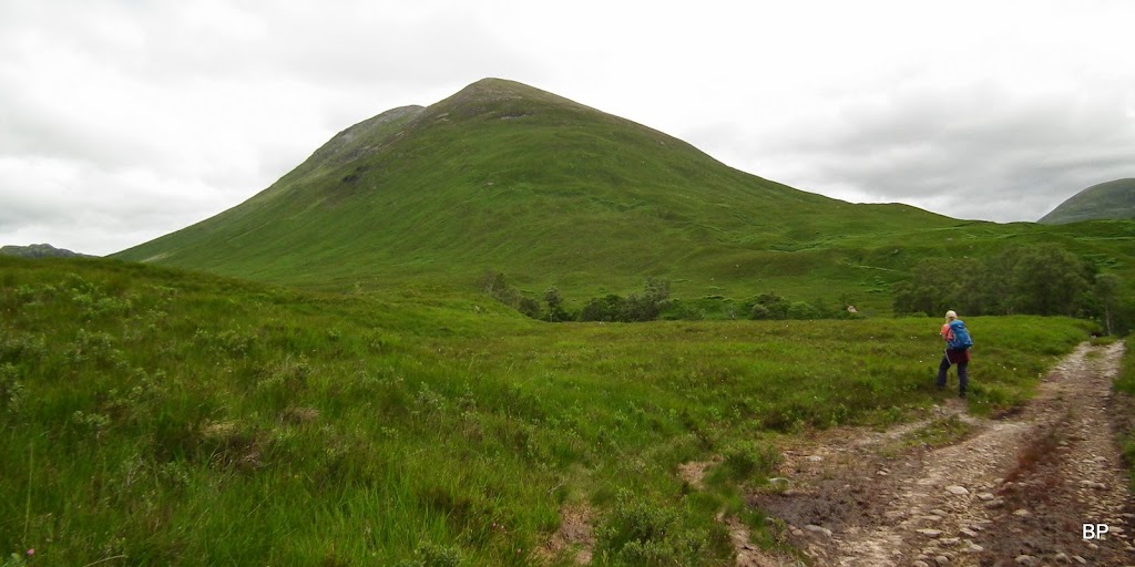
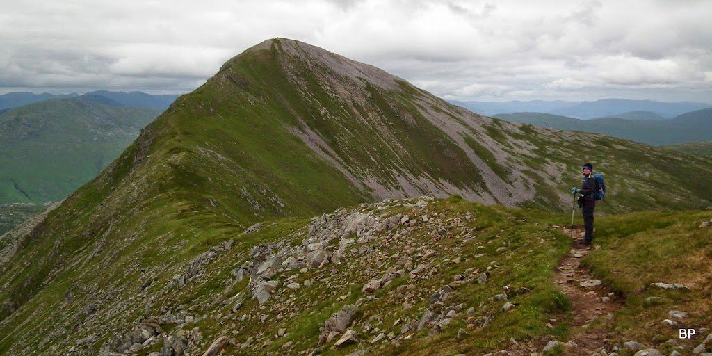
The first glimpse of Gulvain peeking out from behind Beinn an t-Sneachda, confirmed my suspicions that it was going to be a knee-jerking experience...
The track crosses the river on a bridge and passes the buildings of Uachan. We noticed a pair of bikes chained to the fence here, but the track can be cycled further up:

In just over an hour since leaving the car park we were facing The Big Boy. The mountain looked so green, that immediately I found the right nickname for it - Green Giant. Ho-ho-ho!
We crossed Allt a'Choire Reidh on a footbridge, soon the track turned north into Coire Reidh, we continued towards Gulvain on an obvious path (the start ids marked with a small cairn). In wet weather this would be a bogfeast, but thankfully, after a period of sunny weather everything was bone dry. The path begins to ascend the hill very quickly, and higher up it steepens. At the moment, it wasn't too bad:
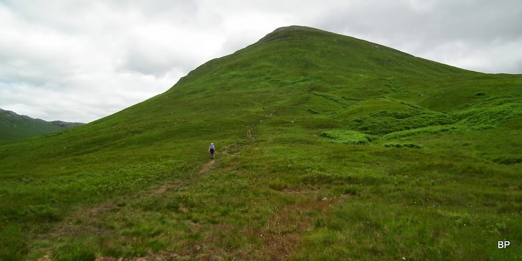
Thank heavens the path goes up mostly in zig-zags, making this ascent a bit more bearable, but it is, honestly, 700m of relentless, steep trudge. It felt neverending, and every time I stopped asking Kevin - we can't be far away from the summit now?? He would look at his GPS and say - still another 500... 400... 300 meters to climb!


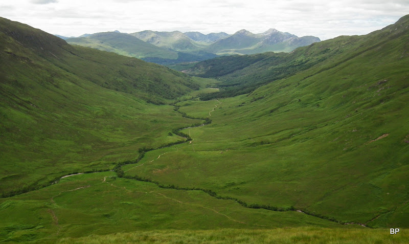
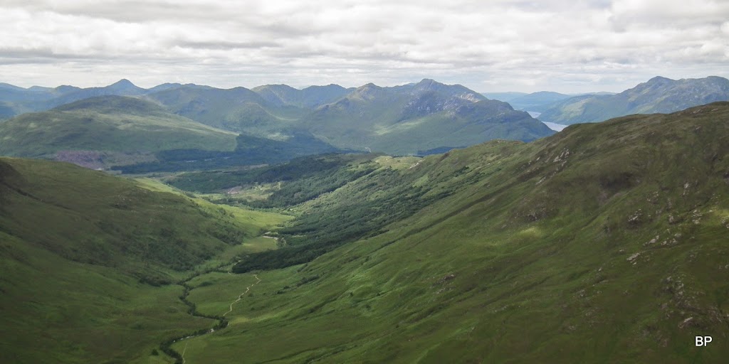
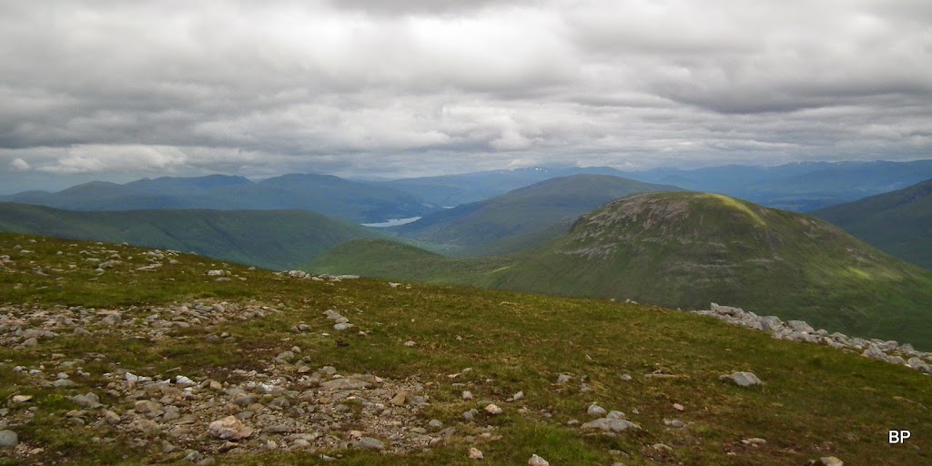
The best view at the moment was behind us - the panorama of Gleann Fionnlighe like seen from a plane:
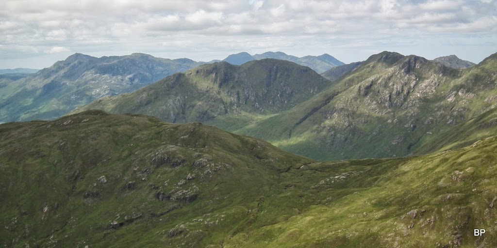
As we gained height, the eastern horizon showed up with some interesting peaks:
My right knee started to ache a bit, it's been an issue since the injury I had in 2011 and it doesn't like very steep ascents/descents. Well, I grew used to it, all i needed was just a short break...

Another excuse for a stop - time to photograph the views, and something very interesting was emerging...

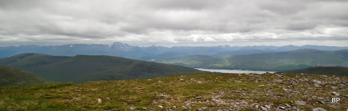
Loch Shiel:
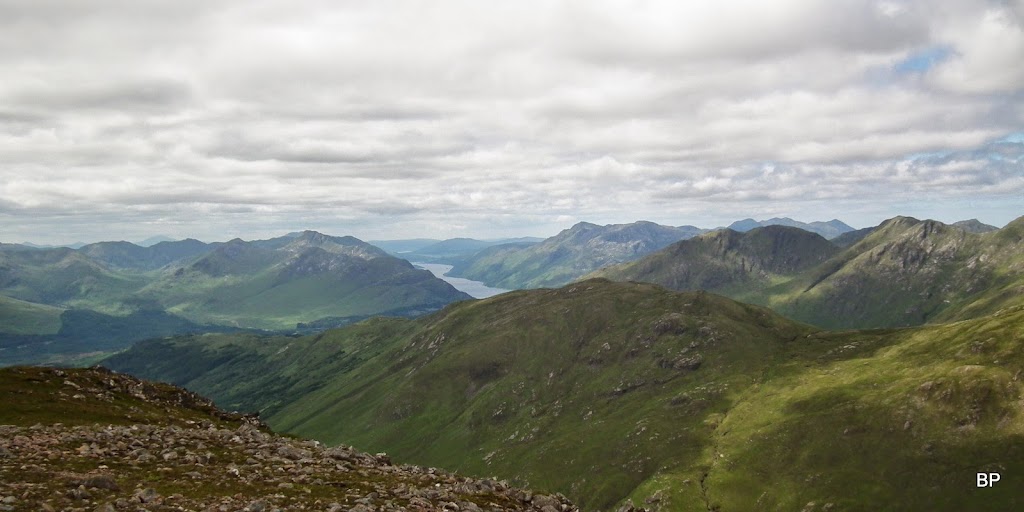
Gleann Fionnlighe and the mountains beyond. So many hills to climb, I haven't even touched this area yet, and I was worried about running out of mountains
I guess in Scotland that's never the case. You may run out of lifetime first

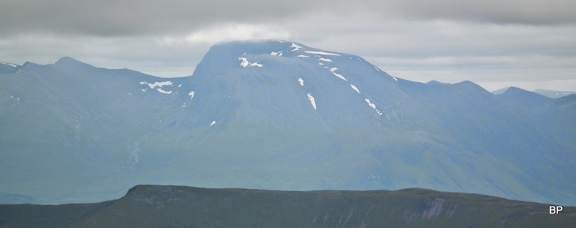
I have already done this one, but no sin to return to the Big Ben. Can you see the tourist path zig-zagging up the slopes of Nevis?

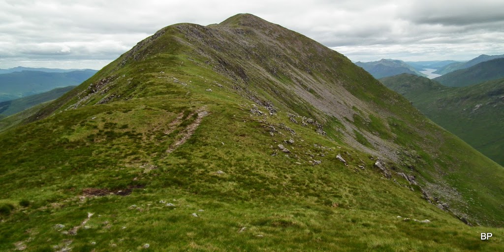
We reached what I hoped would be the lower top, but to my disappointment I discovered it was just the 885m lump on the ridge, the lower top was another 100m up, but at least it was now JUST a 100m... The summit of Gulvain is further behind (seen here to the right):

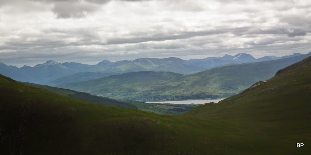
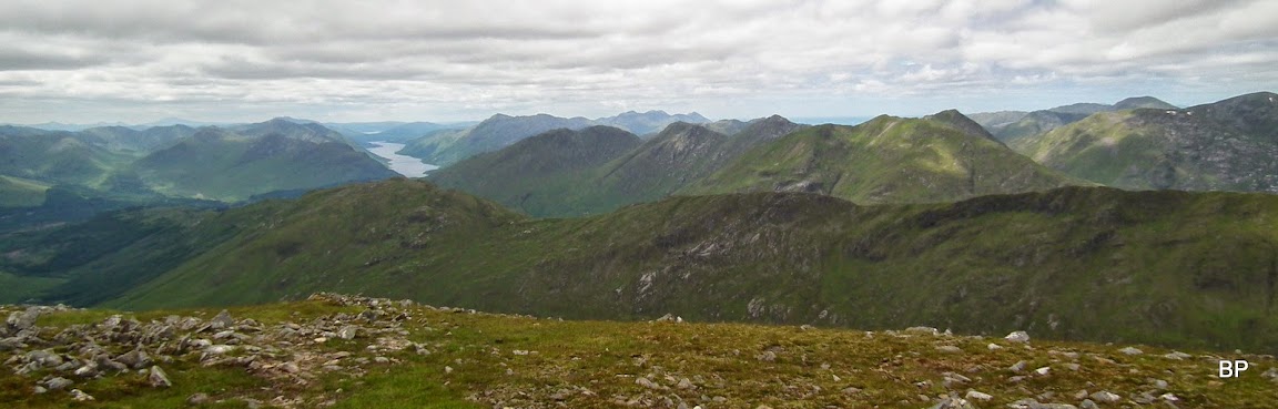
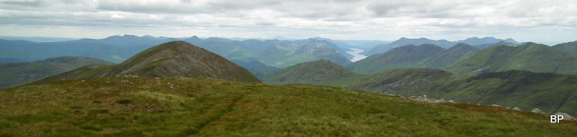
The cloud was thickening but we grabbed the opportunity to take some snapshots using the good light as long as we had it... The long, painful ascent is well rewarded with excellent panoramas, especially to the south and west:

Glenfinnian hills:
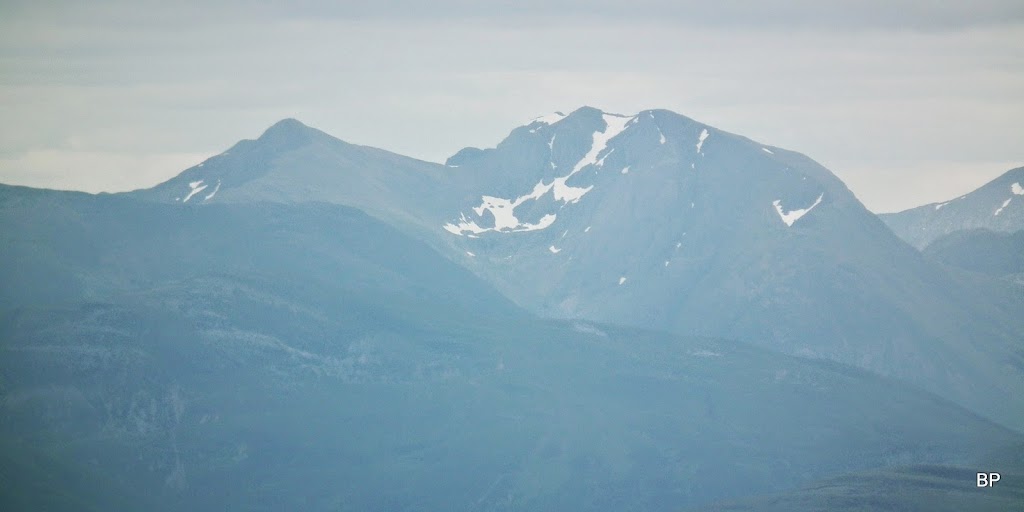
To the east, Ben Nevis is the most prominent feature, but I recognized Bidean nam Bian, too:
The north panorama was disappointing

with gray cloud hanging low. The rounded shape in the foreground is another Corbett, Meall a'Phubuill (how the hell is this one pronounced??

):
The final climb to the lower top became more rocky at some point, but a faint path avoids all the tumbling stones. We had to take another break to dress up though - the wind was very cold

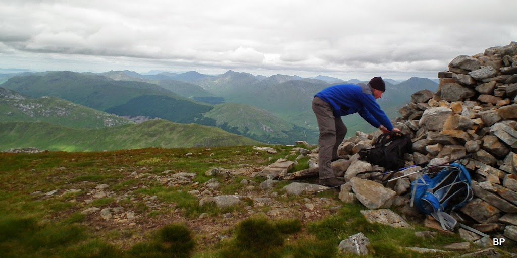
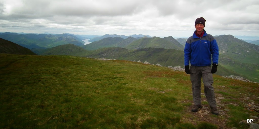
I hoped for a snack break on the lower top, but it was so cold and unpleasant here that we decided to push on to the summit and look for shelter by the cairn. So it was just a pose by the trigpoint...

...and a couple of panos:
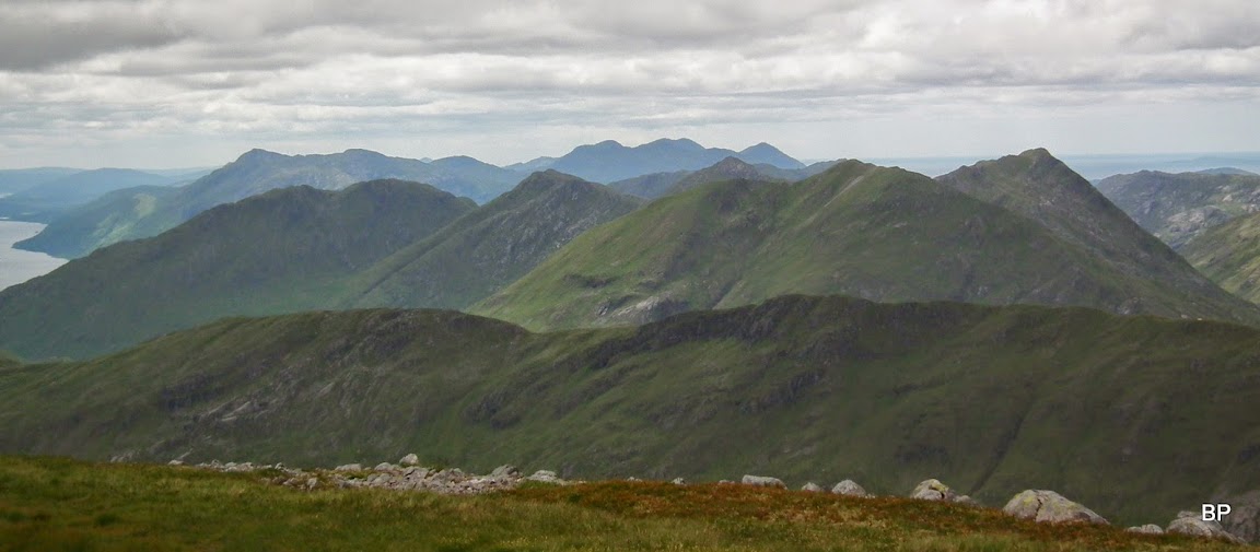
Upper Glen Dessary and Knoydart hills, now looking very dangerous:

On the horizon - the Cuillin Ridge:
The drop between the two tops is less than 100m and the ridge is well-defined, lovely short traverse:
Looking back at the lower top from the middle of the ridge:
The last climb of the day is steep again, but after the 700m trudge in one push who would complain about that?

We reached the summit eventually and found out it was cold, windy and the cloud didn't even think about dispersing
Still it was a great feeling to have climbed another Munro, especially with views so spectacular. Yes, Gulvain is a great spot for vistas
On a warm day you could sit on the summit forever and play mountain spotting... But Kevin had another thing in mind - Lunch, lunch, where is my lunch???
This is a different take on "mootin' porn" - fifty shades of grey...
The lower top to the right and Loch Shiel in the middle:
Isle of Rum:

The northern panorama somehow obstructed:

The Cuillin Ridge of Skye:

There must be some good hills to climb here... No Munros, but surely a few Corbetts?...

The eastern pano:

The Ben with a hat
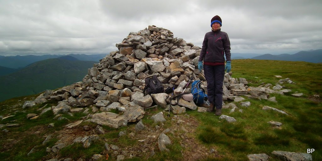
A happy husband
despite temperatures hardly above zero:
Munro No. 145 for me:
Zoom to Bidean:
Two more M's in this area to climb for us both - Sgurr Thuilm and Sgurr nan Coireachan, plus some interesting lower hills, including Streap:
A quick peek into Gle Dessary:
This trip could be summed up with this one snapshot, called "50 shades of grey and one Black Panther":
The only logical return route is to retrace steps back to lower top and then down the 700 painful metres down to Gleann Fionnlighe. Ultrafit folks would probably add the Corbett Braigh nan Uamhachan to make a circuit but the very idea felt beyond us
so we just returned the way we came. The descent wasn't the most pleasant part of the day, with knees asking - please, no more of that!, but at the end of the day it was well worth the effort. Green Giant may be a painful experience, but it's not a pointless trek, quite the opposite. It actually made me aware of how many hills are still out there waiting for me, how many of them I don't even recognize, and how many challenges I'm still to tackle. Hopefully there is still enough life in Panther's bones to carry on climbing. Meow!
There is one more TR to come, this one a true mountain porn, not for the weak hearted
