free to be able to rate and comment on reports (as well as access 1:25000 mapping).
Poor old Meall Gorm doesn't qualify in any hill-walking lists as the drop from Sgurr a'Chaorachain probably isn't sufficient, but it and the connecting Creag a' Chumhaing are the most photographed of all the Applecross hills. In fact CaC is featured on the cover of the Cicerone Corbetts book (Volume 2 by Brian Johnson ) even though it isn't a Corbett - go figure!
I parked at the little two-vehicle parking spot above the top hairpin bend on the Bealach na Ba road and went straight up to the summit cairn - just because it's there (710m). It's recessed from the rim of the corrie and there really isn't much to say about it other than it's the highest point on this side of Coire na Ba. What is spectacular on a good day is the walk along the rim. There are many gullies down into the corrie below, some of which are negotiable and some are not. You can tell the ones the deer don't use as the grass is long and uneaten! As you can see from my track I pretty much peered into them all. One gradually loses height until down at the tip of CaC which is a mere 540m. At this point one is quite a bit below the road and you look up at it.
My track was along the rim of Meall Gorm right down to the buttress at the end.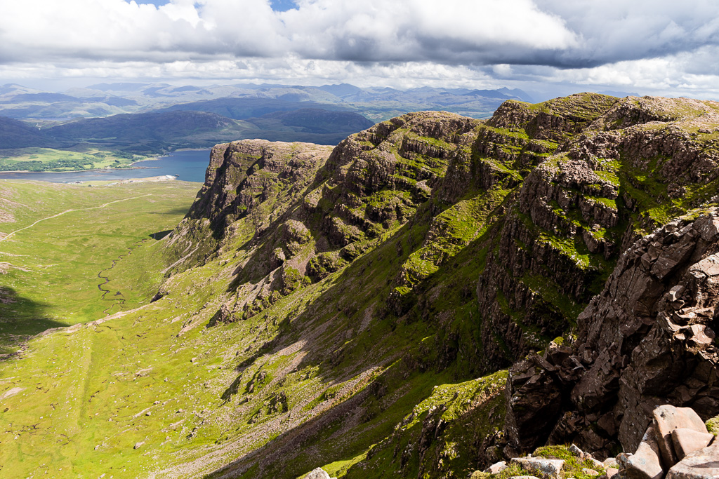 Meall Gorm
 by
anniesmountains, on Flickr
Looking down Coire na Ba with Sgurr a' Chaorachain on the left.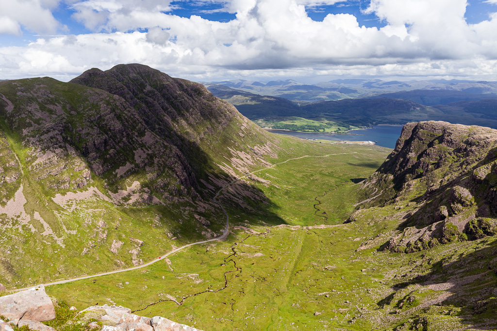 Meall Gorm-2
 by
anniesmountains, on Flickr
Looking back up to the Bealach road.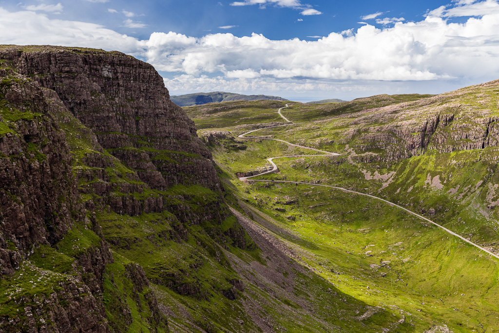 Meall Gorm-3
 by
anniesmountains, on Flickr
Almost at the top of the buttress of Creag a' Chumhaing.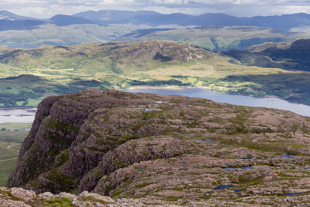 Meall Gorm-4
 by
anniesmountains, on Flickr
Loch Kishorn and beyond.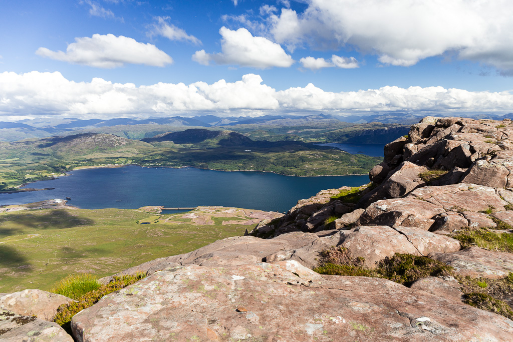 Meall Gorm-5
 by
anniesmountains, on Flickr
On the top of the buttress. Maol Chean-dearg, An Ruadh Stac and Sgurr a' Gharaidh to the left.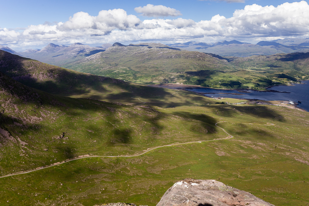 Meall Gorm-6
 by
anniesmountains, on Flickr
I had the choice of returning the way I had come or heading west and finding a way down after the craggy bits.
Heading south and looking over to Broadford on Skye.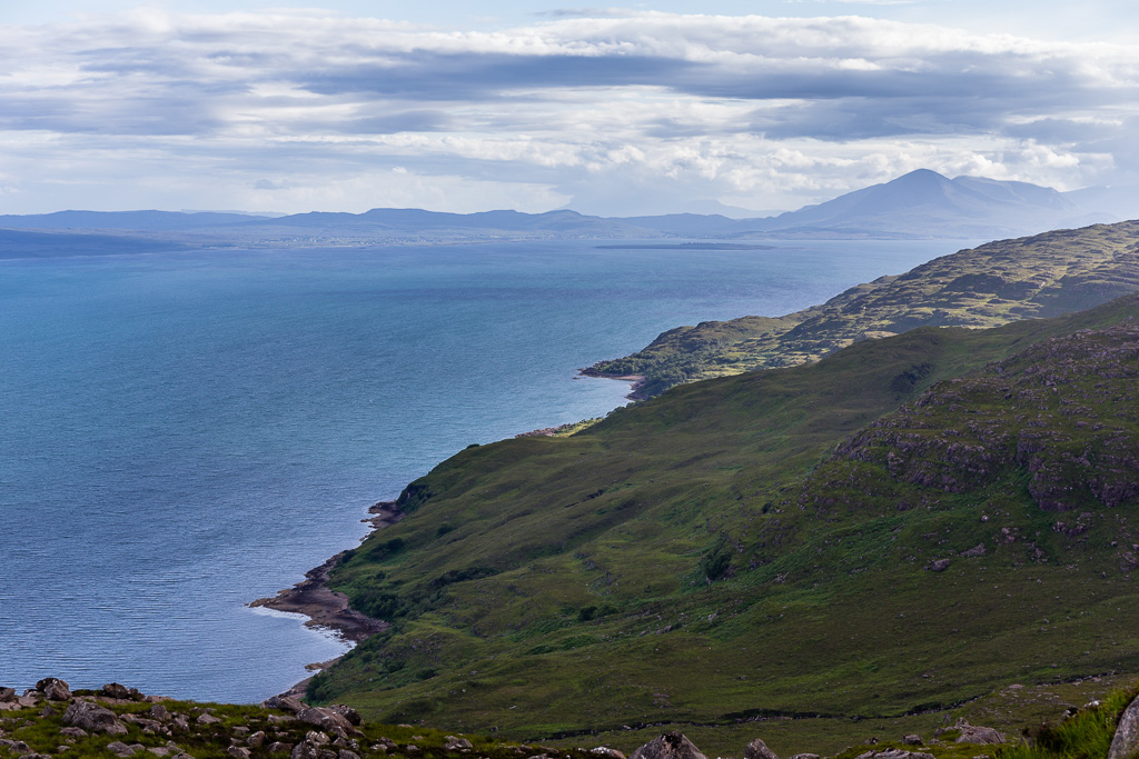 Meall Gorm-7
 by
anniesmountains, on Flickr
Plockton and the Kintail hills in the distance.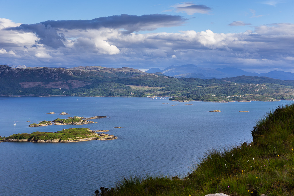 Meall Gorm-8
 by
anniesmountains, on Flickr
From the descent - Beinn Damh, Maol Chean-dearg and An Ruadh Stac in the evening light.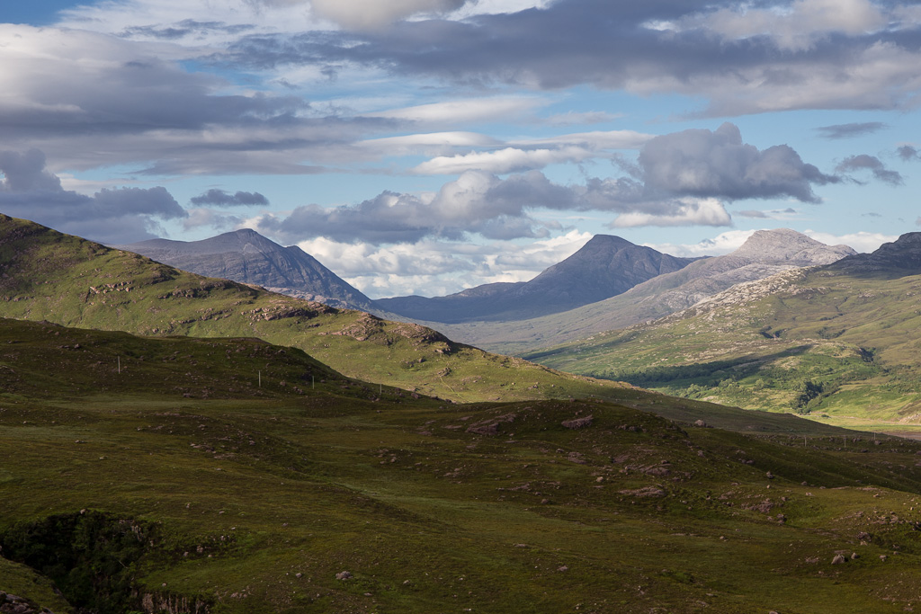 Meall Gorm-9
 by
anniesmountains, on Flickr
I literally had to walk round the hill and then made a bee-line for the road as the walking was pretty rough. It was then a long haul up the road back to my car at the top of the pass.
Coming round the base of the buttress. You can just see the road running along the base of Sgurr a' Chaorachain.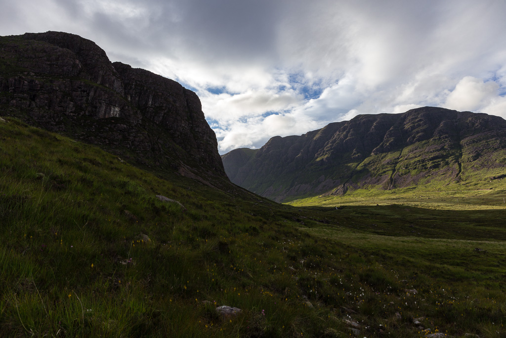 Meall Gorm-10
 by
anniesmountains, on Flickr
The long haul up the road. Meall Gorm on the left.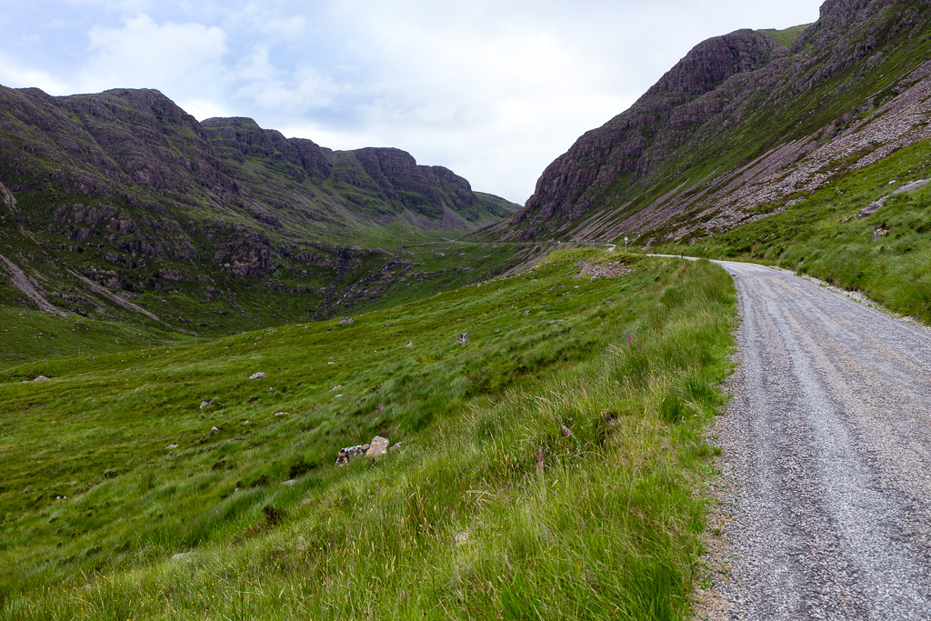 Meall Gorm-11
 by
anniesmountains, on Flickr
Looking back at Creag a' Chumhaing - I had descended the back of the hill and come around the base.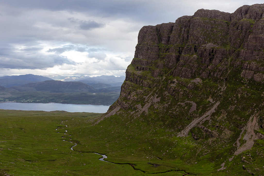 Meall Gorm-12
 by
anniesmountains, on Flickr
The worst part of this walk is that the ascent is all at the end

As I was walking up the corrie two eagles circled overhead. I got photos of them but it was really too dark to take decent shots. But then this bunch of hinds and fawns was grazing just below the second hairpin bend.
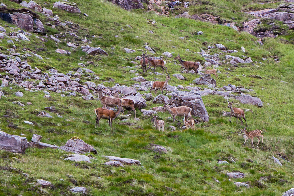 Meall Gorm-13
 by
anniesmountains, on Flickr
Fantastic walk and highly recommended.
