free to be able to rate and comment on reports (as well as access 1:25000 mapping).
I didn't really walk 15.4 km on this walk but the GPS got totally confused under Clach Glas and inserted a whole lot of zig-zags which I did not do! I would have had to be running around at the speed of light on steep scree to follow this route

Last year before climbing any Munros I had it in mind to go up Blà Bheinn on 4th July (day off) but, to cut a long story short, turned back due to the wind. However, I wasn't ready to go home so walked around the foot of Blà Bheinn and Clach Glas and went part way up Coire a’ Càise . I could see two scree runs going up on to the ridge between Clach Glas and Sgurr nan Each the left hand one looking easier of the two. However, as far as I could find out only climbers going up Clach Glas used it and most of the walkers used the other one. This meant that I couldn't find any information about the bump in the middle and I didn't know if there would be any difficulties getting over it. My usual mantra is, "well, I can always turn back." but I rarely follow it as I don't like giving up! Also, I knew I wouldn't manage the Sgurr nan Each slab (after reading clivegrif's and ianaird's reports), so decided this would be my route of ascent.
The forecast was for low cloud cover in the morning which was due to clear up about lunch time. With this in mind I didn't leave home until 9am.
I parked in the Blà Bheinn car park and headed up the regular path until the first river crossing. Then cut across the heather for Coire a’ Càise . The mist was down but it was a great day for walking and I made better time than expected as the mist was still down as I reached the head of the corrie with no sign of it lifting.
Heading for Coire a’ Càise with the cloud level very low.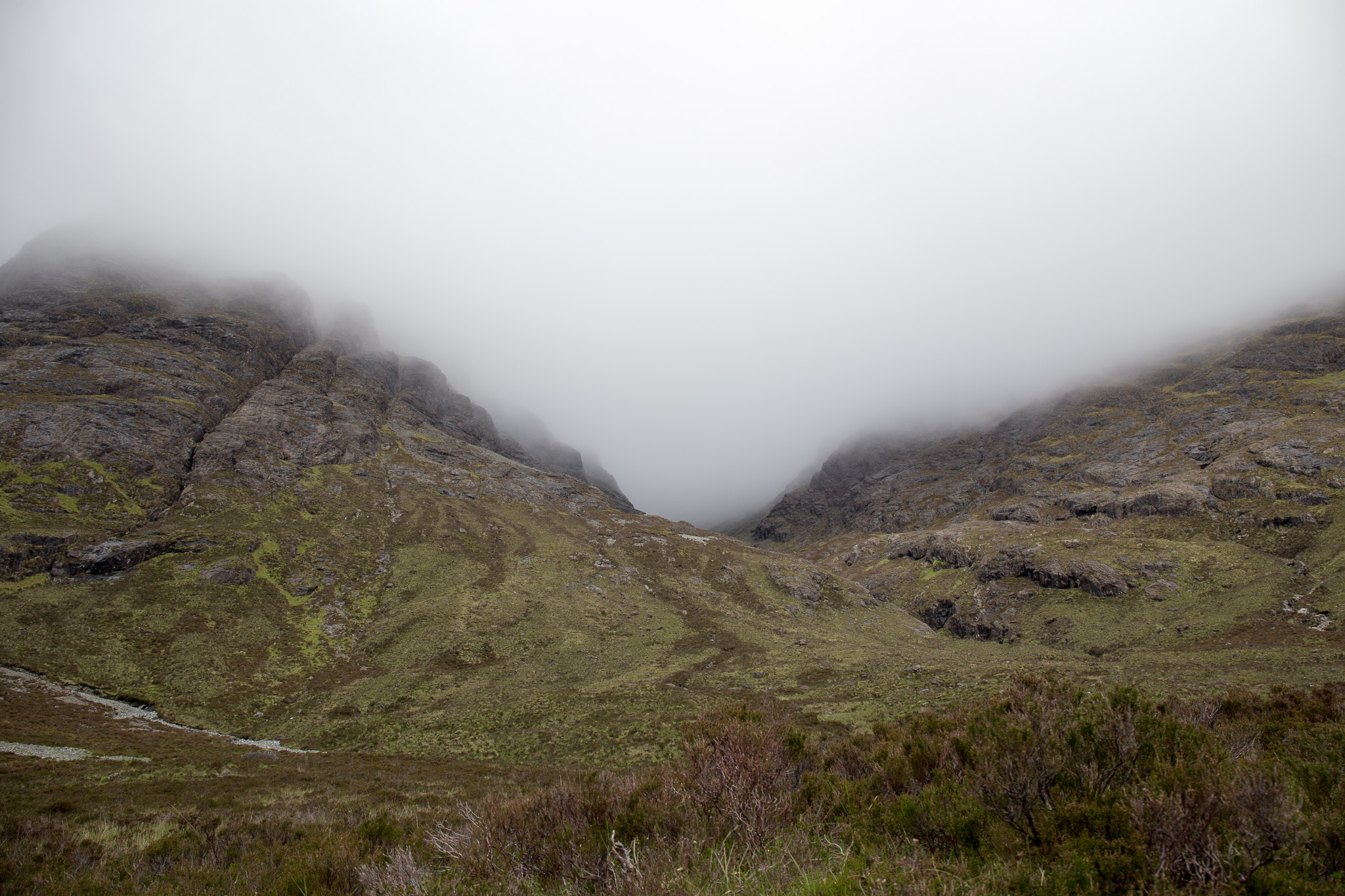 Garbh-bheinn and Belig
 by
anniesmountains, on Flickr
Clach Glas on the left and Sgurr nan Each on the right.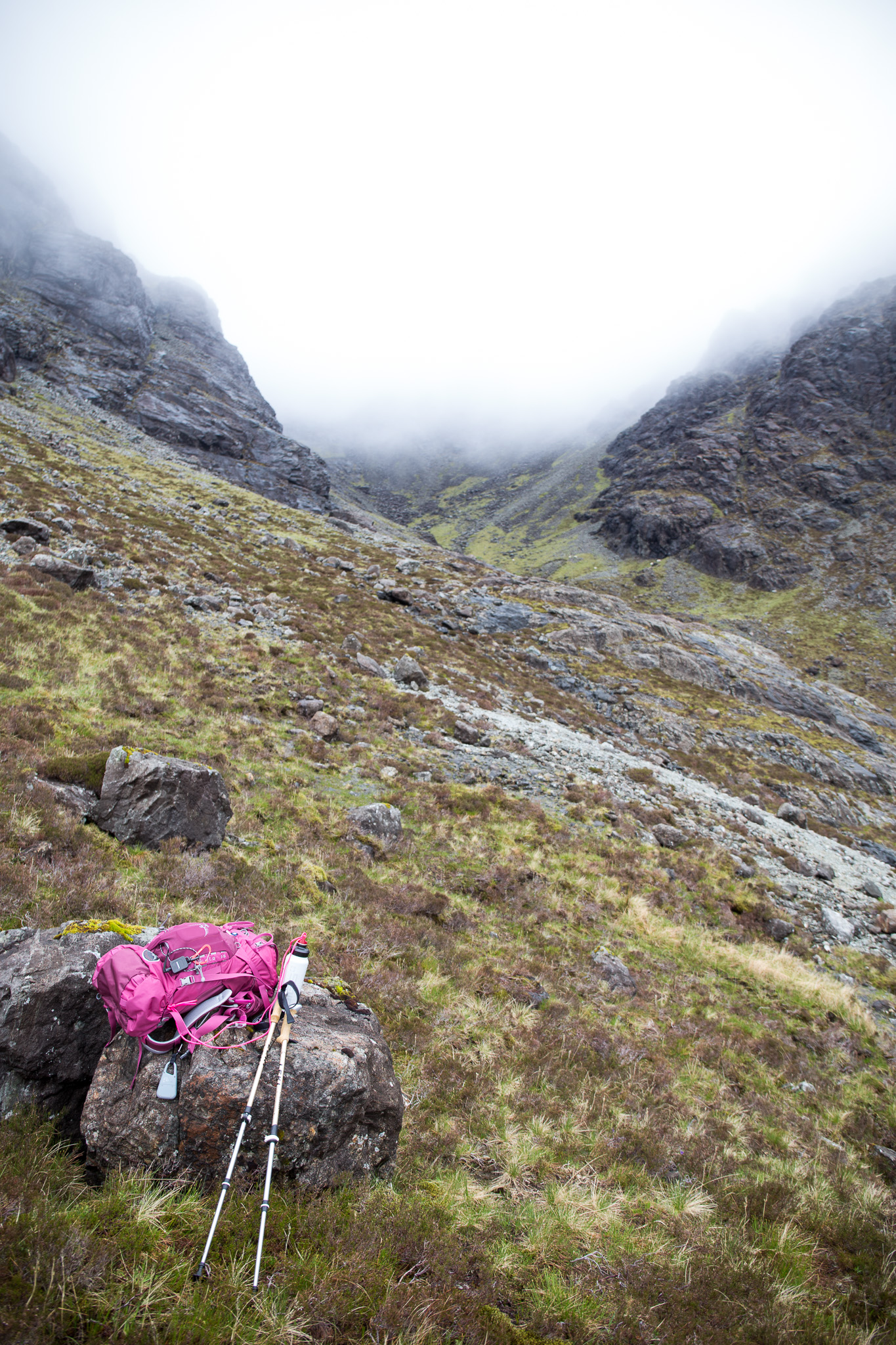 Garbh-bheinn and Belig-3
 by
anniesmountains, on Flickr
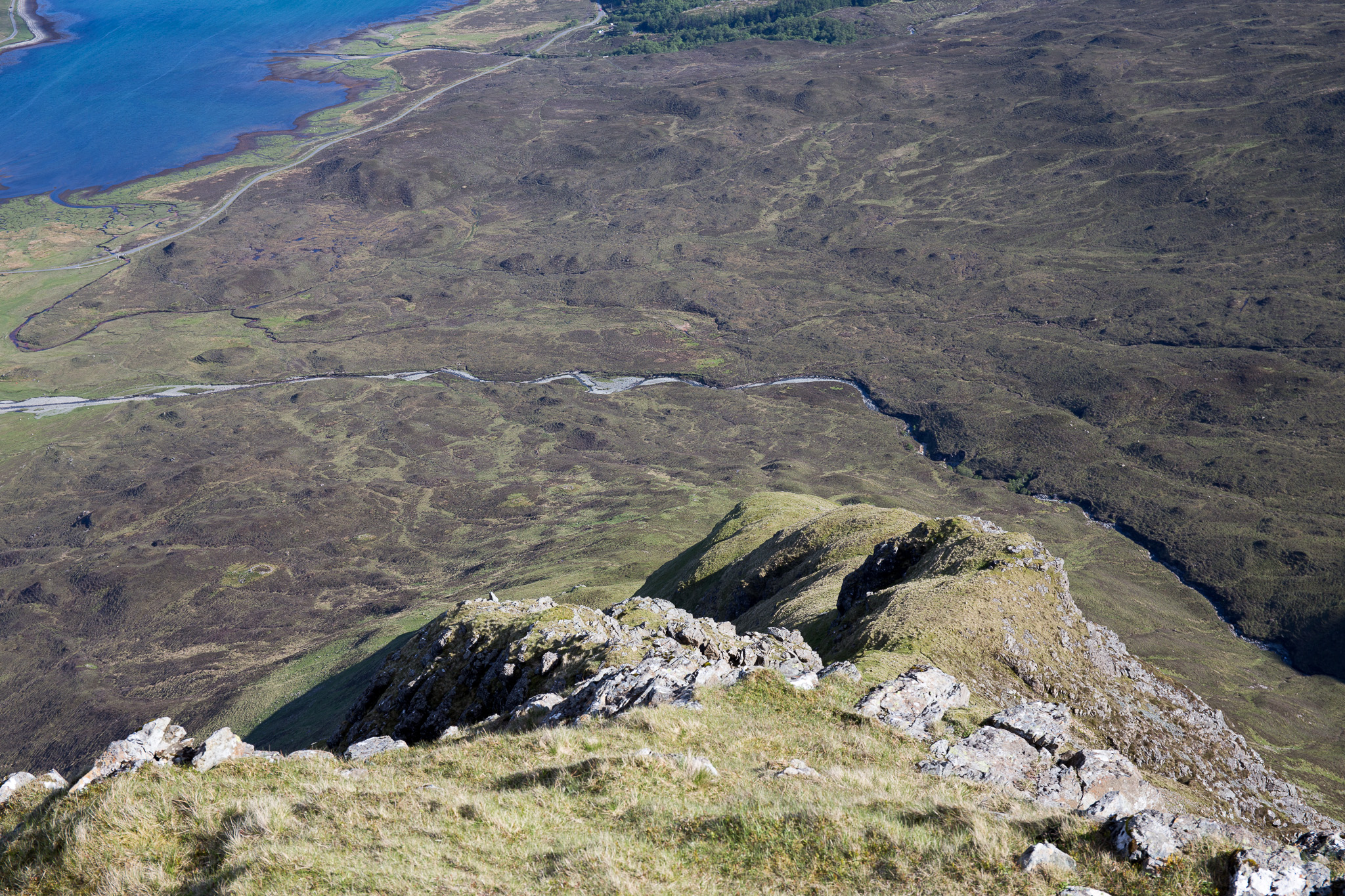
My route was up the extreme left (not seen as I had to go round a rock). The other route is the scree run in the centre-right of the photo. Garbh-bheinn and Belig-4
 by
anniesmountains, on Flickr
I pretty much followed the rock until I had to cross a boulder field to head for the obvious scree path up the final gully. It's quite steep but pretty short-lived and at the top is a fairly narrow grassy bealach just wide enough to accommodate a path. I'm sure the drop down the other side is spectacular but I couldn't see much except for the very spooky looming form of Clach Glas on one side and a rock face on the other. This was an easy scramble (even for me!) and then I was up on a short ridge which skirted the top of the buttress. This takes you to the top of the right-hand scree ascent - looks nasty from this angle too - and the foot of Sgurr nan Each. You then have to descend in a north-westerly direction to the base of Garbh-bheinn and in poor visibility you have to keep your wits about you as most of the routes indicate this is a three-way bealach - but it isn't really - it's two two-way bealachs!
Under the cliffs of Clach Glas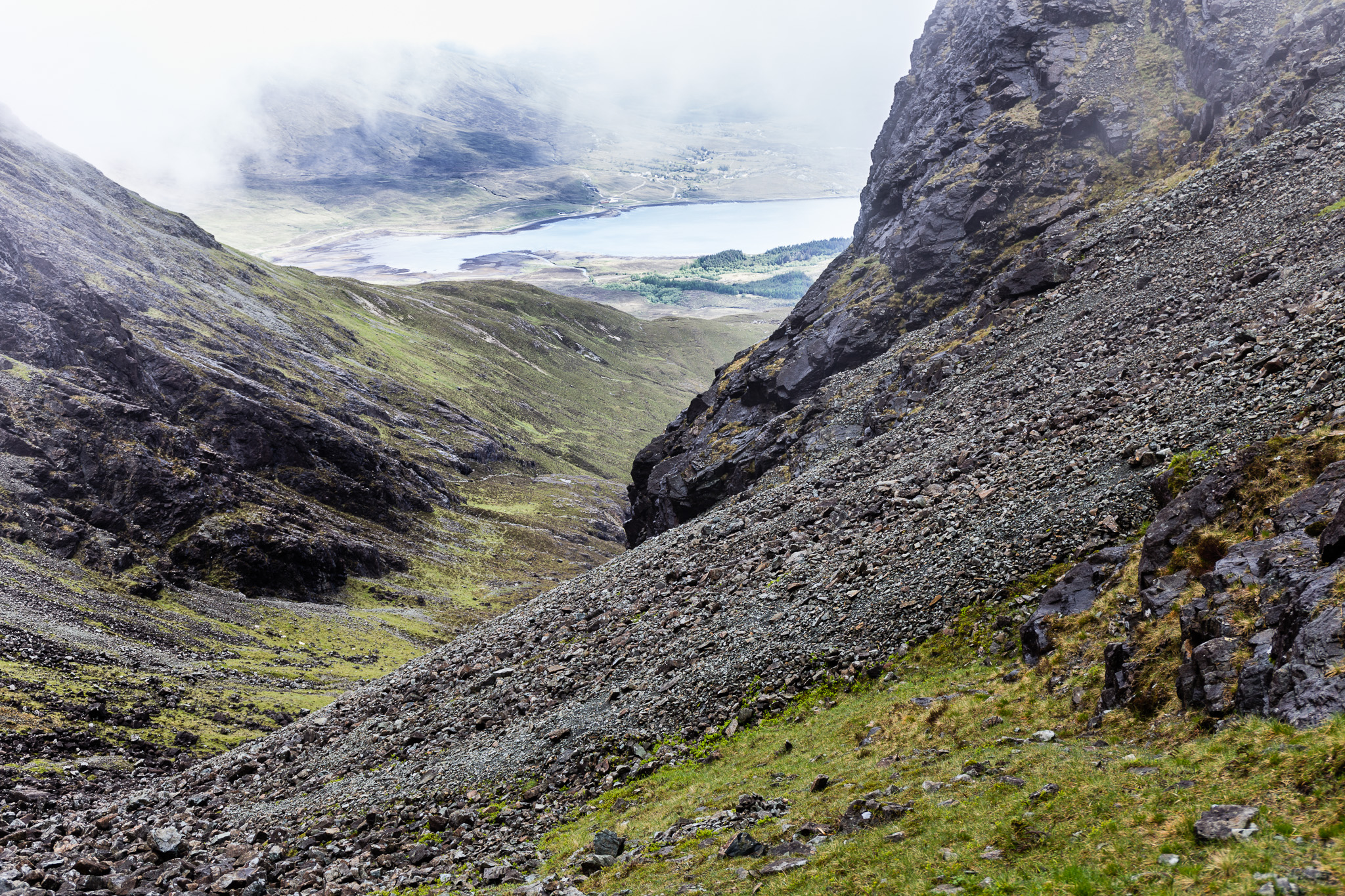 Garbh-bheinn and Belig-5
 by
anniesmountains, on Flickr
At the narrow bealach looking up to Clach Glas - very poor visibility now.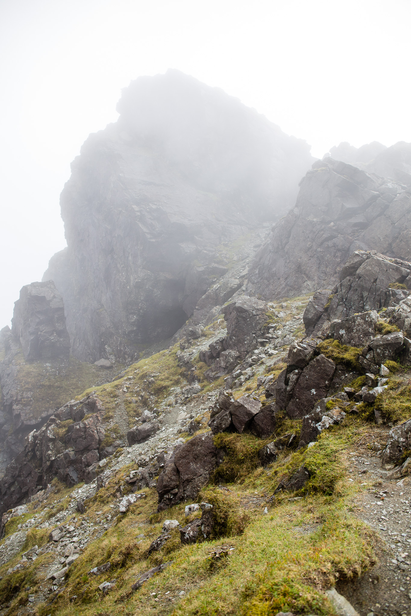 Garbh-bheinn and Belig-6
 by
anniesmountains, on Flickr
Looking back down Coire a’ Càise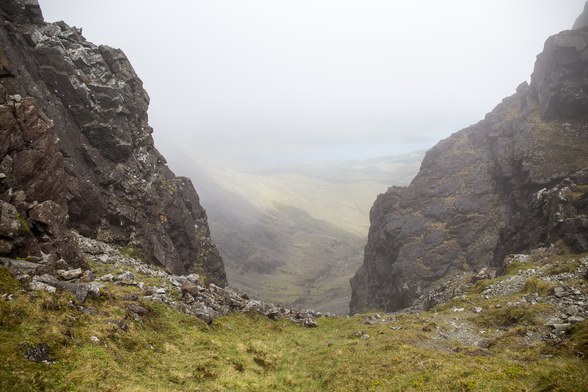 Garbh-bheinn and Belig-7
 by
anniesmountains, on Flickr
From the same spot looking in the opposite direction down to Coire Dubh. I have to get up the rock on the right!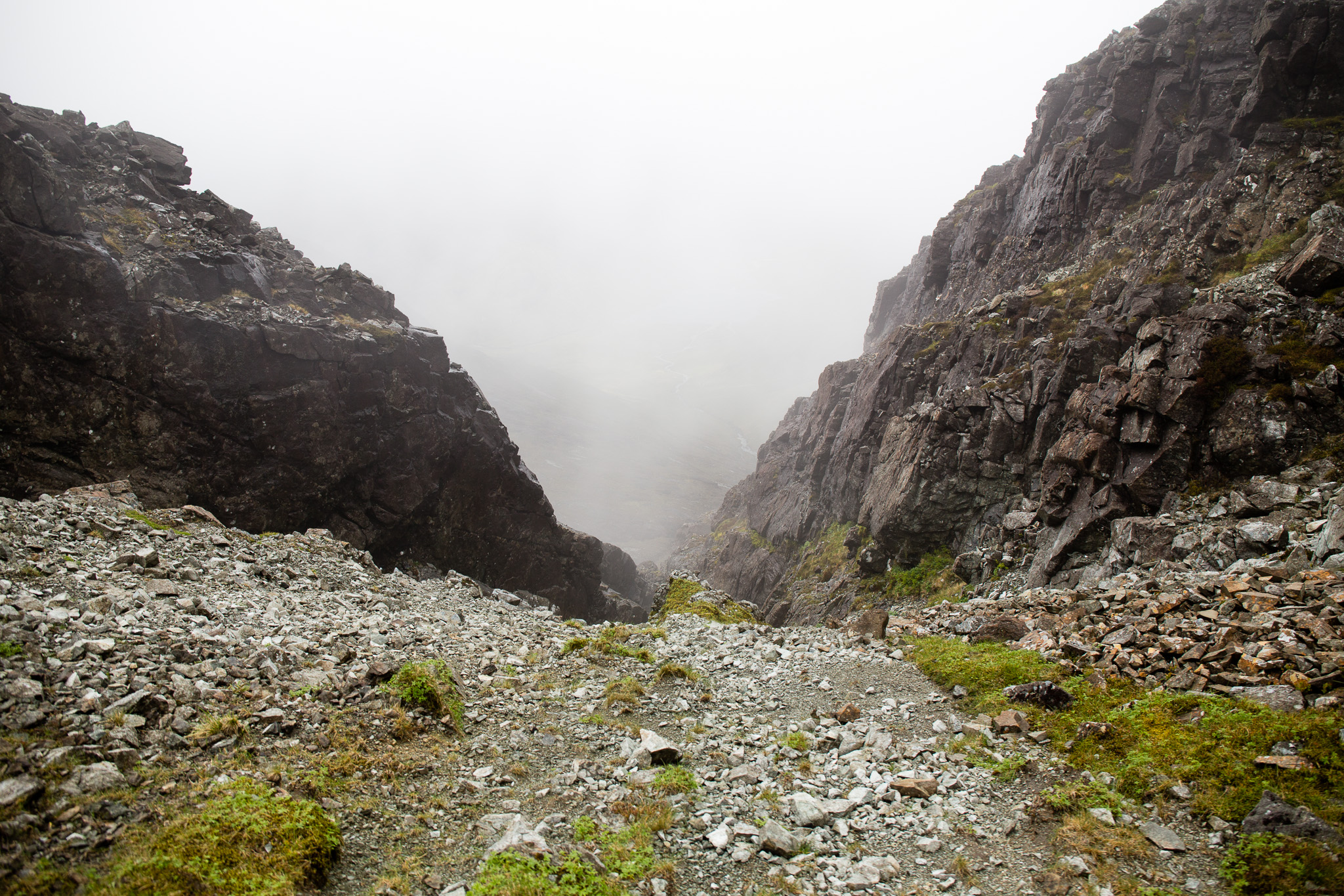 Garbh-bheinn and Belig-8
 by
anniesmountains, on Flickr
From the top of the buttress after scrambling up the rock. Clach Glass looks ominous in the mist. You can see the narrow bealach at the base.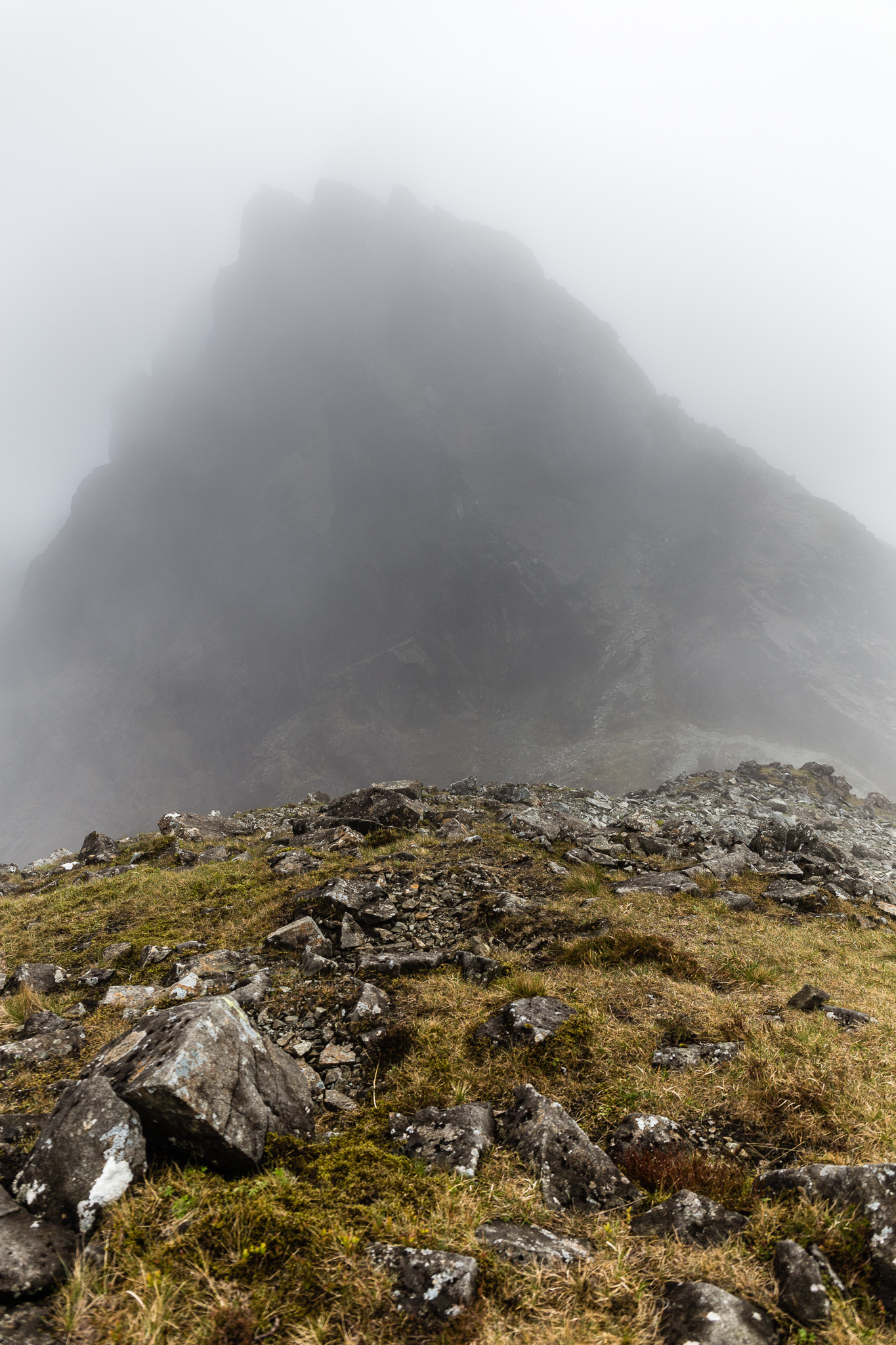 Garbh-bheinn and Belig-9
 by
anniesmountains, on Flickr
Back down to Coire a’ Càise. There are fantastic crags on the buttress.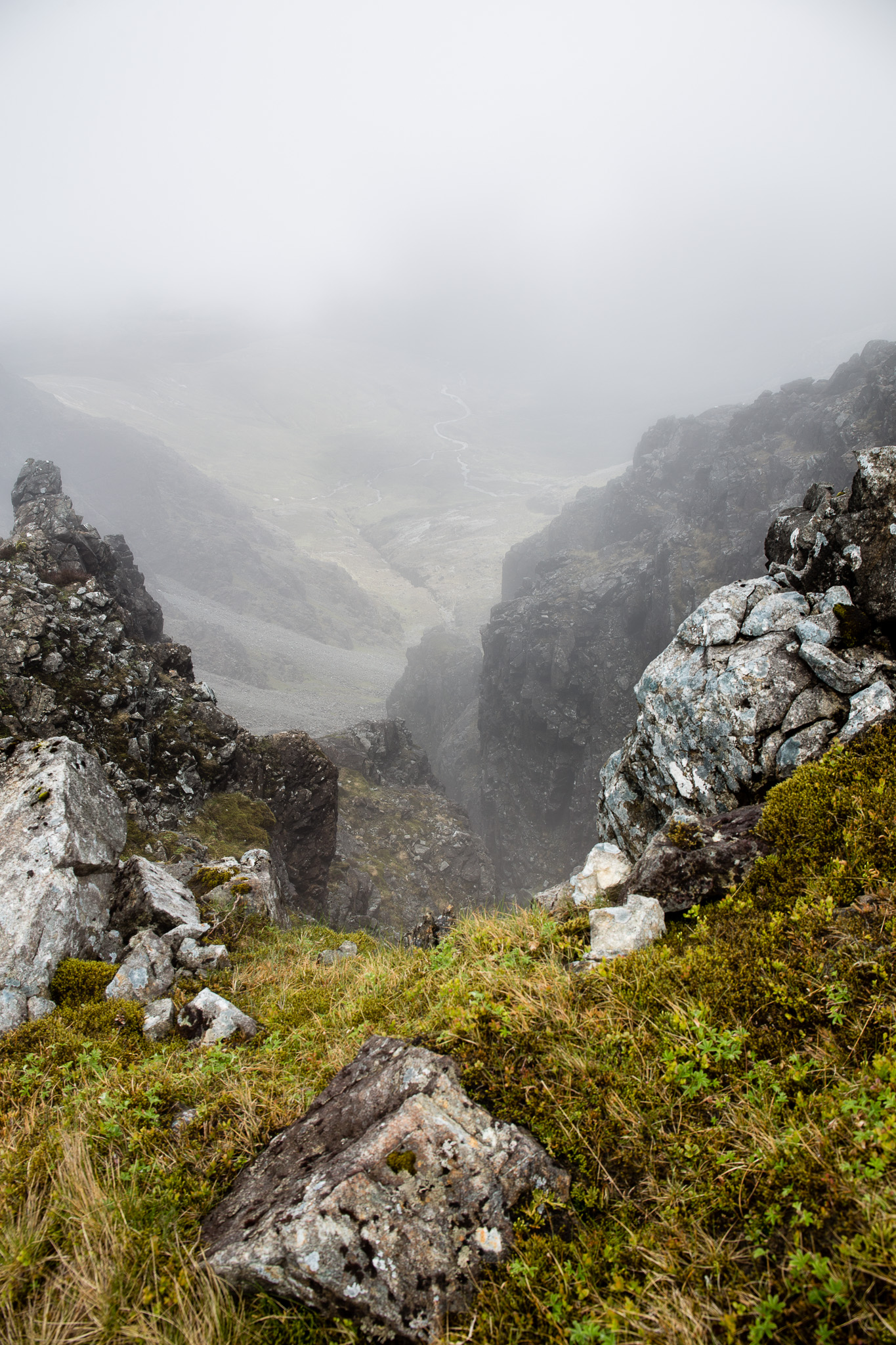 Garbh-bheinn and Belig-10
 by
anniesmountains, on Flickr
The top of the right-side scree ascent.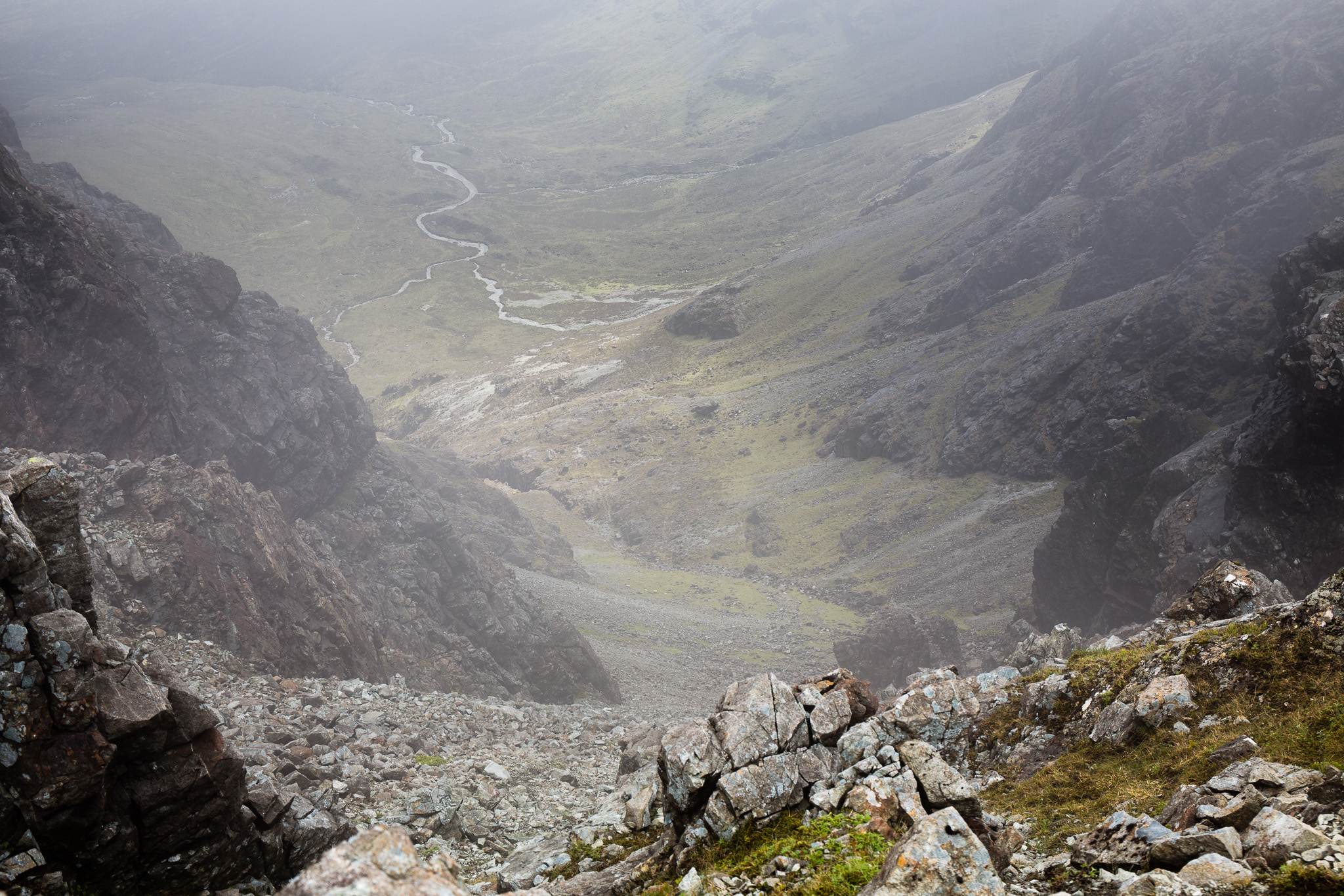 Garbh-bheinn and Belig-11
 by
anniesmountains, on Flickr
At the base of Garbh-bheinn the cloud lifted for seconds so I could see Loch an Athain but not enough to see the Black Cuillin behind. The north slopes of Blà Bheinn on the left and Ruadh Stac on the right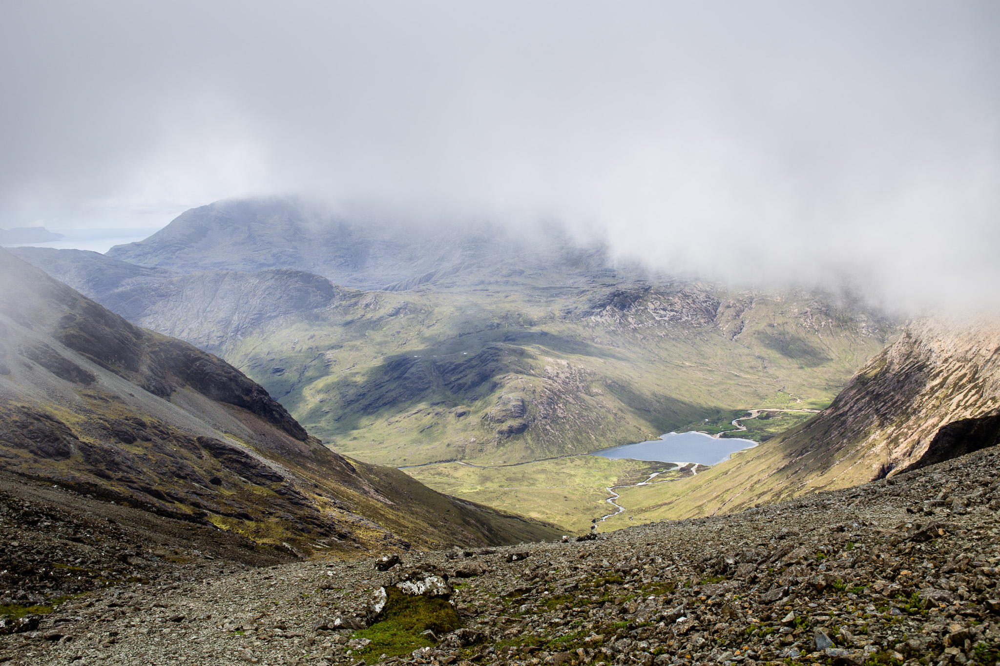 Garbh-bheinn and Belig-13
 by
anniesmountains, on Flickr
The task ahead - Garbh-bheinn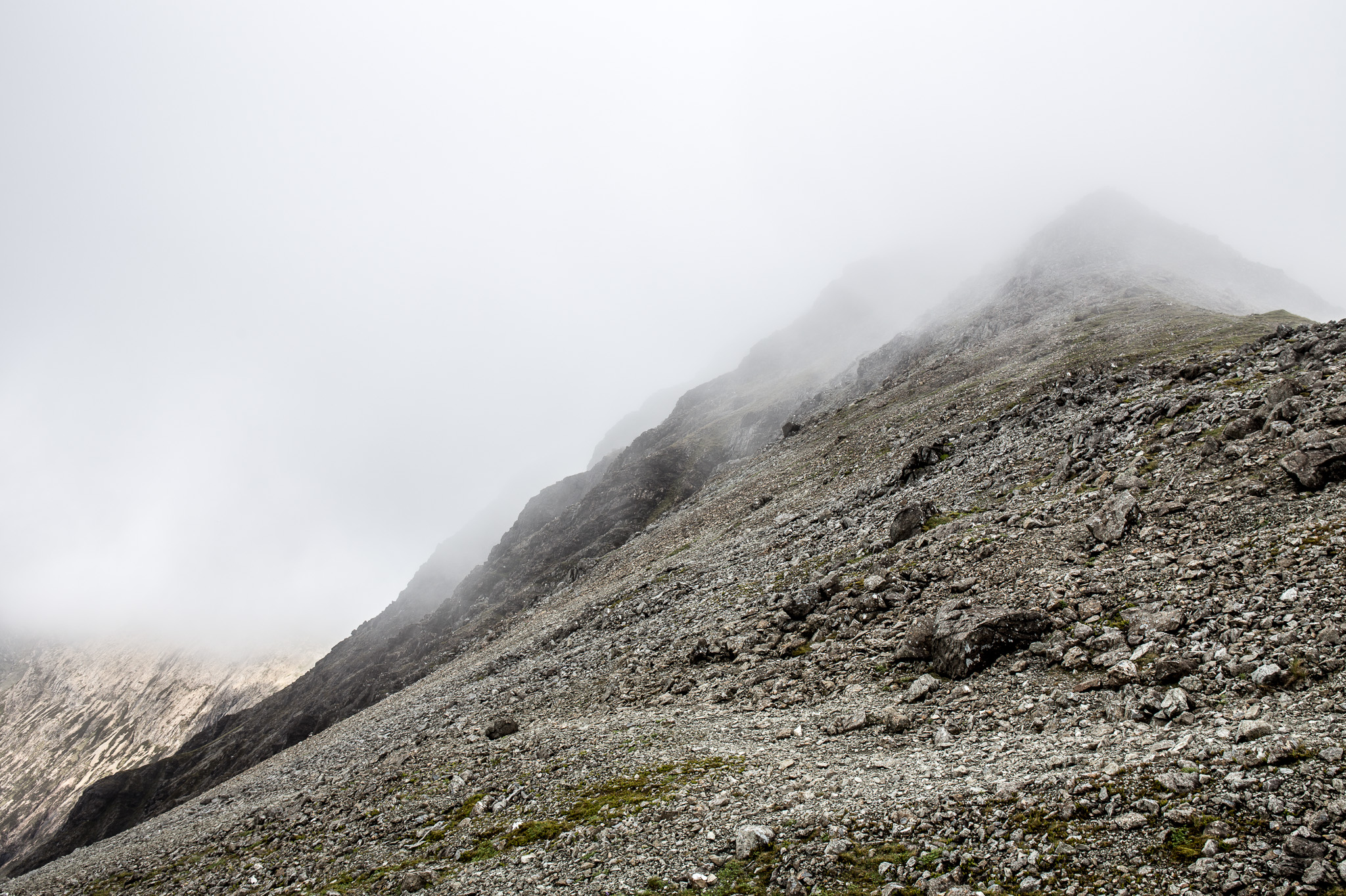 Garbh-bheinn and Belig-14
 by
anniesmountains, on Flickr
I stopped here for a breather and ate an apple - listening to the chatter of some people (maybe only two but I couldn't see them) above me coming off Sgurr nan Each. I saw one ghostly figure heading in the direction of Clach Glas so presume they were going to do the traverse. Hope they got some views!
I really enjoyed the ascent of Garbh-bheinn from here. There are lots of by-pass paths to avoid the direct line but I only took one near the top where I was faced with a tower of rock where I couldn't see any way up. It reminded me of being a child not knowing what you would find round the next corner. The summit area is tiny, there was no sign of the mist lifting so I took a photo and headed down the east ridge towards Belig.
The tiny summit of Garbh-bheinn with the east ridge showing through the mist.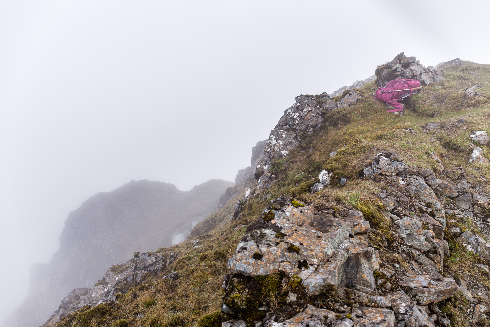 Garbh-bheinn and Belig-15
 by
anniesmountains, on Flickr
I read mixed reports about the initial descent of this ridge but I had no trouble with it - it's a bit steep but steep was the order of the day by this time! The bulk of the descent was on scree that is much more troublesome for me so I slowed down and my mood went downhill too! However, the cloud started to lift and some views were starting to show. I find it a strange experience when this happens as you really have no knowledge of the scenery until this miracle happens and one is stuck with awe. Here's what I saw.
Descending out of the mist looking down Coire Aigeinn.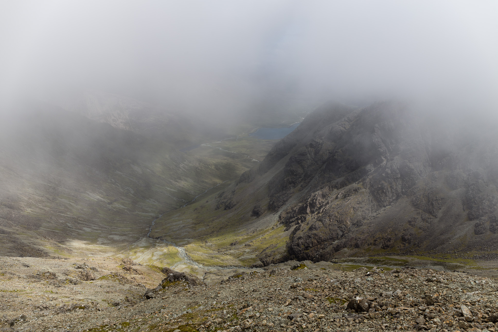 Garbh-bheinn and Belig-16
 by
anniesmountains, on Flickr
A little wheatear sits in the sun.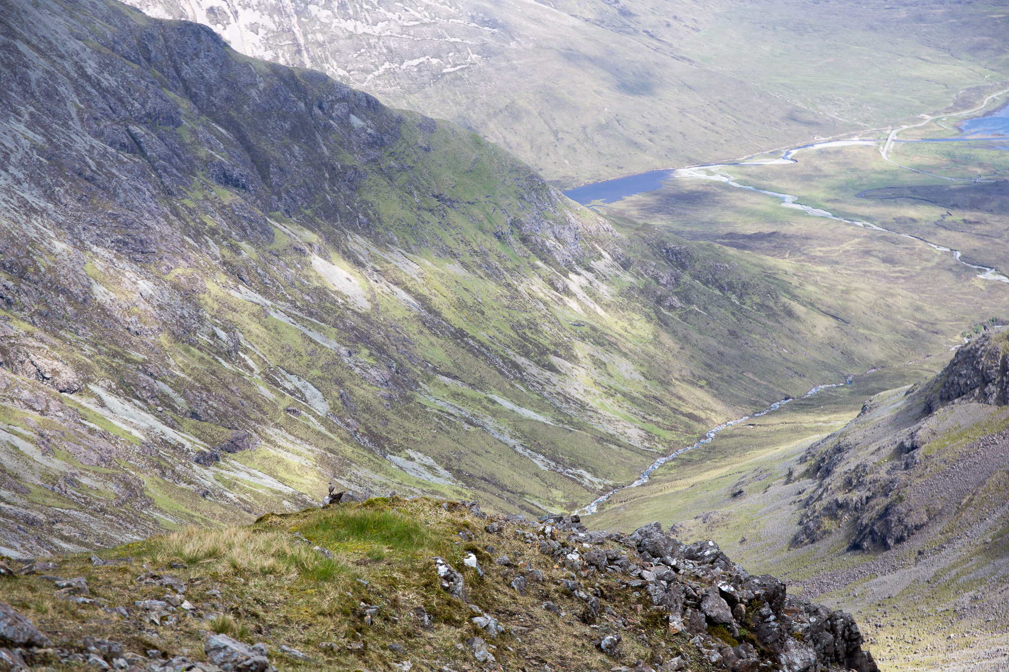 Garbh-bheinn and Belig-17
 by
anniesmountains, on Flickr
Sgurr nan Each shows up and even the base of Clach Glas. You can see where I ascended from the corrie at the base of the V shape at the base of CG.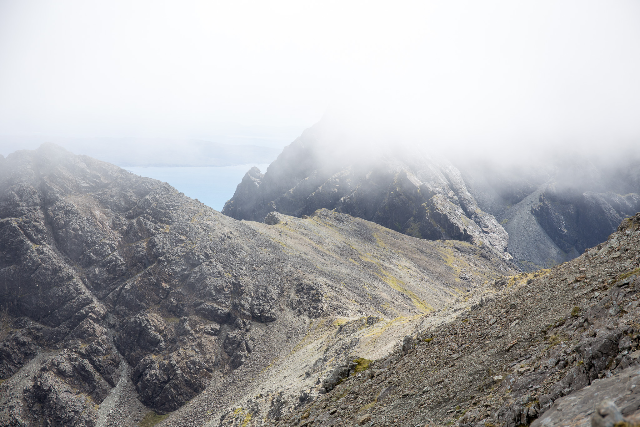 Garbh-bheinn and Belig-18
 by
anniesmountains, on Flickr
The north ridge of Garbh-bheinn, Druim Eadar Dà Choire and the bulk of Marsco behind. Wow!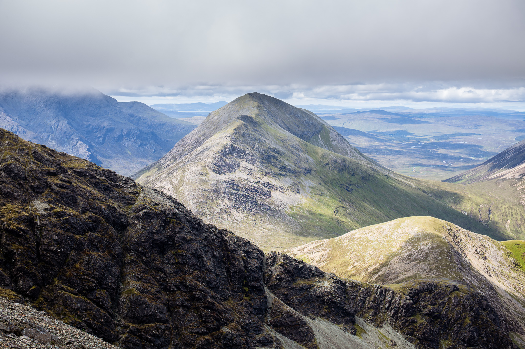 Garbh-bheinn and Belig-19
 by
anniesmountains, on Flickr
A little later and more things to see. Six walkers crossing Sgurr nan Each. You can see the big slab on the very left of the photo. Clach Glas starting to look like the Matterhorn!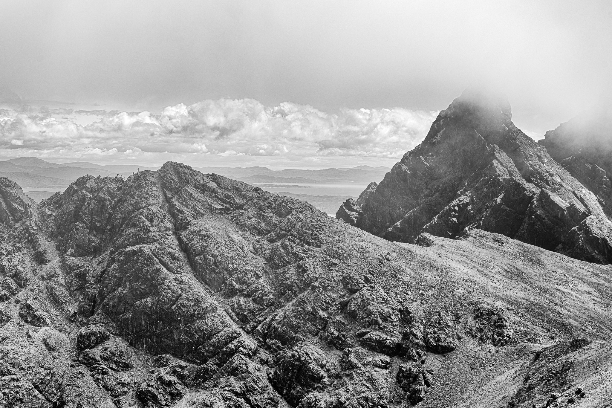 Garbh-bheinn and Belig-20
 by
anniesmountains, on Flickr
It was all so powerful that I really though for a few minutes of going back up Garbh-bheinn! One of the views I really wanted to experience was of the Black Cuillin Ridge. However, I also saw Belig looming in front of me and it looked impossibly steep from the descent of GB.
Belig awaits.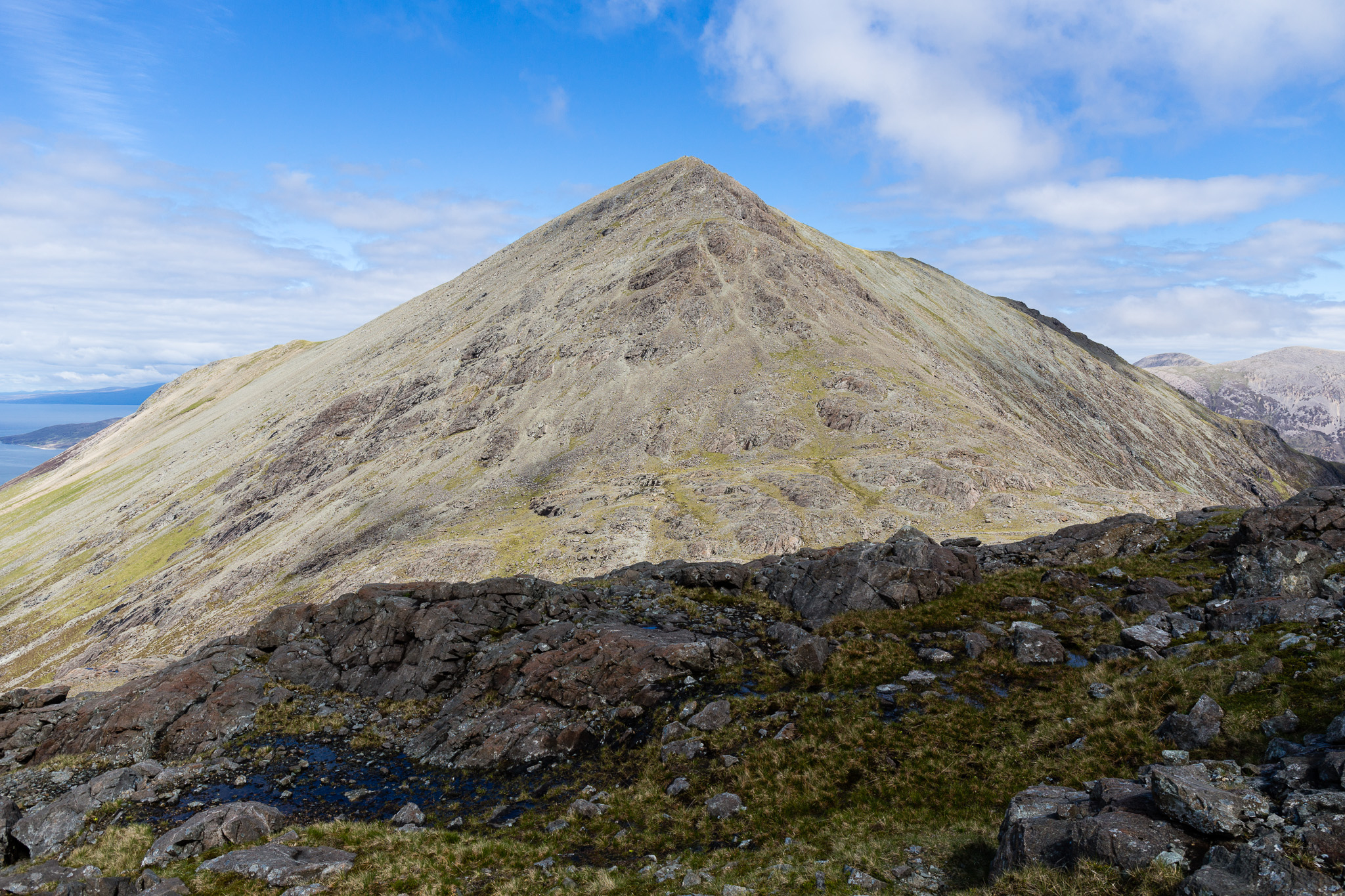 Garbh-bheinn and Belig-21
 by
anniesmountains, on Flickr
I climbed up from Bealach na Beiste a bit and found a fantastic picnic spot out of the wind (it was just a light wind but a bit chilly). I could have stayed there all day drinking in the views.
First sight of Sgurr na Gillean and the north part of the main ridge.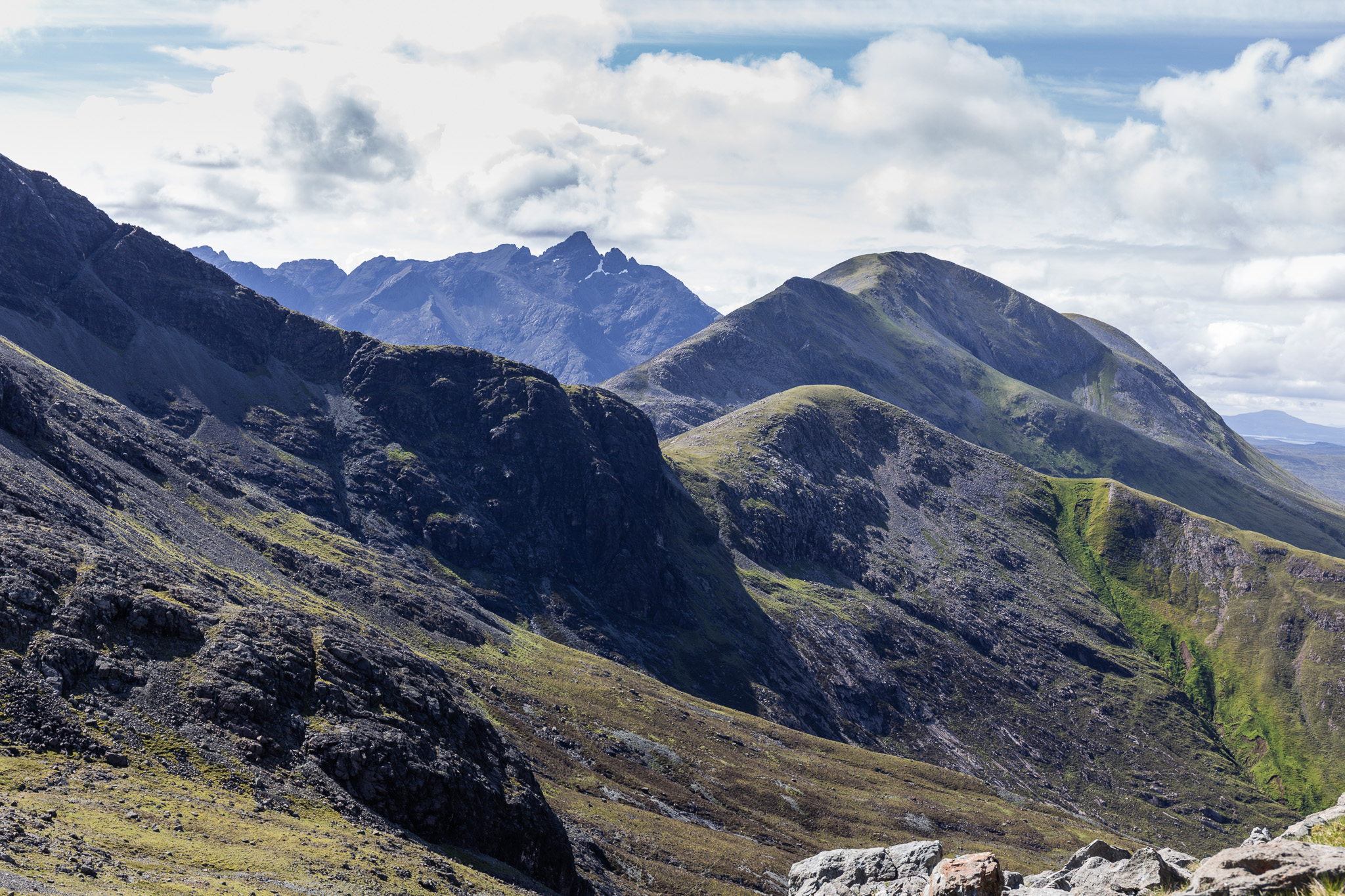 Garbh-bheinn and Belig-22
 by
anniesmountains, on Flickr
Bealach na Beiste and Garabh-bheinn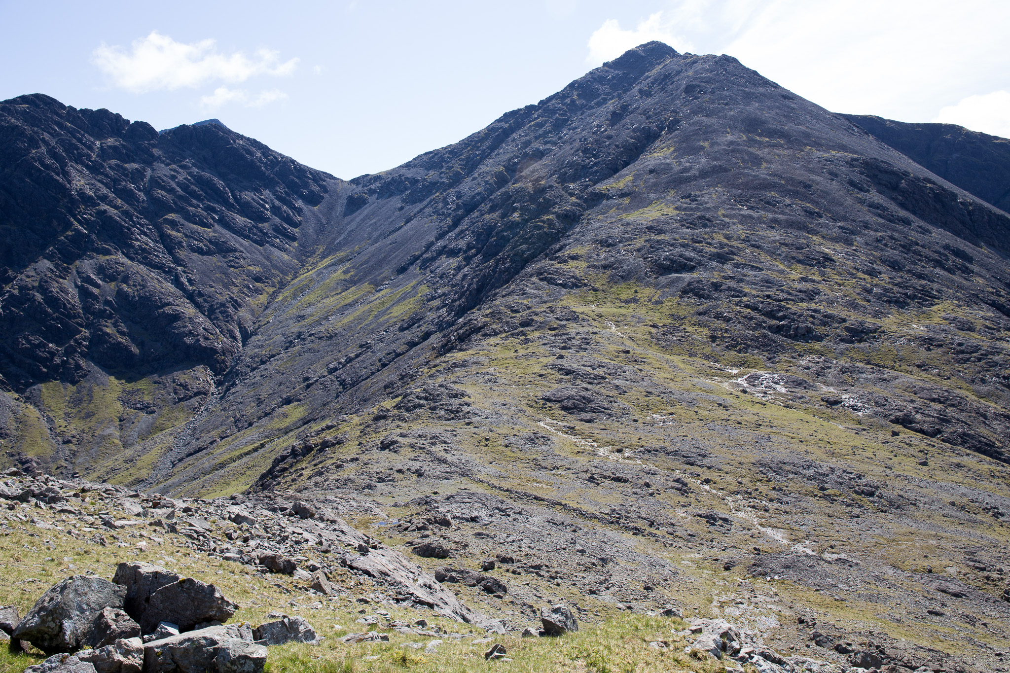 Garbh-bheinn and Belig-23
 by
anniesmountains, on Flickr
But I had a steep scree climb ahead of me. There's a red rock about half way up from the bealach that I headed for - after that the scree got steeper up a sort of gully but at the top of that the wall begins and then the going gets easier with some simple scrambling and grass. Before you know where you are the summit cairn appears. Wow, it was worth the effort.
Looking back from the summit of Belig.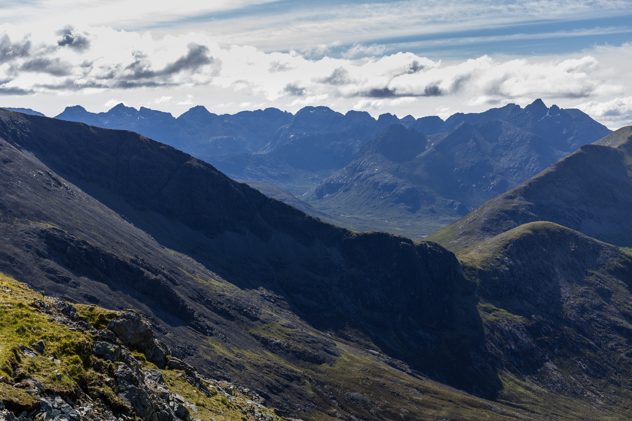 Garbh-bheinn and Belig-24
 by
anniesmountains, on Flickr
The Beinn Deargs and Glamaig behind.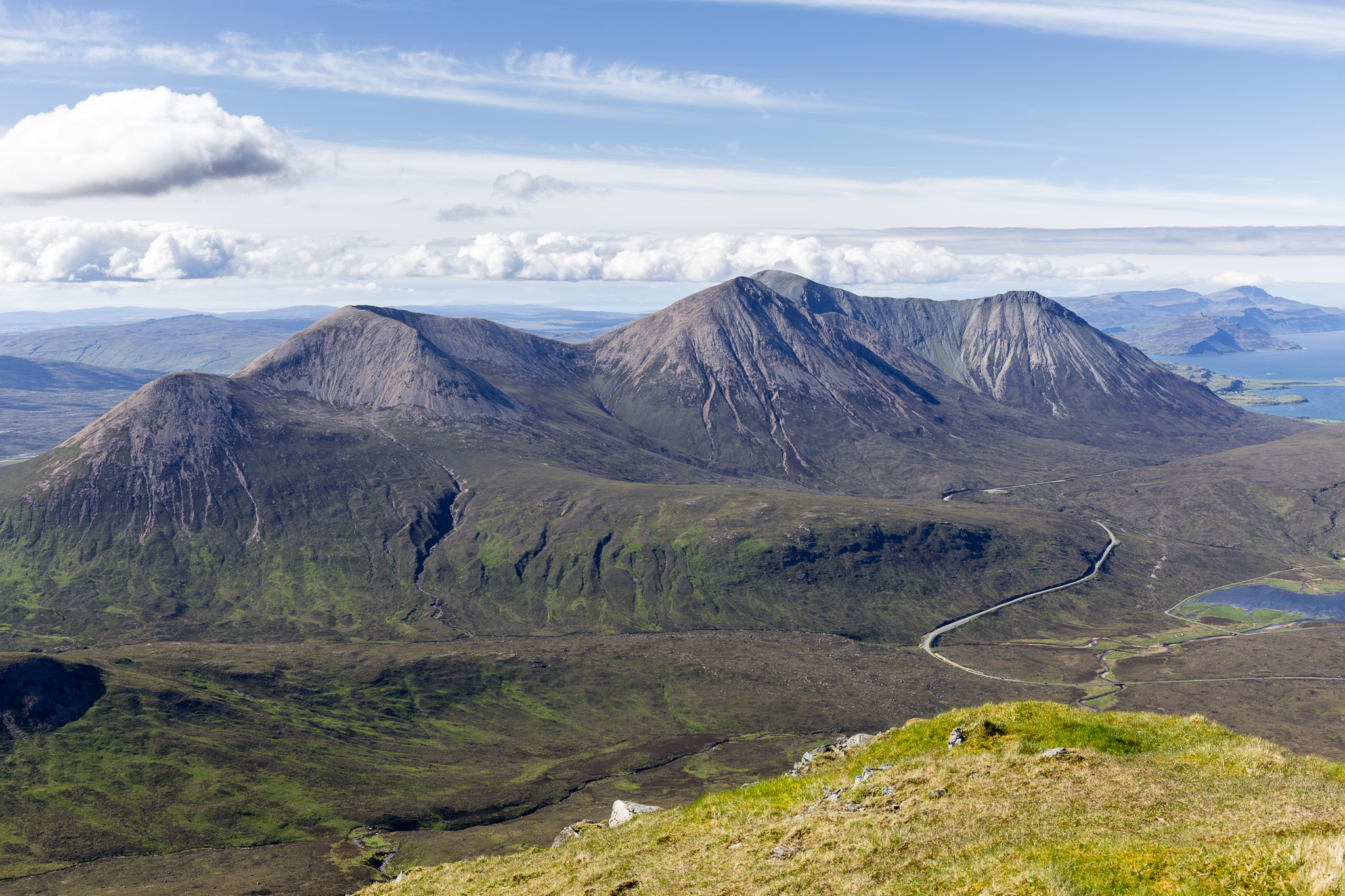 Garbh-bheinn and Belig-25
 by
anniesmountains, on Flickr
Blà Bheinn, Sgurr nan Each and Garbh-bheinn.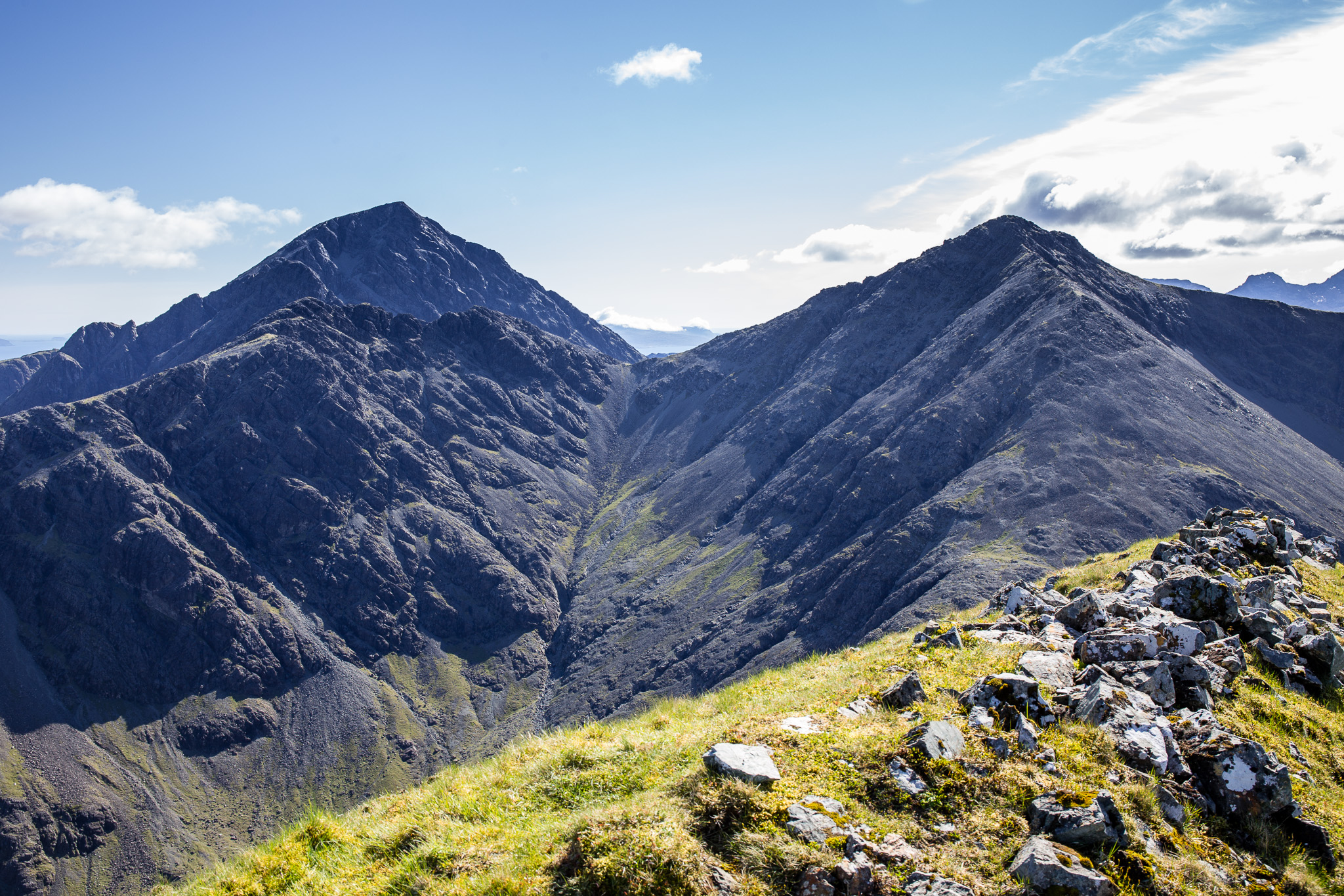 Garbh-bheinn and Belig-26
 by
anniesmountains, on Flickr
Beinn na Crò and the Broadford Grahams behind the lovely ridge of Belig.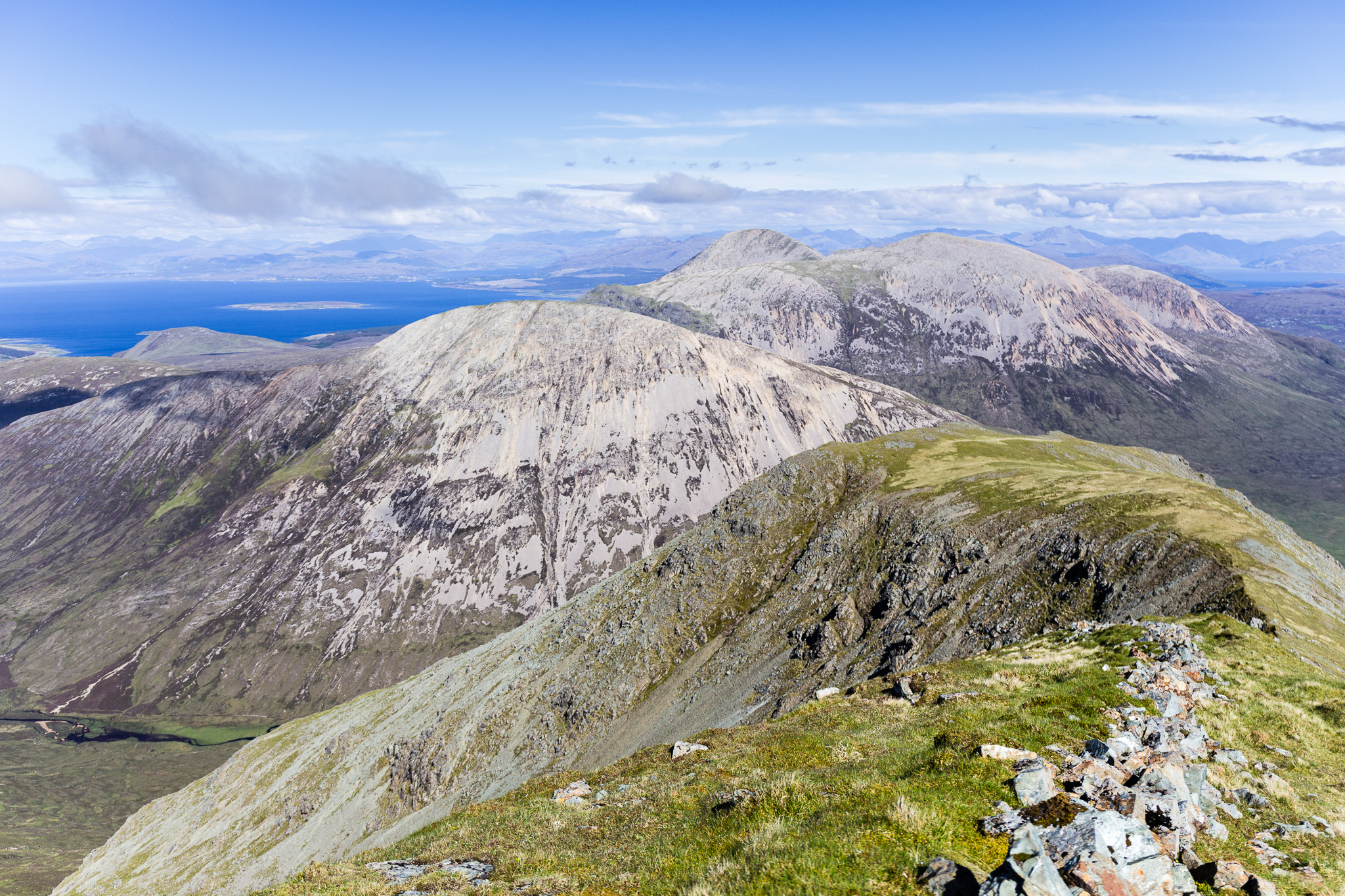 Garbh-bheinn and Belig-27
 by
anniesmountains, on Flickr
 Garbh-bheinn and Belig-28
 by
anniesmountains, on Flickr
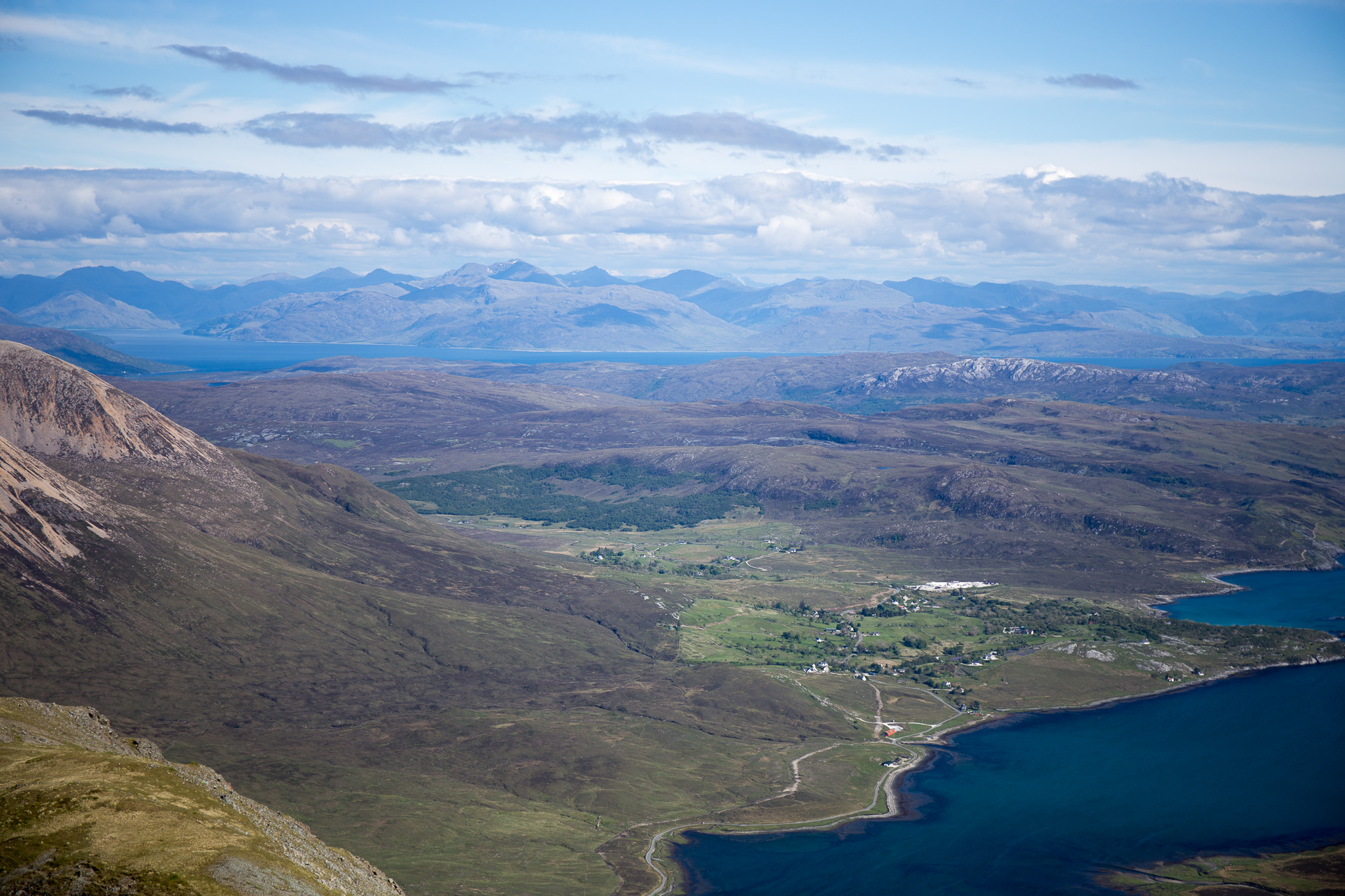
Torrin and Loch Scavaig.Garbh-bheinn and Belig-28 by
anniesmountains, on Flickr
Gorgeous Glamaig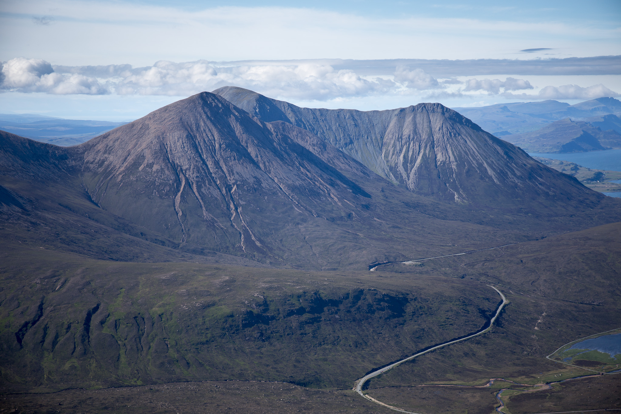 Garbh-bheinn and Belig-29
 by
anniesmountains, on Flickr
Glas Beinn Mhor with Scalpay, the Inner Sound and Applecross behind.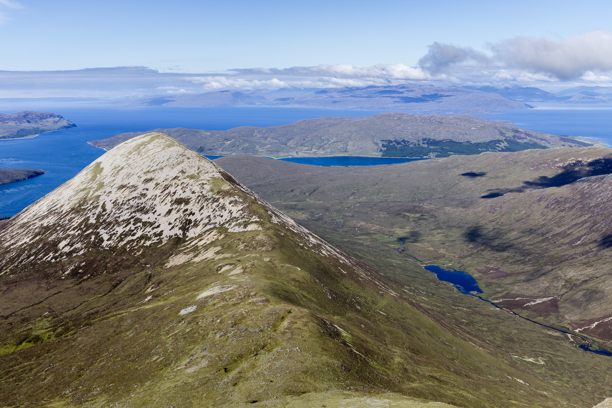 Garbh-bheinn and Belig-34
 by
anniesmountains, on Flickr
I decided to go down the south-east ridge after much pondering and I have to say it was quite exciting too.
Descending on the ridge.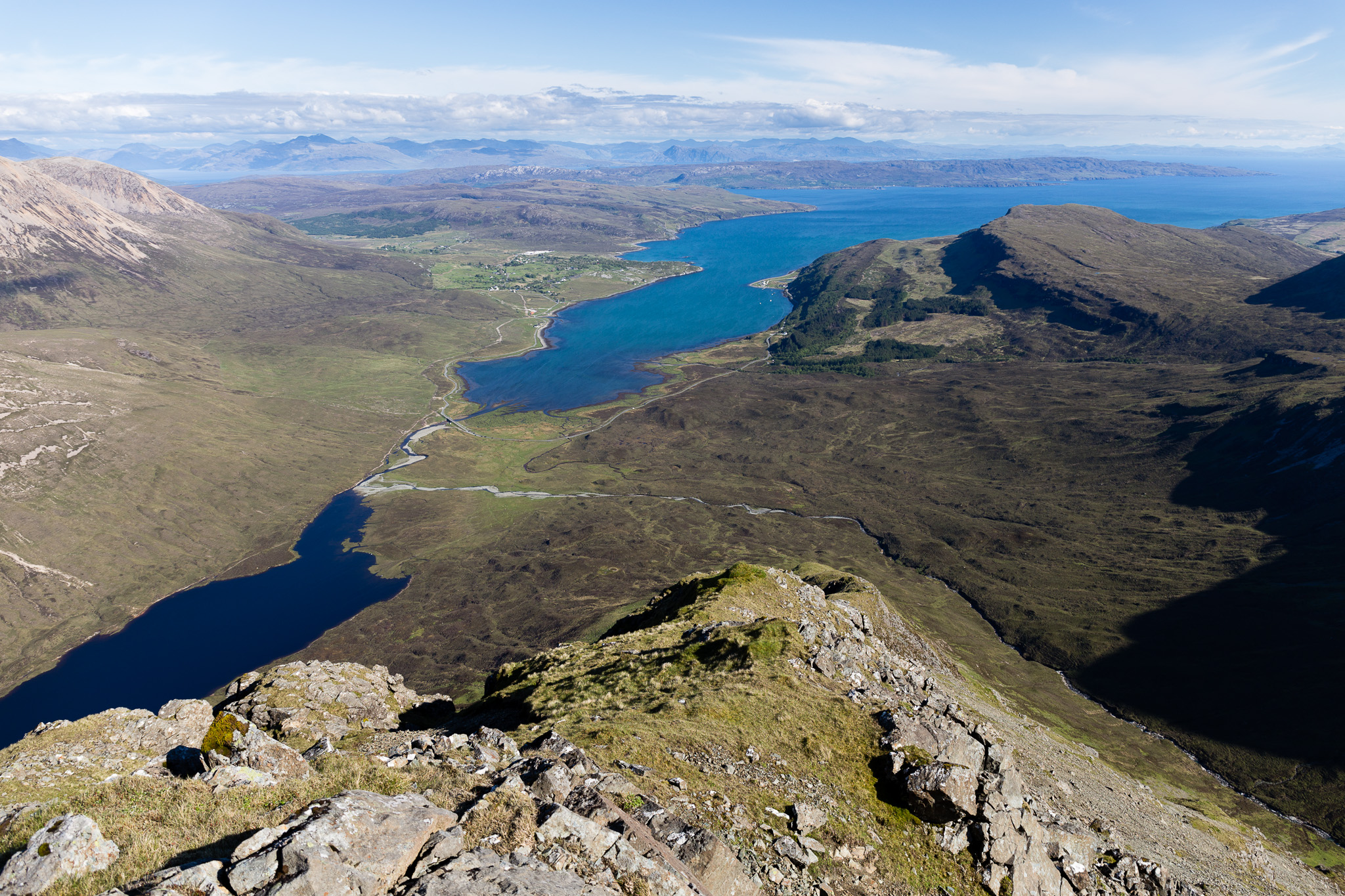 Garbh-bheinn and Belig-30
 by
anniesmountains, on Flickr
 Garbh-bheinn and Belig-31
 by
anniesmountains, on Flickr
It's mostly grassy but there are ridges of rock to get down with lots of scrambling opportunity. I didn't take any bypass paths and then I hit an obstacle when I was at about the 300m mark. Straight cliffs ahead, so I took a sharp left onto the grassy but very steep slope. This wasn't too bad but very steep and I had to walk down sideways
My big mistake was not circling back on to the ridge again. It looked an easy way down as it was just grass all the way down to sea level, so decided to do a bum-slide on the dryish grass. It really speeded my progress and it was great fun BUT I had not secured my camera in its case and it somehow fell out and went tumbling down the hillside bouncing as it went, faster and higher, faster and higher until it disappeared out of sight. I raced after it and eventually came upon it wedged between two small rocks. Amazingly the lens was not broken even though the lens cap had come off and the electronics seem OK but mechanically there's lots wrong so it looks like it will have a pretty expensive visit to Canon after the holiday.

No more incidents on the return across Allt Aigean and back to the road and the Blà Bheinn car park.
I had another camera in the car, so here is a last look at Belig with its beautiful ridge. Garbh-bheinn and Belig-32
 by
anniesmountains, on Flickr
An amazing day and my most adventurous so far. I think I can really get into this scrambling lark
Last view from the Bealach na Bà on the way home.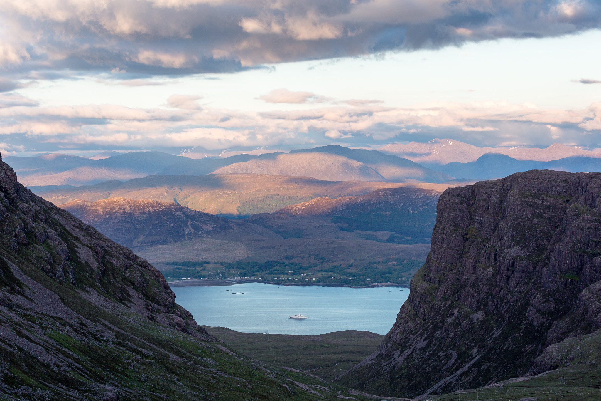 Garbh-bheinn and Belig-33
 by
anniesmountains, on Flickr
