free to be able to rate and comment on reports (as well as access 1:25000 mapping).
Corbetts: Broad Law, Hart Fell, White Coomb.
Grahams: Tinto, Culter Fell, Gathersnow Hill, Andrewhinney Hill, Ettrick Pen, Capel Fell, Croft Head, Queensberry, Ballencleuch Law.
Sub 2000ft Marilyns: Lamington Hill.
Date: 12-16/07/2014.
Distance: 136km
Ascent: 7100m
Time taken: 38 hours over 5 days
How do you do the Borders hills if you live in the far north? It's not just the distance away from home that is the problem, more that it makes you question your motives for hillwalking in the first place. While anyone living in the Central Belt will find them a handy alternative when the weather in the Highlands is crap again, I really struggle to justify the 4 hour plus journey in each direction when such greats as Kintail, Torridon, Skye, Fisherfield and Assynt are less than half that distance away. It was clear that the way to get the best feel of the area and make it most interesting would be to turn it into a series of overnighters.
I've had some of these overnighters planned for a while now, but when Gill said she would be volunteering at the Commonwealth Games for 3 weeks, I could see a way to roll them all together into one big walk. I was now quite excited at the prospect of spending time in south, as my route got more and more ambitious, which is something I hadn't expected to feel. As Gill was staying with some of our friends in Paisley for the duration of the Games, I also had the possibility of a temporary base there, although I didn't think they would appreciate me turning up periodically with a bagful of smelly clothes!
The way things ended up, I would need to go back to work for the middle week of Gill's volunteering, so a crazy 3 week assault on everything within 100 miles of Glasgow would not occur. I decided to split my time into two, with the first week taken up by a 7 or 8 day walk around the Borders and Galloway, and the 3rd consisting of a number of shorter daytrips. This is the account of the long walk, which is further broken down into 2 parts - a Borders part and a Galloway part, separated by a bus journey and a visit to Dumfries.
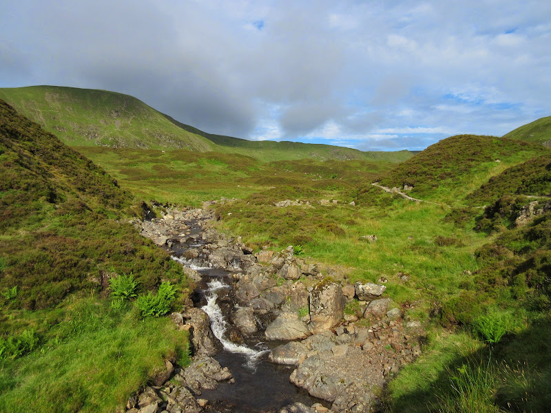
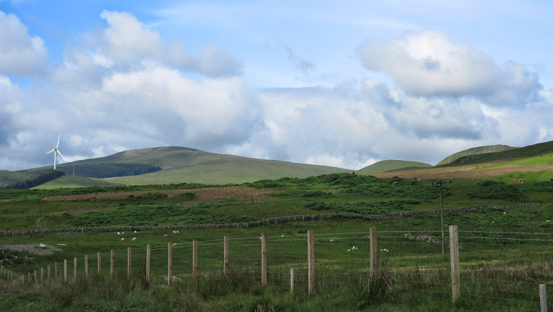
Saturday, 12th July - Thankerton to Gathersnow Hill: 6 hours, 1410m ascent, 24km. Windy, weak sunshine and showers.The Games don't actually start for over a week, but they want the volunteers down for a week of training first, so we set off down the A9 on Saturday morning. A very quiet journey in every sense of the word, with Gill wondering how she was supposed to get between Paisley and Glasgow for some of her more oddly-timed shifts when there was no parking available, and me wondering what the hell I was letting myself in for. 6 or 7 nights? Usually my longest backpacking trips are 2 or 3 nights at most!
I left Gill and the car outside the SECC and jumped on the next train to Lanark. A bit less glamorous than getting off at a stop on the Kyle or Mallaig line! Then it was straight onto a bus which deposited me at the Thankerton road junction at 2:30pm.
This was good. At worst case, I had thought I might not get started until 5pm. It also meant that I didn't really know where I was camping for the first couple of nights, as this would largely be dictated by the distance covered on day 1.
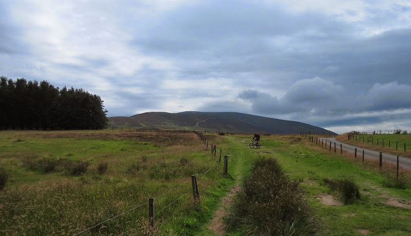
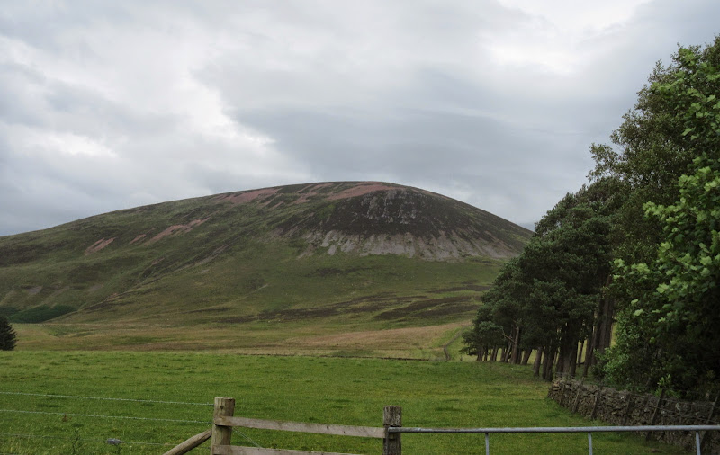
Tinto carpark was unsurprisingly busy, with all manner of people gearing up for an ascent or getting back. A guy with a mountain bike set off just ahead of me. He wasn't a great deal faster on the way up, but I'm sure he got back down in about 5 minutes.
Somebody heading up Tinto on a bike:
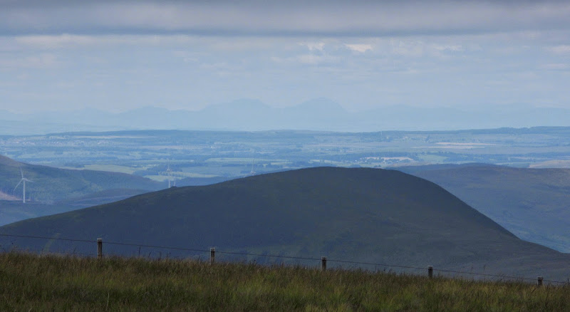
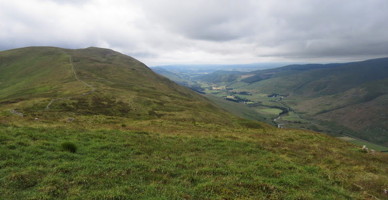
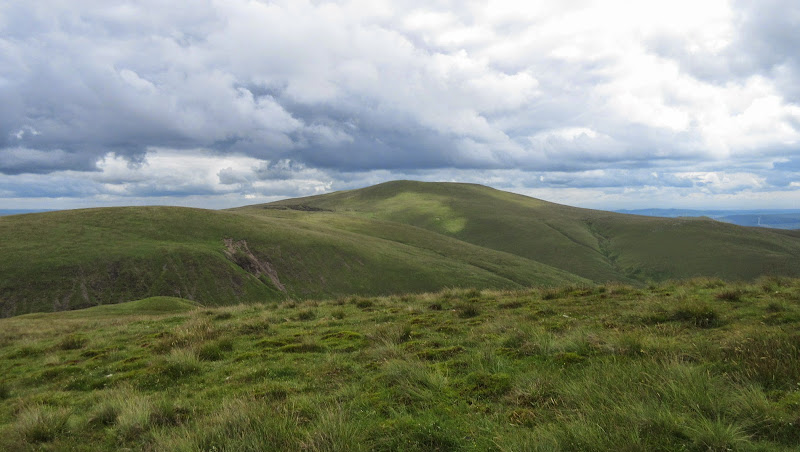
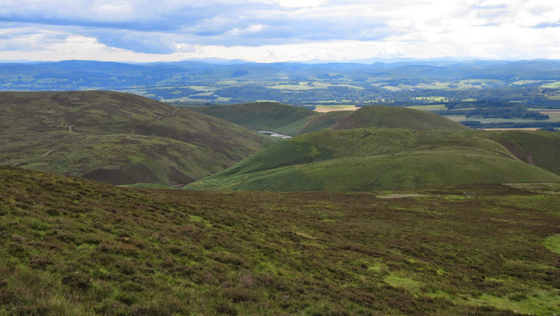
There was some pleasing sunshine which hadn't been forecast. It was a pretty uneventful ascent on a wide path, reminding me of a larger version of the Sidlaw hills behind Dundee. Pretty much exactly an hour after getting off the bus, I was on top and looking at my next hills, the Coulter Fells.
Looking north. The moodiest weather is over Glasgow:

NE to the Pentlands:
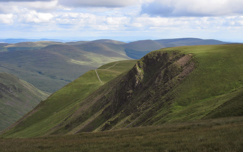
Across the Clyde to Culter Fell:
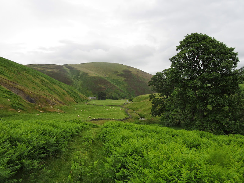
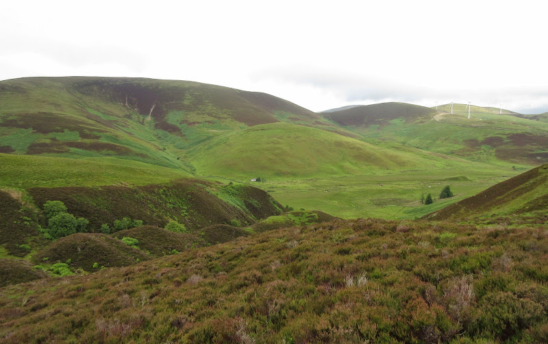
One of the things that had attracted me to Tinto as a starting point was the challenge of working it into a route with other hills. To do this, I descended the Wiston path over Pap Craig. Unlike the way up, I didn't see anyone on this, and the zigzags down the steep craggy section were quite overgrown. I'd expected more traffic as it had struck me as the most interesting way up Tinto, based on about 15 years of looking at it while passing round the base of it on the train. Still, everyone else's loss = my gain

Looking back to Pap Craig:
Then it was down through some fields to a slightly creepy looking outdoor centre at Wiston Hall, followed by a few miles on minor roads and tracks through Wiston itself, and the grounds of Hardington House. I was hit by a heavy shower at this point.
Tinto from Wiston:
Once over the Clyde, I had to follow the A702, which was not much fun, but fortunately a few minutes later I was turning up the Lamington Burn and back roads and paths again. Lamington Hill was an easy grassy ascent, and the rain eased off as I crossed the summit and dropped down into Cow Gill. At one point, I had contemplated camping up here, but it was only 6pm now - I knew I could get further.
Crossing the Clyde:
Cow Gill:
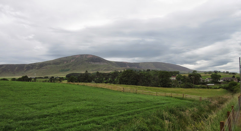
The Coulter Fells are fairly undramatic for the most part, but the steep-sided little glens and neat farms that I passed on the way to Coulter Fell were quite alluring. I paused for a water refill at the foot of Coulter Fell and started up, following a path which joined up a line of grouse butts. For a heathery lump of a hill, it was steeper than I expected.
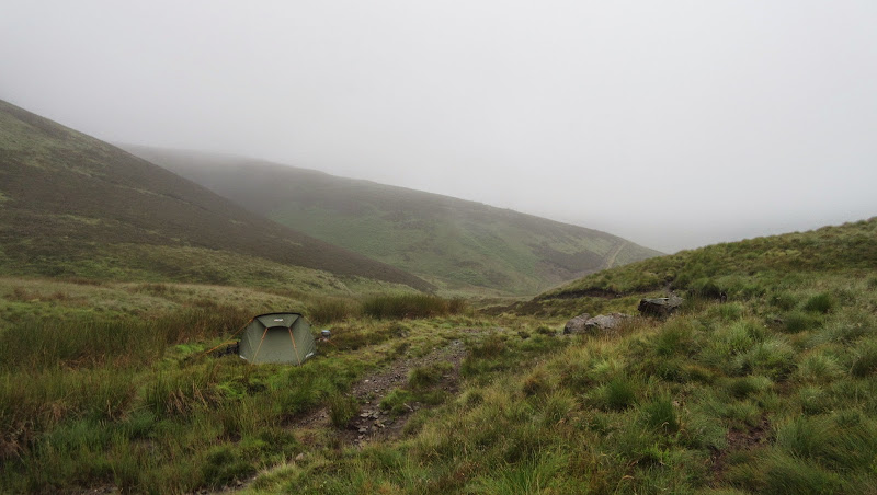
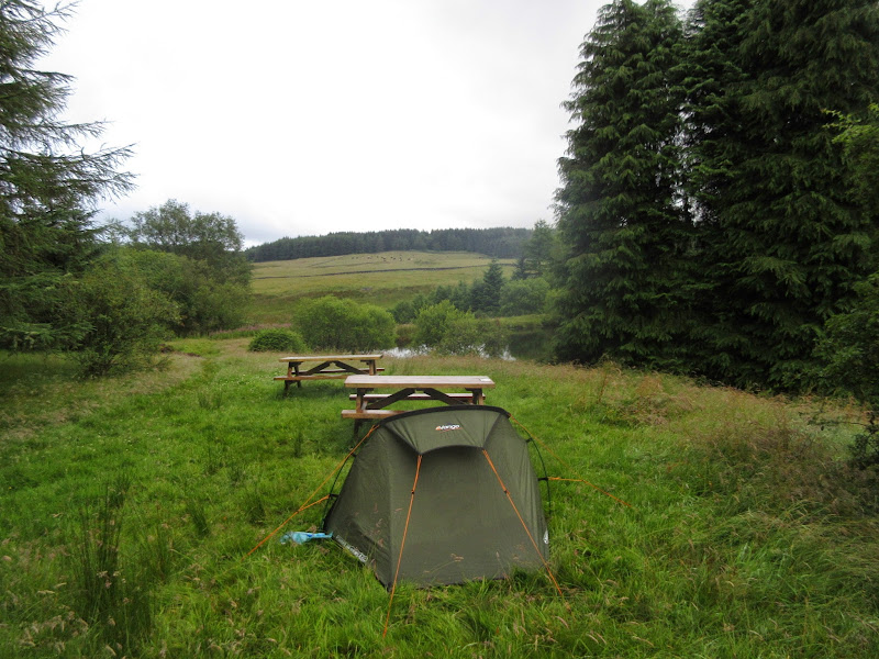
The rain was back on at the summit plateau, and quite a breeze with it. No chance of any views, and definitely not a spot for camping today! I decided to push on towards Gathersnow Hill, following a fence across springy ground. At Holm Nick, there was some respite from the wind, a small patch of firm ground and a burn. Although I had contemplated carrying on to Kingledores Burn, it was now 8:30pm and I'd have been daft to pass up on this camping spot. I'd still got further than expected on my first day.
Camping under Gathersnow Hill:
Despite the slightly miserable start to the walk, it hadn't been that bad, and a series of easy paths along the majority of the route had been a gentle break-in for tougher stuff to come.
Sunday, 13th July - Gathersnow Hill to Loch Skeen: 11.5 hours, 2340m ascent, 40km. Breezy, mostly sunny.The cloud was still lingering in the morning, but there was a shaft of sunlight on the hillside opposite, and the promise of better weather. I got going earlyish - packed up by 7:30 and on the summit of Gathersnow Hill 20 minutes later. This was in the cloud, but I soon escaped it on the descent to Kingledores Burn. A quick descent led to a good track which I followed slightly too far.
Coulter Reservoir and Hudderstone from my campsite in the morning:
Kingledores Burn:
The path over to Tweedsmuir wasn't in the slightest bit obvious on the ground, and after an easy ascent of the valley side, there was some deep heather bashing to contend with to get on the forestry track. Some nice views back to the Coulter Fells.
Coombe Hill:
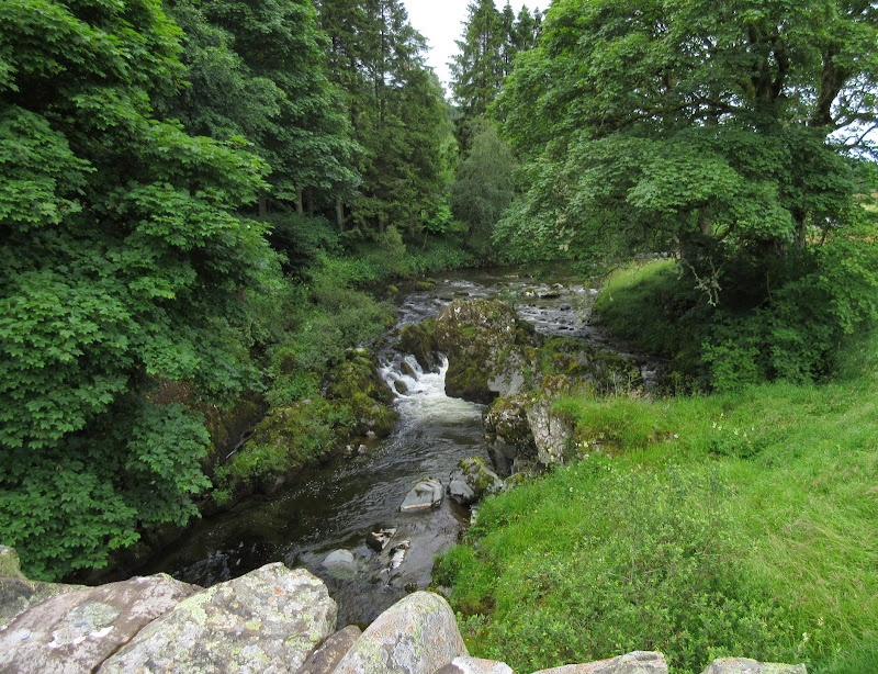
I had the choice of a forestry track descent to Tweedsmuir or my original path. I should have known it wouldn't be obvious, but stupidly I went for the path. I was able to follow forest rides down to the road, but the trees were thick in a couple of places and I had to force my way through them. The rides were also choked with wet long grass, bracken and something I hadn't considered before - nettles! I was soon to discover that these can add an extra dimension to bashing through forests in the Borders.
A minute or 2 on the road took me to the bridge over the Tweed, after which I decided to pick up an old railway line up to Talla Reservoir. I had considered using the vehicle track to the summit of Broad Law, but this didn't seem very exciting. Fortunately I remembered a circuit that Dooterbang had done which included Talla Cleuch Head, an impressive viewpoint. I hiked down the side of the reservoir for 20 minutes and headed up Muckle Side.
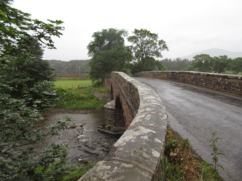
Crossing the Tweed:
Talla Reservoir:
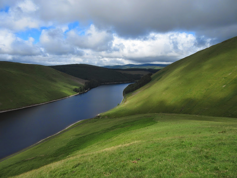
This spur was very steep, but the grass was mown short by sheep, so the walking was easy and fast. It made me think of Wales quite a bit - there are numerous hills in the south end of Snowdonia National Park that are very similar to this. Views of the head of the reservoir were brilliant on the way up, although less so from the actual summit itself.
Talla Linfoots:
Broad Law from Talla Cleuch Head:
A springy tramp took me to Cairn Law, where I abandoned all my stuff at a junction of fences. The walking on the ridge to the summit was very easy - I thought it might be boggy, but it wasn't. I could see someone ahead moving at a fair pace, but I had just experienced the joy of dumping my heavy rucksack, so had no trouble catching up. It was a woman who was also working her way around the Corbetts, although at a fairly leisurely pace. Although she only lived in Stirling, even she had struggled with the concept of heading south instead of north for the hills until recently. She had started near the Megget Stone, so we chatted away for the section of ridge between Cairn Law and Broad Law and back again, after which I headed for my bag to think about what to do next.
Summit of Broad Law:
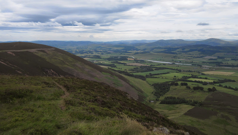
My plan had been to drop back to the reservoir and climb Garelet Hill, before following the long ridge over other summits to Hart Fell. Although Garelet Hill looked like another good viewpoint, it seemed like a lot of extra ascent would be involved. Instead, I dropped to the high point of the road and went up Moll's Cleuch Dodd. Donald bagging from Inverness seems like a pointless endeavor, so I wasn't too bothered about missing the additional summits, a number of which are probably unexciting anyway.
Ascent of Moll’s Cleuch Dodd:
Some big hills to the north – Arrochar Alps or perhaps Ben Ledi?
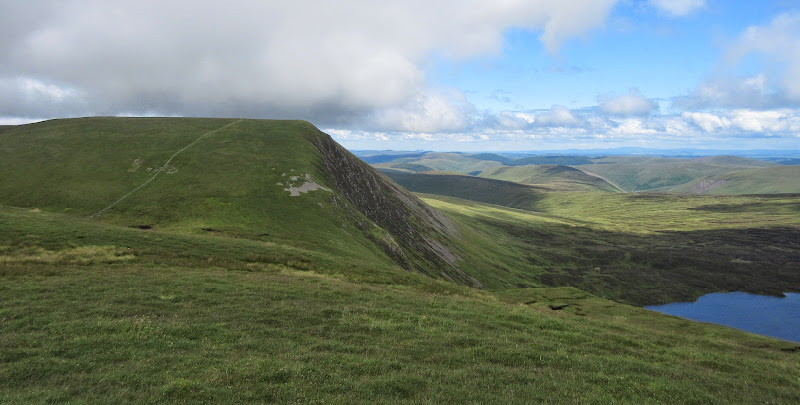
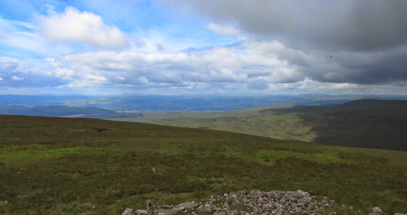
On the White Coomb plateau, the walking was also easy, following long straight drystone dykes. The thing that alarmed me was how far away Hart Fell appeared. I'm not a big fan of out-and-back additions to a walk, but this was a chance for me to dump my bag and have an easier time of it. I reckoned 90 minutes away from my bag on Donald's Cleuch Head to visit the two Corbetts. I hadn't looked at the map too hard to back up that guesstimate.
Lochcraig Head and Loch Skeen:
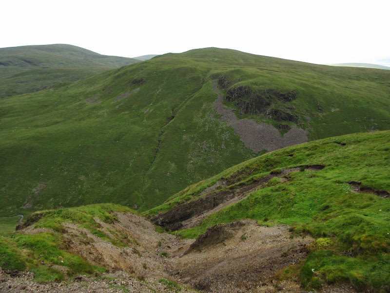
The going stayed easy until I got to Rotten Bottom, which was an interesting soup of bog. After passing behind Raven Craig, there was a second boggy col, although not as bad, followed by a long ridge to Hart Fell. There was quite a contrast in the landscape, with the plateau being unexciting grassland, but the southeastern corries having lots of attractive crags. Again, rather like some of the less showy parts of Southern Snowdonia.
I had been going well up to now, but then I had what I can only describe as a 'sugar crash', probably brought on by eating little other than chocolate and cereal bars all day. My legs went all wobbly and I slowed right down. As I had left my bag, all I had in my pockets were a couple more chocolate bars, which didn't seem to have any effect.
Crags on Hart Fell:
Down Black Hope:
Falcon Craig:
…including large group of walkers:
All this made the return from Hart Fell a bit of a trial, and I had to include White Coomb on the way past! Again, the interesting crags were at odds with the dull plateau (which made for easy walking at least).
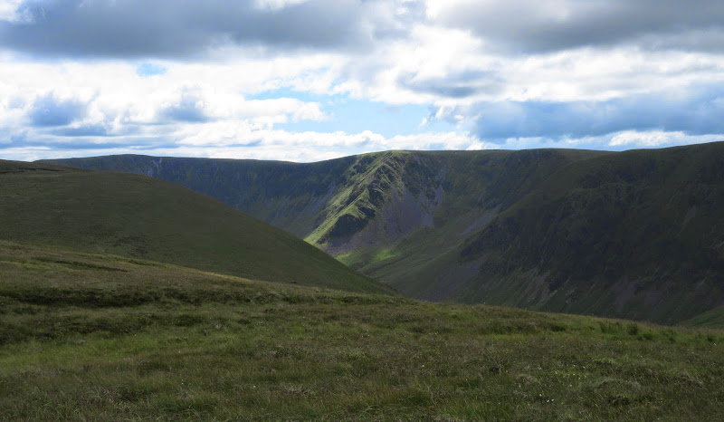
Carrifran Burn and Sadldle Yoke:
Saddle Yoke:
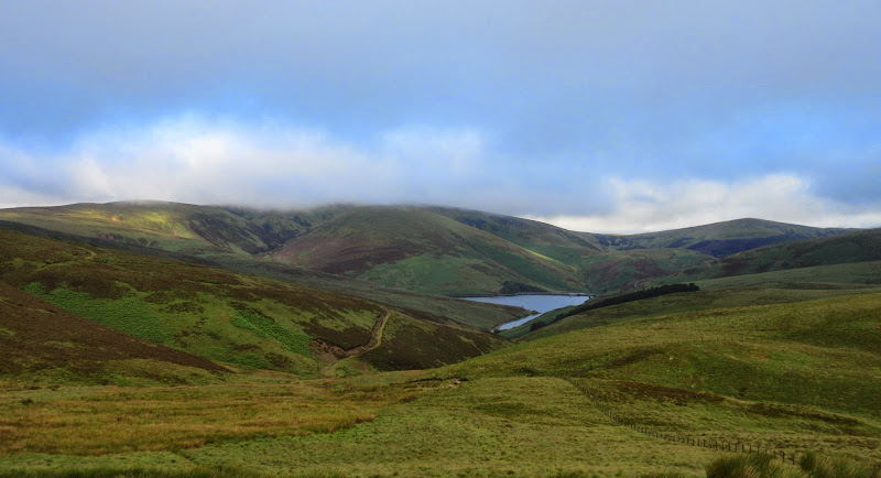
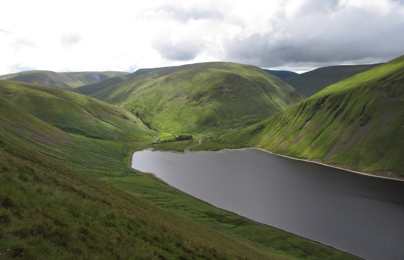
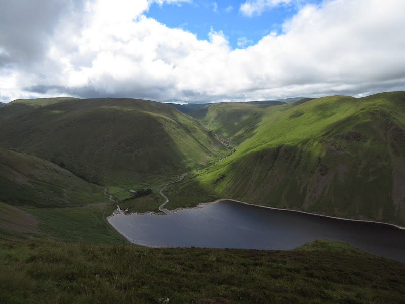
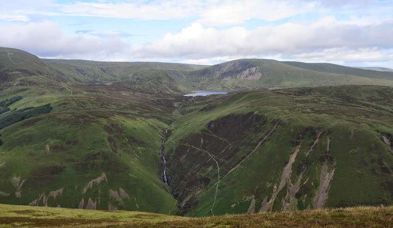
I had a break back at my bag and considered my next move. My 90 minute diversion had taken more than twice that, and it was time to start thinking about where to camp. Loch Skeen seemed like the obvious option, which pleased me immensely, as in most of my plans it hadn't come at the right part of the walk for a camp, despite my best efforts to make it fit. A slow, knee-jarring descent of Mid Craig ensued, as my strength still hadn't completely returned.
Loch Skeen from Mid Craig:
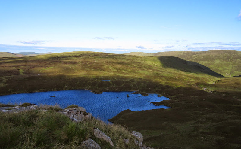
It was a lovely evening and I found a great spot out of the wind, right down by the water. The loch and crags behind were probably the most impressive thing I had seen on the walk so far.
Camping at Loch Skeen:

Last of the evening sun:
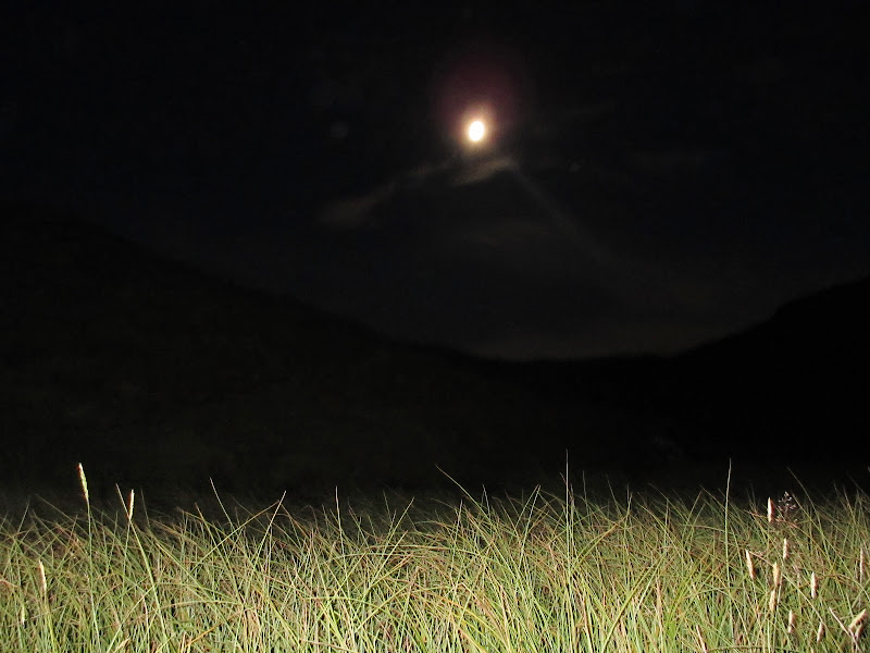
Full moon:
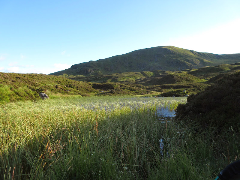
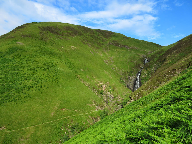
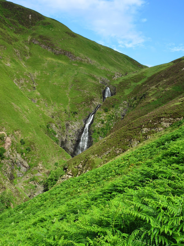
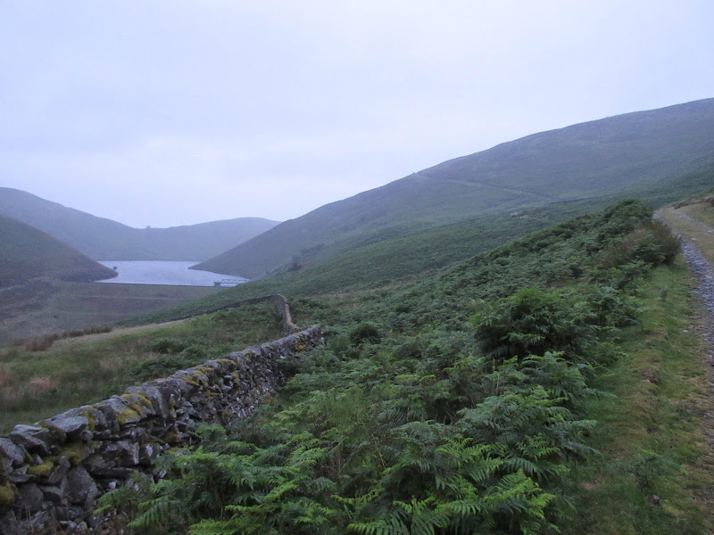
 Monday, 14th July - Loch Skeen to Earshaig: 11 hours, 2010m ascent, 38km. Starting sunny, turning to absolute misery at lunchtime.
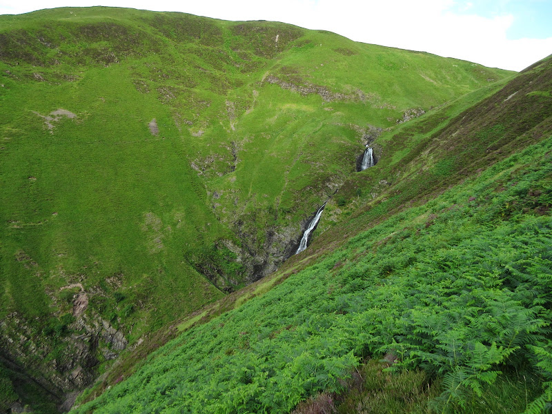
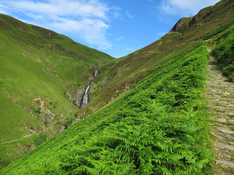
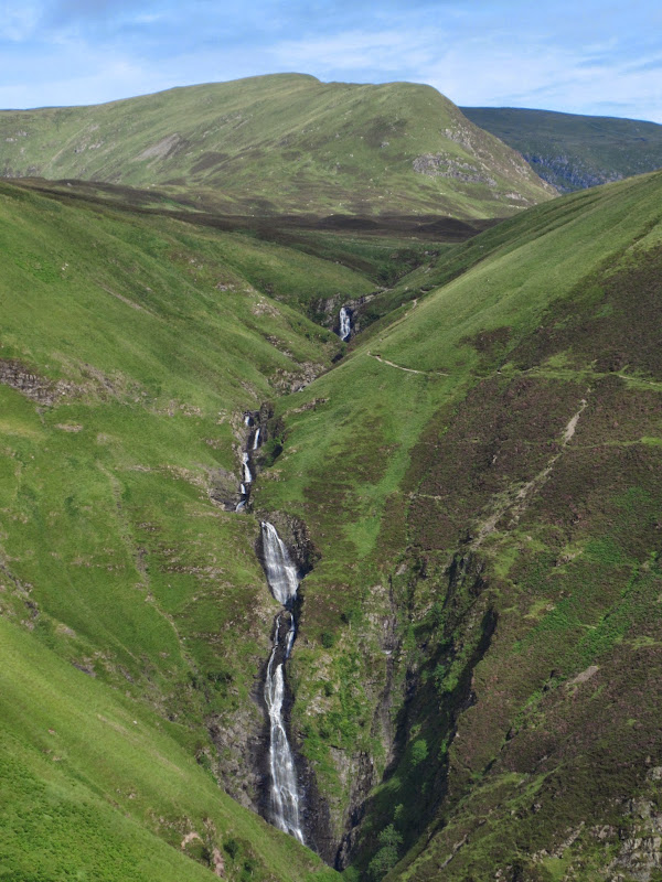
I had a lie-in, but was still off shortly after 8am. The morning sun was beautiful, and it was the best time of day to be seeing the Grey Mare's Tail. I'd seen this from the car before, but never walked right up to it. It was impressive stuff, and with a good path down to the road, I had started the day on a high.
Loch Skeen in the morning:
The Tail Burn:
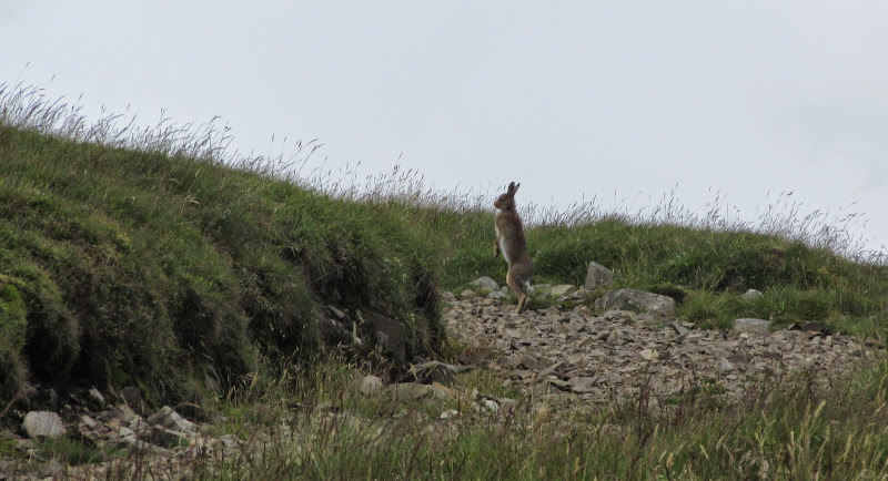
Goats above the Tail Burn:

Upper falls:
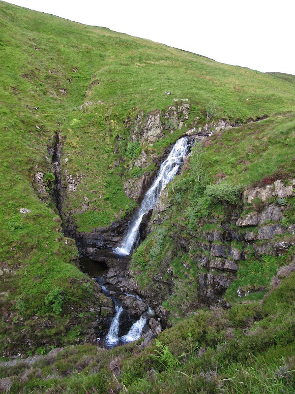
Grey Mare’s Tail:
Moffat Water:
Then it was onto the hillside facing the waterfall for the ascent of Andrewhinney Hill. Very steep in the lower parts, but again with lovely short grass, making the going reasonable. Soon, the slopes settled back and I was on the ridge. The views back to the Falls and the Moffat Fells were good initially, but the sky soon clouded over and everything looked a bit flat.
Looking back to the tail from the slopes of Andrewhinney Hill:
White Coomb, Loch Skeen, Lochcraig Head:
Big skies looking east from Andrewhinney Hill:
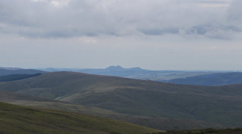
Eildon Hills stand out despite their low elevation:
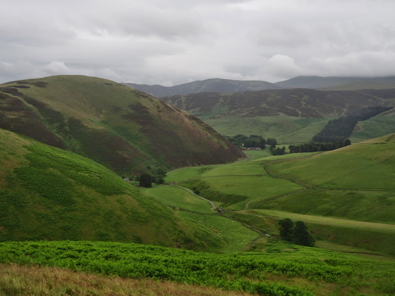
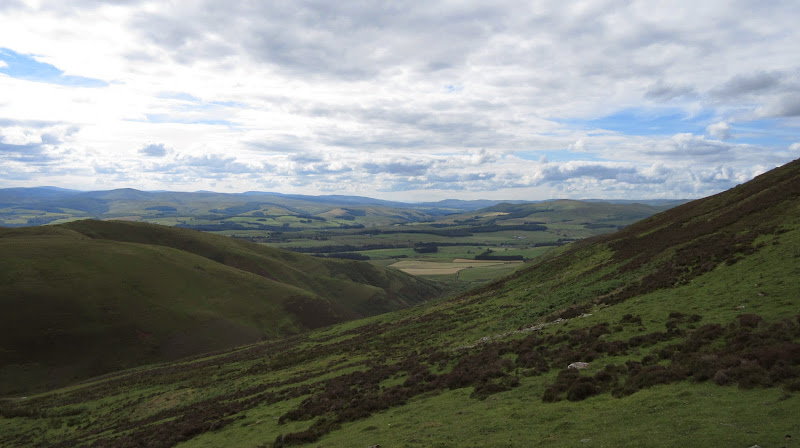
Maybe it was the dull skies, but the views down the Moffat Water from the ridge weren't as impressive as I'd hoped. They improved a bit for the final stretch to Bodesbeck Law, from it was an easy descent to the col. I picked up a forestry track here that took me down to the Ettrick.
Bodesbeck Law and Moffat Water:
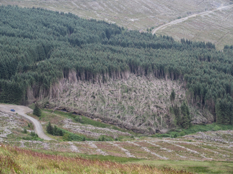
There were some pretty serious new forestry tracks in the Ettrick leading right up to the bothy. Likely to be an area that will get less attractive over the next few years, as the trees start coming out. The sun had returned at this point, but even in the glen there were strong gusts, so I went into the bothy for an early lunch. Considering the ease of access, I was impressed with the tidiness
Over Phawhope Bothy and Ettrick Pen:

Barely half an hour of walking on track and grass behind the bothy took me to the summit of Ettrick Pen. Again the odd spot of sun, but in most directions depressingly grey.
Back to the Moffat fells (in the clag) from Ettrick Pen:
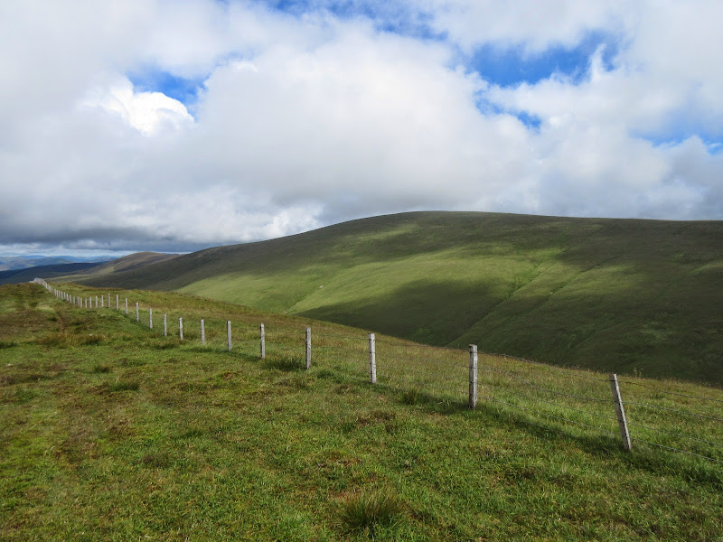
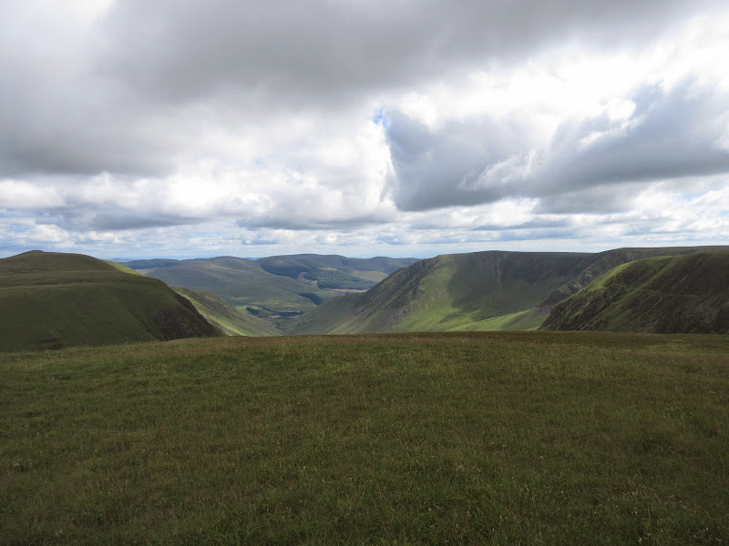
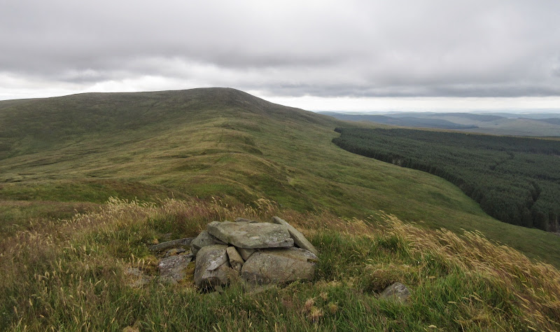
I continued towards Wind Fell along a fairly unexciting ridge. This might have been fine with a bit of sunshine, but highlighted to me why I will never do all of the Donalds as long as I live a long way from them. There seem to be too many ridges like this.
Not the most inspiring length of ridge: Hopetoun Craig:
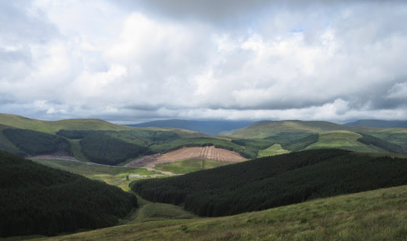
If the fellers were making Ettrick Water ready for the chop, they had already been pretty busy down in Eskdale. I've nothing against the felling, as that is why the trees were planted in the first place, but when there is little else but trees in a valley, removing them leaves little to look at other than a sort of no-man's land.
Windblown trees in upper Eskdale:
Anyway, the weather soon took care of the problem for me by moving a band of rain and cloud in to obscure the view. By the time I got to the top of Wind Fell, I was soaking. Dropping down to the Southern Upland way gave little respite, and after putting down my bag, things were even worse on the summit of Capel Fell.
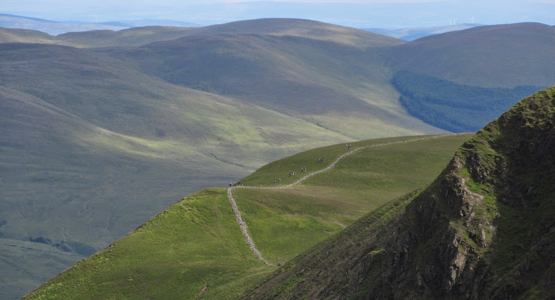
Back at my bag, I started along the Southern Upland Way, which I would probably be following for the rest of the day. Another highlight of the day would have been the gorge carved out by the Selcoth burn, but the clinging cloud and rain was so thick I barely saw anything of it. Another dump of the bag for Croft Head, which had the benefit of a Southern Upland Way alternative route over it, making walking easier. In fact it was a bit incongruous, this well-made path snaking up the back of what was quite a steep and narrow ridge for these parts.
Then it was down into the forest, where I hoped for some protection from the weather at least. The Marilyn of Scaw'd Law had been a possible add on, but this was immediately dismissed. Unfortunately the wind was coming from the SW, driving the rain up the valley I was walking down. I entered Automaton mode and tried to ignore anything to do with reality and just keep plodding down the forestry tracks. At least the waymarkers helped, meaning I didn't have to think about where I was going.
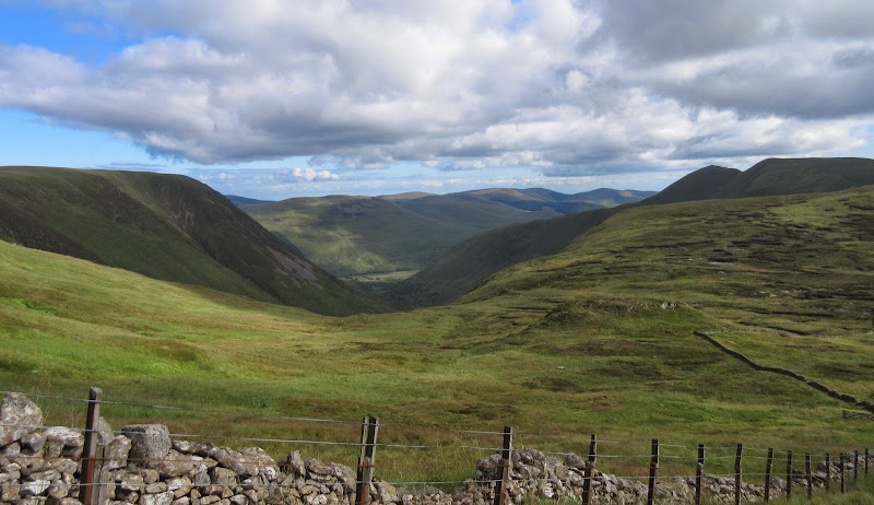
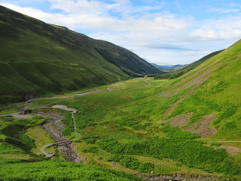
Then it was on to minor roads, down the banks of the Moffat Water, and through a couple of fields, until I reached the M74. Things were so bad that I was looking forward to reaching the underpass so I could have a break and some food! By now it was approaching 6pm and I wasn't sure where to stay for the night. Burleywhag bothy on the far side of Queensberry was out of the question as it was at least another 3 hours away over high ground. I didn't even fancy camping in the glen behind Lochanhead Farm (on the east slopes of Queensberry), which had been a previous thought. Then looking at my map I spotted a picnic spot halfway along the Crooked Road behind Beattock. That might do.
Back at the start of the 80's when I was barely a year old, we actually lived in Beattock for a year while my dad taught physics in Lockerbie Academy. But I don't have a single memory from that far back, so there was little point going looking for familiar landmarks. Instead, I carried on up the Crooked Road towards Earshaig. At least now there was some respite between the rain showers. The lochans were a short way off the road, and I was happy to find an information board there with a small roof over it - perfect for a cooking spot and somewhere to sort my gear out of the rain. Water was the issue - the stuff I got out of a nearby burn was full of visible solids - some of them even wriggling - yeuch! Best to eat the savoury rice tonight that requires half an hour of simmering...
Camping at Earshaig Lochans:
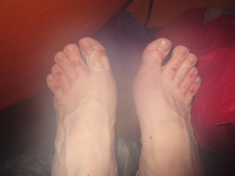
Blisters aren't usually an issue for me, but with 2.5 days of hard walking and a number of soakings, my feet weren't looking good. In fact I was having second thoughts about the trip. I could traverse the Daer hills tomorrow and quit at Thornhill, or if the weather was still foul, I could trot back to Beattock and get the bus to Glasgow. I didn't think I'd actually quit, but allowing myself to consider the option made a miserable day more bearable.
If you’re eating dinner, look away now:
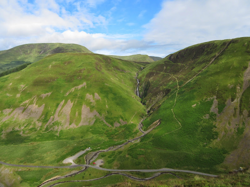
 Tuesday, 15th July - Earshaig to Kettleton Byre: 7.5 hours, 1240m ascent, 25km. Breezy, mixture of sunny and overcast.
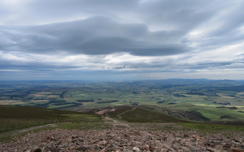
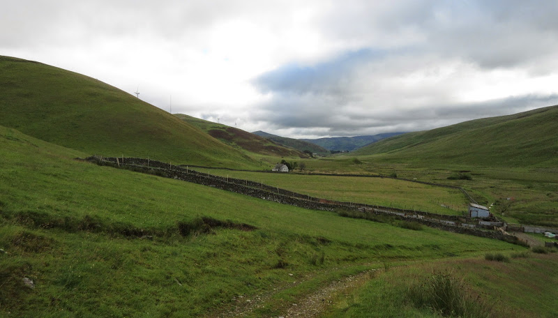
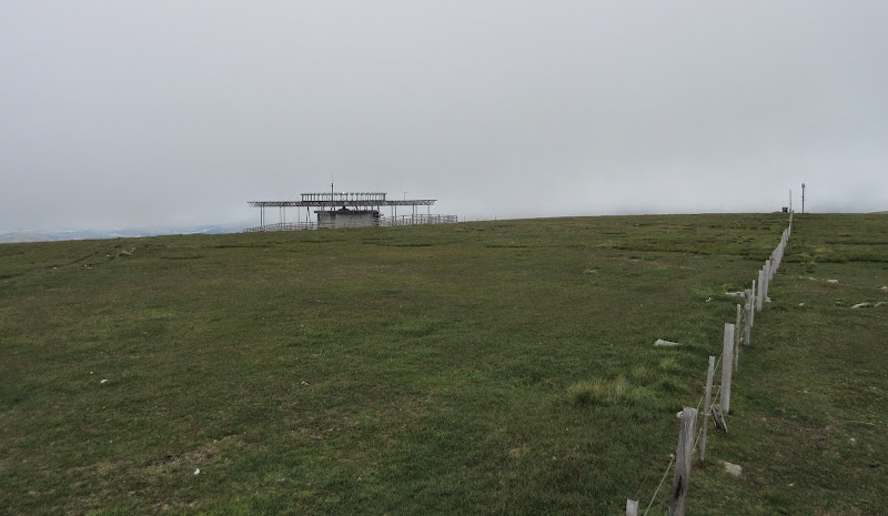
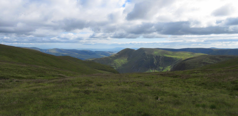
Fortunately, the next morning's weather was fine, if still a bit breezy. As this was one of my shorter days, I didn't leave until 9:30am. It was a pleasant walk along the road, and Queensberry was sitting clear of the clouds. My ascent route looked potentially wet, following the edge of the forest over gradually rising moorland. And so it transpired to be in places. The final bit to the top was nice and firm, and there were some nice rocks and moss to stroll over. Overall, the actual summit area of Queensberry felt much more like a Highland hill than any of the others I had been up so far. Views weren't bad either, although there was still a fair bit of cloud around, and a haze obscuring the Lake District.
Queensberry and Earshaig Lochans in the morning:
Harestanes Heights from the Crooked Road:
Queensberry:
West to the Galloway Hills:
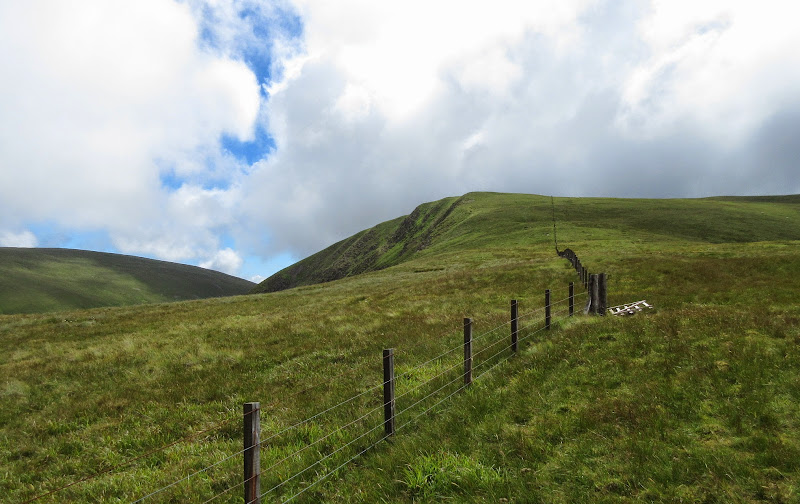
That was where the fun ended though. In order to join up the two Grahams of the Daer Hills, you have to cross quite a few intermediate summits, all of which have a fair amount of ascent. Also, while there is nothing specifically wrong with these hills, they offer the same kind of heathery grouse moorland and occasional estate tracks as the ones 15 minutes from my house (which also have views of the Cairngorms to boot). Bagging aside, I don't have any real reason to make a 400 mile round trip for this type of walking.
Still, this is why I wanted to sandwich them into a longer walk, so I enjoyed the ease of a couple of the estate tracks and considered it as a rest day (although with the amount of ascent, it wasn't really).
Earncraig Hill from Penbreck:
North to Tinto:
Back to Queensberry from Earncraig Hill:
There was also the chance to play around with the zoom on my new camera.
What’s over there?
…or maybe it’s that way:
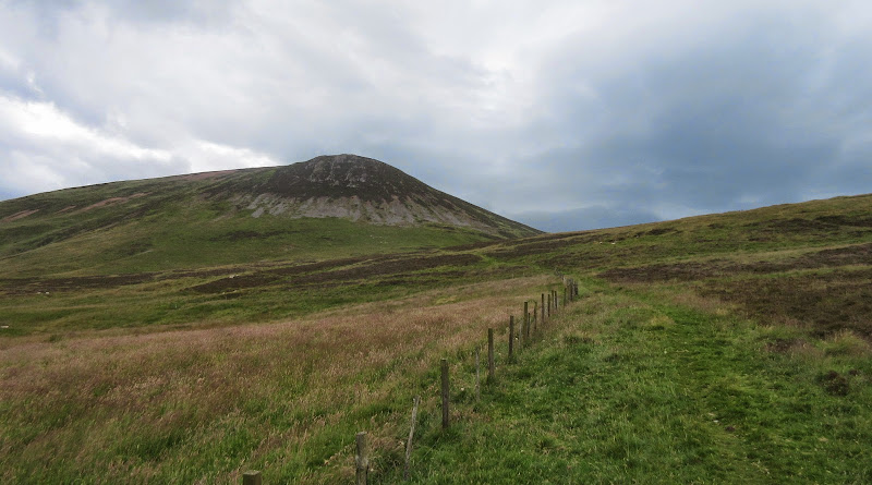
There is only 1m in height difference between Ballencleuch Law and Rodger Law, and always the risk that some interfering tamperer may re-survey and swap the Graham round. Despite that, I couldn't muster up the enthusiasm to walk out to Rodger Law, so I headed back to my bag instead (which I had abandoned just under Scaw'd Law). The day was getting sunnier and I was looking forward to finishing my walking at a reasonable hour, and spending the rest of the day lounging around at Kettleton Byre bothy.
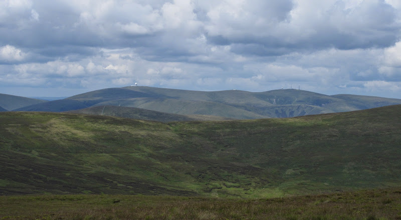
Lowther Hill and Green Lowther:
Nithsdale, with Kettleton Reservoir in front:
Towards Durisdeer:

Descending to the bothy, it wasn't visible until the last minute. I had planned to use it, but when I arrived at 5pm there were already 5 people and 2 dogs present (on a Tuesday night?), and it was rather small. So I pitched my tent again and used the rest of the day to loaf about and dry off some kit in the sun. Eventually one group (a father and his 2 young kids) had second thoughts about staying, but I already had the tent up by then. Besides, I had been carefully formulating the next part of my trip over the last day or so (quitting notwithstanding), and to make it work, I needed to be on my way by 5am the next day.
The area immediately round the bothy stretches the definition of wild somewhat, but it was an idyllic spot to be on a sunny evening with the prospect of a visit to town tomorrow.
Kettleton Byre, but looks like I’m camping again:
 Wednesday, 16th July - Kettleton Byre to Thornhill: 1 hour 50 min, 100m ascent, 9km. Damp and grey.
I slept intermittently, and was up before 4am and packed and on my way by 4:45. Last night's weather had turned grey, and as soon as I started walking, it started drizzling and the wind got up. Crossing the exposed moorland above the reservoir was quite grim, but soon enough I was down in the valley and on tarmac.
Kettleton Reservoir:
Then it was a quick march down the road to Thornhill. My aim was to catch the 7:35am bus into Dumfries, but between leaving early and moving fast, I actually had 10 minutes to wait for the 6:55 one! That got me into Dumfries for 7:20, where I had almost 2 hours to fill before the bus out to Creetown and the next part of the walk.
Link to part 2