free to be able to rate and comment on reports (as well as access 1:25000 mapping).
Here’s one that Charles will no doubt appreciate!
My wife was visiting folk near Hay on Wye, and that left me with a few hours to spare, but where to go? There was plenty of weather coming in from the North West, with showers scudding across the tops of the Black Mountains and the Beacons. There was surely some shelter to be had on the Southside of these hills.
So to Waterfall country, just to the south of Ystradfellte. Monty and I parked in the small car park by the single track road about halfway between Pont Nedd Fechan and Ystradfellte, and headed off down the track into the steep sided valley of the Afon Mellte to pick up the very well way-marked ‘Four-Waterfalls’ Walk. The very clear path passes the first of the four falls, the Sgwd Clun-gwyn, but not yet, the first target is the furthest way. I wanted to reach that fall whilst the weather was still reasonable.
Crossing the river by the footbridge, the path is obvious, but in places quite rocky and muddy. The way is very obviously way-marked, and we followed the wooden posts with the red arrows that led through the forest high above the valleys below. Eventually we reached the point where a path zigzags steeply down to the first of the four falls, the Sgwd-yr-Eira. This waterfall is the centre-piece of an amphitheatre, and is one of those rare falls that you can walk behind, as the water has undercut the rock shelf above.
Sgwd-yr-Eira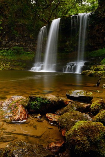 Sgwd-yr-Eira
 by
cliveg004, on Flickr
Swyd-yr-Eira-close-up-slow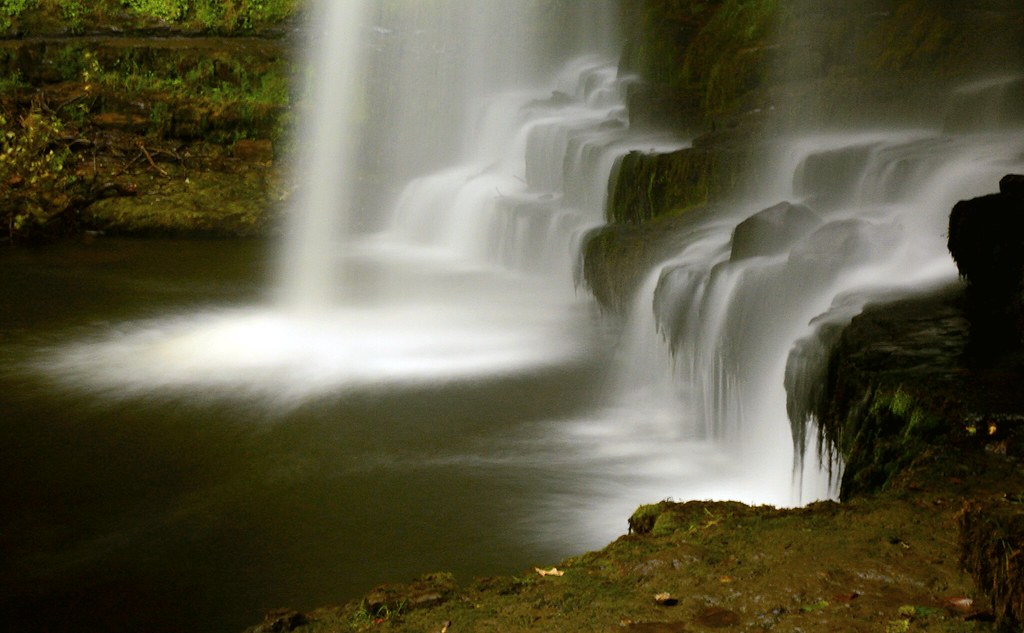 Swyd-yr-Eira-close-up-slow
 by
cliveg004, on Flickr
Swyd-yr-Eira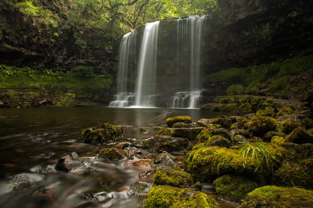 Swyd-yr-Eira
 by
cliveg004, on Flickr
Back up the zigzags, and head North again. Not far to the parting of the ways, picking up the green markers of the Four Waterfalls walk, descending steeply again to the Afon Mellte, and the second set of falls, the Sgwd-y-Pannwrl. These form a string of falls set diagonally across the river. The best vantage point is a shelf almost at the top of a sheer cliff, hardly a place for an errant Border Terrier, so Monty gets tied to a tree root while I get the camera out.
Sgwd-y-Pannwr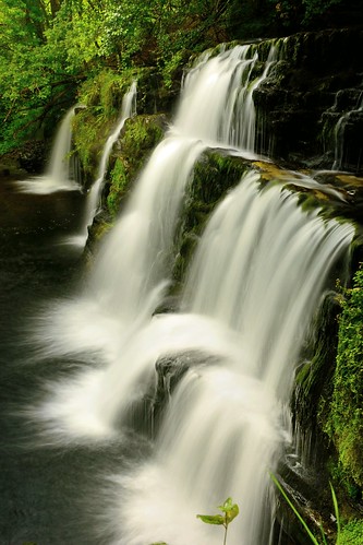 Sgwd-y-Pannwr
 by
cliveg004, on Flickr
I feel eyes boring into the back of my head, and glancing round I see two people in wet suits and crash helmets looking pointedly at me. Can’t see their canoes, but oh well, move out the way. They then walk straight up to the ledge and jump off! Ah, ‘Extreme Sports’ ….
Off we go again, heading upstream along the river’s edge. Soon afterwards we come across a very helpful sign that says the path alongside the waterfalls is rough and steep. So up we go, and onto a ledge that leads to the third of the four waterfalls, the fine curtain of the Sgwd-Isaf-Clwn-gwyn.
Sgwd-Isaf-Clwn-gwyn Sgwd-Isaf-Clwn-gwyn
 by
cliveg004, on Flickr
The next part of the route is an entertaining walk along a ledge high on the cliff above the river. The ledge runs out onto a broad shoulder, and we come across the grey metal of the back of a sign. Walking past it, we see that it helpfully states that the path we have just come along is closed – presumably it’s too risky for holiday-makers...
We walk past the high view point for the last of the four waterfalls, the Sgwd-Clun-gwyn. The view is quite good, but it is really too high and the trees partly obscure the view. So continue upstream and then go back over the footbridge. This time take the less obvious path that leads down to the river’s edge and right up to the top of the falls. Poor Monty gets tied to a tree again, and he sits there whimpering as I descend onto the ledge about two thirds of the way up the falls
From there it’s greasily and steeply down to a slippery flat expanse of rock that is clearly under water during times when the river is high.
As we trudge back up hill along the track to the car, the rain that has been holding off finally decides to fall. Good timing!
