free to be able to rate and comment on reports (as well as access 1:25000 mapping).
It’s a long way to the top….
The weather forecast was looking fantastic for the following day so I decided to head off to the west highlands to bag a solitary Corbett that remained on my “unclimbed list”. Having climbed the two Innse hills last month, Leum Uilleim was the last hill remaining in section 4 of the SMC Corbetts book! Nearly all the route descriptions I investigated gave a route from the station at Corrour, however having biked into Glas Bheinn, I wanted to do a similar thing with Leum Uilleim. As always , the internet was scoured and I found a mountain bike route called the Glean Iolairean circuit. The southerly half of this route seemed to take me to the Loch Chaiarain Bothy – exactly where I wanted to climb the hill from.
http://youtu.be/Ld__Fv8TuO8?list=UUJyJKu3ysdceGqK_JaZFUNA
Not being a mountain biker, I naively thought the route would be a nice wide path – maybe even a four by four route. Looking at the map I was certain the track to the Blackwater Reservoir would be good and would maybe only deteriorate a little after that – how wrong I was!!
Anyway, I rose extremely early as I wanted to be back mid afternoon for the kids. I had estimated the route to take about 6.5 hours (based on good cycling track all the way!!). I left the house about 4 ish and headed off. The skies were clear and I couldn’t resist stopping and taking a few starry pics and experimenting with the new camera again. Pulling in to the Glen Etive road, I stopped and happily snapped away at the Buachaille!
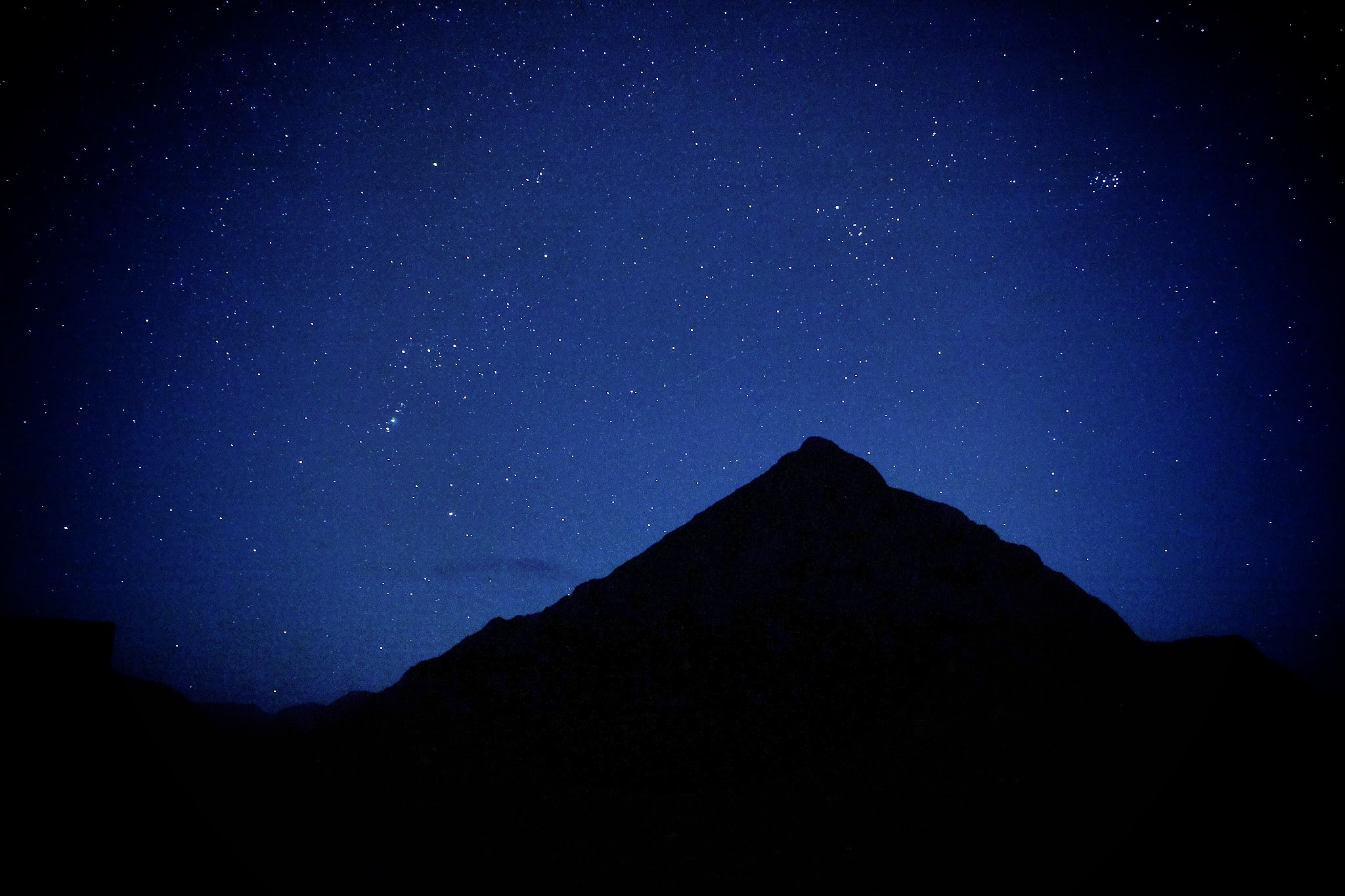 Buachaille nightgggg
 by
mountains MJVW, on Flickr
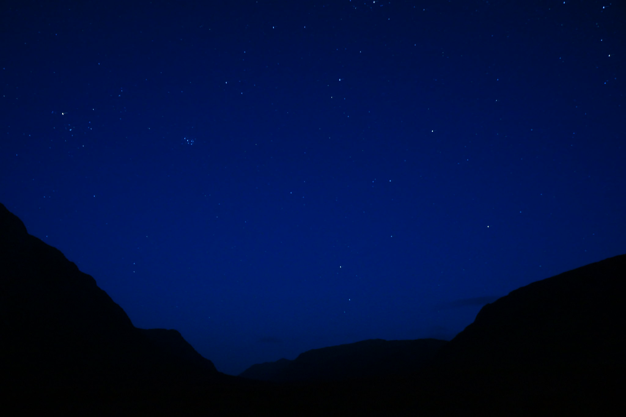 skies aboveglencoe
 by
mountains MJVW, on Flickr
Dawn was now approaching to the east so I eventually headed back to the car and drove round to Kinlochleven – parking the car in the car park behind the COOP.
At 06.58 I headed off in marginal light up the good vehicle track or West highland way!! It was a steep pull and I must admit I did push nearer the top as I neared the power station and cottage. However once at this point the track levelled off. Next to the track is a concrete “path” which must have the pipes in it for the power works? Anyway I soon decided to cycle along this. It was smooth and exhilarating – easily one of the finest rides on the bike I have had. The path traverses high along the steep Glen above the River Leven and the views are epic. With steep drops in to Gorge like glen below. The sun was now rising over the Glencoe hills and illuminating the Mamores, lightening them up with a red Autumnal Hue. The very highest peaks had their first dusting of snow and the visibility was superb.
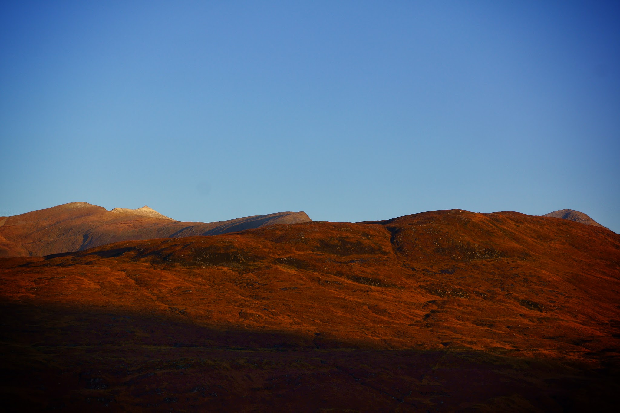 morning gggg
 by
mountains MJVW, on Flickr
Any water was frozen and there was a fine nip in the air. Couldn’t get any better!
I had read about the Navvies Grave yard, where those who lost their lives when building the Blackwater Dam were laid to rest. The dam was hand built without the aid of machinery by about 3000 Irish and Scottish “Navvies”, some of whom died during this time. The grave yard is located not far from the dam and is in a pretty lonely and remote spot. I stopped and visited it. This morning the weather was fine – making it hard to imagine the bleak conditions which batter this part of the country 90% of the time!
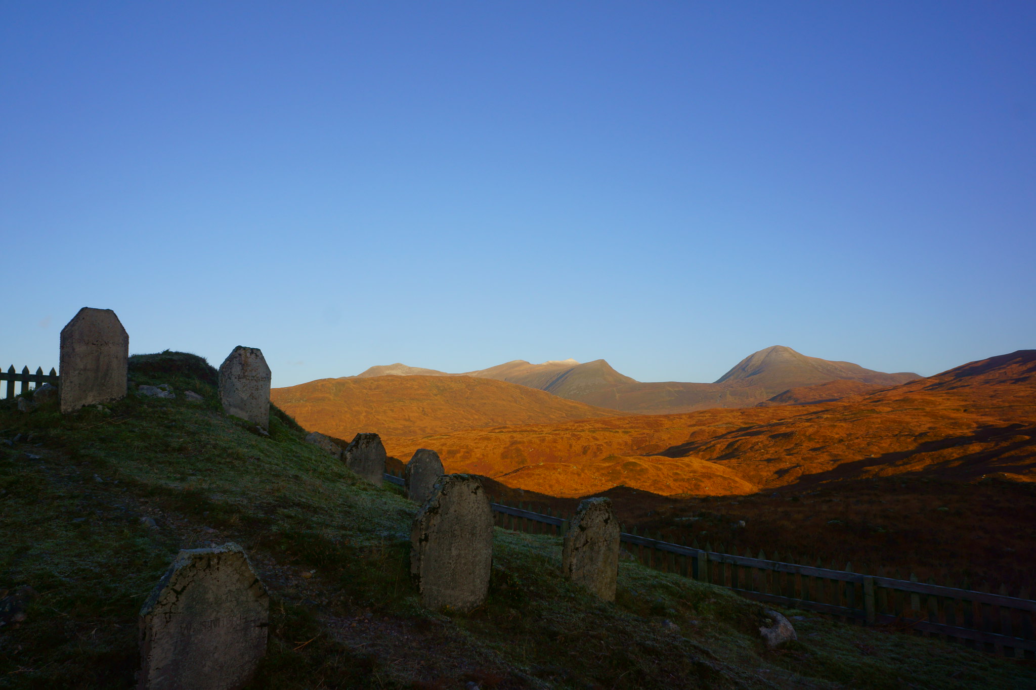 Graves
 by
mountains MJVW, on Flickr
Back to the path, it was now about 08.45 and I decided to head along the top of the dam as I was unsure if there was a bridge below it to cross the outflow? I headed along the top and soon had to lift the bike over a gate at the far end. There was as sign stating unauthorised people are not allowed access – didn’t read this on the other side – oops!
The cycling up until this point had been sublime – smooth concrete, airy rides and blue skies I was about to get a shock!! Heading off the dam I managed to miss the path and ended up pushing my bike across the moor for about 2.5km until I found the path along the side of the Allt an Ruadha Dheirg. 2.5km is not too far but given the rain in the previous days – the moor was very boggy – a rather frustrating push. Anyways – eventually found the path and started along it. As I mentioned before I’m no expert mountain biker and I must admit there were sections I found hard where the path was so narrow and deep the peddles kept caching the ground and if I came off the path to the side it was so wet and or icy that the bike was slipping or sinking into the bog!! So after a testing hour or so, I eventually reached the Bothy at Loch Chiarain.
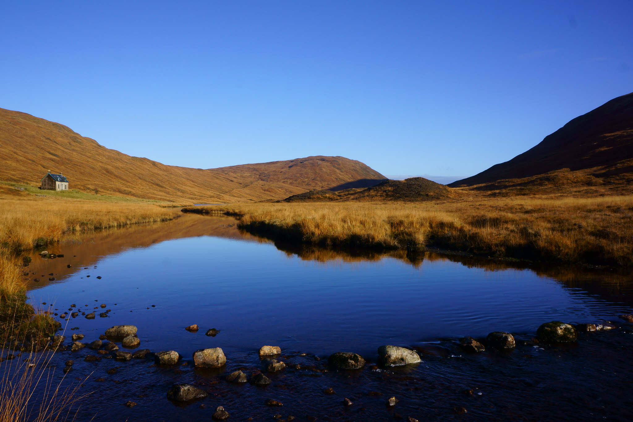 bothy stones
 by
mountains MJVW, on Flickr
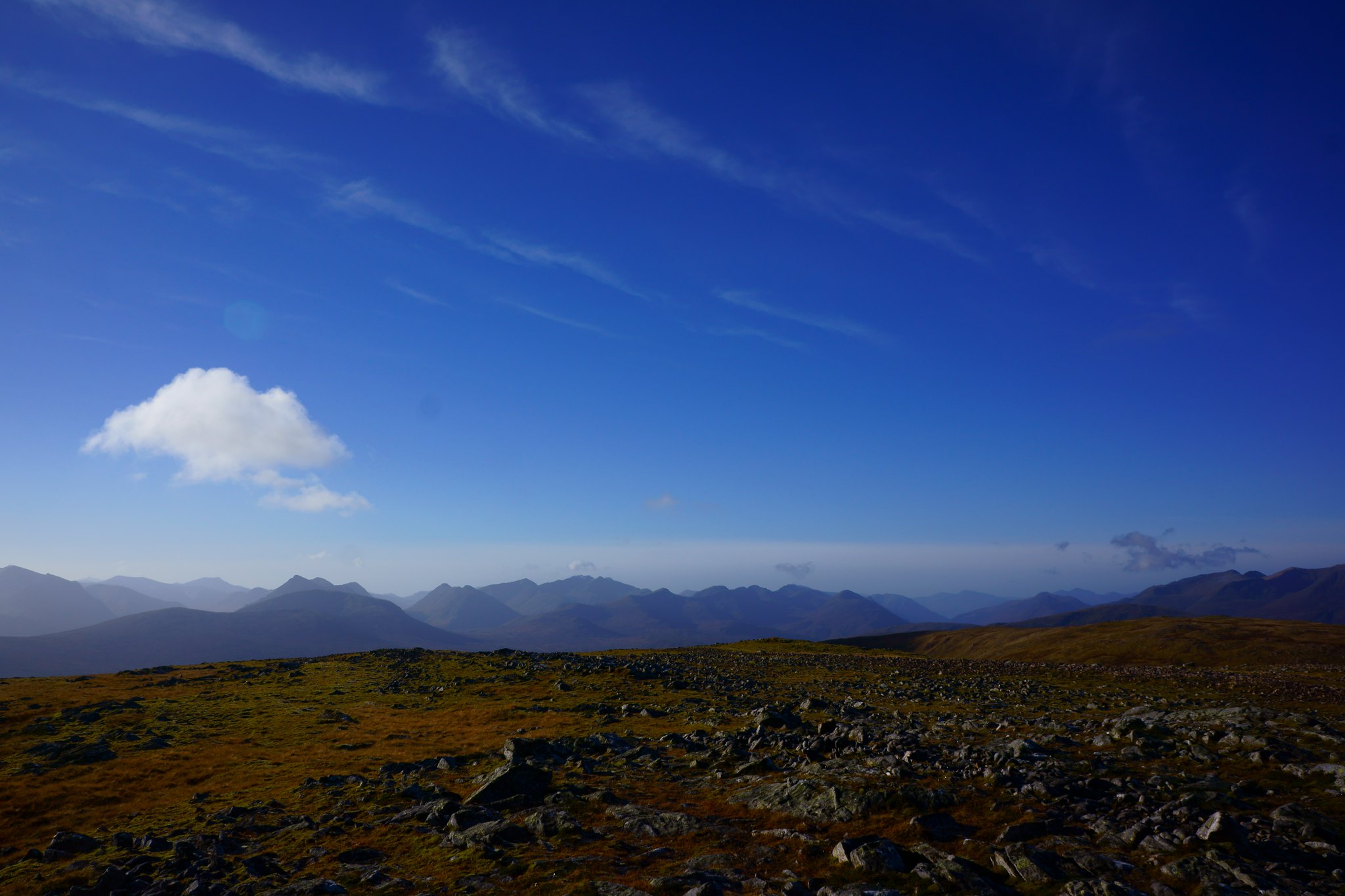
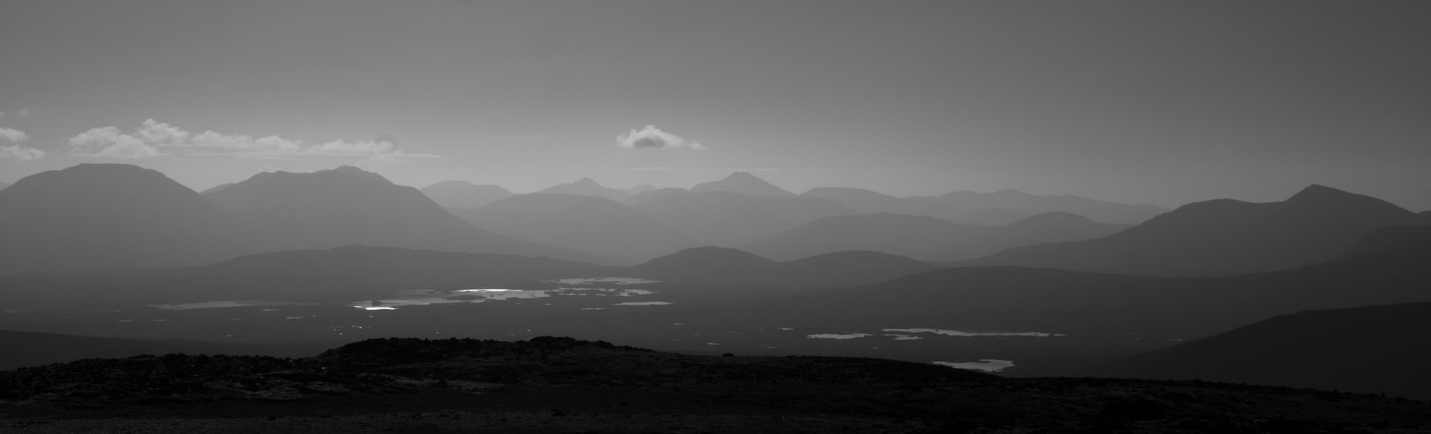
Here I left the bike, it was now 10.15. My turn around time was 12 but I was confident I would reach the summit in plenty of time……. I reached the summit at 11.55!! I was tired but the stunning views made it all worthwhile. To the east the Alder group and Loch Ossian looked fine, to the North the Loch Trieg Munros stood high above my last wild camp spot on the Innses. South and west Rannoch dominated with its glittering pools merging to the west with the peaks of Glencoe. And finally the white peaks of the Aonachs and The Ben shone against the blue skies. The visibility was superb….
 ggggggggg
 by
mountains MJVW, on Flickr
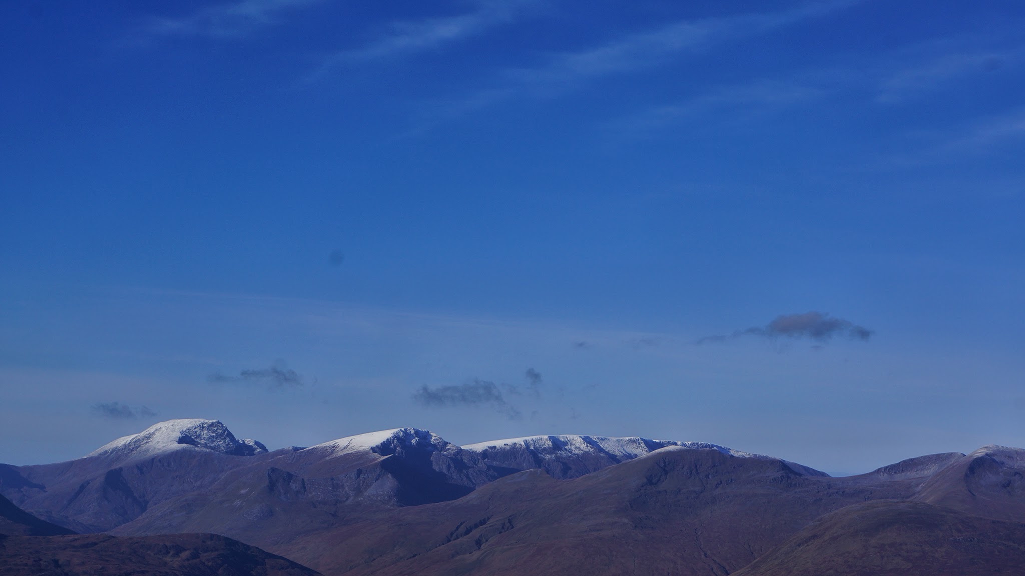 Ben Nevis gg
 by
mountains MJVW, on Flickr
A quick bite to eat and then it was the romp home. Hard to keep my eyes on my feet with the views!! The cycle back was again testing until the dam (lots of swearing) as I came off my bike a few times. Then the final 1.5km along the loch side was basically a bog, made worse this time by my tiredness! Cue more swearing!!! I hadn’t seen anyone until this point but near the dam caught up with a hiker who was hiking through from Corrour to Kinlochleven – I hope he didn’t hear my expletives !! – apologies if he did!!
Taking note of the Dams notice I now headed under the dam and eventually found my way back onto the superb concrete path Rapid progress was now made and the brakes were tested on the descent – a good idea to check your brakes work before heading down here!!
Got back to the car for three – absolutely knackered but feeling very satisfied – a great day out.
 rannoch 3
 by
mountains MJVW, on Flickr
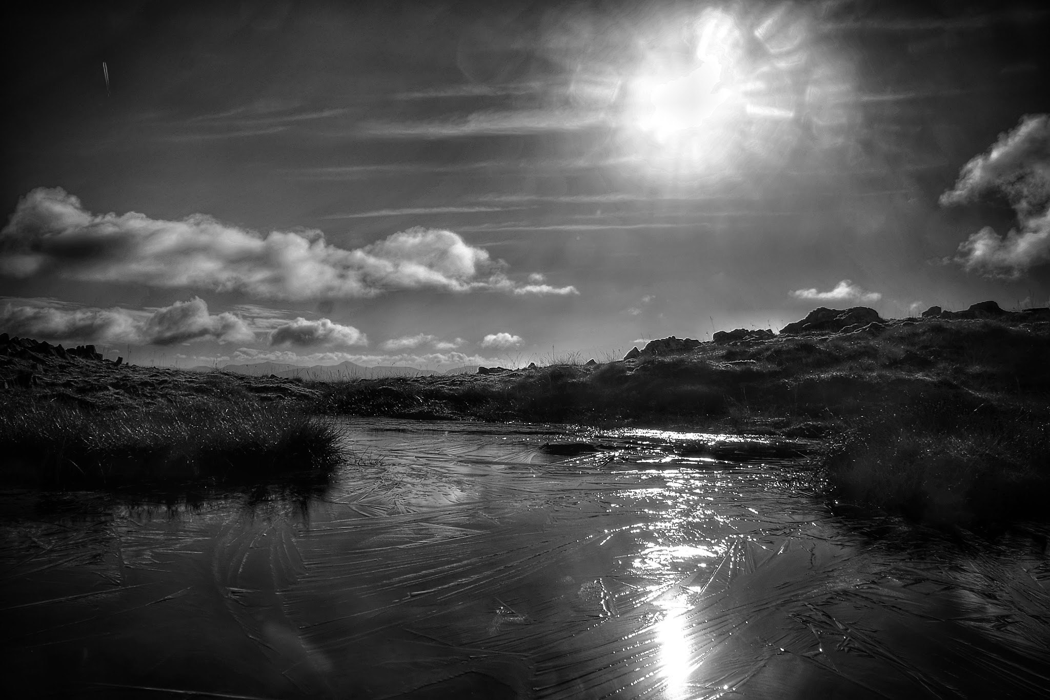 ice ggg
 by
mountains MJVW, on Flickr
