free to be able to rate and comment on reports (as well as access 1:25000 mapping).
A trip to my brother's in Thurso on Friday combined with an unexpected opportunity for a day off work on the Thursday got me thinking about what could be accomplished on the way. I'd initially set my sights on Morven & Scaraben, or possibly the remoteness of ben Armine. However the lure of getting some Corbetts instead proved too strong. I'm not really meant to be doing Corbetts on my own, but having set myself the goal of finishing them by the end of 2015 I decided I needed to be cut some slack. The group of 3 hills - Carn Chuinneag, Beinn a'Chaisteil and Carn Ban looked do-able in one long loop. But maybe not for the end of November

I planned out a route leaving from Glencalvine and hoped that I'd be able to make it in the short daylight hours of this time of year - well aware that my summer fitness had been eroded by too much food and drink over recent months. I hadn't even backpacked since September and had some concerns about my abilities.
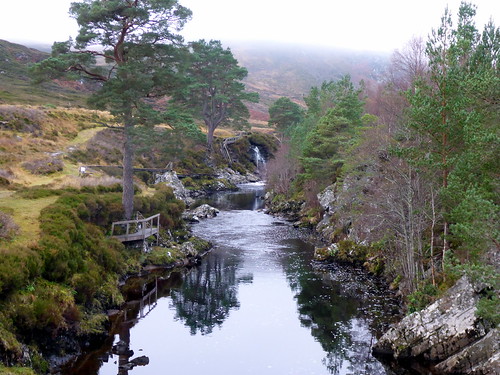
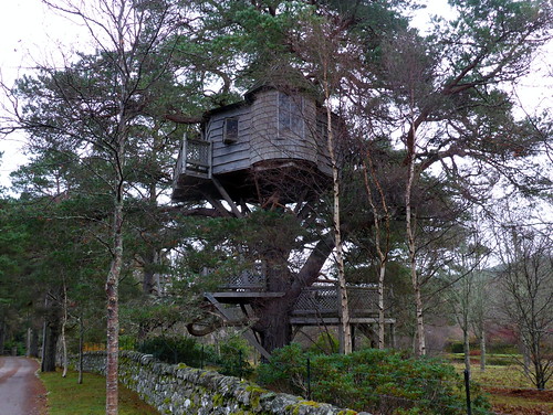
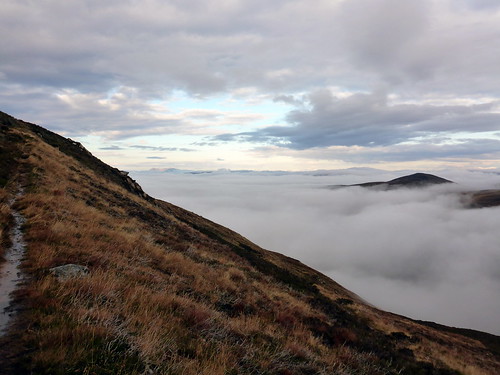
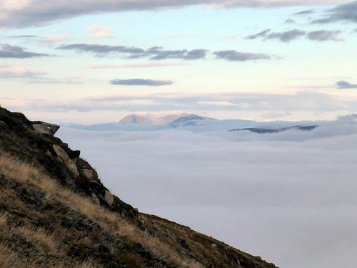
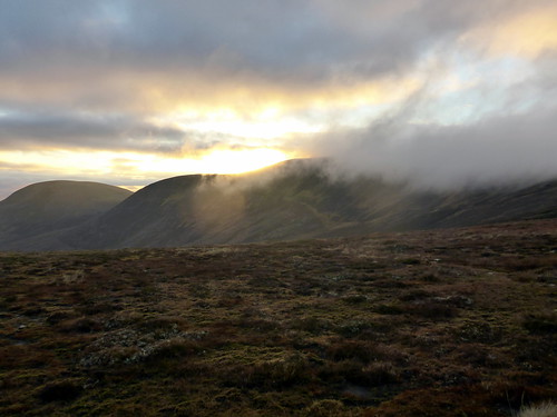
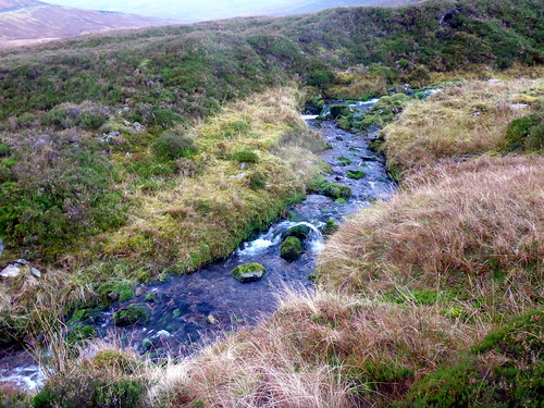
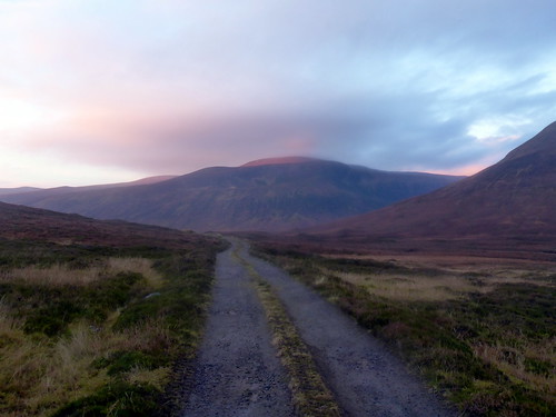
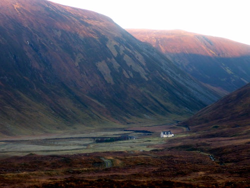
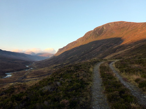
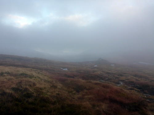
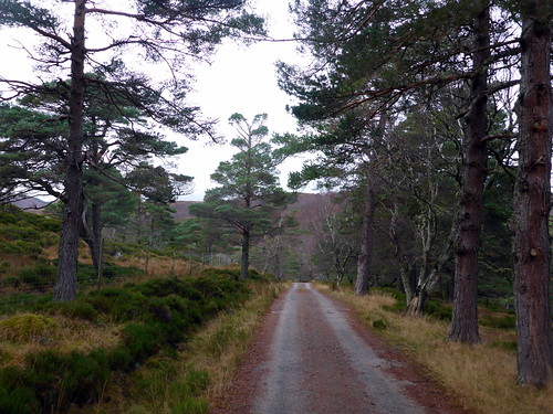
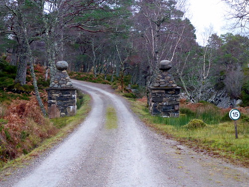
Left the house just after 5am on Thursday and had a pleasant drive up to Ardgay. Then onto single track road for about 10 miles to the parking area near Glencalvine Lodge. Off at the respectable time of 10.20 with the knowledge that I'd have about 6 hours of usable light today. I knew the first section would be fair enough on good track, but I was expecting bog and wetness in the section between Carn Chuinneag & Bein a'Chaisteil and had little idea how far through it I'd get. I walked along toward the lodge, past the fantastic tree house and in through the gates...wasn't entirely sure if this was allowed until I saw a sign pointing to "Footpath". Various estate workers were out tending to the well kept gardens - looks a lovely place. The next section took me along a good stony track running alongside the Water of Glencalvie. Grouse announced their presence as I walked by. I was disappointed to note a blanket of cloud lying over the hilltops, but hoped that it would clear as the day went on. Progress was brisk and I was soon down at Diebidale. Ahead, just visible in the mist, were the twin tops of Chuinneag. A faint path leads from the track - so faint in fact I missed it - but the path becomes drier and clearer as height is gained. As I climbed I rose above the cloud-line and had some great views of the surrounding tops peaking through the mist.
Parking spot
 P1040672
 by
23weasels, on Flickr
 P1040673
 by
23weasels, on Flickr
Tree house
 P1040674
 by
23weasels, on Flickr
It's off into the mist
 P1040676
 by
23weasels, on Flickr
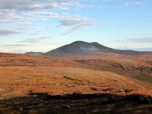
Twin tops of Chuinneag pushing through the mist
 P1040678
 by
23weasels, on Flickr
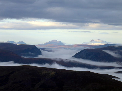
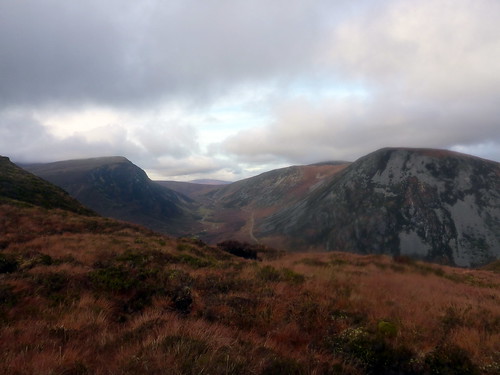
The going is steady and heads round to the west of the subsidiary top before heading across the northern flank of the mountain. Saw my first clutch of seasonal ptarmigan clag in their new whites. At an appropriate point I left the track and headed up over a rocky terrace to reach the summit. Views were superb - all the way over to the Assynt hills with Cul Mor, Suilven, Ben Hope glowing in the distance. It was much colder up here in the wind and another layer was needed whilst I grabbed a quick lunch.
Above the clouds
 P1040683
 by
23weasels, on Flickr
Ben Hope (zoomed)
 P1040684
 by
23weasels, on Flickr
Looking northeast
 P1040688
 by
23weasels, on Flickr
And west
 P1040689
 by
23weasels, on Flickr
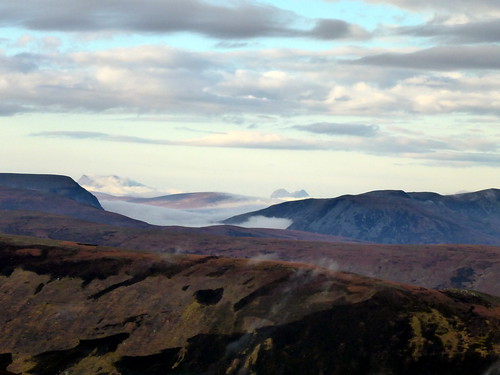
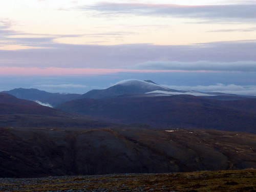
Klibreck (?) popping thru the cloud
 P1040690
 by
23weasels, on Flickr
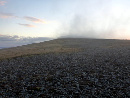
Leaving the track for the summit
 P1040692
 by
23weasels, on Flickr
 P1040695
 by
23weasels, on Flickr
 P1040696
 by
23weasels, on Flickr
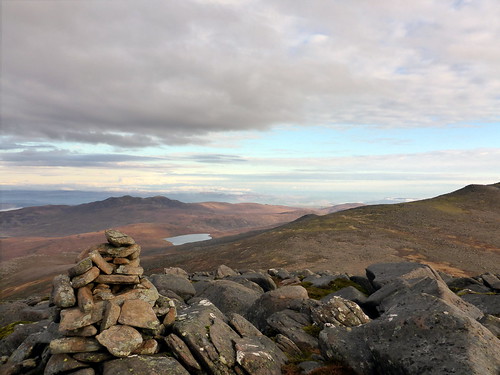
Over to Cul Mor etc
 P1040698
 by
23weasels, on Flickr
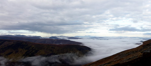
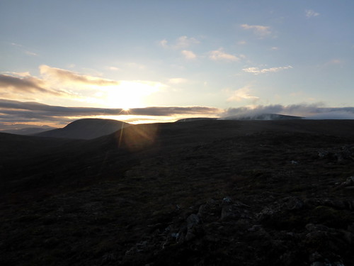
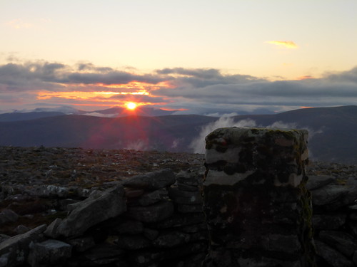
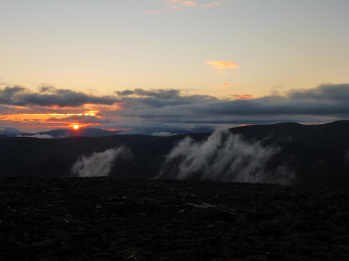
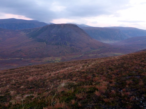
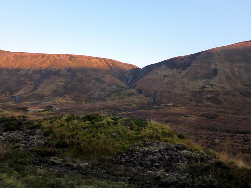
Headed over to the subsidiary summit then took a line down to the south-west over rocks initially then boggy heather. Made for the obvious line of Leaba Bhaltair then continued to head west towards Creag Ruadh. This was in the main a trudge over undulating peat bogs that sapped the energy. I pressed on hard, wanting to get as close to Beinn a'Chaisteil before darkness fell as I could. it was hot work - down to base-layer but having to wear my cap as the low sun was shining directly into my eyes. Over to my right rose the Graham Beinn Tharsuinn - with more daylight hours I'd have thought of adding it in. The terrain was cast in an ochre light from the sinking sun. I made it onto the lower slopes of Creag Dubh Mhor, Beinn a'Chaisteil somewhere up ahead obscured by cloud. A steady climb over stony hillside brought me within sight of the flank of Beinn a'Chaisteil curving to the south. I was really feeling the pace now, stumbling about. I crossed a small river and thought about filling up my bladder, but I was too fatigued to bother - something I'd regret later. Anyway I made the summit of Chaisteil just as the sun was setting over the western hills, the ruby glow illuminating the clouds. Fitting I thought for my 100th Corbett of the year.
Subsidiary summit of Chuinneag
 P1040703
 by
23weasels, on Flickr
The way ahead
 P1040704
 by
23weasels, on Flickr
Suilven
 P1040705
 by
23weasels, on Flickr
View back to Chuinneag
 P1040708
 by
23weasels, on Flickr
Dazzled
 P1040709
 by
23weasels, on Flickr
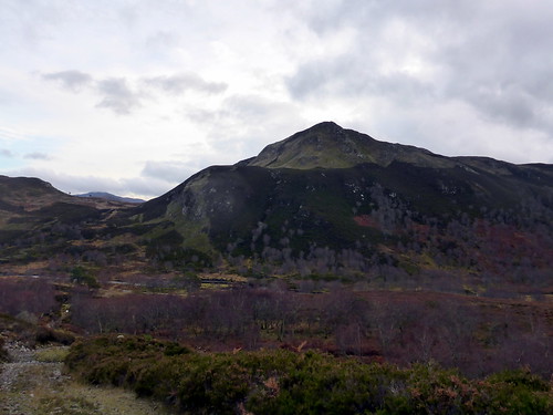
Beinn Tharsuinn
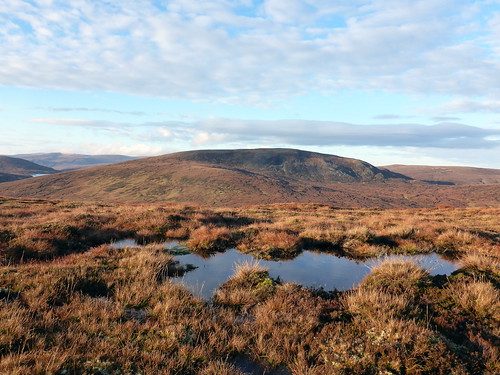 P1040711
 by
23weasels, on Flickr
Up ahead onto this hill
 P1040712
 by
23weasels, on Flickr
Another look back at Chuinneag
 P1040713
 by
23weasels, on Flickr
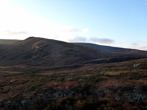
Beinn a'Chaisteil up ahead
 P1040714
 by
23weasels, on Flickr
 P1040715
 by
23weasels, on Flickr
Flat summit of Ba'C
 P1040717
 by
23weasels, on Flickr
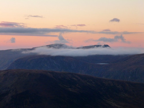
Chuinneag with a scarf of cloud
 P1040719
 by
23weasels, on Flickr
Summit Ba'C looking west
 P1040721
 by
23weasels, on Flickr
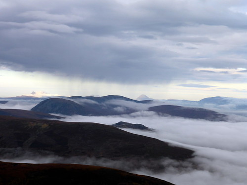
Pink glow over Carn Ban
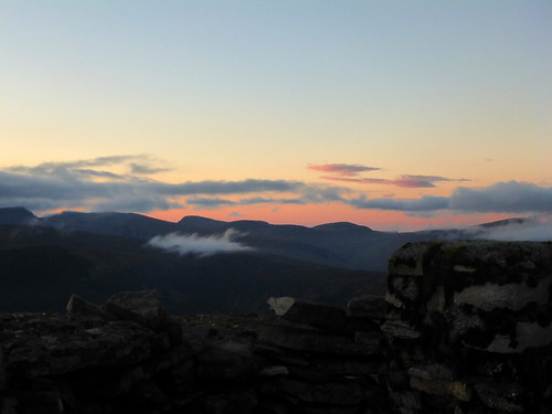 P1040722
 by
23weasels, on Flickr
 P1040723
 by
23weasels, on Flickr
 P1040725
 by
23weasels, on Flickr
 P1040726
 by
23weasels, on Flickr
What to do now? My options were to camp up near the summit or head down over what looked to be quite steep western flanks to the track in Strath Vaich. I wasn't sure if I'd have the time to get fully down before the light failed so decided to sleep up high. I knew that there would be no long sunset or glimmering dawn light from a high camp at this time of year and I worried a little about how cold it would become overnight, but hey - I should be alright. Found a flatter, if somewhat moist - grassy area after dropping 100 or so metres from the top and pitched up in the last of the light. Quite pleased with the day's efforts - almost half the distance covered. Made a quick meal which I ate from the comfort of my sleeping bag and settled down for what would be a long night - it was only 5pm and I knew I couldn't get going again before about 7.30. Snuggled in my bag was warm enough, but after a hot and hard day I was a bit thirsty - and found my bladder empty. I had a small bottle of water for breakfast needs but that was it. drat - should have filled up when I had a chance - nothing for it but to dehydrate through the night. That added to the sense of longness of the dark hours - especially when I would flit in and out of sleep and dream about streams of clear water
Day 1 stats
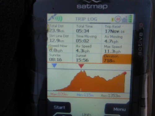 P1040727
 by
23weasels, on Flickr
Tent
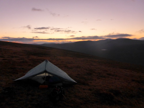 P1040728
 by
23weasels, on Flickr
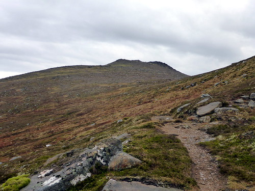
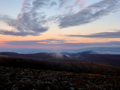
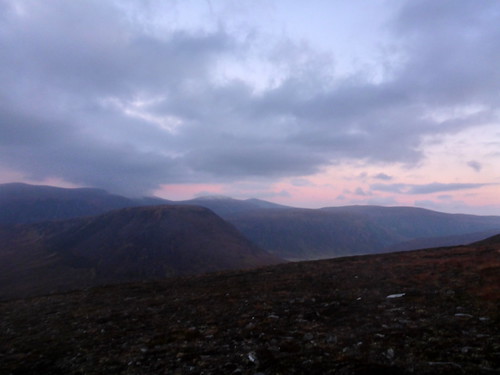
Morning came - I could feel my head thumping with the mix of dehydration, yesterday's low sunlight and no coffee. made breakfast and put the coffee situation right then bundled up my belongings and set off at a stagger down the hillside towards the first stream I could find. Ahhh - cool water. I drank my fill and restocked my bladder before setting off along the excellent track along Strath Vaich. It looked another fine day with fluffy pink clouds hovering atop the hills. Over to my right was the beautifully isolated Deanich Lodge. I had originally intended to head up over Meall a'Chaorain - a graham - but the way I was feeling today I thought I'd better give that a miss - it looked a steep fellow and I didn't have it in me to take on an extra 350m straight up in my current condition. So I stuck to the track, winding round that hill and making for the bridge. The track continues on up the first part of the hillside to a small dammed installation - oops - no way up here. I backtracked a little and found a stalker's path zigzagging its way up Cail Mhor. As I gained altitude the clag came down - disappointing as I'd really wanted another glimps of my favourite hills in the West. A long boggy trudge took me over featureless hillside to the southern cairn of Carn Ban. it was cold again up here - out of the sun and with a cutting wind blowing in my face. I felt pretty wretched, a bit sick, most likely the ongoing effects of being dehydrated yesterday. Keeping going I walked along the fairly flat hilltop towards the summit cairn, which finally rose out of the mist. Yeah - all three in the bag.
Morning glow over Meall a'Chaorain
 P1040729
 by
23weasels, on Flickr
Descent towards the path
 P1040730
 by
23weasels, on Flickr
Ah - water!!
 P1040731
 by
23weasels, on Flickr
Good track up Strath Vaich
 P1040734
 by
23weasels, on Flickr
Deanich Lodge
 P1040737
 by
23weasels, on Flickr
Heading up here, to the left of the stream
 P1040739
 by
23weasels, on Flickr
Crossing the bridge
 P1040740
 by
23weasels, on Flickr
Beinn Dearg group over to the west
 P1040742
 by
23weasels, on Flickr
Dam - damn - can't go up here
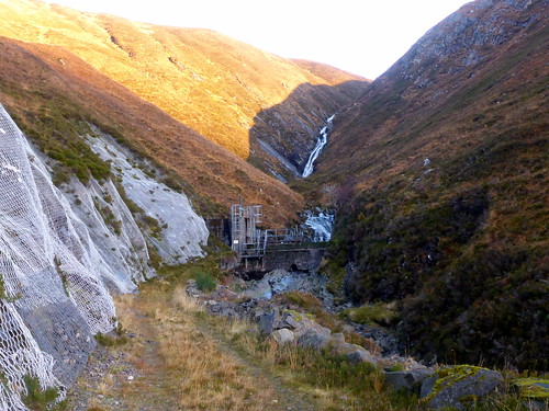 P1040743
 by
23weasels, on Flickr
Exciting way up
 P1040745
 by
23weasels, on Flickr
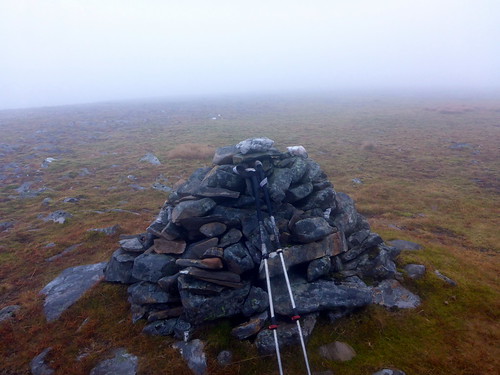
Cairn Carn Ban
 P1040748
 by
23weasels, on Flickr
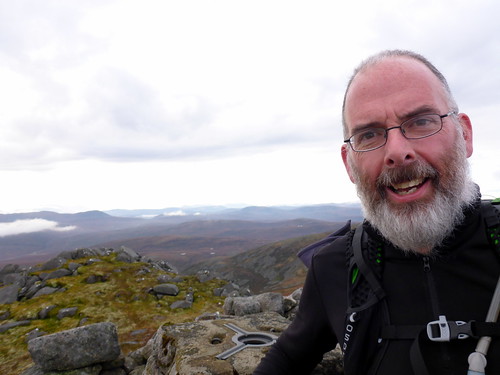
Crazy man at the top
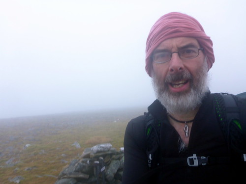 P1040749
 by
23weasels, on Flickr
 P1040750
 by
23weasels, on Flickr
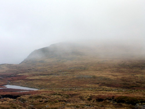
I would have quite liked to be teleported or helicoptered off the hills at this point with the objectives completed, but knew I had a trek still to go. Firstly over to the summit of Bodach Beag - a re-ascent of 150 painful metres. At some points it looked like the clouds might actually lift, giving a view of Carn Ban - but any temporary gaps were quickly filled by more clag. Skirting SE from the summit I had to trudge over bogs and peat hags in mist - one of my least favourite aspects of hillwalking. Came to a drop before Lochan nan Leac, which I could just make out in the mist, then - oh no - not up again

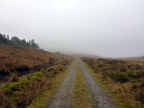
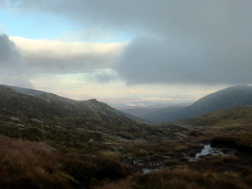
Another 130m or so up the side of An Socach was just about enough to finish me off. It was about midday by this time but I didn't feel much like food. Set off along the back of the ridge towards Sron Gun Aran, chilled and knackered. Found a deep gouge that looked as if it would provide reasonable shelter for a spot of lunch but couldn't be bothered getting my stove out to brew up and instead choked down half a sandwich. Looking around when the clag momentarily lifted I was heartened to see the end of an ATV track not far ahead. Salvation at hand - much easier to follow a track through mist than stumble about in it. The track turned out to be boggy for the most part, but it was headed where I wanted to go. Disturbing a medium sized herd of deer as I walked along - their forms looming out of the mist as they'd run off a few hundred yards, then wait to see if I was following. A marshy descent past Sron Gun Aran then up to a gate in a deer fence. As I descended I came out of the fog and could look back up Glen Allandale. The track heads down into an area planted with new native trees. Ahead of me I could make out the track going towards Allandale Lodge - good walking terrain at last! Exiting the gate at the bottom returned me to the track and from then it was a mere matter of 5km back to the car. Over to my right the jagged form of Carn na Speireig rose upwards - an impressive sub500. Across the bridge before Allandale Lodge, through the gates with giant boulders perched and a flat walk along the Allandale River as it cuts and chunders through the dark rocks. Arrived back at the car just gone 2pm to find a small Army encampment surrounding it. The squaddies all seemed to be asleep as I got out of my boots and prepared for the drive up north.
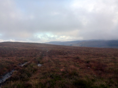
This was the going from here on in
 P1040751
 by
23weasels, on Flickr
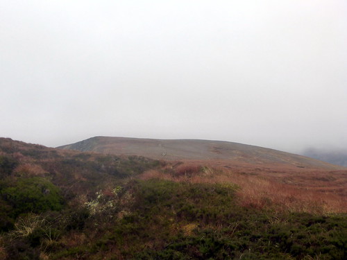
View towards Bodach Beag
 P1040753
 by
23weasels, on Flickr
View west
 P1040754
 by
23weasels, on Flickr
Lochan
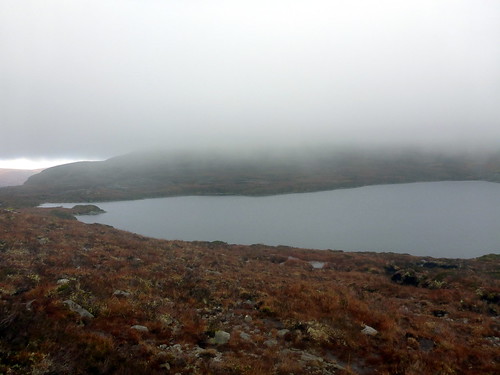 P1040758
 by
23weasels, on Flickr
Unflattering slopes of An Socach
 P1040759
 by
23weasels, on Flickr
The track is finally spied
 P1040762
 by
23weasels, on Flickr
The deer
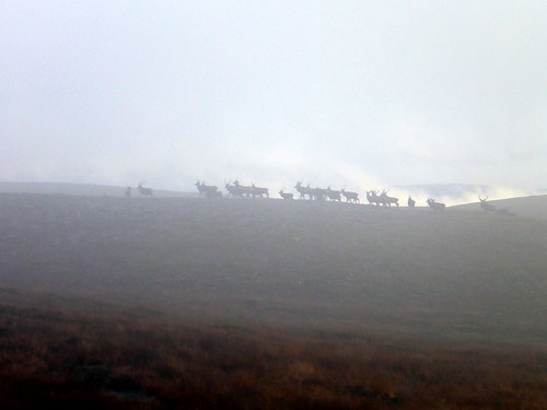 P1040763
 by
23weasels, on Flickr
Still boggy miles to go
 P1040764
 by
23weasels, on Flickr
View up Glen Allandale
 P1040766
 by
23weasels, on Flickr
Carn na Speiraig
 P1040768
 by
23weasels, on Flickr
Path past Allandale Lodge
 P1040770
 by
23weasels, on Flickr
Bouldergate
 P1040771
 by
23weasels, on Flickr
Stats
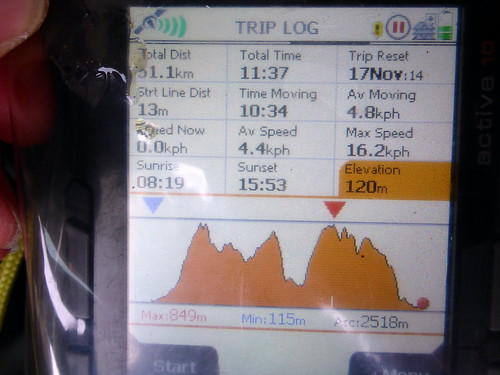 P1040774
 by
23weasels, on Flickr
A good walk this, but reminded me of the need to get a bit leaner and fitter before heading out again
