free to be able to rate and comment on reports (as well as access 1:25000 mapping).
![49055.jpg]()
- This famous old horse was named after the hill
What a dilemma we faced, looking back I realise now that we were spoilt for choice.
After chatting for a few weeks on FB trying to decide what the plan of action would be for the Durness invasion, we had opted to tackle Cranstackie and partner on the Friday because the forecast was promising and Saturday was all doom and gloom.
One of the big problems was the 5 hour drive before we even reached the start.
The plan was to pick up Martin (mg1976) from Inverkeithing Railway Station at 0550hrs and head up to Inverness (Dobbies) where we were meeting up with Gary, Leia and Ruth for breakfast. A slight flaw in the plan was Dobbies didn’t open until 9am, that meant I could dawdle up the A9 and we still arrived 20mins before the shutters of Dobbies were raised

I opted for the 10 piece breakfast and as it turned out it kept me going all day until the evening meal at 7.30pm, great value for a fiver

It was whilst devouring the breakfast that we decided to amend the plan and go for Arkle as the WH timings were a bit more favourable, in theory would take less time

As the organiser of the “Meet” I had been planning to be first to arrive, but I decided to make the most of the weather window and arrive at the bunkhouse once we had finished, I was confident everyone would be able to cope in my absence

, as it turned out we (the Martin's) arrived not long after 7pm. It was a quick hello to everyone who was there, dump the bags in the room, beer in the fridge and then down to the pub for dinner
Now onto the walk itself, after the long drive north in a mini convoy with Gary we reached the parking area near Achfary which also doubles up as the start point for Ben Stack, at the south end of Loch Stack.
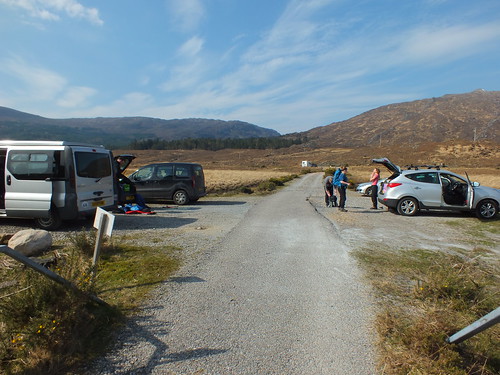 DSCF0580
 by
martin_beswick, on Flickr - parking area
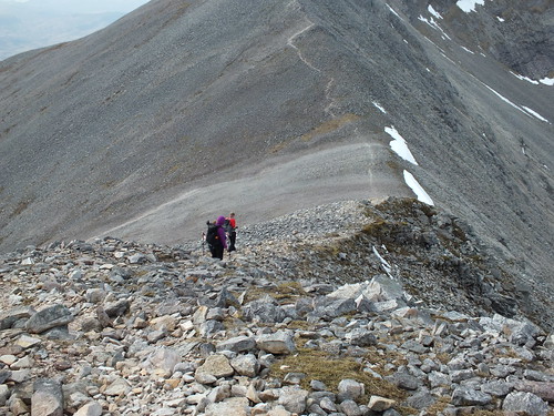
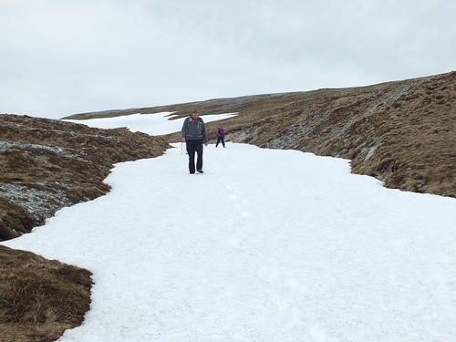
The walk starts off along a tarmac road which then turns into a good track which is fairly flat for just over 3km, the next 1.5km continues along the track albeit rising a wee bit. The clue to tell you when to start ascending up Arkle for real is a cairn on the left hand side
As usual for reasons that we couldn't come up with answer for, we never noticed the cairn until the descent
We much rather see parts of the hill that other walkers miss

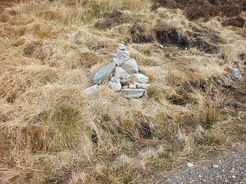 DSCF0738
 by
martin_beswick, on Flickr - how did we not notice that?
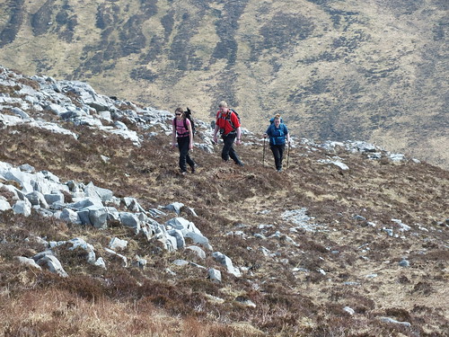
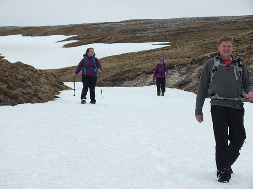
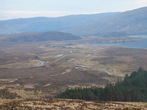
The path/track gives great views of the target and Arkle looks absolutely amazing, also Loch Stack and Ben Stack which looked rather pointy when we first saw it from the north, but as we made progress much less pointy

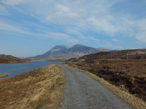 DSCF0582
 by
martin_beswick, on Flickr - Arkle in the distance with Loch Stack on the left
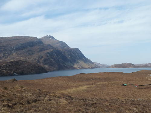 DSCF0584
 by
martin_beswick, on Flickr - Loch Stack with Ben Stack in the background
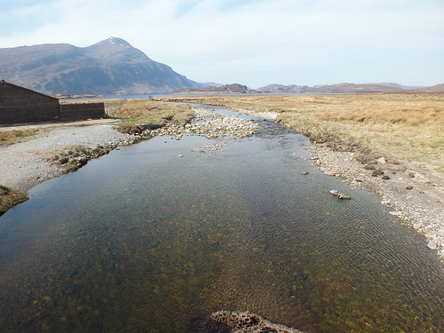 DSCF0589
 by
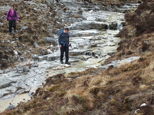
martin_beswick, on Flickr - Abhainn an Loin which goes into Loch Stack, fortunately a sturdy bridge is on hand.
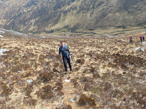
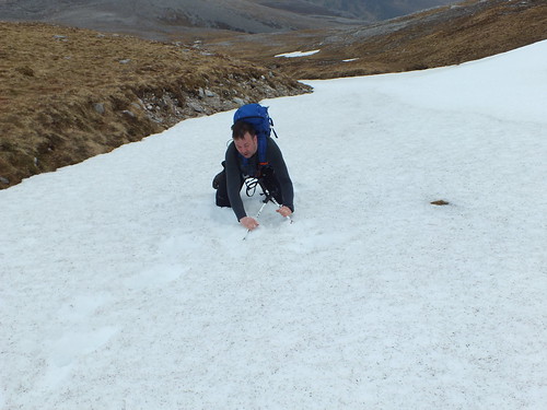
The ascent up the side of Arkle was very straightforward, over boulders and heather, I had noticed a snow covered gully so opted to ascend up that way whilst the rest of the gang took the easy route
 DSCF0600
 by
martin_beswick, on Flickr
 DSCF0608
 by
martin_beswick, on Flickr
 DSCF0612
 by
martin_beswick, on Flickr
 DSCF0618
 by
martin_beswick, on Flickr
 DSCF0619
 by
martin_beswick, on Flickr - my route of ascent to the large plateau top
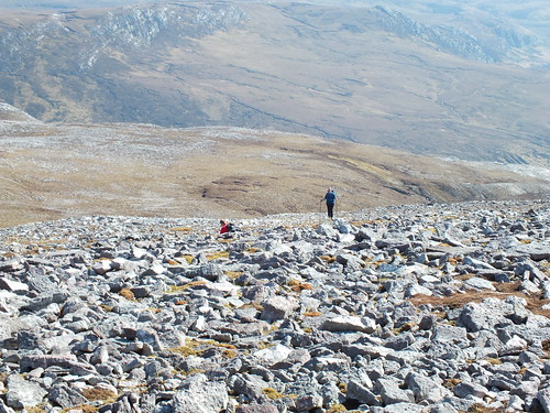
 DSCF0628
 by
martin_beswick, on Flickr - large plateau top
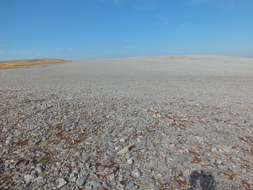
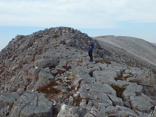
We soon reached the plateau top which is certainly unique and unlike any summit I have ever seen. It was as if loose stones had been steam rollered and flattened into the soil

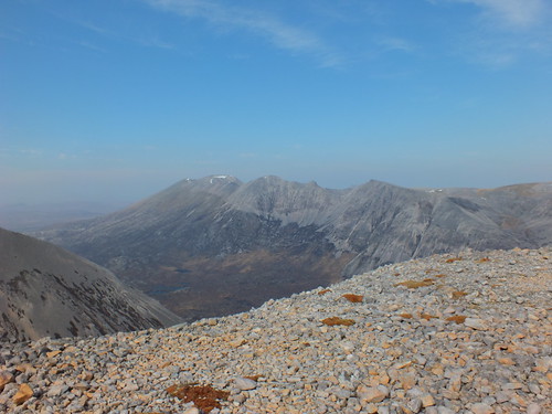
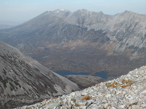
There are a couple of cairns on the plateau and the views of Fionaven were awesome, it looks like an amazing hill and am still puzzled why the huge mass with ridges joining all the pointy bits is only one Corbett
 DSCF0630
 by
martin_beswick, on Flickr - Fionaven, the photo says it all
 DSCF0631
 by
martin_beswick, on Flickr - Arkle
 DSCF0635
 by
martin_beswick, on Flickr - indicates how large the plateau is
 DSCF0637
 by
martin_beswick, on Flickr - Fionaven
 DSCF0639
 by
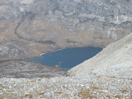
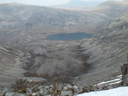
martin_beswick, on Flickr - Loch an Easain Uaine
 DSCF0643
 by
martin_beswick, on Flickr
 DSCF0646
 by
martin_beswick, on Flickr - the way down to the bealach and then up to the ridge
 DSCF0648
 by
martin_beswick, on Flickr - looking down Am Bathaich (a huge gully)
 DSCF0650
 by
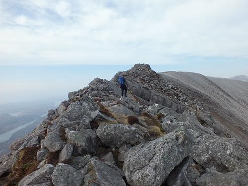
martin_beswick, on Flickr - Martin on the ridge that leads to the summit
 DSCF0651
 by
martin_beswick, on Flickr - Gary and Leia with a superb backdrop
The descent off the plateau was probably the worst part of the walk. There is a well worn path down that consisted of dusty loose stones and boulders then the bealach was reached. We had a quick look to the south to see if it would be possible to descend and traverse round the loose scree back to the path, however there was no obvious route, so we would be ascending up to the plateau again
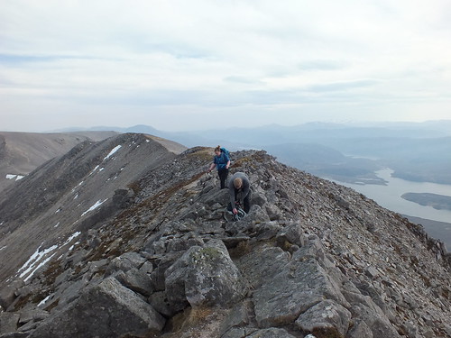
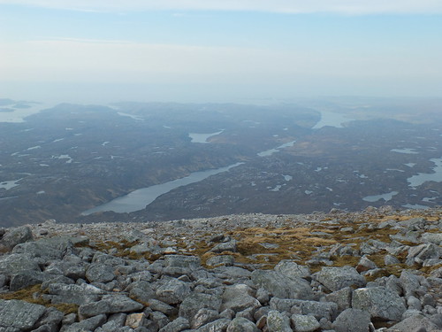
The route from the bealach to the summit involved a bit of minor scrambling across large boulders and walking across large flat slabs of rock, with fantastic views on both sides
 DSCF0654
 by
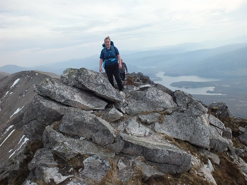
martin_beswick, on Flickr - Leia posing
 DSCF0656
 by
martin_beswick, on Flickr - Martin posing on the slabs
 DSCF0660
 by
martin_beswick, on Flickr - looking out to the Atlantic, shame it was a bit hazy
 DSCF0663
 by
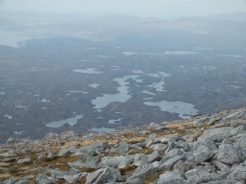
martin_beswick, on Flickr - a typical high level Sutherland photo
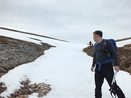
After spending time on the summit taking in the amazing views it was time to head back down to the bealach and then up to the plateau. I had mentioned the snow filled gully as a descent option and we all agreed to head that way and have a bit of fun
 DSCF0672
 by
martin_beswick, on Flickr - Martin waiting patiently
 DSCF0673
 by
martin_beswick, on Flickr - Gary walking gingerly
 DSCF0674
 by
martin_beswick, on Flickr - great to get snow on your boots
 DSCF0675
 by
martin_beswick, on Flickr - Martin pretending to do an arrest with his poles
 DSCF0676
 by
martin_beswick, on Flickr - Crossing an interesting burn with hardly any wet stuff in it

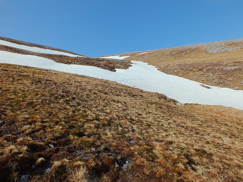
Descending down the snow field was easy until we reached the lower part, Leia kindly showed us where the stream underneath was, we could hear running water and Leia managed to find it
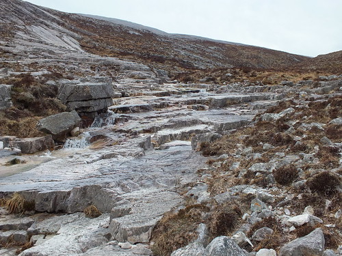
After the snow field it was just a matter of picking our way down the through the heather and boulders, we opted to follow the burn downhill. We were fortunate in that we could see the path at the bottom that we were aiming for
 DSCF0686
 by
martin_beswick, on Flickr - the burn was fascinating in that it was running over slabby rock that looked almost marble like
 DSCF0690
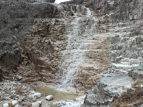
 by
martin_beswick, on Flickr - water featurel
 DSCF0694
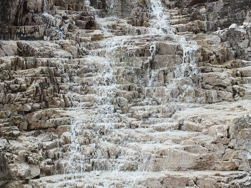
 by
martin_beswick, on Flickr - same water feature, looking like one of those champagne glasses creations where the champers trickles out of the glasses, am sure someone understands what I mean
 DSCF0696
 by
martin_beswick, on Flickr
 DSCF0704
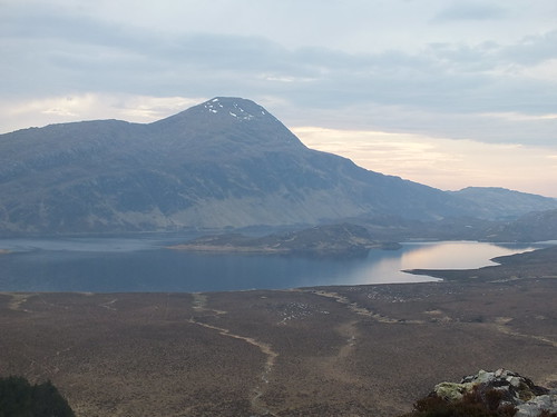
 by
martin_beswick, on Flickr - Ben Stack looking amazing in the late afternoon light
 DSCF0705
 by
martin_beswick, on Flickr - view back to the car
 DSCF0706
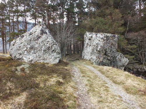
 by
martin_beswick, on Flickr - Narnain boulders
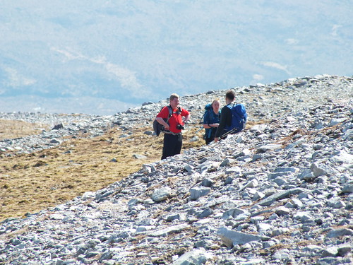
 DSCF0710
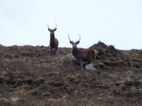
 by
martin_beswick, on Flickr - a couple of locals checking to see if we were carrying guns
The walk back along the track as usual seemed much longer than the walk in
A fantastic day out, in great company on a superb unique hill. Gary and Leia summed it up as the best hill so far this year
The forecast for Saturday was doom and gloom, but I had volunteered to accompany Theresa, Charlie and the "leg-end" we all know as Rod to tackle Meall Horn - over to you Rod
PS: A big THANK YOU to all who made the long trek to the far north, hopefully the wee drive was worth the effort
Maybe someone else will opt to have another meet in Durness in the future, I for one would definitely attend as Fionaven is calling me back, along with so many other fantastic hills
