free to be able to rate and comment on reports (as well as access 1:25000 mapping).
I started writing this last Friday, but didn't have enough time to finish... After another Munro walk on Saturday, I'm now 5 reports behind

The fourth day of our week off "hillidays" looked good for the northern part of the Highlands. Originally, I had planned South Glen Shiel Ridge, but as the best forecast was for the north, we opted for the Fannichs. In the end, we managed 4 new Munros and completed the Fannichs

I was desperate to ignore the growing blister on my foot, a painful memory of Arnisdale Corbetts. Didn't know how far and how fast I'd be able to go, so we aimed for Beinn Liath Mhor Fannaich and Sgurr Mor as plan minimum.
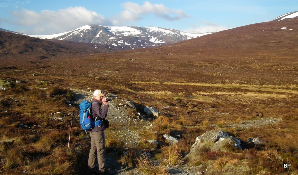
It's only a short drive from Beauly, so we started our walk early, before 8am. We packed in crampons, but only as a precaution, as even from the road it didn't look like we were going to need them:

Our route followed the WH description. SMC Guide suggests splitting this walk into two, but when we reached the high ground, we admitted that it would be stupid to leave the ridge when the two easternmost Munros were only a stroll away!
From the parking area by the weather station, just north of Torrandhu bridge, we walked along the road for a short distance to pick a good track following the lower slopes of Beinn Liath Mhor a Ghiubhais Li (great winter Corbett!) through the growing forest. I remembered, when we climbed the Corbett in 2008, the trees were hardly visible in snow-covered terrain, now the forest looks decent:

The track descends slightly towards the bridge over Abhainn an Torrain Dubh. Just before the bridge, we came across three half-decomposed deer corpses

The smell was overwhelming (yuck!

). I wondered what happened, three dead deer together, were they shot and left to rot, did they starve or maybe got poisoned accidentally?
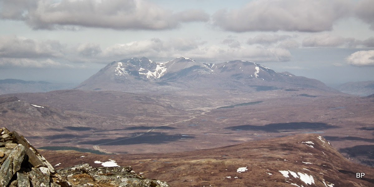
We walked past as quickly as we could, soon the nasty view (and stench) was forgotten, as the day was shaping up nicely and Beinn Dearg group looked great across the glen:

We crossed the bridge and followed a track for a short time:
After five minutes or so we left the track to aim directly for the heathery lump of Creag Dubh Fannaich. What we didn't realize, the newly made track (going to Loch Li) climbs half way up CDF so we could have used it to avoid the bog and peat hags. We only spotted that track on the descent from An Coileachan.
Luckily, after along spell of dry weather, the bog was mostly dry and peat hags here are not very high, so we were making good progress even on tougher terrain. The day was rather windy so long sleeved tops proved useful, the wind had a definite chilly edge. The angle was not too steep and the climb felt easy so far:

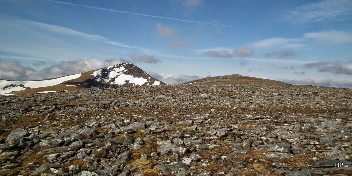
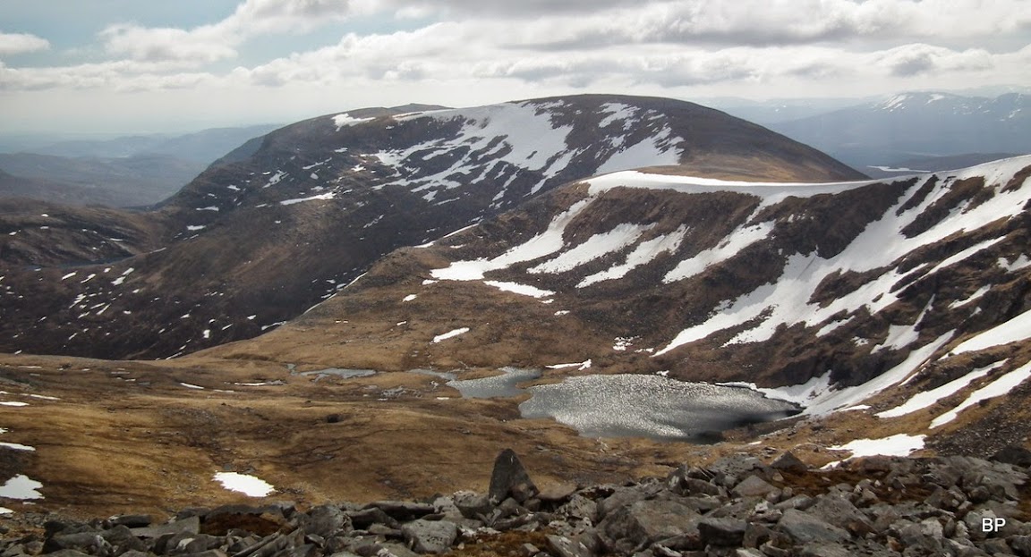
The eastern end of the Fannichs ridge:

We reached Creag Dubh Fannaich and had a short break here - the main ridge was now in sight, with Beinn Liath Mhor Fannaich only a stroll away, and Sgurr Mor "the Monster" as Kevin called it, peeking out from behind:

Creag Dubh Fannaich from the final climb to Beinn Liath Mhor Fannaich:

Beinn Dearg zoomed. Cloud was gathering over peaks to the north, but "our" ridge remained clear, just as well we picked the right place in Scotland for this particular day!
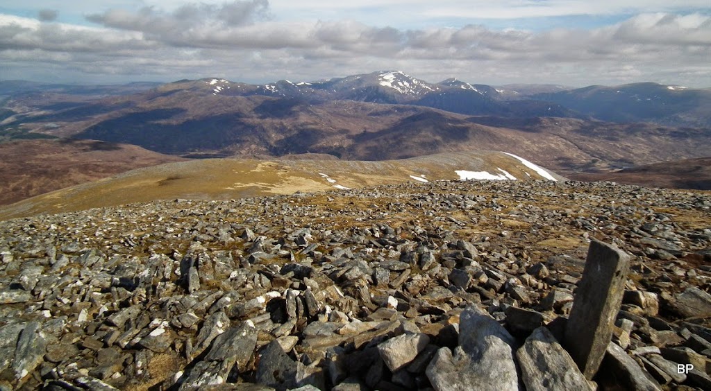
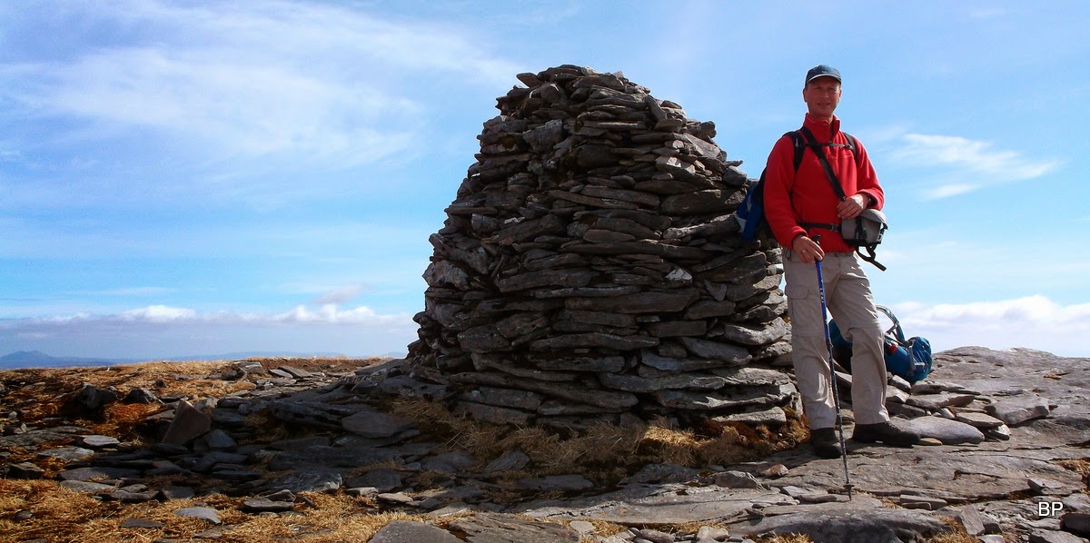
The final 200m push to the first Munro was on more bouldery ground, but a sketchy path follows the easiest line of ascent. We encountered very little snow and soon we emerged on the summit "plateau". there are two cairns on both ends of the ridge, but the western one is higher:
The true summit cairn. A new Munro at last, after 4 Corbetts, and it's only first one out of four today, hopefully!

I love ridgewalking (who doesn't?) so I was excited to the point of meowing, when I looked at the Fannichs ridge in front of me, all this yummy stuff still awaiting us today, wow!
An Teallach showing its best profile. I must return to the Forge someday, I still feel like I didn't do it properly... (I skipped the pinnacles):
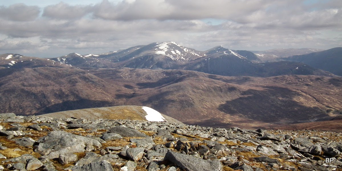
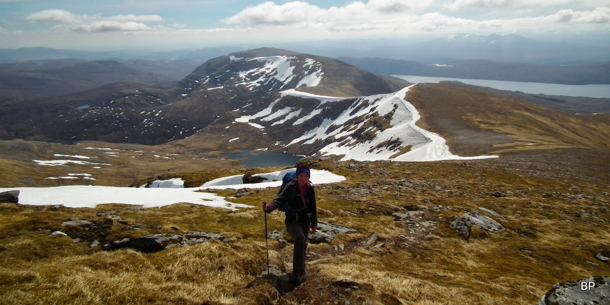
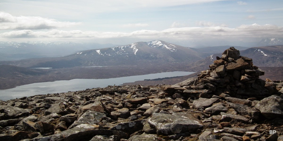
Beinn Dearg & friends from the summit of Beinn Liath Mhor Fannaich:
Loch a'Mhadaidh and the ridge connecting Sgurr Mor to the least significant Munro of the Fannichs, Meall a'Chrasgaidh:

We checked the time and decided we had more than enough to do the whole ridge from Mor to Coileachan with daylight to spare. That's the advantage of starting early! To be honest, it was Kevin who woke up at 5 am and dragged me out of bed with the smell of fresh coffee and toast

. Now we had burned our breakfast so decided to take a longer pause on the slopes of Beinn Liath Mhor Fannaich, enjoy early lunch and excellent views around. We descended a short distance from the summit and found sheltered spot to sit with great vistas for company:

Other walkers showed up, somebody walked past without even noticing us sitting behind a rock
I wasn't surprised to see people on the hills today, even though it was a Tuesday. Good conditions, despite the cold wind.
After "hill brunch" we packed up and started to descend to the col between the two Munros. Most folks follow a faint path to the right, but we just hopped down on rocks and boulders, then picked a snow patch and used it to run down to the col
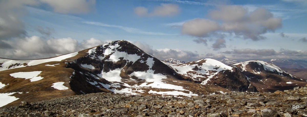
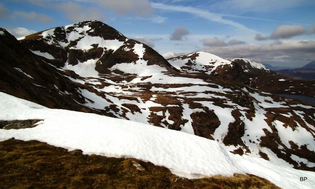
As we began to climb towards "the Monster", I noticed that the northern corries still held on to a fair amount of the white stuff:
The North Face of the Monster - Coireag Barr an Fhialaidh. Very impressive:

Back to BLMF, the snow patch we used on descent visible in the middle. Up to the 944m shoulder, climbing was very easy:

Panther posing with snow cornices behind:
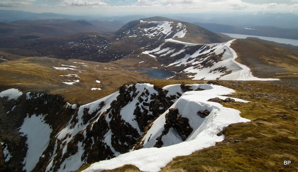
This part of the Fannichs ridge is full of hidden lochs and lochans, looking beautiful from above when framed by high mountain peaks and spiced up by white patches of snow here and there. Like this one, Loch an Fhuar Thuill Mhoir, framed by Creachan Rairigidh and Meall Gorm:
I spotted a stone shelter and couldn't resist having a peek inside:

Next, the steep push (about 150m) to the summit of Sgurr Mor. There is a path, but it was partially covered by snow, so we just charged up in a straight line
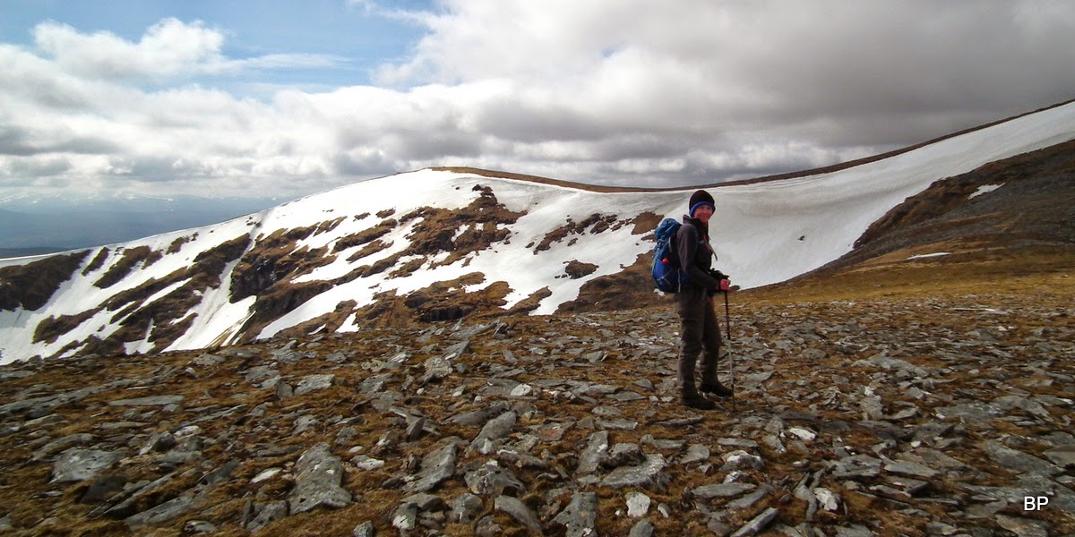
The slopes may be steep but they are easy, mostly grassy. Higher up, we walked past some impressive cornices:

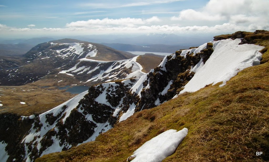
Near the summit, we located the path again. We were now close to the highest point of the Fannichs and views around were excellent. To the south-east, the whole length of the ridge, with Loch Fannich behind:
Fionn Bheinn, the only Fannich Munro separated from the main ridge:

I really loved the way the snow cornices "spice up" the landscape!
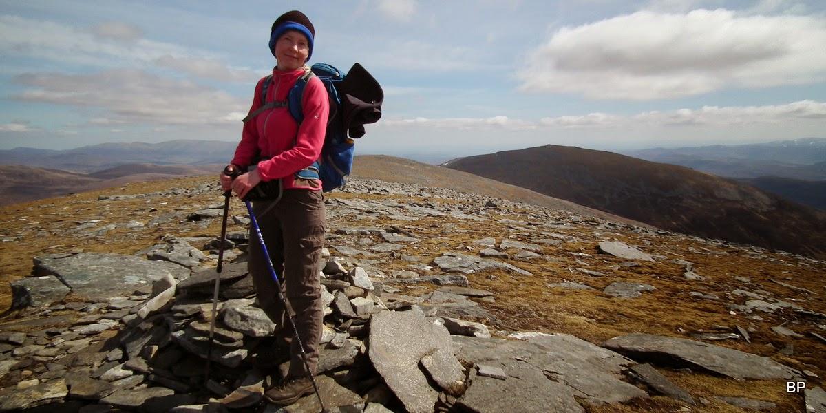
The impatient, curious cat running to the summit!

Veni, vidi, vici, meow! Number 164 ticked off and another "Monster" tamed
An Teallach behind me to the left:

As this is the highest mountain for many miles, we enjoyed excellent vistas in all direction and couldn't resist a longer break yet again. I really don't understand people who touch the cairn and run forward as if beating the fastest time for the round was the most important aim in hillwalking! Well, perhaps it is for some, not for us though... So much to admire, why would I want to turn my back an such treats?
The western half of the Fannichs, with Sgurr nan Clach Geala in the foreground:

Distant Fisherfields:

Zoomed An Teallach with Meall a'Chrasgaidh in the foreground:

Beinn Eighe cloudy:

Slioch:

Me and the next target of "biggies" - Beinn Dearg and friends! Last year we only managed Am Faochagach and Seana Bhraigh, now it's time for me to face the leviathans!

Weather was playing up a bit, clouds passed over our heads, but we had a few good spells of sunshine and even the wind didn't feel so cold any more:
Ready to go! Two more Munros to bag today!
As Kevin stated with his "I know it all best" smile, once you've done the Monster Mor, the rest of the ridge is downhill
I don't even know how we found ourselves past the minor top of Creachan Rairigidh and on the way up to Meall Gorm!
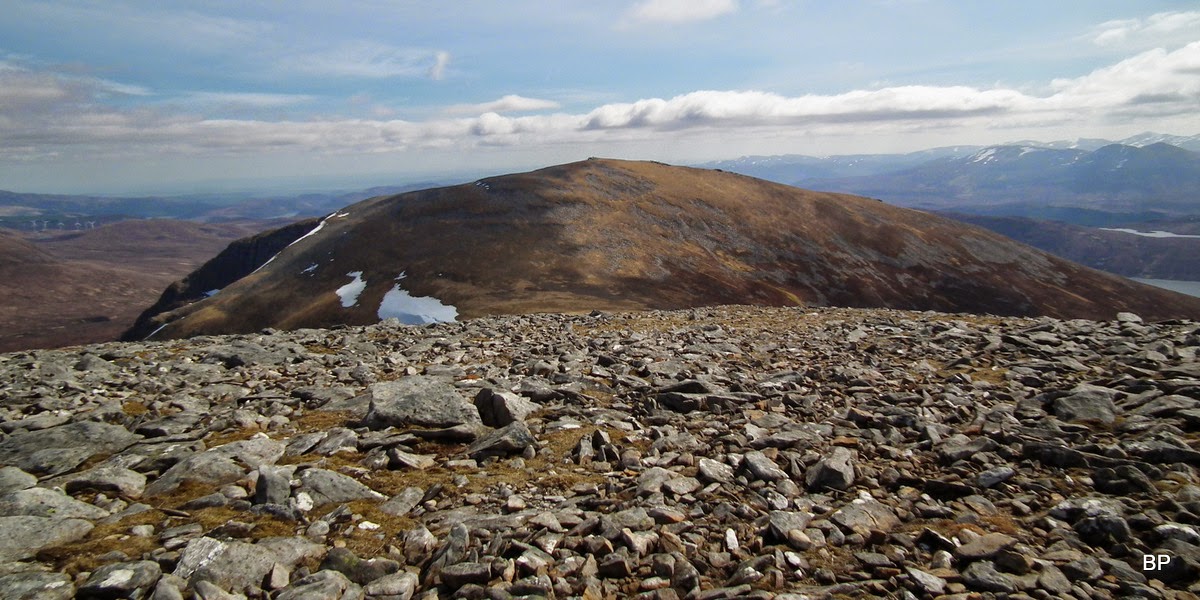
Looking back to Sgurr Mor from the slopes of the next Munro, it really looks massive!

Beinn Liath Mhor Fannaich and Loch Li:

Meall Gorm summit, we stopped only for a few photos and carried on to the final top:
Fannichs panorama from Meall Gorm:

Kevin by the cairn on the next top, 922m, overlooking Loch Gorm:

Fionn Bheinn across Loch Fannich:
The final Munro, An Coileachan. The col drops to 775m, which means another 150m of ascent... And it was supposed to be downhill now!
Luckily, the traverse to the last Munro was just as easy as the previous section of the ridge and soon we were climbing up the stony slopes of An Coileachan, with great views behind us:

The cairn of AC is situated on a rocky outcrop and it's a good viewpoint, especially to the south/east. I was glad to pose for my No. 166!

Camera games

Am Faochagach and Beinn Dearg from An Coileachan:

Ben Wyvis (snow bare!) and of course, windfarms

Is there a mountain in Scotland, from which you can't see a turbine???

An Eigin, the easternmost top of the Fannichs ridge:

The rocky summit outcrop with Sgurr Mor behind:

For the return route, we followed the instructions

and started to descend towards a lower lump to the north, Meallan Buidhe. On the map, the slopes look all right and we didn't have any problems descending (there is a faint path in places), except that my blistered foot began to hurt again. Well, it's been quiet almost all day so I was glad it only started aching now, not on the way up!
Looking down the descent route with Loch Gorm in the background:

The descent route from below. Piece of cake. Any rocks can be avoided, it's just steep:

Loch Gorm is enchanting. What a lovely, quiet spot, in the shadow of the vertical cliffs...

I wanted to spend more time here, but Kevin was eager to get back to the car, drive home and cook dinner!
We knew that the walk back from Loch Gorm across the moorland was going to be wet and boggy. This particular area has bad reputation and many walkers complain about this part spoiling all the pleasure of doing this circuit. But as it's been dry recently, we were lucky. A path follows the slopes of Meallan Buidhe, before petering out in the vast area of large peat hags. We were able to walk across most of them without much trouble, but I can imagine trudging through this in wet conditions. An absolute nightmare!
We aimed for Abhainn a'Ghiubhias Li and to our delight, we noticed a footbridge over the river, so we descended to cross it:

I was hoping that a path existed on the other side, and indeed, we found one following the banks of the river. It was wet in places but we were happy to use it to reach the bigger bridge we crossed in the morning. From now on, it was easy going on wide track. We had to walk past the stinky deer corpses again, but it wasn't enough to spoil the satisfaction! Not the first time we bagged four in one day... But we finished the Fannichs! Meow!
Despite my sore foot, we managed one more day of hillwalking on Wednesday, this time involving two rocky Grahams, a real treat! The day was hot and I wondered how come it was April, not July
TR to come soon.
